Bolivia occupies a central position in South America and shares borders with Brazil, Argentina, Paraguay, Chile, and Peru. Although it is often associated with the Andes Mountains, the country also includes extensive lowland regions that stretch toward the Amazon Basin. Because of this geographic variety, a bolivia map can be especially useful for understanding how different regions connect across the country.
This printable bolivia map collection was created for students, teachers, bloggers, designers, travelers, and presentation creators who need a practical visual reference. Instead of offering only a single map style, the collection includes four different versions that serve different purposes. Users can choose between a color administrative map, a clean labeled map, a black and white printable map, and a blank outline map for editing projects.
All files were prepared in A3 format and exported as high-resolution JPG images. During the design process, readability was checked at larger print sizes to ensure that labels, borders, and symbols remain clear when enlarged. Whether the goal is classroom instruction, infographic design, educational worksheets, or regional comparison projects, the bolivia map collection provides several options that can be adapted to different situations.
One thing that became clear while organizing the maps was that users often prefer different levels of detail. Some want a colorful visual reference, while others need a simplified layout for printing or editing. Creating multiple versions allows the bolivia map collection to support a wider range of practical uses without forcing users to modify the files themselves.
Table of Contents
Map Collection Overview
The bolivia map collection includes:
- Color administrative map
- Labeled basic map
- Black and white printable map
- Blank outline map
- A3 high-resolution format
- JPG image files
Designed for:
- Classroom reference
- Educational handouts
- Travel presentations
- Infographic projects
- Blog graphics
- Graphic editing work
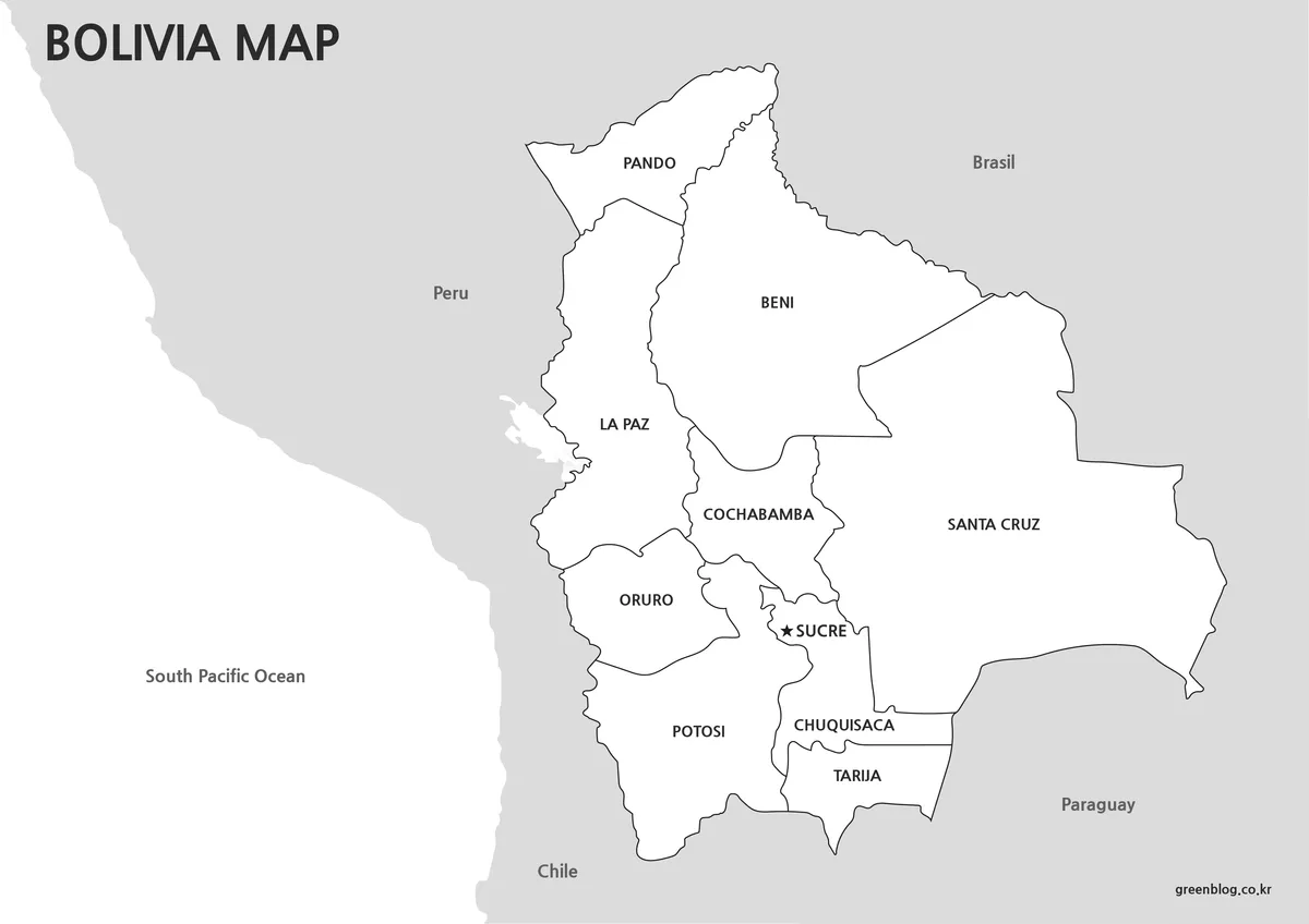
Regional Color Version
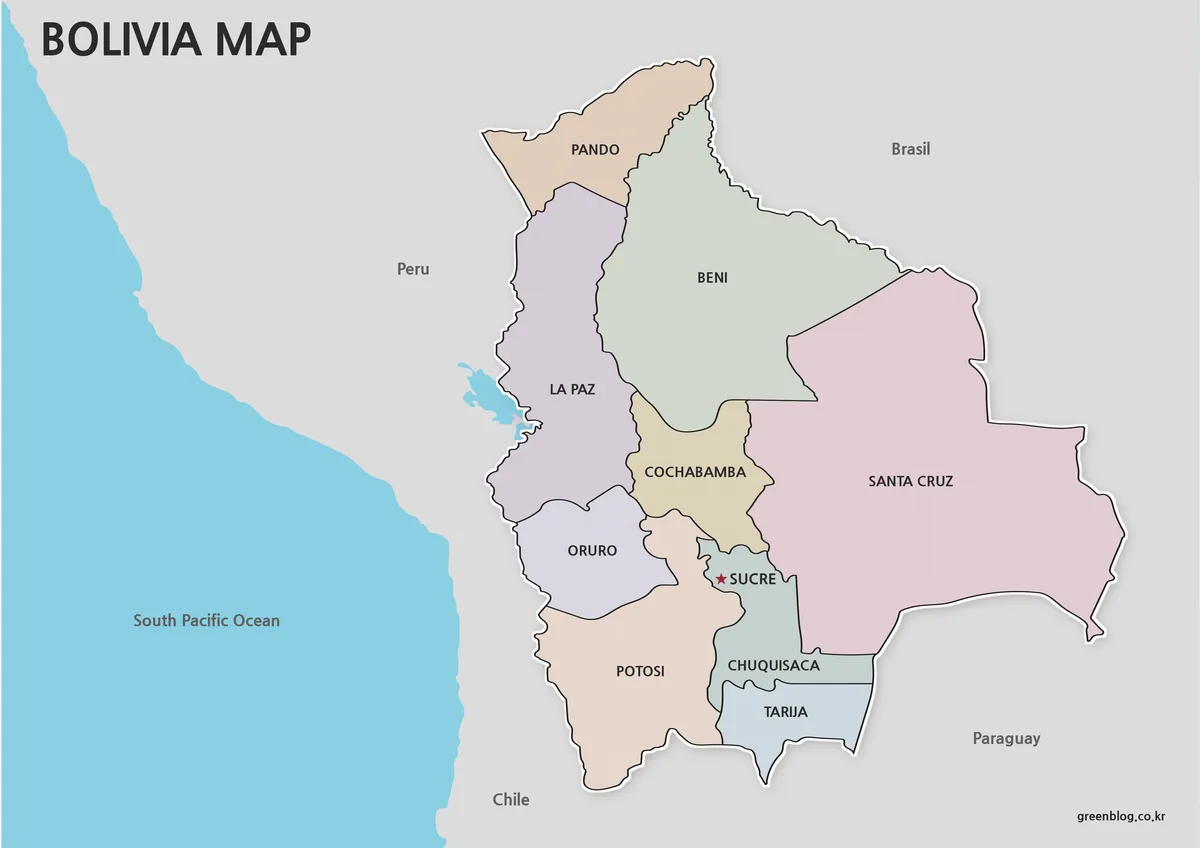
The color bolivia map was created to improve visual distinction between administrative regions. Different color tones make it easier to compare neighboring areas while keeping the overall layout easy to read.
While preparing this map collection, regional boundaries were reviewed carefully to ensure that adjacent areas remain visually separate. Color adjustments were completed after the base map was finalized, helping maintain clear border visibility even when viewed at larger sizes.
This version works particularly well for presentations, educational displays, and visual reference materials where quick regional identification is important.
Best Uses
- Geography lessons
- Educational presentations
- Regional comparison materials
- Travel content
- Blog graphics
Labeled Administrative Version
For users who prefer a cleaner layout, the labeled bolivia map focuses on regional names and administrative boundaries without relying heavily on color.
A subtle shadow effect was added to improve visual depth while preserving simplicity. Regional names appear in both Korean and English, and the capital city is marked with a visible symbol to improve location recognition.
Because unnecessary visual elements were minimized, this bolivia map fits naturally into reports, educational documents, and reference materials.
Black and White Printable Version
The black and white bolivia map removes all color while preserving regional boundaries and structural details. This approach reduces printing costs and provides a practical format for classroom activities and study materials.
During preparation, boundary visibility was checked specifically for monochrome printing. The result is a clean layout that remains readable even when printed on standard office printers.
Many users also prefer this version as a starting point for manual annotations, regional highlighting, and educational exercises.
Ideal For
- Classroom worksheets
- Printed reports
- Educational activities
- Study resources
- Regional marking exercises
Editable Outline Version
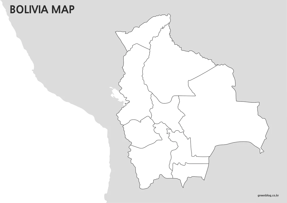
The bolivia map collection also includes a blank outline version designed for customization and graphic editing projects.
Labels and color elements were intentionally removed so users can add their own information without first cleaning the file. This makes the outline version particularly useful for infographic creation, data visualization, educational assignments, and presentation graphics.
Boundary lines remain continuous and clear, reducing the amount of preparation required before editing begins.
Useful For
- Infographics
- Data visualization
- Classroom assignments
- Graphic design
- Custom mapping projects
Built for Printing and Presentation Use
Every bolivia map in this collection was designed with both digital viewing and physical printing in mind. Labels were reviewed for readability, and map elements were adjusted to remain clear when enlarged.
The A3 format provides flexibility for classroom displays, educational posters, conference presentations, and visual reference materials. Users who need smaller print sizes can scale the files while maintaining good visibility of regional boundaries and labels.
Frequently Asked Questions
What map versions are included in the bolivia map collection?
The collection includes a color map, labeled map, black and white map, and outline map.
Can I print the bolivia map in A3 size?
Yes. All files were prepared in A3 format and reviewed for readability when printed.
Is the bolivia map suitable for editing?
Yes. The outline version was created specifically for customization, annotations, and graphic projects.
Which bolivia map is best for classroom use?
The black and white map is often the most practical option for worksheets, educational handouts, and study materials.
Download Information
Choose the bolivia map version that best matches your project requirements. Printable and editable versions are included for different educational and design purposes.
Bolivia Map Download
Select the bolivia map version that fits your project. Multiple printable and editable options are included.
- File Format: JPG
- Image Size: A3 High Resolution
- Included Versions: Color, Basic, Black & White, Outline
- Intended Use: Printing, Education, Presentation, Editing
Related Maps
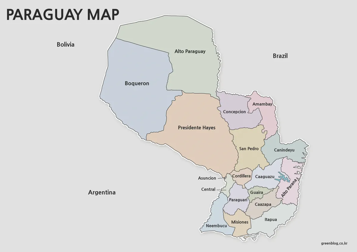
- Printable Paraguay Map Collection for Education and Design Projects
- Argentina Map Pack – Color, Blank and Printable A3 Maps
- Printable Colombia Map Set – Regional, Blank, and Black & White Versions
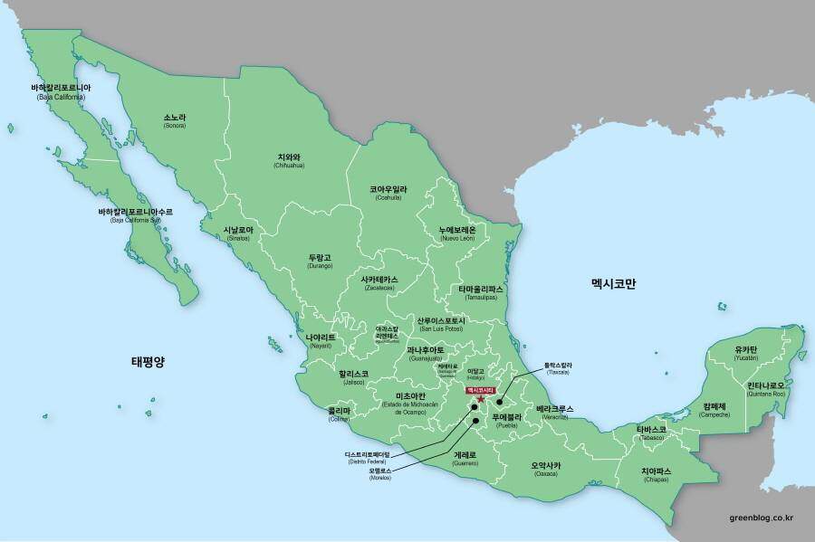
- Mexico Maps Download Collection (3 Files for Regional Reference)
Additional Resources
- Bolivia Maps Nations Online Project – Educational map resource featuring Bolivia’s regions, major cities, and geographic information.
Green Map creates custom-edited map images using open geographic data sources such as geoBoundaries, Natural Earth, OpenStreetMap, and government open data.
These maps are edited visual materials, not raw data files, and are provided for education, documents, presentations, and graphic reference.