When people write about India for travel notes, country profiles, or study materials, having a clear map makes a big difference. Explaining such a large country with text alone often feels limiting, especially when regions, neighboring countries, and capital locations need to be shown together.
This India maps download collection was prepared as a visual reference to help readers quickly understand how the country is laid out, rather than as a detailed street or terrain map.
This guide focuses on how an india map can help readers understand the country’s layout at a glance.
Table of Contents
Why This Map Was Compiled
While searching for India maps online, many available images are either too small, lack Korean labels, or lose clarity when printed. This makes them difficult to use in blog posts, documents, or presentation materials.
To solve this, the map set was created at a large size with clear boundaries, readable labels, and a layout that works both on screen and on paper.
Understanding India’s Regional Layout
India covers a vast area in South Asia, stretching between the Himalayas and the Indian Ocean. With many regions grouped into one country, it helps to see how areas connect rather than trying to remember locations by name alone.
The maps focus on showing regional divisions, capital placement, and surrounding countries in a way that feels easy to follow. Looking at an india map makes it easier to understand how these regions relate across the country.
How the Map Is Structured
All map versions share the same base structure so that switching between them does not change how regions are positioned. This makes it easier to compare or reuse the india map in different situations.
The main version uses color to separate regions clearly, while white boundary lines help each area stand out. A light shadow effect was added so the land shape does not appear completely flat.
Regional names are shown in both Korean and English, which helps the india map remain readable for a wider audience.
Map Variations Included in This Set
1️⃣ Color-Based Regional Map
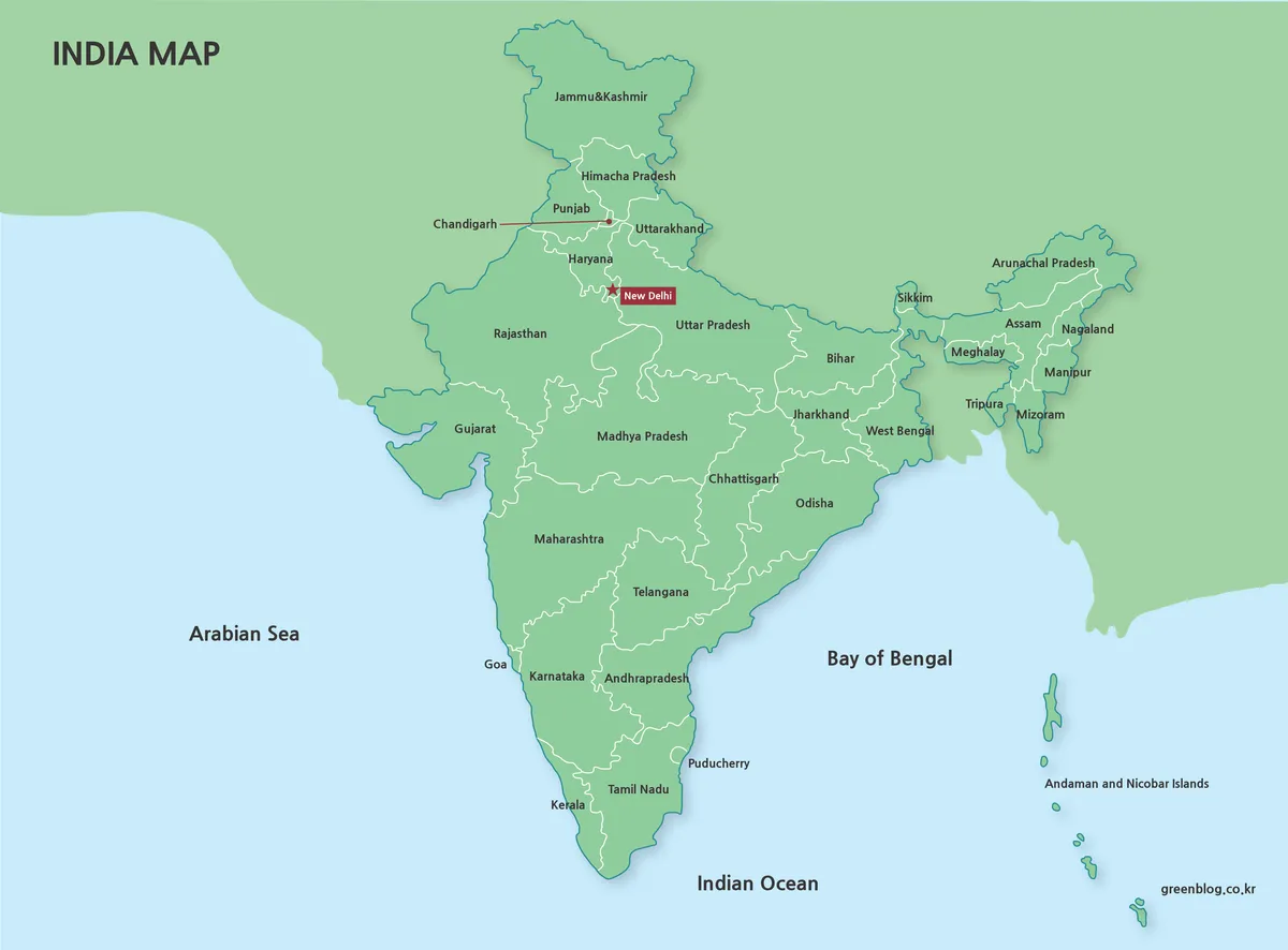
This version shows India divided by color so regional boundaries are easy to follow. White lines separate each area clearly, and a subtle shadow helps define the country’s outline.
New Delhi is marked with a red star and box so the capital can be identified quickly, while neighboring countries appear in different tones. This approach keeps the india map readable without crowding the image.
Summary:
- Clear regional separation using color rather than dense labels
- Capital and neighboring countries visible without clutter
- Suitable for quickly understanding the country’s overall layout
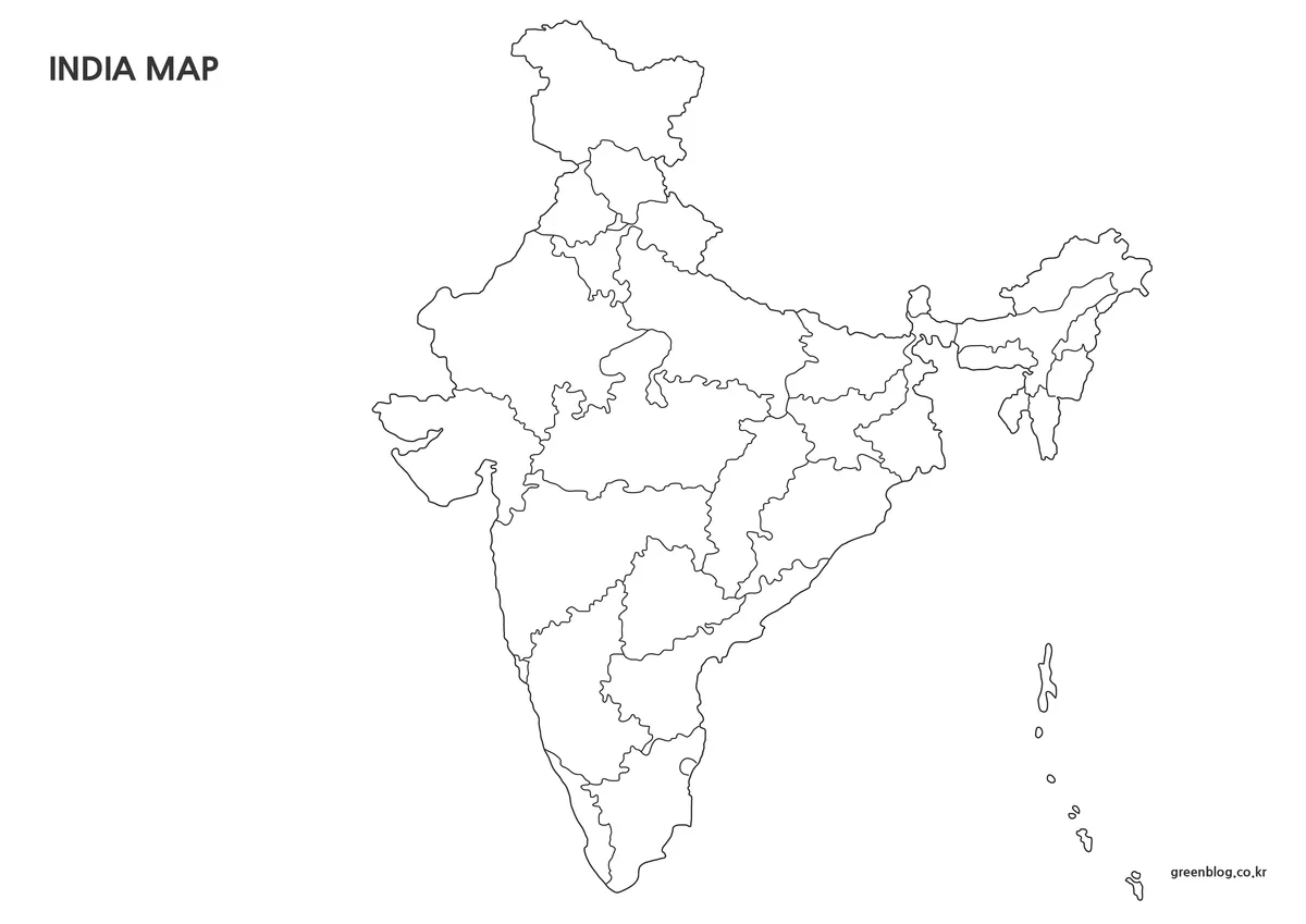
2️⃣ Black-and-White Boundary Map
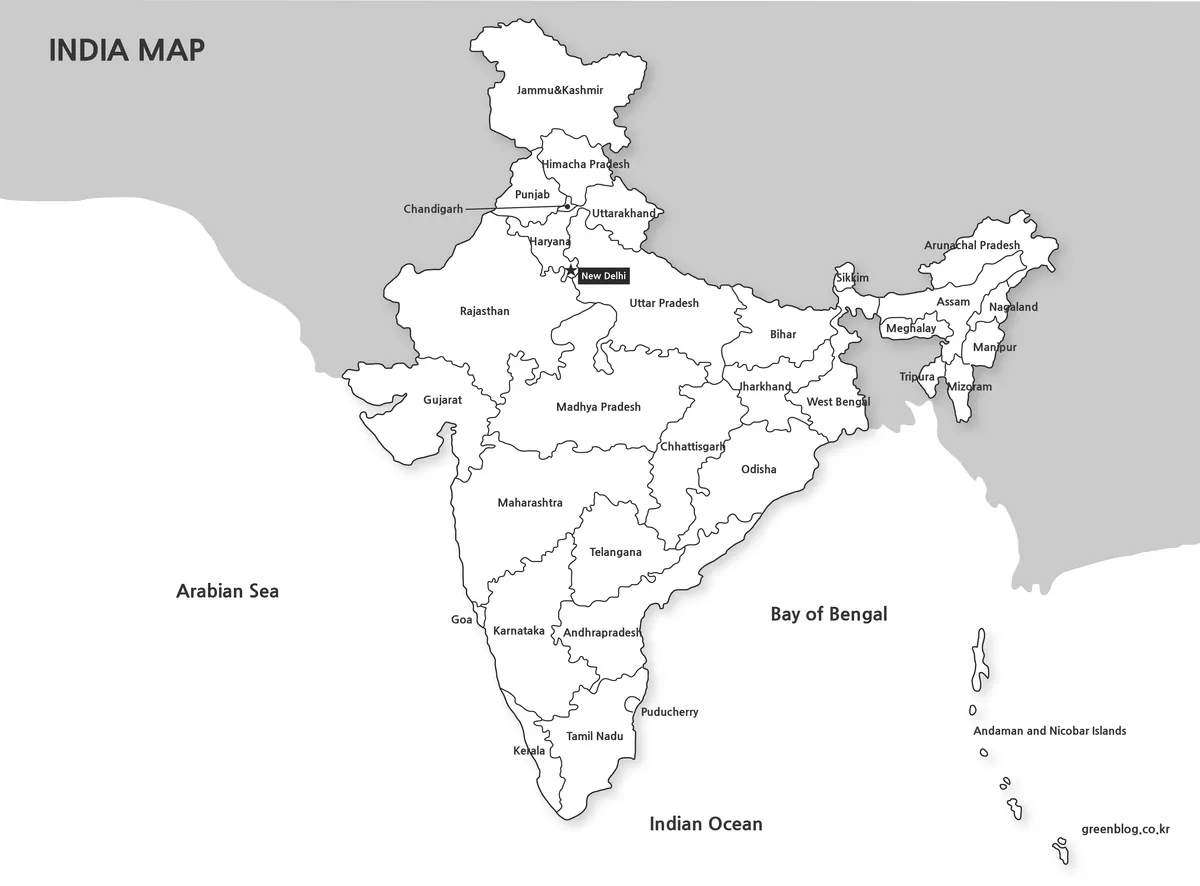
The black-and-white version was added for users who plan to print their materials. It uses only black lines, so borders and labels stay sharp even when an india map is printed on a standard monochrome printer.
Because there is no background color, it also works well when multiple copies are needed. This makes the india map practical for documents, handouts, and reports.
Summary:
- Maintains clarity when printed in grayscale
- Easy to annotate or mark by hand after printing
- Works well as a clean base for documents and reports
3️⃣ Outline-Only Map for Editing
This version keeps only the outer and internal boundary lines. With all fills and labels removed, it provides a flexible base for graphic work.
An outline-only india map allows users to add custom colors, replace region names with other languages, or build visuals without interference from existing elements.
Summary:
- Boundary-only layout for maximum editing freedom
- Allows custom colors and language changes
- Useful as a base image in Photoshop or Photoscape
Practical Contexts for Using the Map
- A student trying to understand India’s regional structure for the first time
- A teacher preparing materials to explain large-scale geography
- A blogger organizing country information visually
- A presenter showing how regions relate within a wide territory
- A designer needing a clean base map before starting graphic work
Frequently Asked Questions
Can I edit the map files for my own work?
Yes. You can resize the maps, change colors, replace text, or add your own notes for personal projects, study materials, or internal documents. Please avoid re-sharing the edited files as standalone map downloads.
Will the maps still look clear when printed?
The maps were created at a large size and prepared with print use in mind. Lines and labels stay readable when printed, and the black-and-white version works well on standard monochrome printers.
Are these maps suitable for graphic design work?
The outline-only map is especially useful for design tasks. Since it contains only boundary lines, it works well as a base image in tools like Photoshop or Photoscape when creating custom visuals.
Can I use these maps in blog posts or presentations?
They can be used in blog articles, presentations, study notes, and similar informational content. Just make sure the maps are used as supporting visuals rather than redistributed as downloadable map packs.
Download Information
The India map files are provided as a single ZIP package. After extracting the file, you will find the color map, the black-and-white version, and the outline-only map, all in large size and ready for use in documents, presentations, or design work.
This map set is also available in Korean. You can view the original Korean version through the link below.

▶ Germany Maps Download Collection (4 Map Types)
▶ Spain Map Download Set – 3 Types with Regions and Cities
▶ Mexico Maps Download Collection (3 Files for Regional Reference)
Green Map creates custom-edited map images using open geographic data sources such as geoBoundaries, Natural Earth, OpenStreetMap, and government open data.
These maps are edited visual materials, not raw data files, and are provided for education, documents, presentations, and graphic reference.