
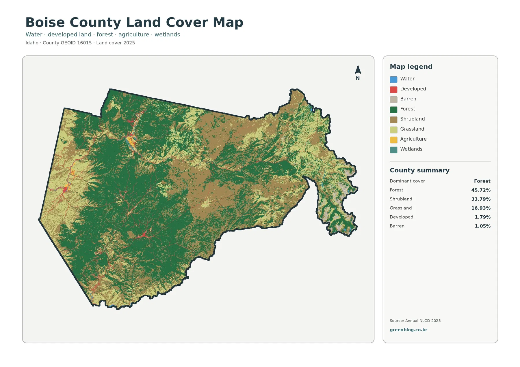
Boise County Idaho Land Cover Map | Forested Mountain Basins, Open Ridges, and Small Settlement Nodes
Forest is the largest class on the supplied 2025 Boise County image at 45.72%, but it does not cover the […]
Forest is the largest class on the supplied 2025 Boise County image at 45.72%, but it does not cover the […]
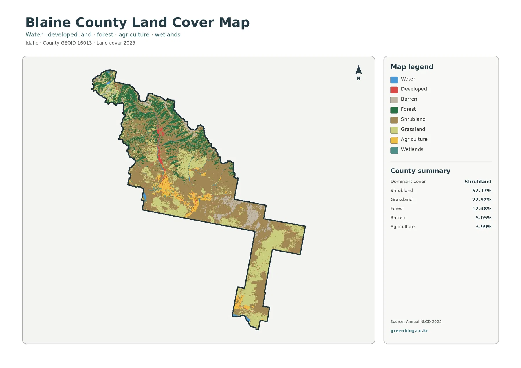
Shrubland is the defining cover on the supplied 2025 Blaine County map, accounting for 52.17% of the county. Grassland adds
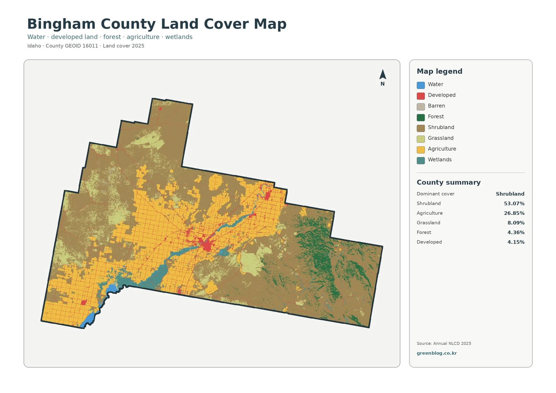
Shrubland dominates the supplied 2025 Bingham County land-cover summary at 53.07%, while agriculture accounts for another 26.85%. Grassland is 8.09%,
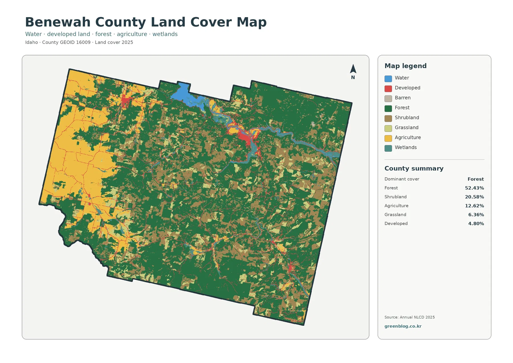
Forest is the largest 2025 land-cover class in Benewah County at 52.43%, but the county does not appear uniformly wooded.
Benewah County Idaho Land Cover Map | Western Agriculture and a 30.72% Class Difference Read More »
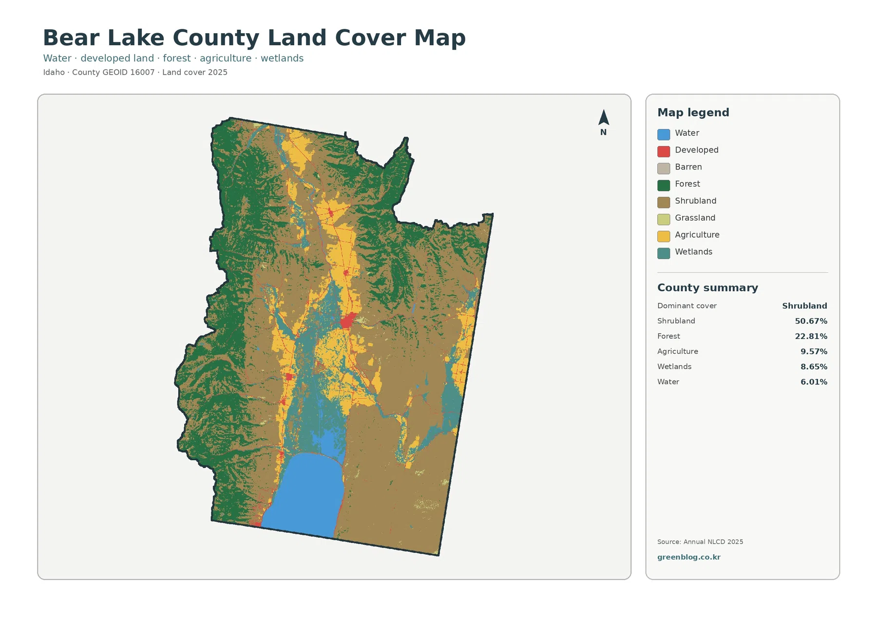
Bear Lake County has one of the clearest internal contrasts in this Idaho map series. The supplied 2025 summary is
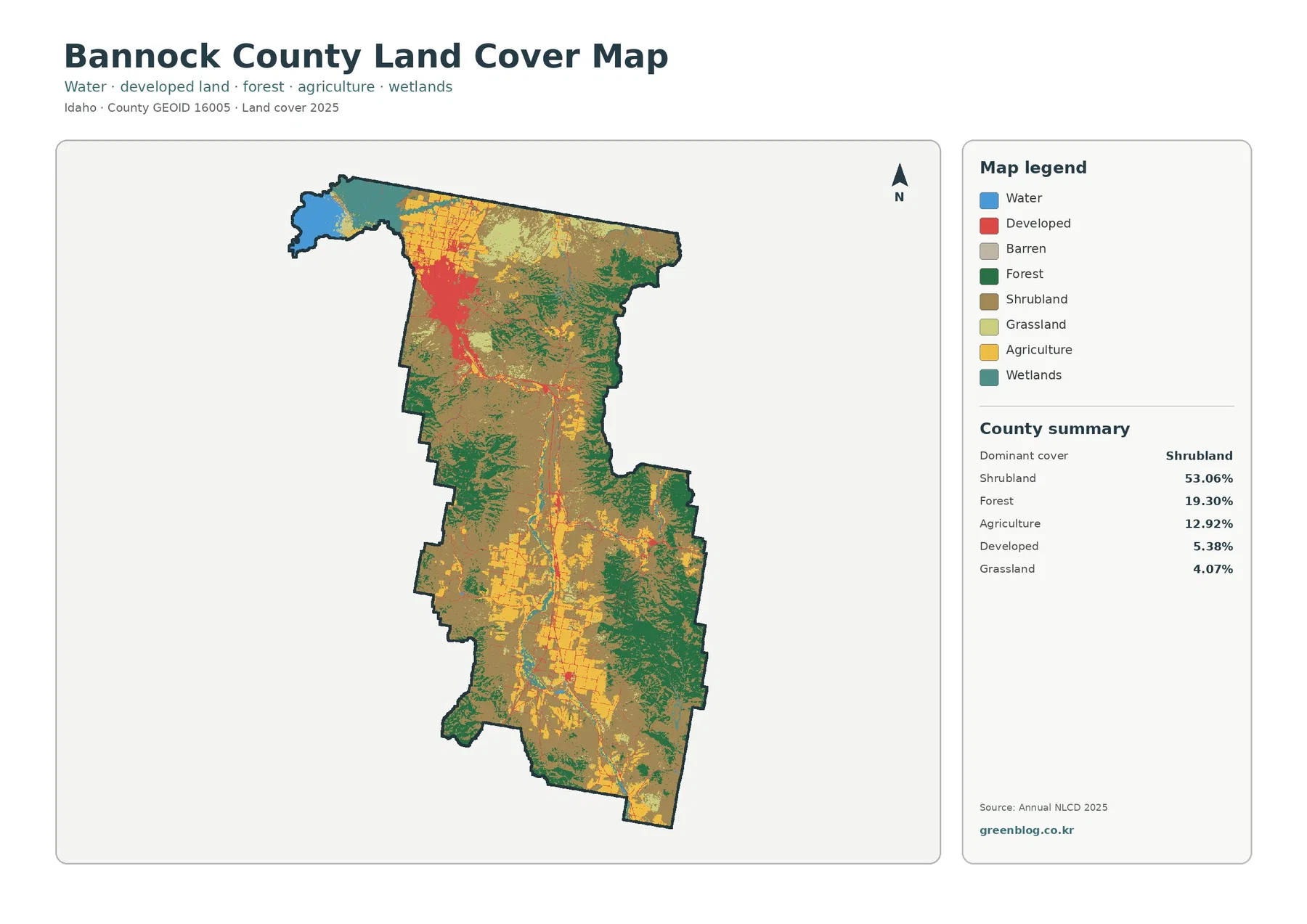
Shrubland dominates the 2025 Bannock County map, covering 53.06% of the county, yet the most striking contrast sits in the
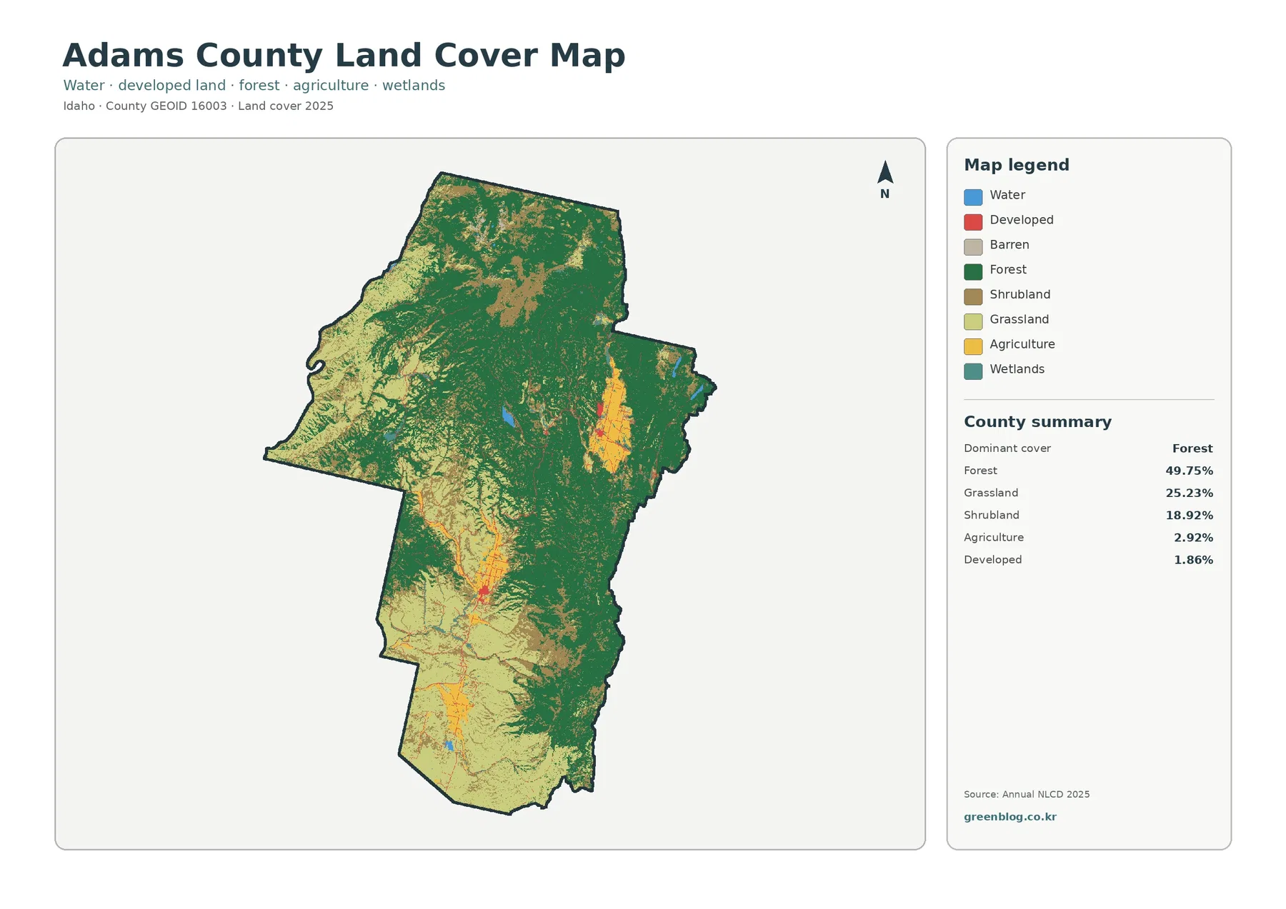
The Adams County Idaho Land Cover Map shows a county where natural cover occupies almost the entire frame. Forest is
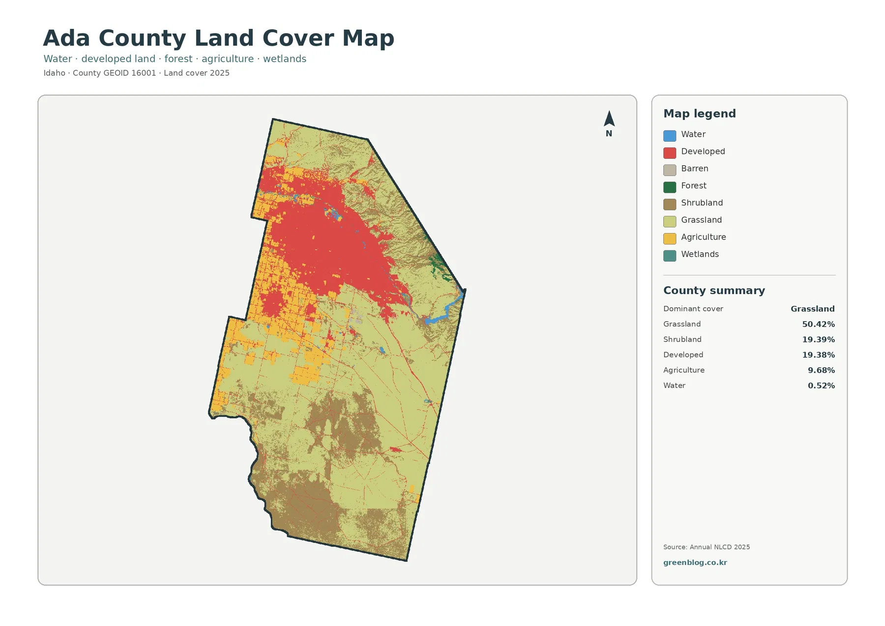
Ada County has one of the sharpest internal contrasts in this map series. The 2025 summary is led by grassland
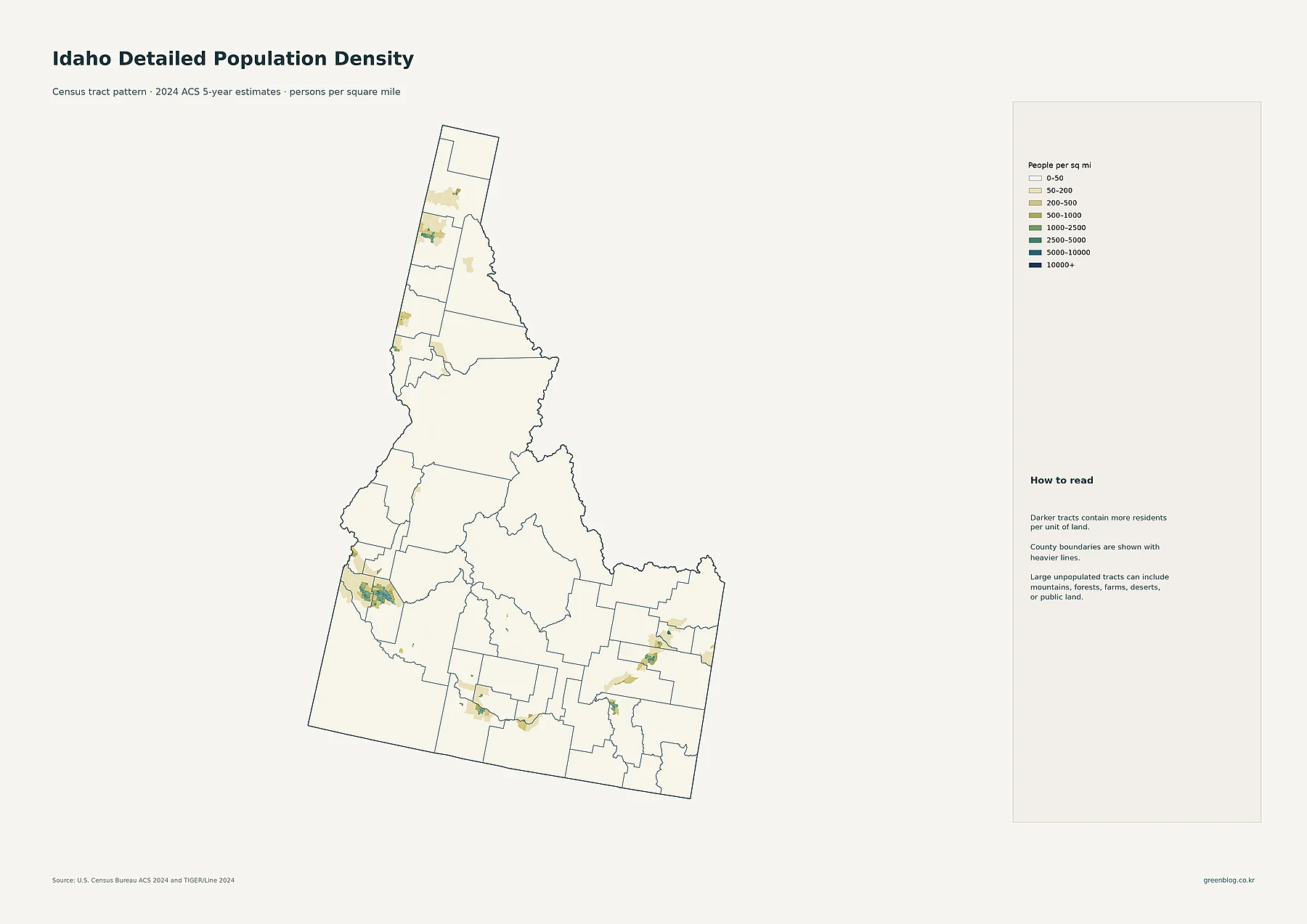
Idaho looks sparsely populated at the statewide scale, but the detailed maps show that its residents are concentrated in a
Idaho Population Density from the Boise Metro to the Sparse Interior Read More »