
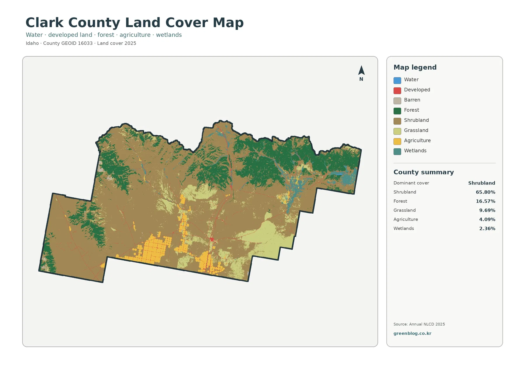
Clark County Idaho Land Cover Map — Shrubland Plain, Mountain Forest, and Sparse Development
Clark County in eastern Idaho is dominated by open shrubland, while forest becomes much more visible along the mountainous northern […]
Clark County in eastern Idaho is dominated by open shrubland, while forest becomes much more visible along the mountainous northern […]
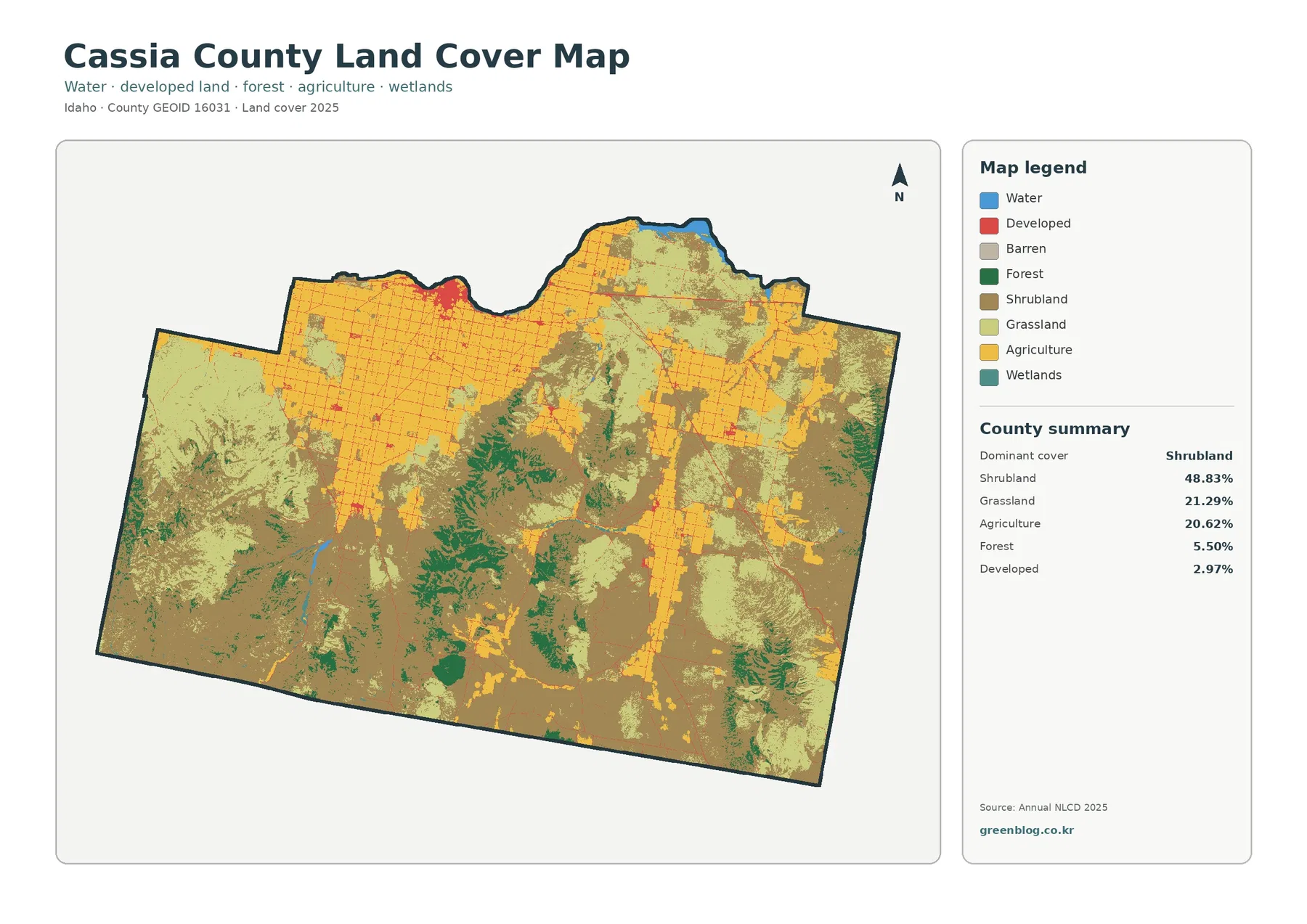
Cassia County in south-central Idaho has a land-cover pattern that changes sharply from broad farm blocks in the north to
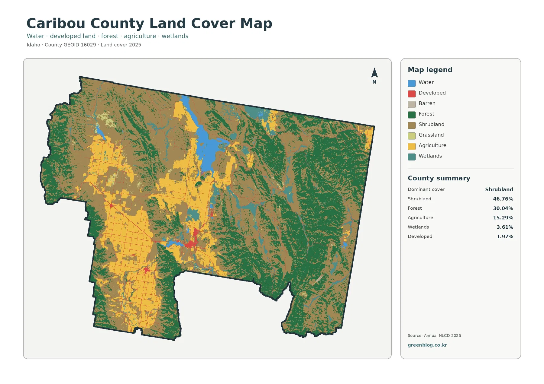
Caribou County in southeastern Idaho is dominated by open shrubland and forest, while broad farm blocks stand out in the
Caribou County Idaho Land Cover Map | Shrubland, Eastern Forest, and Western Farm Blocks Read More »
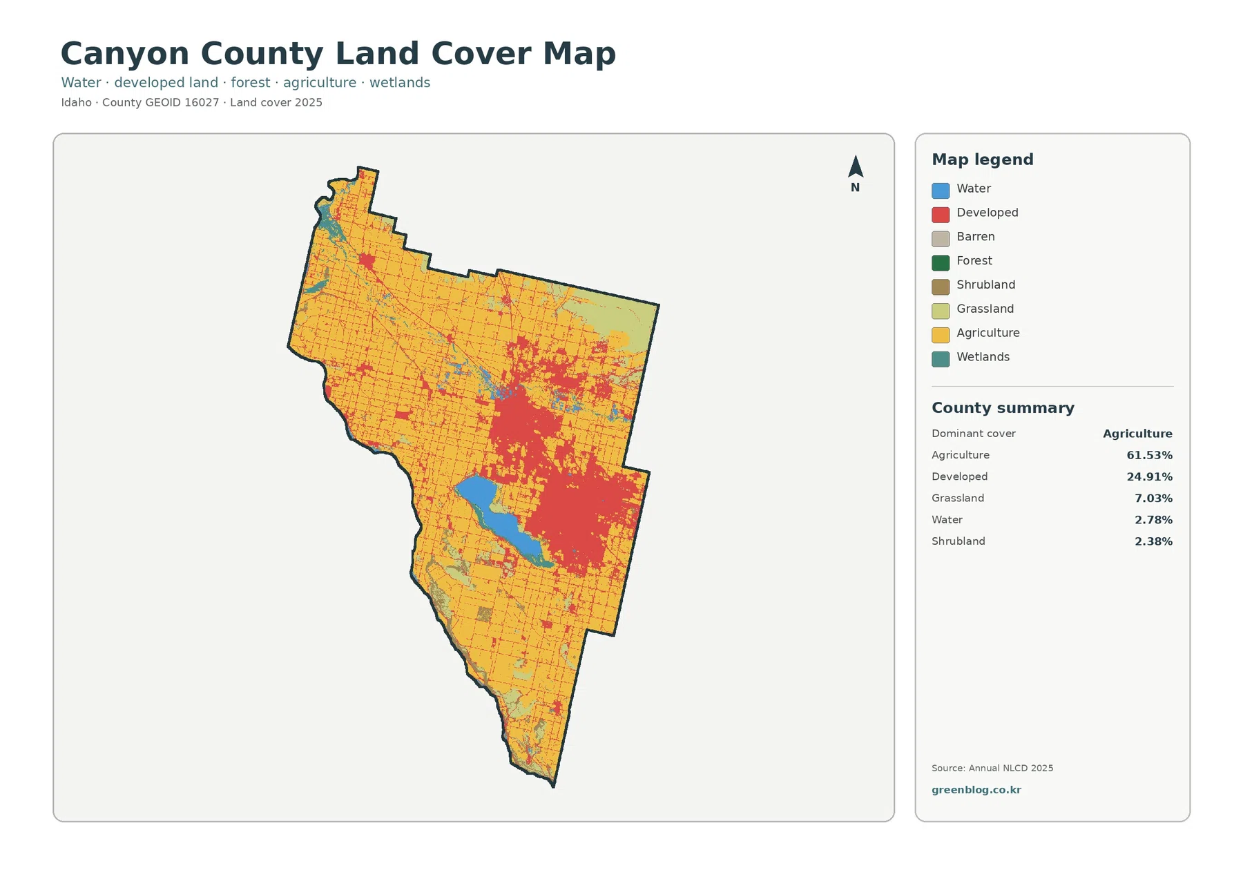
The supplied 2025 data makes Canyon County unusual among the Idaho counties in this series: agriculture remains the largest land-cover
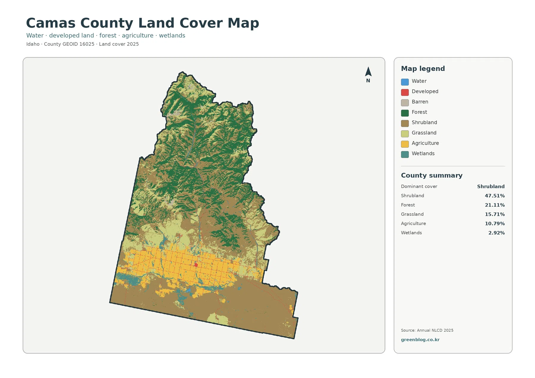
Camas County’s supplied 2025 land-cover summary is led by shrubland at 47.51%, but the county does not look uniform. Forested
Camas County Idaho Land Cover Map | Camas Prairie Farms Below Forested Mountains Read More »
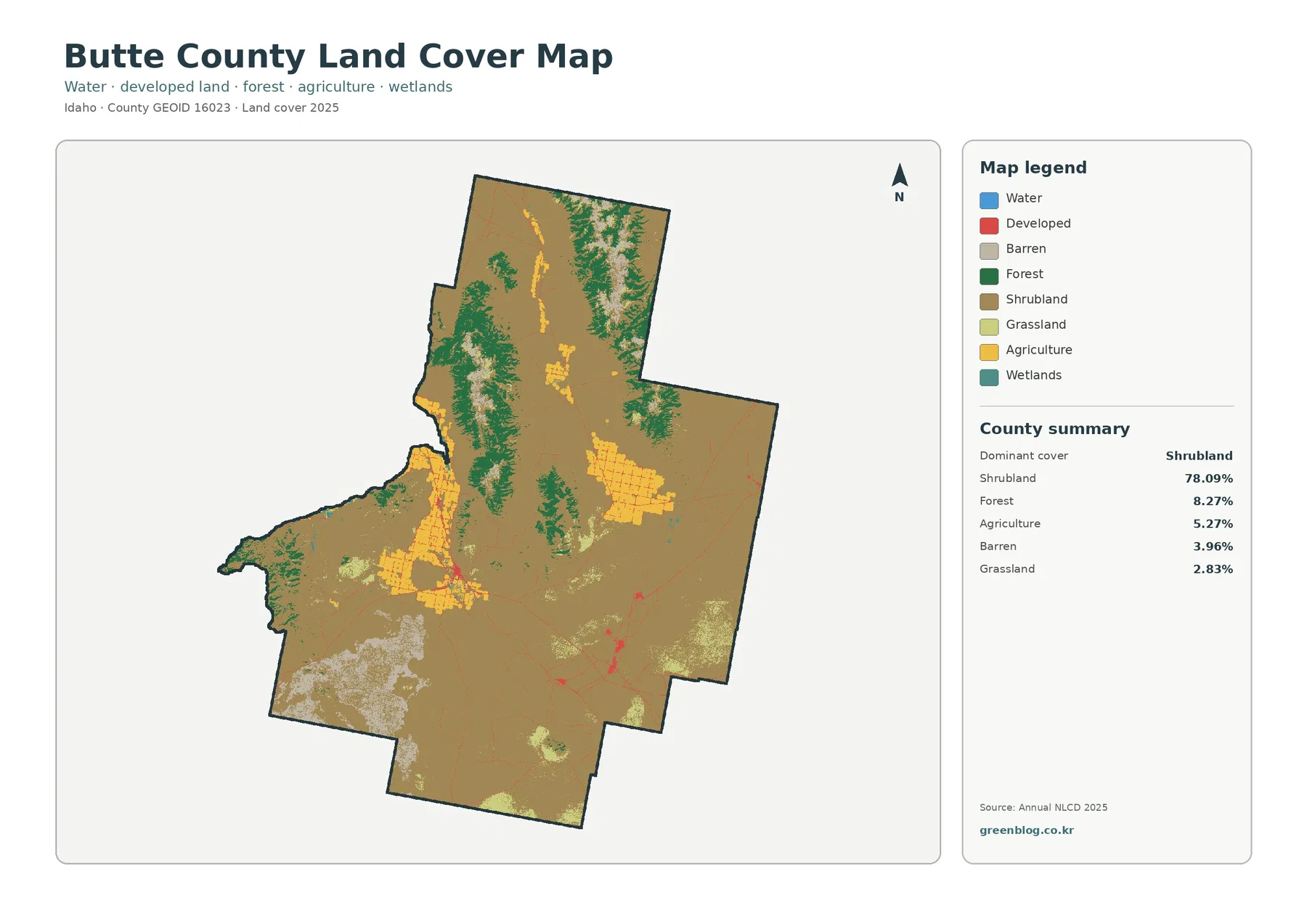
Butte County is overwhelmingly open country on the supplied 2025 classification. Shrubland accounts for 78.09% of the county, while forest
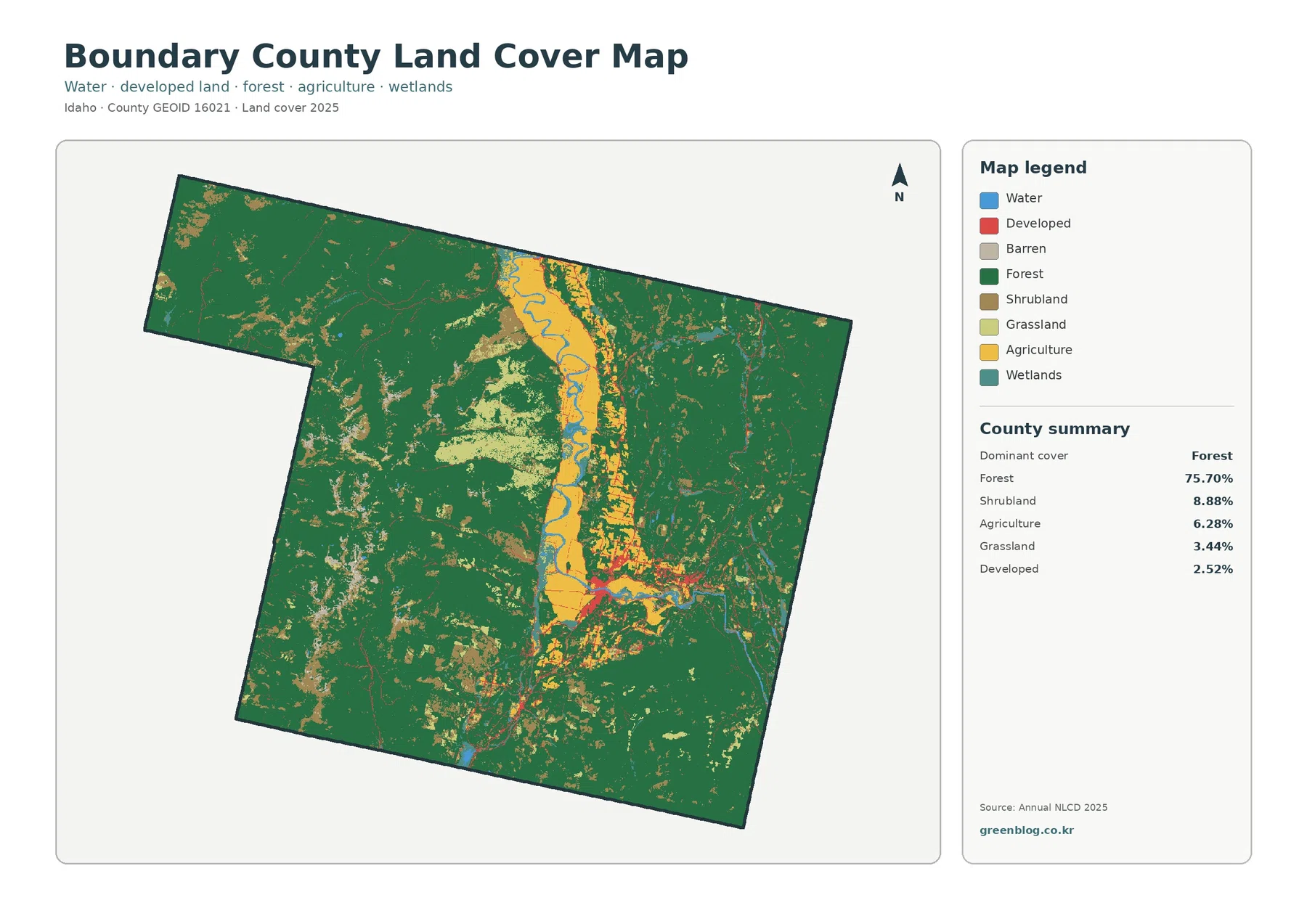
Boundary County’s 2025 land-cover pattern is dominated by forest, which accounts for 75.70% of the supplied summary. The main exception
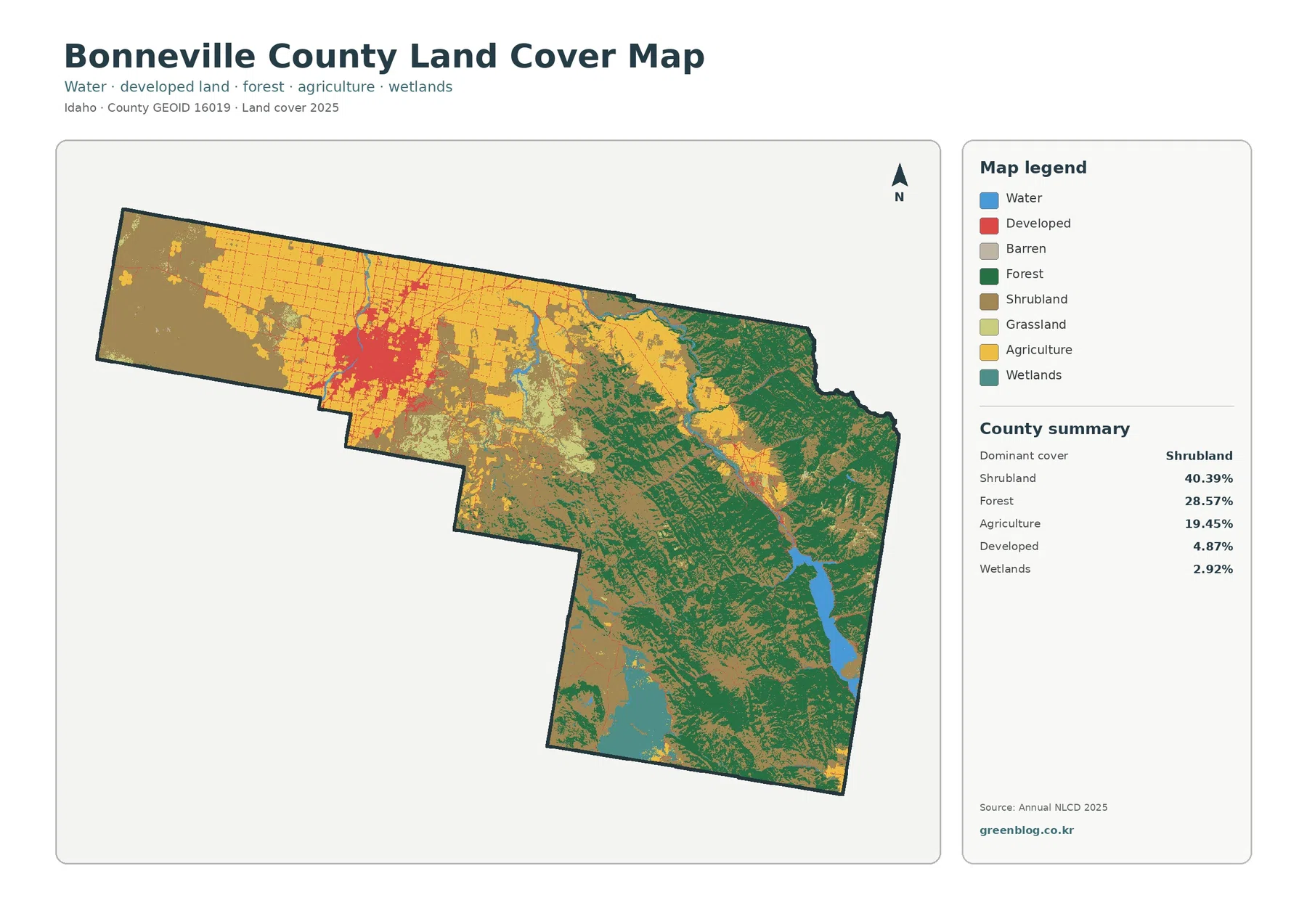
Bonneville County stretches across two sharply different land-cover settings. The western side is a broad Snake River Plain landscape of
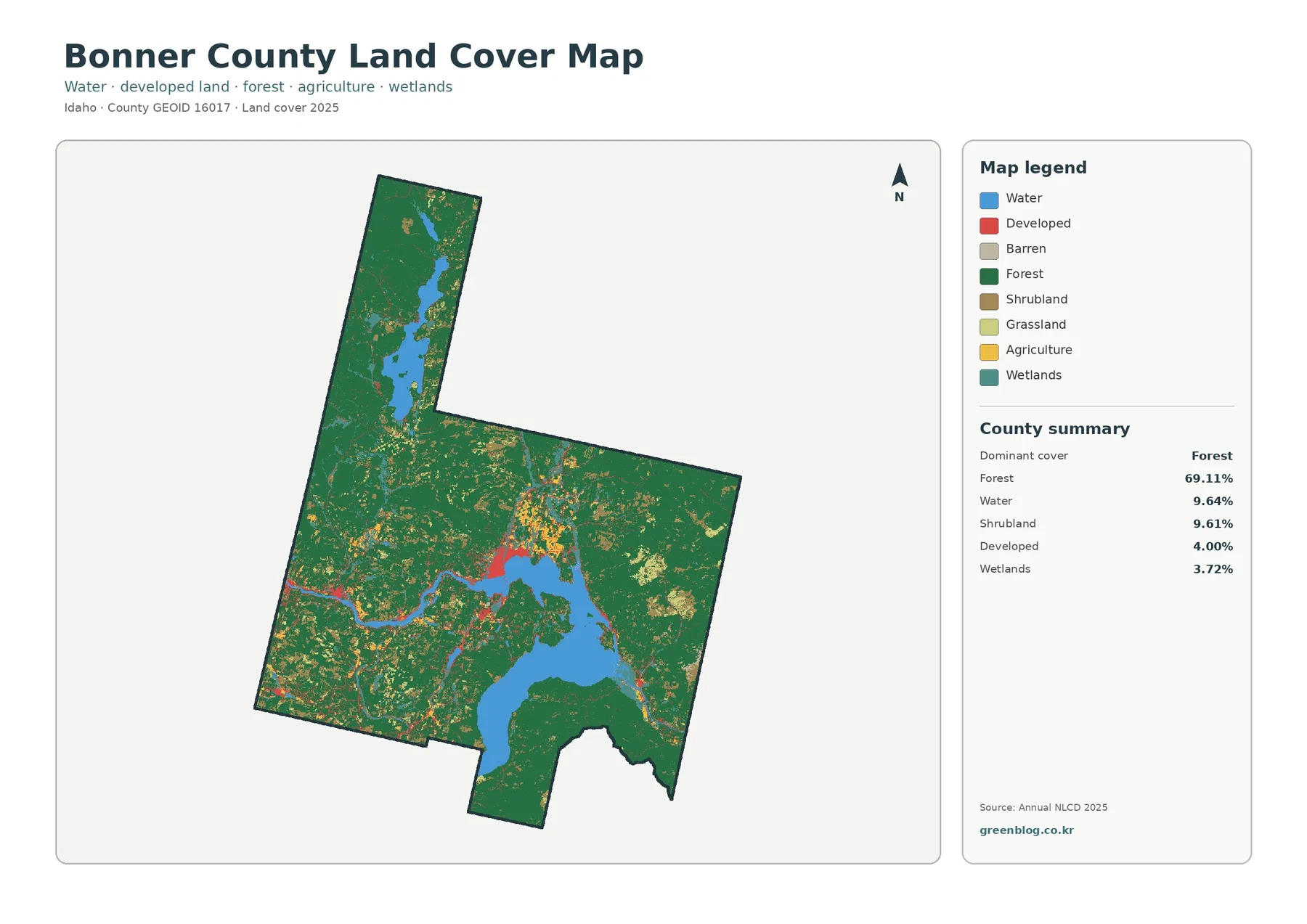
Bonner County is overwhelmingly forested on the supplied 2025 classification, but water is nearly as important to its visual identity.