
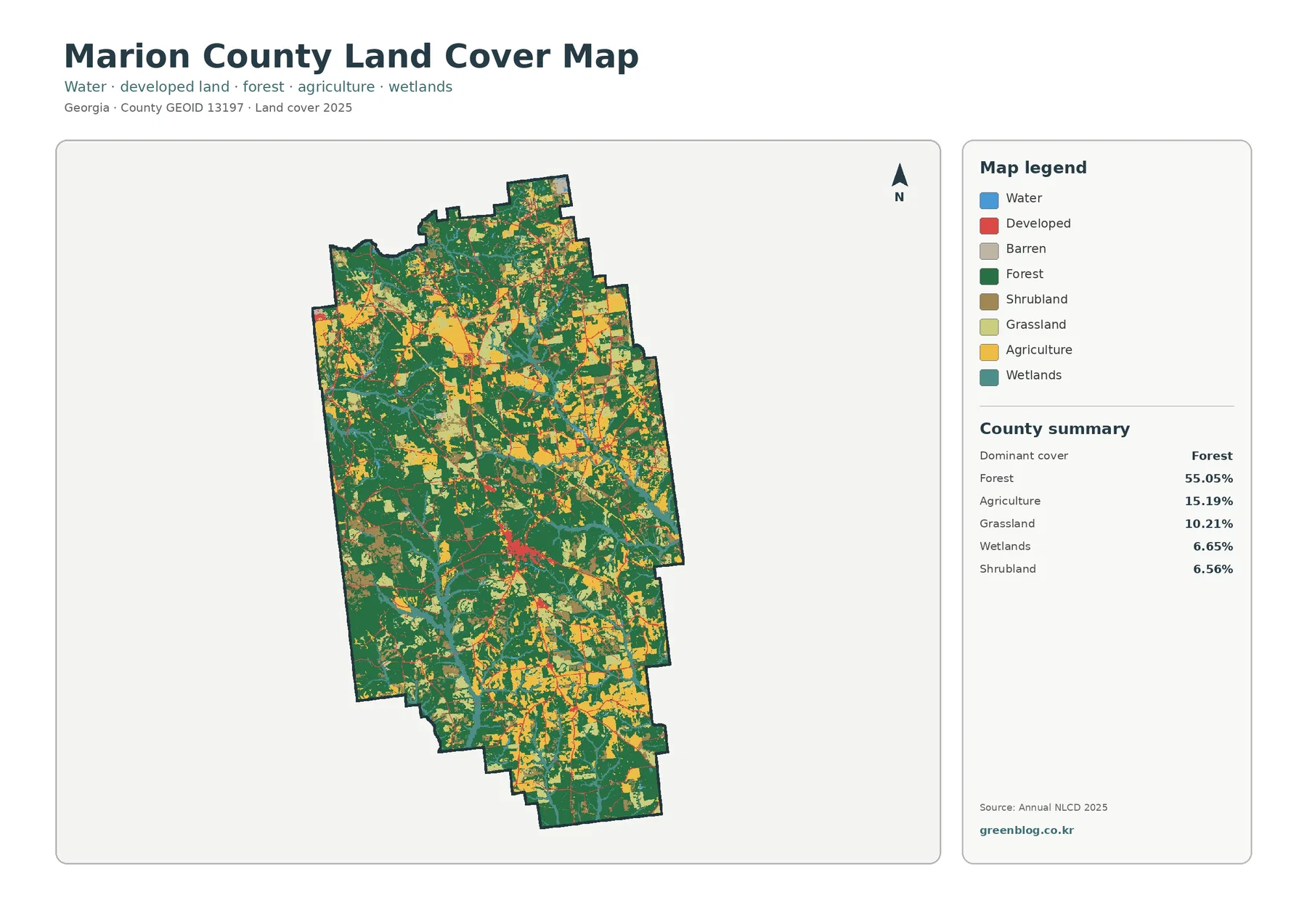
Marion County Georgia Land Cover Map | Forest Majority, Open Farm Country, and a Small Buena Vista Core
Marion County has a clear forest majority, but the county is far from uniformly wooded. Forest covers 55.05% of the […]
Marion County has a clear forest majority, but the county is far from uniformly wooded. Forest covers 55.05% of the […]
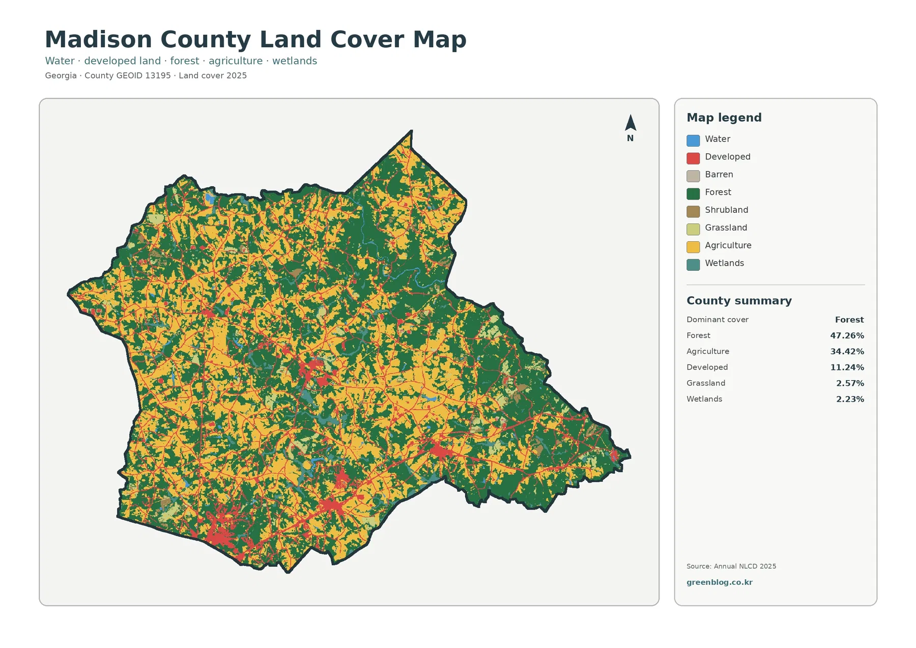
Madison County is a patchwork of forest and working agricultural land rather than a county dominated by one surface type.
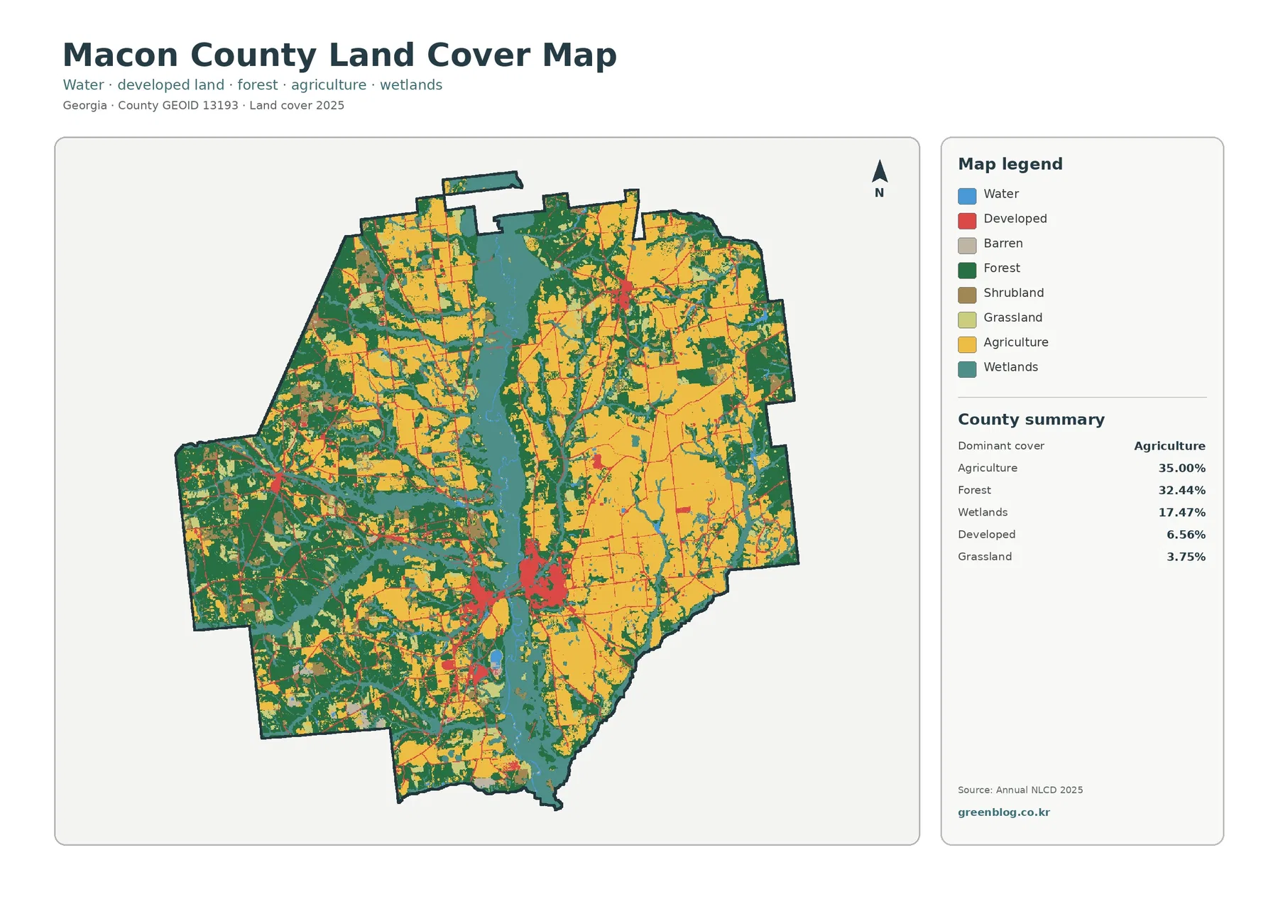
Macon County has a more balanced rural surface than a single label such as “farm county” or “forest county” would
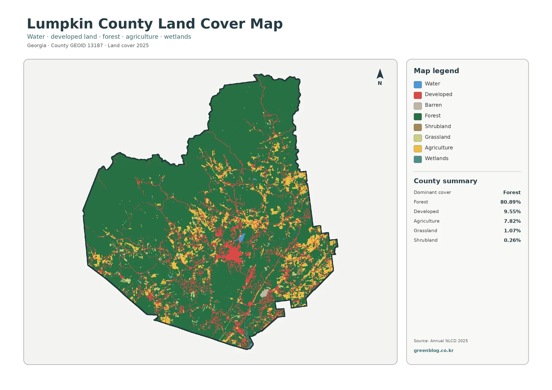
Lumpkin County is overwhelmingly wooded in the supplied 2025 data. Forest covers 80.89%, while developed land accounts for 9.55% and
Lumpkin County Georgia Land Cover Map | Dahlonega Amid an 80.89% Forest Landscape Read More »
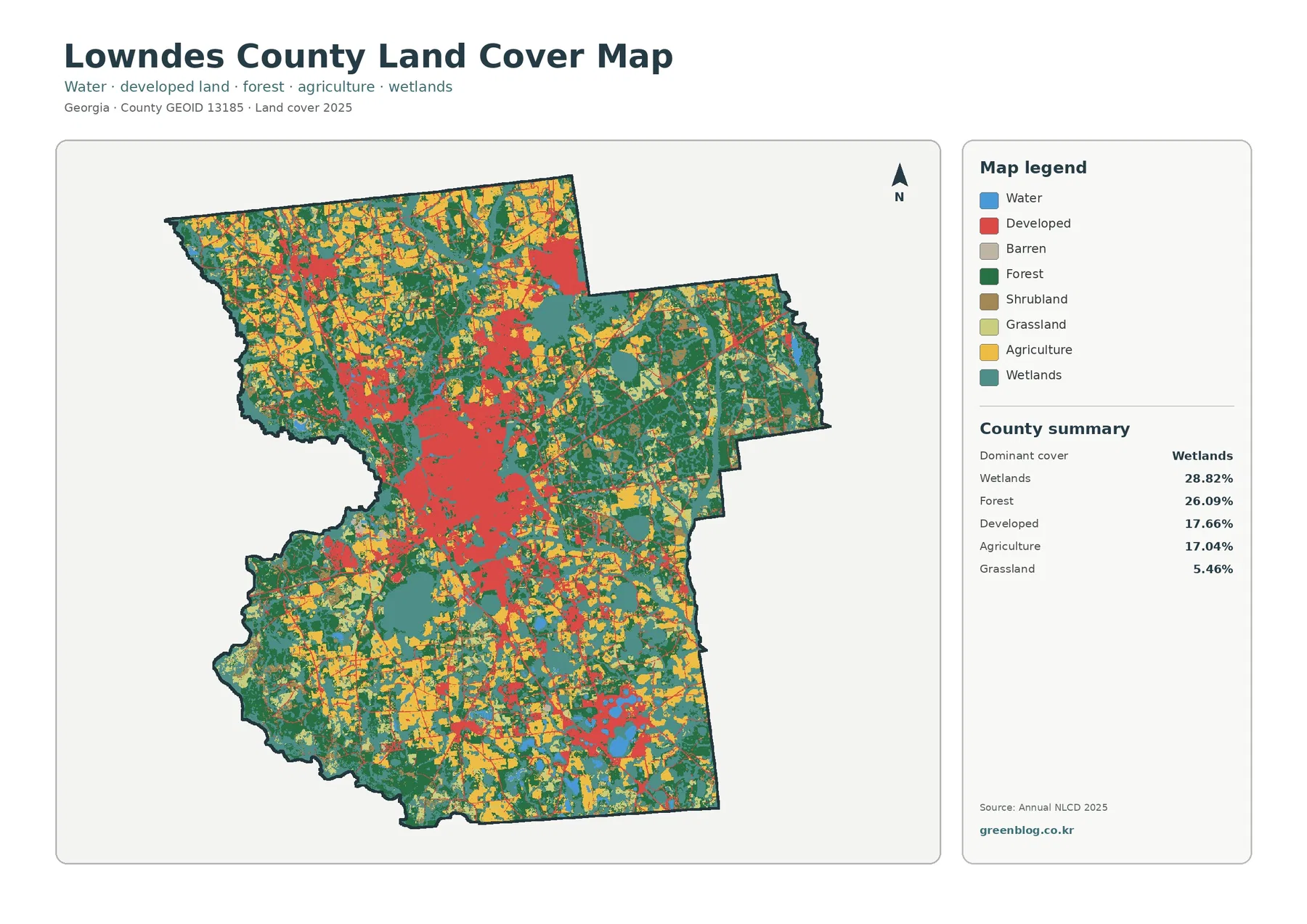
Lowndes County combines a large urban center with substantial wetlands, forest, and working farmland. In the supplied 2025 summary, wetlands
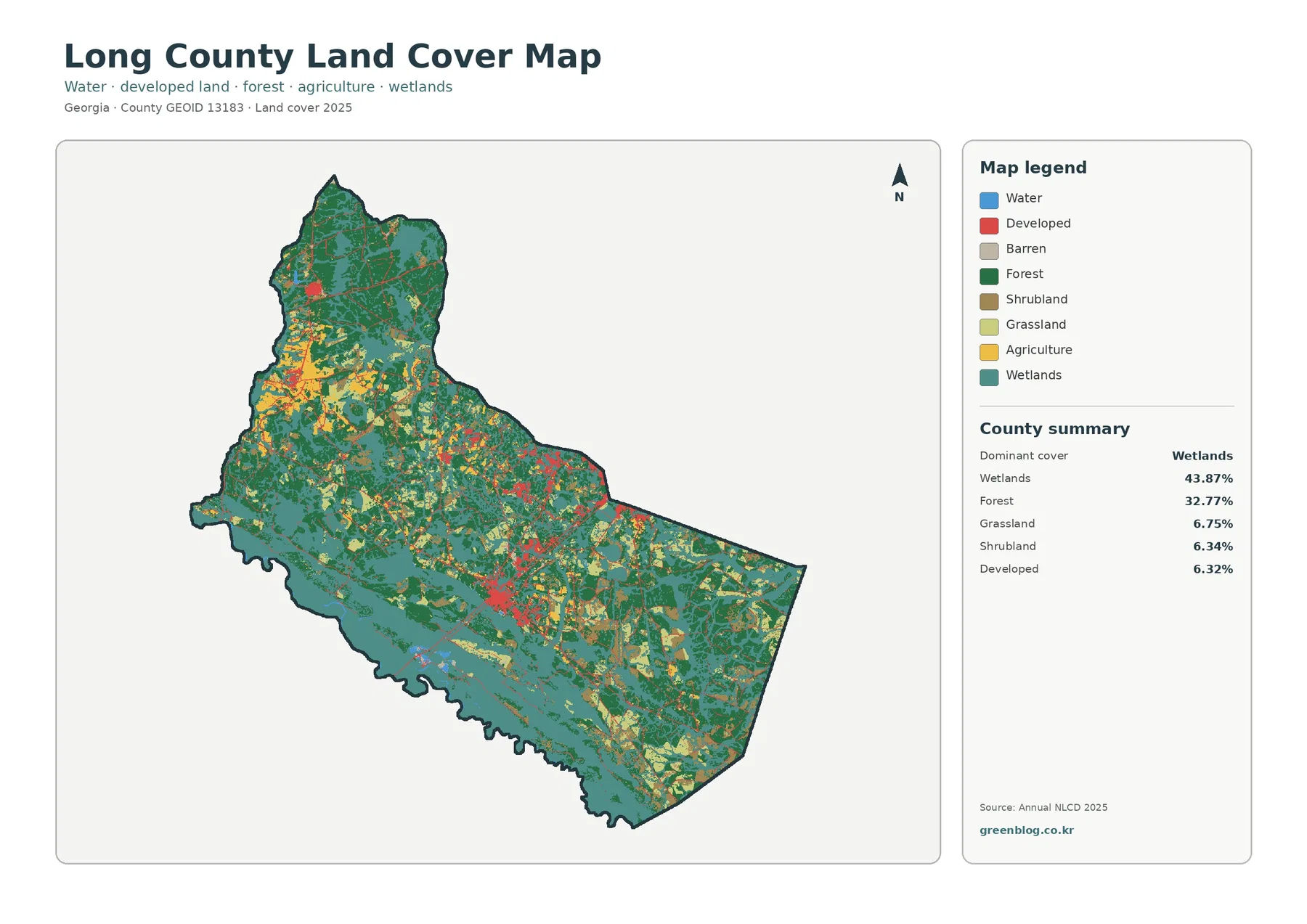
Wetlands are the largest surface class in Long County’s supplied 2025 data, covering 43.87% of the county. Forest follows at
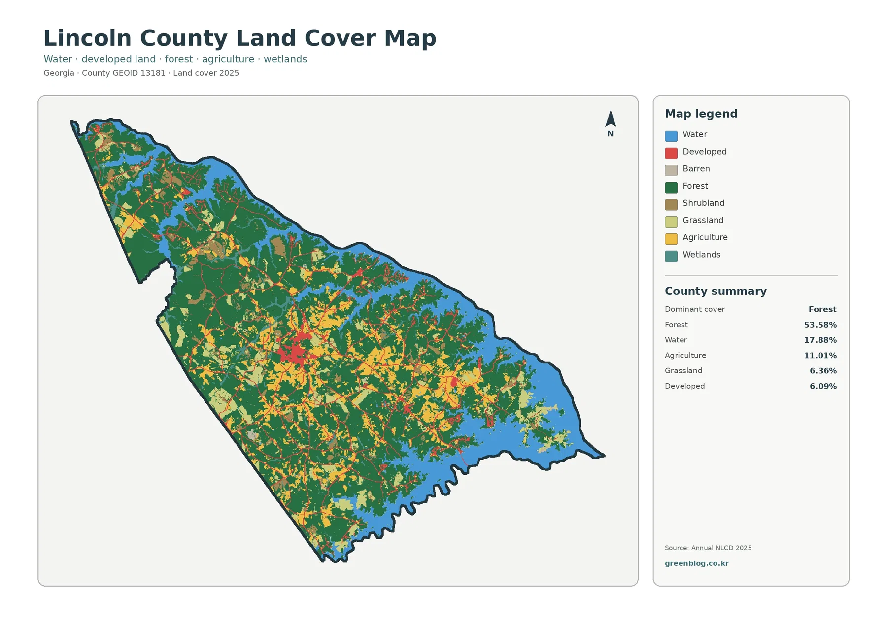
More than half of Lincoln County is forest in the supplied 2025 summary, and open water is unusually prominent for
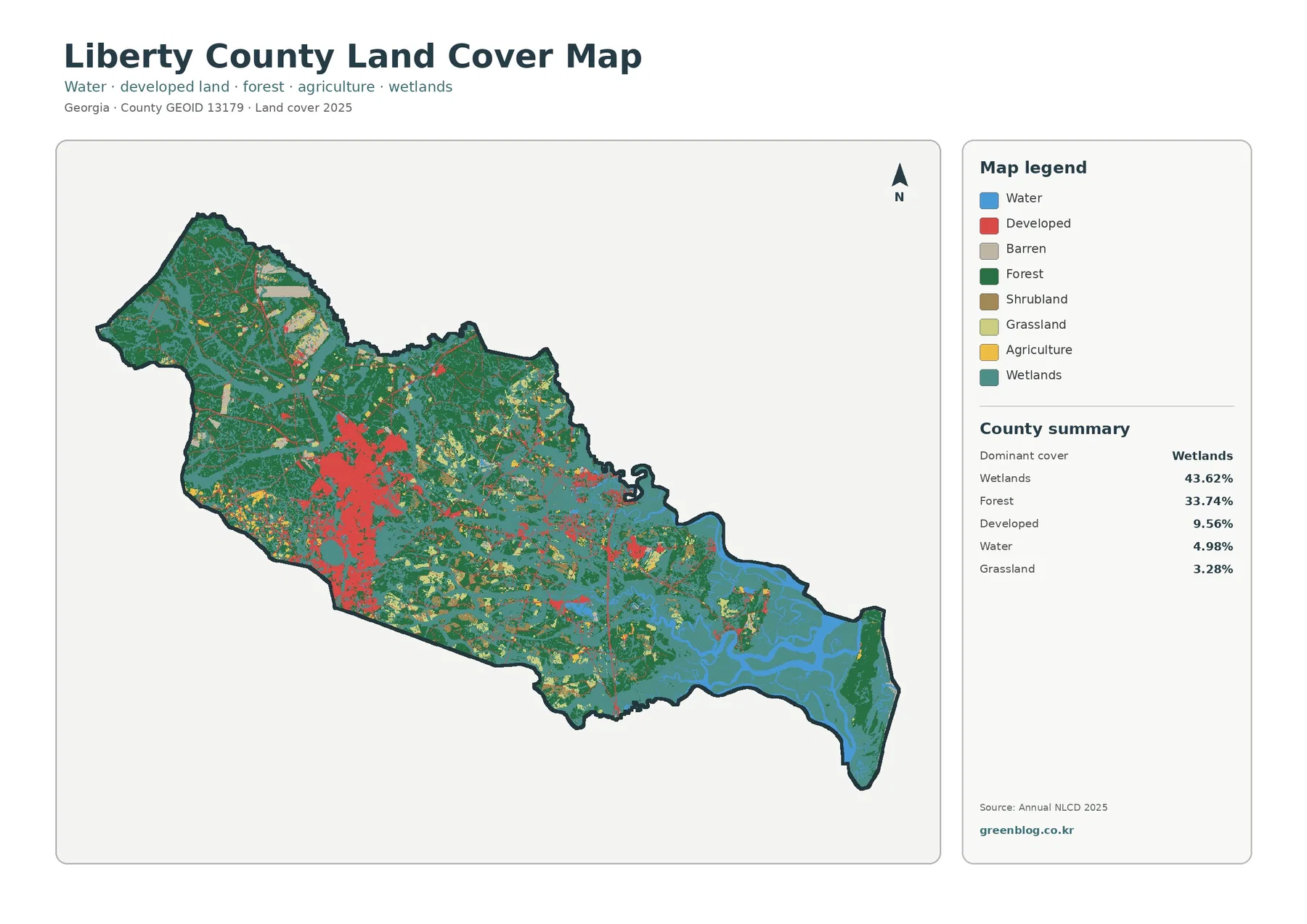
Wetlands define the supplied 2025 Liberty County map. They cover 43.62% of the county, followed by forest at 33.74%. Developed
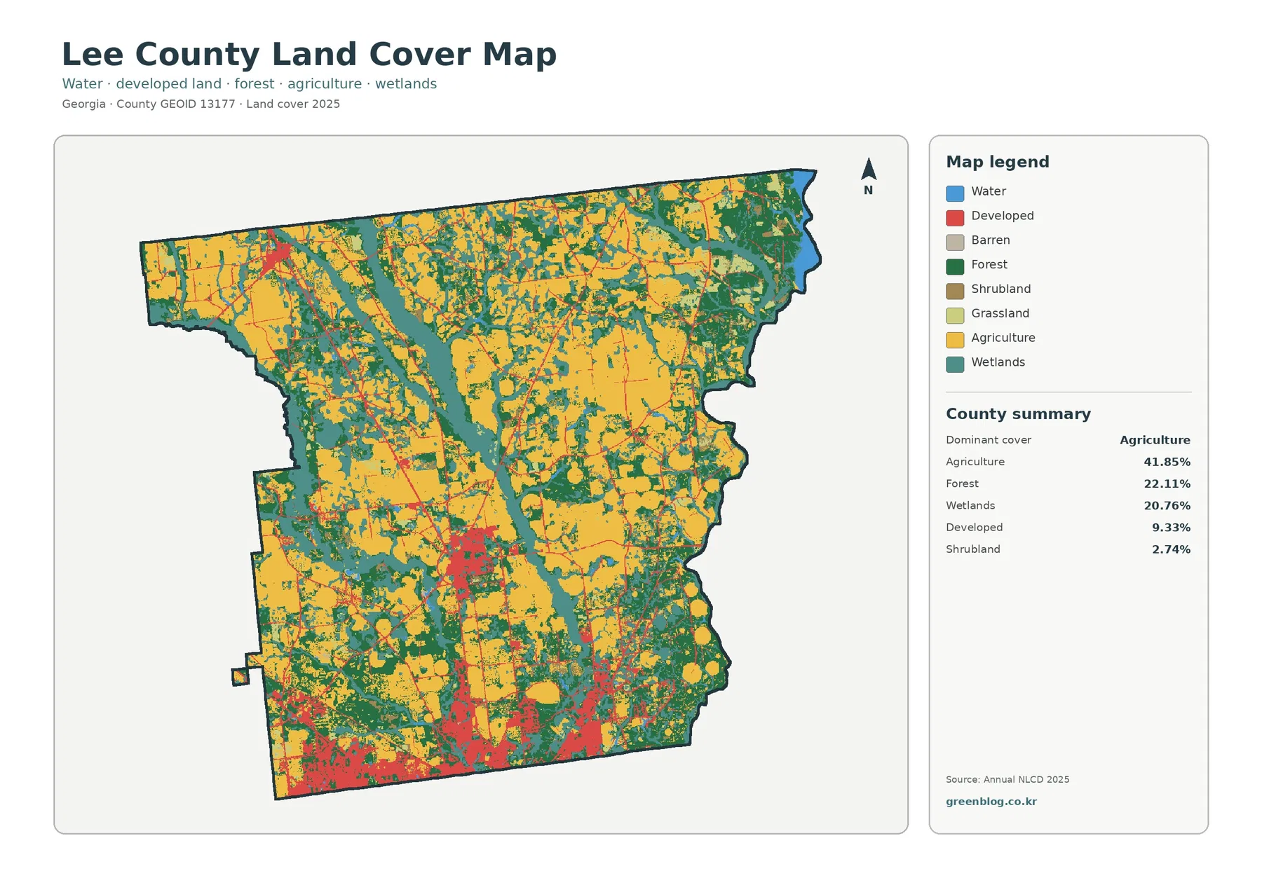
Agriculture is the largest surface class in Lee County, covering 41.85% of the supplied 2025 map. Forest accounts for 22.11%