
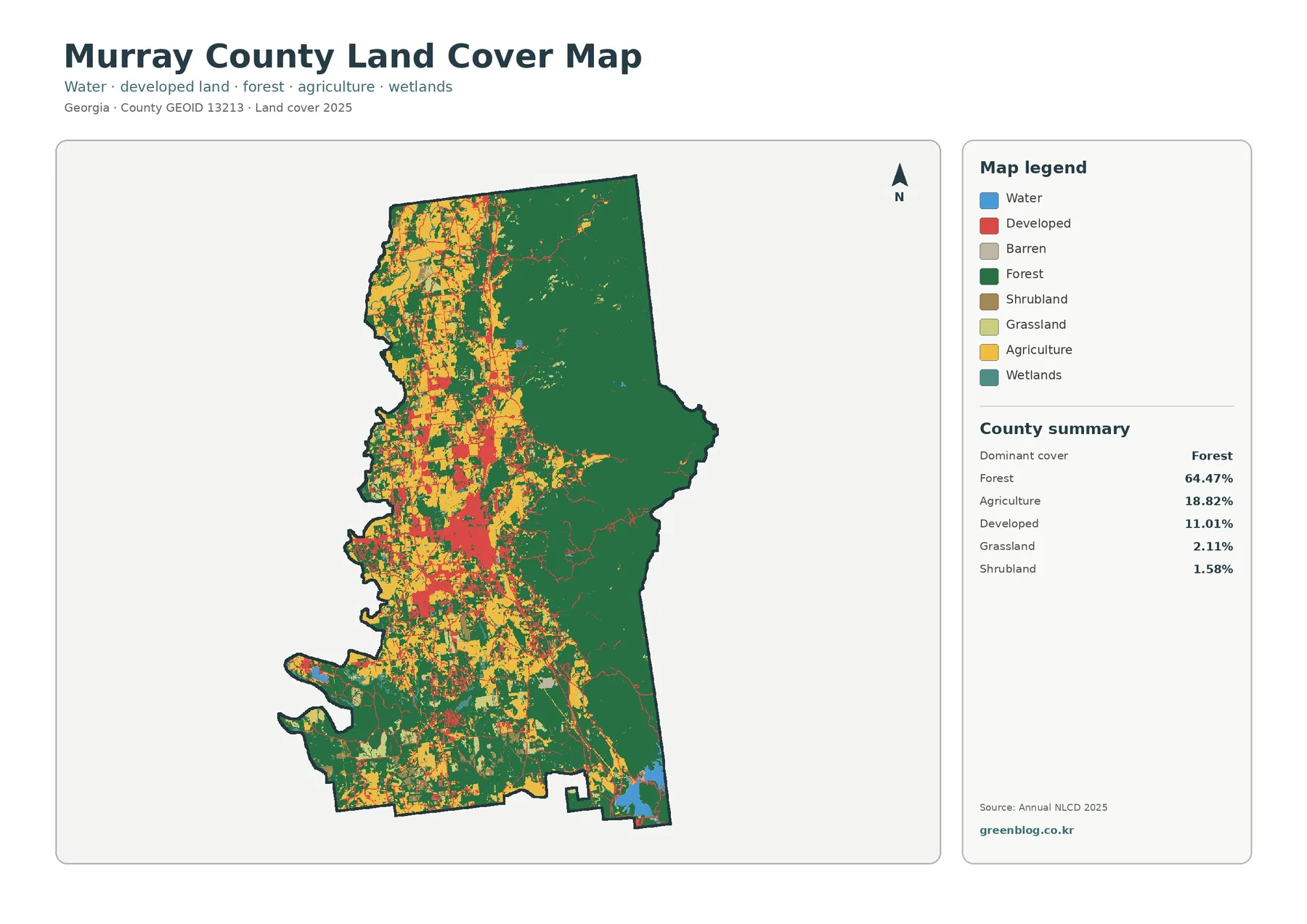
Murray County Georgia Land Cover Map | Cohutta Forests East of the Chatsworth Farm-and-Town Corridor
Murray County has one of the clearest east-west land-cover contrasts in this Georgia map series. Forest accounts for 64.47% of […]
Murray County has one of the clearest east-west land-cover contrasts in this Georgia map series. Forest accounts for 64.47% of […]
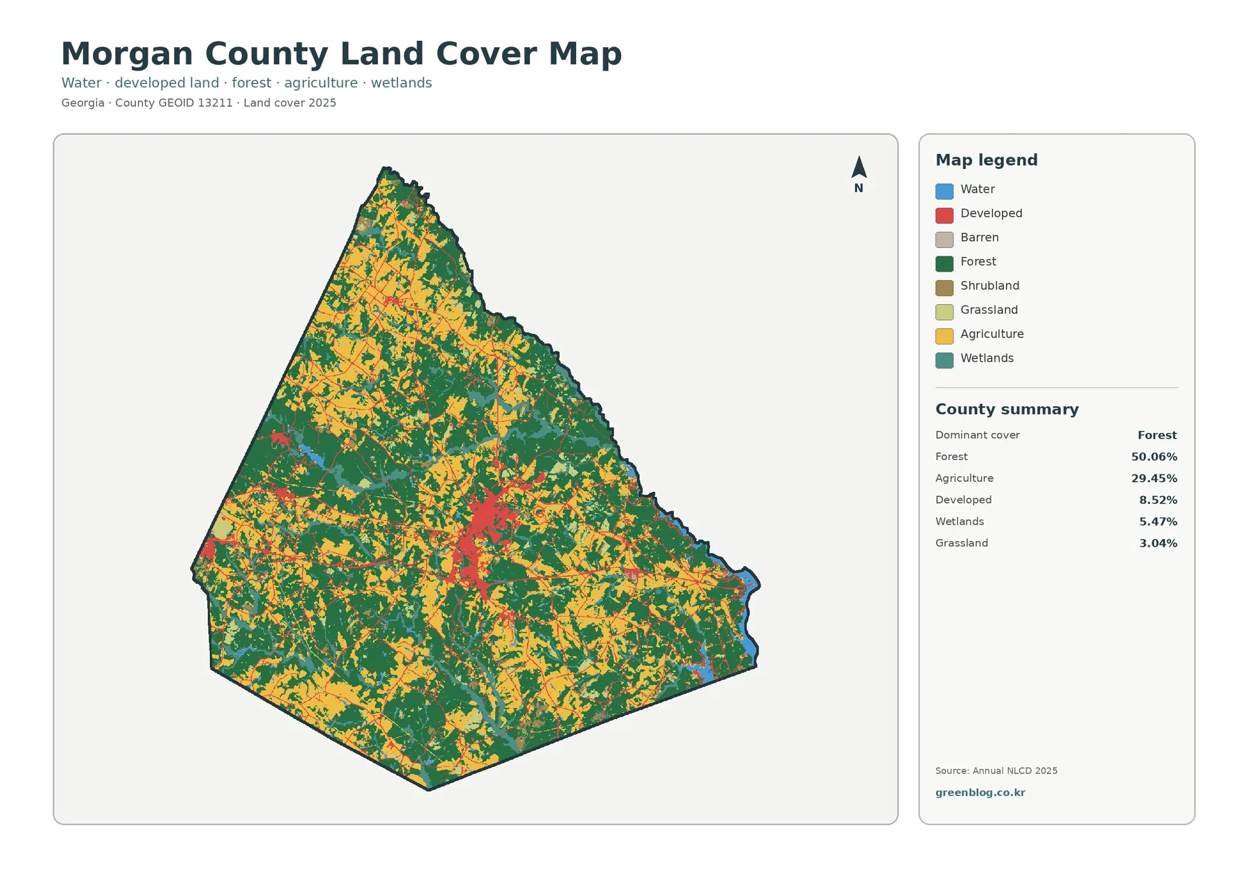
Morgan County is evenly split enough between woods and working land that neither can be ignored. Forest covers 50.06% of
Morgan County Georgia Land Cover Map | Madison and I-20 Through a Forest-and-Farm County Read More »
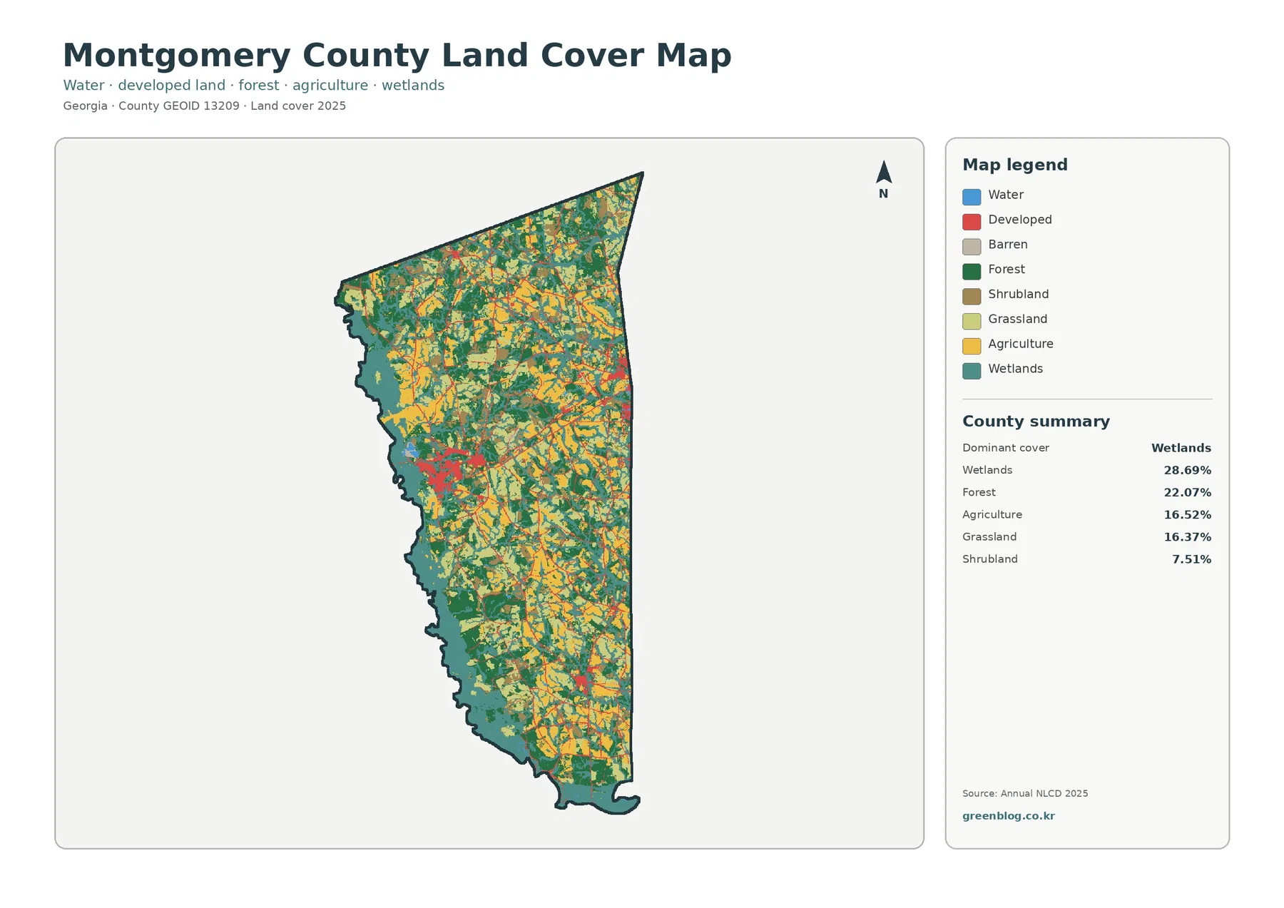
Montgomery County has no single land-cover class that overwhelms everything else. Wetlands lead the supplied 2025 summary at 28.69%, followed
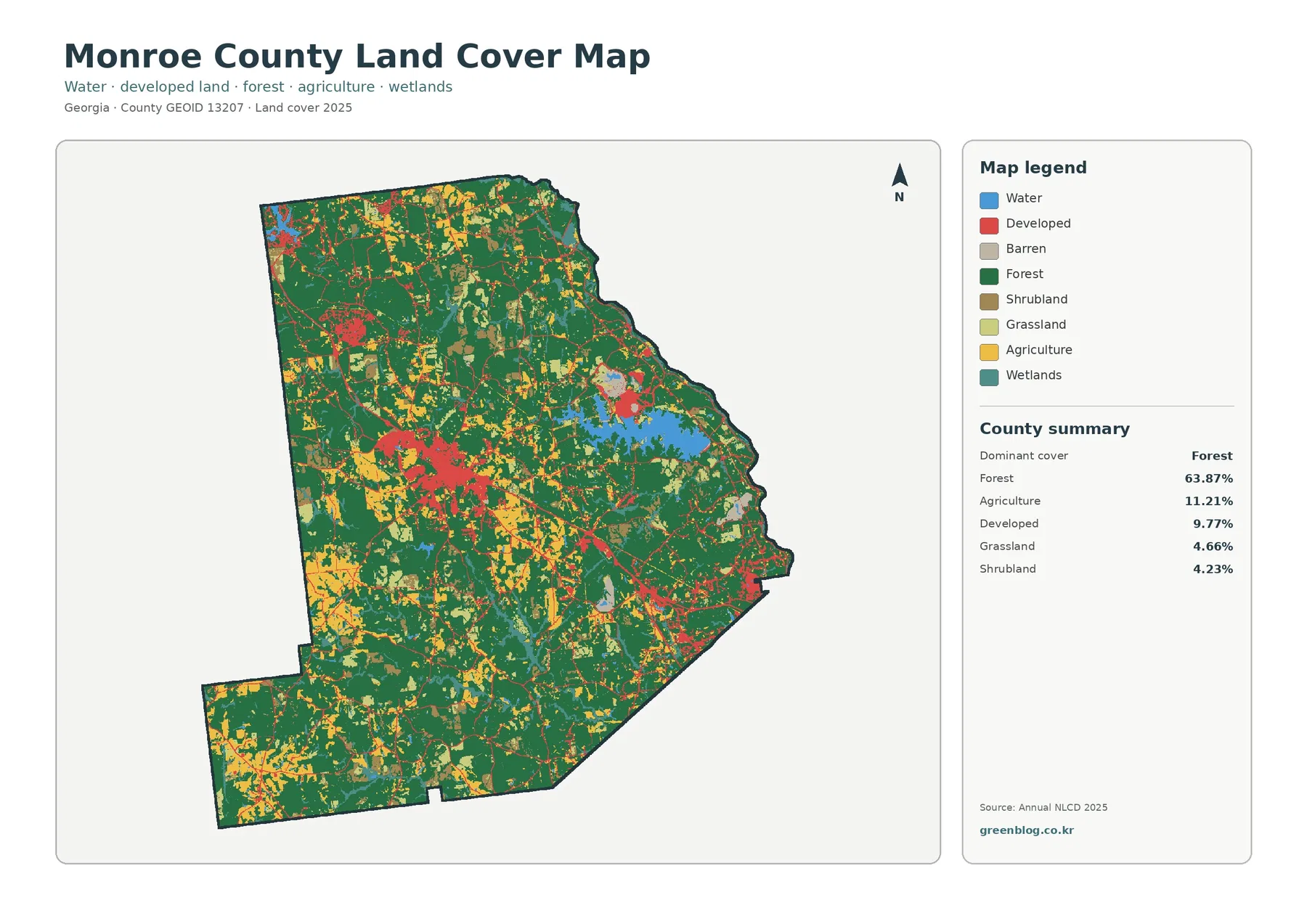
Monroe County is heavily wooded in the supplied 2025 data, but two built settings make the map distinctive. Forest covers
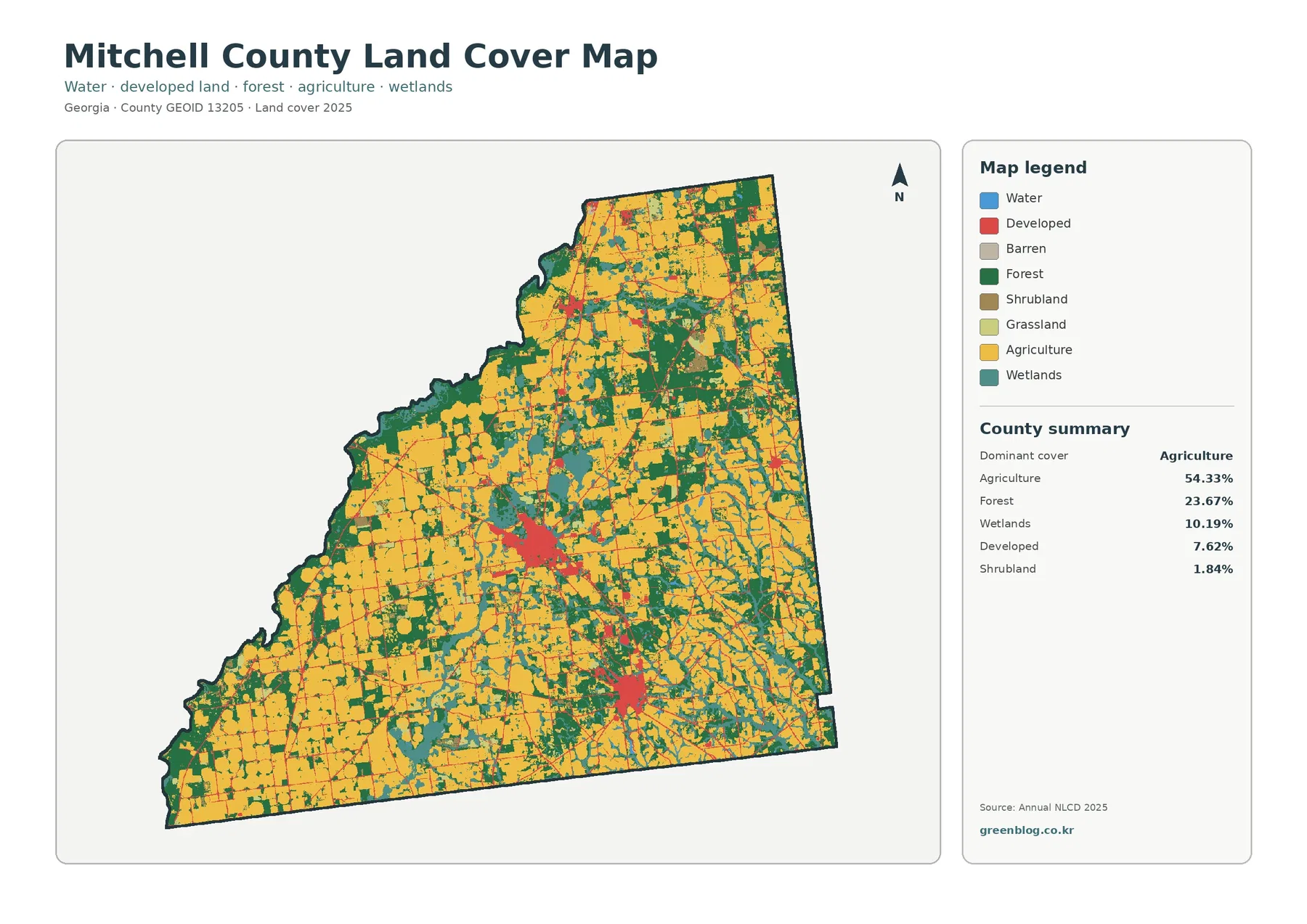
Mitchell County is strongly agricultural, but the county is not visually uniform. Agriculture covers 54.33% of the supplied 2025 map,
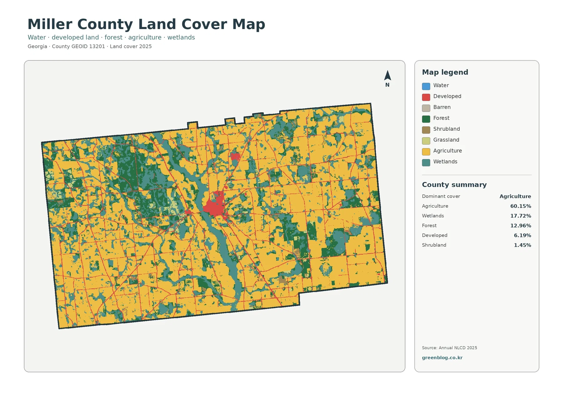
Miller County is unmistakably agricultural in the supplied 2025 data. Agriculture covers 60.15% of the county, followed by wetlands at
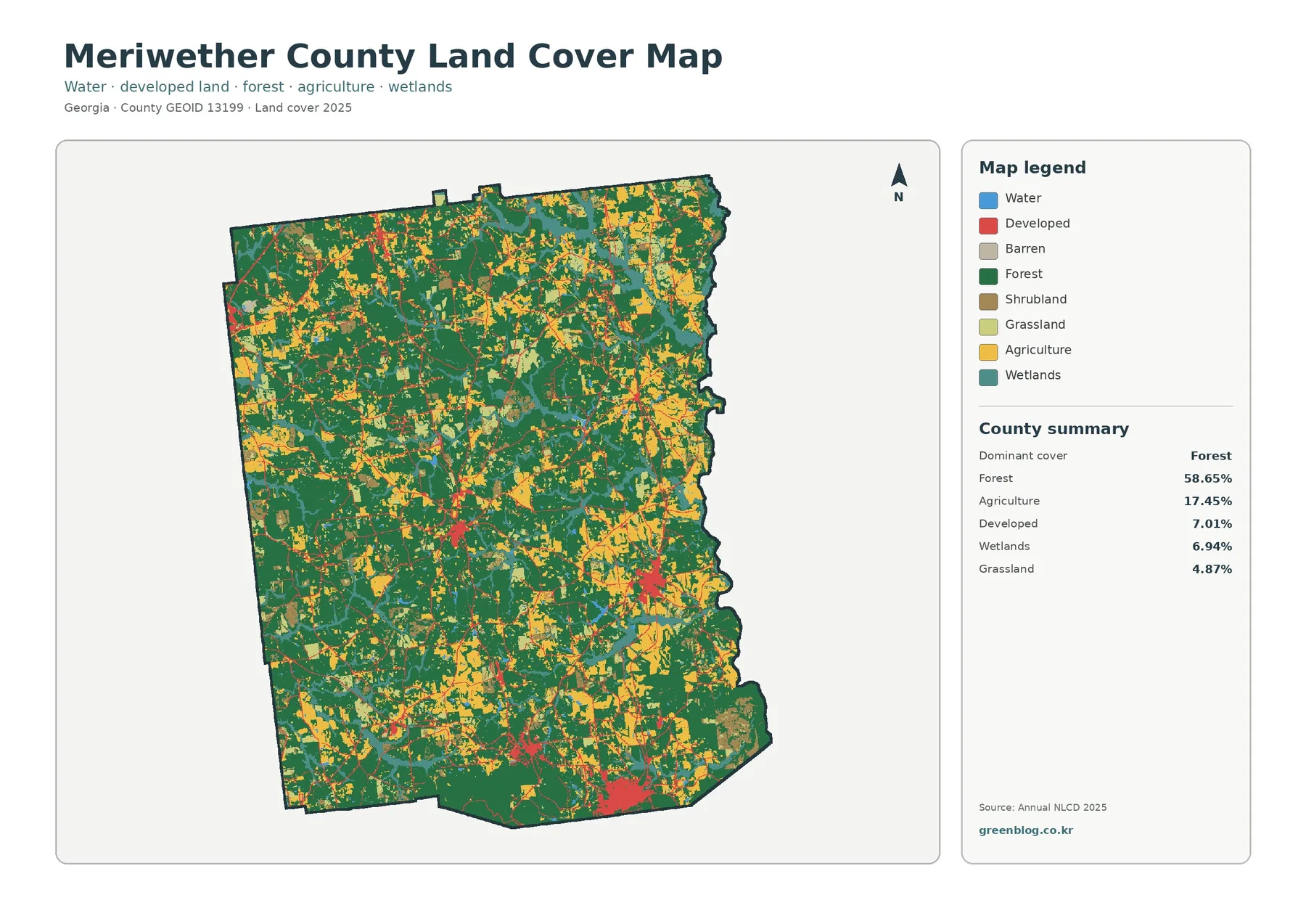
Meriwether County is mostly wooded, but its settlement pattern is more scattered than a single county-seat-centered map might suggest. Forest
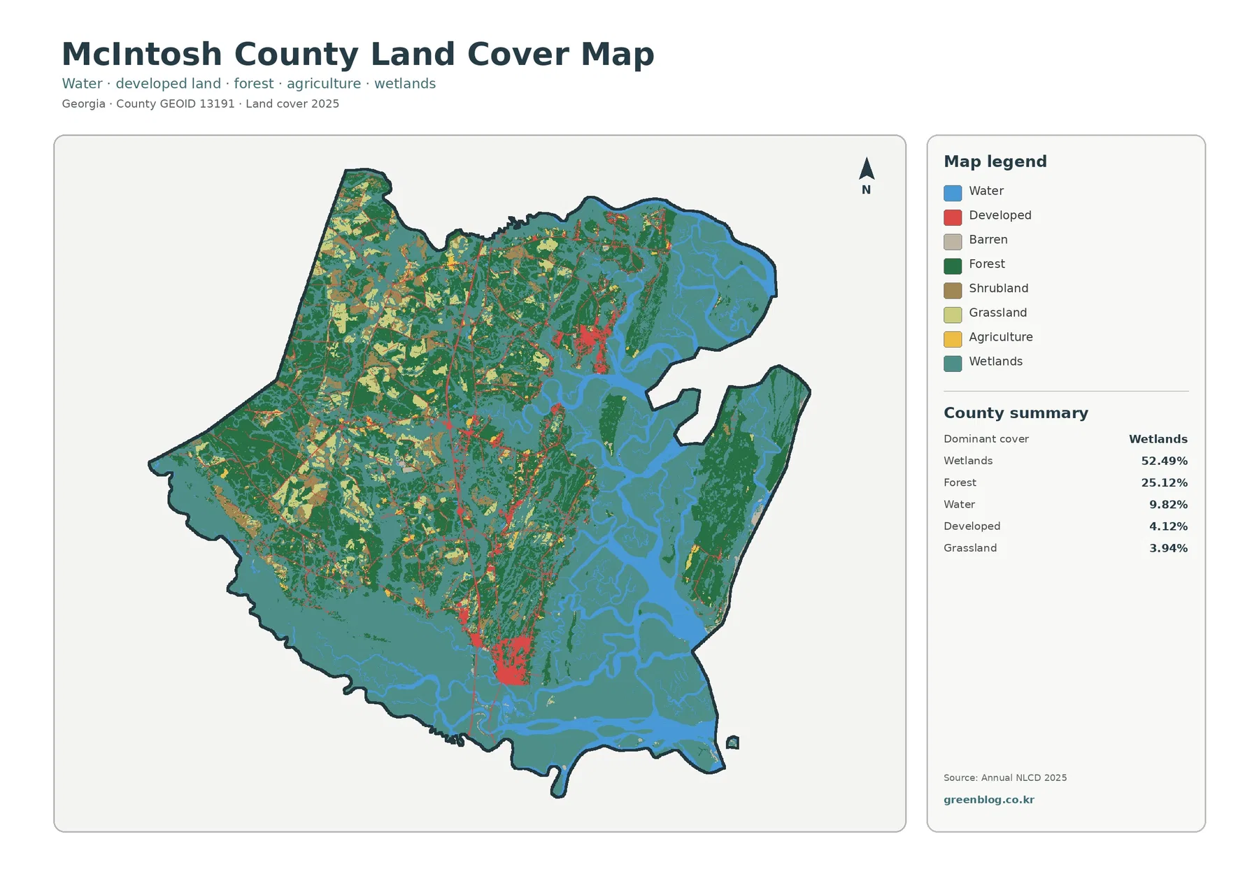
McIntosh County looks different from an inland Georgia county before the details are even counted. Wetlands cover 52.49% of the
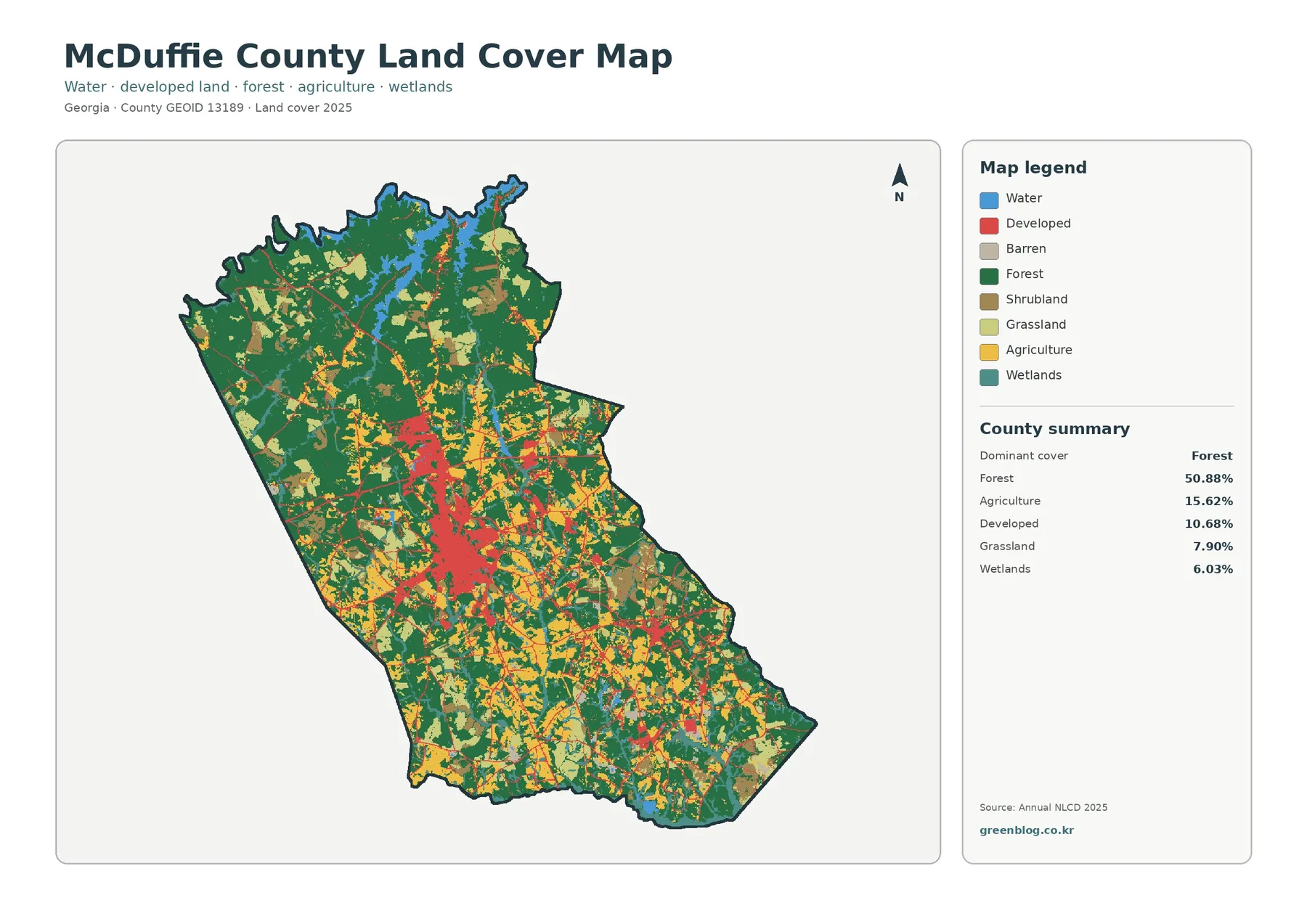
McDuffie County is more than half forest in the supplied 2025 data, yet its central built area is easy to