
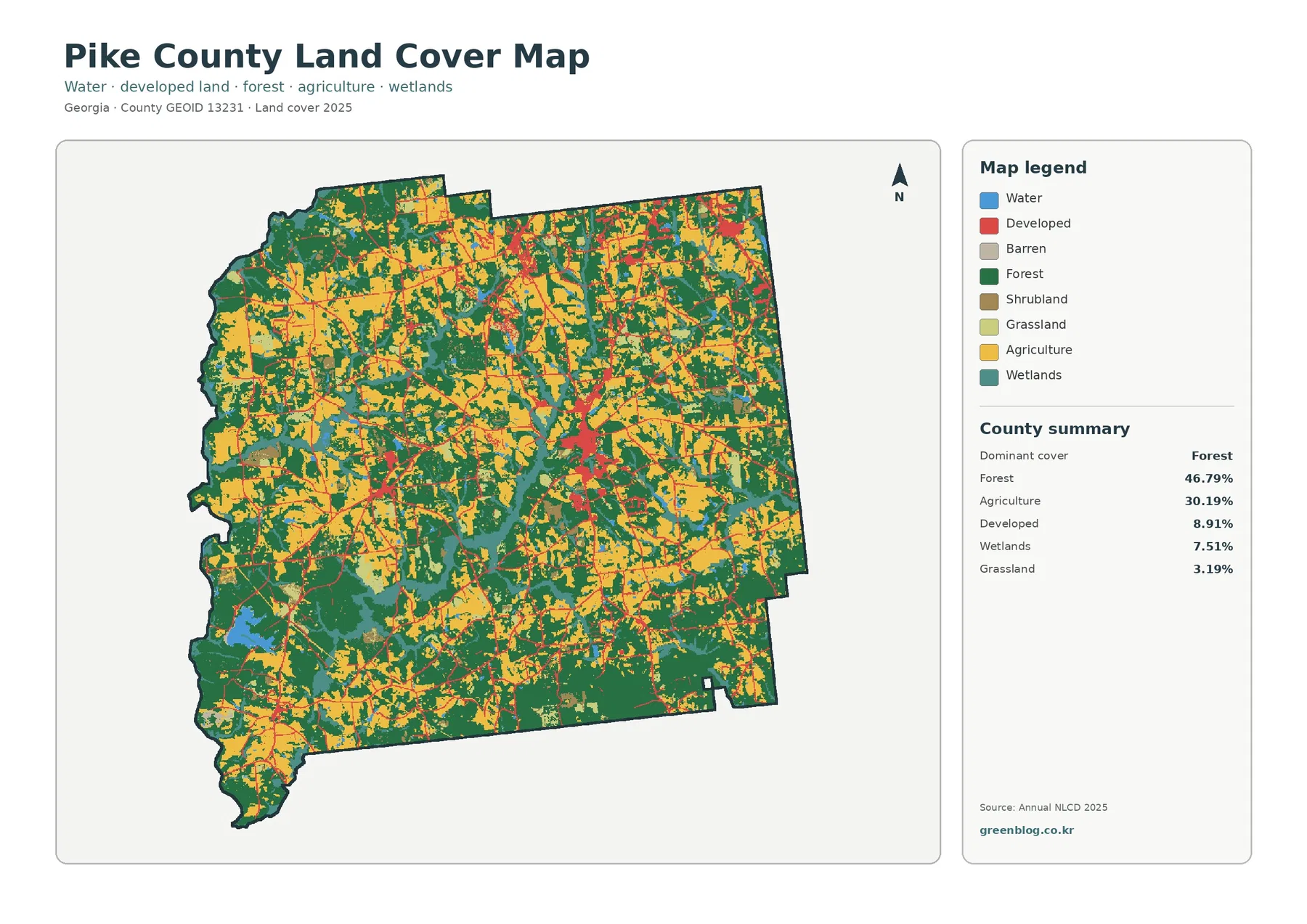
Pike County Georgia Land Cover Map | Forest and Farmland Around a Small-Town Zebulon Network
Pike County is mostly forest and farmland, with development broken into small-town centers rather than one continuous urban area. Forest […]
Pike County is mostly forest and farmland, with development broken into small-town centers rather than one continuous urban area. Forest […]
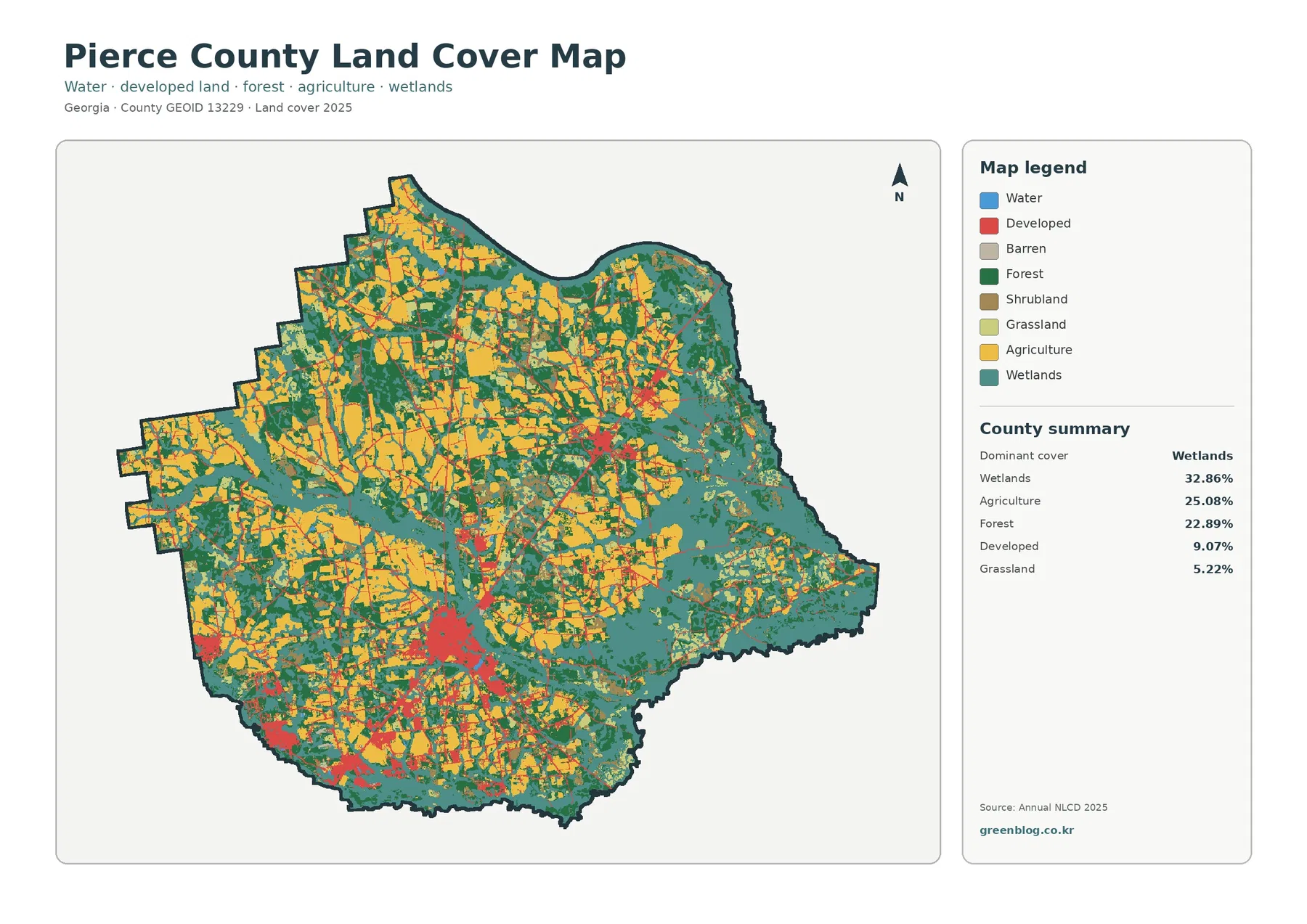
Pierce County is a wetland-and-farm county before it is an urban one. Wetlands cover 32.86% of the supplied 2025 classification,
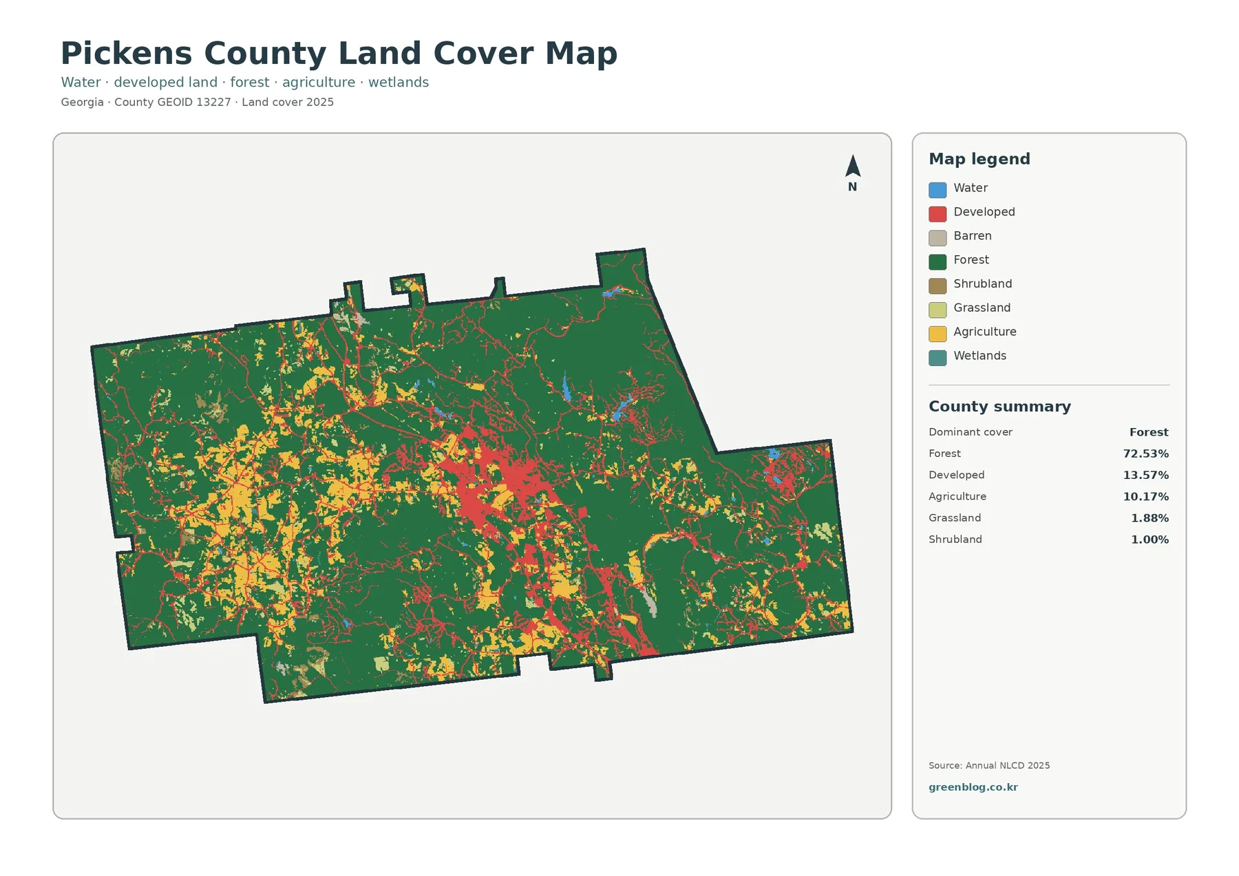
Pickens County is overwhelmingly forested, but the Jasper area creates a clear built corridor through the middle of the map.
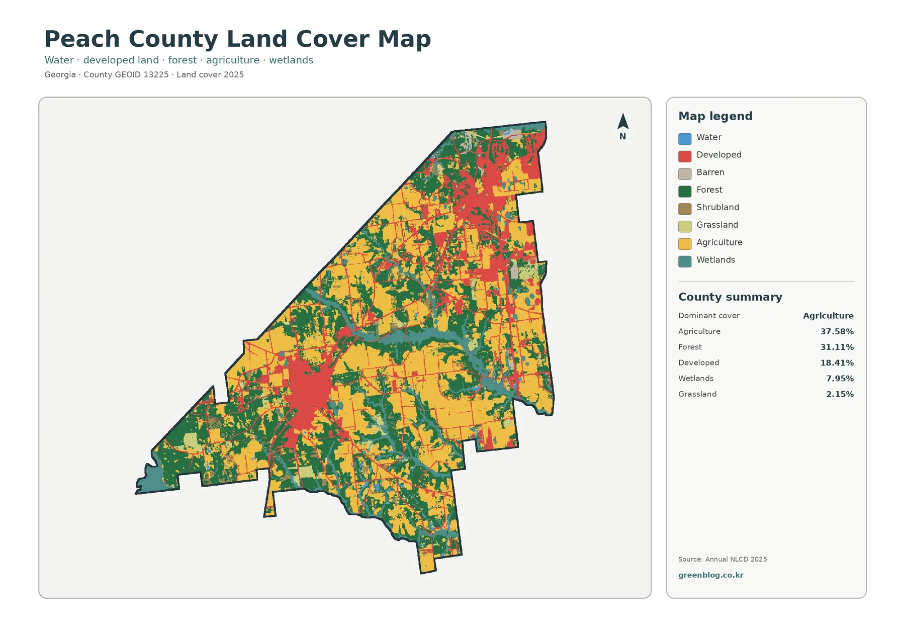
Peach County is agricultural first, but its two main built centers give the map a distinct shape. Agriculture covers 37.58%
Peach County Georgia Land Cover Map | Farms Between Fort Valley and I-75 Growth in Byron Read More »
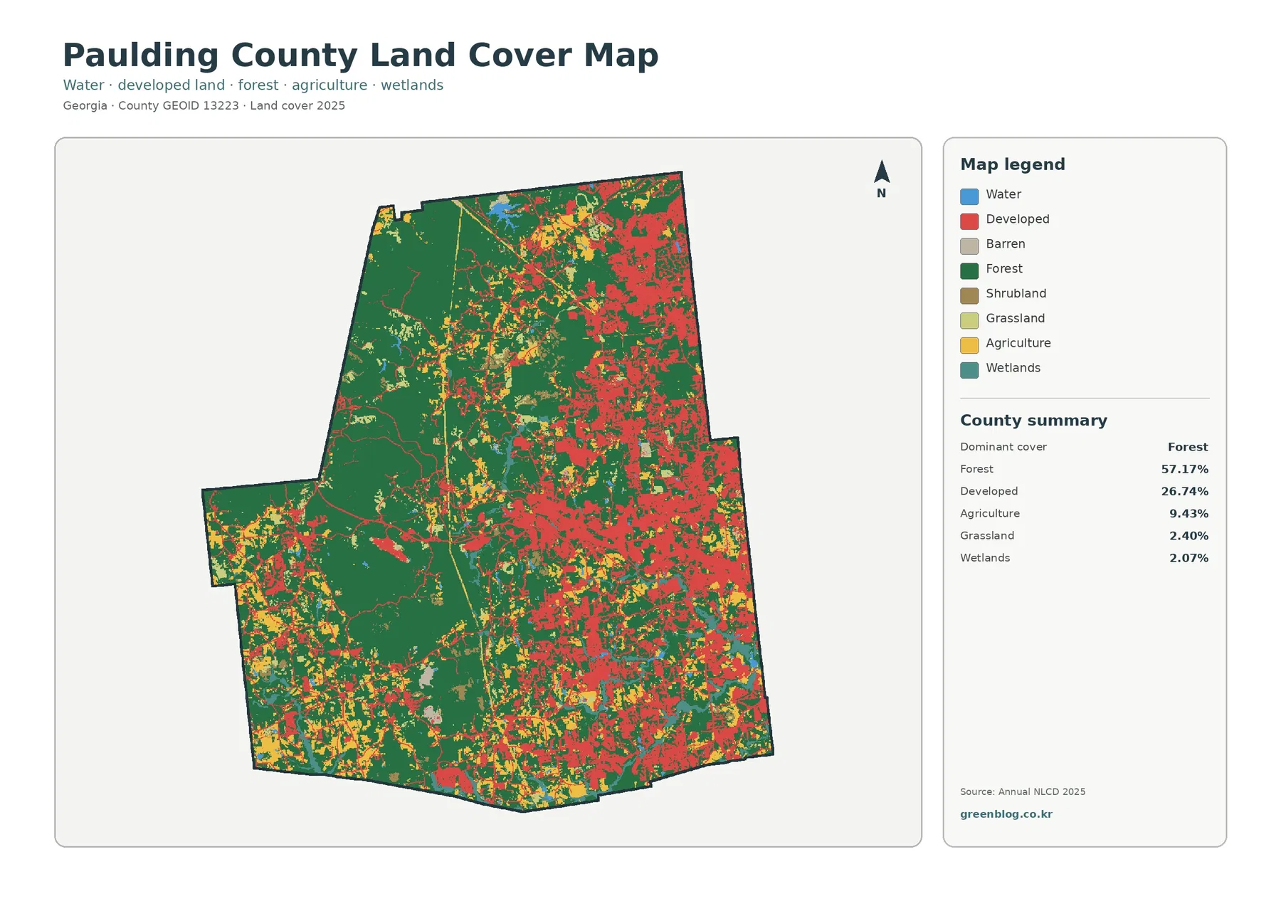
Paulding County has a sharp development gradient across its 2025 land-cover map. Forest remains the largest class at 57.17%, but
Paulding County Georgia Land Cover Map | Eastern Growth Corridors Beside a Forested West Read More »
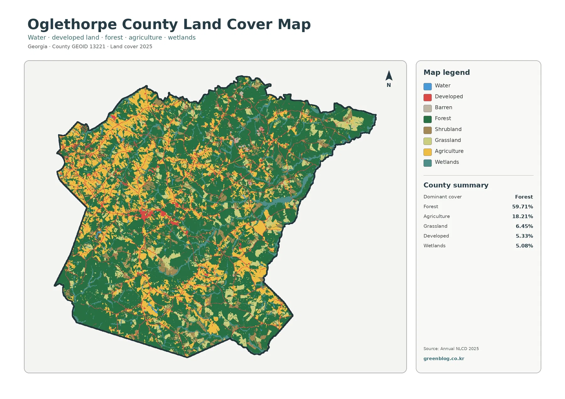
Oglethorpe County is primarily forested, but farms, grassland, and small settlements give the western half a much more varied appearance.
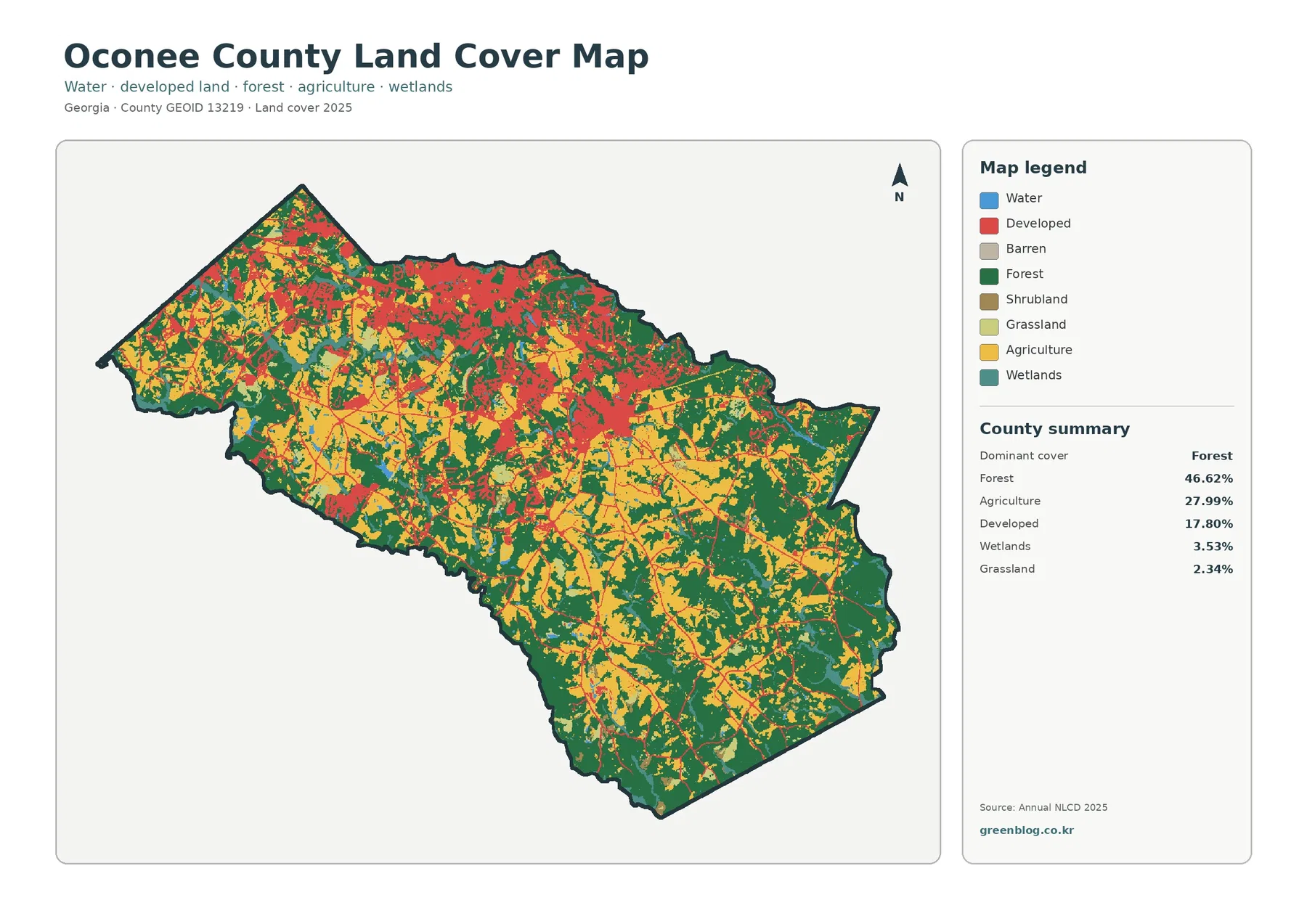
Oconee County combines a fast-growing northern and central area with a substantial farm-and-forest landscape farther south. Forest covers 46.62% of
Oconee County Georgia Land Cover Map | Northern Growth Above a Farm-and-Forest South Read More »
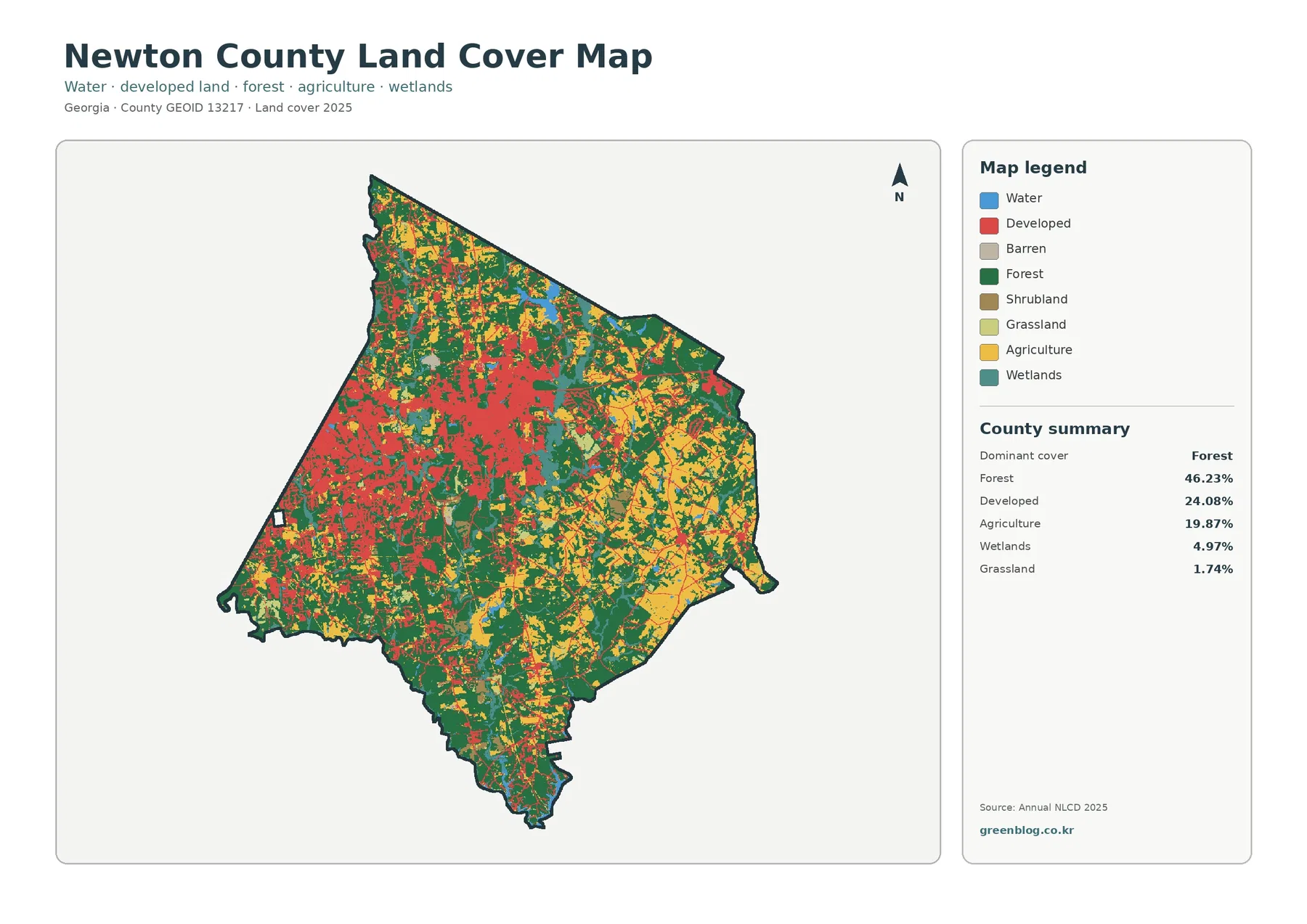
Newton County shows a strong transition from suburban growth to a more rural eastern landscape. Forest covers 46.23% of the
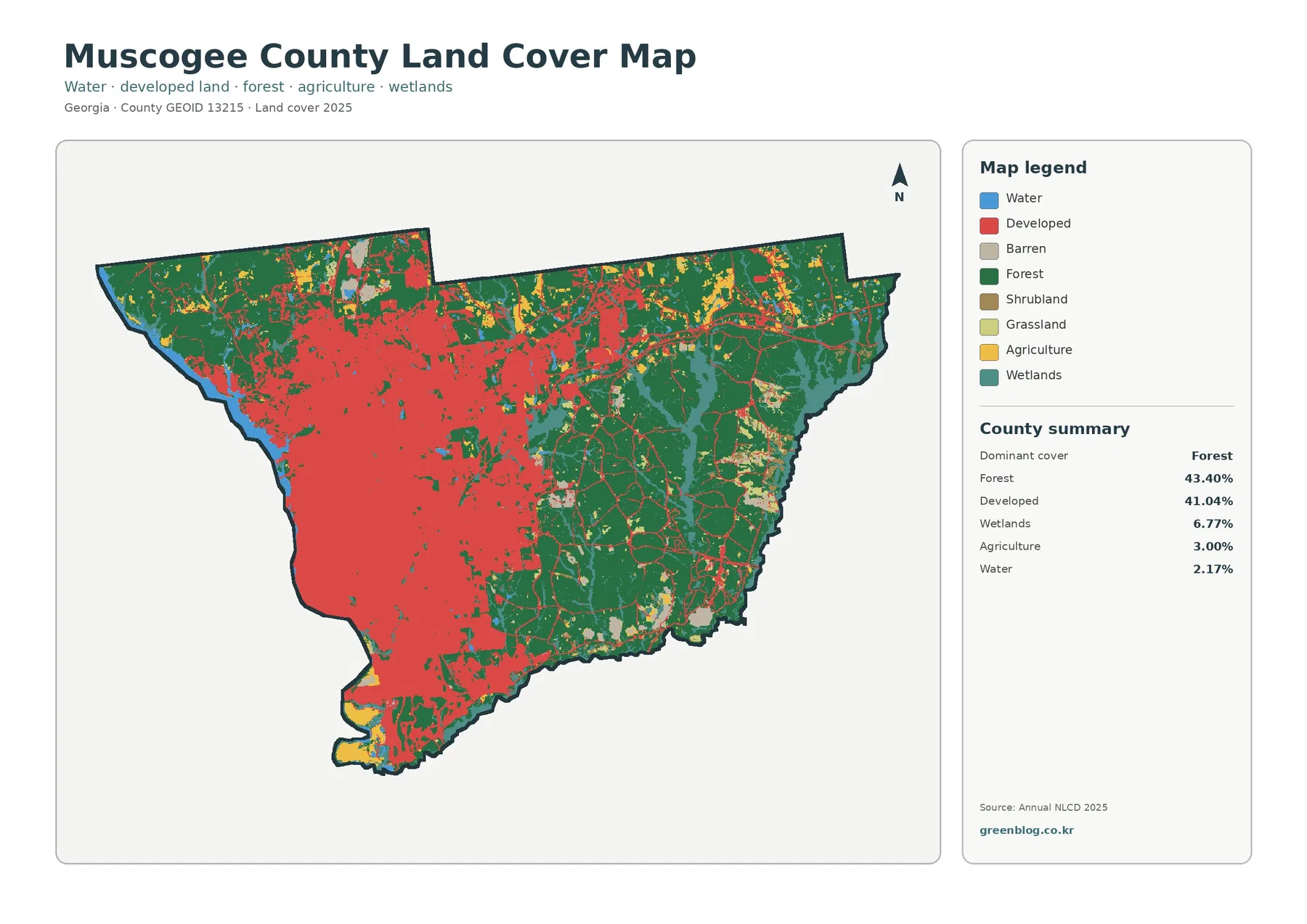
Muscogee County is unusual among Georgia counties because forest and developed land occupy almost the same share of the 2025