
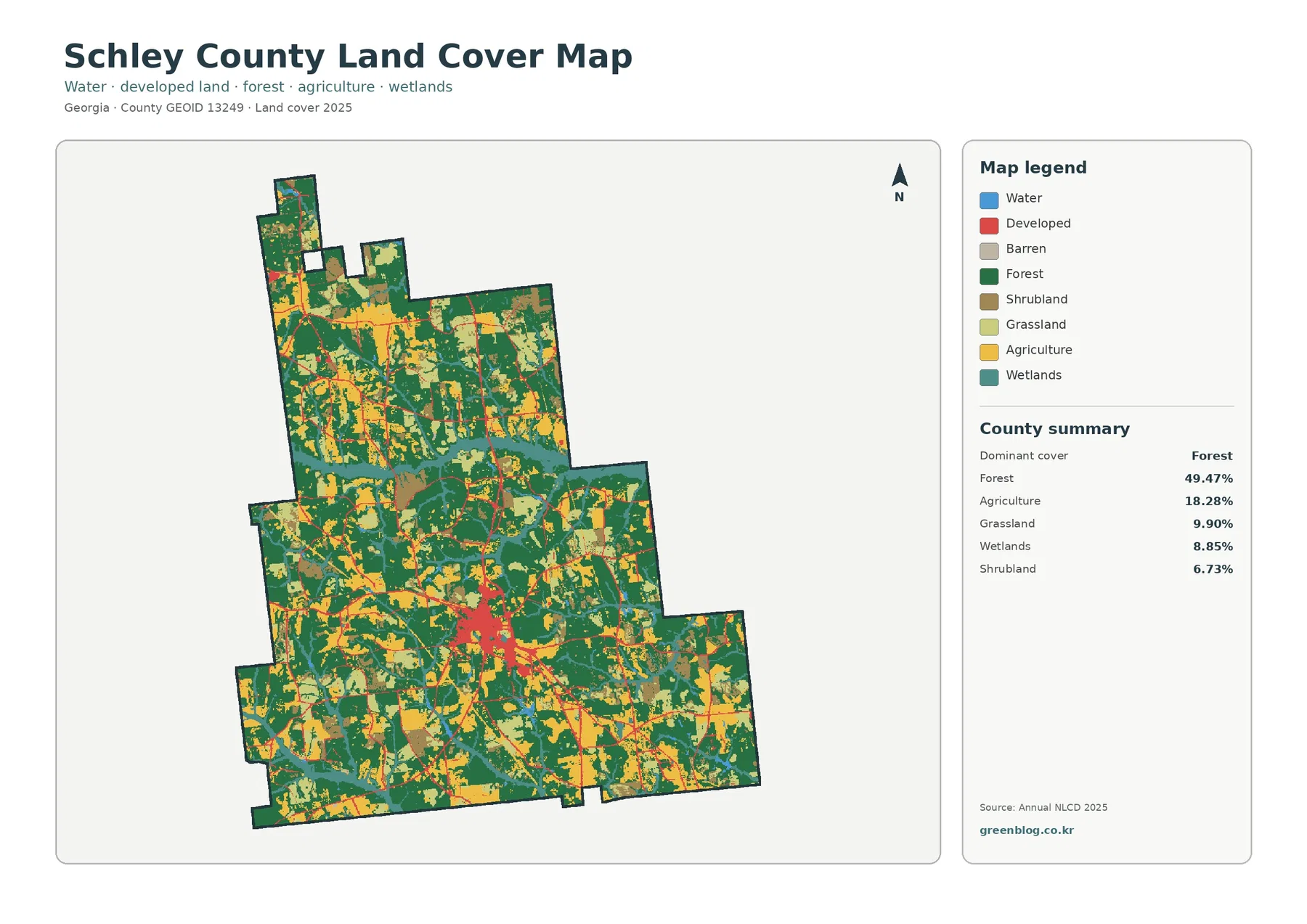
Schley County Georgia Land Cover Map | Ellaville at the US 19–GA 26 Crossroads Among Woods and Fields
Schley County is a rural Georgia county where forest is the largest cover, but fields, grass, shrub cover, and wetlands […]
Schley County is a rural Georgia county where forest is the largest cover, but fields, grass, shrub cover, and wetlands […]
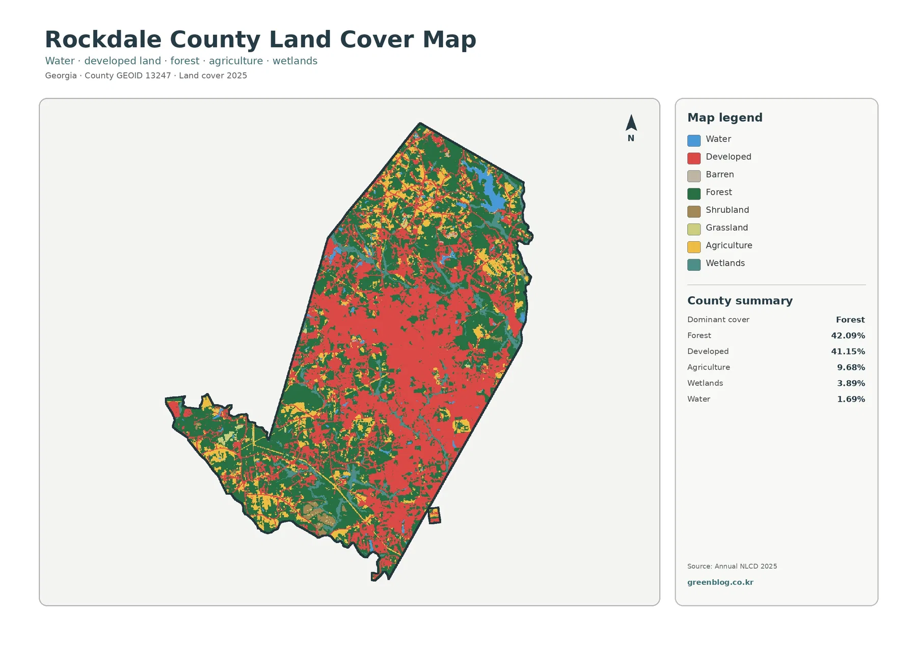
Rockdale County is almost evenly divided between forest and developed land. Forest covers 42.09% of the supplied 2025 classification, while
Rockdale County Georgia Land Cover Map | Conyers Suburban Growth Beside a Forested North Read More »
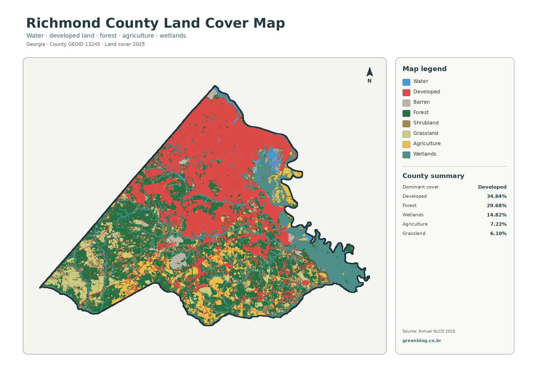
Richmond County has one of the clearest urban-to-rural gradients in this Georgia map series. Developed land is the largest 2025
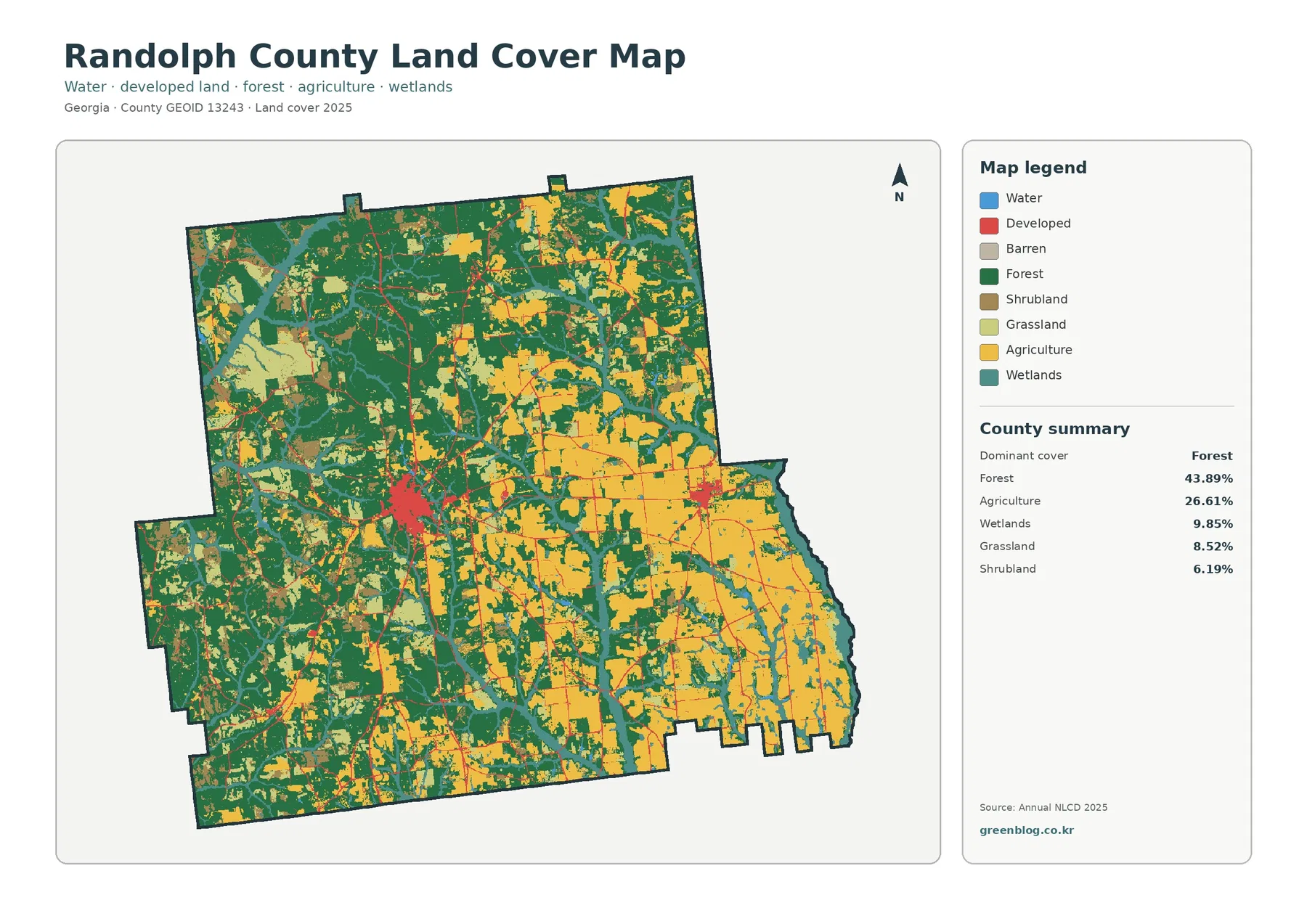
Randolph County is split visually between a more wooded western half and broad agricultural areas toward the east. Forest covers
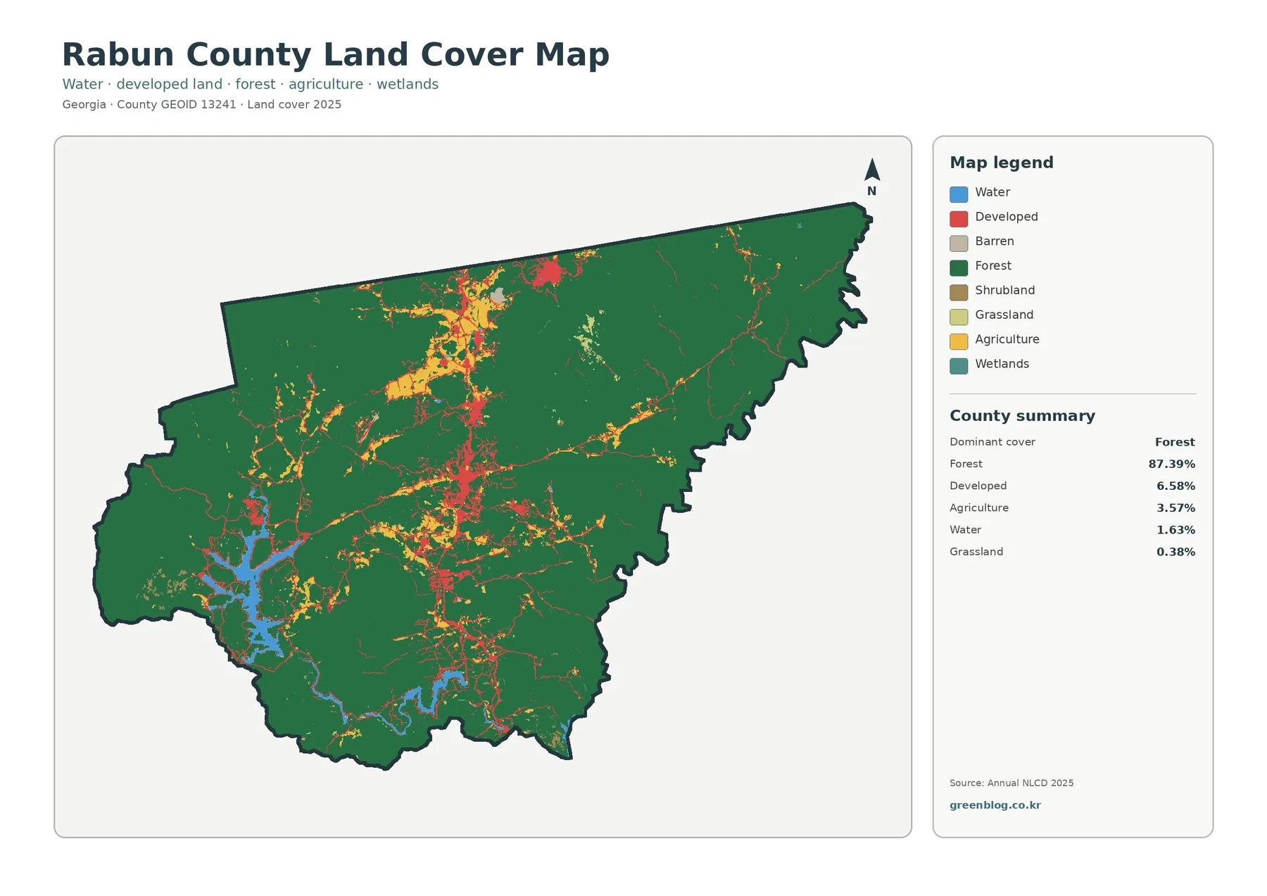
Rabun County is one of the most forest-dominated counties in this map series. Forest covers 87.39% of the supplied 2025
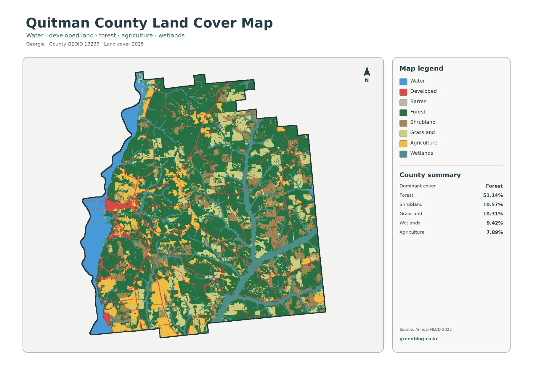
Quitman County has an unusual combination of broad forest, open scrub and grass, and a major reservoir forming much of
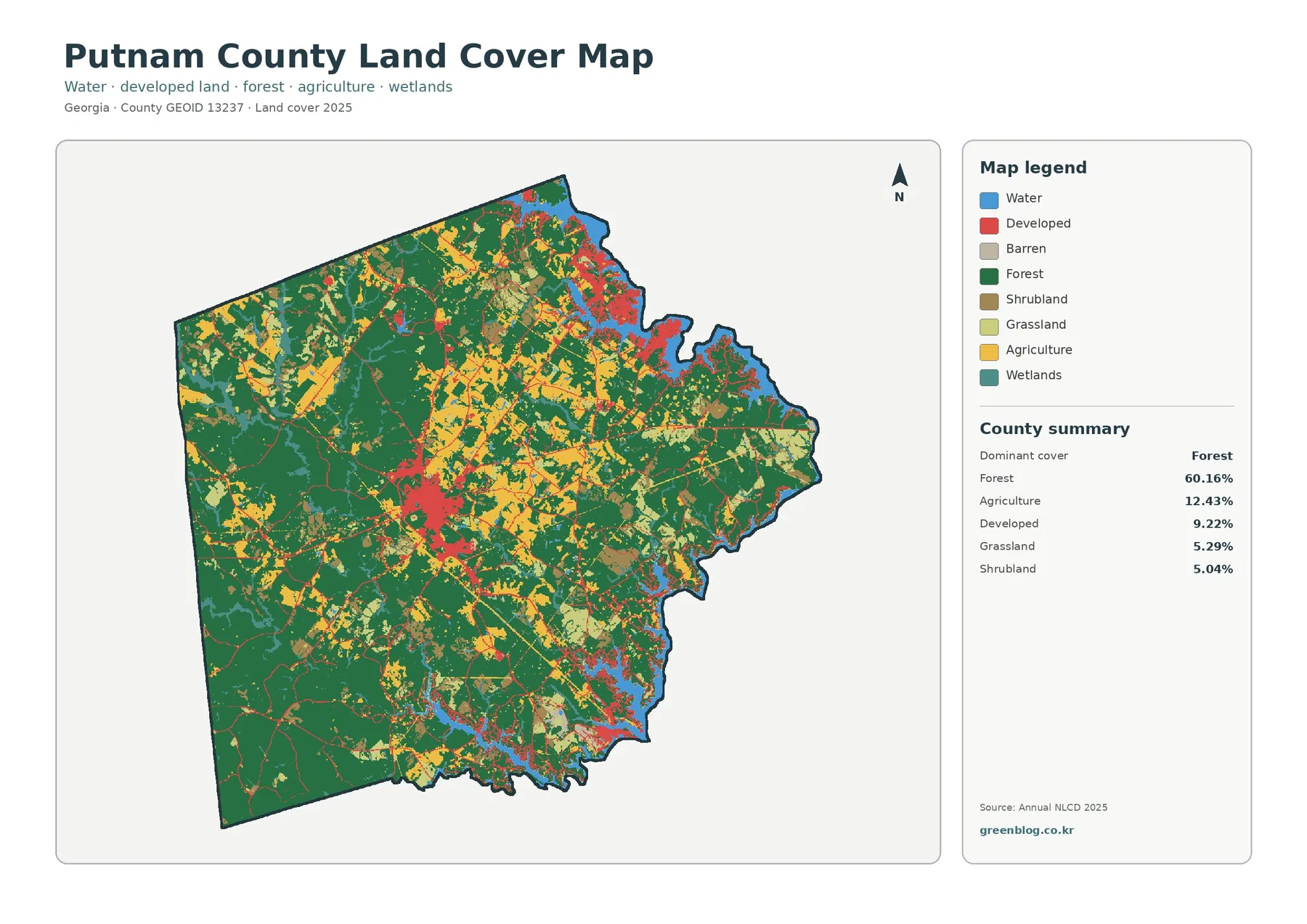
Putnam County is mostly forest, but its developed land has two very different forms: a compact inland center around Eatonton
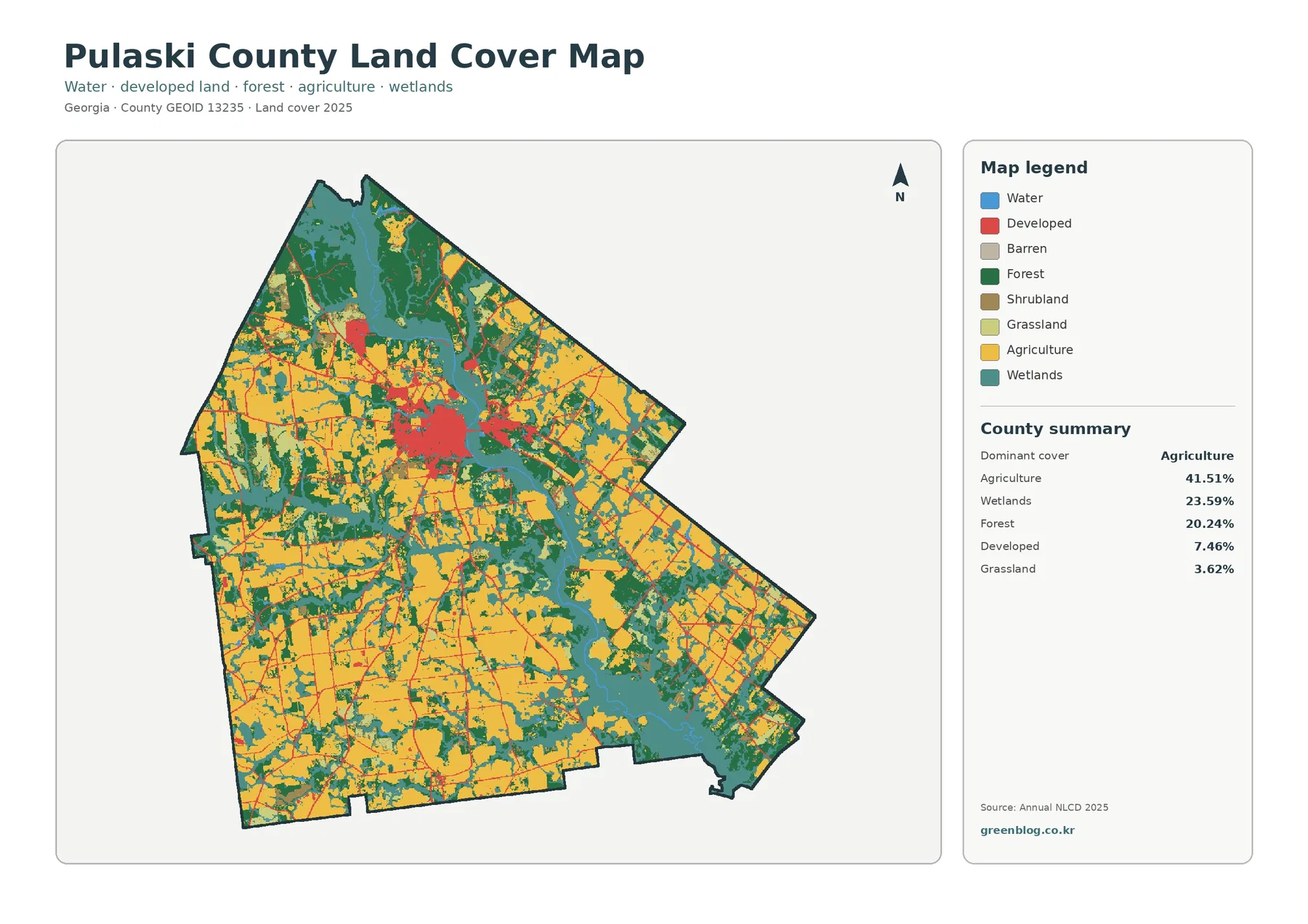
Pulaski County is dominated by working land and wet corridors rather than by built cover. Agriculture accounts for 41.51% of
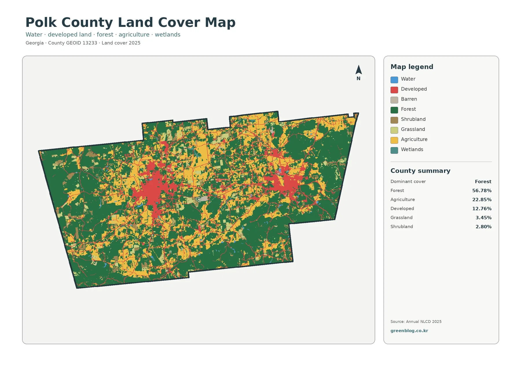
Polk County has two obvious settlement centers inside a county that is still mostly forest and farmland. Forest covers 56.78%