
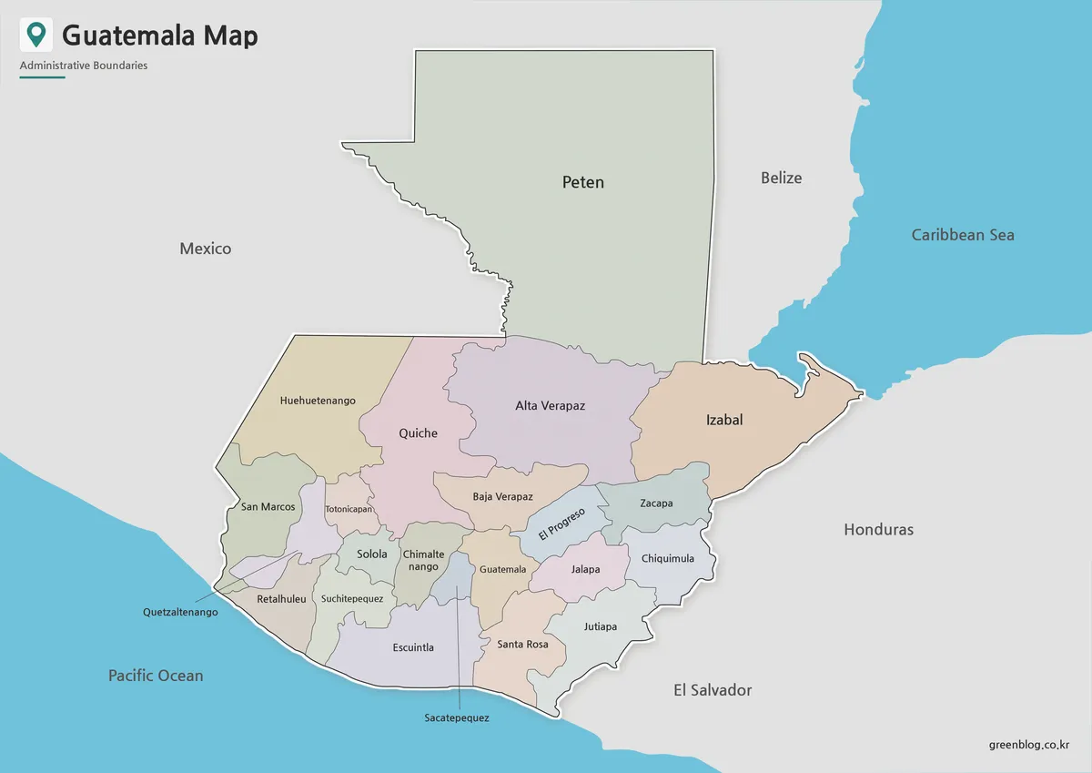
From Petén to the Pacific: Reading a Guatemala Map
A Guatemala Map has to connect a very large northern department with a denser band of smaller departments stretching toward
From Petén to the Pacific: Reading a Guatemala Map Read More »
A Guatemala Map has to connect a very large northern department with a denser band of smaller departments stretching toward
From Petén to the Pacific: Reading a Guatemala Map Read More »
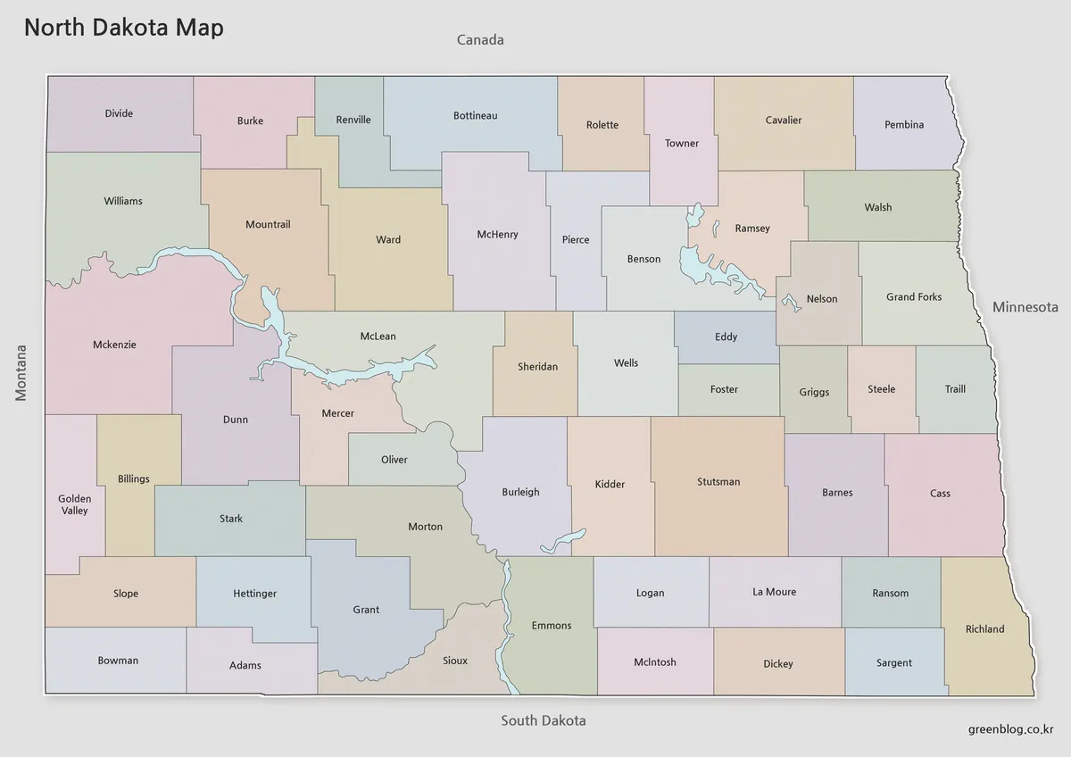
A North Dakota Map becomes more interesting once its 53 counties are viewed inside the state’s nearly rectangular frame. Much
North Dakota Map Guide to 53 Counties and River Boundaries Read More »
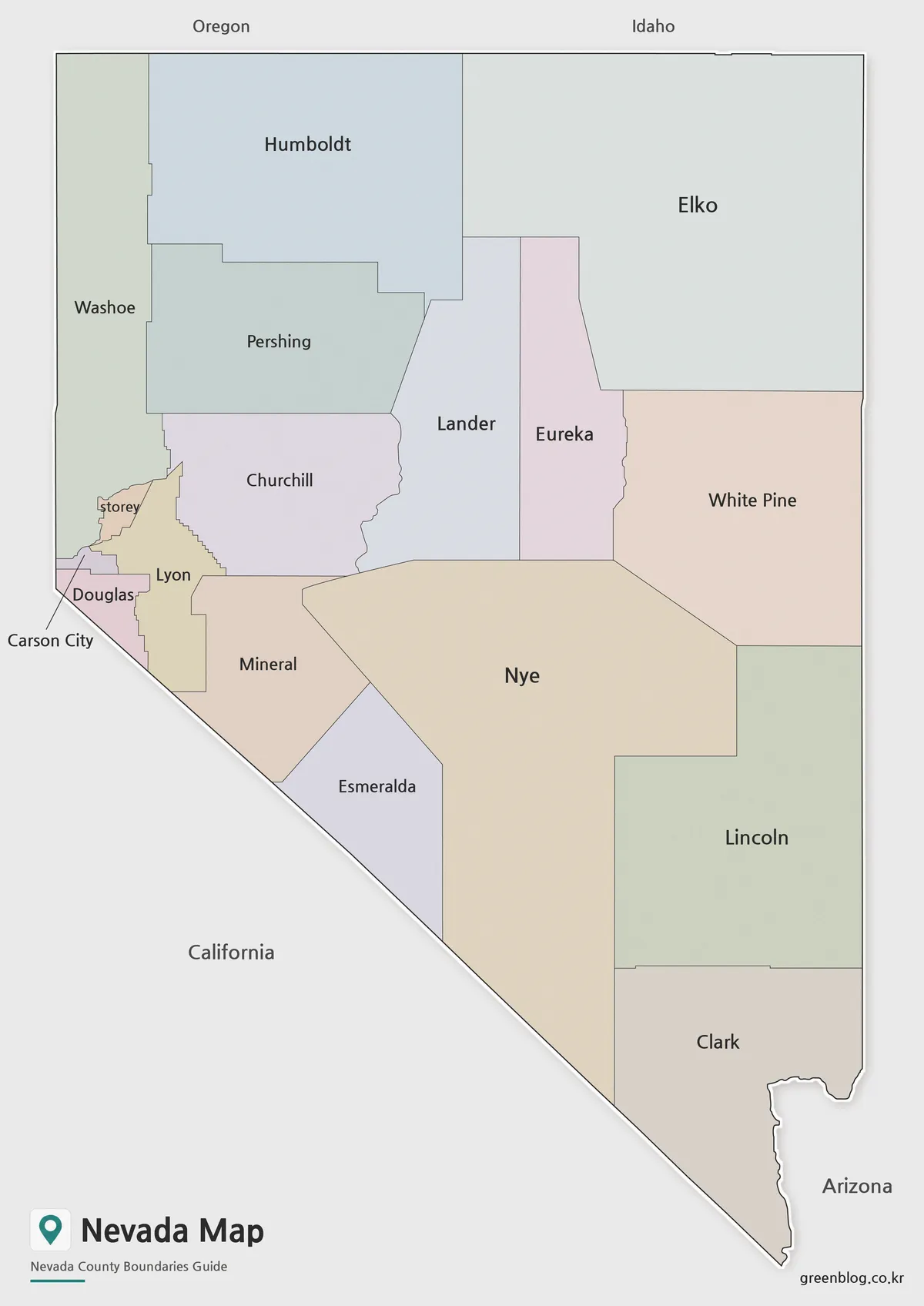
A Nevada Map needs to explain one detail that a simple county count can hide: the state has 16 counties
Why Carson City Changes How You Count a Nevada Map Read More »
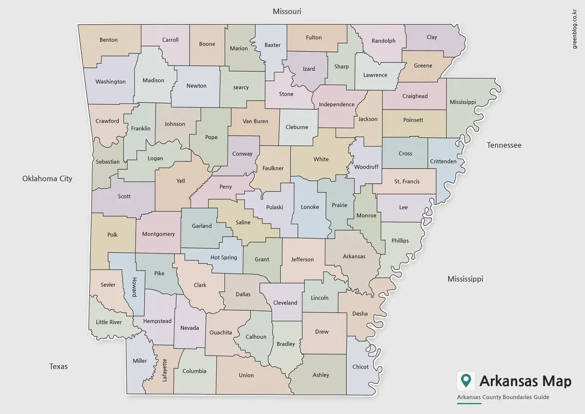
An Arkansas Map has to make 75 county names readable inside a state whose straight northern and southern edges contrast
Following 75 County Shapes Across an Arkansas Map Read More »
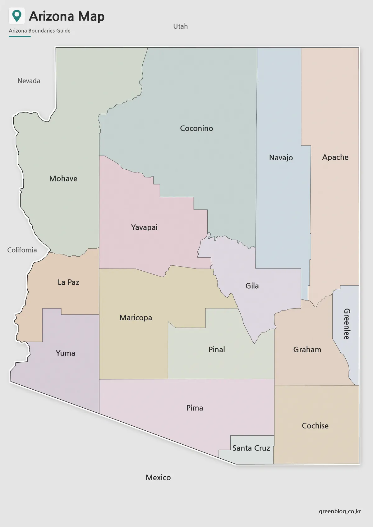
This Arizona State Map turns a familiar southwestern silhouette into a county-by-county reference. Arizona appears nearly rectangular along its northern
From Mohave to Cochise: Reading an Arizona State Map Read More »
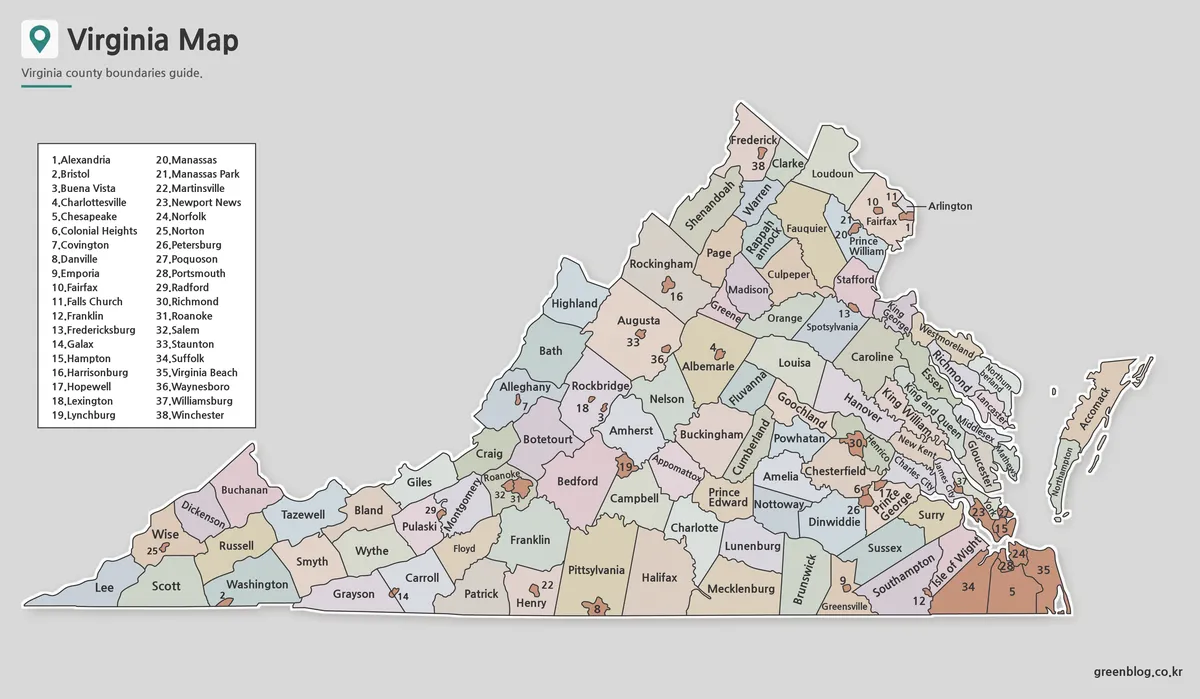
A Virginia Map must explain two kinds of first-level local government on the same page: 95 counties and 38 independent
Why a Virginia Map Needs 38 Numbered City Markers Read More »
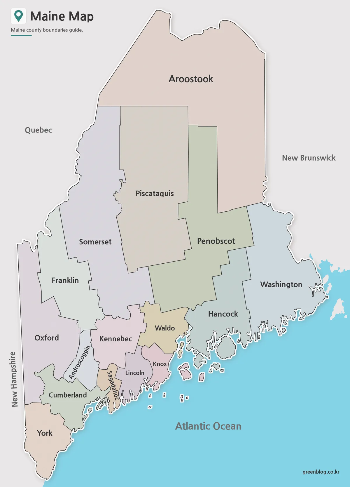
A Maine Map must balance two very different shapes: an expansive northern interior and a deeply indented Atlantic coast. Maine
Which Maine Map Fits Your Project? Three 16-County Views Read More »
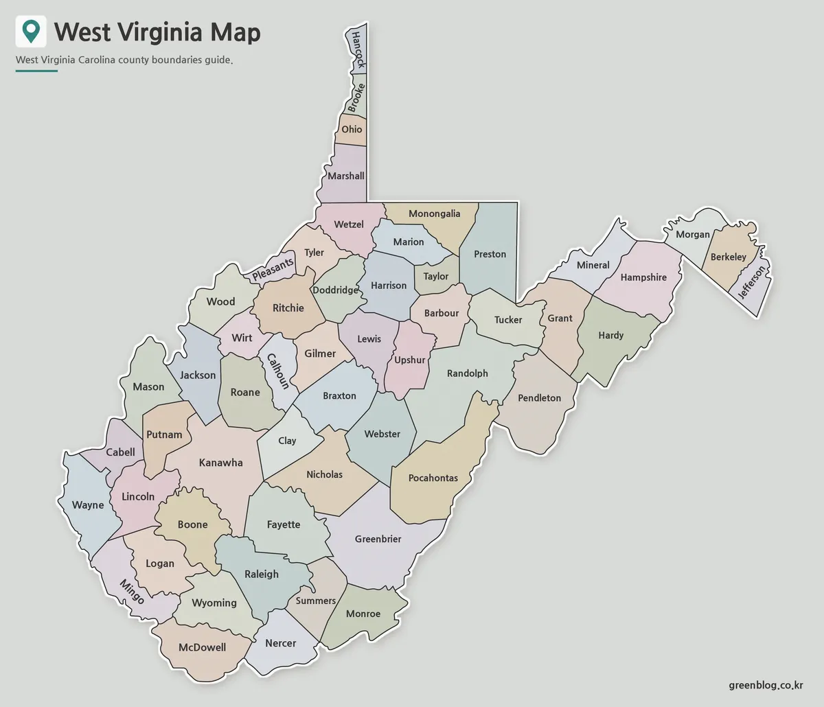
A West Virginia Map must accommodate one of the most irregular state silhouettes in the eastern United States. The Northern
Why a West Virginia Map Needs Room for 55 County Labels Read More »
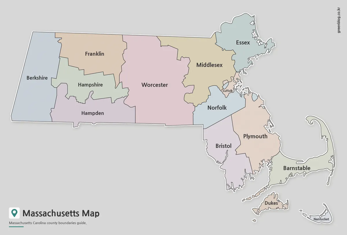
A Massachusetts Map is useful for much more than locating the state within the northeastern United States. Teachers often use
Massachusetts Map Collection | Printable County Maps in High Resolution Read More »