
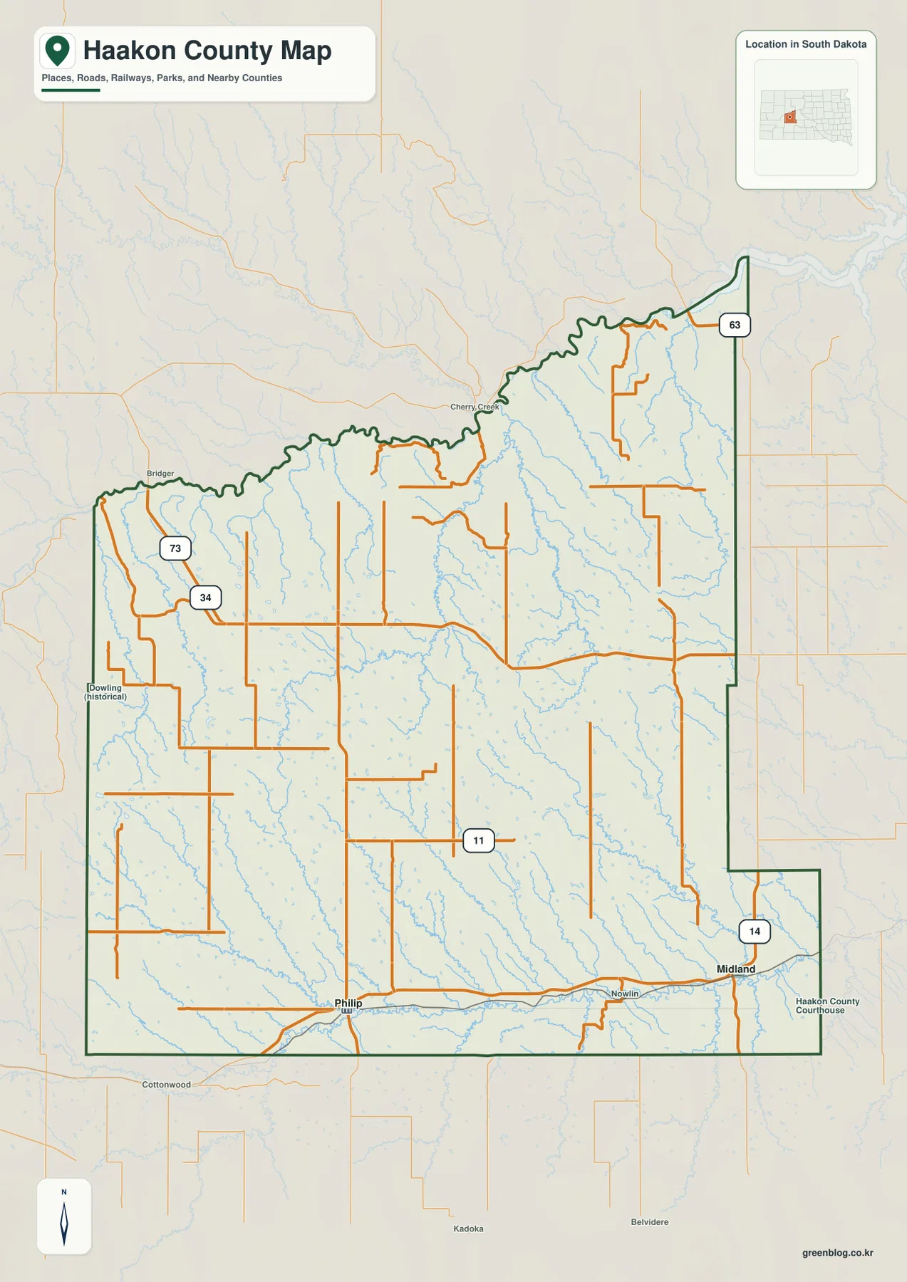
Haakon County Map from Philip to Midland — Bad River Valleys beneath the Southwest Uplands
You can download four high-resolution JPG maps of Haakon County from this page in one ZIP file, while the WebP
You can download four high-resolution JPG maps of Haakon County from this page in one ZIP file, while the WebP
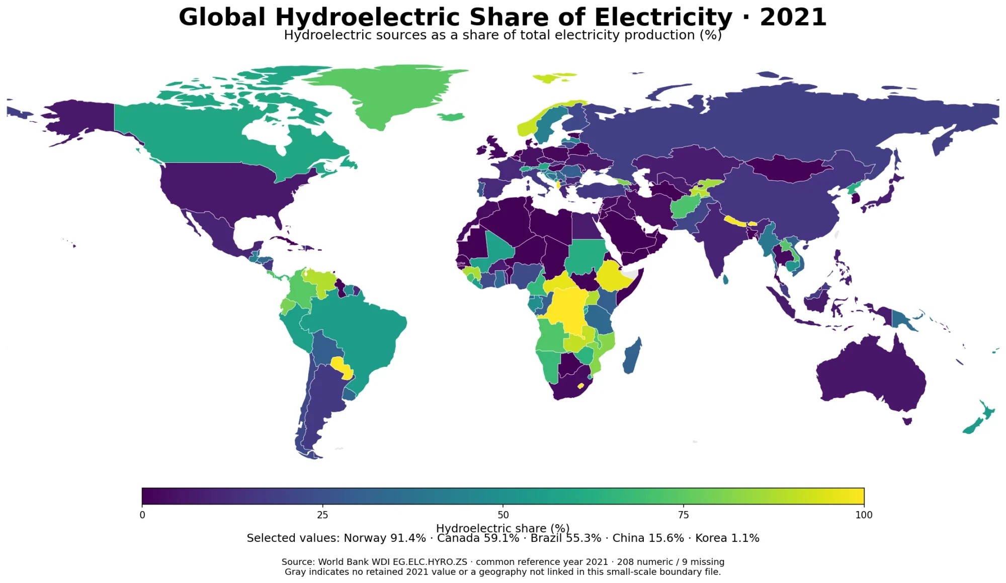
Hydroelectricity plays radically different roles across national power systems. In the verified 2021 World Bank file, 208 of 217 country/economy
Hydroelectric Share of Electricity Map – 2021 Country Comparison Read More »
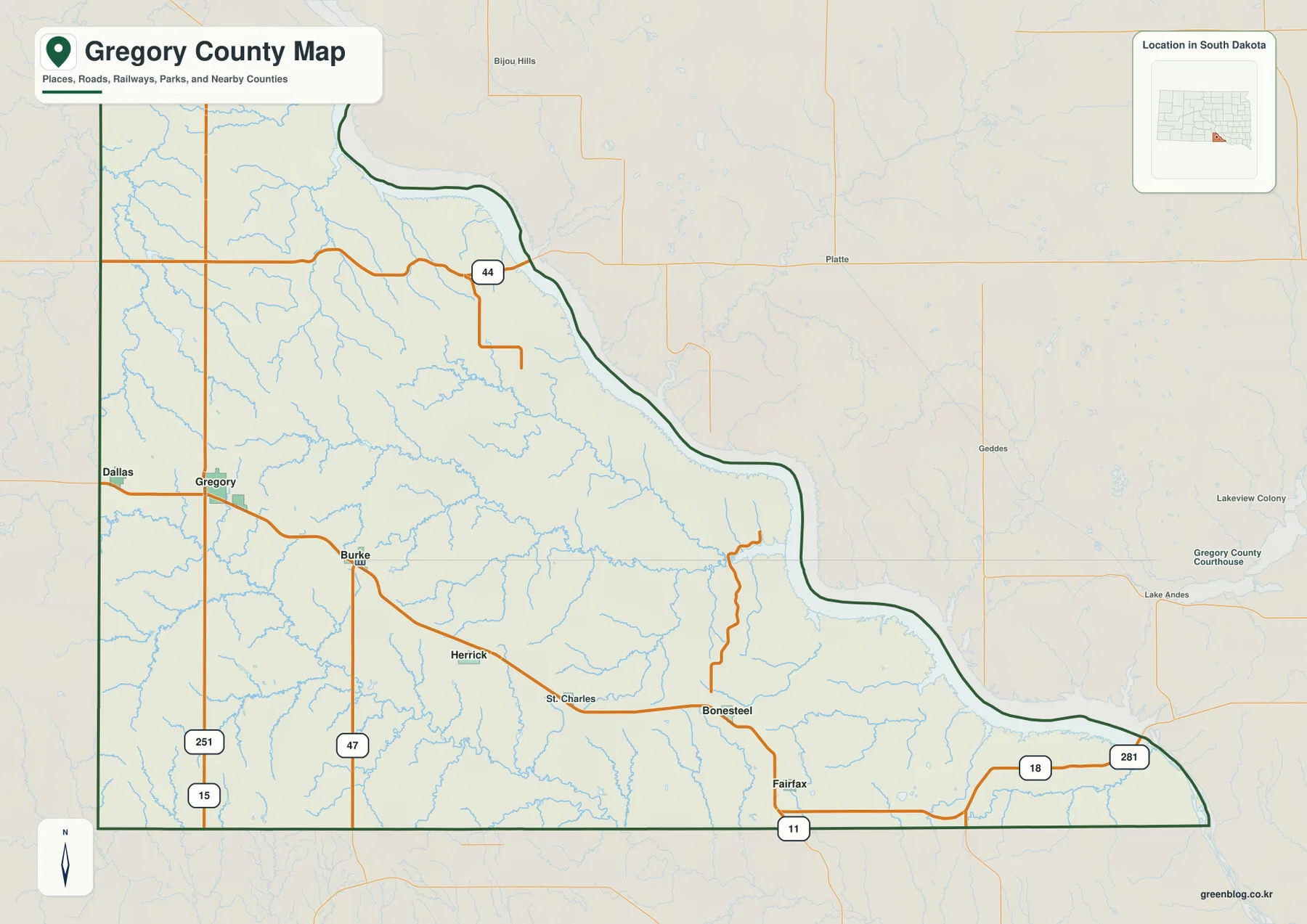
You can download four high-resolution JPG maps of Gregory County from this page in one ZIP file: a general county
Gregory County Map across Gregory, Burke, Whetstone Bay, and the Western Uplands Read More »
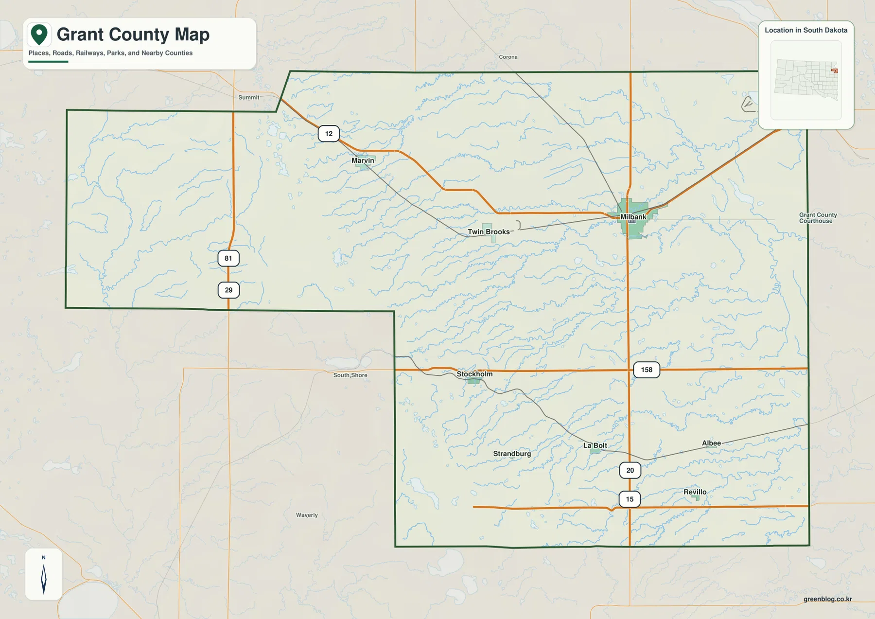
You can download high-resolution JPG maps of Grant County, South Dakota, while using the WebP versions on this page to
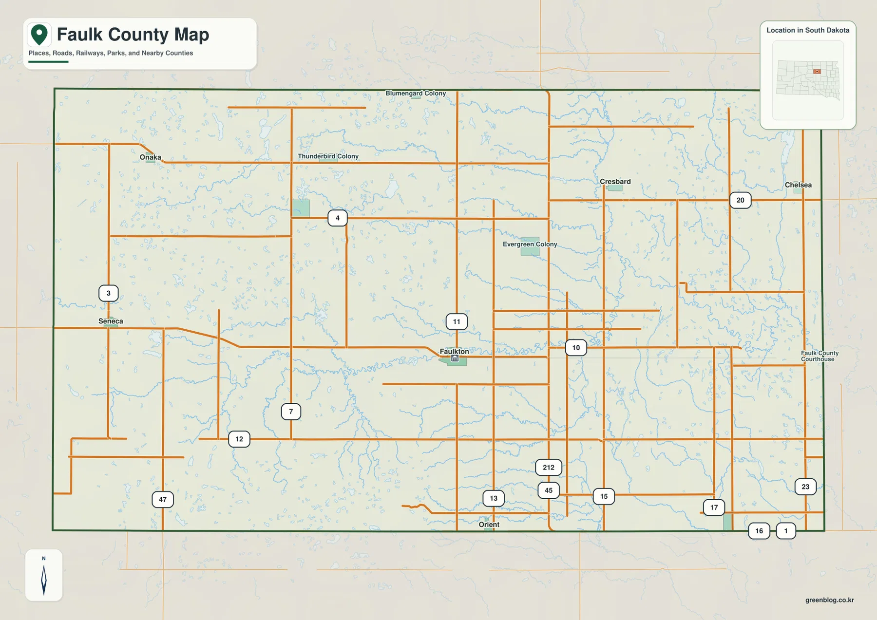
You can download high-resolution JPG maps of Faulk County, South Dakota, from this page in one ZIP file. The county
Faulk County Map — Faulkton, Lake Faulkton, and the Snake Creek Lowlands Read More »
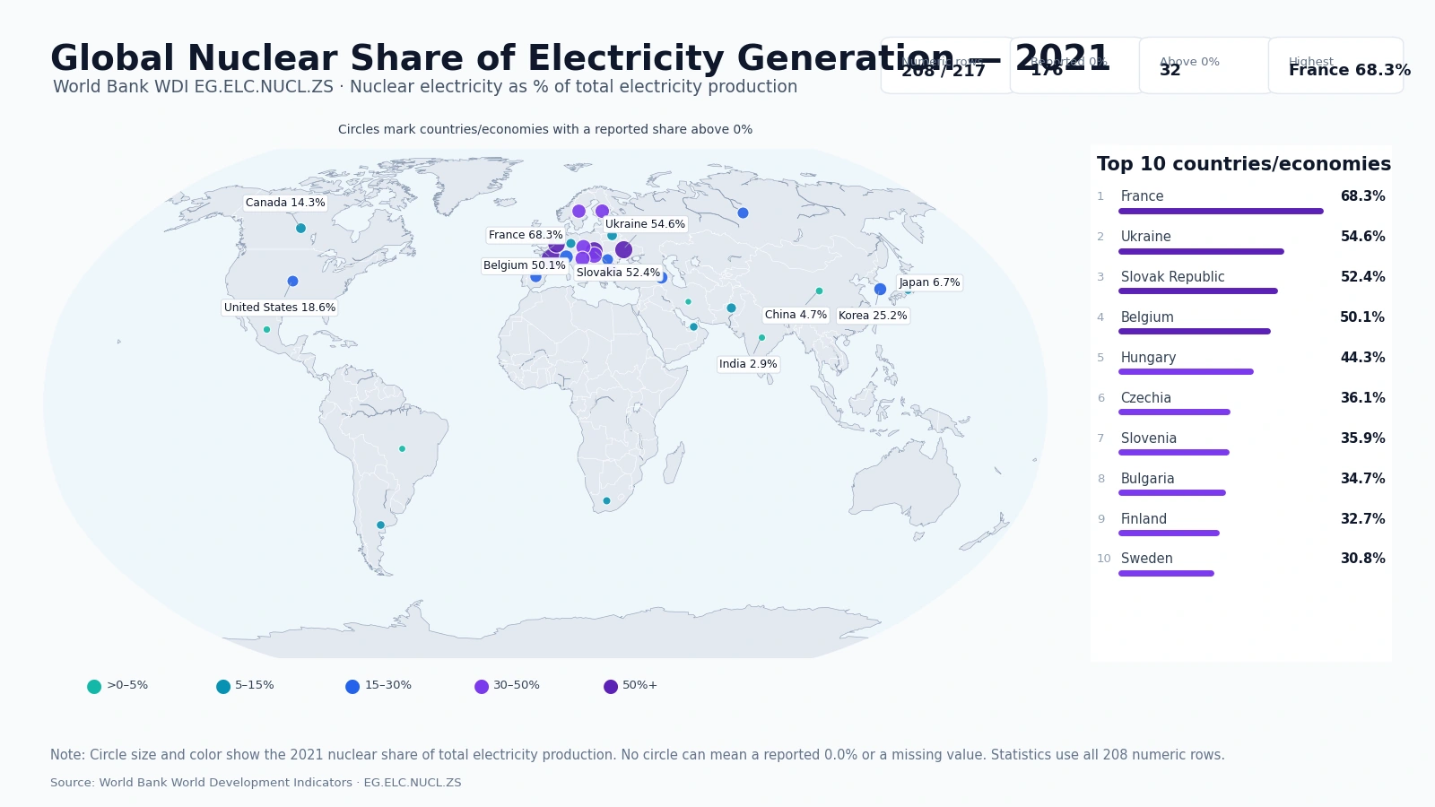
A same-year comparison of nuclear electricity reveals a highly uneven global distribution. The verified World Bank master contains 217 countries
Nuclear Share of Electricity Generation – 2021 Country Map Read More »
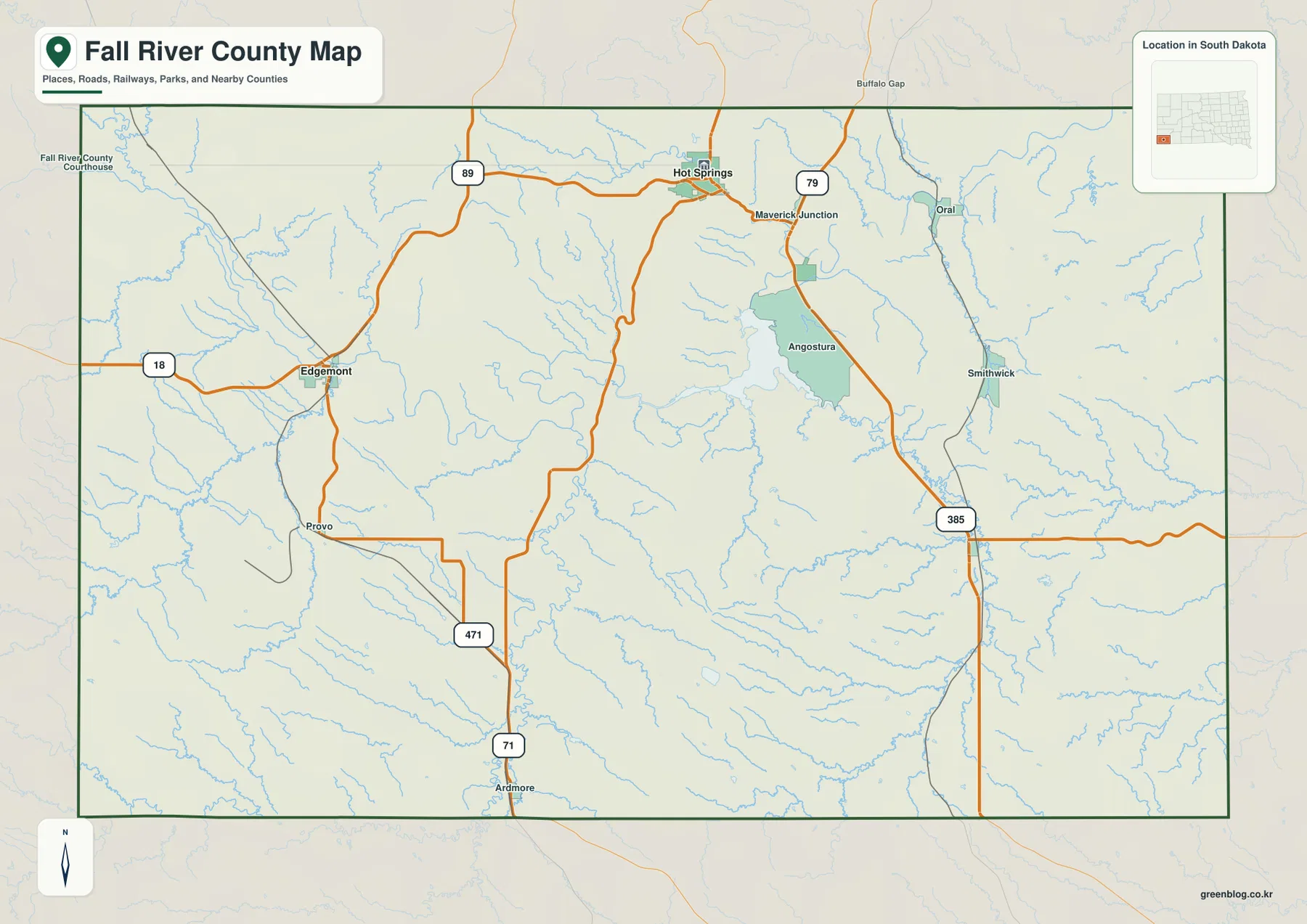
You can download high-resolution JPG maps of Fall River County, South Dakota, from this page in one ZIP file, including
Fall River County Map— Mapping Fall River County Roads, Water, and Relief Read More »
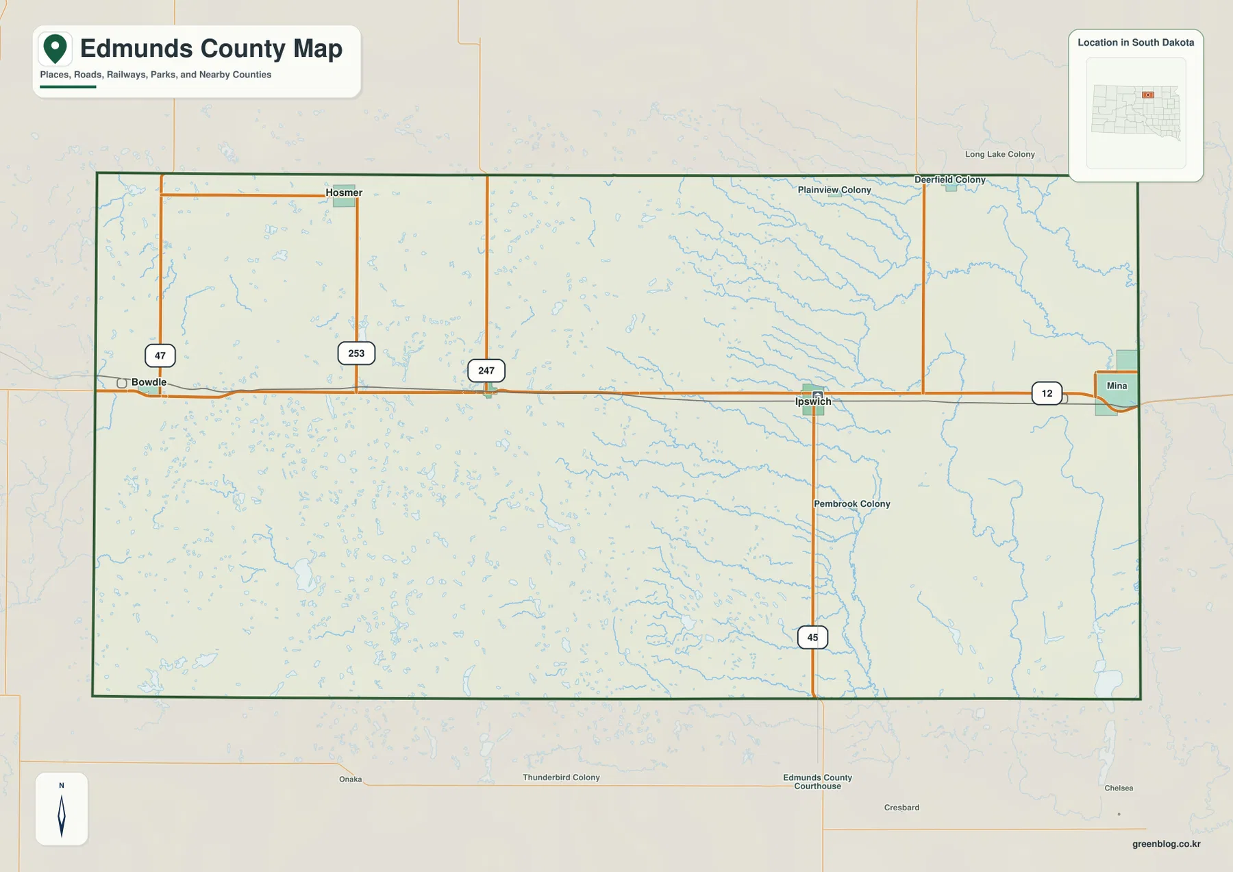
You can download the high-resolution JPG versions of all four Edmunds County maps on this page together in one ZIP
Edmunds County Map — Ipswich, U.S. 12, Snake Creek, and the West-to-East Elevation Drop Read More »
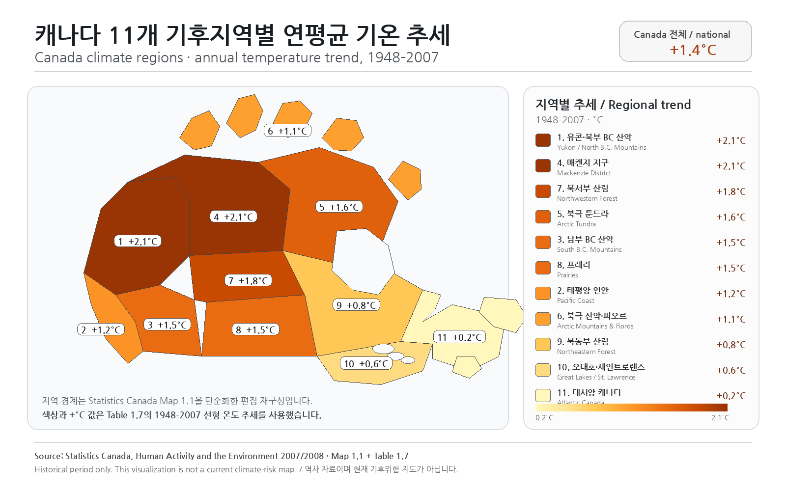
A map-first guide to the 11 climate regions, historical temperature trends and data limits in Statistics Canada’s archived 2007–2008 environment report.