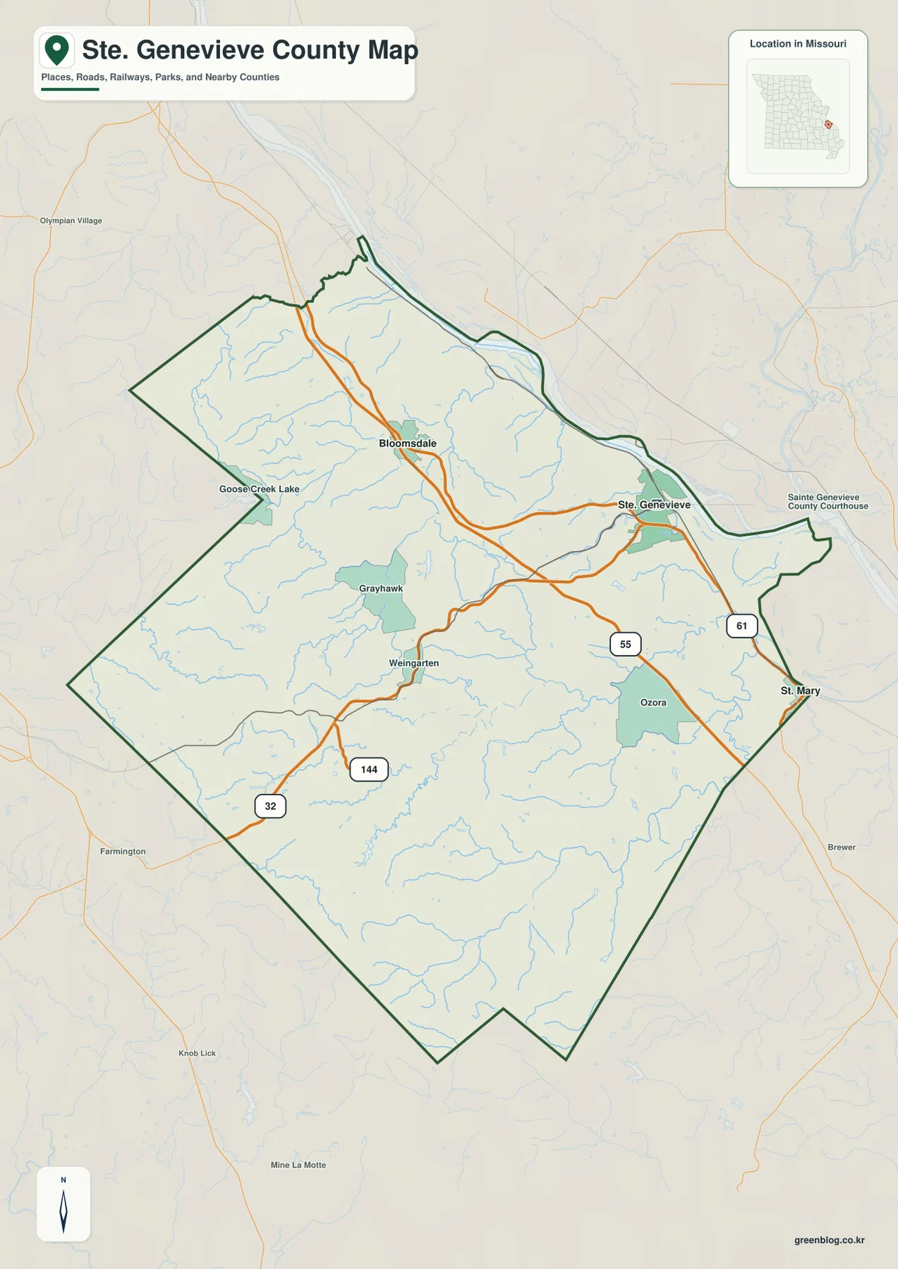
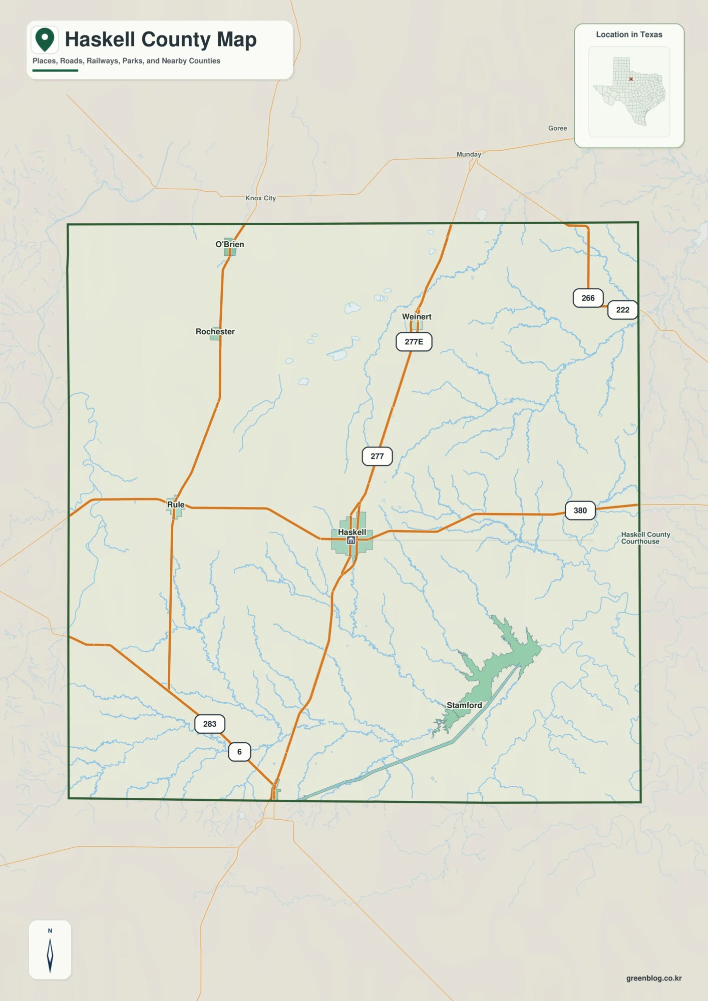
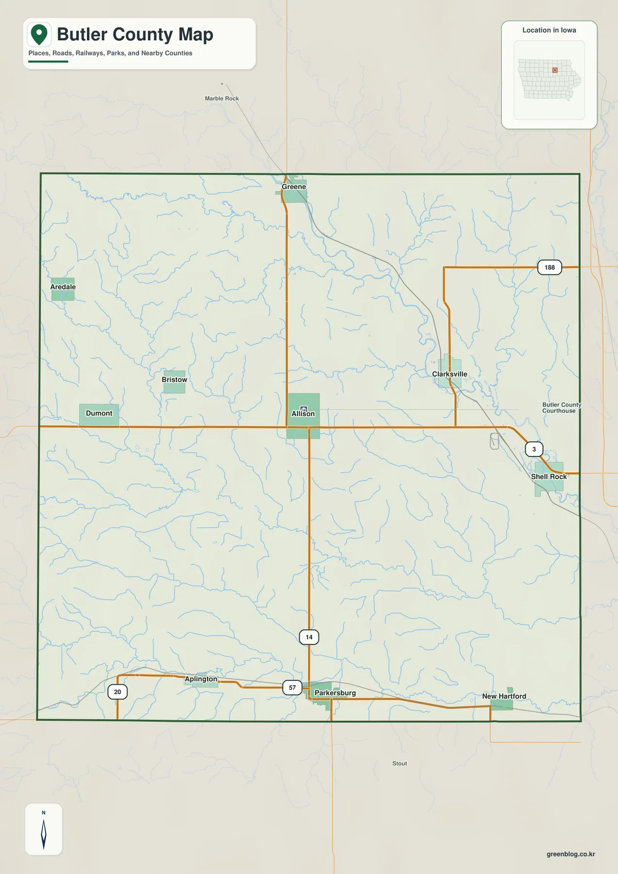
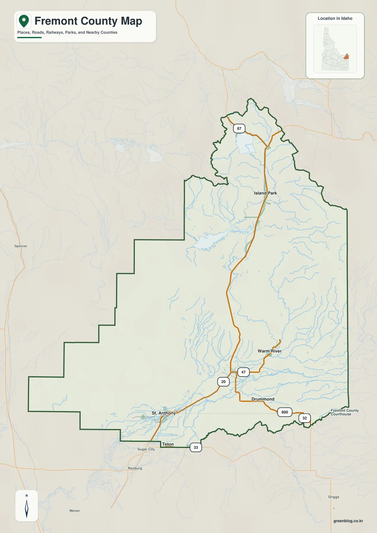
Seward County sits west of Lincoln in eastern Nebraska, with the City of Seward near the middle of the county and smaller communities extending toward Milford, Utica, Beaver Crossing, Staplehurst, and Goehner. This Seward County Nebraska Map page shows the road network around U.S. 34, Nebraska 15, Interstate 80, and U.S. 6; the Big Blue River and several named creeks; and the elevation difference between the river valleys and the higher western uplands. High-resolution JPG versions of the maps can be downloaded below in one ZIP archive. High-resolution map files are available for download in the section below.
Seward is the simplest place to use as an anchor. U.S. 34 crosses the county through Utica and Seward, while Nebraska 15 runs south from the county seat. Milford occupies the southeast near the Interstate 80 and U.S. 6 corridor, and Beaver Crossing lies farther southwest. The Big Blue River cuts through the middle of the county from north to south, tying many of the settlement, water, and elevation patterns together.
Table of Contents
Seward at the U.S. 34 and Nebraska 15 crossroads
The general county map makes Seward the clearest transportation center. U.S. 34 approaches from Utica and Tamora in the west, passes through Seward, and continues toward the eastern side, while Nebraska 15 runs south from the city. Nebraska 2 also reaches east from the Seward area. The concentration of roads around the county seat stands out against the broader rural road grid elsewhere in the county.
Milford is separated from Seward to the southeast and is closely connected with the Interstate 80 and U.S. 6 corridor. Pleasant Dale lies still farther east near the county line. To the west, Utica forms the main U.S. 34 reference point, while Beaver Crossing and Cordova mark the southwestern part of the county. Staplehurst and Bee provide northern reference points, and Garland sits in the northeast.
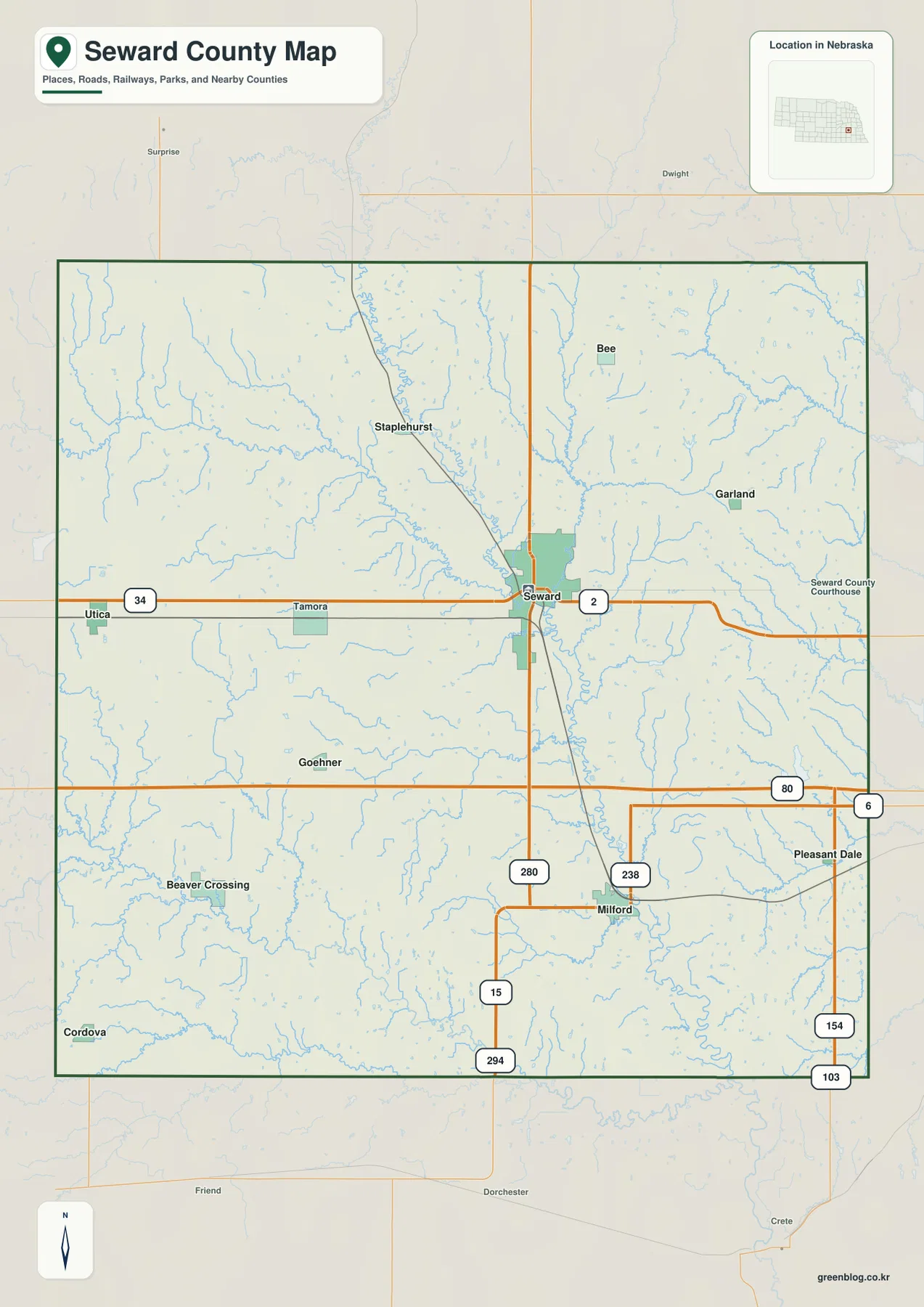
The road pattern also reveals how settlement density changes across the county. Roads and labels are most concentrated around Seward and along the southeast route network near Milford. The west and southwest contain larger stretches of rural land between communities, even though a regular grid of local roads remains visible. This contrast makes the general map useful for understanding both travel direction and the spacing of settlements.
The map is not intended to replace current navigation. Construction, closures, and seasonal road conditions can change after a static image is made. Its value is regional orientation: readers can quickly see how Seward relates to Utica, where Milford sits relative to I-80, and how the smaller towns are distributed around the county boundary.
A dispersed set of communities led by Seward and Milford
The ranked city map simplifies the county to six major communities: Seward, Milford, Utica, Beaver Crossing, Staplehurst, and Goehner. Seward occupies the central position and ranks first, while Milford stands apart in the southeast as the second-largest place shown. Utica is near the western boundary, Beaver Crossing lies in the southwest, Staplehurst is north of Seward, and Goehner sits southwest of the county seat.
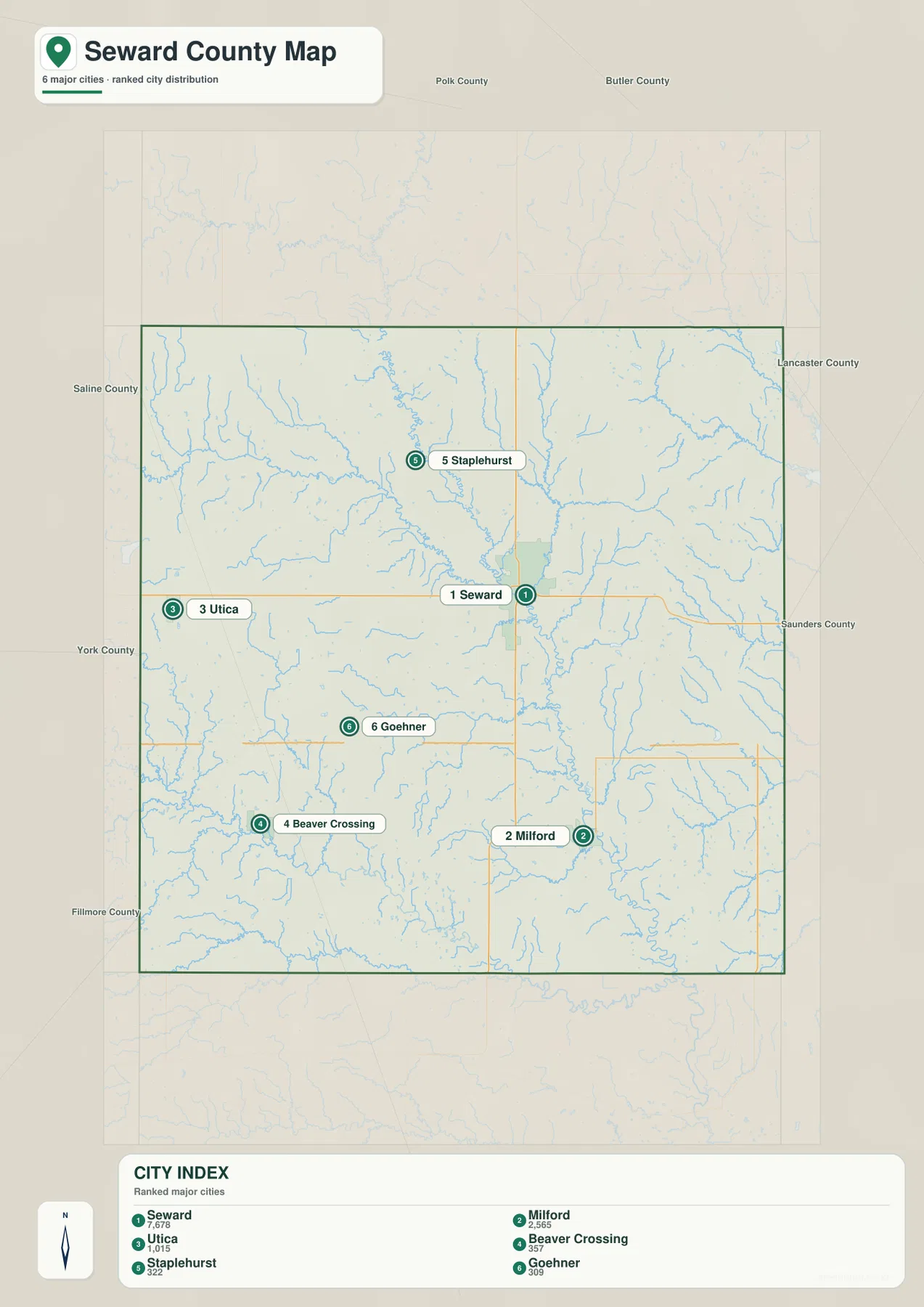
The ranking panel is useful for relative scale, but exact current population figures should come from the latest Census or local estimates. Geographic position is the stronger message here. Seward and Milford do not form one continuous urban area; they are separated by rural land and creek valleys, while Utica, Beaver Crossing, Staplehurst, and Goehner give the county a dispersed settlement pattern.
The official county website lists four additional cities and villages—Bee, Cordova, Garland, and Pleasant Dale—along with the six highlighted on the ranked map. Those smaller places are easier to locate on the general county map, where they help define the outer parts of the county. Using both views avoids the mistaken impression that only the six ranked communities exist.
Big Blue River, Lincoln Creek, and Plum Creek through the county center
The Big Blue River is the dominant water feature. It enters from the north, runs through the central part of the county just west of Seward, and continues toward the south. Lincoln Creek approaches from the west and joins the river near the middle of the county, while Plum Creek descends from the north and northeast. Together they create a broad connected set of low valleys across the central landscape.
Middle Oak Creek winds through the northeast, and Big Muddy Creek reaches toward the Big Blue system from the north. Milford Creek drains the eastern and southeastern side, while Coon Creek appears farther south. In the southwest, the West Fork Big Blue River forms a separate valley with Walnut Creek and several smaller tributaries. North Fork Johnson Creek is also labeled near the southern edge.

North Lake is labeled on the western side, but the image should not be treated as a recreation-status or water-level map. Stream width and blue color also do not measure flow, depth, or flood danger. Floodplain decisions, property restrictions, and access questions require current information from FEMA, USGS, or the appropriate local water agencies.
The water map becomes especially useful when compared with the settlement map. Seward lies close to the Big Blue River and the Lincoln Creek junction, while Milford is surrounded by smaller southeastern drainage lines. Utica and Beaver Crossing sit among west-to-east tributaries. That relationship helps explain why the county’s road grid crosses many narrow valleys even though the region can appear broadly open from a distance.
Low river corridors cut through higher western uplands
The elevation map shows the Big Blue River valley as a long green lowland extending through the center of the county. Warmer tan and brown colors dominate much of the west and northwest, where the land rises above the river corridors. The mapped surface ranges from roughly 382 to 500 meters, with a mean near 458 meters. The overall difference is modest compared with mountainous regions, but the creek valleys and rolling uplands are clearly visible.
Lincoln Creek creates a broad lower corridor from the west toward the Big Blue River, while the West Fork Big Blue River forms another green valley across the southwest. Between these valleys, higher rolling ground remains in orange and brown. East of the main river, numerous small tributaries cut narrow channels through the uplands, giving the surface a more dissected appearance than the simple road map suggests.
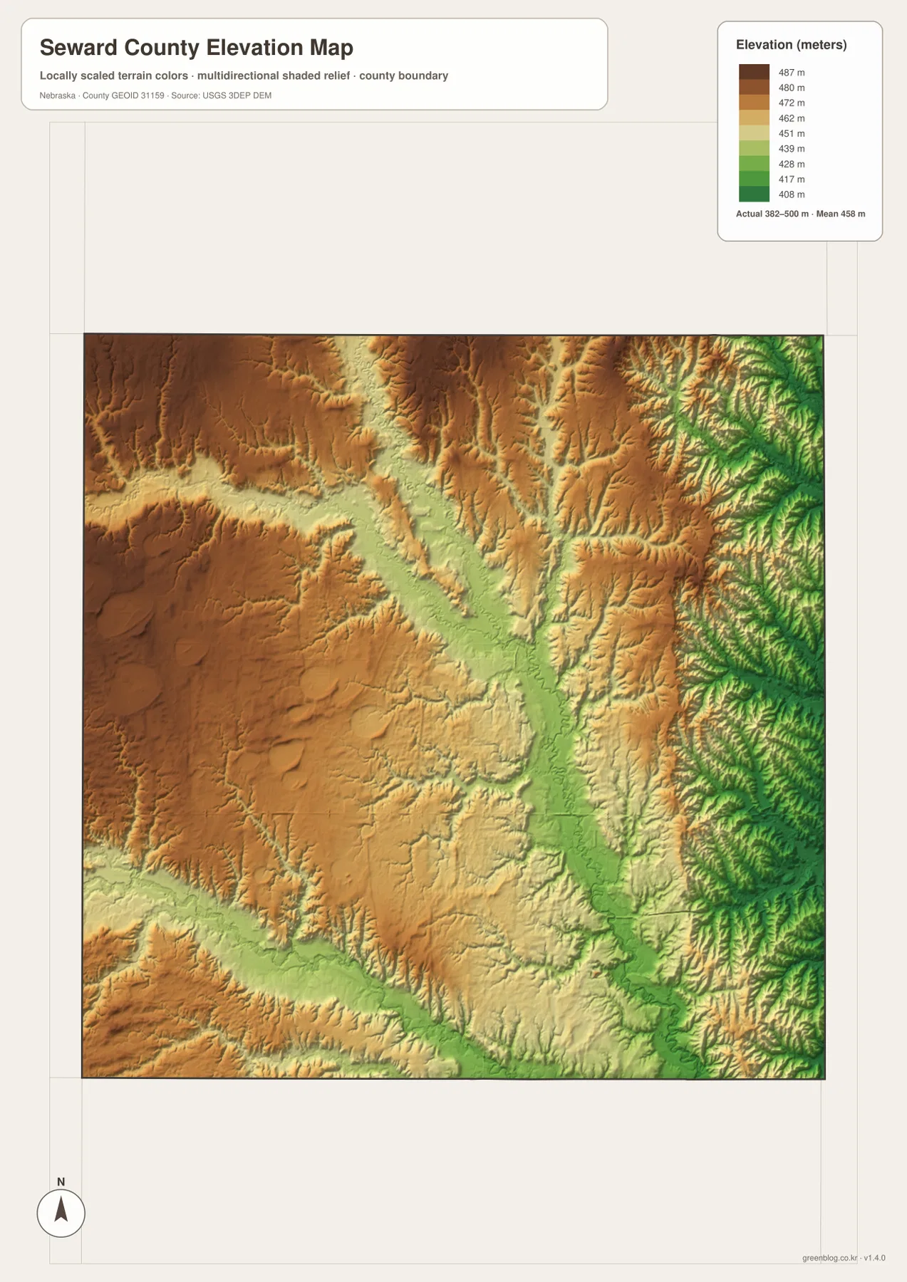
Comparing the water and elevation images makes the relationship straightforward. The green corridors generally line up with the Big Blue River, Lincoln Creek, and the West Fork Big Blue River, while the higher western areas sit between major drainage lines. This is why the county is better understood as rolling terrain broken by river and creek valleys rather than as a completely flat plain.
This elevation surface is intended for county-scale comparison, not parcel surveying or engineering. Exact site elevations, road grades, construction benchmarks, and design values require USGS source data, professional surveying, or another appropriate technical source. For regional reference, the image is most useful for comparing the central river valley with the higher western uplands.
From Milford to Seward: how the county seat was settled
Seward County’s official history describes an early dispute over the county seat involving Seward, Milford, and Camden. Milford served as an early center, but Seward was officially established as the seat of county government in 1871. Local residents then built a courthouse, fixing the administrative center in the same town that now appears as the county’s largest and most central community on the maps.
The current courthouse stands in Seward near U.S. 34 and Nebraska 15, reinforcing the connection between county government and the road crossroads visible on the general map. Milford remains a major southeastern community, so the old county-seat competition can still be placed easily on the modern landscape. The two towns occupy different parts of the county and connect to different regional road corridors.
The official county website lists ten cities and villages: Beaver Crossing, Bee, Cordova, Garland, Goehner, Milford, Pleasant Dale, Seward, Staplehurst, and Utica. The county assessor describes Seward County as about 576 square miles in area. That combination of a broad rural landscape and several small communities explains why a single map centered only on Seward would miss much of the county’s character.
Using the maps together for printing and local reference
For a first overview, the general map is the best place to start because it combines roads, towns, nearby place labels, and the county outline. Locate Seward first, follow U.S. 34 west to Utica, then compare Milford in the southeast and Beaver Crossing in the southwest. The ranked city map is cleaner when the goal is simply to compare the six larger communities and their relative positions.
Use the water map to trace the Big Blue River, Lincoln Creek, Plum Creek, and the West Fork Big Blue River. The elevation image then shows how those same waterways occupy lower corridors through rolling terrain. In a classroom, students can identify the towns first, trace the main river next, and then compare the river valley with the higher west and northwest on the elevation map.
High-resolution JPG files are more useful than the WebP previews when printing or zooming in on small creek names and road labels. These maps remain regional references rather than legal or safety documents. County boundaries can be checked against Census TIGER/Line data, waterways against USGS National Hydrography, and elevation against the USGS 3D Elevation Program.
Frequently Asked Questions
Which map is easiest for comparing Seward, Milford, and Utica?
The ranked city map is the simplest choice because it removes most road detail and makes the relative positions easy to compare. Seward is near the center, Milford is southeast, and Utica is west. Use the general county map when U.S. 34, I-80, U.S. 6, and local road context also matter.
Where does the Big Blue River cross Seward County?
The Big Blue River enters from the north and runs through the central part of the county toward the south. Lincoln Creek joins from the west, Plum Creek approaches from the north and northeast, and the West Fork Big Blue River creates a separate valley in the southwest.
Can the elevation map be used for surveying or construction design?
No. It is designed to compare the low river and creek valleys with higher rolling ground at county scale. Exact site elevations, road grades, and engineering benchmarks require appropriate USGS source data or professional surveying.
Map File Information
Download the four high-resolution JPG maps shown on this page for Seward County in one ZIP archive.
- Included Files: Use only the versions confirmed in the article and supplied images
- File Type: Use the confirmed download contents
- Intended Use: Printing, education, presentations, and map-based projects
Related Maps
Sources and references
Community listings and county-seat history come from the official Seward County website. The federal sources below provide authoritative references for county boundaries, hydrography, and elevation data.
- Seward County – Official Website
- Seward County – Our History
- U.S. Census Bureau – TIGER/Line Shapefiles
- USGS – National Hydrography
- USGS – 3D Elevation Program
Green Map creates custom-edited map images using open geographic data sources such as geoBoundaries, Natural Earth, OpenStreetMap, and government open data. These maps are edited visual materials, not raw data files, and are provided for education, documents, presentations, and graphic reference.