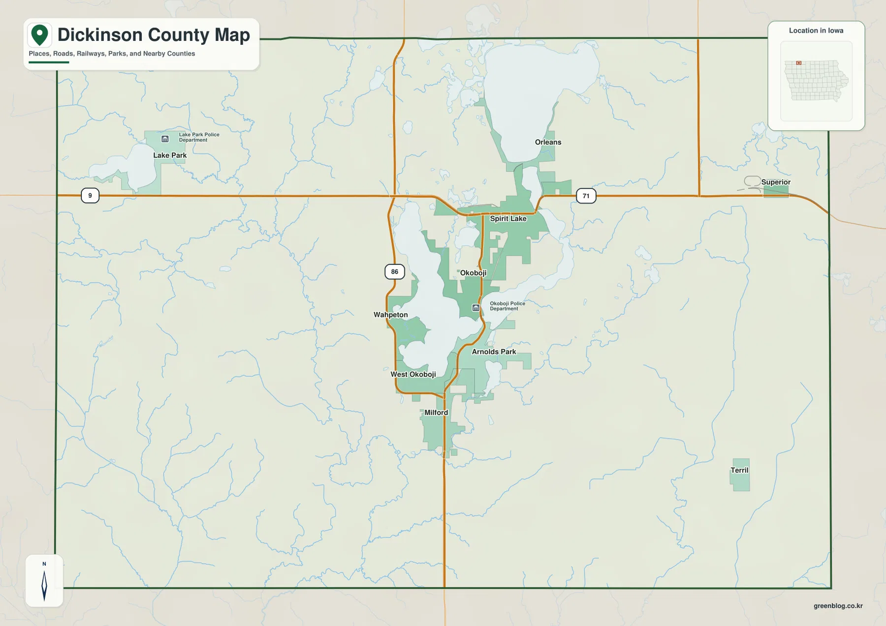
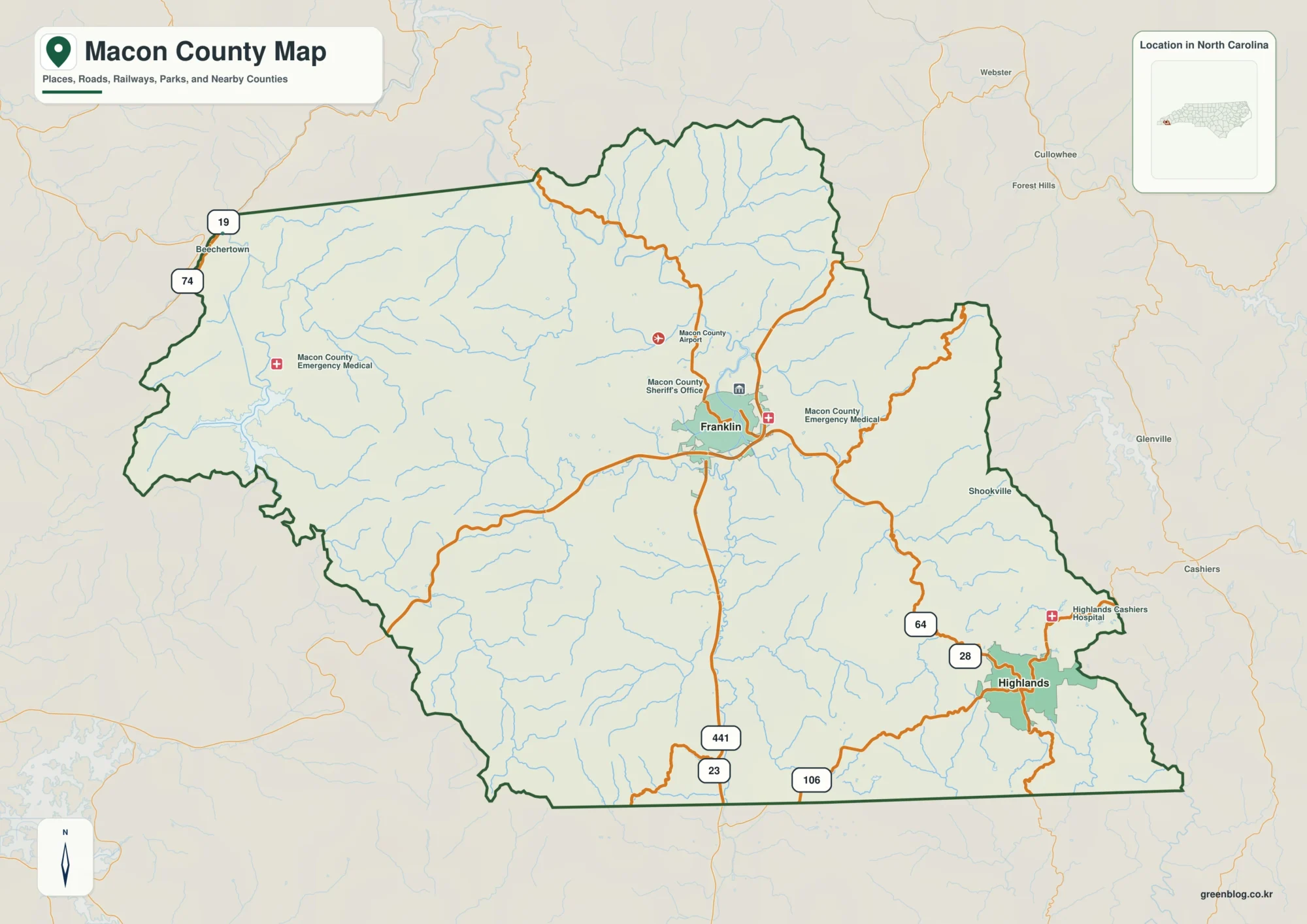
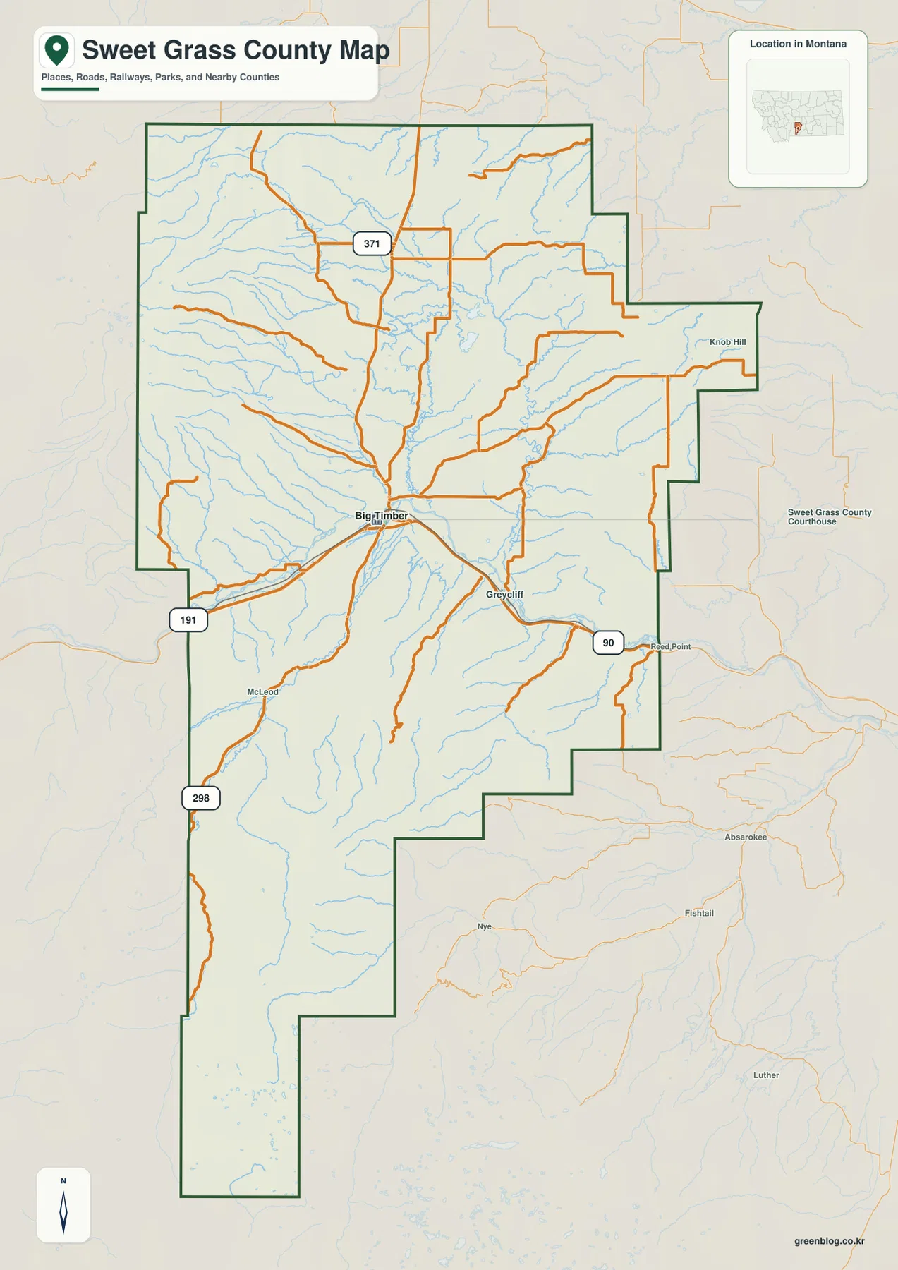
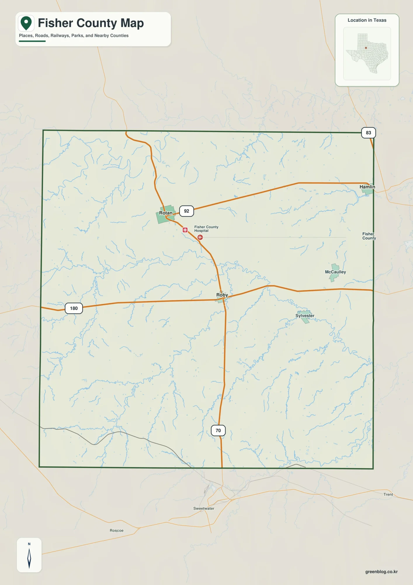
Franklin County lies along Nebraska’s southern border, where the Republican River crosses a broad low valley below higher agricultural tablelands to the north. Franklin, Bloomington, and Riverton occupy the southern settlement corridor, while Hildreth, Upland, and Campbell are spread across higher northern ground. The change from river bottomland to creek-cut uplands is the clearest physical pattern on the county maps. High-resolution map files are available for download in the section below.
This page explains the main towns and roads, the ranked distribution of six communities, Republican River and Little Blue River drainage, named creeks, and an elevation range of about 530 to 679 meters. The original high-resolution JPG versions of the supplied maps can also be downloaded together in a ZIP for printing, classroom use, or personal reference.
Table of Contents
Franklin occupies the low southern corridor near the Republican River
Franklin is the current Franklin County seat. The Nebraska Association of County Officials says the county was authorized in 1867, organized in 1871, and named for American statesman Benjamin Franklin. On the supplied map, Franklin lies in the south-central county near the junction of U.S. 136 and Nebraska Highway 10, making it the easiest reference point for both road and settlement geography.
Bloomington and Naponee lie west of Franklin near the Republican River corridor, while Riverton is east along the same lowland. Hildreth and Upland occupy the northern interior, and Campbell is close to the northeastern side. The county’s communities therefore divide naturally between a southern river belt and smaller towns on higher ground to the north.
History Nebraska records that Franklin County was officially organized in March 1871. County records were first kept at the original Franklin City, but Bloomington won the county-seat election in 1874. Railroad-driven growth later created a new Franklin, and voters eventually moved the county seat there in 1920 after decades of local competition.
U.S. 136 follows the southern settlement belt while Highway 10 crosses Franklin
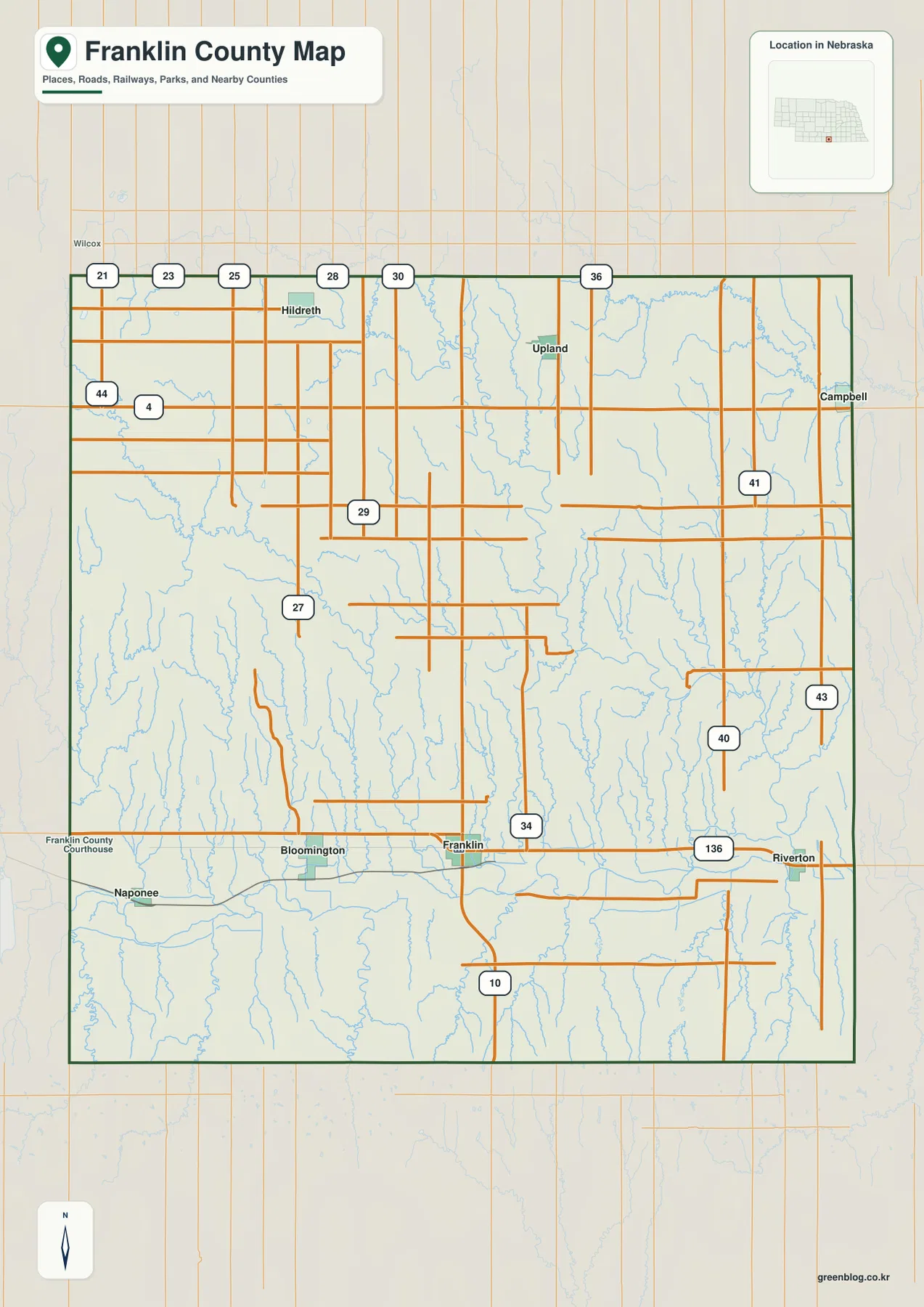
U.S. 136 is the clearest east-west road across the southern part of the county. It links the Bloomington area with Franklin and continues toward Riverton, following the same broad low corridor as the Republican River. Nebraska Highway 10 crosses the route at Franklin and continues north across the interior.
Nebraska Highway 4 provides another east-west reference across the northern agricultural area, while Highway 44 appears on the northwestern side. These routes pass through more sparsely settled uplands than the U.S. 136 corridor. Local roads around Hildreth, Upland, and Campbell form a regular rural network interrupted by stream valleys.
Road and rail alignments are generally straighter on the broad Republican valley floor. Farther north and northwest, creek valleys break up the grid and create more route changes around low draws and ridges. The county map is useful for orientation, while current construction, closures, road surfaces, and travel times should be checked with live Nebraska transportation information.
Six ranked communities reveal a clear north-south settlement split
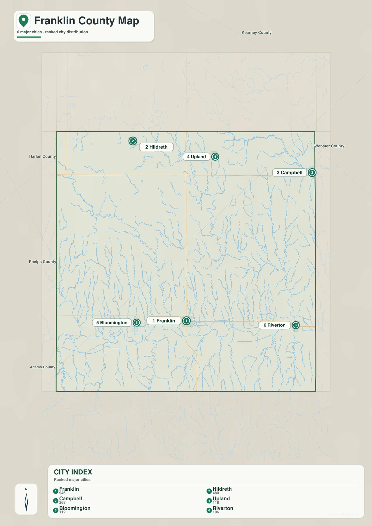
The city distribution map ranks Franklin first, followed by Hildreth, Campbell, Upland, Bloomington, and Riverton. Franklin, Bloomington, and Riverton form a southern line near the Republican River, while Hildreth, Upland, and Campbell occupy the higher northern third of the county.
No connector lines or mileage labels appear on the supplied city map. The useful comparison is positional rather than numerical. Pairing this view with the road map makes it easy to see that the southern towns share U.S. 136 and the river corridor, while the northern communities depend on a more dispersed rural road network.
The values printed on the supplied city graphic are 946 for Franklin, 480 for Hildreth, 268 for Campbell, 118 for Upland, 112 for Bloomington, and 106 for Riverton. They are part of the supplied ranking and should not be treated as a continuously updated population table. Current figures should be checked with the U.S. Census Bureau or county sources when needed.
Republican River dominates the south while Little Blue drainage reaches the northeast
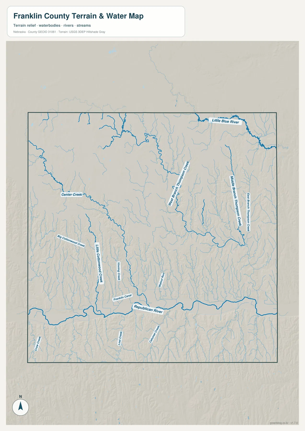
Republican River is the county’s largest water feature and runs east-west through the southern interior. Its valley broadens around Franklin and Bloomington, and Franklin Canal is labeled close to the river corridor. Several short tributaries enter the river from both sides, creating a dense drainage pattern along the county’s lowest terrain.
Little Blue River crosses the northeastern corner and occupies a separate drainage system from the Republican. South of it, West Branch Thompson Creek, Middle Branch Thompson Creek, and East Branch Thompson Creek create long branching valleys. These channels are especially visible in the elevation map because they cut into relatively high northern ground.
Center Creek crosses the western interior, while Big Cottonwood Creek and Little Cottonwood Creek descend through the southwest-central portion of the county. Together with smaller tributaries, they break the northern tablelands into repeated ridges and low corridors before reaching the Republican drainage.
This water map is intended for geographic reference. It does not define flood zones, legal water rights, parcel boundaries, current streamflow, canal operation, channel depth, navigability, or public access. Those questions require current information from USGS and the responsible local or state agencies.
Nearly 150 meters separate the Republican valley from northwestern high ground
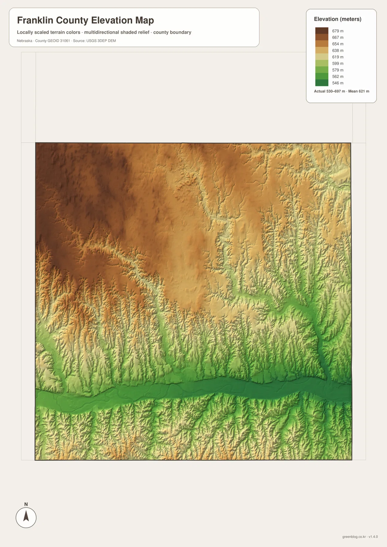
The elevation map reports an actual county-wide range of approximately 530 to 679 meters, with a mean near 621 meters. The lowest dark-green terrain follows Republican River across the south. Franklin, Bloomington, and Riverton occupy this lower corridor, where the valley floor is broad enough to support the county’s strongest east-west transportation route.
The highest brown terrain spreads across the northwest and much of the western interior. High ground also continues across the north-central county, but numerous creeks carve deeply into it. The total relief is about 149 meters, enough to create a strong visual difference between the river valley and the upper agricultural surface.
Center Creek and the Cottonwood Creek system create long lower corridors through the western uplands. In the northeast, Thompson Creek branches and Little Blue River cut additional valleys into the high surface. Comparing the water and elevation maps makes the relationship between drainage and relief particularly clear.
The elevation colors are scaled locally for Franklin County and should be used to compare locations within this map. Similar shades on another county map may represent different absolute heights. The generalized surface is not survey-grade information for engineering, construction, drainage design, or property work.
Bloomington held the county seat before Franklin won it back in 1920
History Nebraska says Governor David Butler called an election for Franklin County officers in February 1871 and the Legislature formally organized the county on March 9. Early records were kept at the first Franklin City, but Bloomington won the county-seat contest in an 1874 election and later received the U.S. Land Office from Lowell.
The Burlington and Missouri River Railroad reached the county in 1879-1880, helping a new Franklin develop near the rail line. Franklin repeatedly challenged Bloomington for the county seat and finally succeeded in the 1920 election. Construction of a new courthouse began in 1925, completing the long shift in administrative focus.
Railroad growth reinforced the Republican River settlement corridor
The railroad’s arrival changed the geography of local settlement. The first Franklin City declined as the newer rail-side Franklin attracted residents and businesses. History Nebraska notes that the new community was incorporated as a village in 1883, only a few years after the railroad entered the county.
The modern map still reflects that pattern. Railroad tracks, U.S. 136, and Republican River all occupy the same broad southern corridor, with Bloomington, Franklin, and Riverton distributed along it. Northern communities remain more scattered across the uplands, where road density is lower and creek valleys interrupt the grid.
Use Franklin and Republican River as two simple map anchors
For basic orientation, start at Franklin and follow U.S. 136 west toward Bloomington or east toward Riverton. Then move north on Highway 10 and use Highway 4 and local roads to locate Hildreth, Upland, and Campbell. The ranked city map provides a cleaner view of the same settlement split when minor roads are not needed.
For physical geography, begin with Republican River and then trace Center Creek and the Cottonwood creeks northward before moving to Little Blue River and the Thompson Creek branches in the northeast. The elevation map adds the vertical context by showing a low green southern valley below higher brown uplands.
For printing or classroom display, the downloadable high-resolution JPG files preserve more road labels, creek names, canal detail, and local relief than the web previews. The county map emphasizes roads and settlements, the city map summarizes six ranked communities, the water map shows the two drainage systems, and the elevation map highlights the south-to-north relief change.
Frequently Asked Questions
Does the city map show distances from Franklin to Hildreth or Campbell?
No. The supplied city map ranks and locates Franklin, Hildreth, Campbell, Upland, Bloomington, and Riverton, but it does not include connector lines or mileage. Use the road map for relative position and a current routing service when actual driving distance is needed.
Where is the lowest terrain in Franklin County?
The Republican River valley across the southern county contains the lowest broad terrain. The mapped elevation range is about 530 to 679 meters, with higher ground becoming most prominent toward the west and northwest. Creek valleys remain locally lower within the northern uplands.
Was Bloomington once the county seat?
Yes. Bloomington won the county-seat election in 1874 and remained the administrative center for decades. Franklin grew after the railroad arrived and eventually won the seat in the 1920 election.
Map File Information
The ZIP contains the original high-resolution JPG files for the Franklin County boundary and road map, city distribution map, terrain and water map, and elevation map.
- Included Files: Use only the versions confirmed in the article and supplied images
- File Type: Use the confirmed download contents
- Intended Use: Printing, education, presentations, and map-based projects
Related Maps
Sources and references
- Nebraska Association of County Officials – Franklin County
- History Nebraska – Franklin County Historical Note
- Nebraska Department of Transportation – Franklin County Highway Records
- U.S. Census Bureau TIGER/Line Shapefiles
- USGS National Hydrography
- USGS 3D Elevation Program
These maps are intended for geographic reference. For legal boundaries, land ownership, flood determinations, water rights, road conditions, construction, surveying, or other decisions requiring current authoritative information, consult Franklin County and the responsible state or federal agency.
Green Map creates custom-edited map images using open geographic data sources such as geoBoundaries, Natural Earth, OpenStreetMap, and government open data. These maps are edited visual materials, not raw data files, and are provided for education, documents, presentations, and graphic reference.