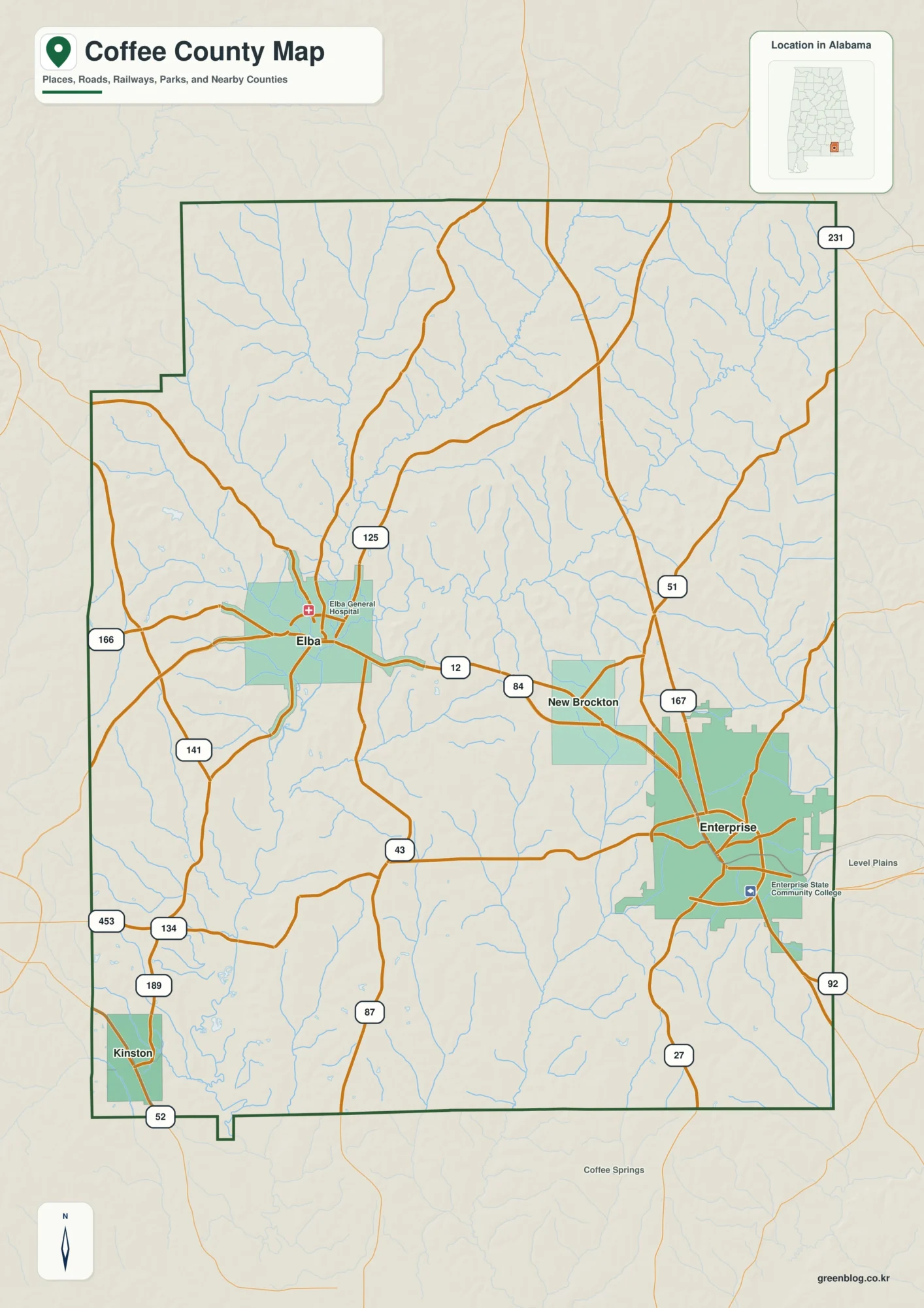
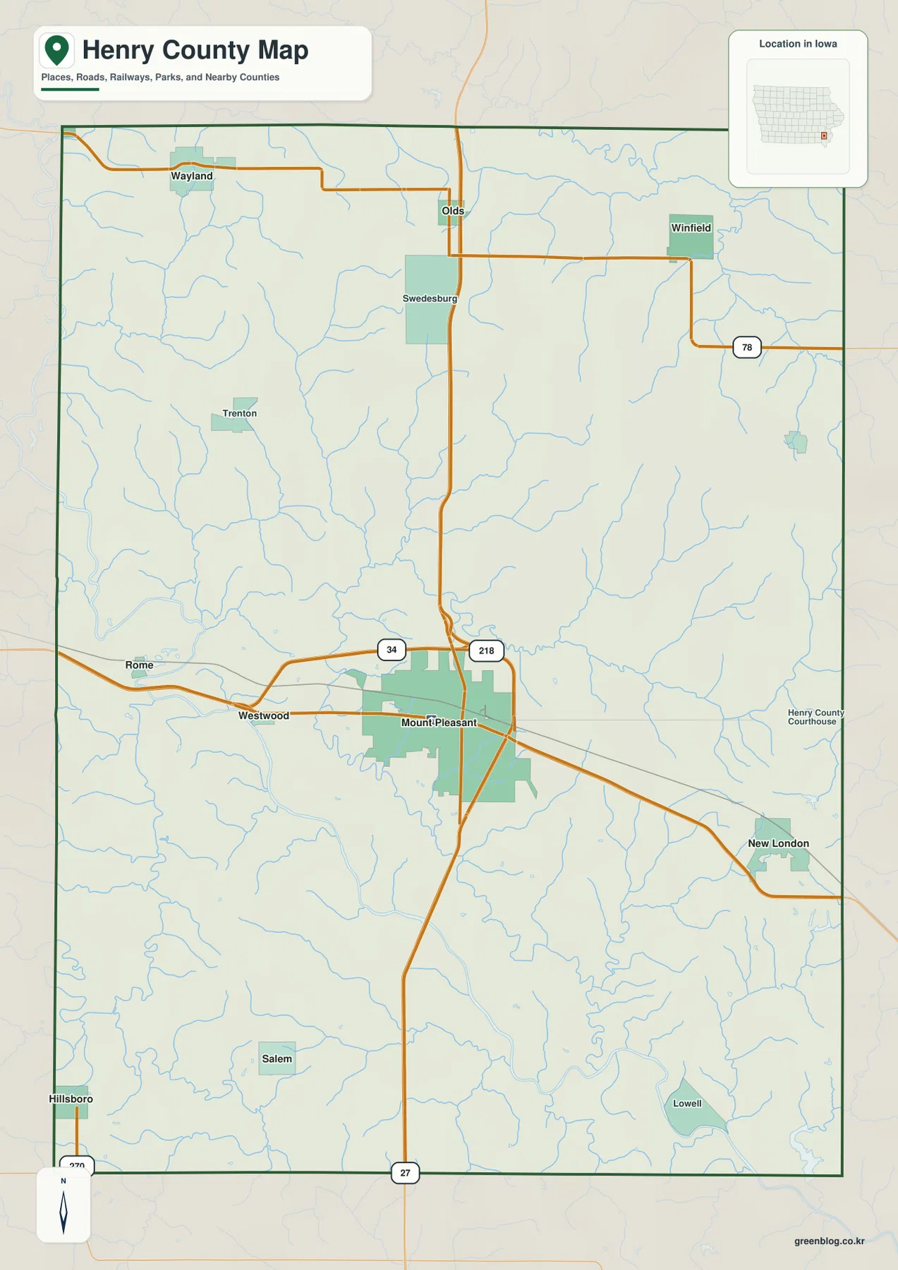
Pratt County sits in south-central Kansas, where the city of Pratt is the obvious road and service center for a wide rural county. US 54 and US 281 meet in the Pratt area, while Iuka, Preston, Cullison, Coats, and Sawyer occupy much smaller settlements around the county. The western side rises into sandy uplands, while the Ninnescah River system and many smaller creeks create lower, more dissected terrain toward the east. High-resolution map files are available for download in the section below.
This guide follows Pratt and the surrounding towns across the road, water, and relief views, with elevations ranging from about 507 to 648 meters. WebP previews are available for quick viewing, and the matching high-resolution JPG files can be downloaded together in one ZIP for printing, classroom work, or offline reference.
Table of Contents
US 54 and US 281 make Pratt the county’s clearest road reference
Pratt sits slightly north of the county center where US 54 and US 281 provide the strongest highway references. US 54 and US 400 continue east and west through the county, while US 281 links the Iuka area in the north with Pratt and the Sawyer side farther south. K-61 leaves the Pratt area toward Preston in the northeast.
The Kansas Historical Society identifies Pratt as the county seat and notes that the county government moved there in 1888. The map helps explain why Pratt became the dominant center: highways, rail lines, and nearby stream valleys all converge around the city.
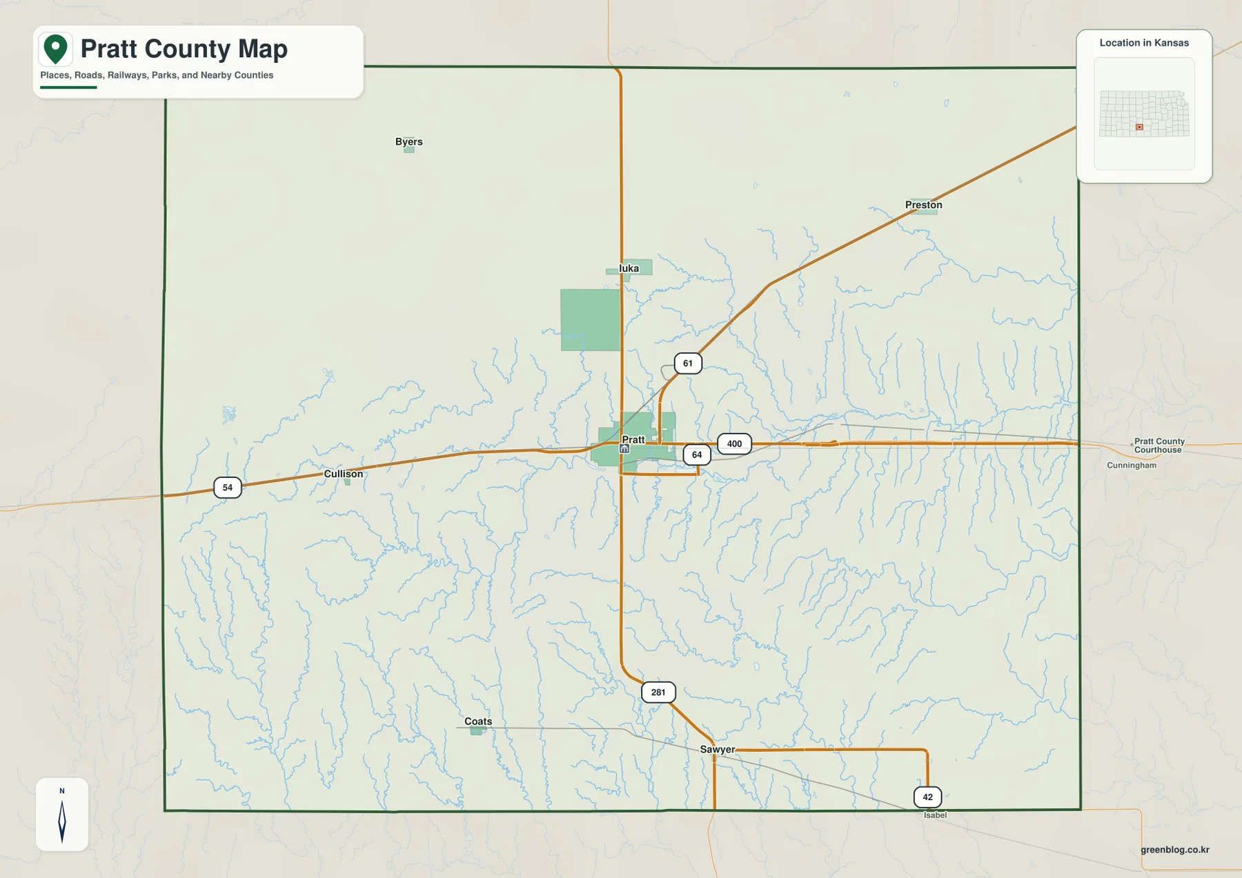
Cullison lies west of Pratt along the US 54 corridor, while Preston is connected to the northeastern side by K-61. Sawyer sits near US 281 in the south, and Coats marks part of the southwestern rural area. These places do not form one continuous settlement line; instead, they occupy separate road corridors around a single dominant city.
Pratt dominates the city index while the surrounding communities remain small
The city panel ranks Pratt at 6,577. Iuka follows at 231, Preston at 111, Coats at 103, Cullison at 97, and Sawyer at 76. These are map index values rather than current official population estimates, but they explain the large visual difference between the Pratt marker and the smaller town markers.
The settlement pattern is easy to see once the roads are added. Iuka sits north of Pratt near US 281, Preston belongs to the northeastern road corridor, Cullison is west on US 54, Sawyer is south, and Coats is southwest. The smaller towns are therefore separated by long stretches of farms, roads, and stream valleys.
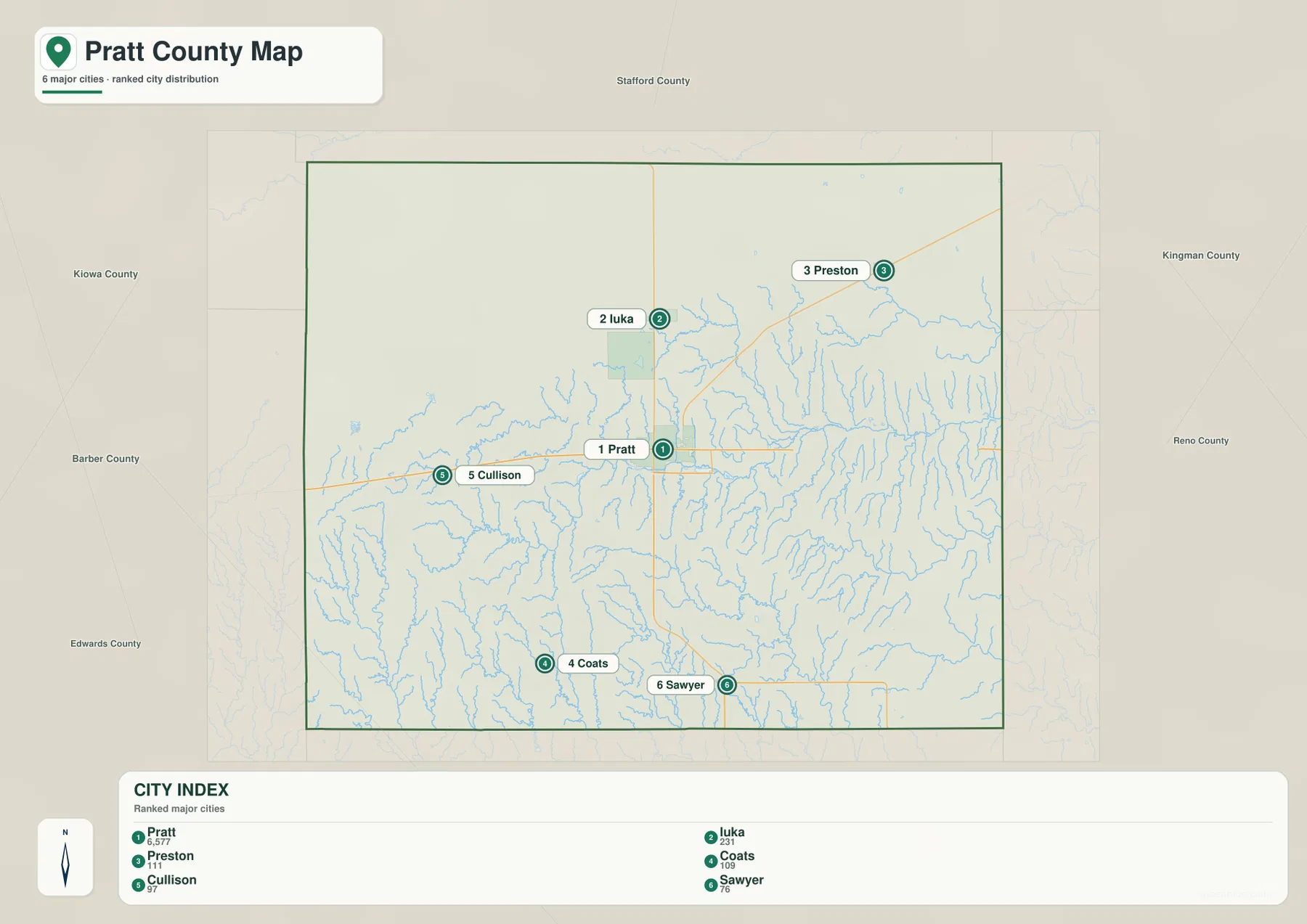
Kansas Historical Society census material also identifies Pratt as the county’s largest city. The census figures and the supplied map index are different datasets and should not be treated as interchangeable, but both point to the same broad settlement pattern: one dominant county center and several much smaller communities.
The Ninnescah River system creates the county’s strongest eastern lowlands
The most prominent water feature on the terrain map is the Ninnescah River system. Tributaries gather west of Pratt and continue through the central part of the county, while the river valley becomes broader farther east. Numerous short creeks descend from the uplands and join the main corridor from both sides.
A second major waterway, the South Fork Ninnescah River, crosses the southwestern part of the county. Sand Creek and North Branch Sand Creek also drain the south-central interior, while the Chikaskia River appears farther southeast. These channels create several separate low routes across terrain that looks much simpler on the road map.
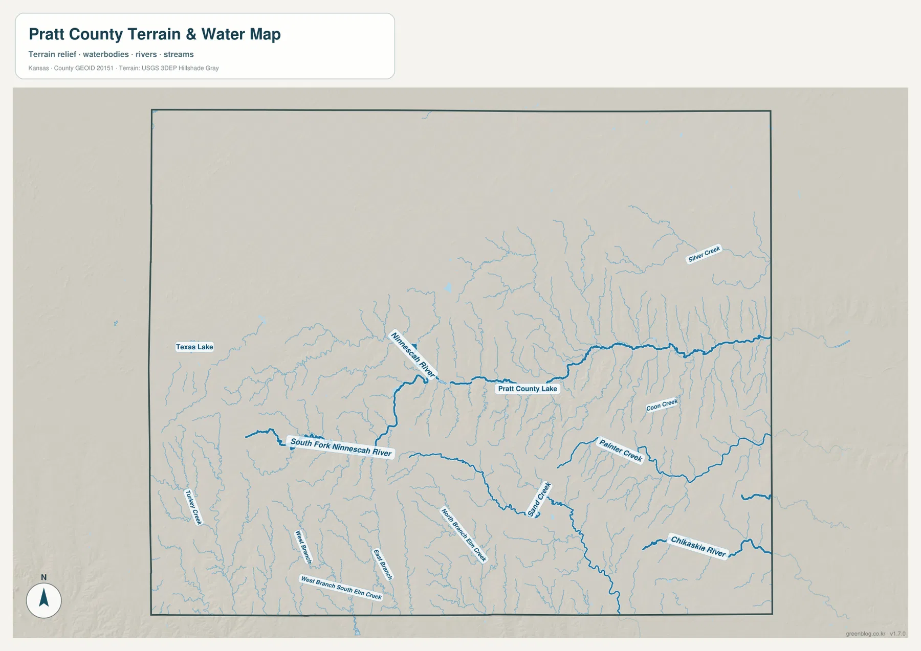
Pratt County Lake appears east of the city near the Ninnescah corridor. Pratt County maintains a dedicated lake page and current rules for the site, making it a useful county-specific landmark for connecting the road network with the eastern water landscape.
Texas Lake is marked in the northwest, while Silver Creek, Coon Creek, and Painter Creek cut long valleys across the eastern half. The dense drainage network helps explain why the east appears lower and more finely dissected on the elevation image than the broad western uplands.
This water image is intended for geographic reference rather than floodplain, navigation, water-quality, parcel, or legal-access decisions. Stream flow and lake conditions can change, so current agency information should be used whenever access or safety matters.
Elevation from 507 to 648 meters drops from western sandhills toward eastern valleys
The elevation surface ranges from about 507 to 648 meters, with a mean near 587 meters. Brown and tan terrain dominates the west, while yellow and green become more common around Pratt and farther east. The broadest low areas follow the Ninnescah River system and its tributaries.
The southwest remains relatively high away from the South Fork Ninnescah River, where narrow drainage cuts create local low corridors. The northwest is also high overall, but small tributaries break up the surface. In contrast, the eastern half contains wider connected valleys and more green terrain.
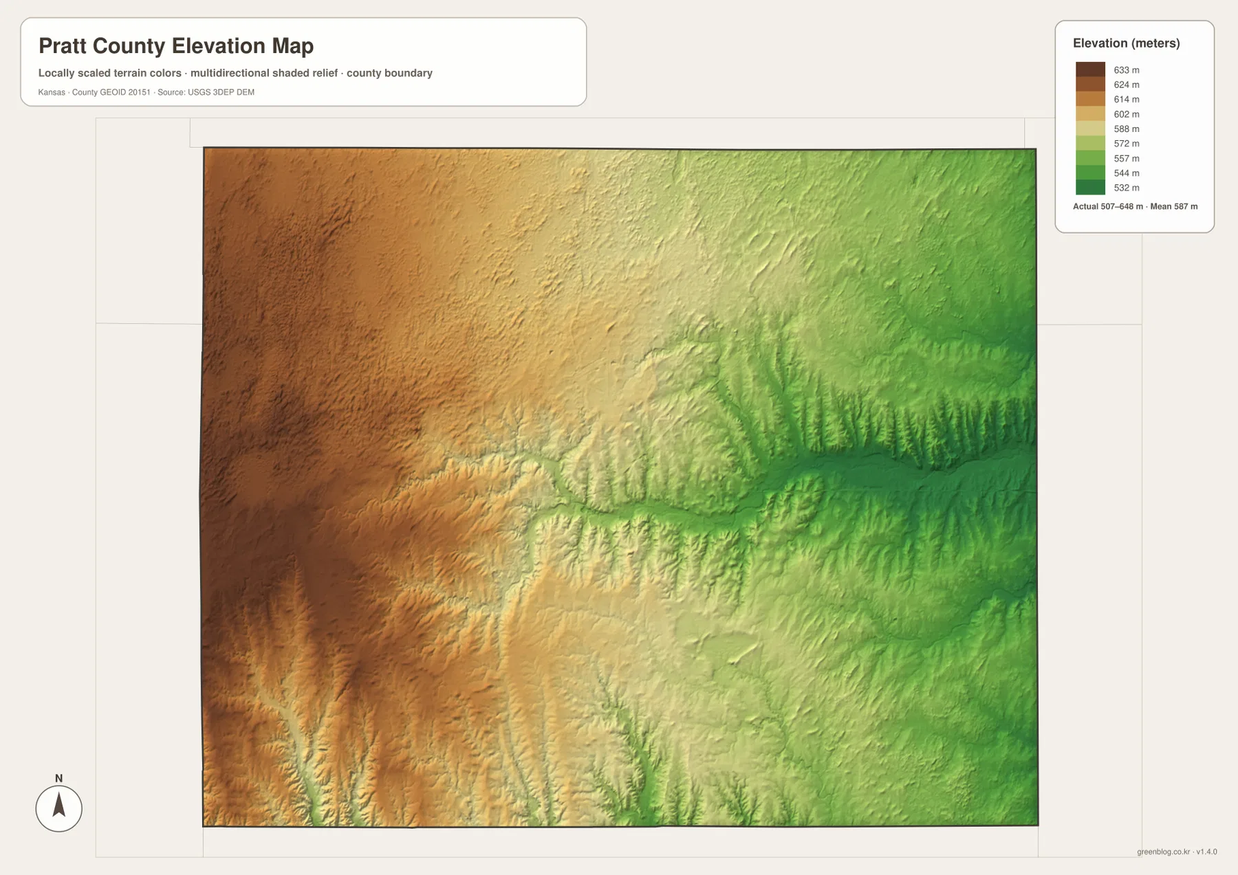
The Kansas Historical Society places Pratt County within the High Plains and Arkansas River Lowlands physiographic setting. That regional description fits the supplied relief image, where elevated western terrain gives way to lower, more heavily drained country toward the east.
The elevation surface is generalized for county-scale comparison. It is not survey-grade or engineering-grade measurement and should not be used for parcel elevations, construction grades, drainage design, or legal boundary work.
Pratt Sandhills Wildlife Area shows what the western uplands look like on the ground
Kansas Department of Wildlife and Parks places Pratt Sandhills Wildlife Area about thirteen miles west and six miles north of Pratt. The agency describes most of the property as sandhill prairie with moderate to steep dune topography, which gives useful real-world context to the higher western terrain on the elevation map.
The official page also notes shelterbelts, wildlife water facilities, and loose-sand township roads. That combination explains why the western side of the county cannot be understood simply as a smooth high plain; it includes dune relief, prairie, windbreaks, and small drainage features.
Pratt County Lake connects the city with the lower eastern drainage country
Pratt County maintains Pratt County Lake as a local recreation area and publishes a dedicated set of lake rules. On the supplied water map, the lake lies east of Pratt near the broader Ninnescah drainage network.
That location makes the lake a useful landmark for comparing the county’s two broad terrain settings. West of Pratt, higher sandy uplands dominate. East of the city, creeks become denser and lower ground occupies more of the map.
Following US 54 through Pratt reveals the west-to-east terrain change
A useful way to compare the county is to follow US 54 from Cullison through Pratt and then east. The western side begins in higher terrain, the route reaches the county’s main city and highway junction, and the eastern side enters a denser network of creek valleys associated with the Ninnescah system.
The southern communities offer a second comparison. Sawyer is tied to US 281, while Coats lies farther southwest near the South Fork Ninnescah country. Looking at one corridor at a time makes the relationship between roads, water, and elevation easier to understand than memorizing a list of map categories.
For posters, classroom prints, or presentation slides, use the original JPG files in the download archive rather than enlarging the web previews. Small road shields, creek labels, town names, and the elevation legend remain clearer at the higher resolution.
Frequently Asked Questions
Which city is largest on the supplied city index?
Pratt ranks first at 6,577. Iuka is 231, Preston 111, Coats 103, Cullison 97, and Sawyer 76. These are map index values rather than current official population estimates.
Are the Ninnescah River and South Fork Ninnescah River the same waterway on this map?
No. The Ninnescah system forms a broad central-to-eastern lowland, while the South Fork Ninnescah River crosses the southwestern part of the county as a separate major channel.
Can the 507–648 meter elevation image be used for surveying?
No. It is a generalized county-scale terrain image for comparing higher western uplands with lower river and creek valleys. Parcel elevations, engineering grades, drainage design, and legal boundary work require more precise official data and, where needed, professional surveying.
Map File Information
The archive contains the Pratt County, Kansas general county map, city map, terrain-and-water map, and elevation map as original high-resolution JPG files.
- Included Files: Use only the versions confirmed in the article and supplied images
- File Type: Use the confirmed download contents
- Intended Use: Printing, education, presentations, and map-based projects
Related Maps
Sources and references
- Pratt County, Kansas official website — county government and Pratt County Lake information
- Kansas Historical Society: Pratt County, Kansas — county seat, history, and regional geography
- Kansas Department of Wildlife and Parks: Pratt Sandhills Wildlife Area — western sandhill prairie and dune topography
- U.S. Census Bureau TIGER/Line Shapefiles — county boundary and geographic reference data
- USGS National Hydrography — river and stream reference data
- USGS 3D Elevation Program — elevation and terrain reference data
Green Map creates custom-edited map images using open geographic data sources such as geoBoundaries, Natural Earth, OpenStreetMap, and government open data.
These maps are edited visual materials, not raw data files, and are provided for education, documents, presentations, and graphic reference.