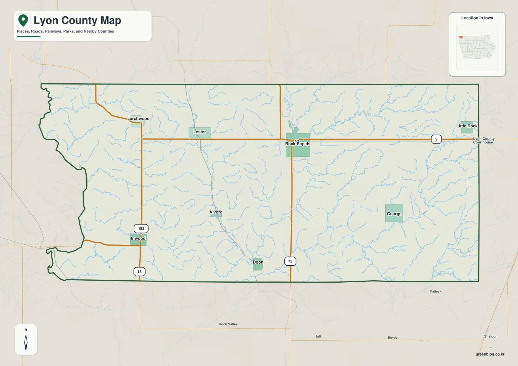
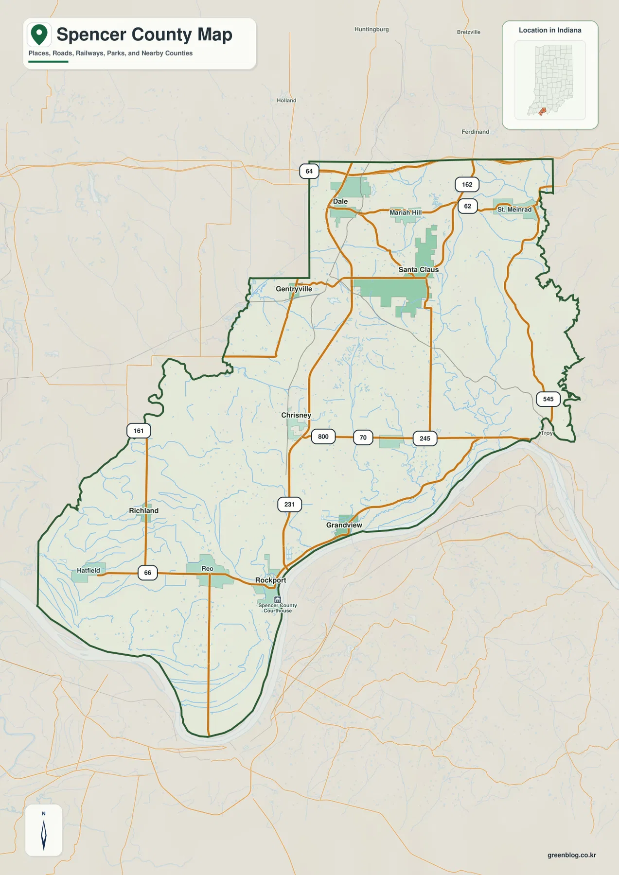
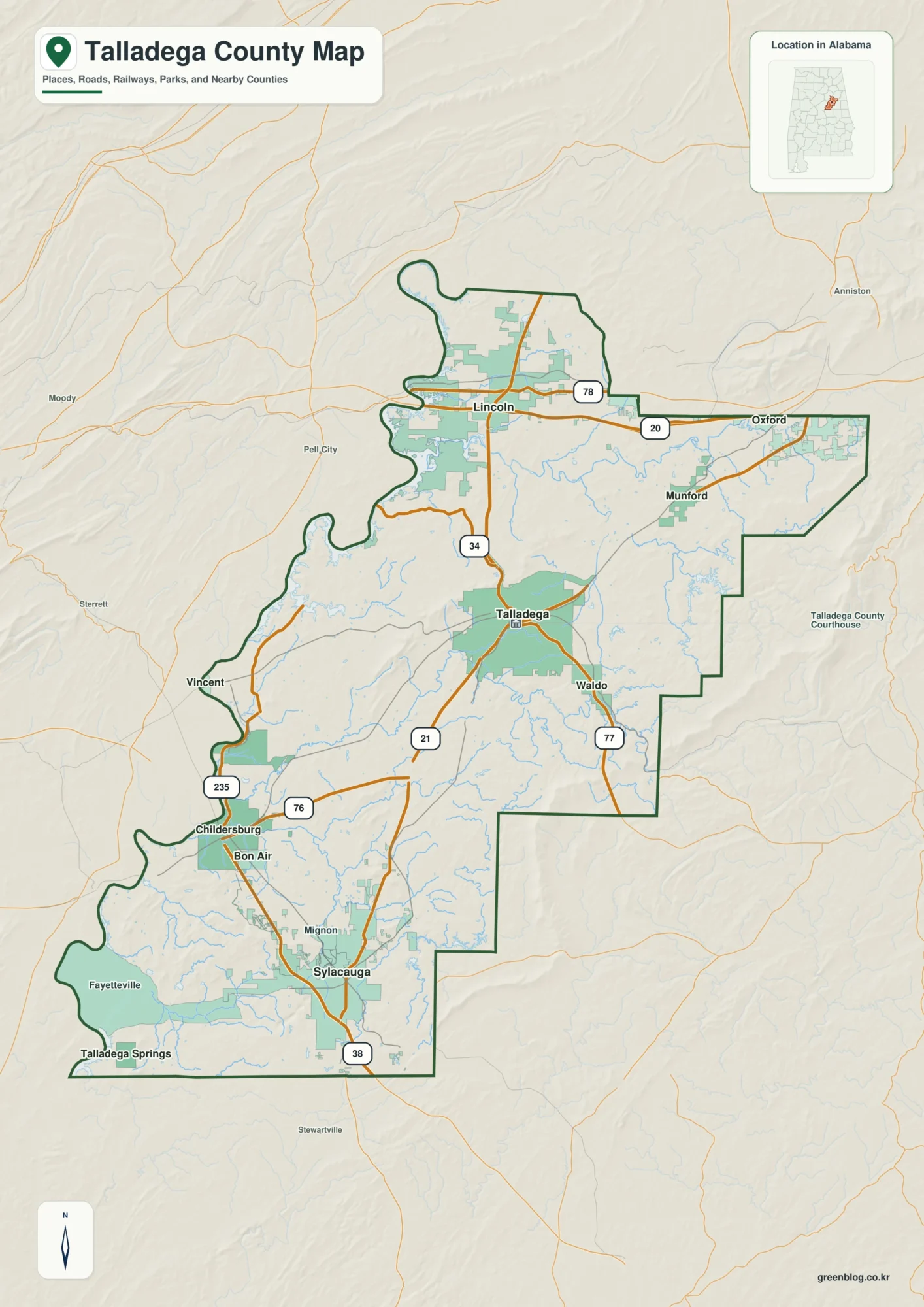
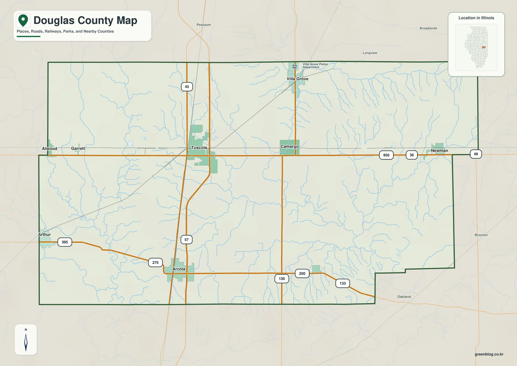
Benton County sits in west-central Missouri, where roads converge on Warsaw and the broad waters of Harry S Truman Reservoir break the landscape into long coves and peninsulas. This Benton County Missouri Map set shows the county boundary, Warsaw, Lincoln, Cole Camp, Ionia, Routes 7, 52 and 65, major waterways, and countywide relief. A download box later in the article provides four high-resolution JPG files for printing or closer viewing.
Warsaw is the easiest place to use as an anchor. It lies near the western-middle part of the county beside Truman Reservoir, while Lincoln is to the north and Cole Camp is farther northeast along Route 52. The water and elevation maps add another layer to that arrangement: low ground follows the reservoir and Osage River, while higher, more dissected ridges stand out across the eastern and northeastern parts of the county.
Table of Contents
Start with Warsaw and the main road network
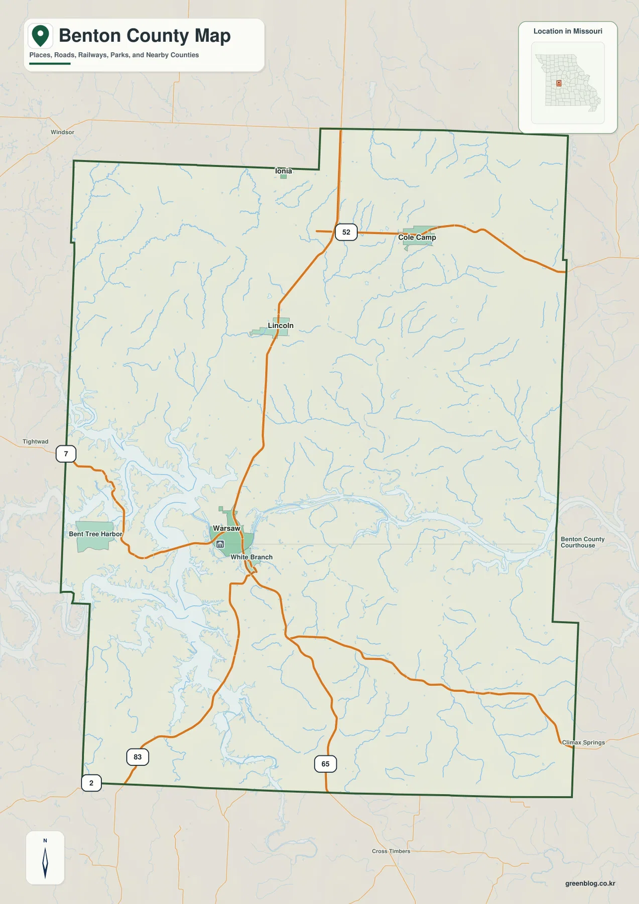
On the general county map, Warsaw is the clearest reference point. Route 7 approaches from the west, and Route 65 runs north-south through the county. Lincoln appears farther north near Route 65, while Cole Camp occupies the northeastern side along Route 52. Ionia is close to the northern boundary, giving the upper part of the county another useful place marker.
The shoreline west of Warsaw is much more irregular than the road network suggests. Harry S Truman Reservoir sends long arms into the western side of the county, and smaller lakeside place names appear along the water. South of Warsaw, Route 65 continues toward the county line, while Routes 83 and 2 are visible near the southwestern edge. These roads make it easier to orient the inland portions of the county around a landscape dominated by water and ridges.
This map works best as an overview rather than as a turn-by-turn navigation product. It is useful for seeing where the major roads and communities sit relative to the county boundary and reservoir. Around Truman Reservoir, actual driving routes can be much longer than the apparent straight-line separation because roads must follow bridges, coves, and the available shoreline crossings.
Northern communities from Lincoln to Cole Camp and Ionia
Moving north from Warsaw, Lincoln becomes an important inland reference point. Route 65 passes through this part of the county, making Lincoln easy to relate to Warsaw on the general map. Ionia lies still farther north near the boundary, while Cole Camp is offset to the northeast and follows a different road pattern centered on Route 52.
Cole Camp is especially useful for understanding the northeastern corner. Rather than sitting directly on the Warsaw-Lincoln north-south line, it lies to the east where Route 52 crosses the upper part of the county. Ionia, by contrast, helps mark the northern edge. Looking at all three places together shows that Benton County is not organized around a single corridor; its communities spread across several road directions and terrain settings.
For a classroom map, local-history handout, or general county guide, these communities provide a simple framework. Start with Warsaw, move north to Lincoln, then place Cole Camp to the northeast and Ionia near the northern line. Adding Truman Reservoir and the Osage River then connects the settlement pattern to the county’s most prominent physical features without requiring a long list of minor road names.
Straight-line city connections from Warsaw
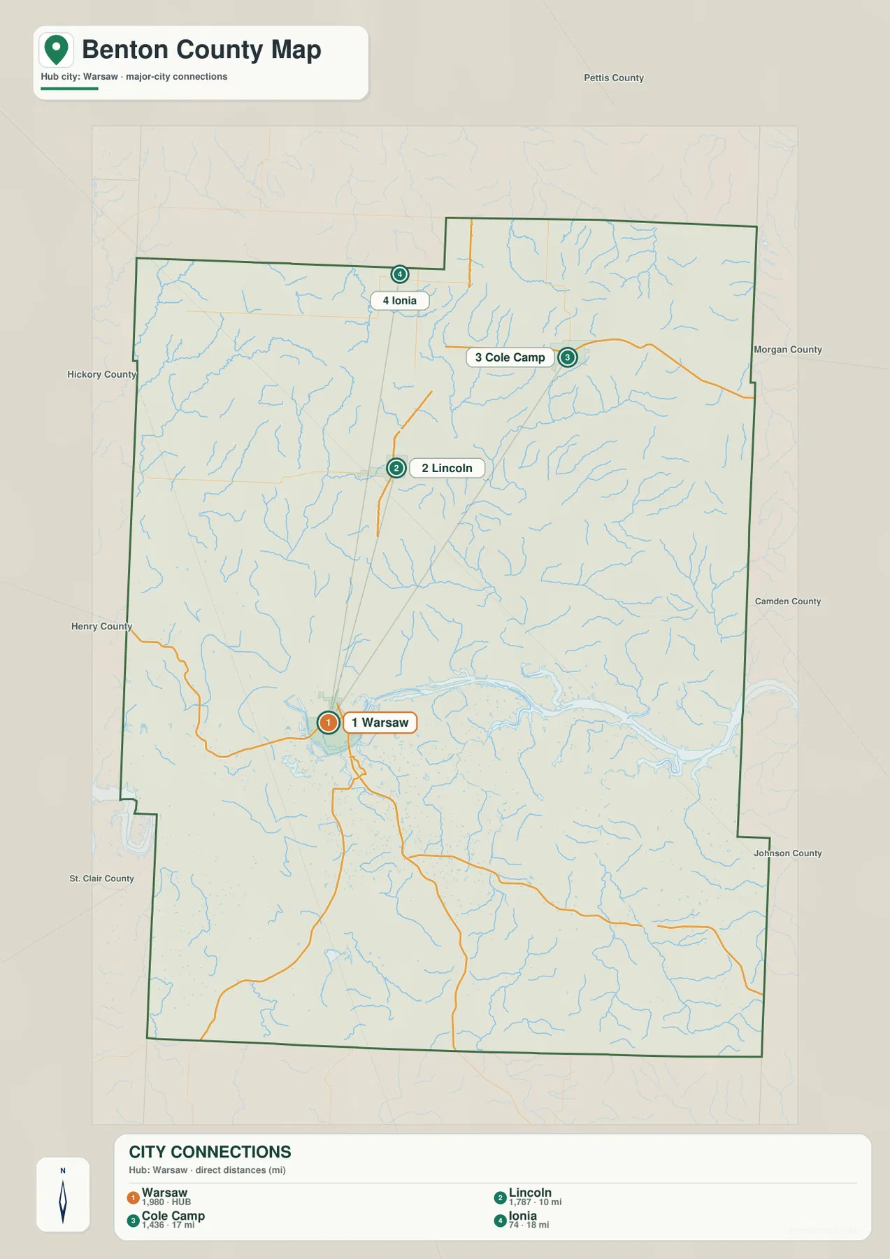
The city-connections map simplifies Benton County to four labeled communities. Warsaw is the hub, with Lincoln shown about 10 miles away, Cole Camp about 17 miles away, and Ionia about 18 miles away. These are straight-line distances between mapped points, not mileage measured along the road network.
The direction of each line is more useful than the number alone. Lincoln lies almost directly north of Warsaw, Cole Camp is northeast, and Ionia is farther toward the north. That simple geometry helps readers understand the relationship among the county’s principal settlements before turning back to the more detailed road map.
Because Truman Reservoir and the county’s rolling terrain can force roads away from a direct line, driving distance and travel time should be checked separately. The connection map is best used as a spatial summary. It does not attempt to show every town, every road, or the fastest route between communities.
Harry S Truman Reservoir, Osage River, and the creek network
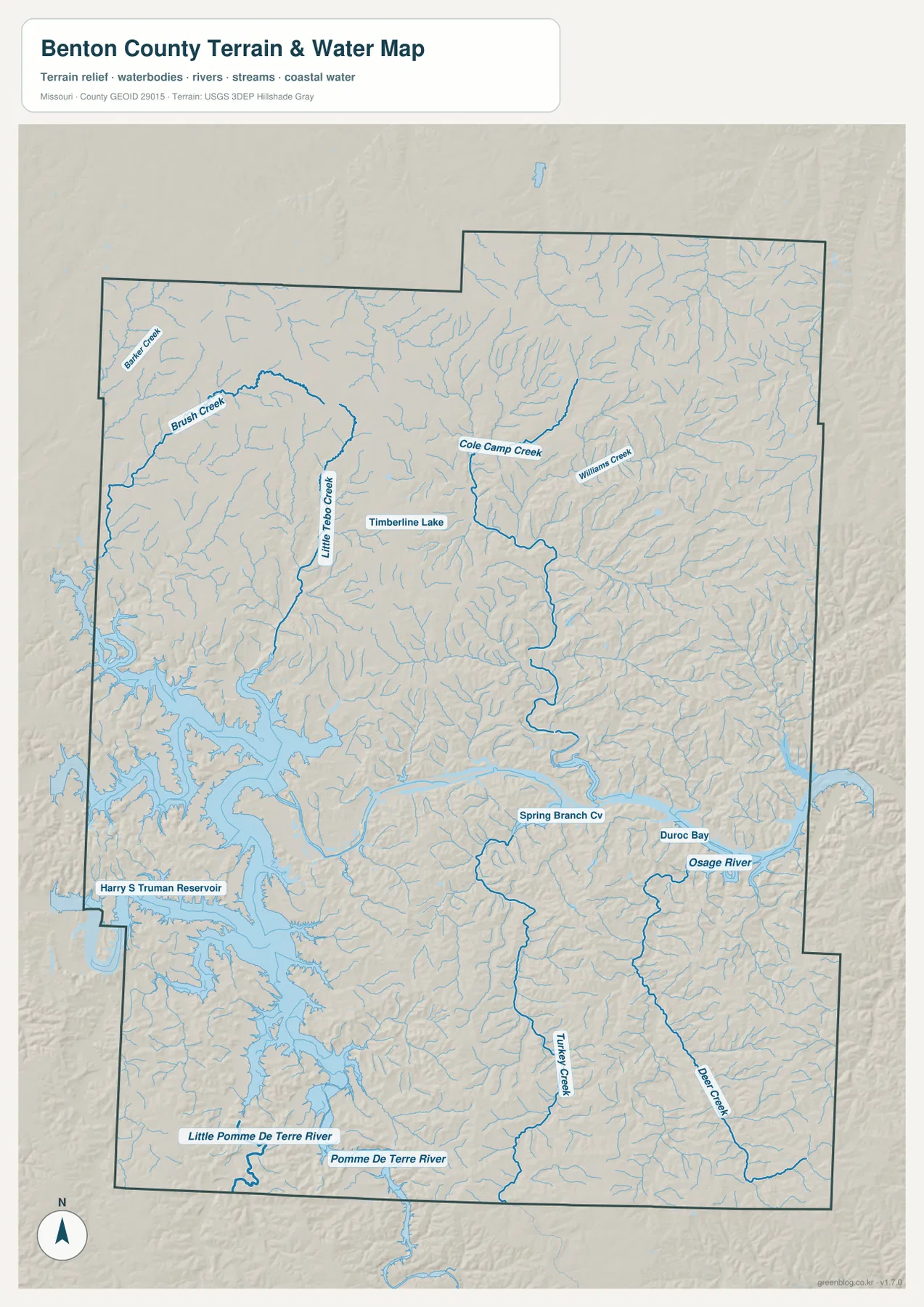
The water map changes the way Benton County looks. Harry S Truman Reservoir dominates the western side with a deeply indented shoreline, while the Osage River extends eastward through the middle of the county. The large water bodies are only part of the story; dozens of smaller channels branch through the surrounding hills and valleys.
Several named streams help organize the northern half. Brush Creek and Barker Creek appear in the northwest, Little Tebo Creek runs through the west-central interior, and Cole Camp Creek drains part of the north and northeast. Williams Creek is also labeled in the northeastern drainage. Timberline Lake provides a smaller inland water reference away from the reservoir.
South of the Osage River, Turkey Creek and Deer Creek form long tributary corridors. Near the southern boundary, the Pomme de Terre River and Little Pomme de Terre River are labeled, adding another major drainage system to the map. These waterways help explain why the county surface is so heavily cut by narrow valleys rather than appearing as one broad, smooth upland.
The water map is a reference for the location and names of rivers, creeks, lakes, and reservoir arms. It should not be treated as a flood-hazard map, a legal shoreline map, a navigation chart, or a parcel-boundary product. Those uses require current information from the appropriate agencies and, where necessary, professional surveying or navigation sources.
Higher northeastern ridges and lower river valleys
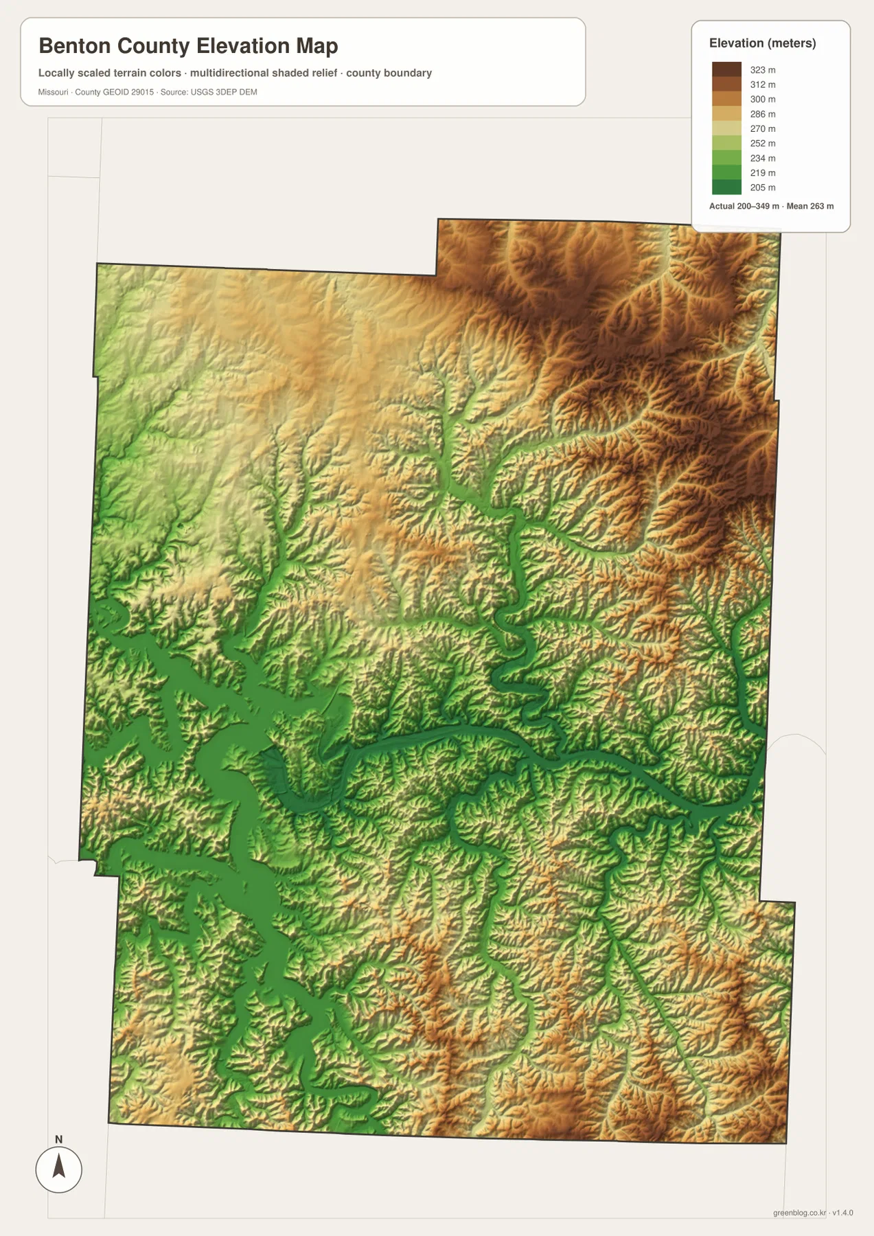
The elevation map gives the county’s relief a clear visual form. Its legend reports an actual elevation range of roughly 200 to 349 meters and a countywide mean near 263 meters. Brown tones represent relatively higher ground, while green tones mark lower elevations. The strongest concentration of higher terrain appears across the east and northeast, where ridges are closely divided by stream valleys.
Around Warsaw, Truman Reservoir, and the Osage River, broad green corridors mark lower ground. Narrow green branches extend away from the major water bodies along tributary valleys. This creates a branching pattern that closely matches the drainage shown on the water map. In the northeast, the contrast is especially strong because short valleys cut into higher brown and tan ridges.
The southern half is also uneven. Low ground follows the larger creek and river corridors, while intervening hills rise above them. The result is a landscape of repeated ridges and valleys rather than a simple slope from one edge of the county to the other. Comparing the elevation map with the water map makes this relationship much easier to see.
This elevation image is intended for county-scale comparison. It is not a substitute for a survey, a construction-grade elevation model, or a precise parcel measurement. Anyone who needs exact elevation, slope, or drainage information for engineering, building, or property work should use more detailed official data and site-specific measurements.
Why Warsaw and Truman Reservoir define the county map
The official Benton County website identifies the courthouse in Warsaw, reinforcing the town’s administrative role. The map also makes Warsaw a natural geographic anchor because major roads and the reservoir meet in the same general area. Once Warsaw is located, readers can move north toward Lincoln, northeast toward Cole Camp, and outward along the reservoir arms without losing orientation.
Harry S Truman State Park adds a useful real-world reference near Warsaw. Missouri State Parks describes the park as occupying a peninsula on Truman Reservoir, with bluffs, trails, camping, and water access. This article is not a park guide, but that setting helps explain why the shoreline near Warsaw appears so broken and why land routes around the reservoir do not follow simple straight lines.
Taken together, the maps show why Benton County cannot be summarized by roads alone. The county includes a large reservoir, a major river, many tributary valleys, and noticeably higher ridges to the east and northeast. The placement of communities makes more sense when those physical features are viewed alongside the road network.
Which map to use for roads, towns, water, or terrain
Use the general county map when the goal is to identify Warsaw, Lincoln, Cole Camp, Ionia, and the principal numbered routes in one view. It gives the most balanced overview of settlement and transportation. If the task is simply to compare the positions of the main communities, the city-connections map removes much of the extra detail and makes direction and straight-line separation easier to explain.
Choose the water map when rivers, creeks, reservoir arms, and named water bodies are the focus. It is the clearest place to find Truman Reservoir, the Osage River, Cole Camp Creek, Turkey Creek, Deer Creek, and the Pomme de Terre drainage. Pair it with the elevation map when you want to show how those watercourses occupy lower valleys between higher ridges.
The downloadable JPG files are more suitable than the on-page WebP previews for printing, zooming, and large-screen use. They preserve more detail in road labels, stream lines, place names, and elevation colors. For legal boundaries, current road conditions, navigation, flood risk, or property decisions, however, the maps should be supplemented with the relevant official sources.
Reading roads, water, and relief together
The strongest relationships appear when the four views are compared rather than read separately. Warsaw is a good example. On the road map it is a transport and settlement reference point; on the water map it sits next to the large Truman Reservoir system; on the elevation map it lies close to broad low ground. Each map answers a different question about the same place.
Cole Camp provides a contrasting example. It appears as a northeastern town along Route 52 on the general map. The water map shows Cole Camp Creek and neighboring tributaries cutting through that part of the county, while the elevation map reveals higher ridges broken by narrow green valleys. The combination explains why the northeastern interior looks much more rugged than the reservoir margin around Warsaw.
The southern part of the county also gains detail from comparison. Route 65 provides a simple north-south road reference, but the water map adds Turkey Creek, Deer Creek, and the Pomme de Terre river system. The elevation map then shows low valley corridors between higher hills. For presentations or printed reference sheets, selecting two or more of these views can communicate the county’s geography more clearly than forcing every feature into one image.
Frequently Asked Questions
What is the easiest way to locate Warsaw on the Benton County map?
Find the eastern side of Harry S Truman Reservoir and look for the area where Routes 7 and 65 come together. Warsaw is labeled there. Lincoln lies north of it, and Cole Camp is farther northeast, so those three places provide a simple orientation framework.
Are the 10, 17, and 18 mile figures on the city map driving distances?
No. They are straight-line distances from Warsaw to Lincoln, Cole Camp, and Ionia. Roads may take a longer path because of the reservoir, bridges, and terrain, so actual driving mileage and travel time should be checked with a current road or navigation source.
Can the elevation range of about 200 to 349 meters be used for surveying or construction?
No. The elevation map is designed to compare countywide high and low areas. It does not provide parcel-level survey accuracy or construction measurements. Exact elevation, slope, and drainage information should come from appropriate official datasets and site-specific survey work.
Map File Information
The Benton County general map, city-connections map, water map, and elevation map are packaged as original high-resolution JPG files.
- Included Files: county map, city-connections map, water map, elevation map
- File Type: JPG
Related Maps
Sources and references
- Benton County, Missouri official website – county government and courthouse information in Warsaw
- Missouri State Parks – Harry S Truman State Park – official park information for the Truman Reservoir setting near Warsaw
- U.S. Census Bureau TIGER/Line Shapefiles – official geographic boundary and road reference data
- USGS National Hydrography – official hydrography reference for rivers, streams, and water bodies
- USGS 3D Elevation Program – official elevation and terrain data
Green Map creates custom-edited map images using open geographic data sources such as geoBoundaries, Natural Earth, OpenStreetMap, and government open data. These maps are edited visual materials, not raw data files, and are provided for education, documents, presentations, and graphic reference.