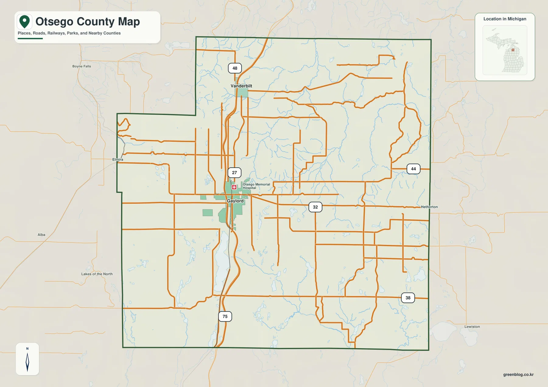
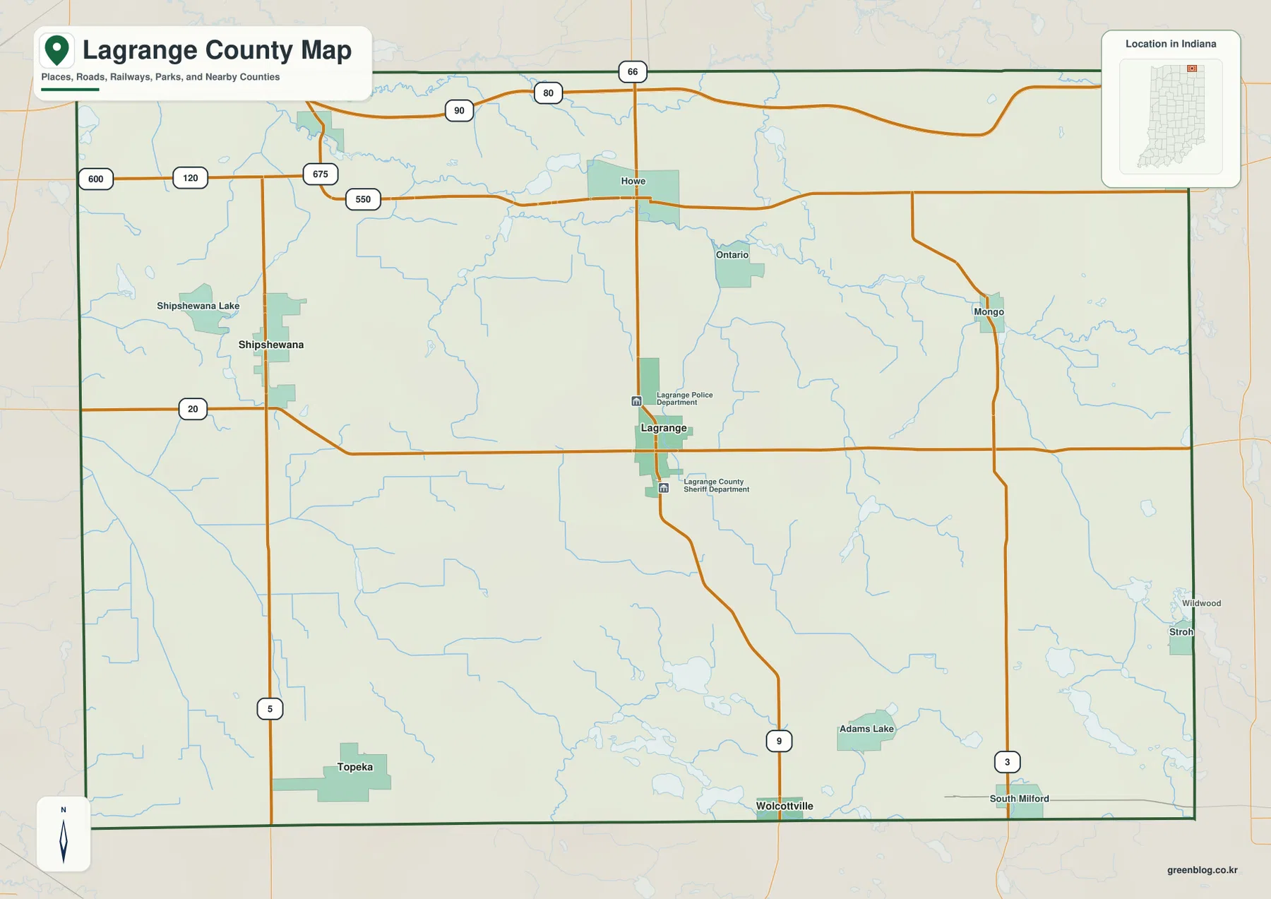
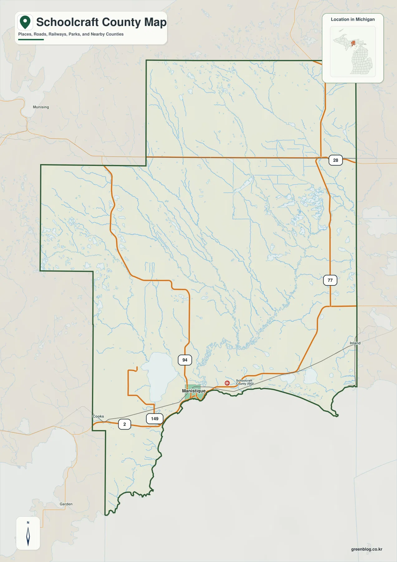
Schoolcraft County occupies a broad part of Michigan’s eastern Upper Peninsula, with Manistique on the Lake Michigan shore and a large interior extending north toward M-28. The county map makes the main travel routes easy to identify: US-2 follows the southern side near Manistique, M-94 runs inland from the city, M-77 crosses the eastern interior, and M-28 marks the northern corridor. Indian Lake, the Manistique River, and a dense network of northern streams add a strong water component to the county’s geography.
This page combines those features with a county road map, a ranked city index, a water map, and an elevation map. The original map files are available as high-resolution A3 JPGs in one downloadable ZIP, allowing each map to be printed or used separately. The maps are intended for general geographic reference, local orientation, and visual comparison rather than parcel, engineering, or legal-boundary work.
Table of Contents
Manistique, US-2, and the main highway pattern
Manistique is the clearest orientation point on the general county map. It sits near the Lake Michigan shore, where US-2 passes through the southern part of Schoolcraft County and continues toward Cooks to the west. M-94 leaves the Manistique area and runs north into the interior before bending across the county, while M-149 appears as a shorter numbered route in the southwest near the US-2 corridor.
Farther east, M-77 forms a long north–south route through the county and reaches the M-28 corridor near the northeastern side. M-28 crosses the northern portion and helps define a very different part of the county from the developed shore near Manistique. Nearby labels such as Munising and Inland appear outside the county boundary, providing useful context for how Schoolcraft County fits among neighboring Upper Peninsula communities.
The county outline is irregular, especially on the west and northwest sides, while the southern edge follows the Lake Michigan shoreline. Rail lines and smaller roads are also visible around the southern part of the map, but the file is not meant to replace a current street map or turn-by-turn navigation service. Its main strength is showing the county shape, major numbered highways, important place labels, and nearby water features in one view.
A city index focused on Manistique
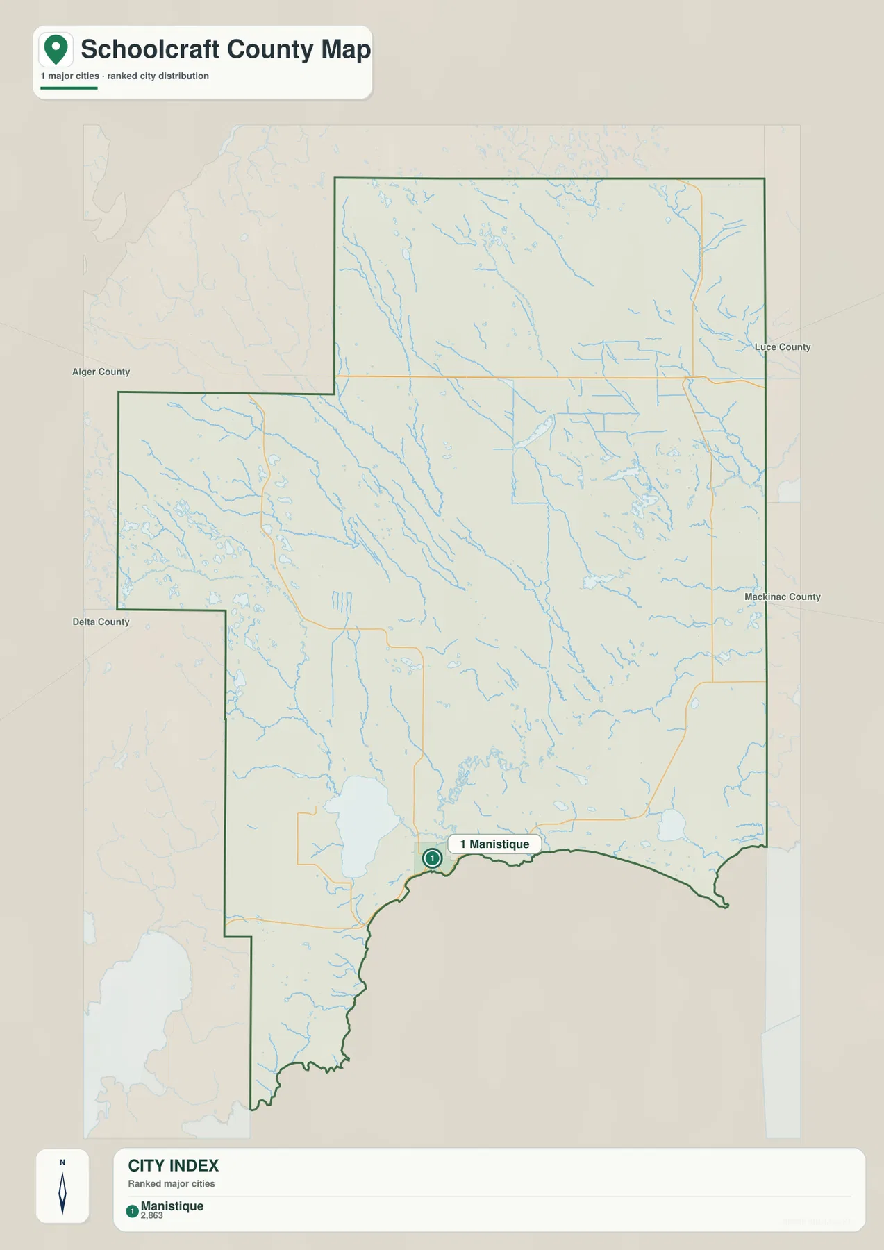
The ranked city index contains one selected major city: Manistique, marked as number 1 near the Lake Michigan shore. The printed index value is 2,863. That number is reproduced from the supplied city-index graphic rather than presented here as a new population estimate, so the map is best used to understand the selected city’s position and ranking within this particular graphic.
A one-city index does not mean that Schoolcraft County has no other communities. The general county map includes additional place labels and a much fuller road network, while the city index intentionally strips away most of that detail. Its simplified layout makes the contrast between the compact southern city location and the county’s large inland area especially clear.
There are no connector lines or distance labels on this city map. It should not be interpreted as a straight-line distance diagram or a driving-distance guide. For travel planning, use the general county map to identify the main highways and then consult a current routing source for actual road mileage and travel time.
Indian Lake and the Manistique River system
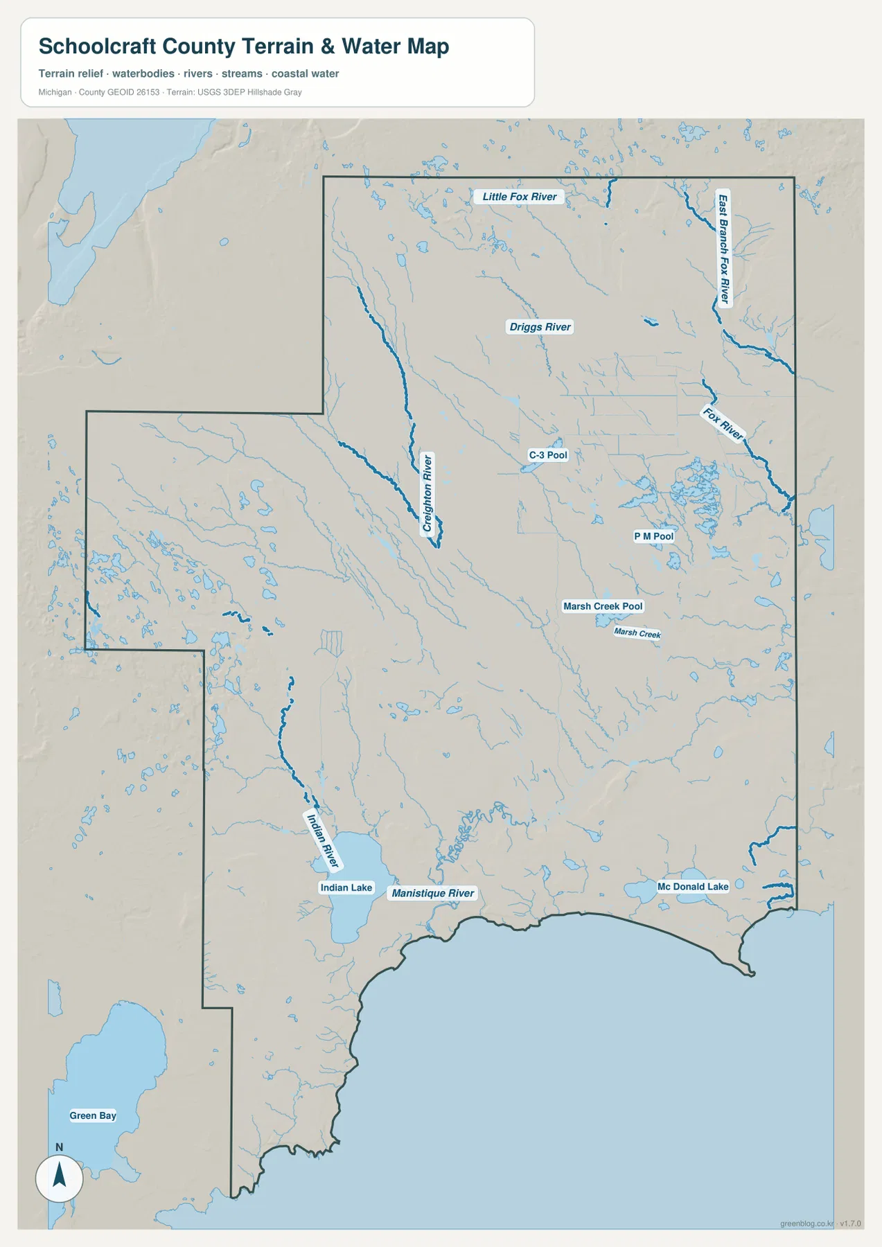
Indian Lake is one of the largest and most recognizable water features in the southern interior. The Indian River reaches the lake from the north, while the Manistique River is labeled near the lake and continues toward the Lake Michigan side of the county. Looking at these names together helps explain why the area around Manistique is closely connected to inland water as well as to the Great Lakes shoreline.
The northern half contains a separate set of rivers and streams. Little Fox River and East Branch Fox River are labeled near the top of the map, while Fox River continues through the eastern side. Driggs River appears farther west, and the central area includes labeled water bodies such as C-3 Pool and P M Pool. Marsh Creek and Marsh Creek Pool are shown to the southeast of those features, with McDonald Lake closer to the county’s southeastern edge.
Numerous smaller lakes and tributaries fill the western and northwestern interior even where individual labels are too small to dominate the map. Green Bay is shown outside the county as a regional reference to the southwest, while Schoolcraft County’s own southern shoreline faces Lake Michigan. The result is a county where inland lakes, river branches, wetland-like pools, and Great Lakes coastal water all appear within the same regional setting.
The water map is a reference for names, relative positions, and broad drainage relationships. It does not show flood probability, navigable depth, legal shoreline limits, or parcel ownership. Anyone making a safety, engineering, boating, or property decision should use current agency data for that specific purpose.
Indian Lake also has a direct public-recreation connection. Michigan DNR describes Indian Lake State Park on the lake west of Manistique and provides current information about access and park facilities. That official page is useful for visit planning, while the map here is better suited to understanding the lake’s position within the larger county.
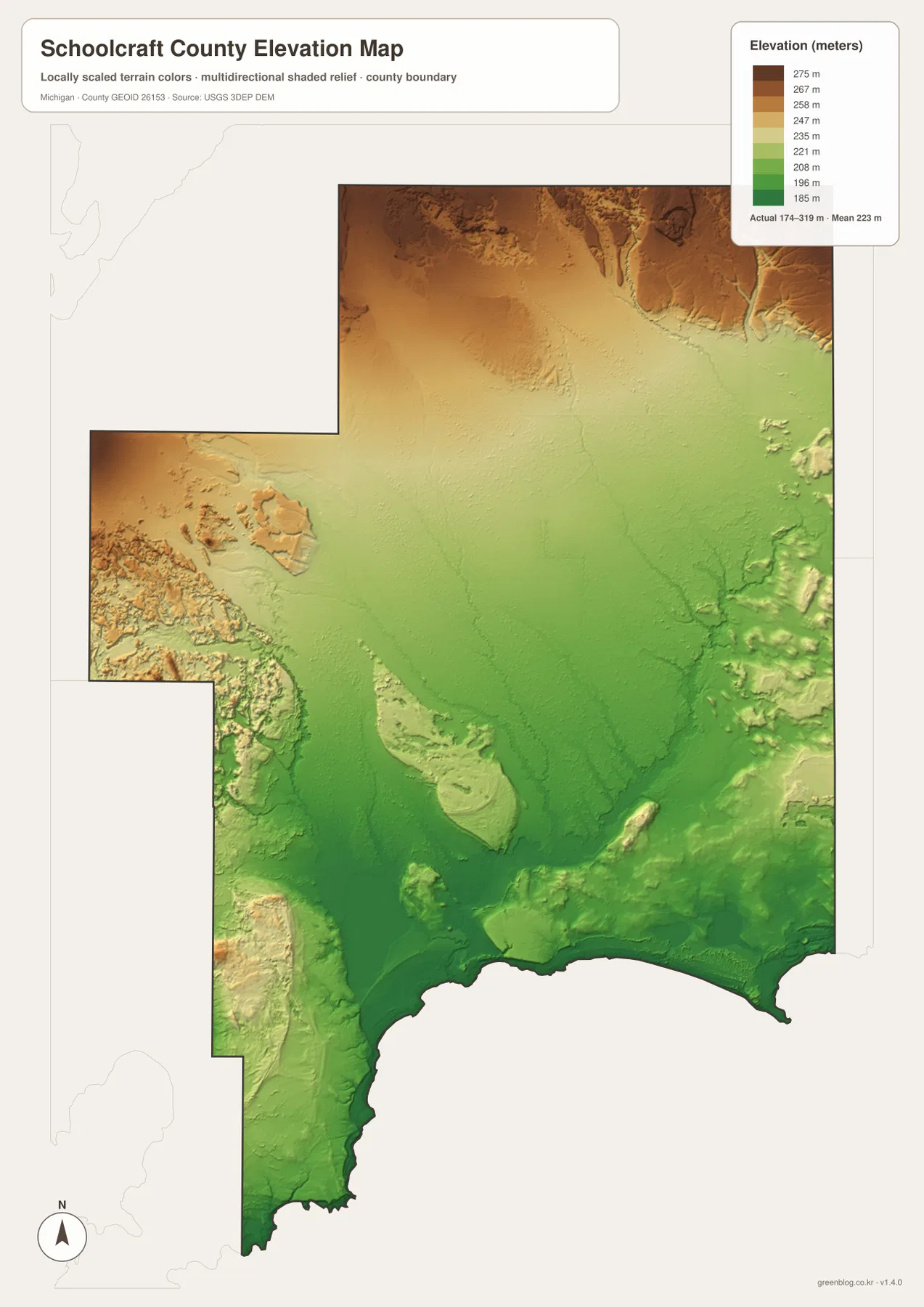
Elevation from 174 to 319 meters
The elevation map reports an actual county range of roughly 174 to 319 meters, with a mean near 223 meters. Greens represent lower land and the tan-to-brown colors represent higher ground. Much of the broad central and southern interior appears in the lower part of the color range, and the Lake Michigan edge is also low compared with the county’s upland areas.
Higher terrain is most evident along parts of the northern edge and across portions of the west, where darker browns and stronger shaded relief appear. Stream valleys cut through some of those higher areas, creating narrow lower corridors. The map also shows smaller ridges and uneven ground in the southwest and east, so the county is not a single flat surface even though large central areas look comparatively gentle.
This map is useful for comparing broad relief, not for reading survey-grade elevations at a house lot, road project, or drainage structure. The colored surface is generalized for county-scale viewing. Engineering, construction, and precise site work should rely on more detailed USGS elevation products and field measurements.
Connecting roads, water, and relief
Using the maps together makes Schoolcraft County easier to understand than relying on any one layer alone. The road map centers attention on Manistique and the major state highways, while the water map shifts attention toward Indian Lake, the Manistique River, and the separate Fox River system in the north. Adding elevation explains why some northern and western stream valleys stand out against higher surrounding ground.
For example, a reader following M-94 north from Manistique can use the water map to see how that route enters an interior filled with rivers and small lakes. Someone focused on Indian Lake can start with the water map, then return to the general county map to relate the lake to Manistique and US-2. The elevation layer adds a third perspective by showing that the low southern corridor differs from the higher terrain farther north and west.
These comparisons are useful for school projects, regional orientation, local-history presentations, or travel preparation that requires a clear overview. They are not substitutes for current road closures, parcel maps, zoning records, flood-regulation maps, or legal surveys. Those specialized decisions require the appropriate county, state, or federal source.
Download the A3 JPG map files
The ZIP below contains the high-resolution A3 JPG originals for the county map, ranked city index, water map, and elevation map described on this page. After reviewing the previews, you can print one file, keep the complete set for reference, or place two maps side by side when comparing roads, water, and terrain.
Frequently Asked Questions
Which map is best for finding the main roads in Schoolcraft County?
Start with the general county map. It shows US-2 along the south, M-94 from the Manistique area into the interior, M-77 in the east, and M-28 across the north, making it the clearest file for broad road orientation.
Why does the city index show only Manistique?
The city index highlights only the selected major city used in that graphic. It is a simplified index, not a complete list of every community in Schoolcraft County, so the general county map should be used when you need more place names and road context.
Can the 174–319 meter elevation range be used for surveying?
No. The elevation map is suitable for broad comparison of higher and lower terrain, but it is not a survey-grade product. Precise construction, drainage, or site-planning work requires more detailed official elevation data and field verification.
Map File Information
A ZIP containing the high-resolution A3 JPG originals for the Schoolcraft County map, city index, water map, and elevation map.
- Included Files: county map, city index map, water map, elevation map
- File Type: JPG
Related Maps
Sources and references
- U.S. Census Bureau TIGER/Line Shapefiles – official geographic files useful for county boundaries, roads, and place references.
- USGS National Hydrography – federal source for rivers, streams, lakes, and other hydrographic features.
- USGS 3D Elevation Program – official U.S. elevation data and terrain resources.
- Schoolcraft County official website – county government information and local background.
- Michigan DNR – Indian Lake State Park – current state information for the park on Indian Lake west of Manistique.
Green Map creates custom-edited map images using open geographic data sources such as geoBoundaries, Natural Earth, OpenStreetMap, and government open data. These maps are edited visual materials, not raw data files, and are provided for education, documents, presentations, and graphic reference.