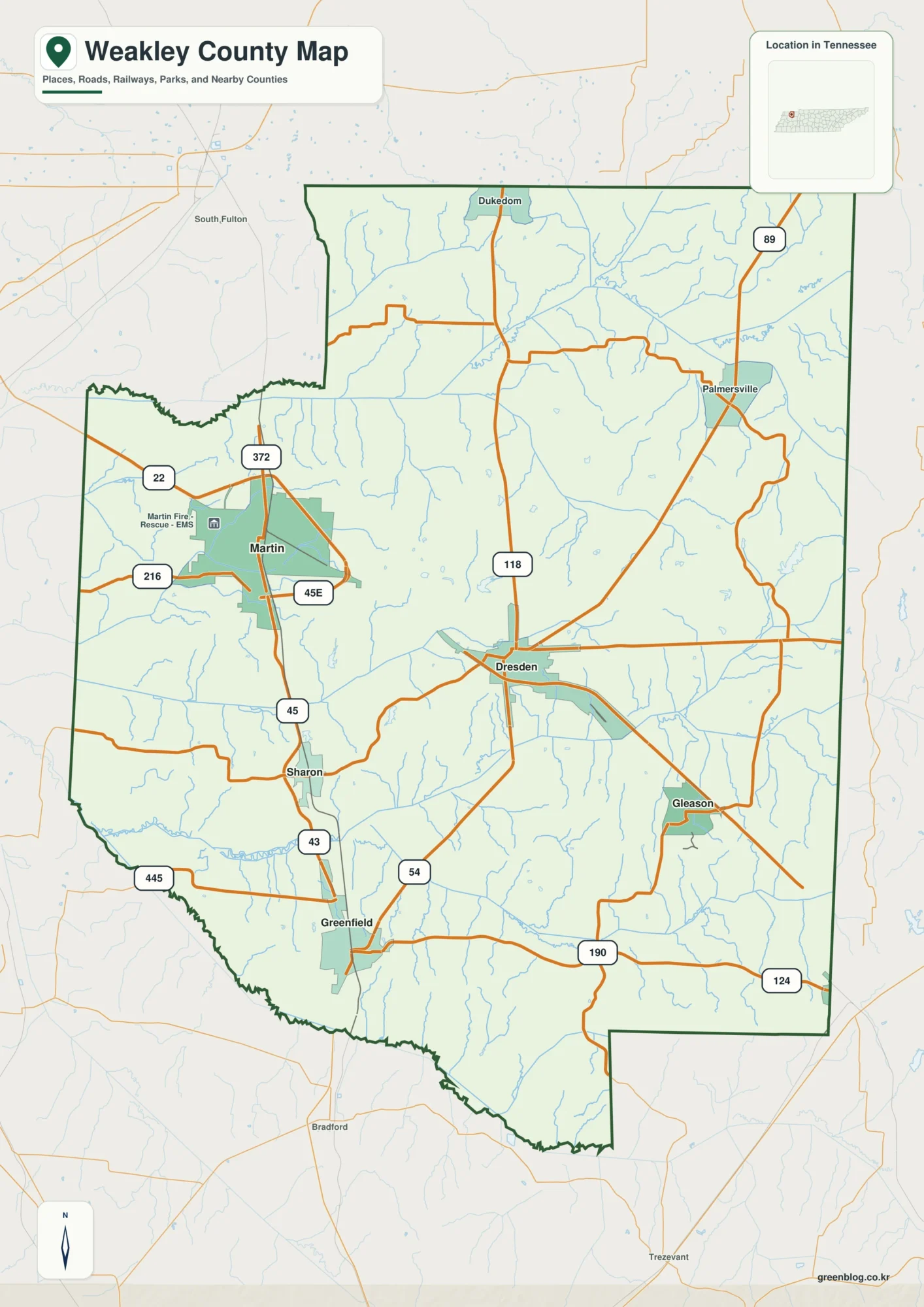
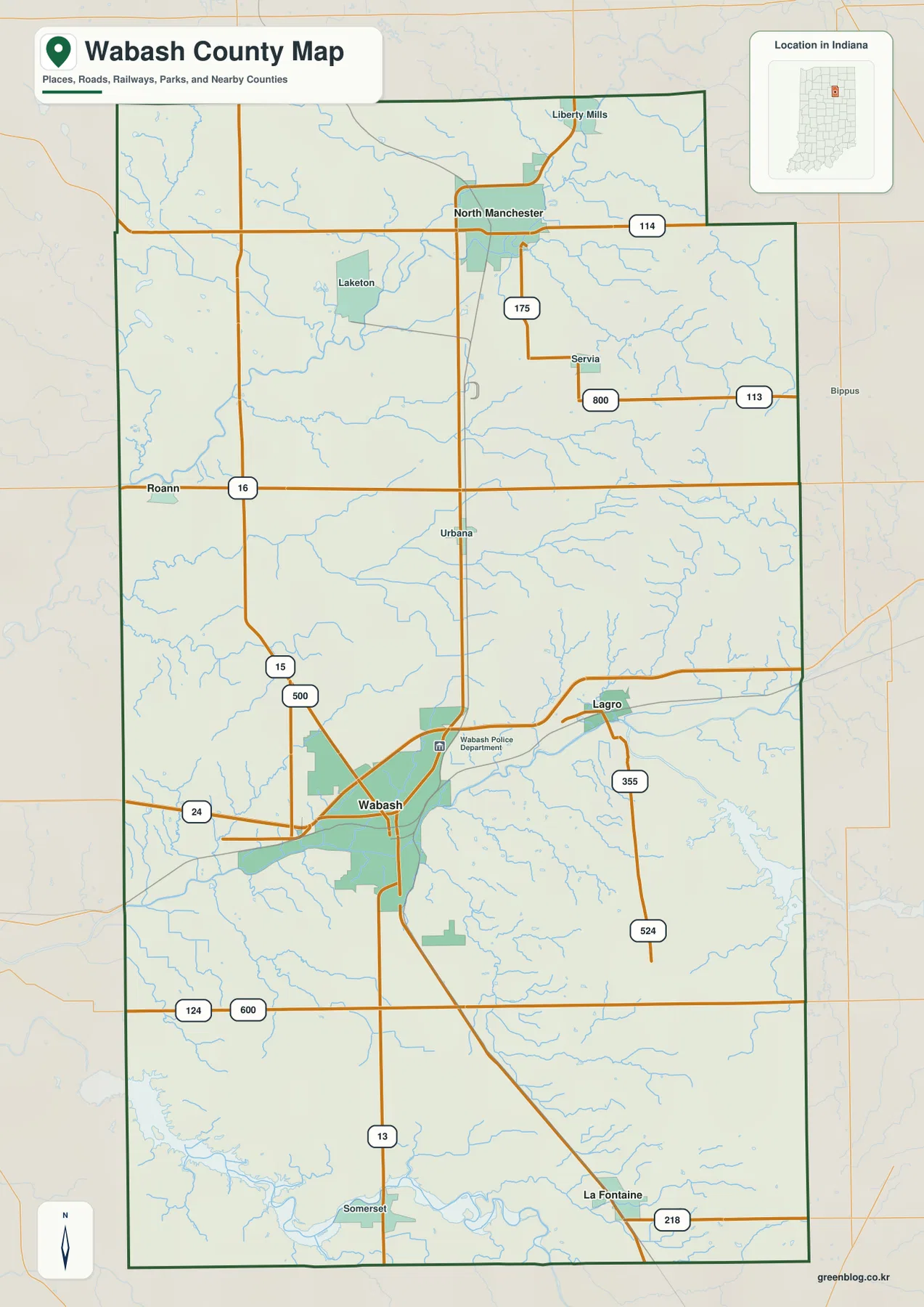
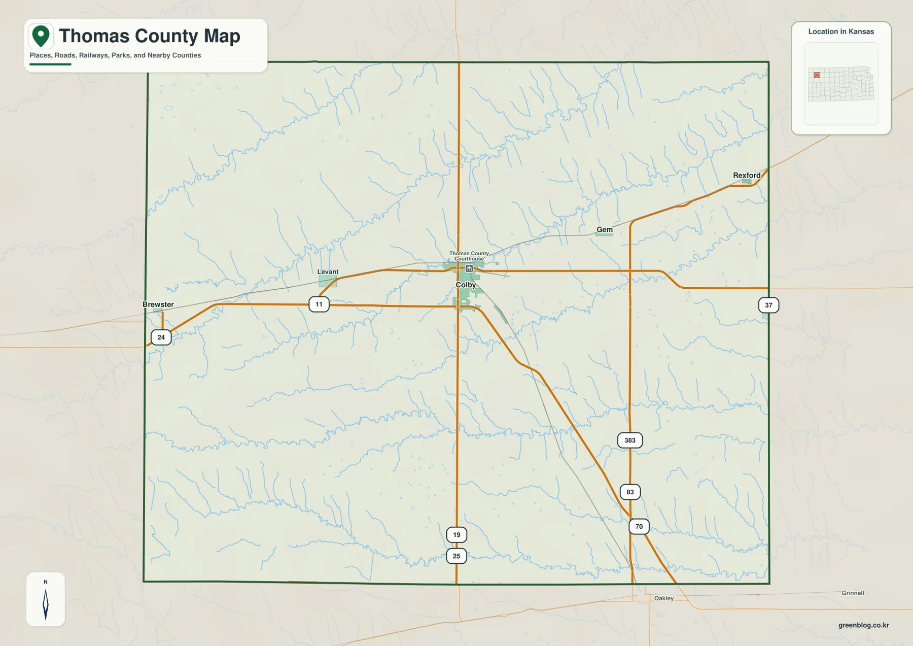
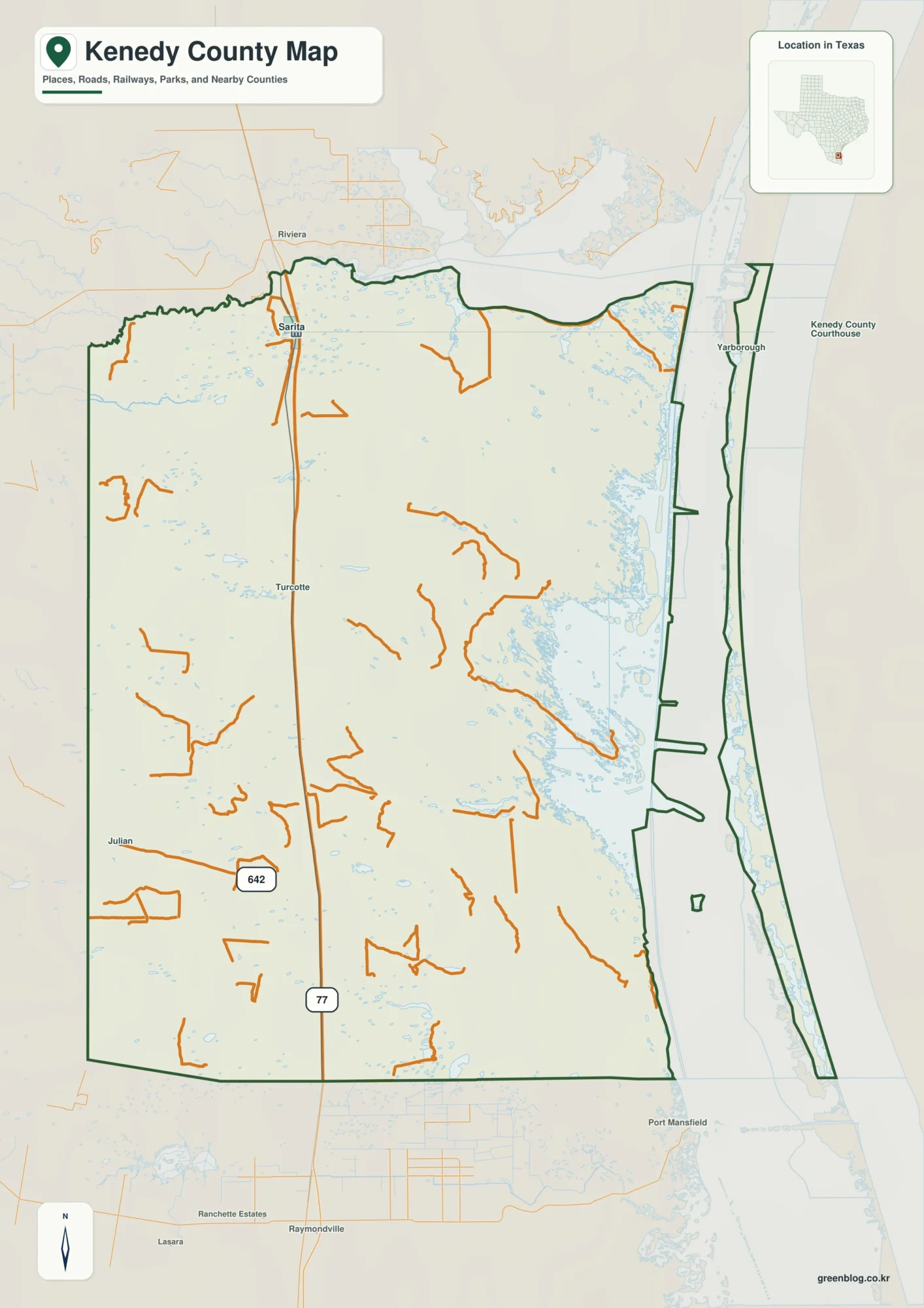
Worcester County forms Maryland’s Atlantic edge, stretching from the Ocean City resort area in the northeast through Berlin and the county seat of Snow Hill to Pocomoke City in the southwest. Its map has an unusual mix of open-ocean coast, shallow coastal bays, inland towns, river lowlands, and a long north-south road pattern. That combination makes the county easier to understand when roads, communities, water, and elevation are viewed together rather than as separate facts.
The Worcester County Maryland Map files on this page can be downloaded as high-resolution JPG images. The general map is the best place to begin because it shows Ocean City, Berlin, Snow Hill, Pocomoke City, and the major route network in one frame; the city, water, and elevation maps then simplify the same county for more focused comparison. These are geographic reference maps, not parcel, flood-hazard, navigation, or survey products.
Table of Contents
From Ocean City to Berlin along the eastern road network
The northeastern part of Worcester County is organized around the connection between Ocean City and Berlin. US 50 approaches from the west, passes through the Berlin area, and continues toward West Ocean City and the Atlantic coast. MD 90 provides another route toward Ocean City from farther north, while US 113 runs north-south through the inland part of the county. Around Berlin, those larger roads meet a network that includes MD 374 and other local connections, making the town an important orientation point between the beach corridor and the interior.
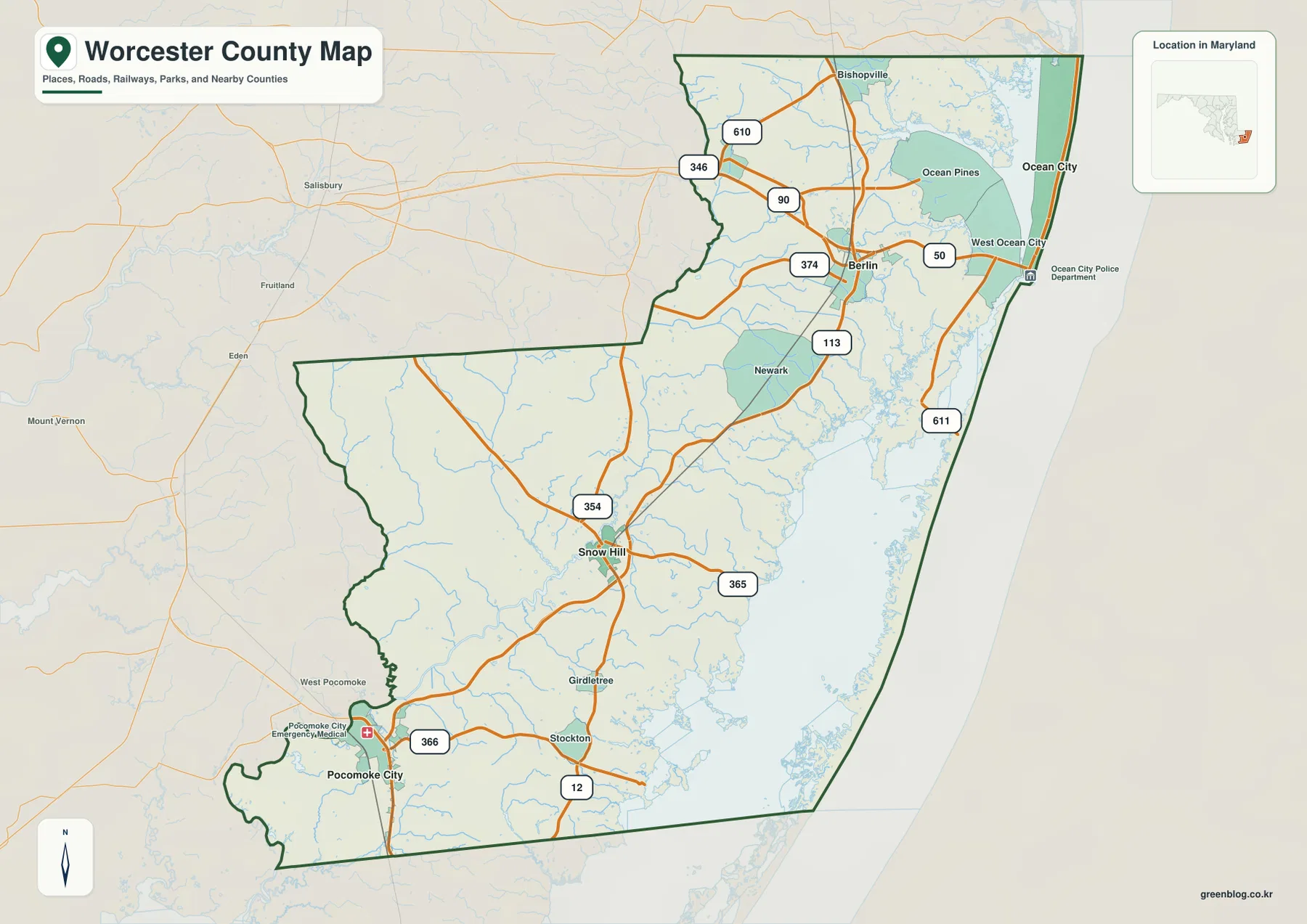
South of Berlin, US 113 continues toward Snow Hill and then farther down the county. Snow Hill sits near several connecting roads, including MD 12 and MD 365, while routes such as MD 354 reach westward from the central part of the county. Farther south, Stockton and Pocomoke City appear in a more rural road pattern. The map therefore does not show one single corridor serving every destination. Instead, US 113 works as the main inland spine, with state highways branching toward the coast, smaller communities, and the southwestern river country.
The northern section adds another set of connections around Bishopville and Ocean Pines. MD 610 and MD 346 appear west of the coastal communities, and MD 90 crosses the northern part of the county toward Ocean City. Along the eastern side, MD 611 runs south from the West Ocean City area near the coastal bays. These route relationships are especially useful when the county is printed on one page because the long shape of Worcester can otherwise make Ocean City, Snow Hill, and Pocomoke City seem less connected than they are.
Ocean City, Berlin, Snow Hill, and Pocomoke City form a long settlement pattern
The city map strips away much of the secondary road detail and highlights four major reference points. Ocean City lies at the northeast edge beside the Atlantic. Berlin is just inland, Snow Hill is farther south in the interior, and Pocomoke City sits near the southwestern end of the county. Rather than clustering around a single central city, these places are distributed along the length of Worcester County. That pattern is one reason the general road map and the simplified city map work well as a pair.
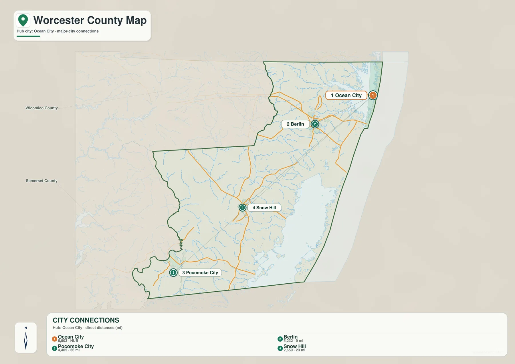
Ocean City and Berlin are relatively close on the map, but their geographic settings are very different. Ocean City occupies a narrow coastal setting between the Atlantic side and inland bays, while Berlin is embedded in the inland highway network where US 50 and US 113 provide strong orientation. Snow Hill is farther south and serves as the county seat, while Pocomoke City is tied more closely to the Pocomoke River area. Looking at these settings prevents the four names from becoming just points on a list and shows why travel direction changes noticeably from one part of the county to another.
For a quick location check, the city map is often easier to read than the full road map. A reader can establish the north-to-south order first, then return to the general map to identify US 50, US 113, MD 12, MD 90, or MD 611. This two-step approach is useful for classroom work, trip planning, or regional comparison because it separates the question of “where is the place?” from the more detailed question of “which road connects it?” without losing the county context.
Sinepuxent Bay, Chincoteague Bay, and the Pocomoke River
Water defines the eastern and southwestern sides of Worcester County in very different ways. The Atlantic Ocean runs along the outer coast, while Sinepuxent Bay, Chincoteague Bay, and Newport Bay occupy the sheltered side of the coastal barrier. The Saint Martin River is labeled in the northeast, and numerous smaller channels extend inland around the Berlin and Ocean City areas. The result is a coast that cannot be understood from the county outline alone because narrow land areas and broad water bodies sit next to one another.
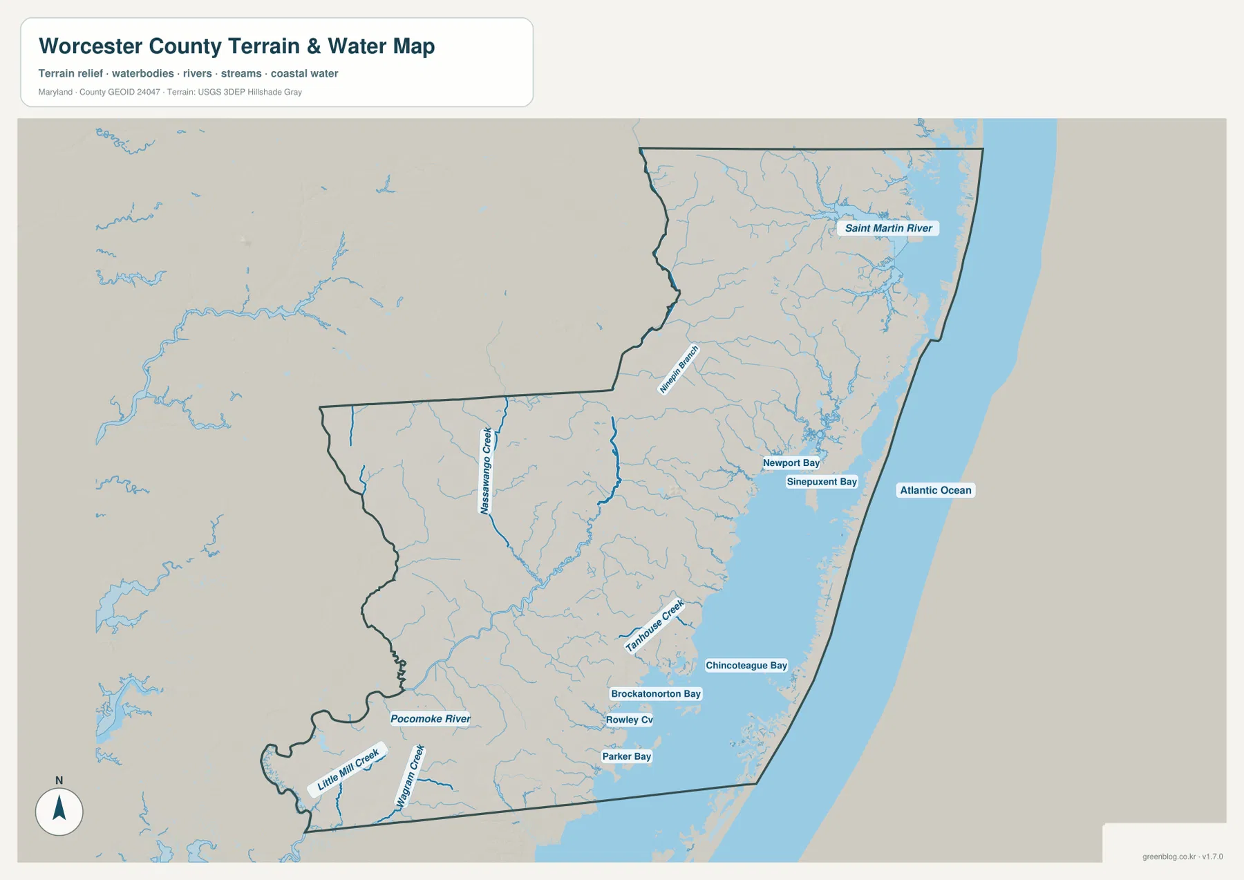
The southwestern side is organized more strongly around the Pocomoke River and its tributaries. Little Mill Creek and Dividing Creek are labeled near the lower part of the county, while smaller waterways branch through low-lying areas toward the coastal bays. Parker Bay and Rowley Cove also appear on the map farther east. The contrast is useful: northern and eastern Worcester has a strong ocean-and-bay character, while the southwestern portion has a river-and-creek character that becomes especially visible around Pocomoke City and the county boundary.
This water layer is intended for geographic orientation rather than hazard or regulatory decisions. A blue line may represent a creek, while a blue area may represent a bay or broader water body, and the map does not provide depth, tidal stage, flood probability, wetland jurisdiction, or navigation information. Its value is in showing how close Ocean City is to both the ocean and inland bays, how Snow Hill and Pocomoke City relate to the Pocomoke system, and how many small waterways cross the land between those larger features.
A very low coast with gentle inland relief
The elevation map confirms that Worcester County is a low-relief Coastal Plain landscape rather than a mountainous part of Maryland. Its legend notes an actual elevation range of roughly -3 to 35 meters and a mean near 5 meters. The broad eastern coastal area is dominated by the lowest colors, while somewhat warmer colors appear across parts of the inland west and northwest. Because the map uses a local scale to make small differences visible, the contrast between green and brown looks stronger than the real-world relief feels on the ground.
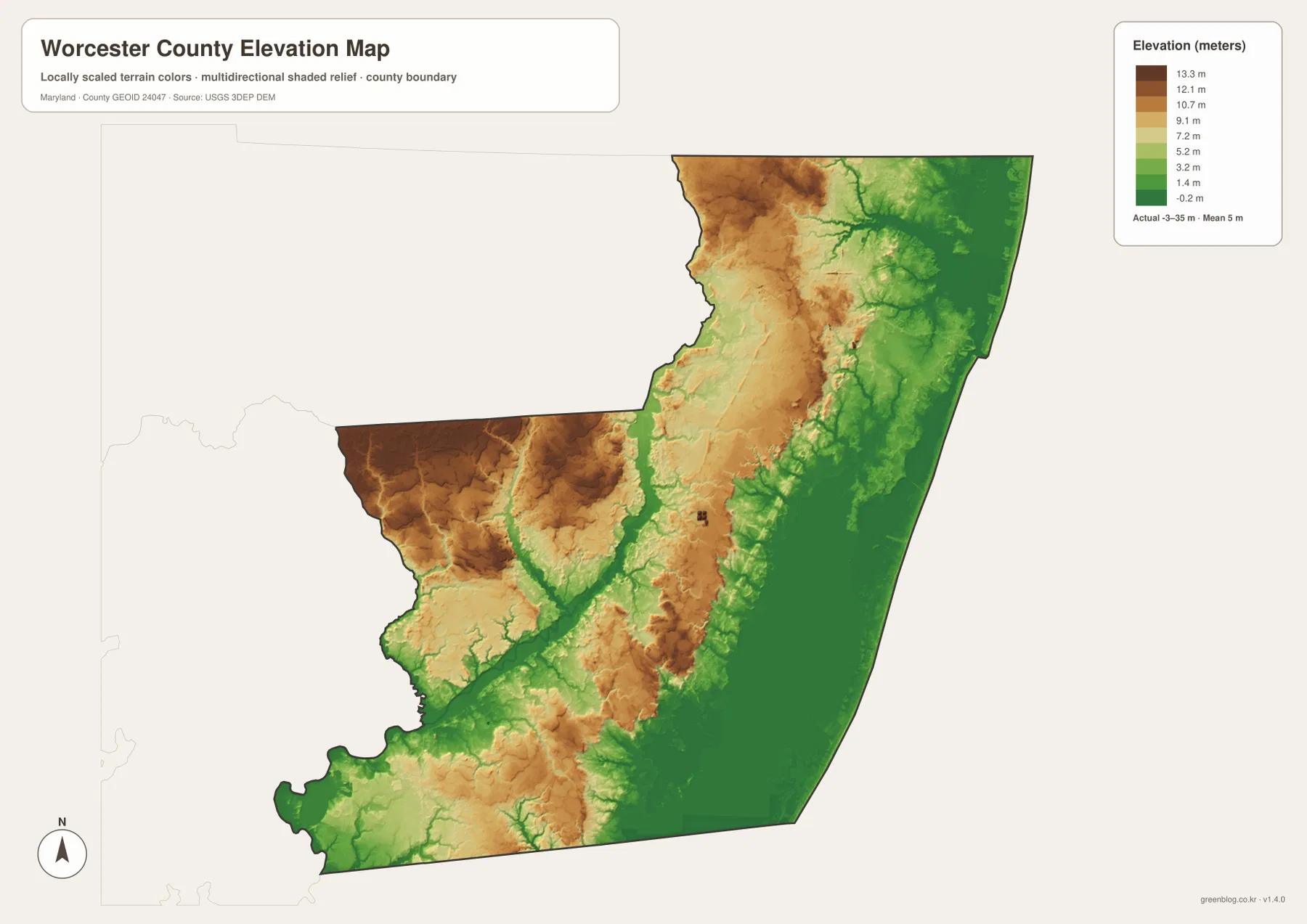
Several drainage lines appear as lower bands cutting through slightly higher surfaces. The coastal bays and Atlantic side remain broadly low, and the Pocomoke River corridor also occupies low terrain. Farther inland, especially in the western and northwestern sections, patches of relatively higher land become more visible. These are not hills or ridges in the western Maryland sense. They are modest differences within a generally flat county, which is why the elevation layer is most useful when it is compared directly with the water map.
When the two layers are viewed together, the relationship between water and low ground becomes clearer. Stream channels and broad wet areas often follow the lowest tones, while slightly higher surfaces occupy the spaces between them. That broad relationship is useful for understanding the physical setting of roads and communities, but the map should not be used for construction design, parcel drainage, or survey work. Anyone needing precise elevation should consult the source elevation data and site-specific measurements rather than estimating from the colors in a generalized county graphic.
Maryland’s easternmost county and its neighboring context
Worcester County is Maryland’s easternmost county and the only county in the state that directly borders the Atlantic Ocean. Worcester County Government also notes that it touches both Delaware and Virginia, giving the county a distinctive position at the southeastern edge of Maryland. On the general map, Wicomico County lies to the northwest and Somerset County lies to the west and southwest. The eastern boundary, by contrast, is defined by the ocean coast and the complex chain of bays and barrier-island waters.
This location helps explain why the county has several different geographic identities within one boundary. Ocean City and nearby coastal communities face the beach and bay environment; Berlin sits at an inland highway junction; Snow Hill functions as the county seat in the south-central interior; and Pocomoke City is closely connected to the river lowlands of the southwest. Treating all four places as one identical settlement corridor would miss those differences. The maps are more useful when each community is read in relation to the roads and water features around it.
Choosing the right Worcester County map for the question
For basic orientation, start with the general county map. Find Ocean City and Berlin first, identify US 50 and US 113, and then trace the county south toward Snow Hill and Pocomoke City. That sequence makes the county’s long shape easier to understand. Use the city map when place names are more important than road numbers, especially when you only need to compare where the four principal communities sit relative to one another.
For coastal or environmental context, the water and elevation maps provide a better match. The water layer separates the Atlantic, the back bays, the Saint Martin River, the Pocomoke River, and smaller tributaries. The elevation layer then shows that these waterways occupy a landscape with only modest height differences, including very low coastal and river areas and slightly higher inland surfaces. Together, the maps explain more about Worcester County’s physical geography than either layer can show by itself.
In a printed report or classroom handout, one map per question is usually clearer than placing every type of information on the same image. Use the general map for roads and communities, the city map for settlement pattern, the water map for the coastal and river systems, and the elevation map for relative height. Because all four maps use the same county outline, a reader can locate Ocean City, Snow Hill, or another reference point on one image and then compare the same area on the others.
For actual driving, current navigation and transportation information should be used in addition to these reference maps. Major highways such as US 50, US 113, MD 90, and MD 611 are useful geographic anchors here, but closures, construction, turn restrictions, and travel times can change. The same principle applies to water and elevation information. These graphics are designed to explain Worcester County at a county-wide scale, while detailed regulatory, engineering, and site-specific questions should be checked against the official sources listed below.
Frequently Asked Questions
Which map is best for finding the road connection between Ocean City and Berlin?
Use the general county map. It shows Ocean City and Berlin together with US 50, MD 90, US 113, and surrounding roads. If you only need the relative positions of the communities, begin with the city map and then return to the general map to identify the actual highway connection.
Can Sinepuxent Bay and the Pocomoke River be viewed on the same map?
Yes. The water map shows Sinepuxent Bay and Chincoteague Bay along the eastern side, the Atlantic Ocean beyond them, and the Pocomoke River and tributaries in the southwest. It is intended for location and regional context, not for flood risk, water depth, navigation, or wetland regulation.
Do the brown areas on the elevation map represent mountains?
No. The colors are locally scaled so small elevation differences are easier to see. The legend gives an actual range of roughly -3 to 35 meters, so the brown areas are only higher relative to the very low coastal and river terrain. Precise site elevations should be checked in the source data or with appropriate survey measurements.
Map File Information
The ZIP contains the original high-resolution JPG versions of the general county, city, water, and elevation maps discussed on this page.
- Included Files: county map, city map, water map, elevation map
- File Type: JPG
Related Maps
Sources and references
These official resources are useful for checking Worcester County information, boundaries, road references, hydrography, and elevation data.
- Worcester County Government – Welcome to Worcester County Maryland
- U.S. Census Bureau TIGER/Line Shapefiles
- Maryland State Highway Administration – Highway Location Reference
- USGS National Hydrography
- USGS 3D Elevation Program
Green Map creates custom-edited map images using open geographic data sources such as geoBoundaries, Natural Earth, OpenStreetMap, and government open data. These maps are edited visual materials, not raw data files, and are provided for education, documents, presentations, and graphic reference.