Wrangell City and Borough is a useful example of why an Alaska county-equivalent cannot always be understood from its town center alone. Wrangell is the clearly defined settlement on the maps, with roads concentrated around the island community, yet the borough boundary reaches far beyond that developed area across islands, coastal water, and mountainous mainland valleys. This page uses the borough map, the ranked-city view, and the terrain-and-water map to explain that contrast. The same high-resolution JPG map files shown in the article can be downloaded together from the map file box below.
The local government describes Wrangell as an island community in Southeast Alaska and operates as a unified home-rule municipality. That combination helps explain the map: the name “City and Borough” refers to one municipal government, but the mapped borough is much larger than the compact roaded area around Wrangell itself. On the eastern side, the boundary crosses rugged mainland country cut by rivers; toward the west and south, islands and broad channels break the coastline into separate pieces. Reading the settlement map first and the water map second makes the full shape much easier to understand.
Table of Contents
A compact Wrangell road network inside a much larger borough
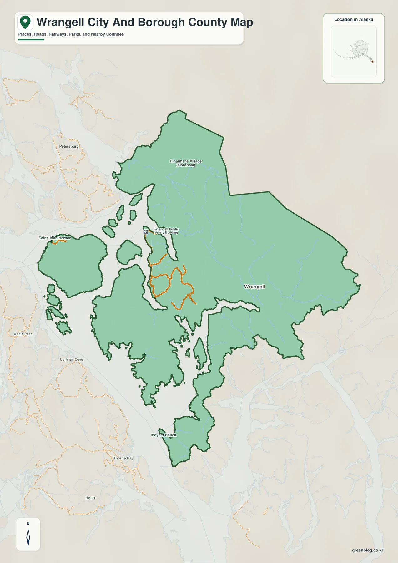
The general map makes the difference in scale immediately visible. Wrangell and its road network occupy a relatively small part of the mapped borough, while the green boundary expands north, east, and south across terrain with few or no comparable road markings. The urban-looking portion is therefore not a miniature version of the whole borough. It is the main settlement area within an administrative region that includes extensive coast, islands, and mountainous mainland.
Alaska Department of Transportation records identify Zimovia Highway as a Wrangell route, and the map shows the same broad pattern of roads clustering around the Wrangell settlement area. Those roads should not be interpreted as a borough-wide highway system. Large parts of the eastern mainland and outlying island sections lie beyond that concentrated network. For orientation, the map is best used to compare the roaded community with the full borough outline rather than to estimate driving routes between distant parts of the municipality.
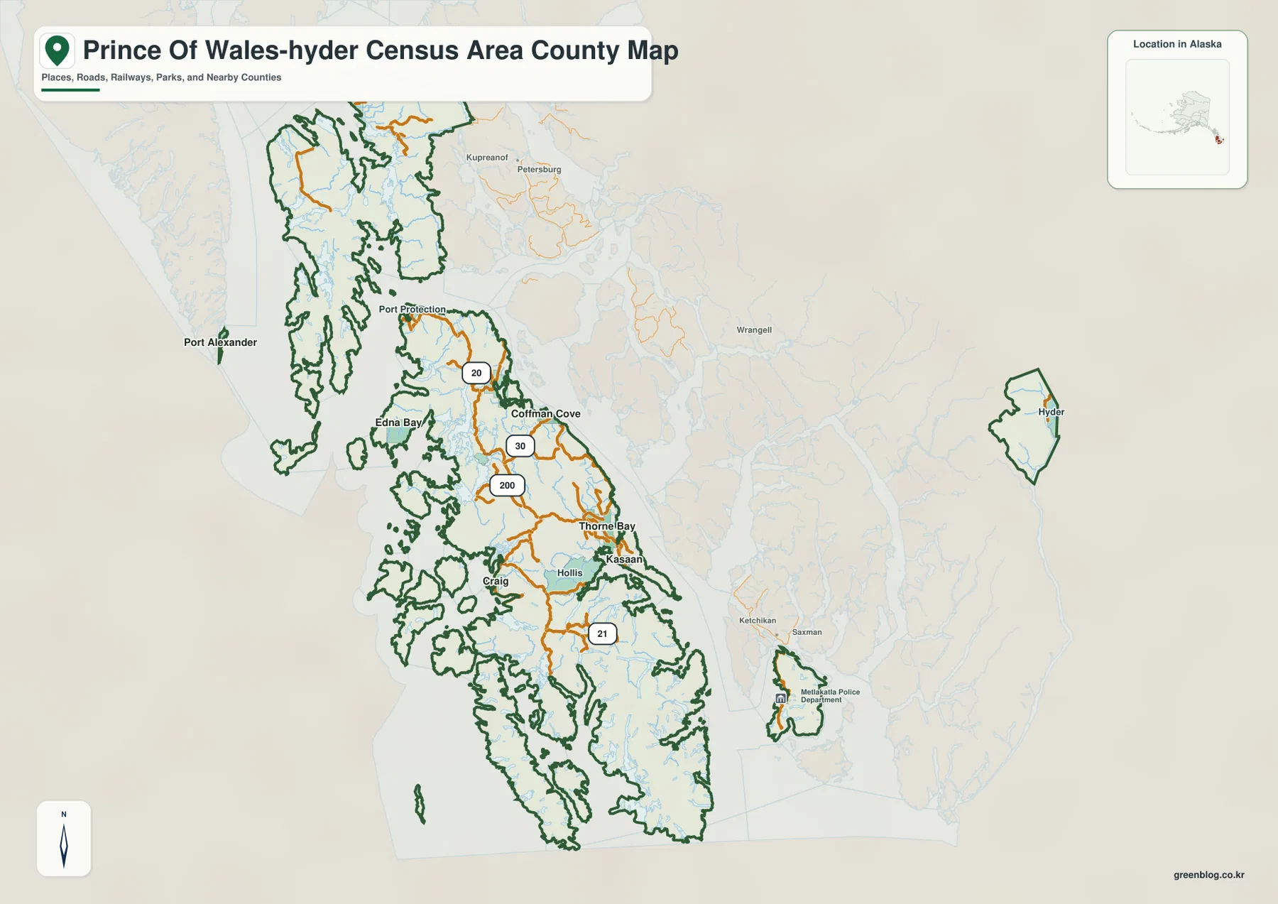
The surrounding labels also place Wrangell within the broader Southeast Alaska geography. Petersburg Borough appears to the north, Prince of Wales-Hyder Census Area to the west, and Ketchikan Gateway Borough to the east on the city-oriented view. Those neighboring names are useful when a reader knows the regional communities but not the borough boundaries. The line itself is still a general geographic reference, not a parcel or survey boundary. For legal or current administrative work, the map should be checked against U.S. Census Bureau TIGER/Line geography or the City and Borough of Wrangell’s own boundary and parcel resources.
Wrangell’s official borough material notes that the unified borough was created in 2008. That history matters because the modern boundary encompasses more than the built-up town on Wrangell Island. The map therefore works especially well in reports that need to distinguish the community of Wrangell from the larger City and Borough of Wrangell. Without that distinction, it is easy to assume the entire green polygon is part of one continuous developed island settlement, which the road pattern clearly does not support.
Why the ranked-city map contains only Wrangell
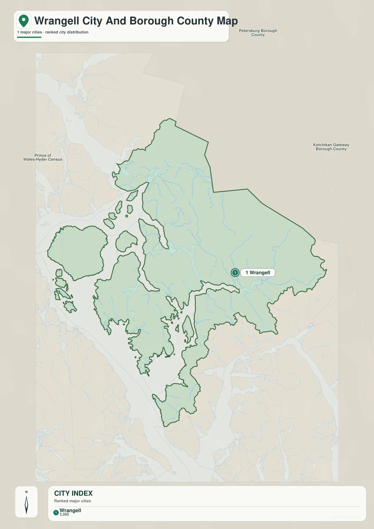
The city index at the bottom of the map has a single entry: Wrangell. Because there is only one ranked city in this supplied layer, there are no connector lines to compare city-to-city distances. That is useful information rather than an empty map feature. It shows that the purpose of this version is to anchor the borough around its primary named city and then let the viewer compare that point with the administrative boundary, rivers, islands, and neighboring boroughs.
For a presentation or classroom handout, this map is the clearest choice when the question is simply “Where is Wrangell within the borough?” The numbered marker prevents the settlement label from getting lost against the long coastline and the large mainland section. It also emphasizes how far the borough extends beyond the roaded community. A reader can see that the city marker sits within one small portion of a much broader shape rather than near the geometric center of a compact county.
The map should not be treated as a street map. Wrangell’s local government pages place City Hall and other municipal facilities in the downtown and waterfront area, while Alaska DOT records show named routes such as Zimovia Highway on Wrangell Island. Those details confirm the roaded community, but the ranked-city map does not provide turn-by-turn access, current road condition information, or transportation schedules. For those tasks, current local and state transportation resources are more appropriate.
Frederick Sound, Sumner Strait, and the river-cut mainland
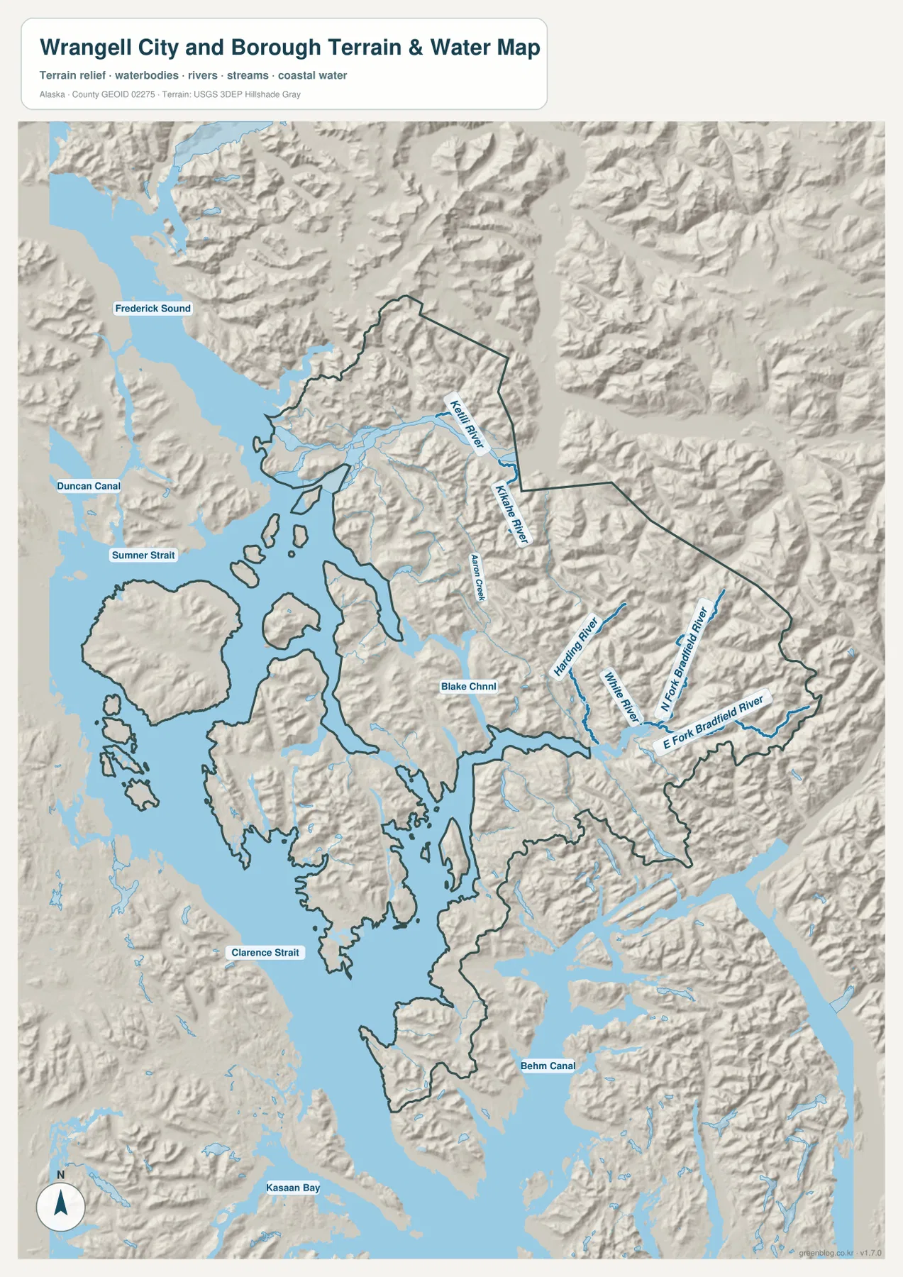
The terrain-and-water map shifts attention away from the town and toward the geography that occupies most of the borough. Frederick Sound is labeled along the northwestern side, with Sumner Strait below it. Clarence Strait appears farther southwest, while Behm Canal is shown to the southeast. Together, those water bodies explain why the western half of the borough has such an irregular outline: islands, passages, and coastal inlets repeatedly interrupt the land.
The eastern mainland is just as distinctive, but for a different reason. Harding River and Whiting River are labeled in the central-eastern section, and the North Fork and East Fork of the Bradfield River run through steep relief farther east. Aaron Creek is also marked in the northern interior. The shaded terrain makes the relationship between these waterways and the surrounding mountains easy to see. Many streams follow narrow valleys toward the coast rather than crossing broad, flat lowlands.
Wrangell’s official visitor information describes the community in relation to the Stikine River, an important regional feature. The supplied water map, however, is more useful for the names it actually labels within this borough view: Frederick Sound, Sumner Strait, Clarence Strait, Behm Canal, Harding River, Whiting River, and the Bradfield River forks. Keeping that distinction matters. The article should not imply that every famous regional waterway is drawn or labeled on this specific map.
This terrain-and-water image is a geographic reference, not a nautical chart, flood-hazard map, or engineering elevation product. It does not show water depth, tides, shoals, navigation aids, evacuation zones, or flood probability. The relief is included to make mountains and valleys easier to recognize, not to provide survey-grade elevations. Marine travel, flood planning, and technical water work require current purpose-specific sources such as official hydrography, navigation, or local emergency information.
Which Wrangell map works best for the question you have?
Start with the general borough map when you need the full administrative shape, the road concentration around Wrangell, and regional context in one image. It is the strongest choice for explaining why the community and the borough are not the same geographic footprint. The green outline also helps place Wrangell relative to nearby Southeast Alaska boroughs and census areas without requiring a separate statewide map.
Use the ranked-city view when the main task is locating Wrangell quickly. Its single numbered marker makes the settlement stand out and avoids implying a network of several similarly sized cities. When rivers, straits, and mountain valleys matter more than the settlement name, the terrain-and-water map provides the most detail. It is especially useful for following Frederick Sound and Sumner Strait on the western side while comparing them with Harding, Whiting, and Bradfield river valleys on the mainland.
For printing or close inspection, use the original JPG files in the downloadable archive rather than relying on the smaller WebP previews embedded in the page. The archive contains the same three map subjects shown here—borough boundary and settlement context, ranked city location, and terrain with water features—and each original image measures 2572 by 3638 pixels. That makes labels easier to enlarge for study notes, classroom material, reports, or regional-reference graphics.
Frequently Asked Questions
Why does the city index show only Wrangell?
The supplied ranked-city map has one indexed city, Wrangell, so it does not draw connector lines to additional ranked cities. The map is designed to make the main settlement easy to locate inside a borough that extends far beyond the roaded community. Use the general borough map when you also need the islands, mainland boundary, and surrounding regional context.
Do the roads around Wrangell continue across the entire borough?
No continuous borough-wide road network is shown. Roads are concentrated around the Wrangell settlement area, while large mainland and outlying sections of the borough have no comparable road pattern on the supplied map. Alaska DOT identifies Zimovia Highway as a Wrangell route, but current road access and conditions should be checked with current transportation information.
Can the water map be used for marine navigation or flood decisions?
No. The map is intended to show the relative positions of straits, channels, rivers, coastline, and terrain. It does not contain the depth, tide, shoal, navigation-aid, flood-probability, or evacuation information required for safety decisions. Use current official nautical, hydrographic, and local emergency products for those purposes.
Map File Information
The archive contains the Wrangell City and Borough boundary map, ranked-city map, and terrain-and-water map as original high-resolution JPG files.
- Included Files: 3 high-resolution JPG maps
- Printable Size: 2572×3638 pixels each
- Intended Use: Printing, classroom materials, presentations, and regional reference
Related Maps
Sources and references
- City and Borough of Wrangell – Borough Boundary Map: local-government reference for the borough boundary
- City and Borough of Wrangell – Welcome: official overview of the island community and its Southeast Alaska setting
- City and Borough of Wrangell – Borough Entitlement Lands: official background on borough formation in 2008
- Alaska DOT&PF – Wrangell Survey Plats: official road and transportation references for Wrangell, including Zimovia Highway projects
- U.S. Census Bureau TIGER/Line Shapefiles: authoritative geographic boundary reference
- USGS National Hydrography: official reference for rivers, streams, and other hydrographic features
Green Map creates custom-edited map images using open geographic data sources such as geoBoundaries, Natural Earth, OpenStreetMap, and government open data.
These maps are edited visual materials, not raw data files, and are provided for education, documents, presentations, and graphic reference.