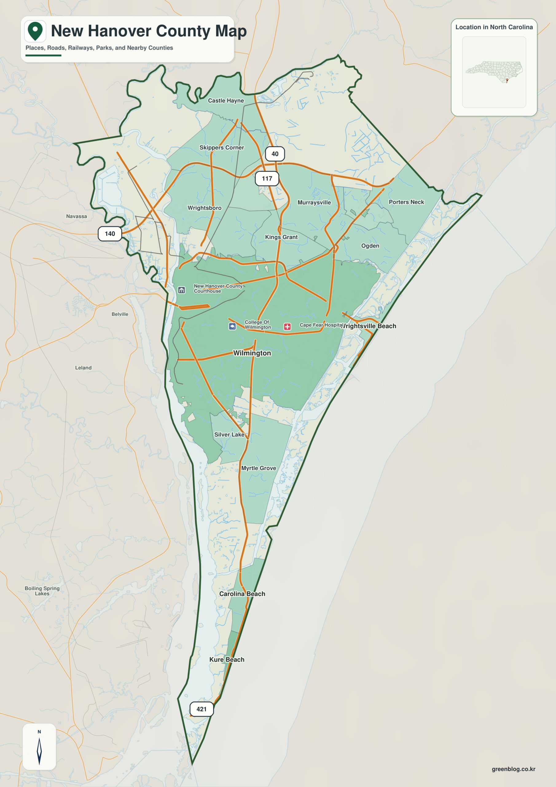
New Hanover County North Carolina map is best read as a narrow maritime county with Wilmington on the Cape Fear River to the west and Atlantic beach communities on the east. Wilmington alone does not explain the county; Wrightsville Beach and Cape Fear River provide equally important orientation.
The county becomes easier to read in two layers: settlement anchors (Wilmington, Wrightsville Beach, Carolina Beach) and physical anchors (Cape Fear River, Atlantic Ocean). That division adds context without turning every place into the same kind of center.
New Hanover County quick facts
- County seat: Wilmington
- North Carolina setting: lower Cape Fear coast
- Place references: Wilmington, Wrightsville Beach, Carolina Beach
- Physical references: Cape Fear River, Atlantic Ocean, Intracoastal / barrier-island coast
- Neighboring counties: Brunswick, Pender
One county between river and ocean
Wilmington sits on the Cape Fear River side, Wrightsville Beach faces the Atlantic, and Carolina Beach occupies the southeastern barrier-island corridor. Water body is a more useful first question than distance between the three places.
Wilmington west, beach communities east
The Cape Fear River on the west and Atlantic Ocean on the east compress New Hanover into a narrow maritime strip. Near Fort Fisher, land narrows further between river mouth and ocean, making water orientation unavoidable.
Different functions in a compressed maritime space
New Hanover was formed from Craven in 1729, and Wilmington became the major Lower Cape Fear commercial center. Port, urban, and beach landscapes remain tightly compressed within a small county.
A practical reading sequence starts at Wilmington, expands to Wrightsville Beach and Carolina Beach, and then checks Cape Fear River and Atlantic Ocean. That order keeps local function, county administration, and physical geography from collapsing into one description.
Reading a coast through water boundaries
New Hanover County is useful for separating Wilmington’s port/urban role from the oceanfront tourism roles of Wrightsville and Carolina Beach. Coastal, flood, and transportation layers become easier to interpret after that distinction.
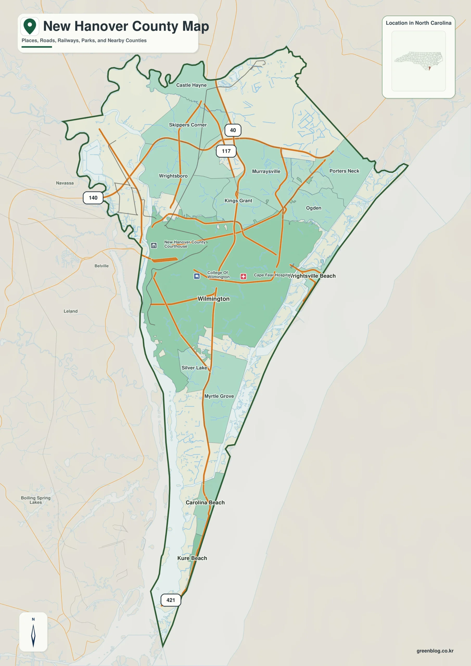
New Hanover County single map file
The image above is a web preview; the button is reserved for the separate original map asset.
Download the New Hanover County map fileFrequently Asked Questions
What does Cape Fear River add when the map is read at county scale?
Starting with Cape Fear River gives Wilmington and the outer communities a common geographic frame. Adding Atlantic Ocean then clarifies how the county’s natural setting differs across its mapped area.
Why is the Wrightsville Beach area worth distinguishing from Wilmington?
The two names represent different map roles rather than competing centers. Wilmington establishes administration, while Wrightsville Beach adds another functional or geographic zone.
Sources
Related County Maps
Green Map creates custom-edited map images using open geographic data sources such as geoBoundaries, Natural Earth, OpenStreetMap, and government open data.
These maps are edited visual materials, not raw data files, and are provided for education, documents, presentations, and graphic reference.