A buffalo-trade post became a county seat, a short-line railroad created two shipping towns, and an oil boom later reshaped the economy. A Scurry County Texas map places Snyder at the center while using Fluvanna, Hermleigh, Ira, Dunn, and several creeks to explain the wider county.
The Census Bureau estimated 16,162 residents on July 1, 2025, 4.4 percent below the 2020 estimate base. Snyder contains most county services and employment, but rural settlements and energy districts remain important map references.
Table of Contents
Snyder Grew from Deep Creek
William Henry “Pete” Snyder established a trading post on Deep Creek in 1878, serving buffalo hunters, ranchers, and travelers. The settlement became county seat when Scurry County organized in 1884 and later developed as a market for livestock and cotton.
Deep Creek begins north of Fluvanna, passes through Snyder, and continues to the Colorado River in Mitchell County. The creek’s water, crossing points, and banks shaped early travel, recreation, and the town’s physical setting.
Railroad Geography Created Fluvanna and Hermleigh
The Roscoe, Snyder and Pacific Railway connected Snyder with regional rail networks and extended northwest to Fluvanna in 1908. Promoters laid out Fluvanna before the line arrived, and the terminus briefly supported hotels, a cotton gin, lumberyards, and shipping businesses.
Hermleigh developed southeast of Snyder as another rail and cotton community. Highway bypasses and station closures later reduced the commercial roles of Snyder and oil fields, but their positions still reveal the county’s historic transportation pattern.
Oil Reversed Rural Decline
Petroleum discoveries after World War II brought workers, service companies, processing activity, and rapid population growth. Snyder became the main supply and administrative center for fields spread across northern, western, and central parts of the county.
Oil and gas remain important, although production fluctuates. The addition of wind-energy development has introduced turbines and transmission lines to the open plains, forming a secondary energy layer that intersects with agricultural and grazing lands.
One County, Two Major Drainage Basins
Deep Creek and Bluff Creek flow south toward the Colorado River system. Rocky Creek in the northwest instead runs north to the Double Mountain Fork of the Brazos River, while Rough Creek and Camp Creek drain the eastern side.
This split is subtle on the ground because much of the terrain is flat or gently rolling. Stream directions, low escarpments, and local hills such as Green Mountain are therefore more useful than dramatic mountain ranges for reading the landscape.
Lake J. B. Thomas Serves Several Cities
Lake J. B. Thomas lies across the Borden–Scurry county line southwest of Snyder. It was developed as a regional water source for Snyder, Big Spring, and Odessa and also supports fishing and boating.
Water levels and shoreline access vary with drought and management conditions. A general county map can show the lake’s position but should not replace current reservoir, boating, or water-supply information.
County Reference Table
| County seat | Snyder |
|---|---|
| Northwestern railroad community | Fluvanna |
| Southeastern railroad community | Hermleigh |
| 2025 population estimate | 16,162 |
| Colorado basin stream | Deep Creek |
| Brazos basin stream | Rocky Creek |
| Regional reservoir | Lake J. B. Thomas |
| Major industries | Oil, gas, agriculture, ranching, and wind energy |
Color Map
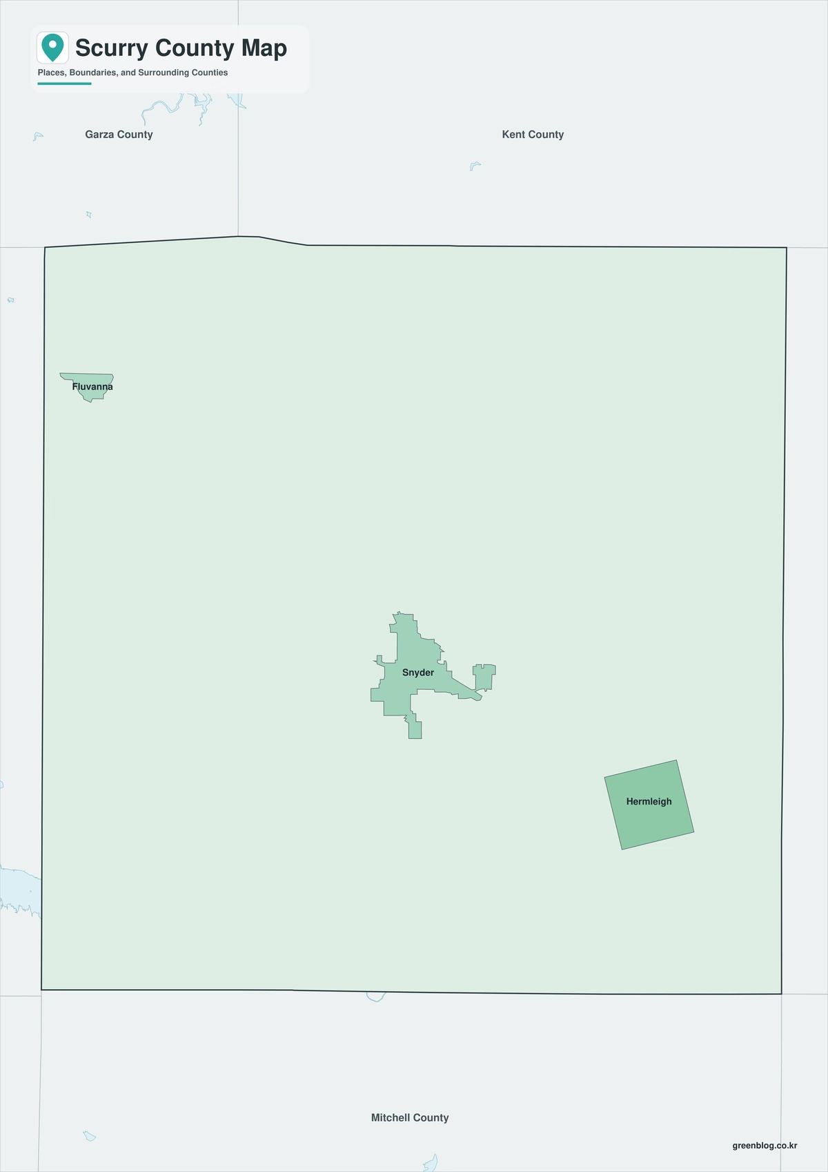
The color edition distinguishes Scurry County from Howard, Borden, Garza, Kent, Fisher, and Mitchell counties. Hermleigh marks the southeast, Fluvanna the northwest, and Snyder the central service area. Deep Creek and Lake J. B. Thomas show the southward Colorado basin, while Rocky Creek provides a contrasting northern Brazos reference.
Black-and-White Map
County fills are removed while selected communities, stream names, the reservoir, and boundary lines remain. The spacing between Snyder, Ira, Dunn, and Camp Springs stays visible without color. This sheet works well for monochrome energy and land-use reports.
Outline Map
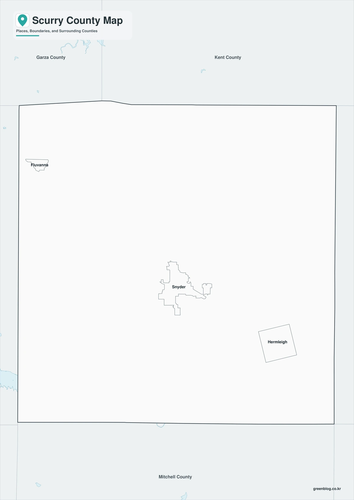
The outline sheet removes colors and labels while retaining Scurry County and adjacent-county boundaries. Users can add Deep Creek, Green Mountain, Lake J. B. Thomas, historic rail lines, oil fields, wind projects, or crop areas from current sources.

Download the Printable County Maps
The Scurry County Texas map set contains color, black-and-white, and outline A3 JPG files. Labeled sheets support orientation, while the blank base is intended for custom watershed, transportation, energy, agricultural, and historical graphics.
County Map File Information
The download contains color, black-and-white, and outline Scurry County maps. Selected communities and geographic references appear on the first two sheets, while the outline version keeps county context without fills or labels.
- Included Versions: Color, Black and White, Outline
- File Type: JPG
- Printable Size: A3 high-resolution layout
- Map Coverage: County boundary, adjacent counties, selected communities, streams, and reservoir context
- Intended Use: Printing, reports, teaching, presentations, and custom annotations
Frequently Asked Questions
Why is Snyder associated with buffalo history?
The town began around Pete Snyder’s Deep Creek trading post, which served buffalo hunters and ranchers during the late nineteenth century.
What caused Fluvanna to decline as a shipping center?
Highways bypassed the community and the railroad closed its station in 1941, reducing freight and commercial activity.
Does the outline map show active oil leases?
No. Lease, well, pipeline, turbine, and transmission information must be added from current regulatory and utility data.
Sources and Further Reading
Population figures come from the U.S. Census Bureau QuickFacts profile. The Handbook of Texas county entry supports the historical, community, oil, cultural, and economic discussion. Separate entries for Snyder, Fluvanna, Deep Creek, and Lake J. B. Thomas provide local detail.
Use current county, transportation, water, appraisal, railroad, energy-regulatory, utility, and environmental records for legal boundaries, parcels, roads, flood decisions, wells, pipelines, and wind facilities to understand the legal framework and infrastructure of Scurry County. Snyder, oil fields, railroad settlements, and two river basins are key features.
Related Maps
- Ward County Texas map|Monahans, Barstow, and Monahans Sandhills
- Tyler County Texas map|Woodville, the Neches River, and Big Thicket
- Wharton County Texas map|Wharton, El Campo, and the Colorado River
- Uvalde County Texas map|Uvalde, Sabinal, the Nueces River, and Frio River
- Washington County Texas map|Brenham, Burton, and Lake Somerville
Green Map creates custom-edited map images using open geographic data sources such as geoBoundaries, Natural Earth, OpenStreetMap, and government open data.
These maps are edited visual materials, not raw data files, and are provided for education, documents, presentations, and graphic reference.