A Montevideo map provides more than the outline of Uruguay’s capital. Montevideo is both the national capital and one of the country’s 19 departments, with a compact administrative area that includes a dense urban center, coastal neighborhoods, industrial zones, and less-developed land near the outer boundaries. Canelones surrounds the department to the north and east, San José meets it in the west, and the southern edge follows the Río de la Plata.
Although Montevideo covers only about 530 square kilometers, it had a population of 1,302,950 in the 2023 census. This concentration makes the internal layout very different from the broad rural departments found elsewhere in Uruguay. Municipal boundaries sit close together around the center and coast, while several western, northern, and eastern divisions extend across larger outer districts. A labeled map makes these differences easier to understand than a city name or capital marker on a national map.
The collection includes color, black and white, and outline versions supplied as A3 JPG files. Each design serves a separate purpose: visual comparison, clean printing, or custom editing. Teachers can use the files for geography lessons and worksheets, while bloggers, designers, and presentation creators can add them to regional comparisons, travel slides, reports, and infographics. The blank version also provides room for population data, transport directions, landmarks, or neighborhood labels.
A second reason to use a Montevideo map is the city’s long coastal structure. The port and Ciudad Vieja sit toward the west, central waterfront districts extend through Parque Rodó and Punta Carretas, and eastern neighborhoods continue through Pocitos, Buceo, Malvín, Punta Gorda, and Carrasco. Seeing these places beside the municipal boundaries helps explain how the capital developed along the water while also extending inland.
Table of Contents
Understanding Montevideo’s Eight Municipalities
Montevideo is divided into eight municipalities named A, B, C, CH, D, E, F, and G. Unlike administrative systems that use town or landscape names, the capital uses letters as the official municipal names. CH is one municipality rather than a combination of separate C and H divisions.
- Municipality A covers western and southwestern areas.
- Municipality B includes Ciudad Vieja and much of the central city.
- Municipality C occupies central-western residential and industrial districts.
- Municipality CH includes compact southern residential and coastal areas.
- Municipality D extends through parts of the north and northeast.
- Municipality E contains eastern residential and waterfront districts.
- Municipality F covers eastern inland and outer areas.
- Municipality G occupies northwestern and western outer districts.
The municipalities contain multiple neighborhoods and local service areas, so they should not be confused with individual barrios. The Montevideo map helps connect the short letter-based names with their actual positions. B, C, and CH appear close together near the central urban area, while A, D, F, and G extend farther toward the departmental limits.
A Capital Shaped by Its Waterfront
Montevideo’s southern edge follows the Río de la Plata from the port toward Carrasco. A coastal avenue and promenade known as the Rambla links many of the waterfront districts and acts as one of the city’s most recognizable geographic features. The route passes historic, residential, recreational, and beach areas rather than belonging to a single municipality.
This east–west coastal line gives the city a clear visual direction. The port and old city anchor the western end, Pocitos and Buceo occupy central-eastern locations, and Carrasco lies near the Canelones boundary. Inland sections have a different pattern, with broader outer municipalities and fewer tightly packed waterfront neighborhoods.
For travel presentations, the coastal arrangement helps organize places into western, central, and eastern groups. For administrative or demographic projects, it highlights the contrast between compact areas near the center and larger districts farther from the coast.
Color Map for Dense Municipal Boundaries
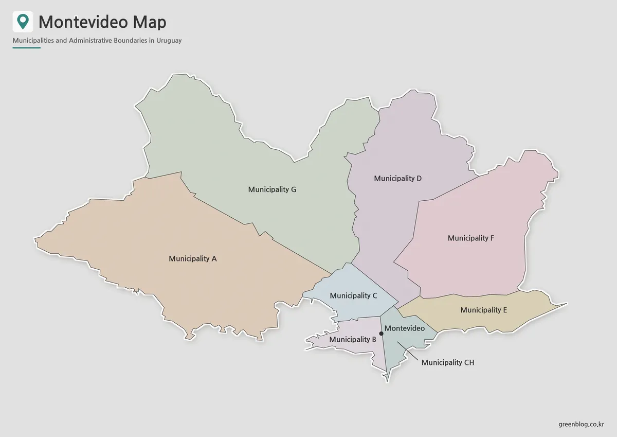
The color Montevideo map is particularly helpful around municipalities B, C, and CH, where several short boundaries meet within a limited area. Separate colors prevent the central divisions from blending together and make it easier to follow the transition toward E in the east and A in the west.
Larger outer municipalities also become easier to compare. A and G occupy much of the western side, D spreads across the north, and F extends into the eastern interior. This version works well on presentation slides because viewers can identify the eight divisions without reading every label first.
It is also suitable for comparing Montevideo with other Uruguayan departments. The colored divisions emphasize how much administrative detail is contained inside a relatively small part of the country.
Clean Black and White Version for Printing
A black and white Montevideo map places more attention on labels and boundary lines. The reduced visual detail works well in reports, classroom handouts, and printed reference sheets where colored backgrounds may be unnecessary or expensive to reproduce.
Short labels such as A, B, C, and CH remain easy to match with their shapes, while the coastline provides a clear reference for direction. The cleaner style is especially useful when the image appears beside written explanations of the municipalities or when students need to locate each division from a list.
The A3 layout gives the closely grouped central boundaries more space than they would receive on a full map of Uruguay. It can therefore be used as a standalone capital reference rather than a small inset that only marks the city’s location.
Blank Outline Map for Data and Annotations
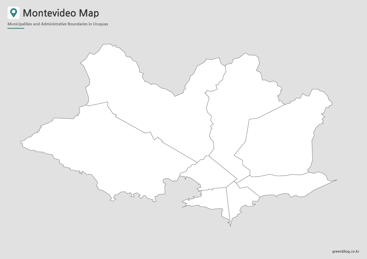
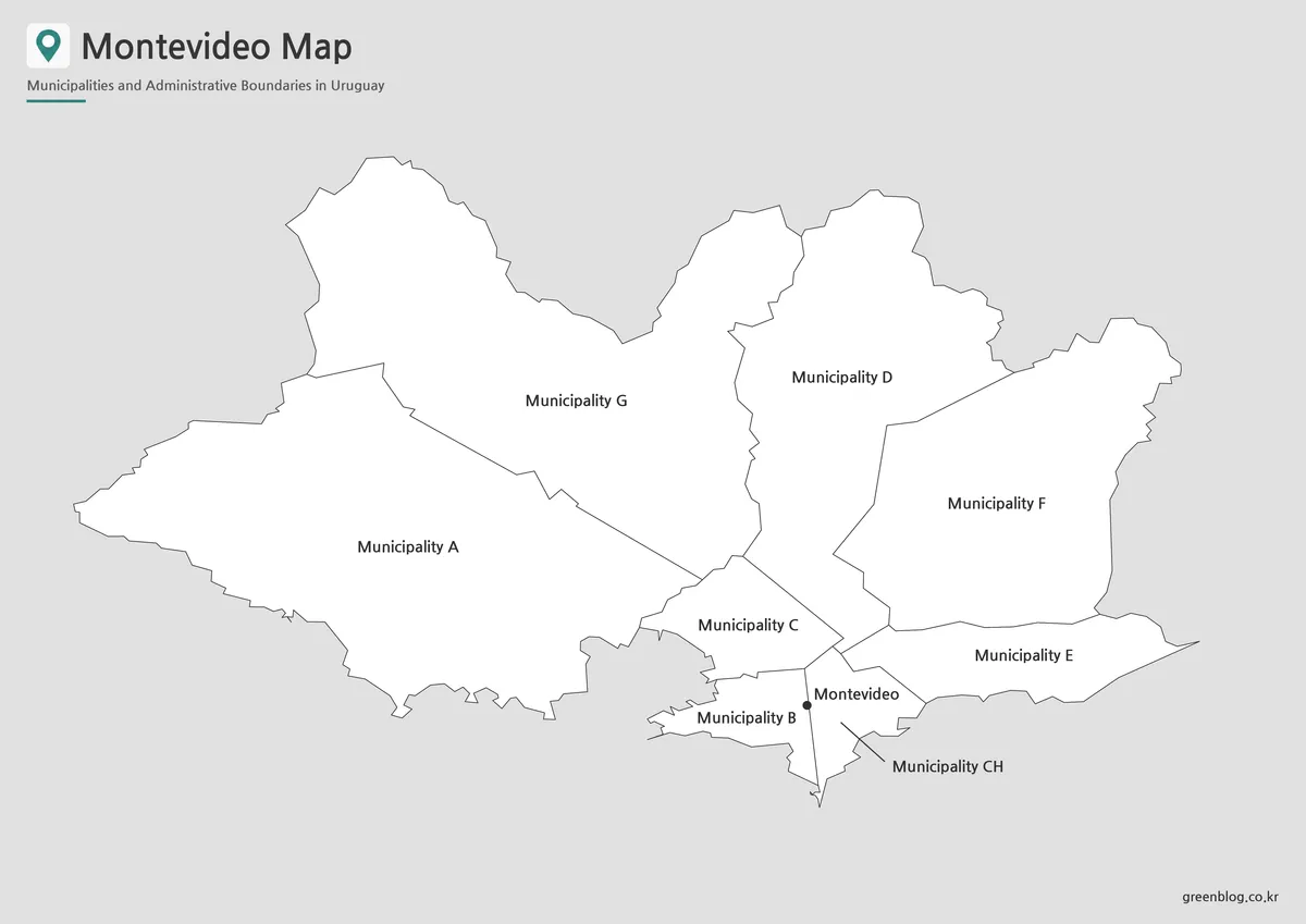
The outline Montevideo map removes the colors and municipal names while retaining the departmental shape and internal divisions. This creates a working base for adding information instead of a finished visual reference.
Teachers can ask students to label A through G, identify the coast, or color the central and outer municipalities differently. Infographic creators may add population figures, public facilities, port activity, environmental data, or transport directions. Travel projects can mark Ciudad Vieja, Pocitos, Carrasco, and other locations along the waterfront.
Because the base image contains fewer competing elements, users can decide which information receives attention. It is useful for projects that need one municipality highlighted, several districts grouped together, or a route drawn from the port toward the eastern coast.
Practical Uses for the Map Collection
A national map usually gives Montevideo very little space because the department is small compared with the rest of Uruguay. Its internal boundaries may be difficult to read or omitted entirely. A separate capital map solves that problem by giving the eight municipalities enough room to remain distinct.
The files can support lessons about Uruguay’s administrative system, comparisons between Montevideo and neighboring Canelones, or presentations about population concentration. They can also provide a geographic base for reports covering public services, coastal development, neighborhoods, or urban growth.
Choose the color file when fast municipal recognition matters most. Select the black and white design for printed documents and worksheets. Use the outline file when the project requires custom labels, statistics, routes, or highlighting.
Frequently Asked Questions
Is Montevideo a city or a department?
It is both. Montevideo is Uruguay’s capital city and one of the country’s 19 departments, with nearly the same territory serving both roles.
How many municipalities appear on the Montevideo map?
The map includes eight municipalities: A, B, C, CH, D, E, F, and G.
Is CH a combination of two municipalities?
No. CH is the official name of one municipality. It is separate from Municipality C and is not divided into C and H.
What body of water borders Montevideo?
The southern coastline faces the Río de la Plata, a broad estuary that opens toward the Atlantic Ocean.
What can be added to the outline file?
Users can add neighborhood names, transport routes, coastal landmarks, demographic statistics, public facilities, or custom color categories.
Can the files be printed at A3 size?
Yes. The supplied JPG maps use an A3 layout suitable for classroom displays, reference sheets, reports, and presentation materials.
Map File Information
This download includes printable Montevideo map versions for educational use, presentation design, document printing, and editable graphic projects.
- Included Versions: Color map, black and white map, outline map
- Printable Size: A3 layout
- File Type: JPG image files
- Intended Use: Classroom handouts, presentations, blog graphics, infographic editing, and printable reference materials
Related Maps
Additional Resources
- Discover Montevideo : The official English-language tourism site introduces Montevideo’s neighborhoods, cultural attractions, coastal experiences, and visitor routes.
Green Map creates custom-edited map images using open geographic data sources such as geoBoundaries, Natural Earth, OpenStreetMap, and government open data. These maps are edited visual materials, not raw data files, and are provided for education, documents, presentations, and graphic reference.