A Printable Nicaragua map is useful when you need to explain more than the country’s location in Central America. Nicaragua sits between Honduras to the north and Costa Rica to the south, with the Caribbean Sea on the east and the Pacific Ocean on the west. Because of this position, it often appears in materials about Central American geography, regional travel routes, neighboring countries, coastal comparison, and country profile projects.
This printable Nicaragua map collection includes color, black and white, and outline versions designed for classroom reference, presentation slides, blog graphics, document printing, and editable infographic work. The files are prepared as high-resolution image files for A3 layout use, making them suitable for both digital content and printed materials. Instead of focusing on roads or small facility details, the map keeps attention on Nicaragua’s administrative regions, coastline, capital location, and overall national shape.
Nicaragua has a clear north-south position within Central America, but its layout becomes more meaningful when the two coasts are shown together. The western side connects to the Pacific, while the eastern side faces the Caribbean, giving the country a different visual balance from a simple inland outline. Managua, the capital, is located in the western part of the country, where urban and population concentration is generally easier to explain with a labeled map.
During the map preparation process, special attention was given to keeping the coastline and regional boundaries readable at A3 size. Nicaragua is not the most visually complex country shape, but once administrative borders and labels are added, the map can quickly feel crowded. The line weight, label placement, and color balance were adjusted so the map remains useful for printing, classroom use, and graphic editing.
Table of Contents
Printable Nicaragua Map Overview
This map set is organized for users who need a practical visual reference rather than a general country description. The color version helps readers understand regional divisions quickly, the black and white version works well for printed handouts and written notes, and the outline version provides a clean base for custom map projects.
Included file information:
- File format: JPG, PNG, and ZIP
- Printable size: A3 high-resolution layout
- Included versions: color map, black and white map, outline map
- Additional image: Nicaragua flag
- Intended use: classroom handouts, travel presentations, blog graphics, worksheets, and editable design projects
For a first visual reference, the color map is the easiest version to use. For printing and note-taking, the black and white map is usually more practical. For custom editing, the outline map gives the cleanest starting point.
Color Nicaragua Map with Regional Boundaries
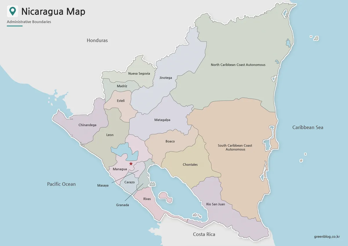
The color map is designed to make Nicaragua’s administrative regions easier to compare at a glance. Since the country is bordered by Honduras and Costa Rica and has coastlines on both the Caribbean and Pacific sides, color separation helps users understand how the regions sit within the wider Central American layout.
Managua is marked with a red star icon so readers can quickly identify the capital. This is helpful for students, teachers, and content creators who need to explain where the country’s main urban center is located in relation to the western side of Nicaragua.
The color balance was adjusted so the regions remain visible on screen without becoming too strong when printed. This makes the map suitable for blog posts, presentation slides, classroom reference materials, and country comparison graphics.
Black and White Nicaragua Map for Printing
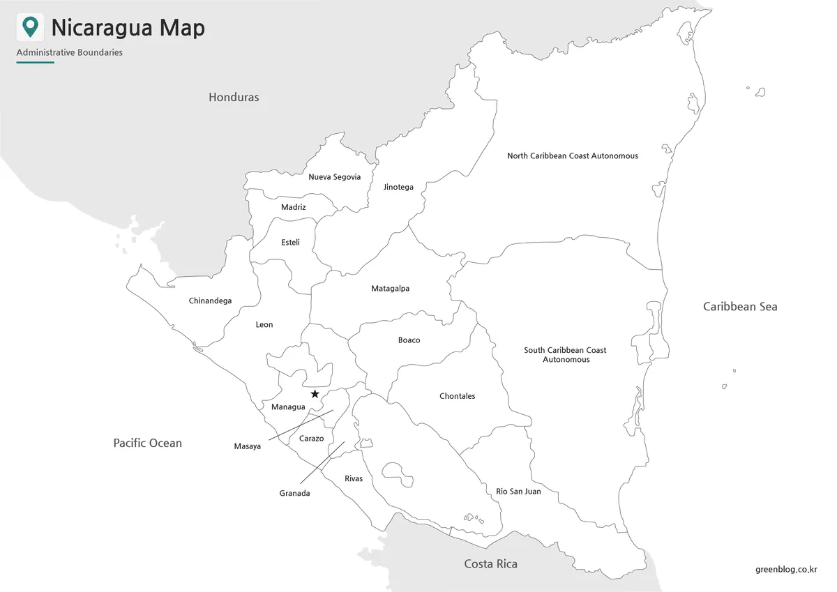
For printed materials, the black and white version offers a cleaner layout. It keeps the regional boundaries and labels while removing the stronger color elements, making it easier to use in worksheets, reports, and handouts.
This version is especially useful when users want to add notes by hand. For example, a teacher may ask students to mark the Pacific coast, the Caribbean coast, neighboring countries, or the capital city. A traveler or blogger may use the same layout to sketch a simple route from Managua toward other regions.
Because the background is simple, the map also fits well inside document layouts. It can be placed in a study guide, country profile sheet, presentation handout, or printable reference page without competing visually with surrounding text.
Blank Nicaragua Outline Map for Editing
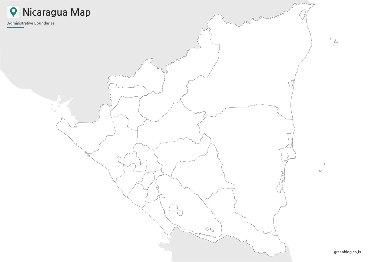
The outline version removes colors and labels, leaving the country shape and administrative boundary lines as a working base. This is the best option when users want to build their own custom map graphic.
Possible uses include adding travel routes, marking cities, highlighting coastal areas, coloring regions by data value, creating classroom coloring activities, or designing an infographic about Central America. The blank map also works well when users need to compare Nicaragua with nearby countries such as Honduras, Costa Rica, Panama, or Guatemala.
The boundary lines were checked so they remain connected and practical for editing. This matters because outline maps are often used as a base for adding new color fills, custom labels, regional groupings, and project-specific annotations.
Nicaragua Flag Image
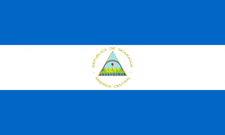
The Nicaragua flag image is included as an additional visual element for country profile materials. The blue and white design pairs well with the map when creating educational graphics, presentation slides, or blog layouts.
Using a flag together with a map can make a country introduction easier to understand. Readers can see both the national symbol and the geographic structure in the same resource, which is helpful for classroom displays, travel content, and basic country reference pages.
Best Uses for This Nicaragua Map Collection
A printable Nicaragua map works well for Central America lessons, regional comparison materials, travel route planning, country profile articles, and educational worksheets. Since Nicaragua has both Pacific and Caribbean coastlines, the map is especially useful when explaining how the country connects to water, neighboring countries, and different parts of Central America.
Bloggers can use the color map as a visual introduction, teachers can print the black and white version for students, and designers can use the outline map as a base for custom graphics. The collection is also useful for presentation creators who need a clean visual reference without unnecessary road or facility details.
Nicaragua Basic Information
Nicaragua is located in Central America. It borders Honduras to the north and Costa Rica to the south, with the Caribbean Sea to the east and the Pacific Ocean to the west. Managua is the capital city, and the country has a population of about 6.62 million people.
Among Central American countries, Nicaragua has a relatively large land area. This makes a regional map more helpful than a simple country outline, especially when explaining coastlines, neighboring countries, administrative divisions, and the position of Managua.
Frequently Asked Questions
What is included in this Printable Nicaragua map collection?
The collection includes a color map, a black and white map, a blank outline map, and a Nicaragua flag image.
Which Nicaragua map version should I use first?
The color map is best for quickly understanding regional divisions and the capital location.
Can I print the map for classroom use?
Yes. The files are prepared for A3 high-resolution use and can also be reduced for smaller classroom handouts.
Is the outline map suitable for editing?
Yes. The blank outline version works well for adding custom colors, labels, travel routes, statistics, or infographic elements.
Does the map show roads or detailed tourist facilities?
No. The map focuses on Nicaragua’s administrative regions, coastline, capital marker, and general national layout.
Download Nicaragua Map
This download includes printable Nicaragua map versions for educational use, presentation design, document printing, and editable graphic projects.
- Included Versions: Color map, black and white map, outline map
- Printable Size: A3 layout
- File Type: JPG, PNG, ZIP
- Intended Use: Classroom handouts, presentations, blog graphics, infographic editing, and printable reference materials
Additional Resources
- University of Texas Libraries – Nicaragua Maps : A useful map archive page with Nicaragua reference maps, including country and political map materials.
Related Maps
- Honduras Map Download – Printable & Editable Map Collection
- Printable Guatemala Map Collection for Education, Travel, and Design
- 5 United States Maps for Download (Color, Black & White, Outline)
- Panama Map Collection – Color, Labeled, and Outline Maps for Printing