A Malaysia Map is especially useful because the country is not shaped like one continuous landmass. Malaysia is located in Southeast Asia and is divided between Peninsular Malaysia on the Malay Peninsula and East Malaysia on the northern part of Borneo. Because of this separated structure, it can be harder to understand the country’s full layout from a small world map or a simple location image.
This printable Malaysia map collection includes a color map, a black and white map, a blank outline map, and a Malaysia flag image. The maps were prepared as high-resolution A3 resources for classroom handouts, blog graphics, presentation slides, travel-related content, regional comparison materials, and editable design projects. The layout focuses on administrative boundaries, regional separation, surrounding countries, and readable labels rather than heavy road or city detail.
Malaysia borders or sits close to several Southeast Asian countries, including Thailand, Indonesia, and Brunei. Kuala Lumpur is marked as the capital, and the map also includes the country’s important administrative structure: states and federal territories. Since some simplified maps leave out smaller federal territories, extra attention was given to including Kuala Lumpur, Putrajaya, and Labuan together with the main state divisions.
During the map preparation process, Illustrator was used for the main boundary work, while Photoshop was used for color adjustment and visual refinement. The goal was to keep the coastline, islands, state boundaries, and label placement clear enough for printing and digital use. Because Malaysia includes both coastal peninsula areas and island-based regions across the South China Sea, a clean regional map can help readers understand the country’s structure more quickly than text alone.
Table of Contents
Malaysia Map Overview
This map set was created for people who need a practical visual reference rather than a detailed road navigation map. It is suitable for students, teachers, bloggers, designers, travelers, and presentation creators who want a clean Malaysia regional map for printed or digital projects.
Included map versions:
- Color Malaysia map
- Black and white Malaysia map
- Blank outline Malaysia map
- Malaysia flag image
Confirmed design details:
- Printable layout: A3 high-resolution format
- Design tools: Illustrator and Photoshop
- Labels: Korean and English names included in the original map design
- Map focus: states, federal territories, surrounding countries, and regional structure
The map includes both Peninsular Malaysia and East Malaysia, making it easier to show the country’s two-part geography in one visual resource.
Regional Color Malaysia Map
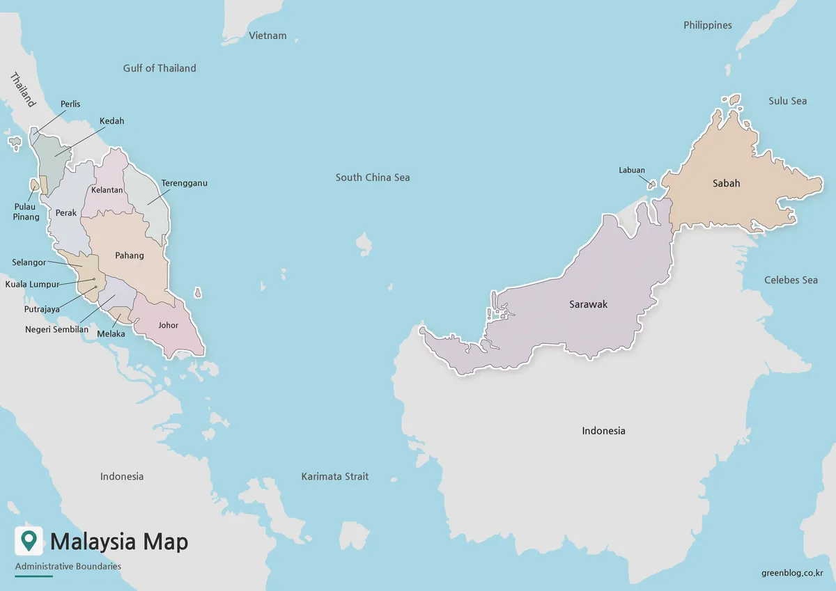
The color version is designed to make Malaysia’s administrative layout easier to read at a glance. Color separation is especially helpful here because the country is split between the Malay Peninsula and the Borneo side, with water separating West Malaysia and East Malaysia. Using different colors for the regions helps viewers quickly recognize the state divisions and understand how the country is arranged.
This map works well for blog posts, country profile pages, classroom slides, tourism content, and presentation visuals. The capital area and federal territories are included so the map does not feel incomplete when used for administrative explanations. For readers who are new to Malaysia’s geography, the color layout helps connect the country’s two main land areas with nearby countries such as Thailand, Indonesia, and Brunei.
While preparing the color map, the boundaries and labels were checked against multiple reference maps. The aim was not to create a dense technical map, but to provide a clean regional layout that is easy to understand when enlarged or printed.
Black and White Printable Map
For printed materials, the black and white Malaysia map offers a simpler and more practical layout. Removing the color makes labels and boundary lines easier to read in worksheets, reports, classroom packets, and document-based materials. It also reduces ink use when printing multiple copies.
Because Malaysia includes several separated regions, a clean black and white version can be useful for students who need to mark Peninsular Malaysia, Sabah, Sarawak, or the federal territories by hand. Teachers can use it for geography exercises, while bloggers or editors can place it inside articles without making the page look too visually heavy.
The boundary lines were reviewed so that users can still edit or highlight specific areas later. For example, someone preparing a report could add color only to Sabah and Sarawak, mark Kuala Lumpur, or compare Malaysia with nearby Southeast Asian countries.
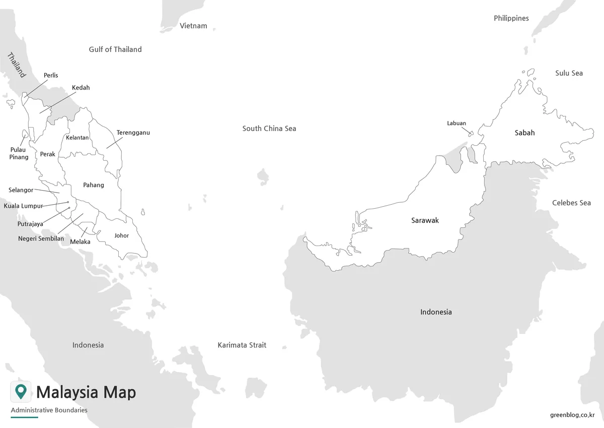
Blank Outline Map for Editing
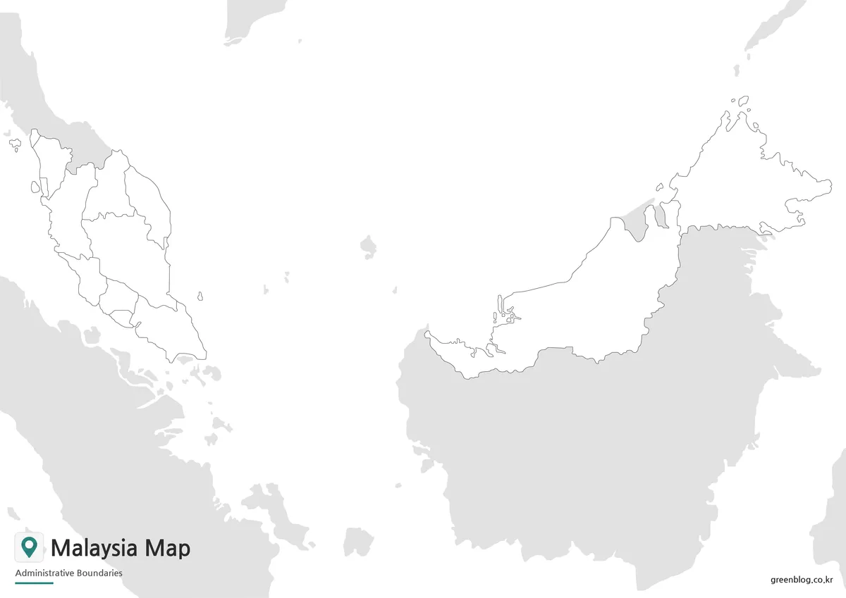
The blank outline map removes both color and text, leaving only the essential boundary structure. This is the most flexible version for users who want to build their own custom Malaysia map.
The outline map is useful for:
- classroom coloring activities
- regional comparison worksheets
- infographic annotations
- tourism route marking
- state or territory highlighting
- population or economic data visuals
- presentation labels
- custom map design work
Because Malaysia has a divided geographic structure, the outline version is also helpful when users want to explain the difference between Peninsular Malaysia and East Malaysia. A teacher could ask students to label the states and federal territories. A designer could add icons for Kuala Lumpur, Borneo, beaches, airports, trade routes, or tourism areas. A blogger could use the blank map as a background for travel or regional guide content.
For graphic editing, this version saves time because users do not need to remove existing labels or colors before adding their own information.
Malaysia Flag Image
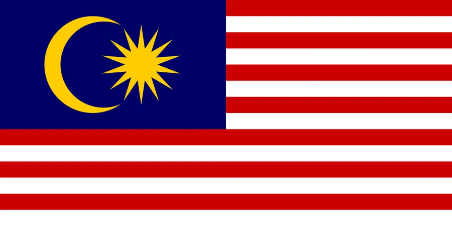
A Malaysia flag image is also included with the map set. The flag features red and white stripes, a blue canton, and a yellow crescent and star. When used together with the Malaysia map, the flag helps complete country profile pages, educational slides, and presentation materials.
This is especially useful for school resources, travel guides, regional comparison content, and visual country information blocks.
Administrative Areas Included
The Malaysia map includes the main state and federal territory structure.
Peninsular Malaysia includes:
- Johor
- Melaka
- Negeri Sembilan
- Selangor
- Perak
- Penang
- Kedah
- Perlis
- Kelantan
- Pahang
- Terengganu
East Malaysia includes:
- Sarawak
- Sabah
Federal territories include:
- Kuala Lumpur
- Putrajaya
- Labuan
Including the federal territories is useful because Kuala Lumpur and Putrajaya are important for explaining Malaysia’s administrative and capital-area structure, while Labuan is geographically separate from Peninsular Malaysia.
Practical Uses for This Map Set
This Malaysia map collection is designed for practical visual work. It can be used in educational content, country comparison pages, Southeast Asia travel materials, printed worksheets, infographic designs, and blog posts.
Good use cases include:
- Southeast Asia geography lessons
- country profile pages
- classroom handouts
- travel presentation slides
- blog graphics
- printable study materials
- regional comparison charts
- editable infographic projects
- state and federal territory explanations
Since Malaysia is divided between the peninsula and Borneo, the map is also useful for explaining why the country appears separated on world maps. A printable regional map gives readers a clearer understanding of Malaysia’s overall shape and administrative layout.
FAQ
What is included in this Malaysia Map collection?
The collection includes a color map, a black and white map, a blank outline map, and a Malaysia flag image.
Does the map include both Peninsular Malaysia and East Malaysia?
Yes. The map includes both West Malaysia on the Malay Peninsula and East Malaysia on Borneo.
Are the federal territories included?
Yes. Kuala Lumpur, Putrajaya, and Labuan are included along with the main state divisions.
Can I use the Malaysia Map for printing?
Yes. The map was prepared as an A3 high-resolution resource, making it suitable for printed handouts, reports, classroom materials, and presentation sheets.
Which version is best for editing?
The blank outline map is the best option for editing because it removes labels and colors, leaving a clean boundary base.
Malaysia Map Download
Download the Malaysia map collection for printing, classroom use, presentation slides, blog graphics, regional comparison materials, and custom editing projects.
- Print Layout: A3 high-resolution format
- Included Versions: Color map, black and white map, outline map, flag image
- Map Focus: States, federal territories, surrounding countries, and regional structure
- Intended Use: Printing, education, presentations, blog graphics, and editing projects
Related Maps
- Kazakhstan Map Download | Printable Color, Black and White & Outline Maps
- New Taipei City Map Download with District Boundarie
- Laos Map Download – High Resolution A3 Administrative Map Set
- Printable Kyrgyzstan Map Resource for Education, Travel, and Design
Additional Resources
- Malaysia StatsGeoportal – Department of Statistics Malaysia : An official geospatial statistics portal for exploring Malaysia’s regional data, administrative areas, and map-based statistical information.