A Nagano Prefecture Map is often needed for more than simple location reference. The prefecture covers a large inland area in central Japan and contains a complex network of cities, towns, and villages spread across mountainous terrain. Because of its size and administrative structure, maps are frequently used in classroom materials, travel planning documents, regional comparison projects, presentations, and infographic design work.
Nagano Prefecture is located in the Chubu region of Honshu and borders several neighboring prefectures, including Niigata, Toyama, Gifu, Aichi, Shizuoka, Yamanashi, Gunma, and Saitama. Major cities such as Nagano, Matsumoto, Ueda, Ina, and Saku serve as important regional centers, while the Japanese Alps create distinct geographic divisions across the prefecture.
This printable collection includes three different map styles prepared for different purposes. Users can choose between a color administrative map, a labeled black and white version, and a blank outline map. The files were organized with printing and readability in mind, making them suitable for educational materials, blog graphics, travel presentations, regional studies, and graphic editing projects.
Extra attention was given to municipal boundaries during the map preparation process because Nagano contains a large number of cities, towns, and villages distributed across mountainous regions. Labels and boundary lines were reviewed at larger viewing sizes to ensure that they remain readable when printed.
Table of Contents
Map Collection Overview
Included map versions:
- Color administrative map
- Labeled black and white map
- Blank outline map
- High-resolution printable format
- Suitable for presentation and editing projects
The Nagano Prefecture Map collection was designed to provide both visual clarity and practical flexibility depending on the type of project being created.
Color Administrative Map
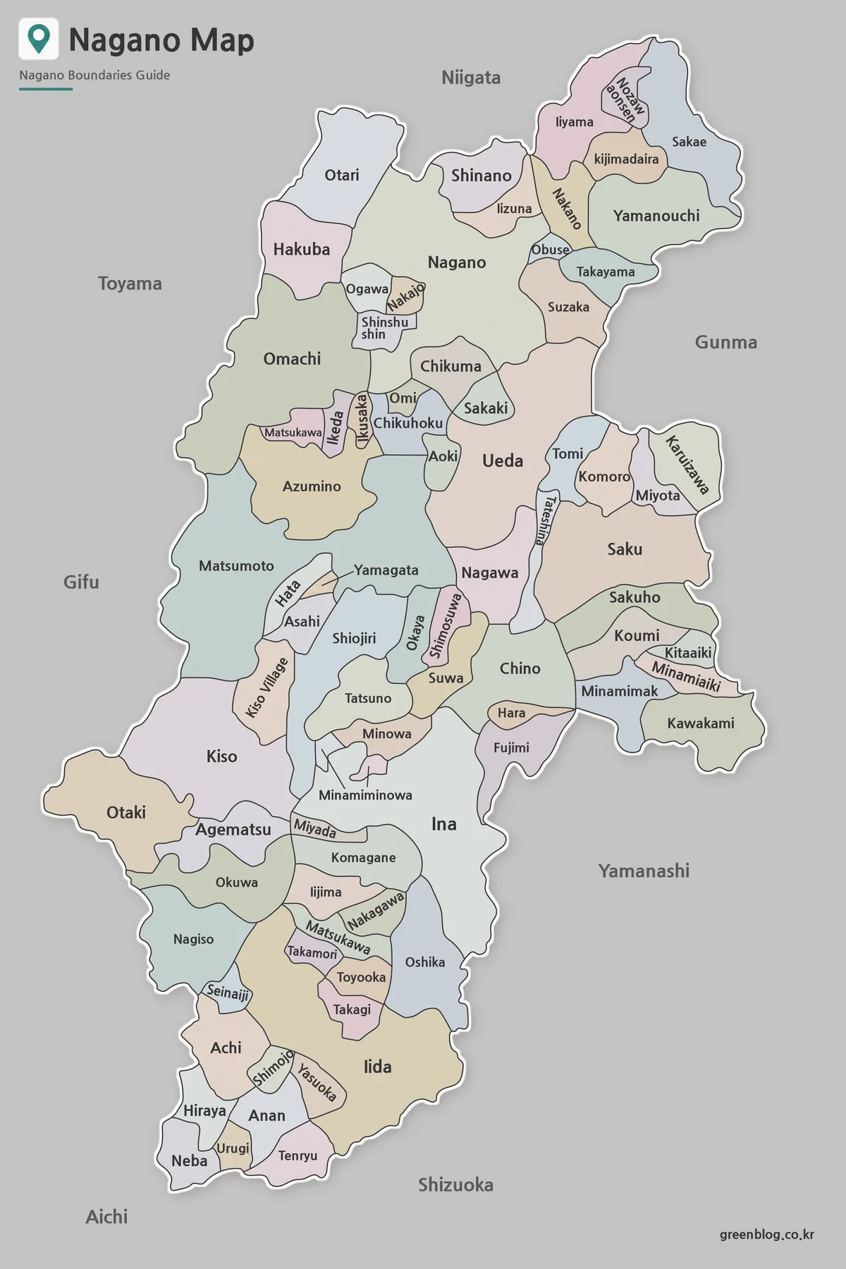
The color version highlights municipal boundaries using separate colors for easier visual distinction.
This Nagano Prefecture Map format works particularly well when comparing different regions across Nagano Prefecture. It is often used in presentations, educational materials, regional planning documents, and travel-related graphics where administrative divisions need to remain visible at a glance.
Since Nagano covers a large geographic area with many municipalities, color separation helps users quickly identify regional relationships without relying solely on labels.
Labeled Black and White Version
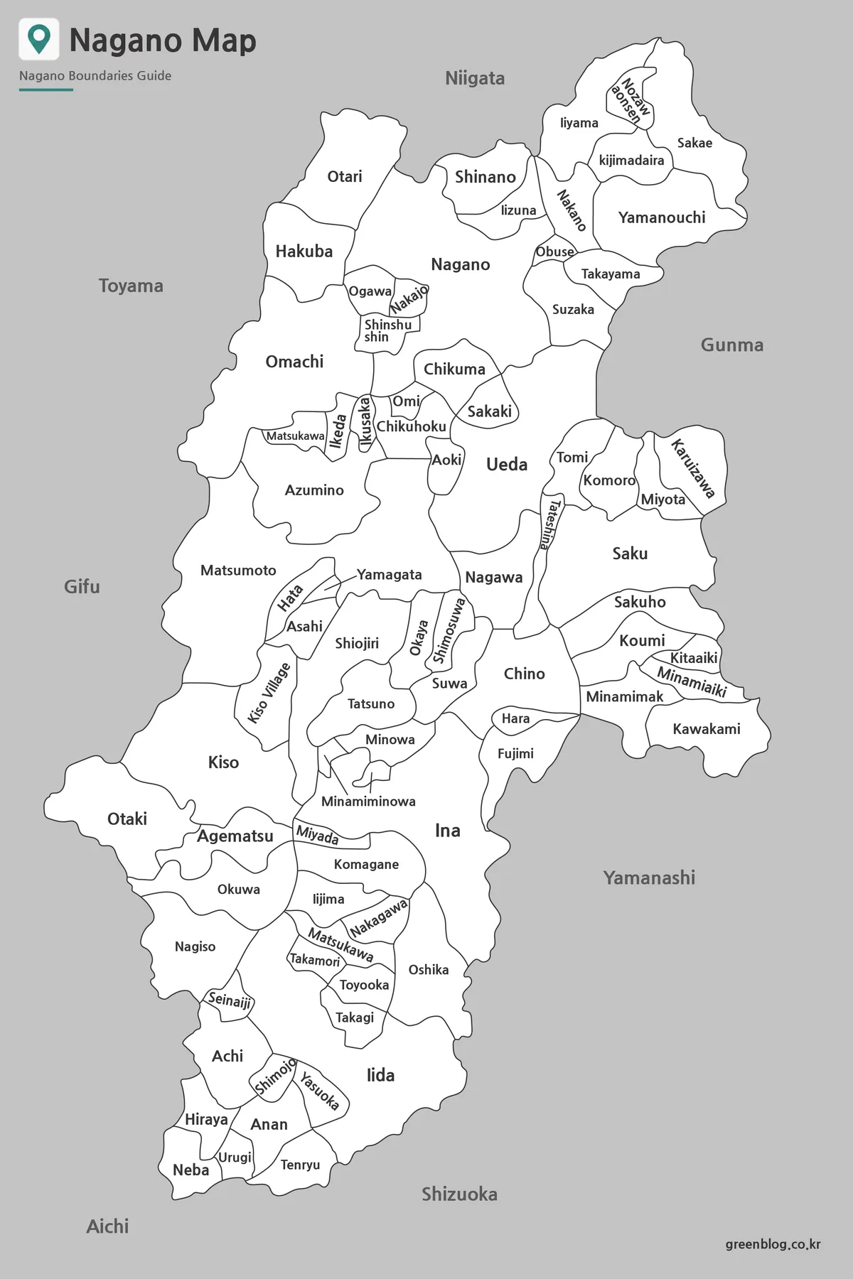
The labeled Nagano Prefecture Map version removes color distractions and focuses on place names and boundary lines.
This style is commonly chosen for printed reports, classroom handouts, worksheets, and research documents. Labels remain readable when enlarged, and the simplified appearance makes it easier to combine with charts, annotations, and supporting graphics.
During review, label placement was adjusted to improve readability in areas where municipal boundaries are densely clustered.
Blank Outline Map for Editing
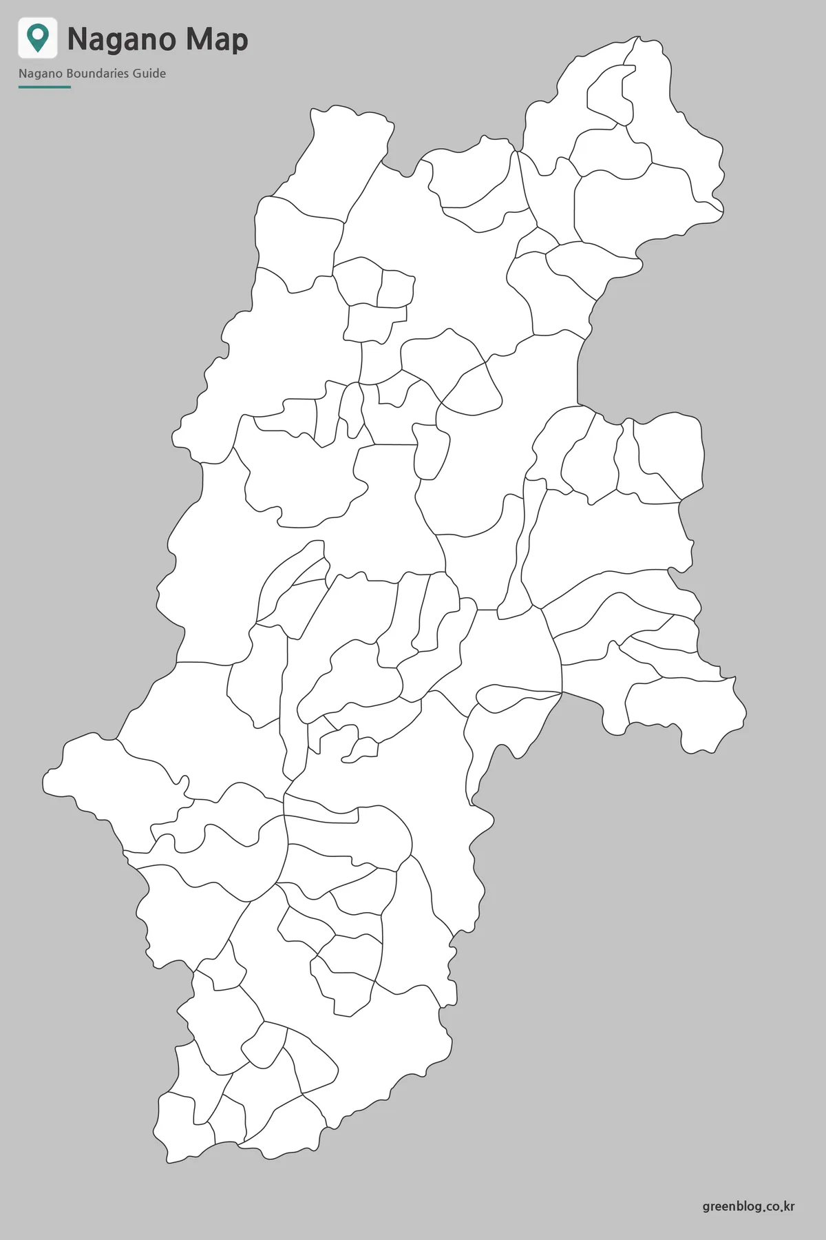
The outline Nagano Prefecture Map contains only the administrative boundaries.
Many users prefer this format when creating custom maps, adding statistical information, highlighting specific municipalities, or building infographic projects. The clean layout also works well for educational worksheets and regional analysis materials.
Boundary lines were simplified where possible while preserving the overall municipal structure of the prefecture.
Built for Printing and Presentation Use
Because Nagano Prefecture contains a large number of municipalities spread across mountainous regions, a simple location map is often not enough.
These maps work well for:
- Classroom handouts
- Educational worksheets
- Travel presentations
- Regional comparison projects
- Blog graphics
- Infographic design
- Geographic reference materials
- Municipal boundary studies
The A3-oriented layout was reviewed for readability when enlarged or printed.
Frequently Asked Questions
Can I print the Nagano Prefecture Map in large format?
Yes. The maps were prepared in high resolution and are suitable for large-format printing.
Which version is best for editing?
The outline map is the most flexible choice for editing, annotations, and custom graphic work.
Does the map include municipal boundaries?
Yes. Municipal boundaries are included across all versions of the collection.
Nagano Prefecture Map Download
Choose the version that best fits your project. Color, labeled, and outline maps are included in the collection.
- File Format: JPG / ZIP
- Image Size: High Resolution
- Intended Use: Printing, Presentation, Editing
- Coverage: Municipal Boundaries
Related Maps
- Free Shimane Prefecture Map for Presentations and Classroom Use
- Printable Nara Prefecture Map Collection for Education and Design
- Okinawa Prefecture Map Free Download | Printable 3-Version Collection
- 4 Japan Maps Download Collection for Print and Design
Additional Resources
- Geospatial Information Authority of Japan (GSI) – Official Japanese mapping agency offering geographic data, topographic maps, and administrative boundary information.