While building map sets for different countries and regions, one gap kept bothering me: Korea didn’t have its own organized collection yet. So I set aside time to finish a complete set—starting with a clean South Korea map and expanding to Korean Peninsula views for broader context.
Everything was created in Illustrator using a simple approach. Instead of visual effects, the focus stayed on tidy outlines and readable labels that remain sharp when zoomed in or printed. Since detailed directions are better handled by online map services, these files are designed for explanations—blog posts, classroom handouts, quick presentation slides, and lightweight design layouts.
If you’re looking for a practical Korea maps download set that you can reuse across different projects, this six-file collection is built to be straightforward and flexible.
Table of Contents
South Korea Basic Facts
- Location: East Asia, southern part of the Korean Peninsula
- Area: about 99,720 km²
- Capital: Seoul
- Population: about 51.96 million (2023 estimate)
- Language: Korean
- Resources: coal, tungsten, graphite, molybdenum, and more
- Climate: temperate, rainy summers and cold winters
What’s Included in This Korea Map Collection
After making maps for many countries and regions, I realized I hadn’t properly organized a full set for Korea. That’s why this Korea maps download collection focuses on practical use first: a South Korea–only set plus Korean Peninsula maps for broader context.
Illustrator was used for the entire project. Instead of relying on heavy effects, the work stays simple—clean coastlines, readable boundaries, and labels placed so they remain clear when zoomed in or printed. For street-level navigation, online map services already do a better job, so these files are meant to support explanations and visual summaries.
Most people use maps like these for blog posts, class materials, quick presentation slides, or lightweight design layouts. With that in mind, the set includes balanced options: a labeled reference map, an outline template for custom edits, and Korean Peninsula views for north–south geography.
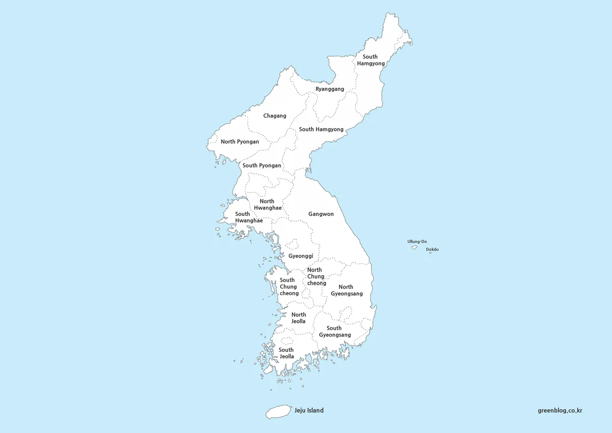
1️⃣ South Korea Map (Regions & Major Cities)
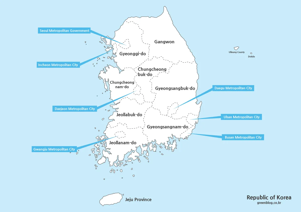
A single-page South Korea map works well when you need a fast overview. Major regions and key cities are labeled, and boundaries are marked clearly without making the layout feel crowded.
A3 formatting was the baseline during production, so the same file works well both on screen and on paper. Dotted boundary styling keeps borders easy to follow while leaving enough breathing room for adding notes.
Ulleungdo and Dokdo are included, since maps that omit them can cause confusion in basic geography explanations. For general reference images, this version is often the easiest starting point in the Korea maps download set.
Good for:
- blog illustrations and country introductions
- classroom handouts and basic geography review
- quick visuals for “where is it?” explanations
- simple regional comparisons
2️⃣ Outline Map (Editing Template)
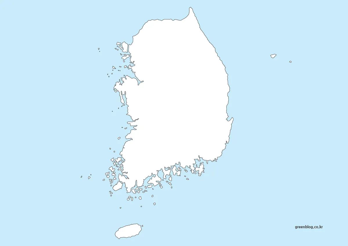
For design work, labels and colors can get in the way. An outline-only template solves that by removing all text and fills, leaving only boundary lines.
This option works well when you want to add labels in another language, color regions for statistics, or place icons for tourism and points of interest. Because it starts clean, edits in Illustrator, Photoshop, or similar tools stay fast and consistent.
If you plan to build infographics or custom visuals, the outline version is likely the most reusable file in the Korea maps download pack.
Good for:
- infographic layouts and data coloring
- customized labeling (other languages or abbreviations)
- tourism maps with icons and markers
- clean “blank template” map activities
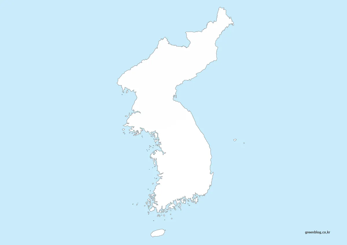
3️⃣ Korean Peninsula Map (Regional Labels)
Not everyone needs South Korea only. Some lessons and posts require a full peninsula view, so a labeled Korean Peninsula map is included as well.
While reviewing references, I noticed that older peninsula images sometimes exclude certain northern provinces, such as Jagang and Ryanggang. These omissions usually come from outdated sources. This version reflects current, complete coverage so regional explanations stay consistent across materials.
When content compares north–south geography or shows the peninsula’s overall shape, this map often communicates the idea faster than text alone—especially for readers less familiar with the region.
4️⃣ Korean Peninsula Outline Map
Alongside the labeled peninsula map, an outline-only peninsula template is included for editing and design use. Removing text and fills keeps the file flexible and easy to repurpose.
A mostly white base was chosen intentionally. During research, I saw many cases where students color maps as part of learning. With a clean background—and only minimal separation for sea areas when needed—it becomes easier to print, color, or annotate without heavy shading.
This file also works well as a background layer for presentations, where geography should remain visible but not dominant.
5️⃣ South Korea Flag
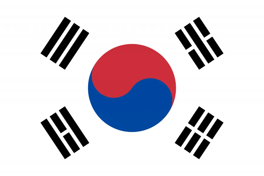
A South Korea flag image is included so you can pair it with maps in slides, worksheets, or country summary graphics. When maps appear in a post or presentation, a flag often helps readers quickly confirm the topic at a glance.
Because Korea’s coastline includes many islands, building clean shapes takes more time compared with some countries. Still, a dedicated Korea map collection is something people frequently need, so the goal here was simple and usable rather than complex or decorative.
FAQ
What can these Korea maps be used for?
Blog posts, education materials, presentations, printable handouts, and design projects all work well. The set is built for clear explanations rather than street-level navigation.
What size and resolution are included?
The primary workflow was based on A3-friendly layout and high-resolution export. Lines and labels stay crisp when zoomed in or printed.
Can I print these on A4 paper?
Yes. The printable-style versions and outline templates are suitable for A4 printing, and text remains readable when you use the full-resolution files.
Can I use them on a personal blog or for study materials?
For personal blogs, study notes, and non-commercial educational content, these files are meant to be easy to reuse as supporting visuals in your materials.
Download Guide
Click the download button below to access the full Korea maps download ZIP file. All maps are provided in high resolution and are ready for print or digital use.
This map is also available in Korean. You can view the original version through the link below.

▶ Italy Maps Download Collection (3 Printable Map Files)
▶ 4 Japan Maps Download Collection for Print and Design
▶ 5 United States Maps for Download (Color, Black & White, Outline)