
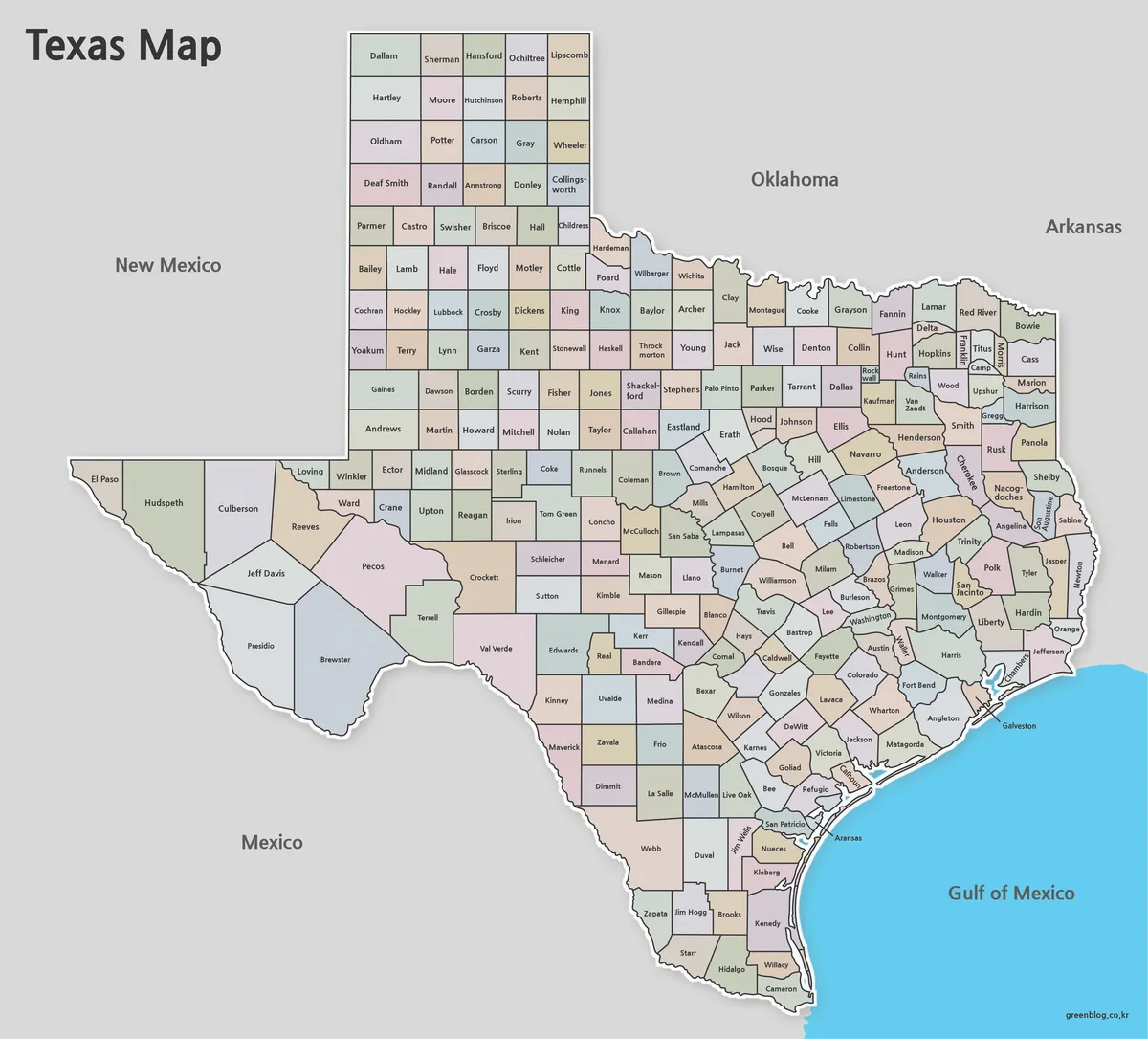
Two Corrections Hidden in a Texas Map of 254 Counties
A Texas Map at county scale turns one familiar state outline into a demanding reading exercise: 254 internal areas must
Two Corrections Hidden in a Texas Map of 254 Counties Read More »
A Texas Map at county scale turns one familiar state outline into a demanding reading exercise: 254 internal areas must
Two Corrections Hidden in a Texas Map of 254 Counties Read More »

The Jamaica Map collection turns the island’s long east-to-west outline into a clear parish-level reference. Jamaica lies south of Cuba
Jamaica Map Download: Color, Labeled, and Blank Parish Views Read More »
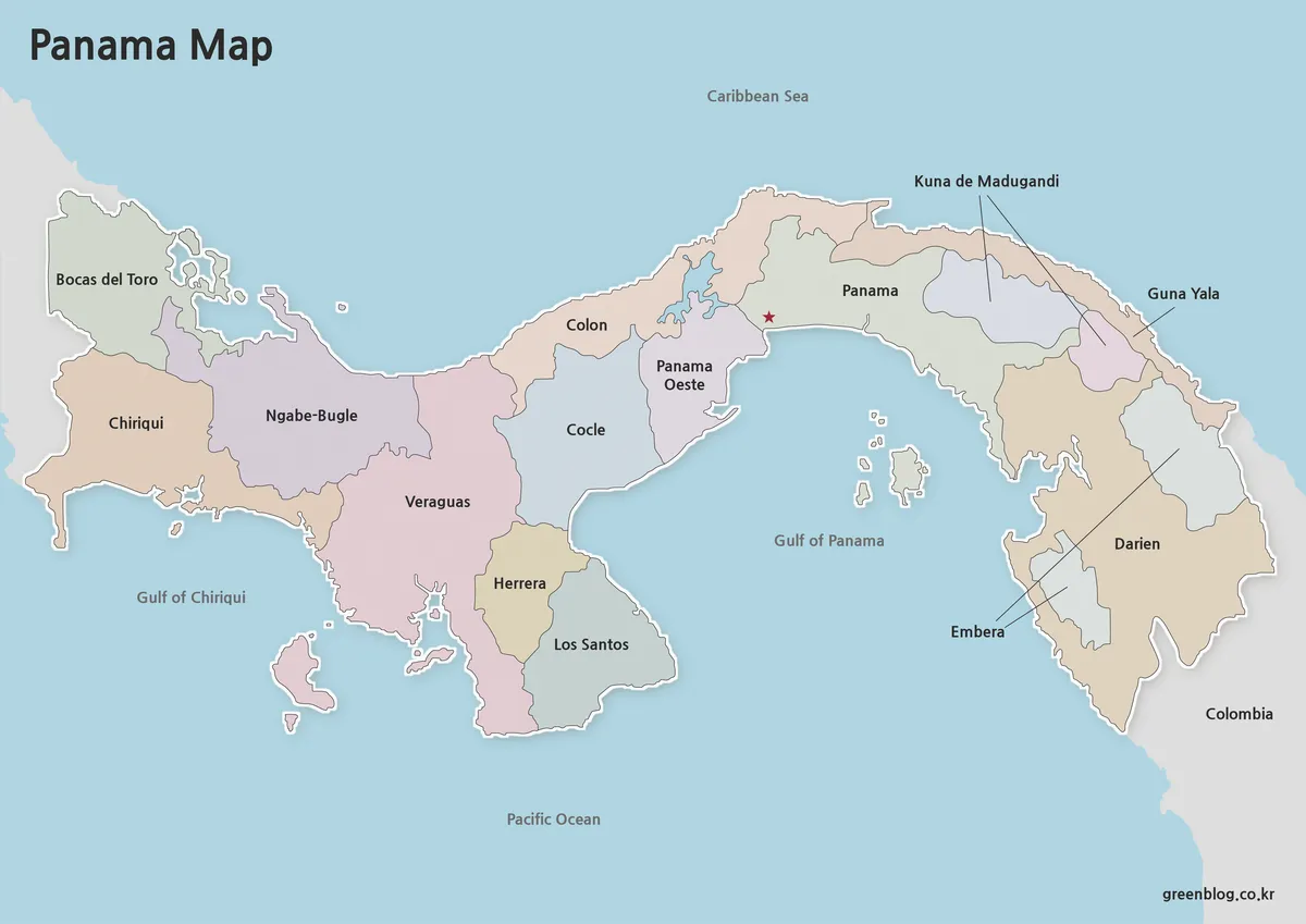
A Panama Map has to explain a country that curves between two continents and two major bodies of water while
Ten Provinces and Selected Comarcas on a Panama Map Read More »
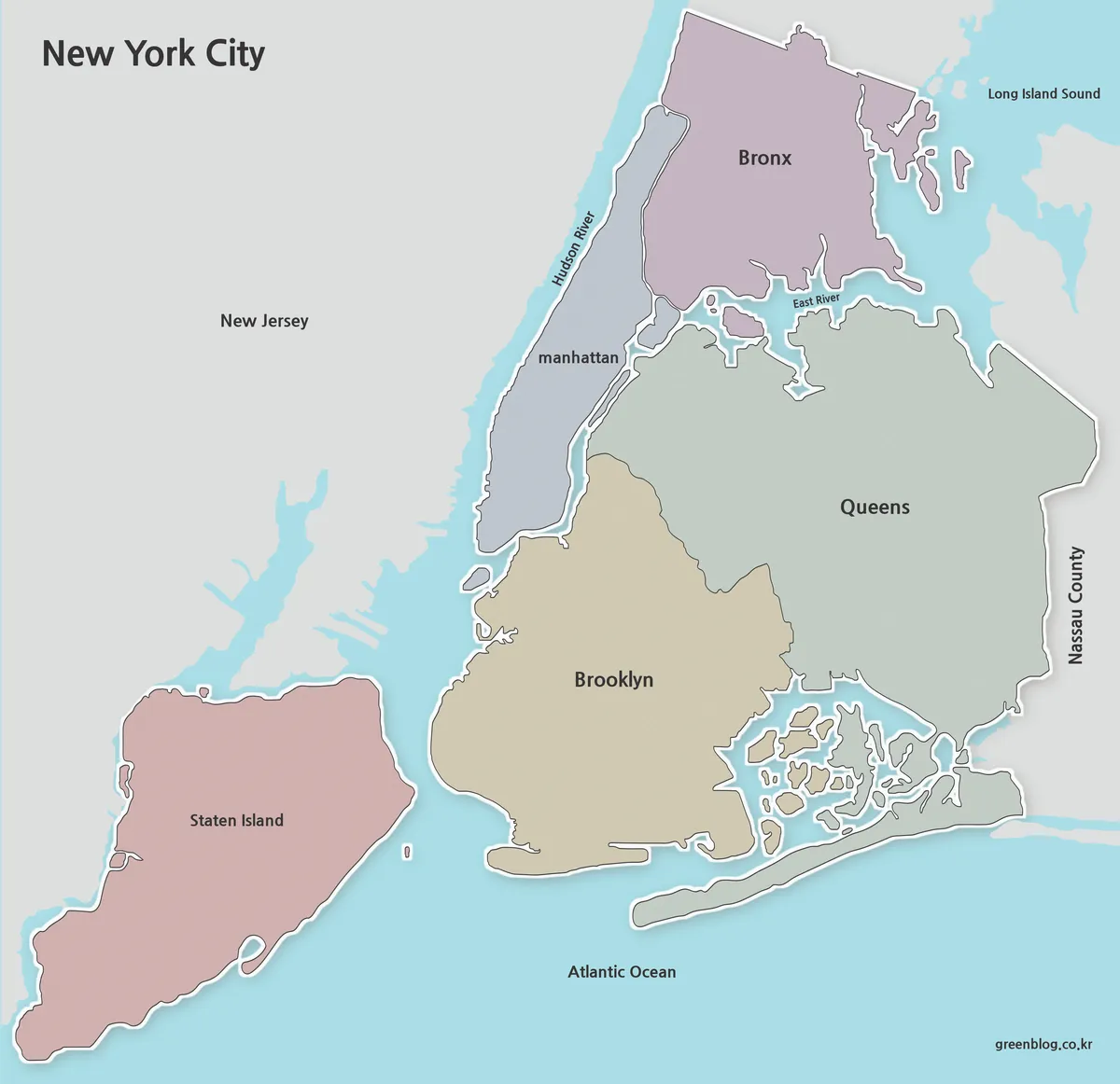
The New York City Map collection makes the city’s five-borough structure easier to read by showing how Manhattan, Brooklyn, Queens,
New York City Map Download: Color, Labeled, and Outline Views Read More »
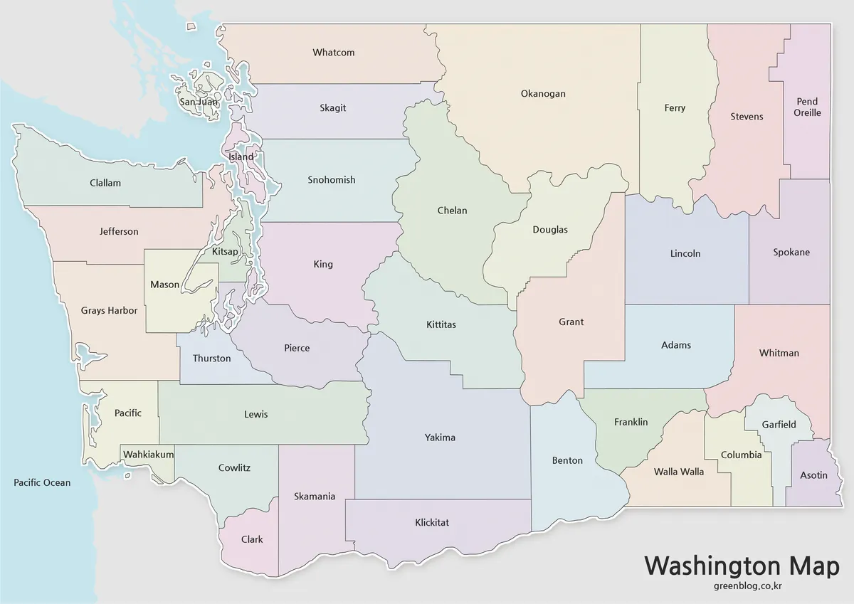
A Washington State Map shows two very different boundary patterns on the same page. Around Puget Sound and the Pacific
Washington State Map Showing All 39 County Boundaries Read More »
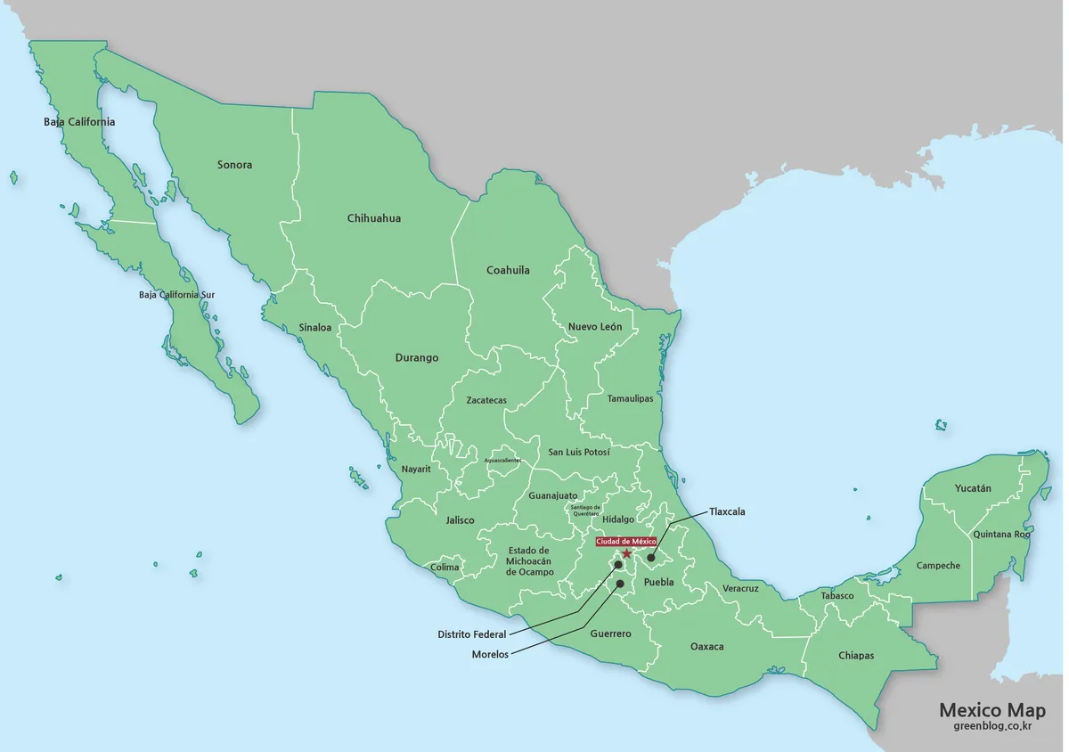
A Mexico Map must accommodate two peninsulas, an expansive north, a densely divided center, and a southeastern land bridge within
How a Mexico Map Connects Baja, Central Mexico, and Yucatán Read More »
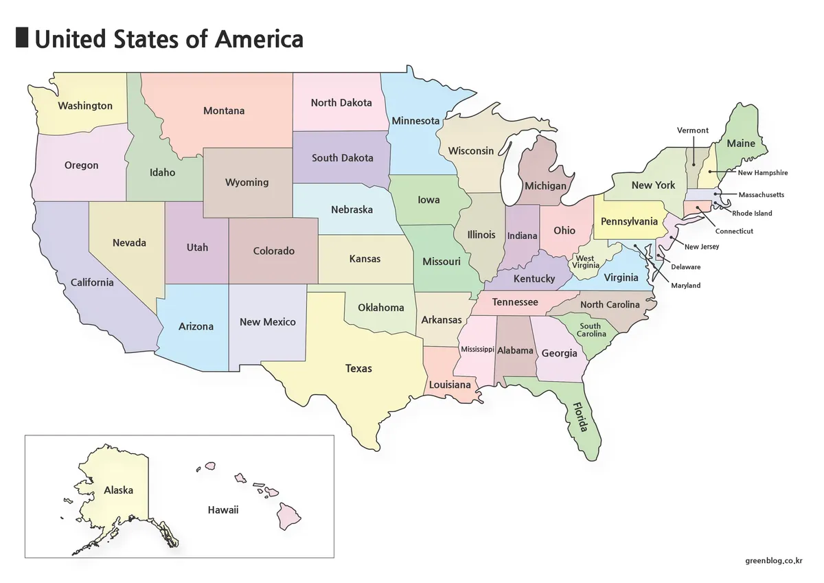
A United States Map must make 50 states readable despite large differences in area, shape, and location. The contiguous states
United States Map Collection: Color, Names, Codes, and Outlines Read More »