
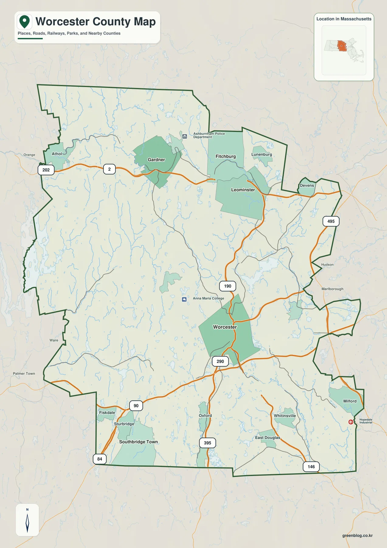
Worcester County Massachusetts Map: Route 2 Cities, Wachusett Reservoir, and Southern Rivers
Worcester County occupies a broad interior section of central Massachusetts, stretching well beyond the city of Worcester to northern centers
Worcester County occupies a broad interior section of central Massachusetts, stretching well beyond the city of Worcester to northern centers
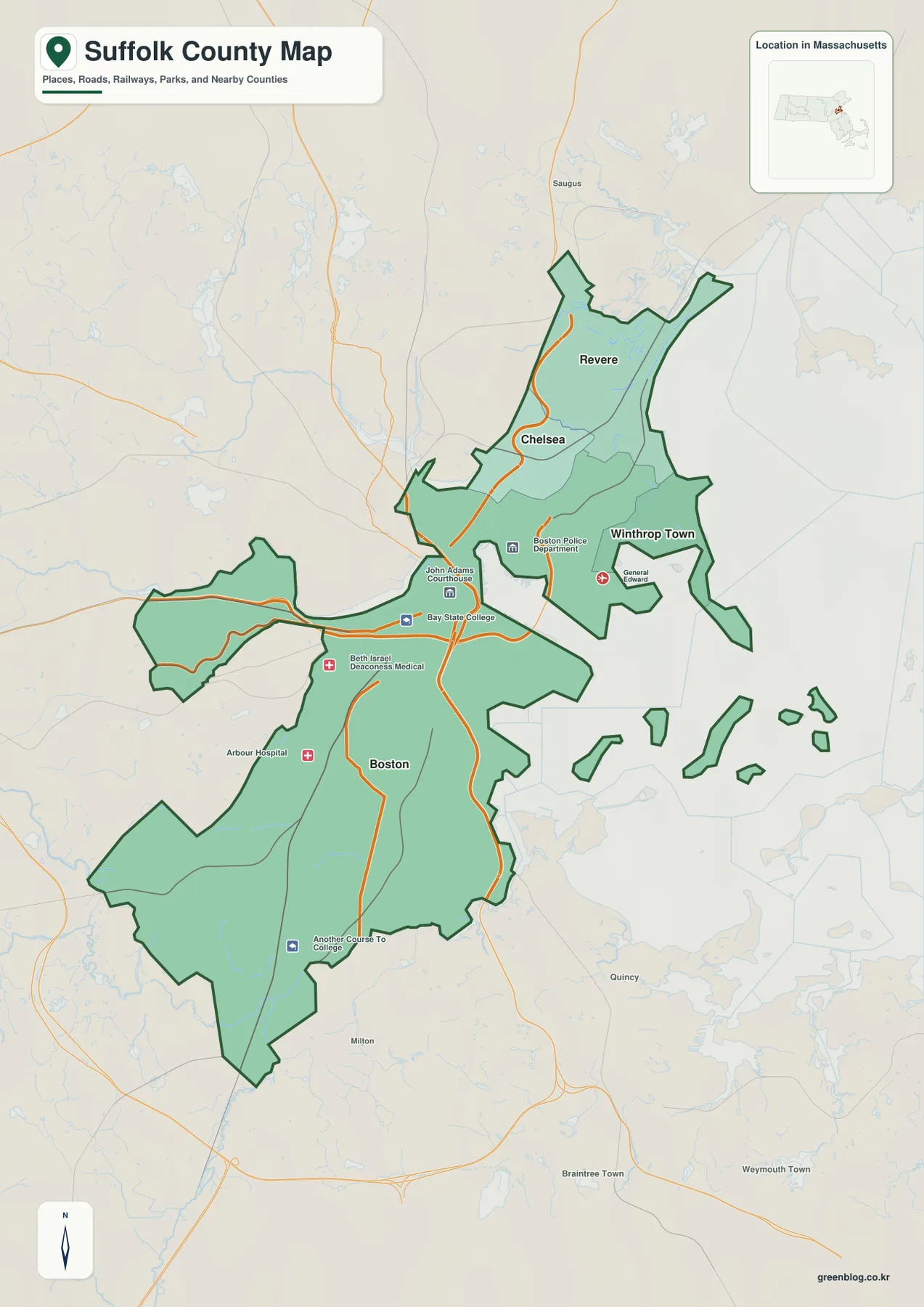
Suffolk County sits on the Massachusetts coast and is organized around Boston, with Chelsea, Revere, and Winthrop clustered close to
Suffolk County Massachusetts Map around Boston Harbor, Chelsea, Revere, and Winthrop Read More »
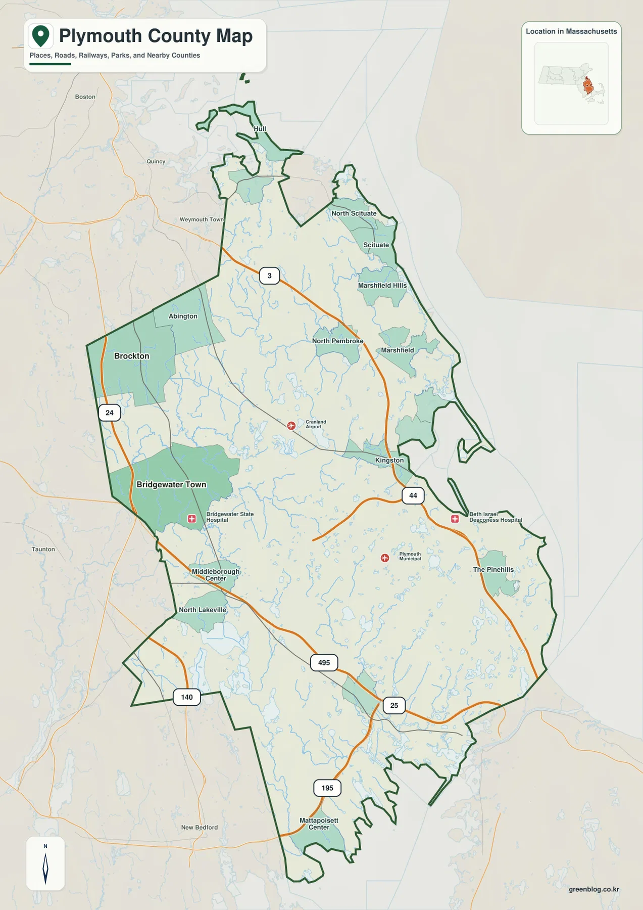
Plymouth County stretches across southeastern Massachusetts from the inland Brockton area to a long Atlantic shoreline facing Plymouth Bay, Cape
Plymouth County Massachusetts Map: Brockton, Route 3, Plymouth Bay, and Buzzards Bay Read More »
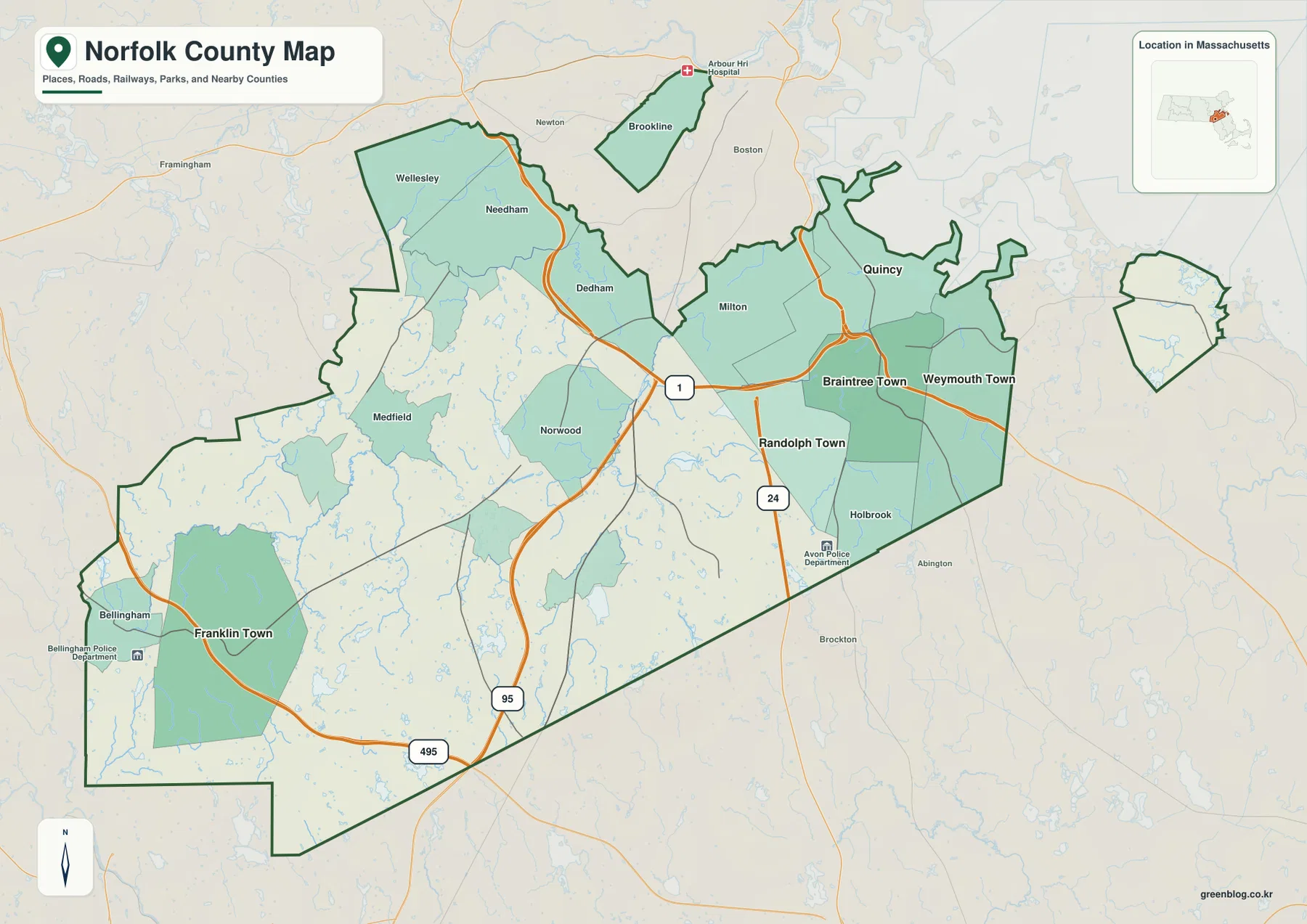
Norfolk County is an unusual county to read from a map because its territory is not shown as one continuous
Norfolk County Map: Quincy Coast, Detached Brookline and Cohasset, and Route 1 Read More »
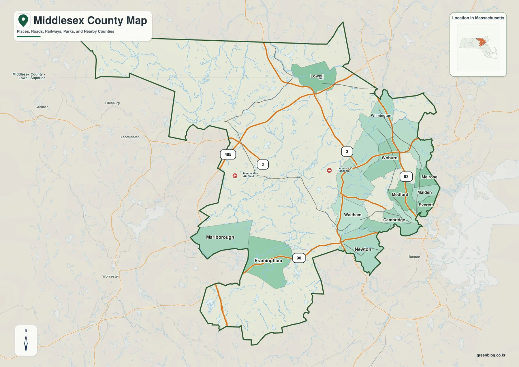
Middlesex County covers a wide cross-section of eastern Massachusetts. On the Boston side, Cambridge, Newton, Somerville, Malden, Medford, and Everett
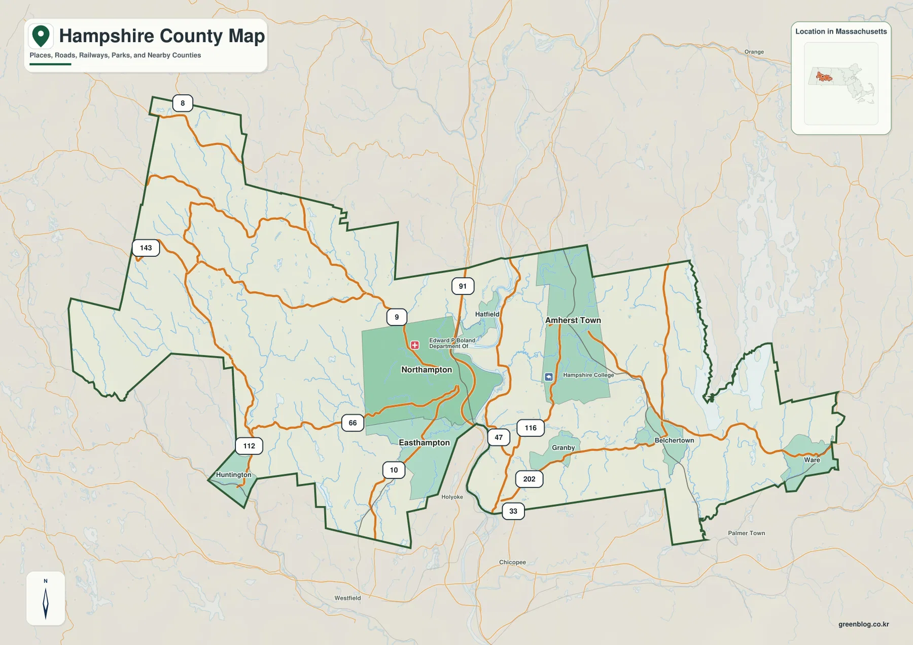
Hampshire County stretches across western Massachusetts from the uplands near the Berkshire County side to the Ware area in the
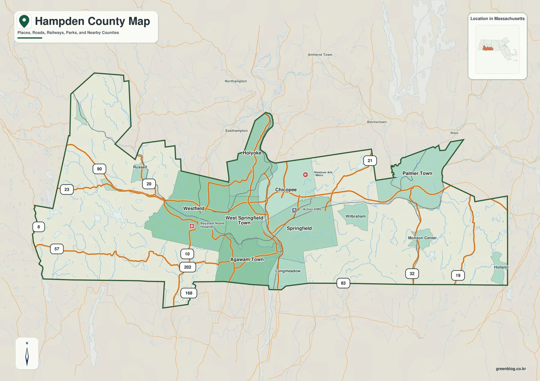
Hampden County occupies the southern part of western Massachusetts, directly above the Connecticut state line. Its geography is easiest to
Hampden County Map: Springfield, the Connecticut River, and the East-West Road Corridor Read More »
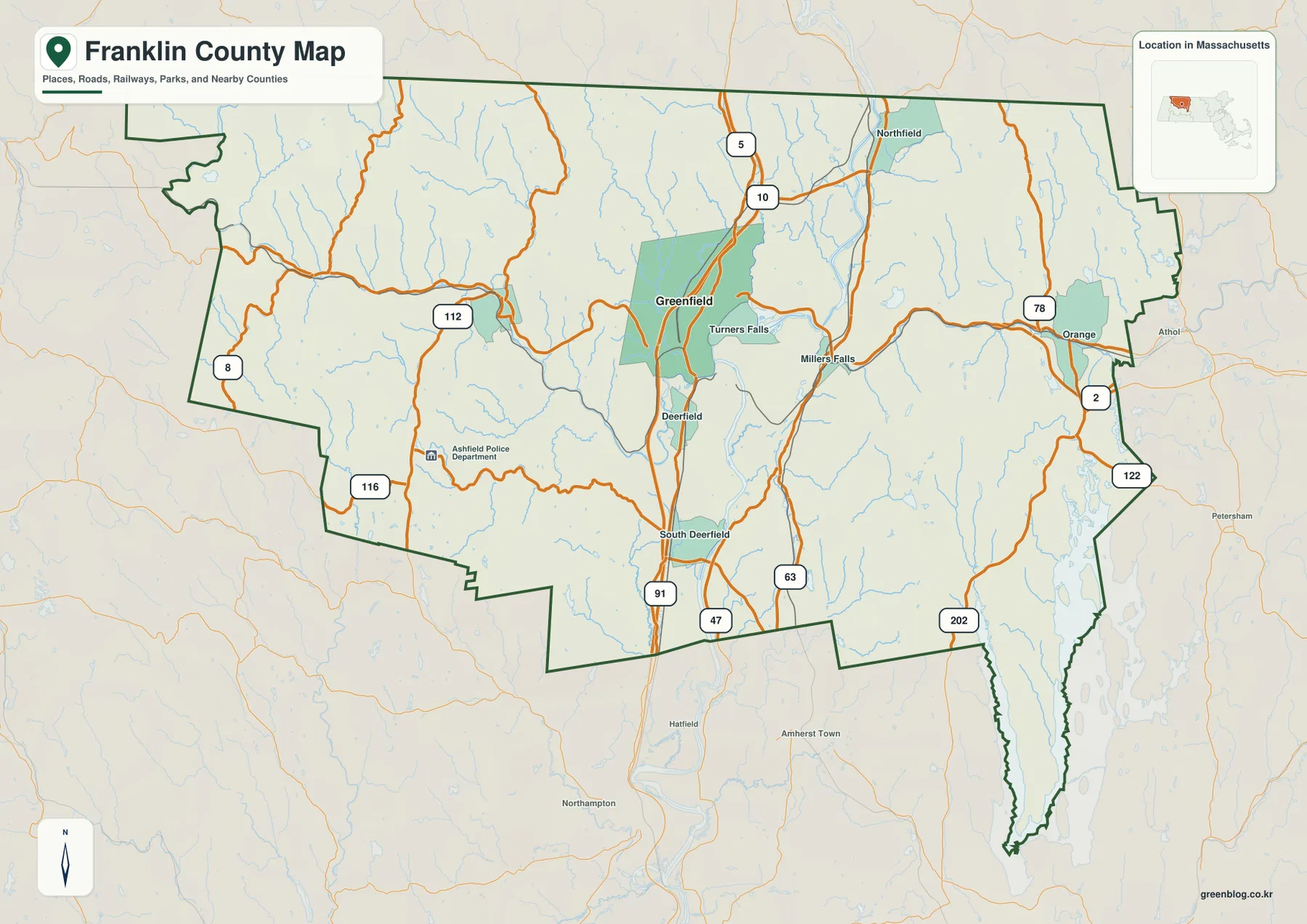
Franklin County occupies a mountainous part of northwestern Massachusetts where broad river valleys cut through uplands and connect a series
Greenfield, River Valleys, and Route 2 | Franklin County Massachusetts Map Read More »
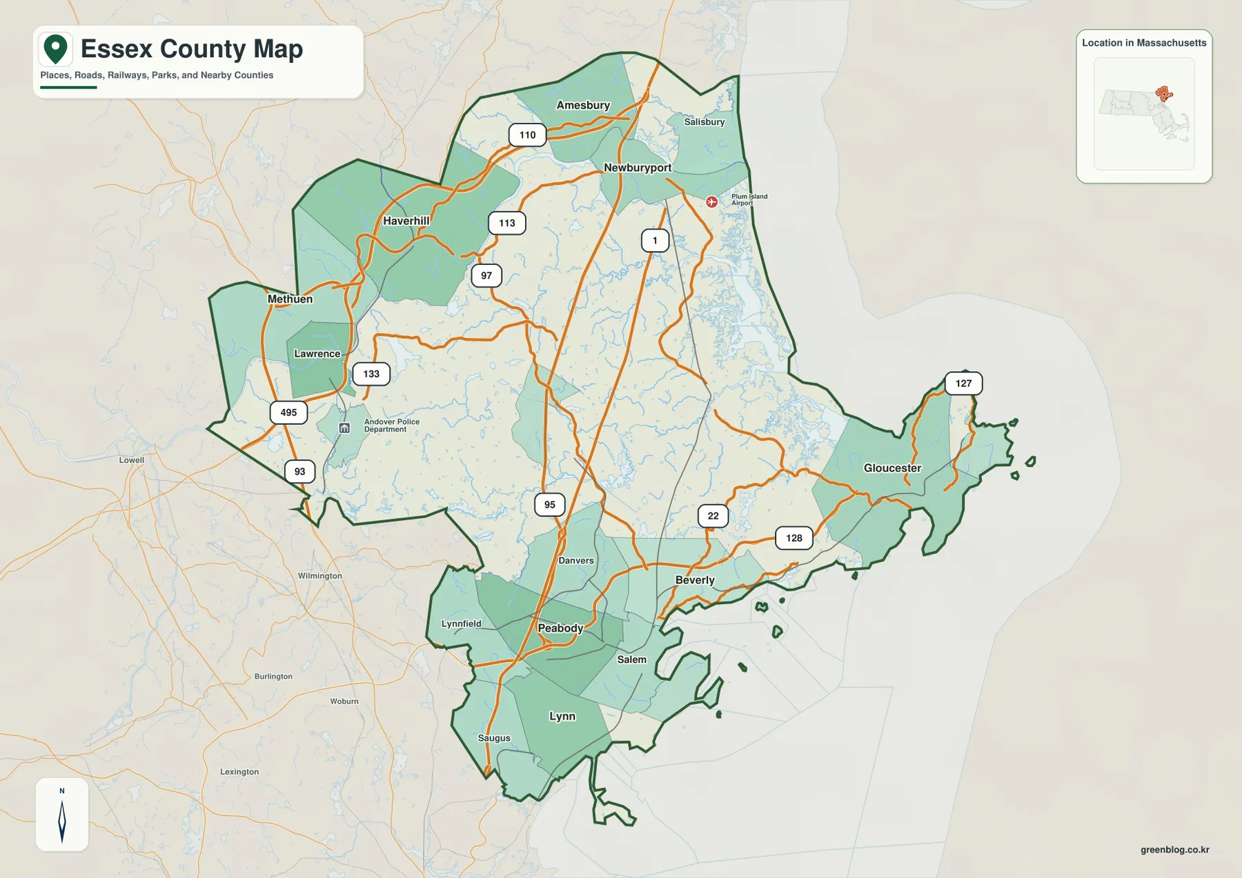
Essex County occupies a distinctive corner of northeastern Massachusetts because its geography changes markedly from one part of the county
Merrimack Valley to Cape Ann: Essex County Massachusetts Map with Salem and Gloucester Read More »