
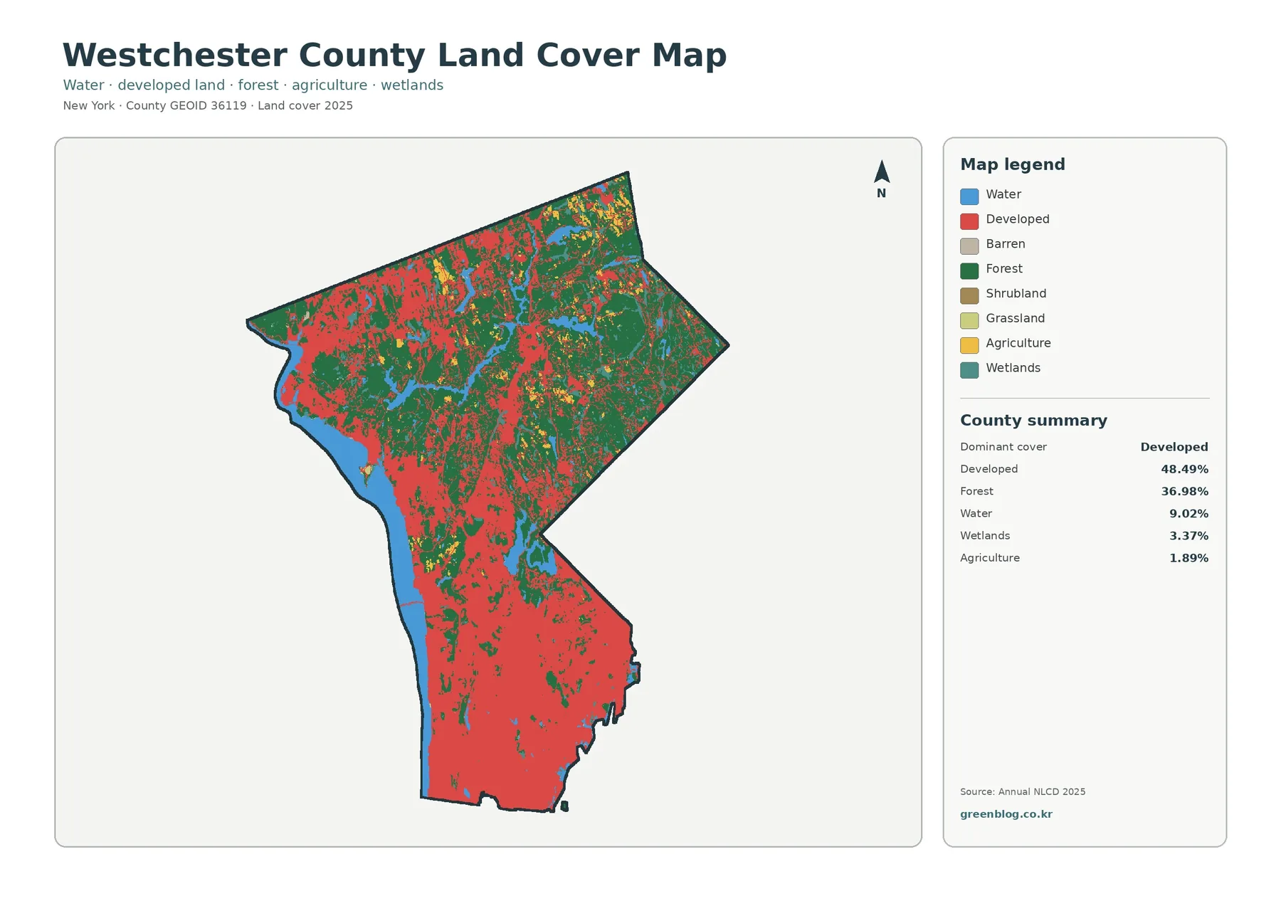
Westchester County New York Land Cover Map – Developed South, Northern Forests & JPG Download
Westchester County’s 2025 land-cover map is dominated by developed cover at 48.49 percent, with forest close behind at 36.98 percent. […]
Westchester County’s 2025 land-cover map is dominated by developed cover at 48.49 percent, with forest close behind at 36.98 percent. […]
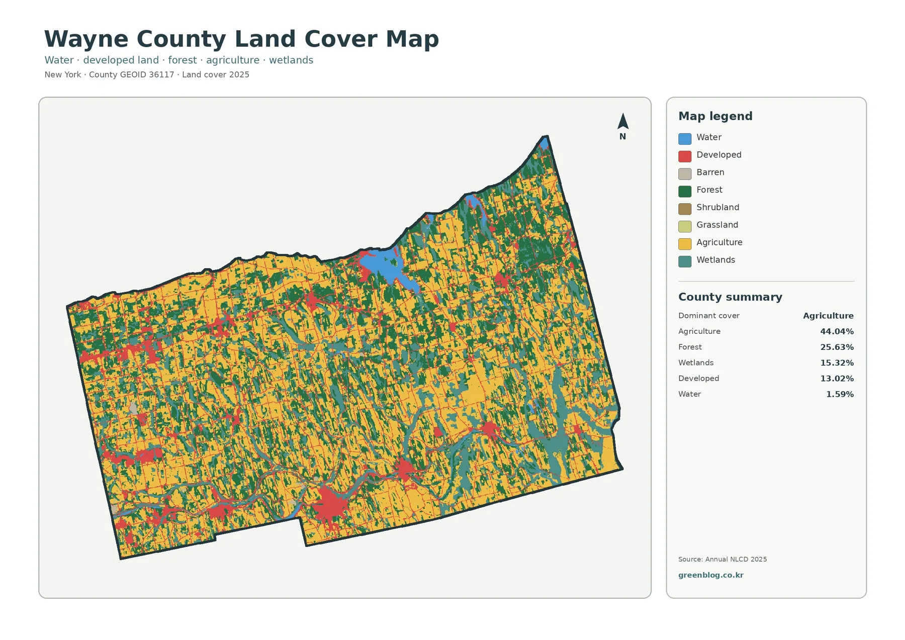
Wayne County, New York is a farm-dominated county on the south shore of Lake Ontario, but the 2025 land-cover map
Wayne County New York Land Cover Map: Farm Belt, Sodus Bay, and Local Development Read More »
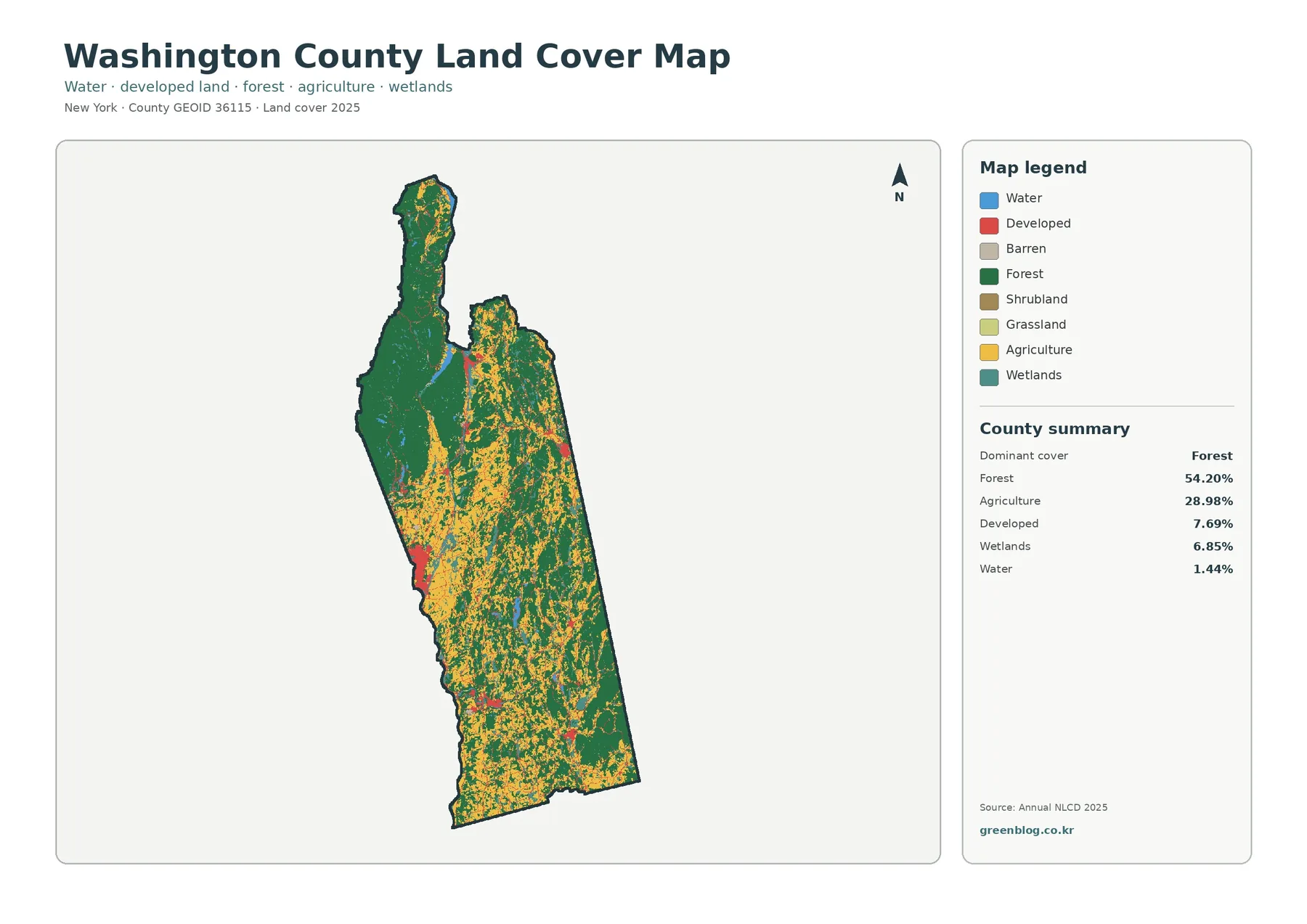
Washington County stretches north to south along New York’s border with Vermont, and its land cover changes noticeably from one
Washington County New York Land Cover Map – Forest, Farms & JPG Download Read More »
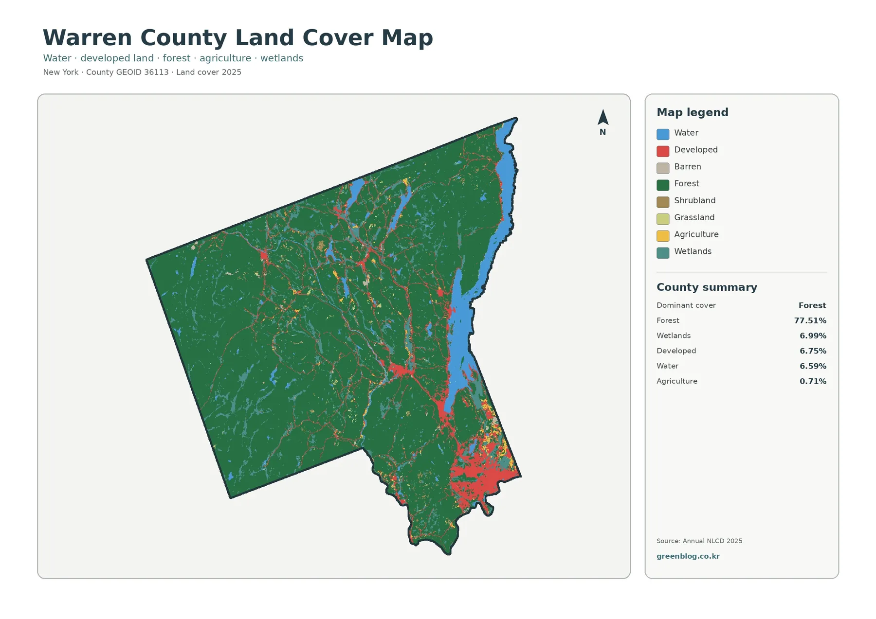
Forest is the defining land-cover pattern in Warren County in 2025. It accounts for 77.51% of the county, while large
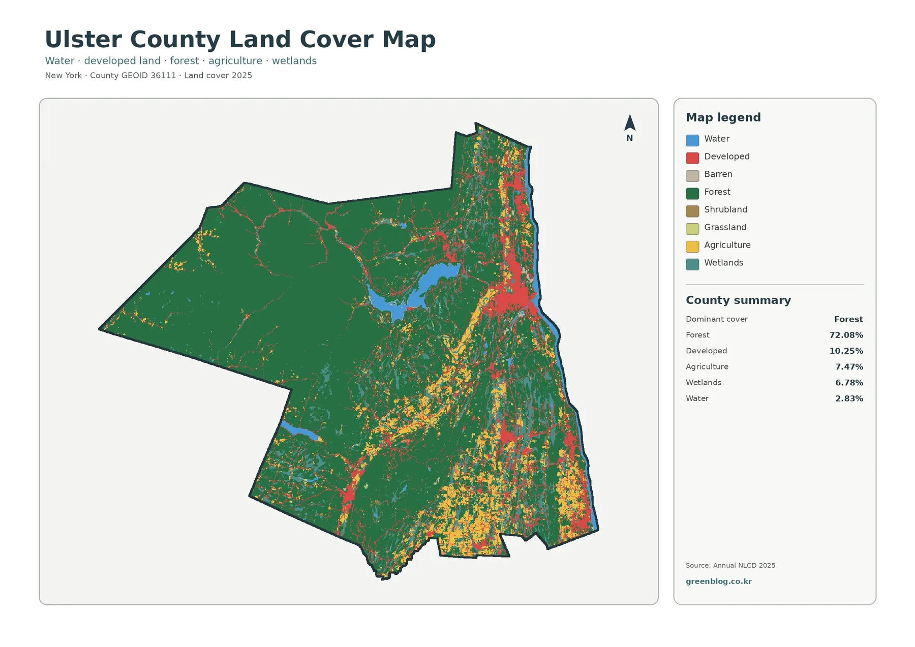
Forest is the defining land-cover pattern in Ulster County in the 2025 map set. It accounts for 72.08% of the
Ulster County New York Land Cover Map: Forest Majority and Eastern Developed Areas Read More »
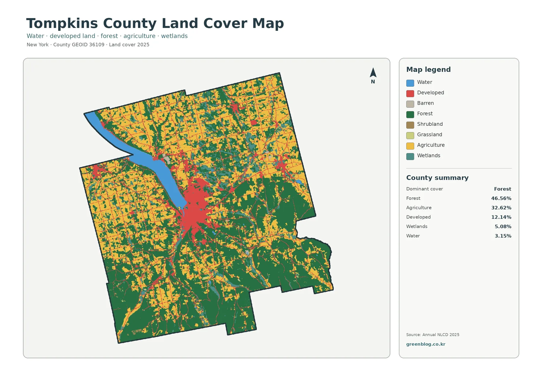
Tompkins County is a mixed forest-and-farm landscape in the 2025 classification rather than a county defined by one cover alone.
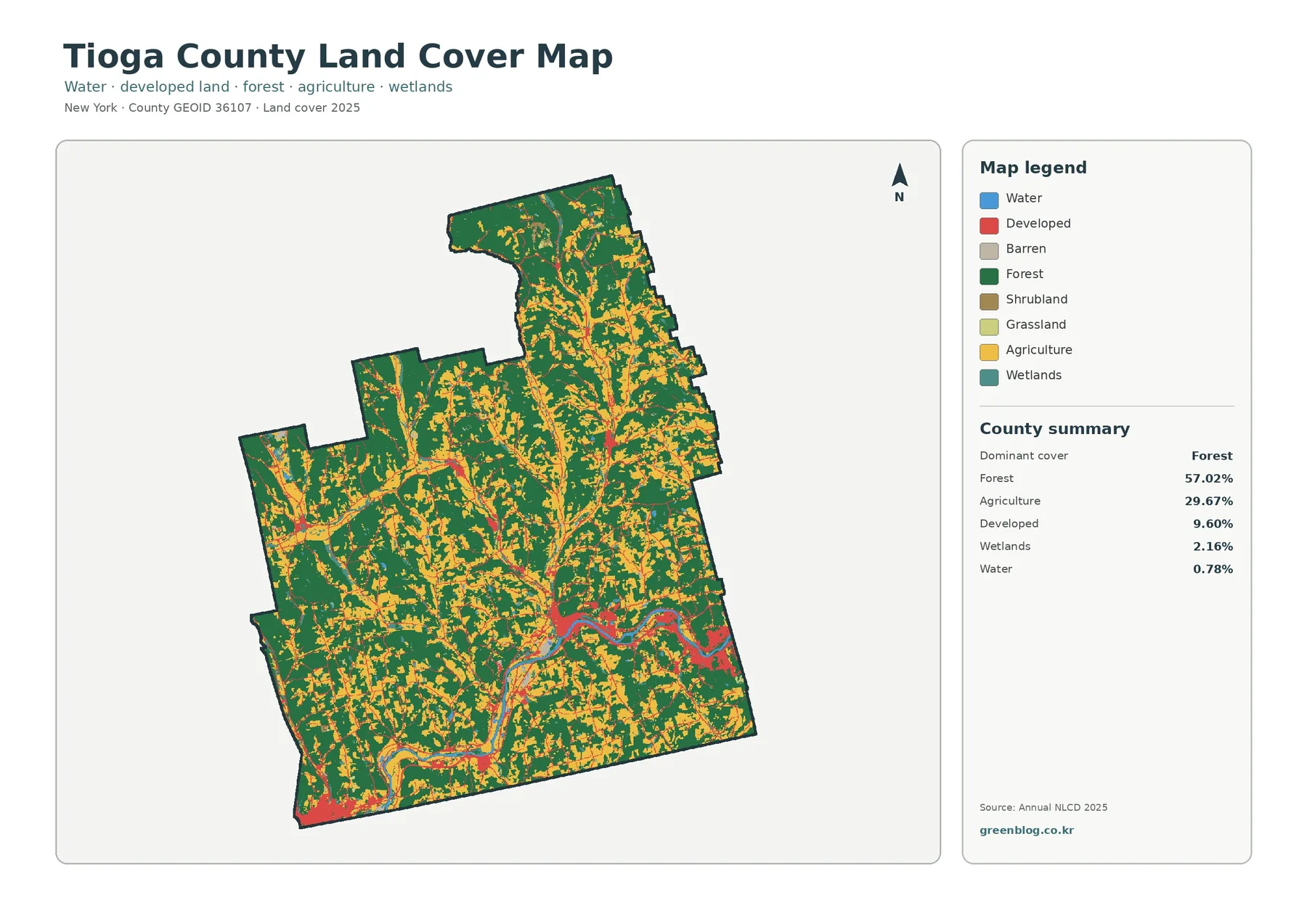
Tioga County has a strongly rural land-cover pattern in 2025: forest occupies 57.02% of the county, agriculture 29.67%, developed land
Tioga County New York Land Cover Map – Forested Uplands Around the Susquehanna Valley Read More »
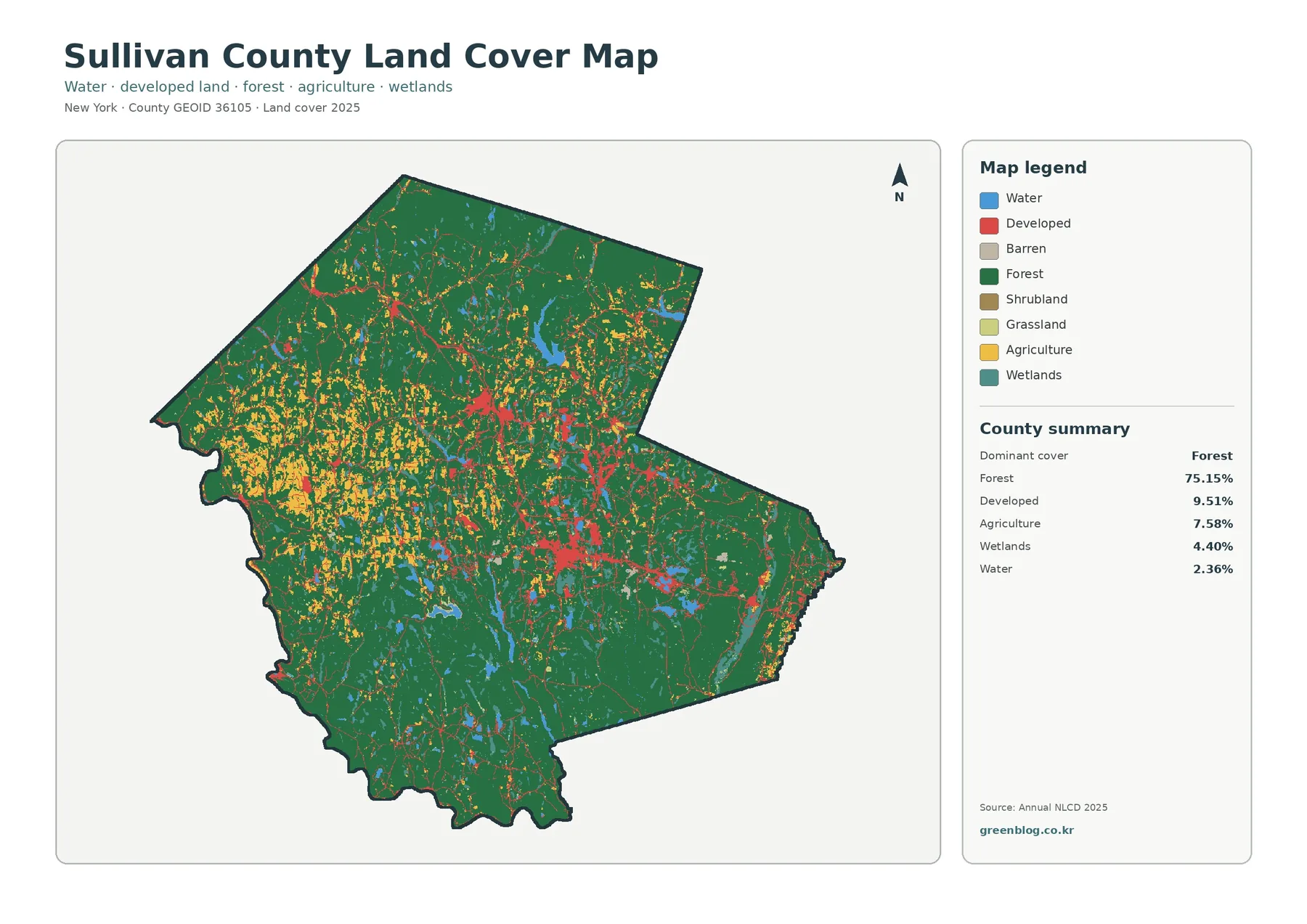
Forest sets the visual baseline for Sullivan County. In the supplied 2025 summary, forest covers 75.15 percent of the mapped
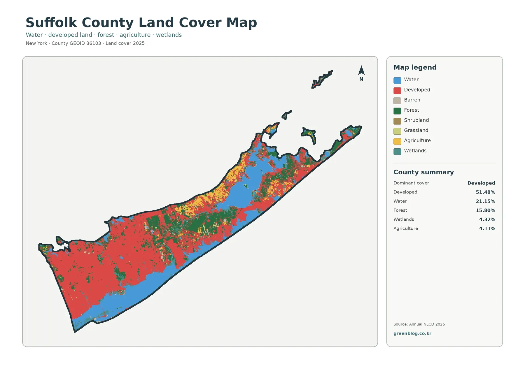
Suffolk County changes character markedly from west to east, and the 2025 land-cover data make that contrast easy to see.