
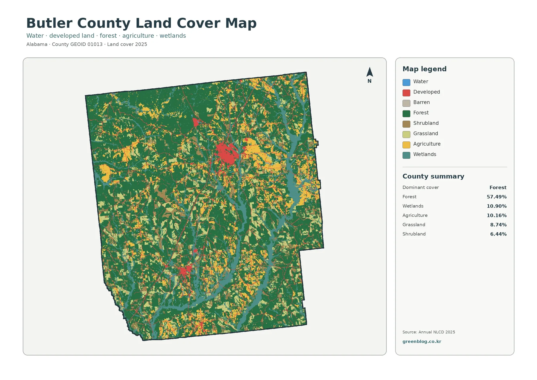
Butler County Alabama Land Cover Map: Forest, Creek Wetlands & Greenville–Georgiana Development
Butler County in south-central Alabama is predominantly forested in the 2025 land-cover data, yet the county is far from uniform. […]
Butler County in south-central Alabama is predominantly forested in the 2025 land-cover data, yet the county is far from uniform. […]
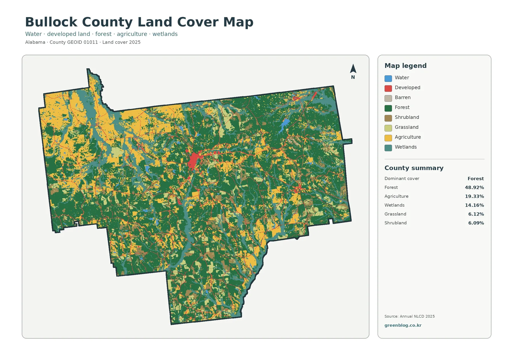
Bullock County’s 2025 land-cover pattern is led by forest, but the county is not a single continuous block of woodland.
Bullock County Alabama Land Cover Map — Forest-Led 2025 Cover and Four JPG Views Read More »
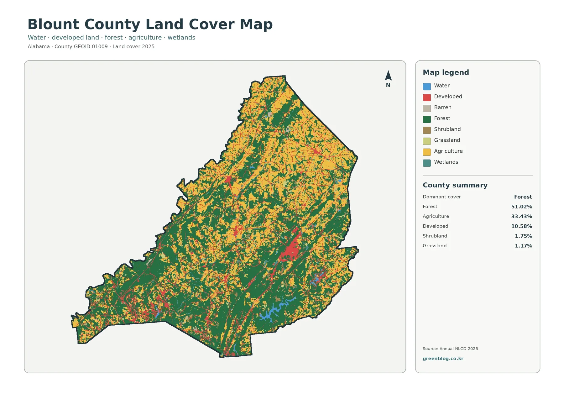
Blount County has a strongly mixed forest-and-agriculture landscape in the supplied 2025 land-cover data. Forest is the largest class at
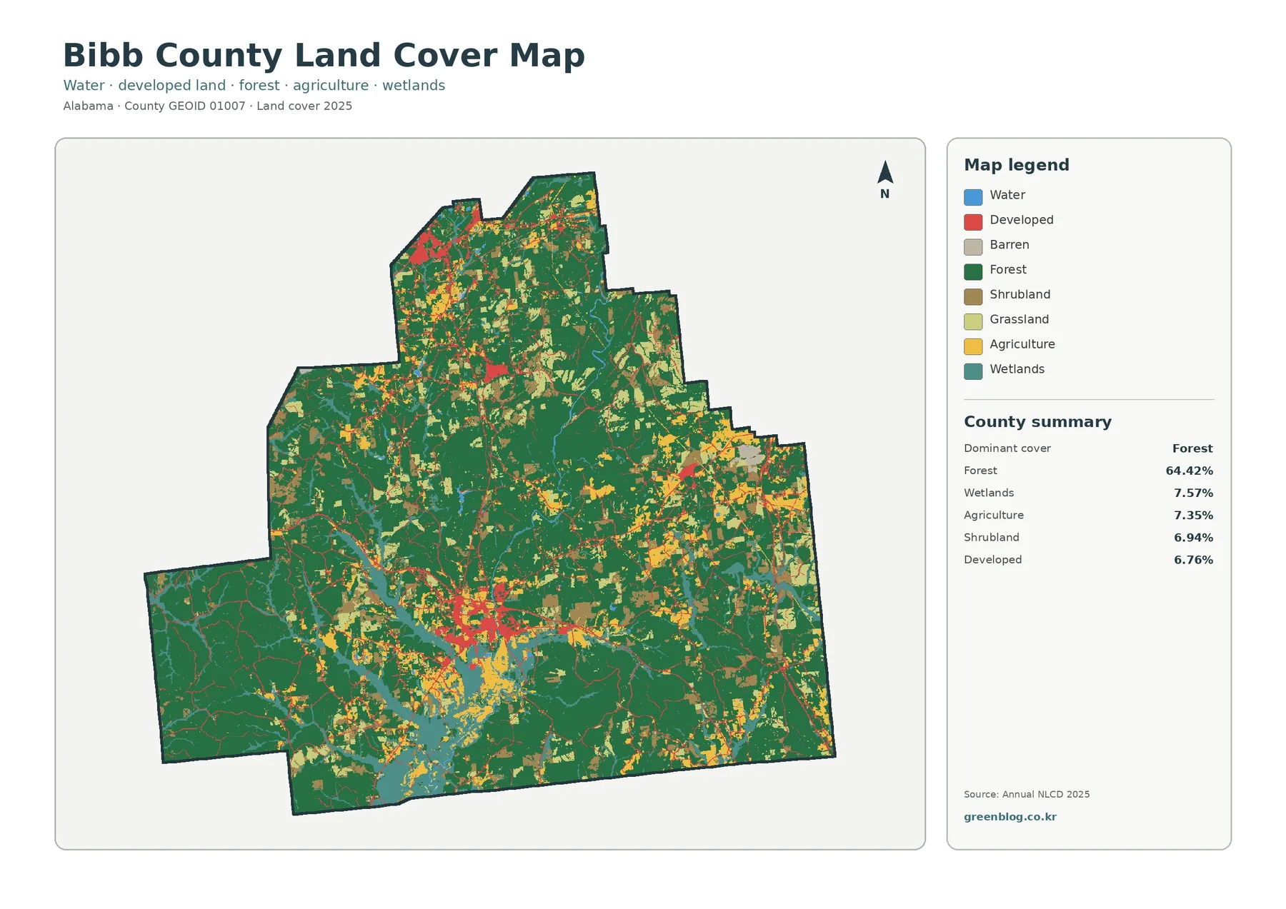
Bibb County is predominantly wooded in the supplied 2025 land-cover data. Forest accounts for 64.42% of the county, while wetlands,
Bibb County Alabama Land Cover Map – Forested Landscape, Built Clusters & Cahaba Context Read More »
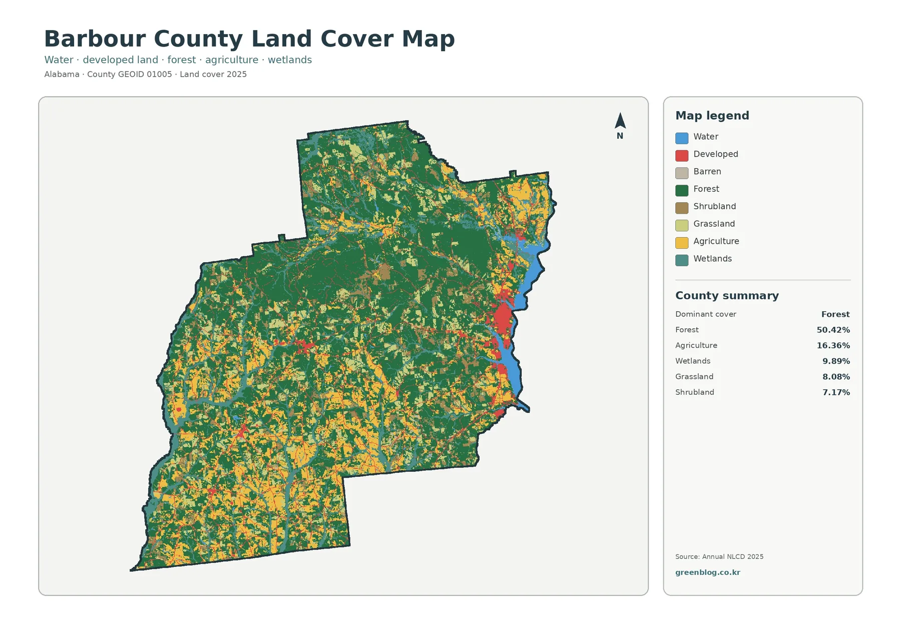
Barbour County’s 2025 land-cover maps show a county where forest is the dominant surface but not the only story. Forest
Barbour County Alabama Land Cover Map – Forest Cover, Farm Patches & Eufaula River Edge Read More »
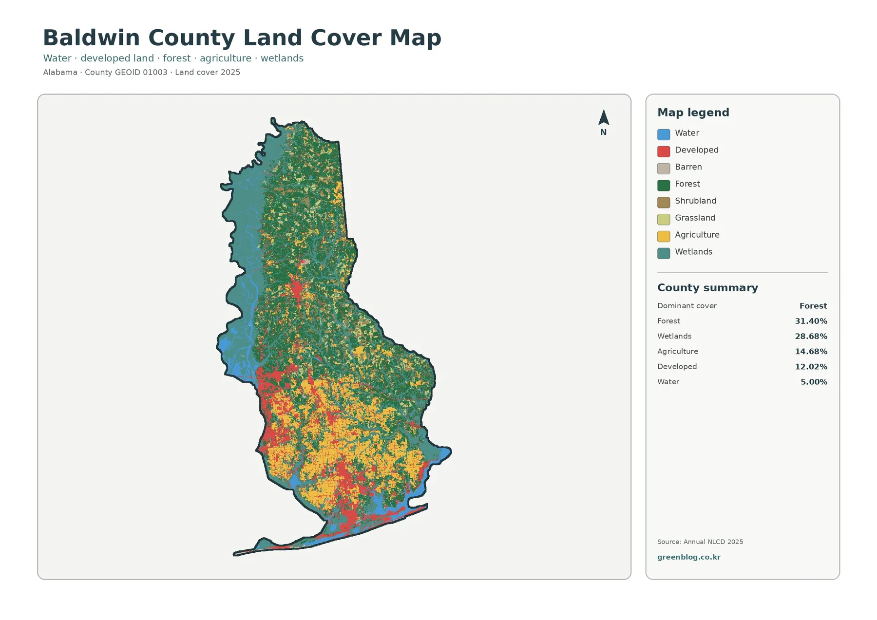
Baldwin County has a land-cover pattern shaped as much by water and wetlands as by forest, farming, and developed areas.
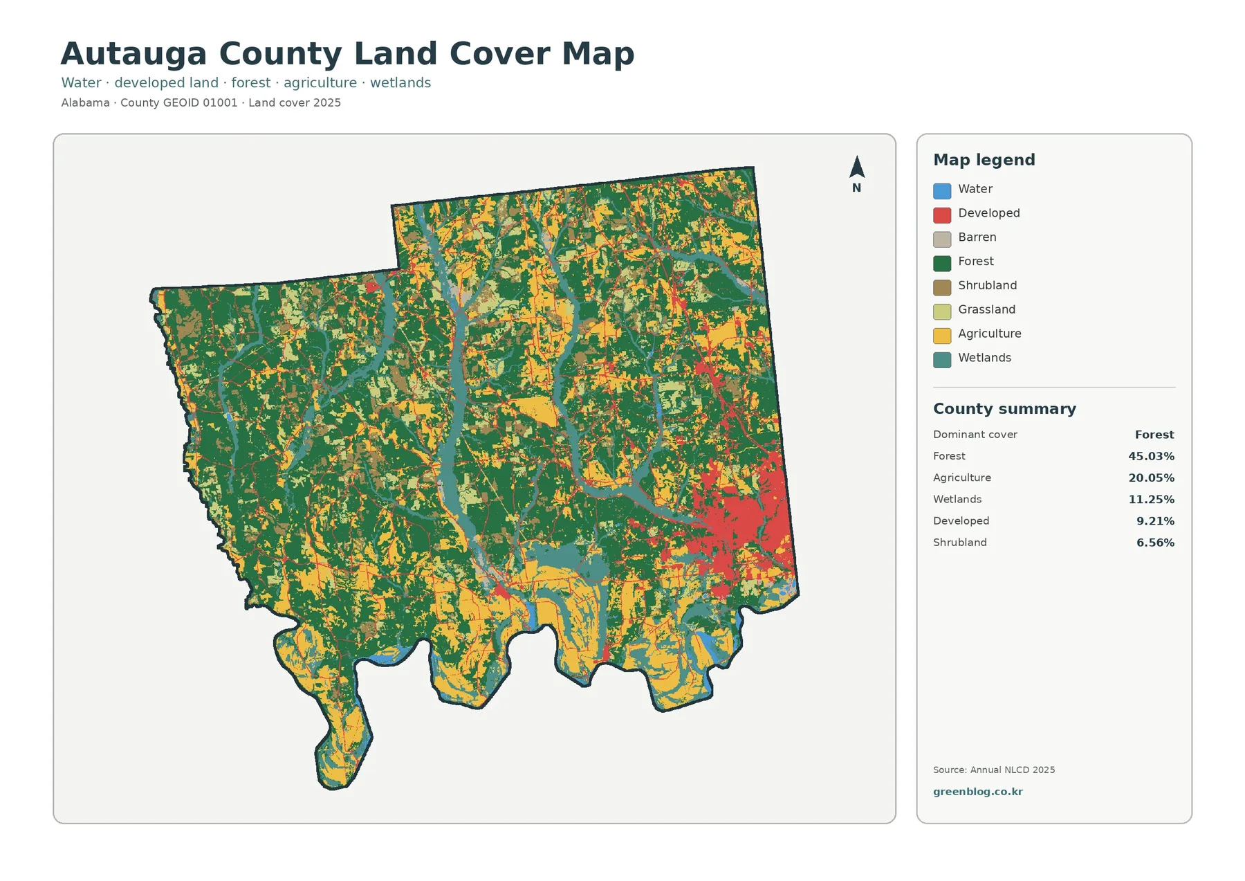
Forest leads Autauga County’s 2025 land-cover summary at 45.03%, followed by agriculture at 20.05%, wetlands at 11.25%, and developed land
Autauga County Alabama Land Cover Map – Wooded West, Prattville Hard Surfaces & Wetlands Read More »
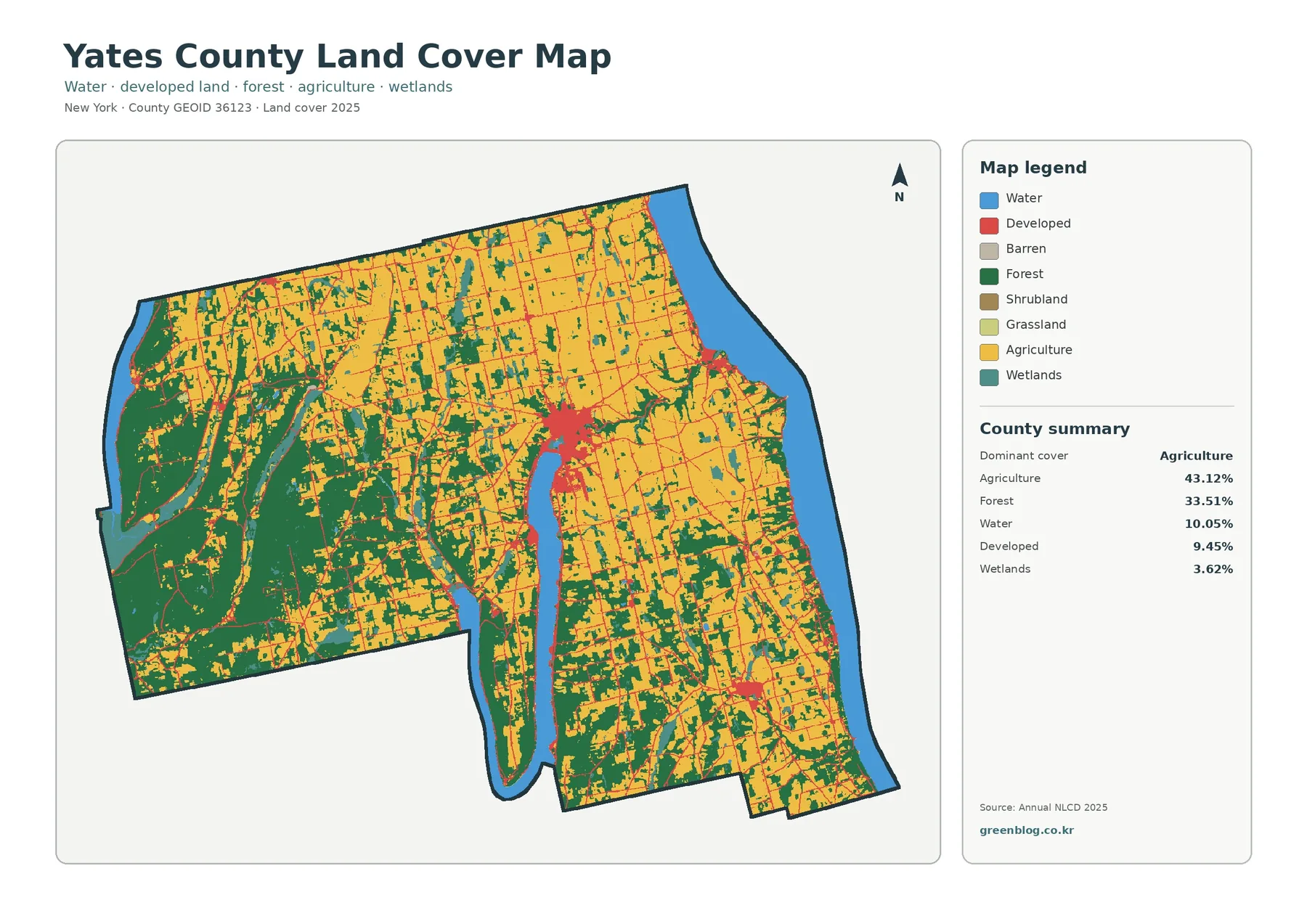
Yates County’s 2025 land-cover pattern is led by agriculture at 43.12%, followed by forest at 33.51%. The map does not
Yates County New York Land Cover Map: Farm-Dominant Interior, Forest Blocks & Lake Edges Read More »
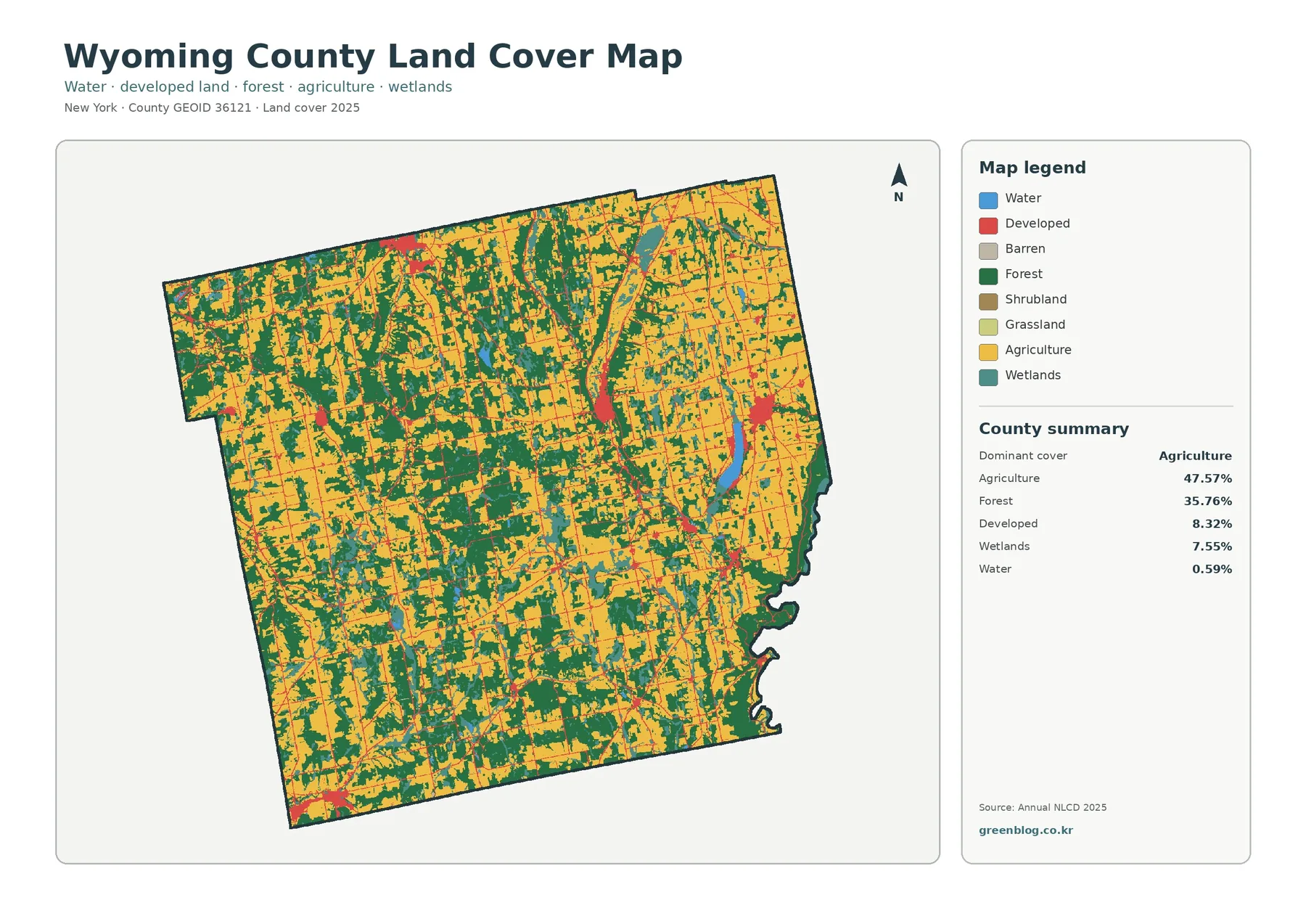
Wyoming County’s 2025 land-cover pattern is led by agriculture at 47.57%, with forest covering another 35.76%. Developed land accounts for
Wyoming County New York Land Cover Map: Farms, Forest Patches, and Wetland Corridors Read More »