
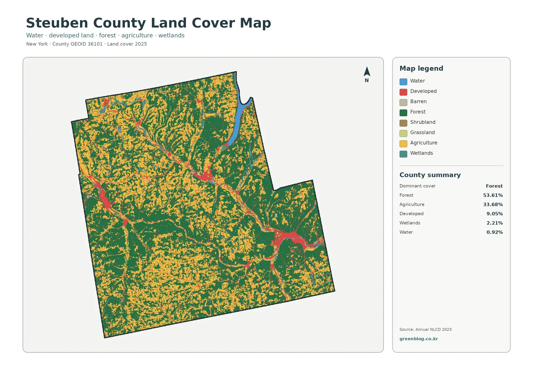
Steuben County New York Land Cover Map — Farm Valleys, Forested Uplands, and Small Urban Centers
Steuben County’s 2025 land-cover pattern is defined by two large surfaces rather than one: forest covers 53.61% of the county […]
Steuben County’s 2025 land-cover pattern is defined by two large surfaces rather than one: forest covers 53.61% of the county […]
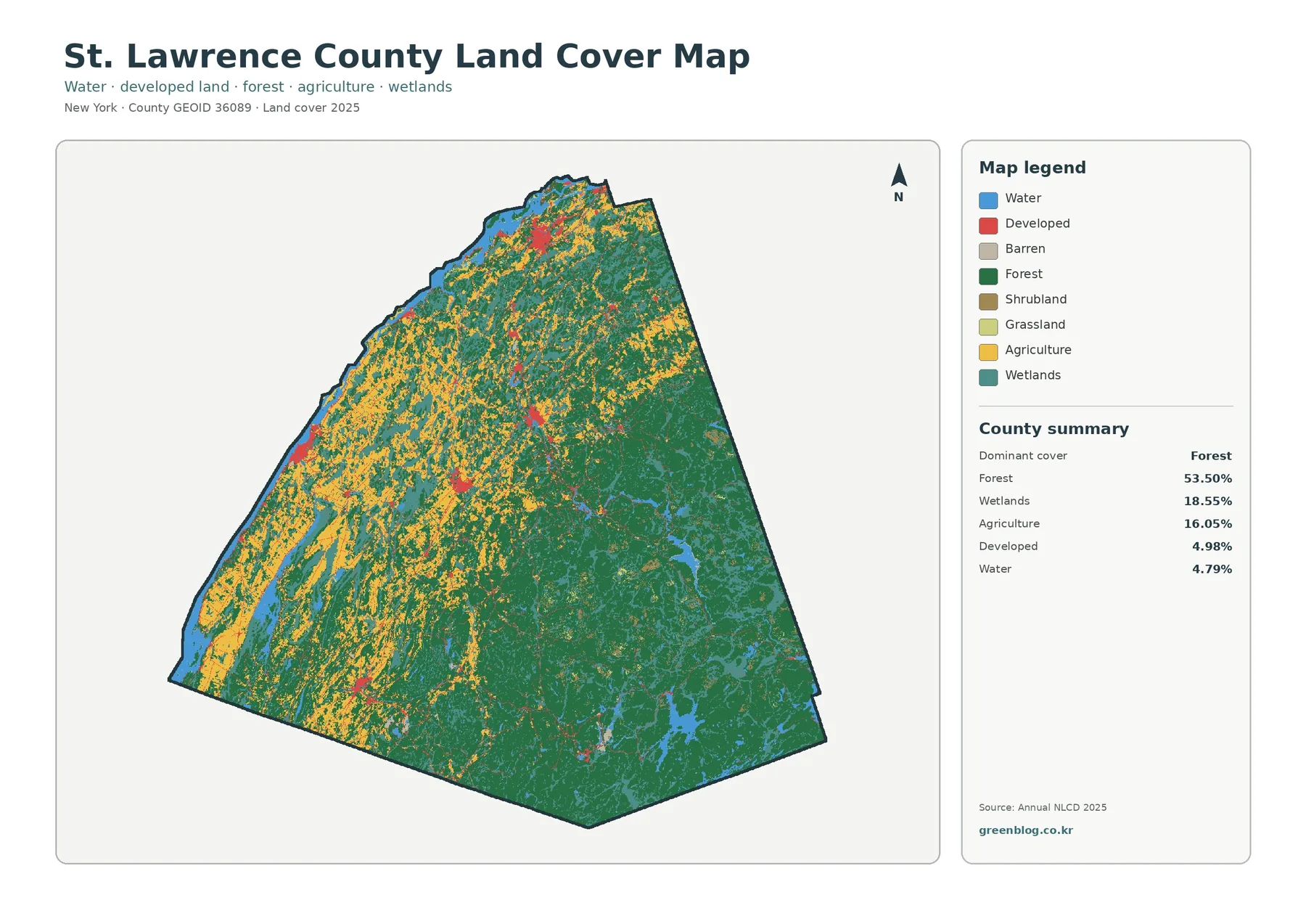
A single countywide average does not describe St. Lawrence County very well because its west and southeast look strikingly different.
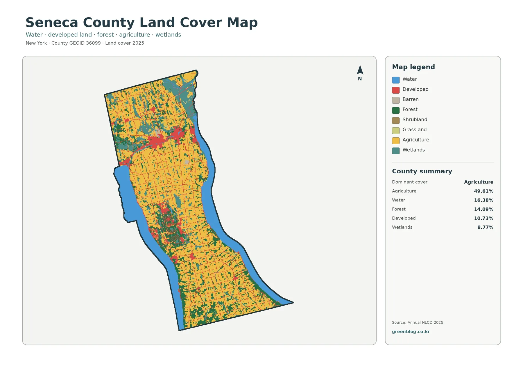
Seneca County has a map pattern that is easy to recognize before any numbers are read. Agriculture fills much of
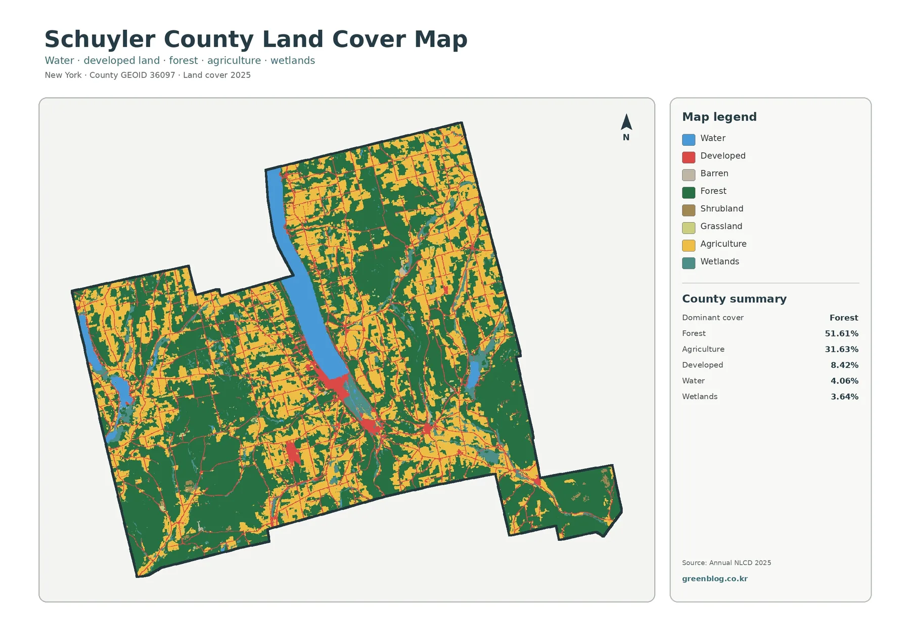
Schuyler County, New York, is predominantly a forest-and-farm landscape in the 2025 land-cover summary. Forest accounts for 51.61 percent and
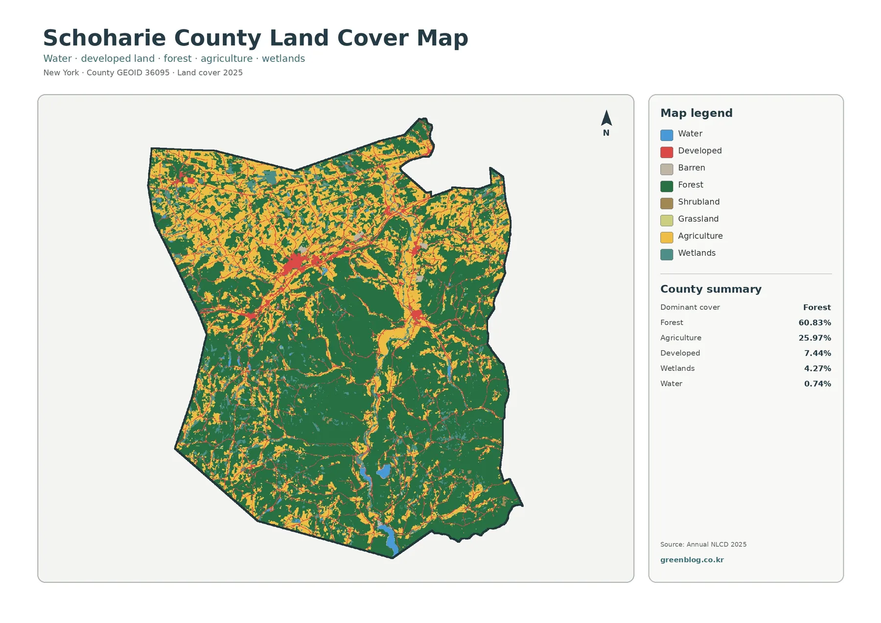
Schoharie County is overwhelmingly green on the 2025 land-cover map, but the county is not uniform. Forest accounts for 60.83%
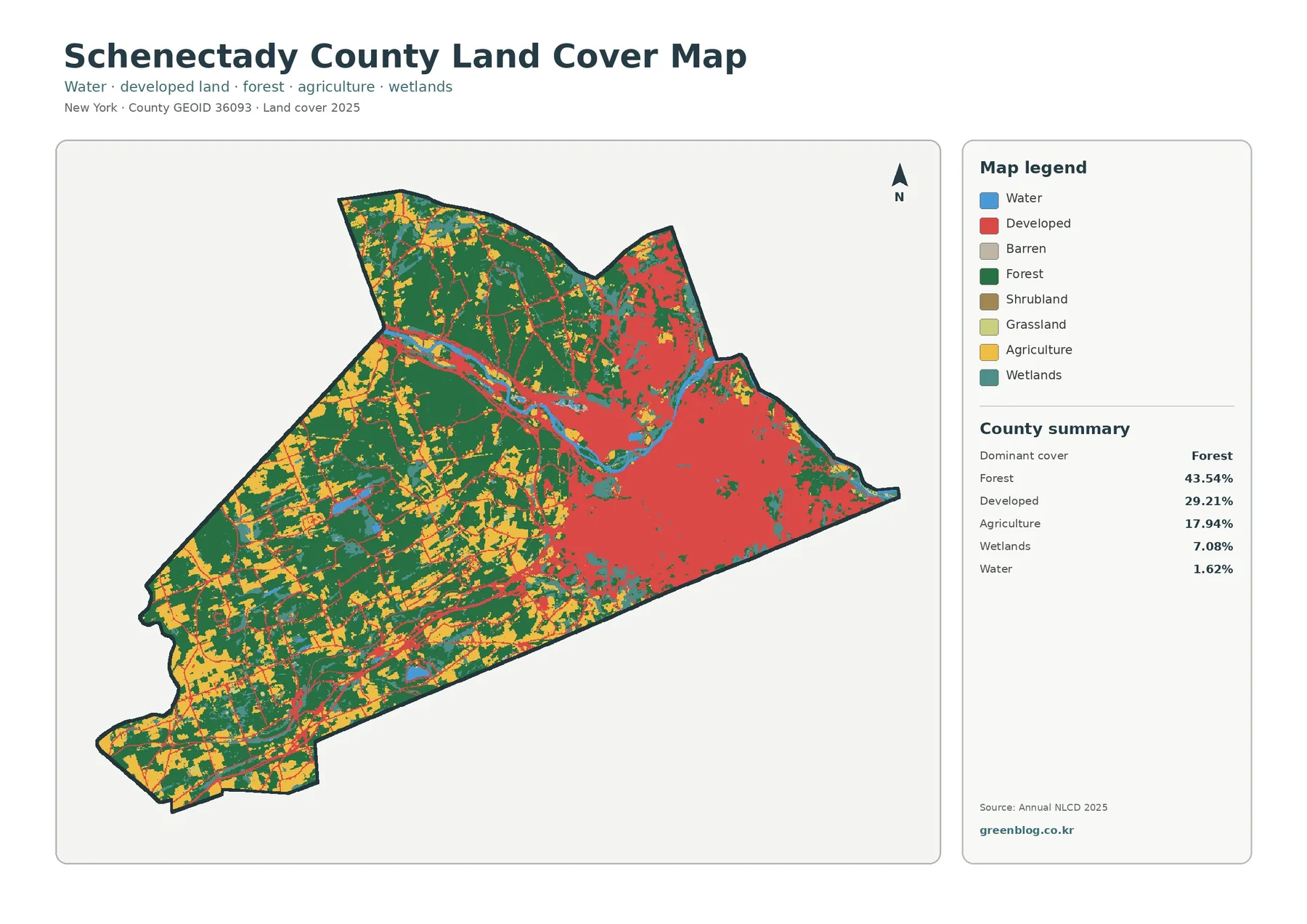
Schenectady County has a compact outline, but its land-cover pattern changes sharply from east to west. The urbanized surface around
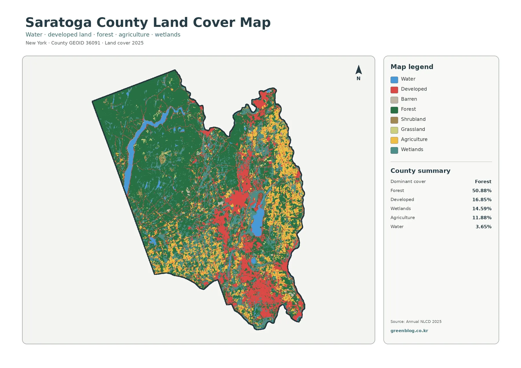
Saratoga County has one of the clearest west-to-east land-cover contrasts in this New York map series. Forest covers 50.88% of
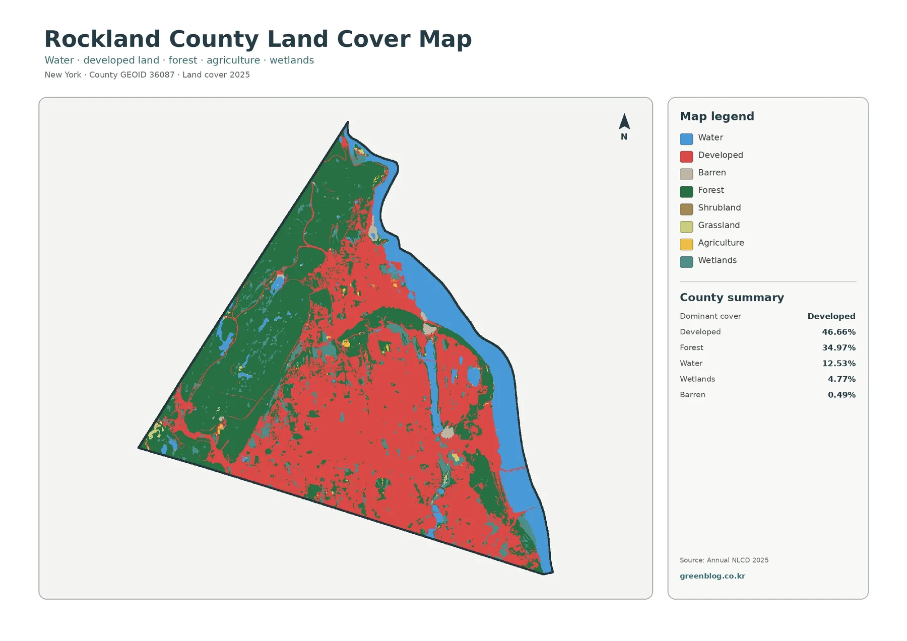
Rockland County has a sharp land-cover contrast that is easy to see even before reading the legend. Developed land spreads
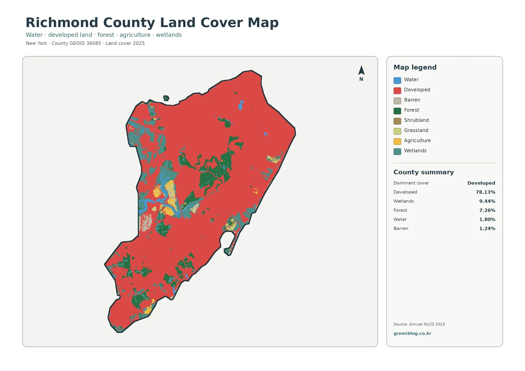
Richmond County covers Staten Island, and its 2025 land-cover summary is dominated by developed land at 78.13%. That figure is