
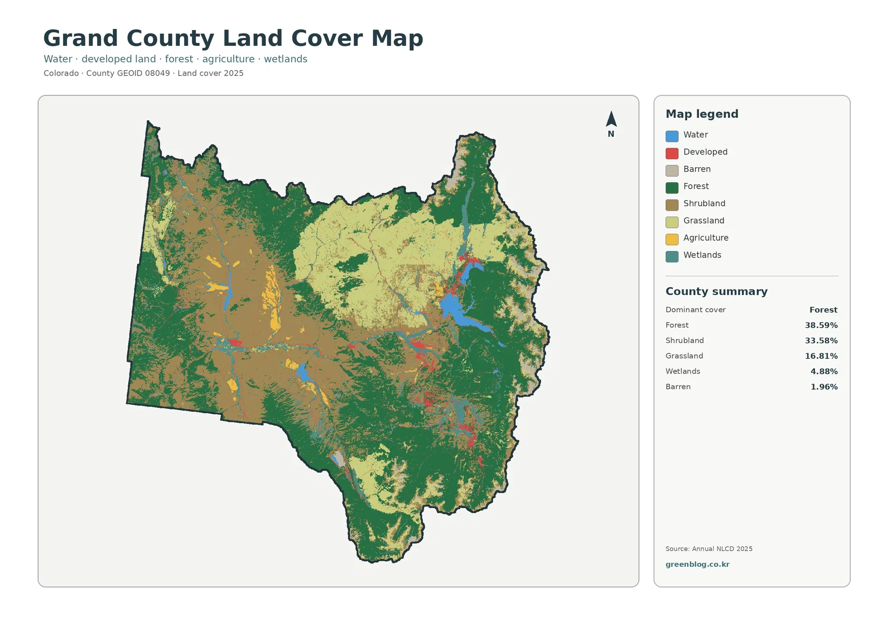
Grand County Colorado Land Cover Map | Middle Park Forests, Three Lakes Water, and Long-Term Change
Grand County is a mountain-basin landscape where forest, shrubland, and grassland share the map rather than one class covering everything. […]
Grand County is a mountain-basin landscape where forest, shrubland, and grassland share the map rather than one class covering everything. […]
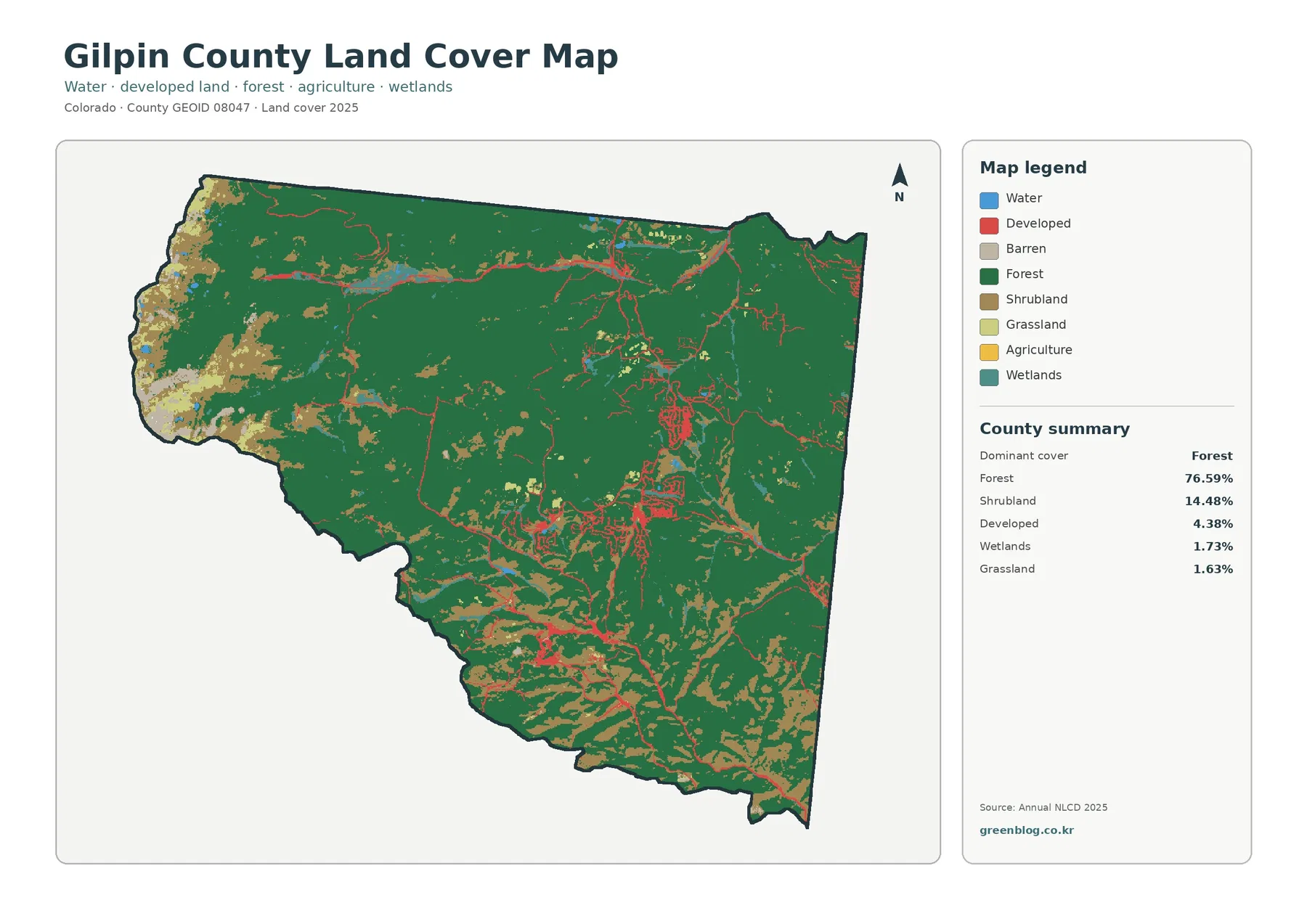
Forest dominates Gilpin County in the 2025 land-cover summary, covering 76.59% of this small mountain county. The map is not
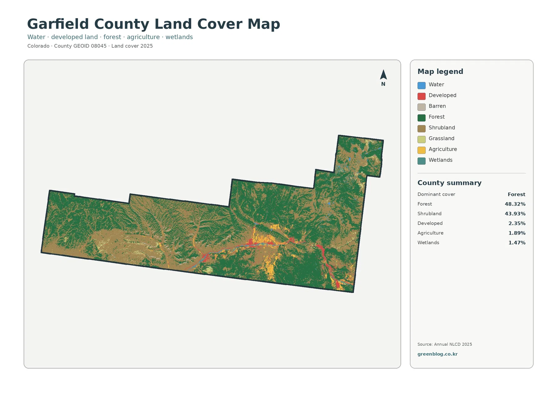
Forest and shrubland cover almost all of Garfield County in the 2025 summary, yet the county does not look uniform
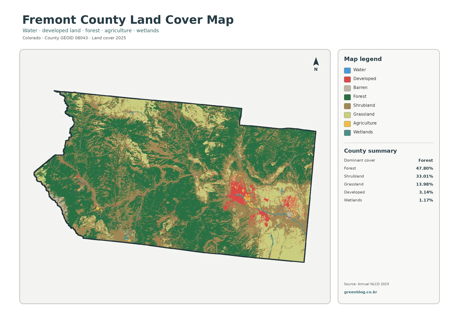
Fremont County is mostly forest and shrubland in the 2025 land-cover summary, but those two classes do not cover the
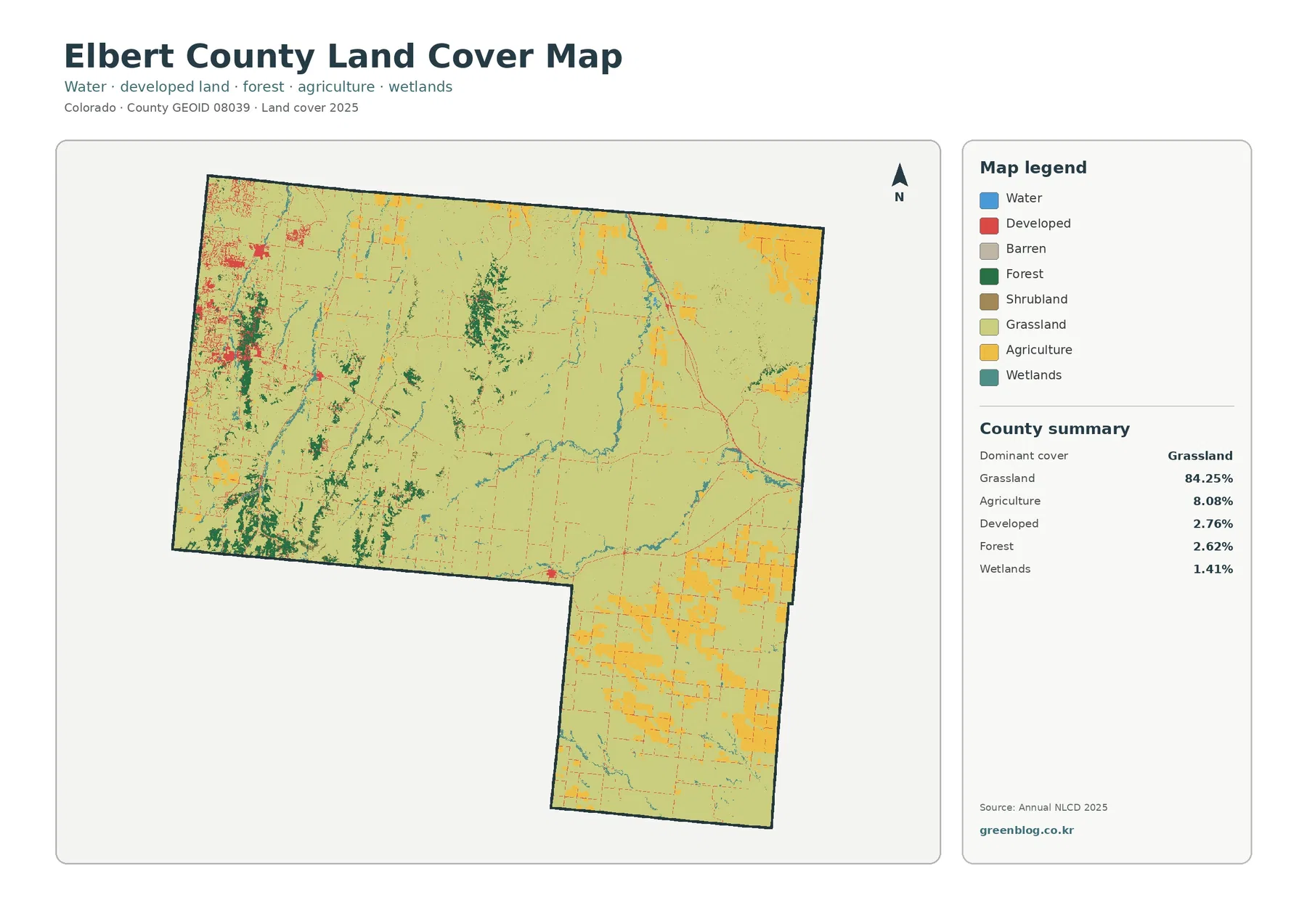
Elbert County is primarily grassland in the 2025 land-cover summary, but the map is more varied than the 84.25% figure
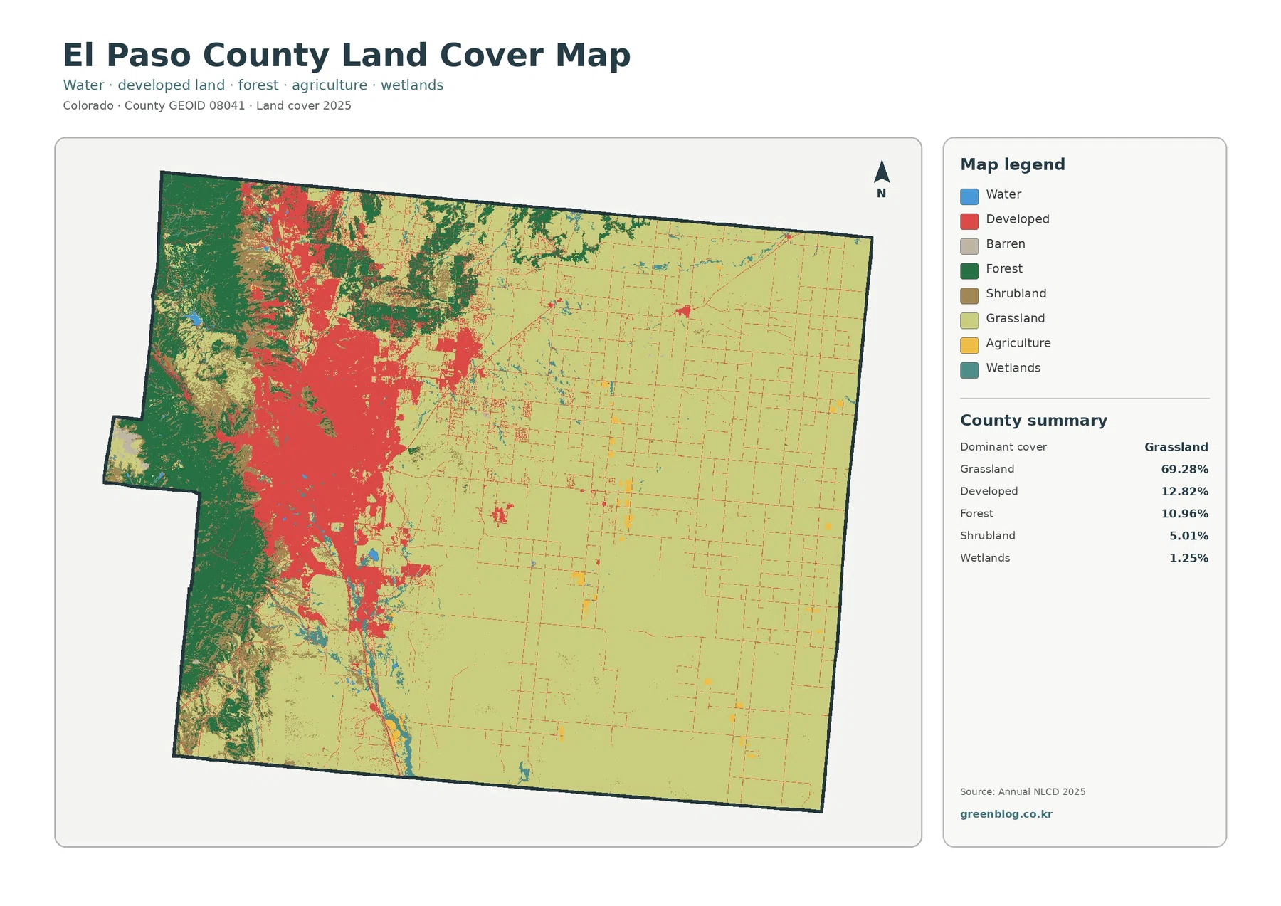
El Paso County has one of the clearest west-to-east land-cover contrasts in Colorado. Forest occupies much of the mountainous western
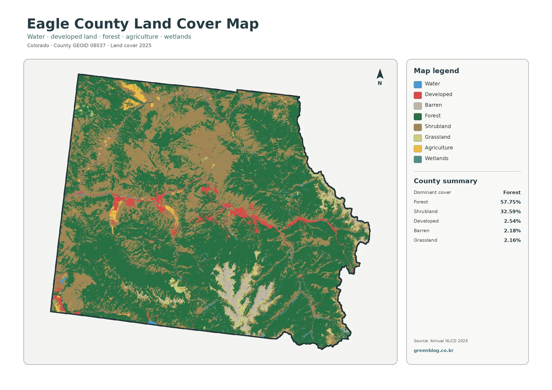
Eagle County is overwhelmingly covered by forest and shrubland in the 2025 summary. Forest accounts for 57.75% of the county
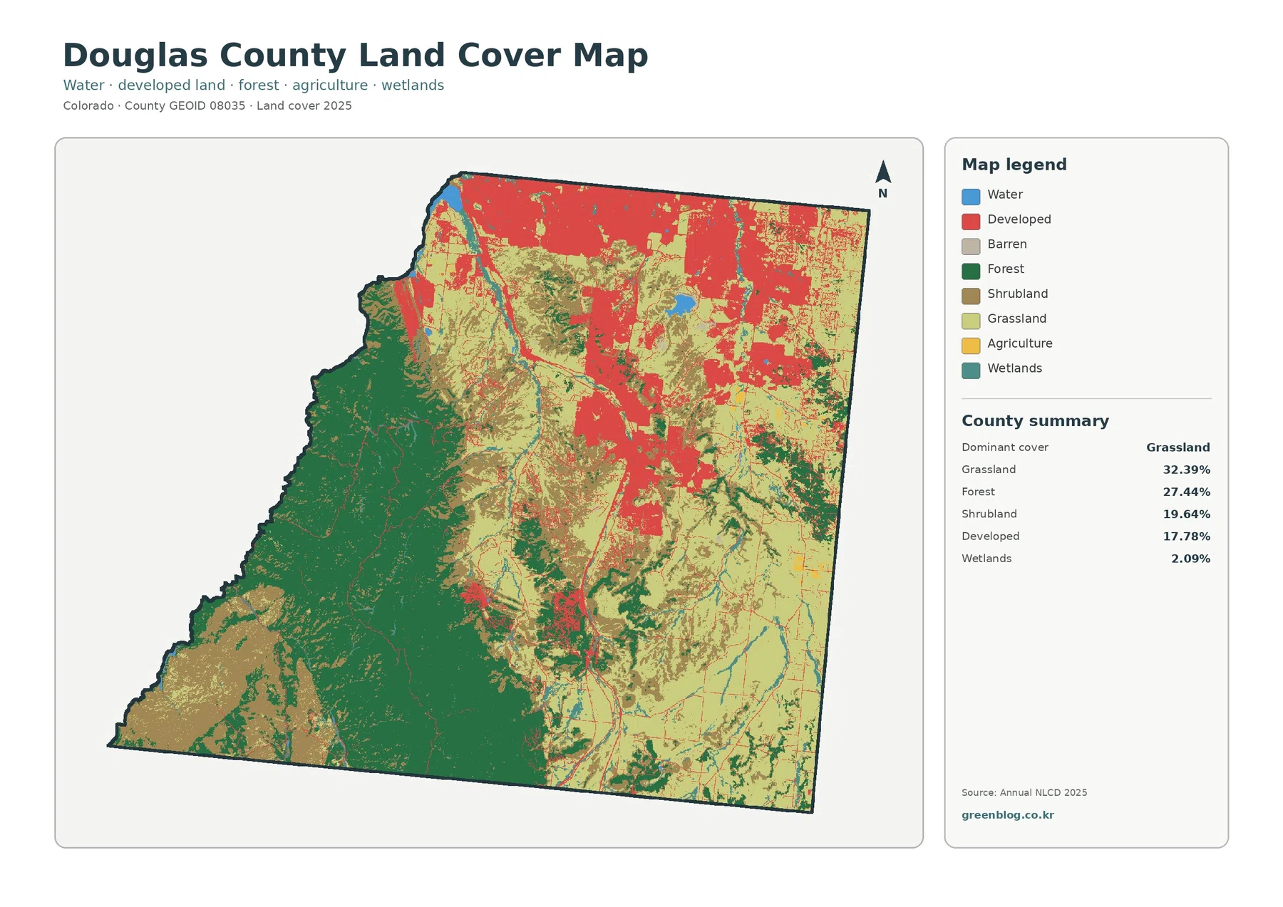
Douglas County has a strongly divided 2025 land-cover pattern rather than one countywide surface type. Grassland is the largest class
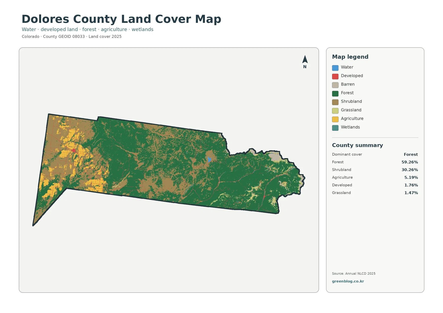
Forest is the defining cover in Dolores County in the 2025 map set, but the county is not uniform from
Dolores County Colorado Land Cover Map | Forested Interior and Western Farm Patches Read More »