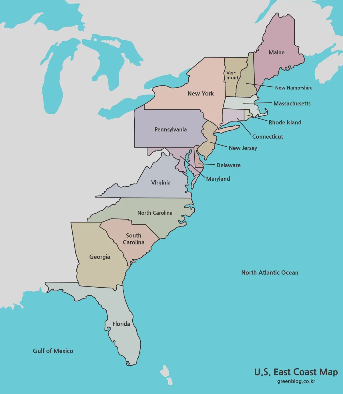
What This US East Coast map Includes from Maine to Florida
This US East Coast map shows 16 states in a continuous portrait view from Maine to Florida. Fourteen of them […]
What This US East Coast map Includes from Maine to Florida Read More »
This US East Coast map shows 16 states in a continuous portrait view from Maine to Florida. Fourteen of them […]
What This US East Coast map Includes from Maine to Florida Read More »
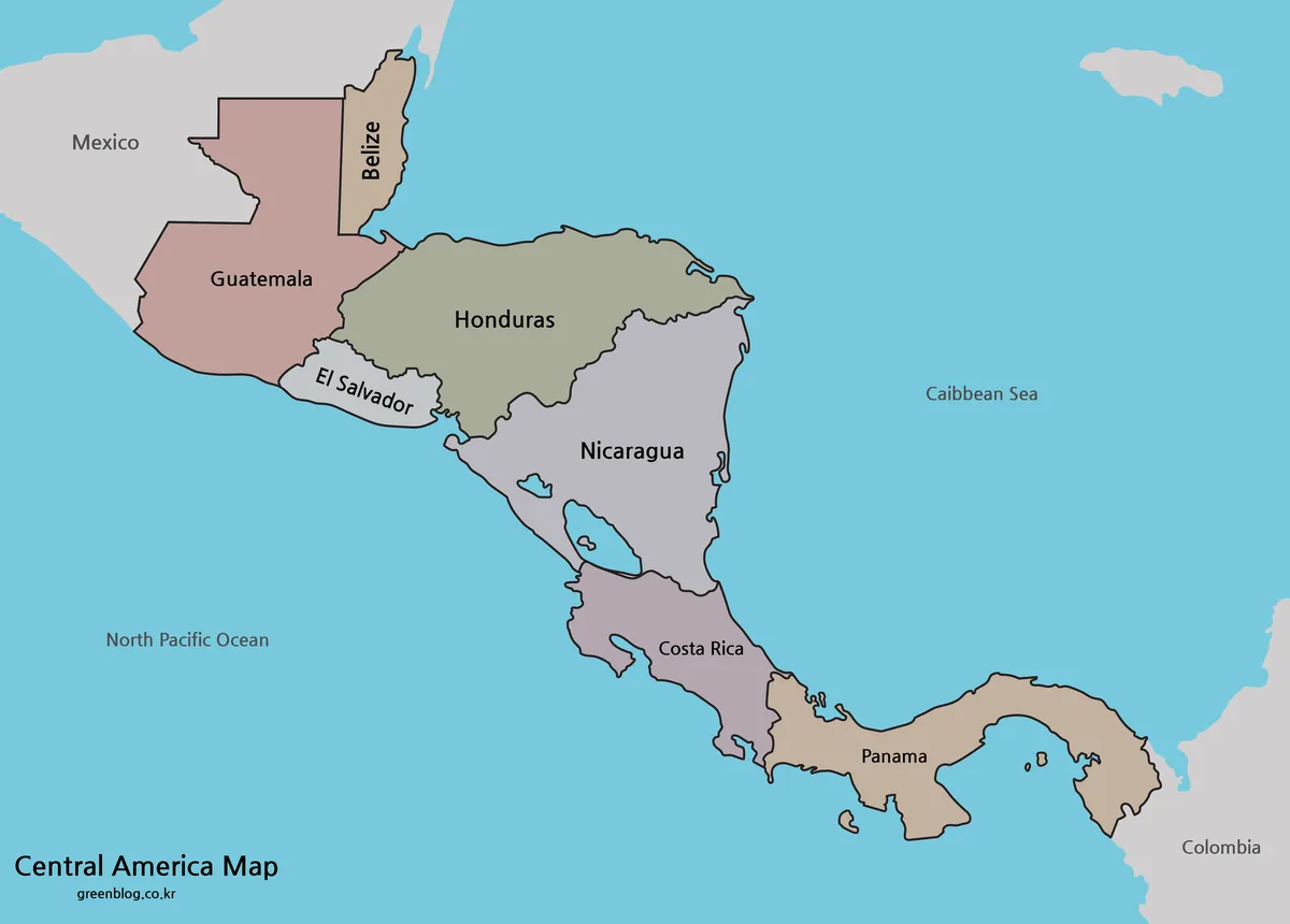
A Central America map turns a narrow isthmus that is easily compressed on a world map into a readable sequence
Between Two Coasts: Reading the Seven-Country Central America map Read More »
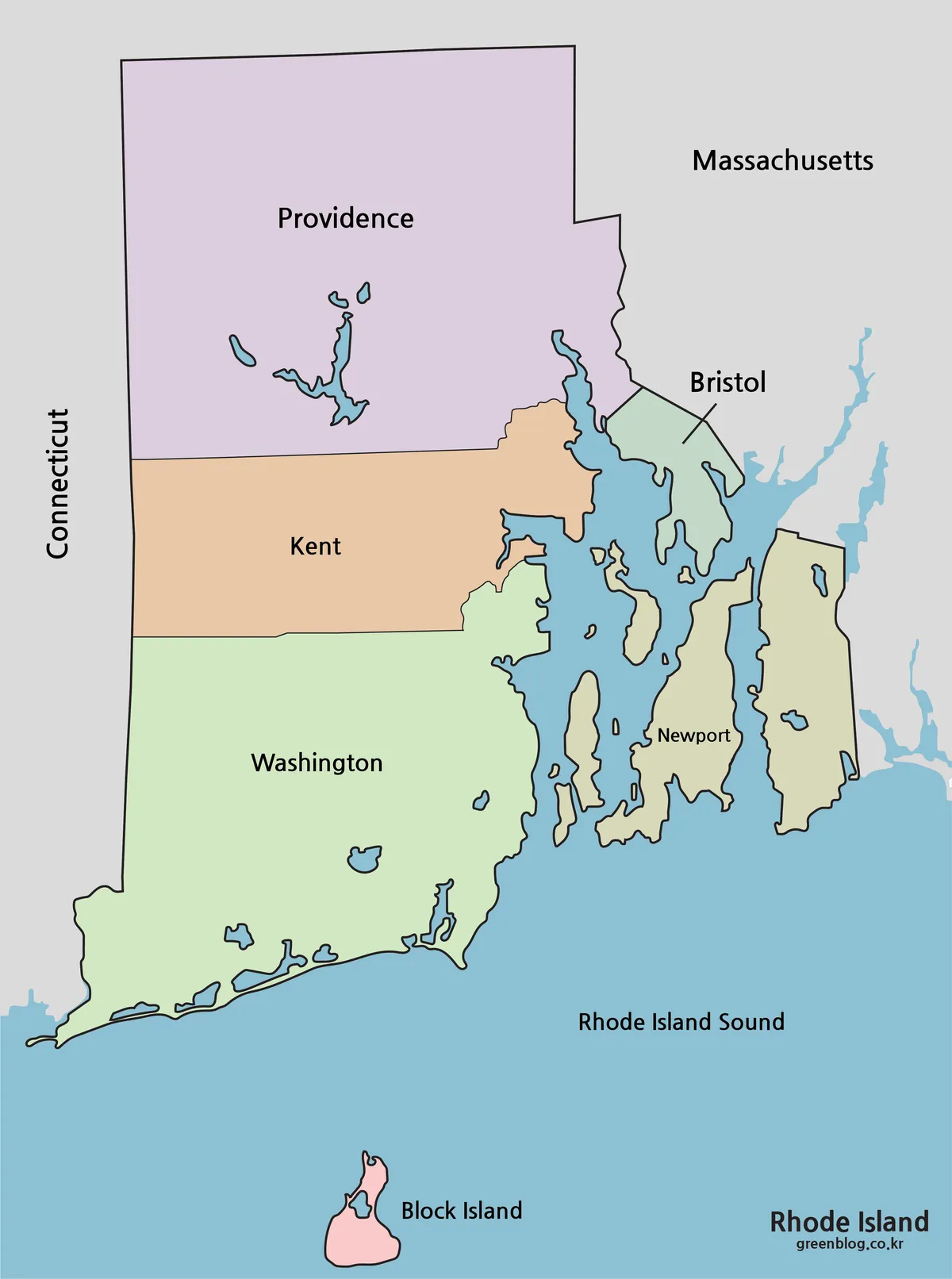
A Rhode Island map has to explain much more than the straight state borders visible on a small national map.
Rhode Island Map: Five Counties Around Bay and Sound Read More »
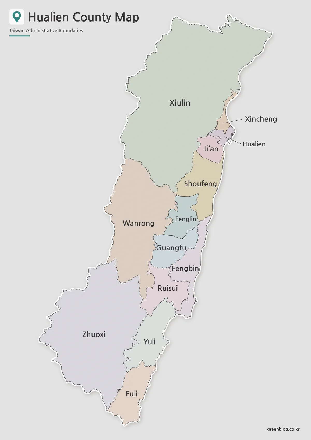
A Hualien County map needs a tall frame because the county runs for a long distance along eastern Taiwan. The
Hualien County Map Reading Key: 13 Divisions in One Long Frame Read More »
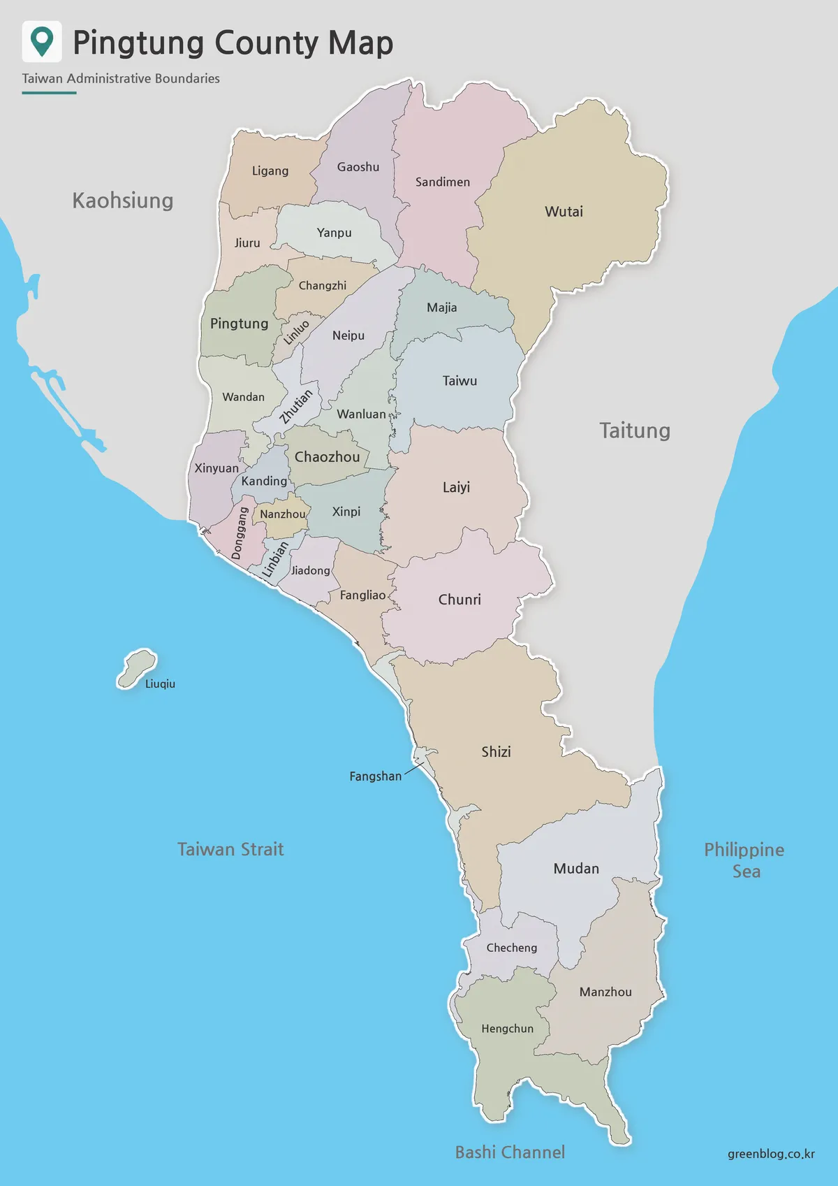
A Pingtung County map reveals a part of Taiwan whose shape is difficult to grasp on a national map. The
Pingtung County Map, Read from the Plains to the Peninsula Read More »
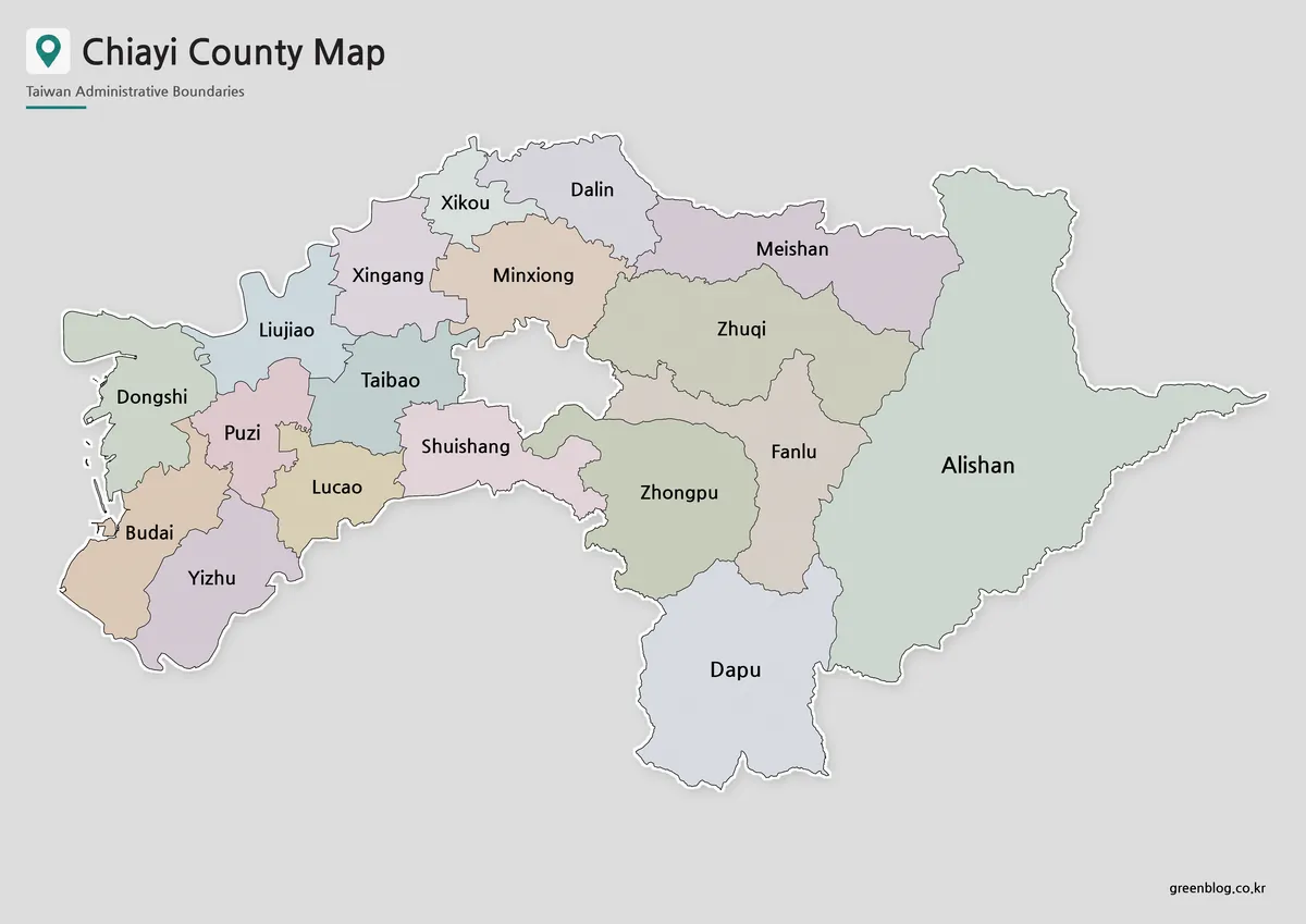
A Chiayi County Map has an unusual visual center: a gray gap where Chiayi City sits as a separate jurisdiction.
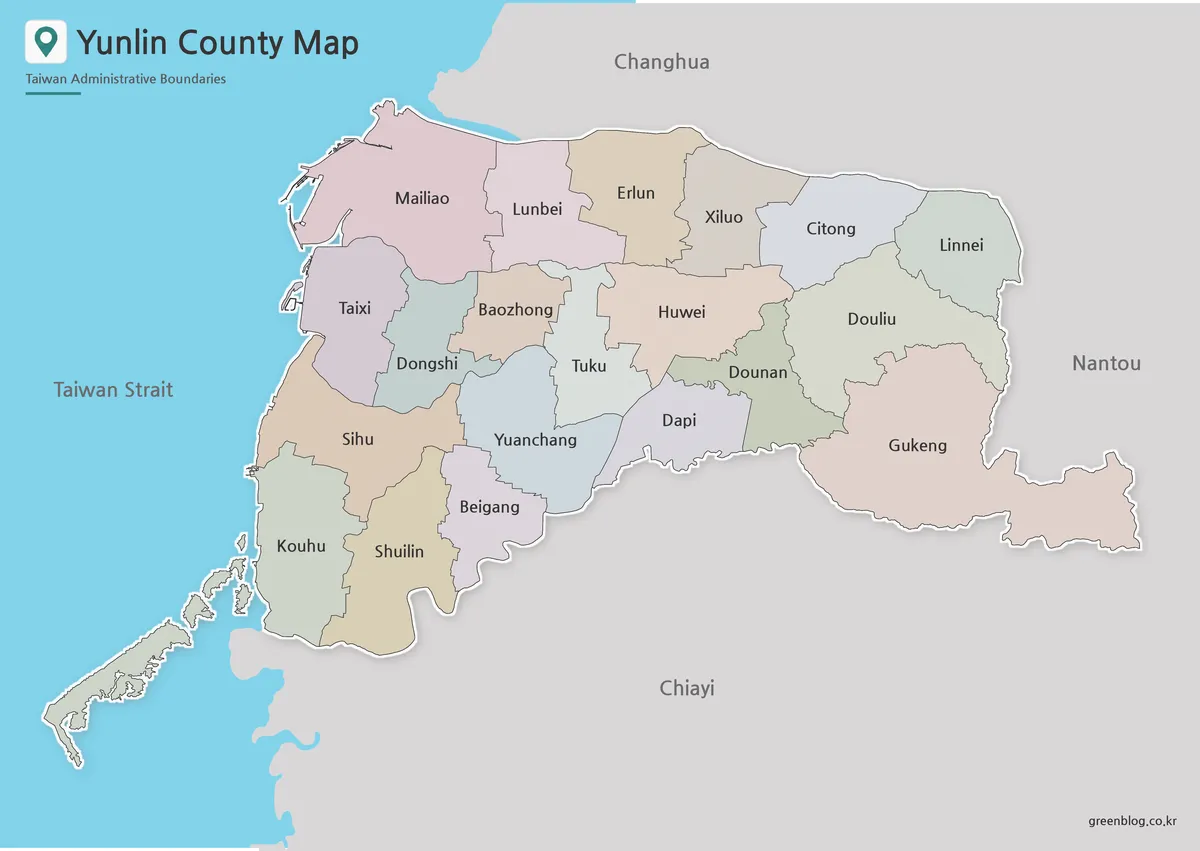
A Yunlin County map has to explain two patterns at once: a long western coast facing the Taiwan Strait and
Between the Strait and Gukeng: A Yunlin County Map Guide Read More »
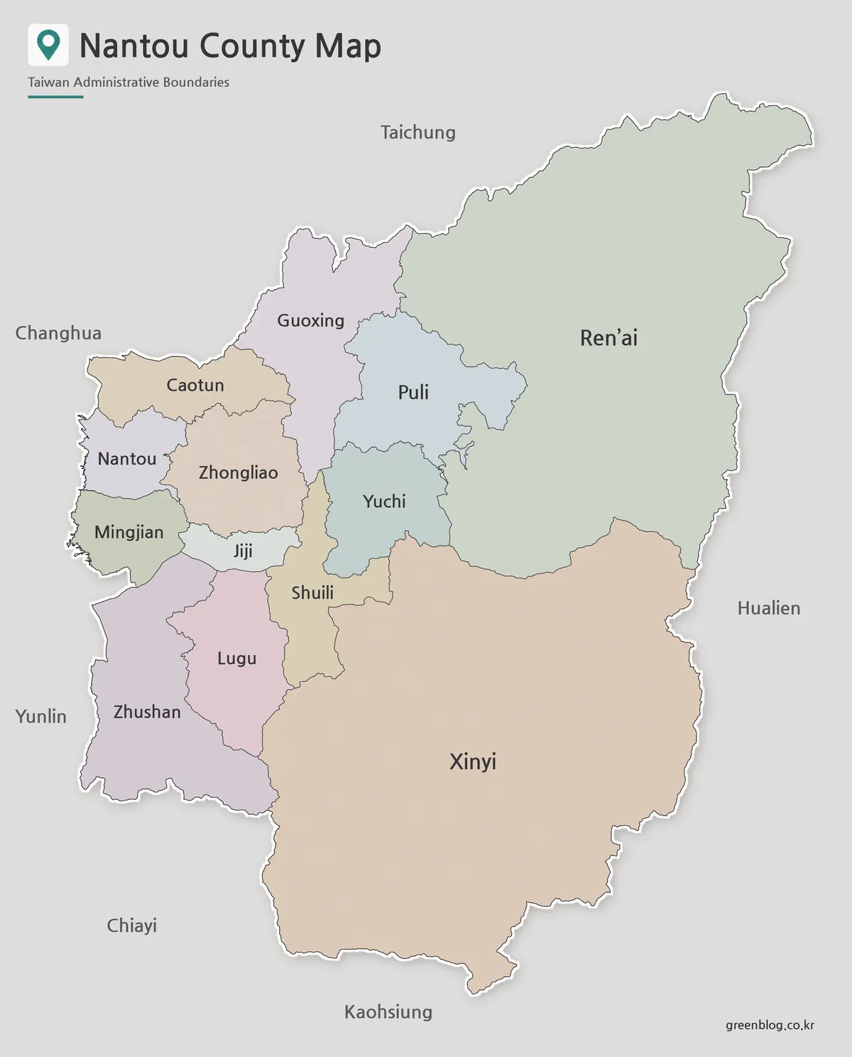
A Nantou County Map immediately shows why this inland part of central Taiwan cannot be understood as a set of
Why Ren’ai and Xinyi Dominate the Nantou County Map Read More »
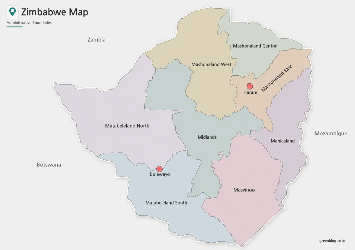
A Zimbabwe Map places an inland southern African country within a distinctive four-neighbor setting, but the supplied artwork is selective
Harare and Bulawayo Appear as Points on a Zimbabwe Map Read More »