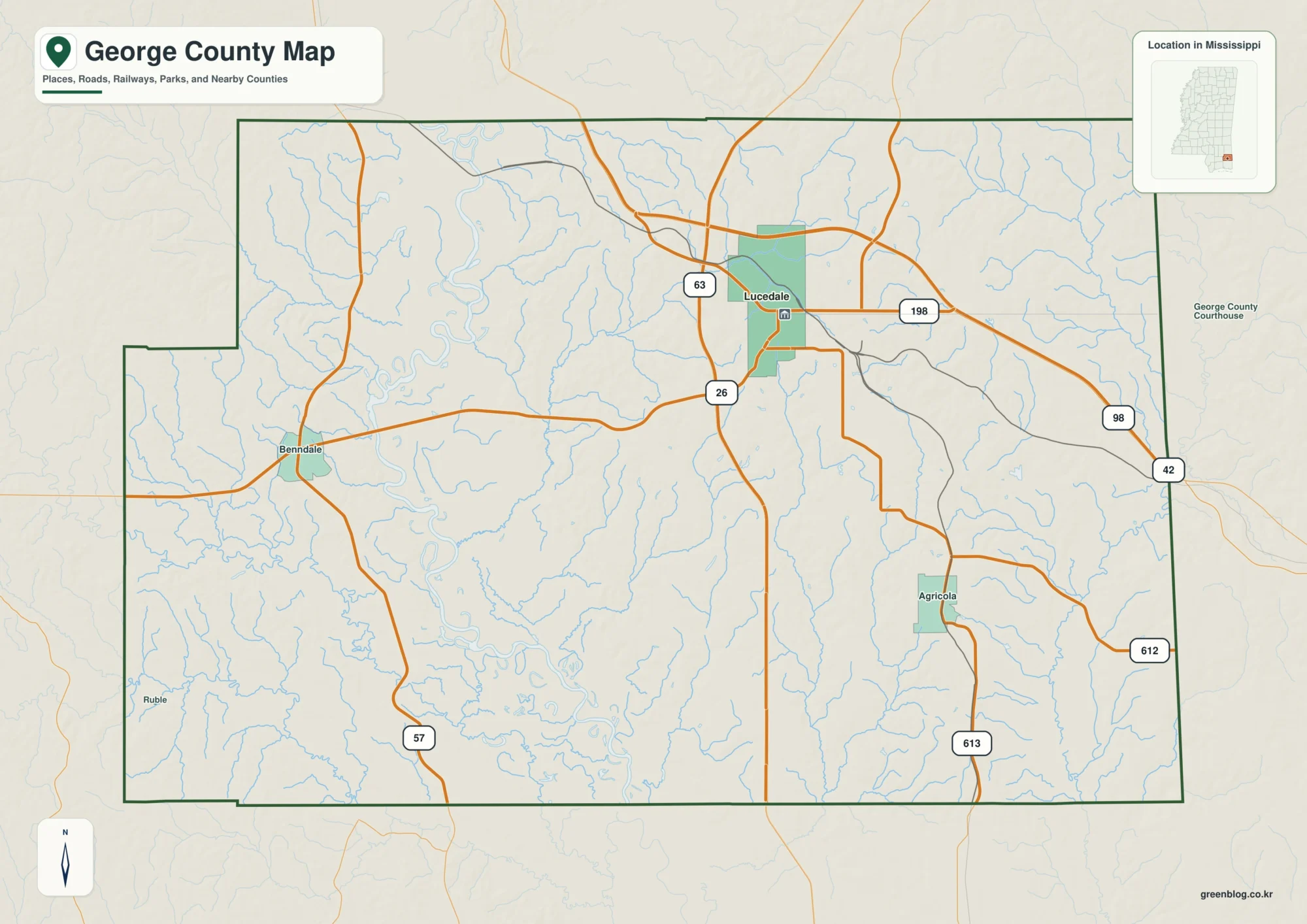
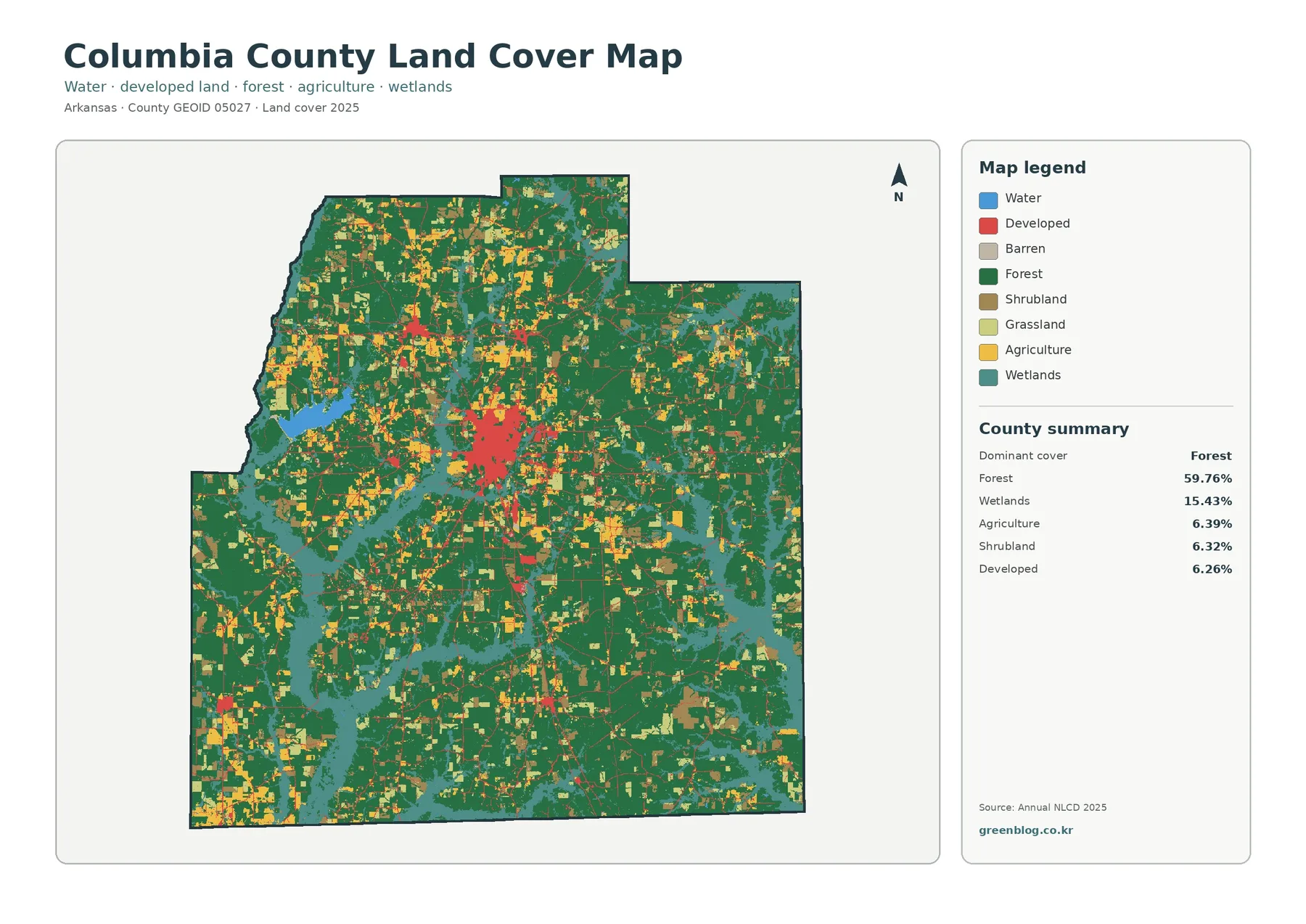
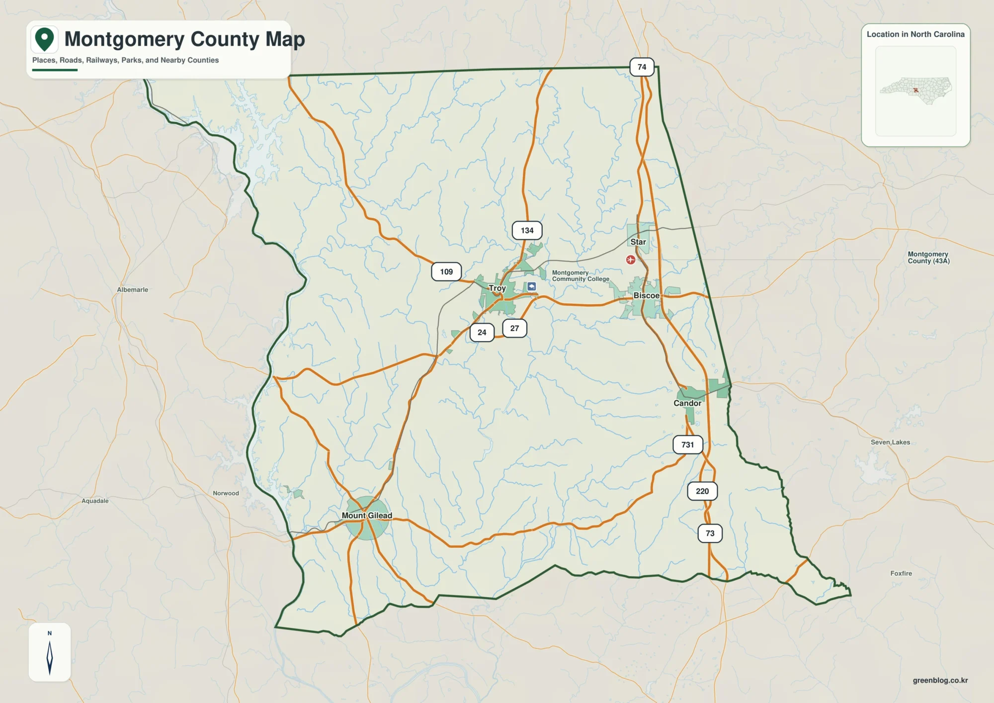
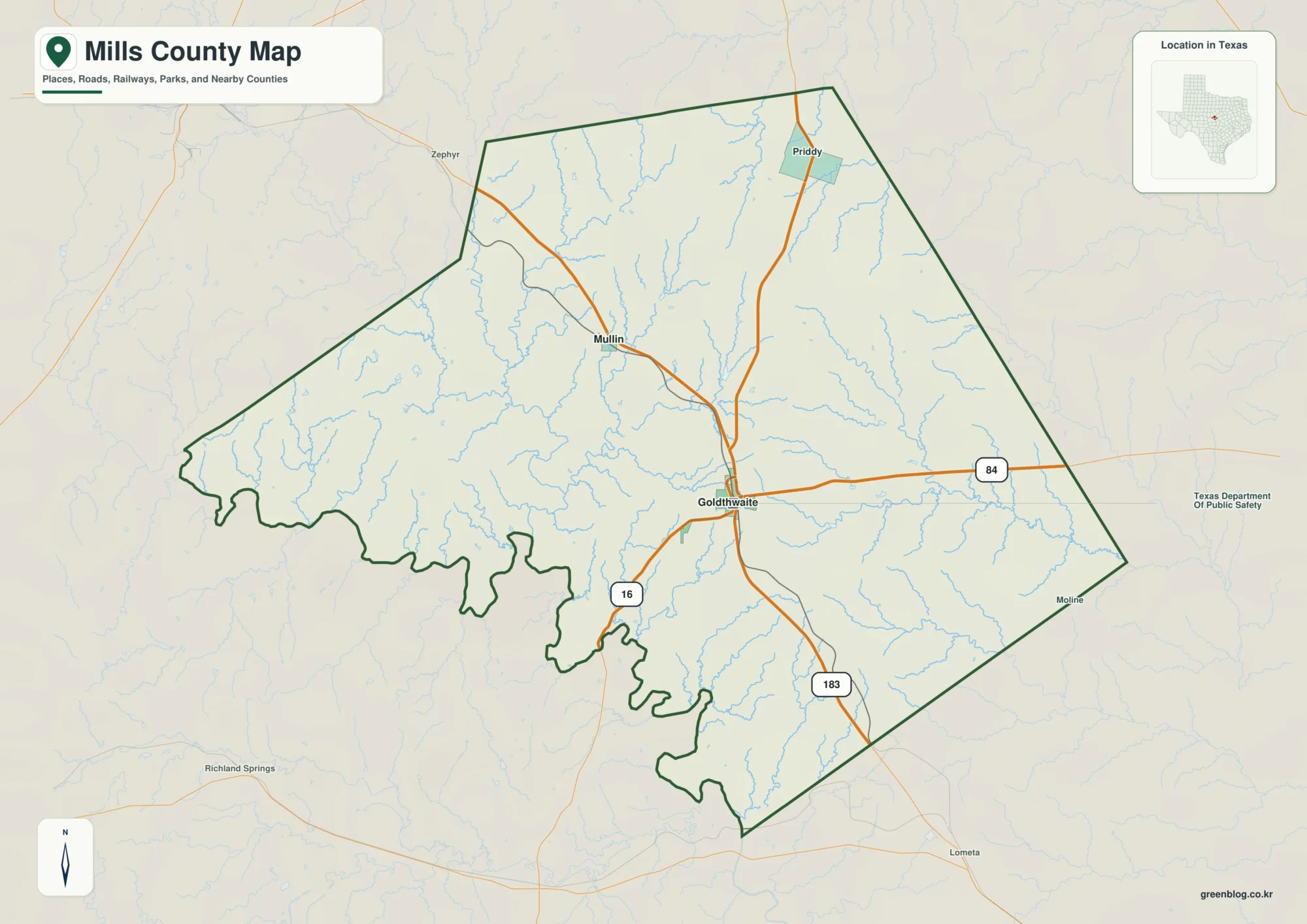
Pawnee County lies in southeastern Nebraska along the Kansas border, with Pawnee City serving as the county seat and a useful center point for understanding the surrounding towns, roads, streams, and rolling terrain. This Pawnee County Nebraska Map collection includes a general county map, a city-index map, a terrain-and-water map, and an elevation map. The WebP images on the page are designed for quick viewing, while the download box farther down the article provides the same map set as larger JPG files in one ZIP archive.
Six communities provide an easy framework for reading the county. Pawnee City sits a little east of the middle, Table Rock is in the northeast, Du Bois is in the southeast, Burchard is in the west, Steinauer is north of Pawnee City, and Lewiston is near the northwestern side. Because these places are spread across the county rather than clustered in one urban area, the relationship among roads, drainage valleys, and elevation becomes especially useful when comparing one part of Pawnee County with another.
Table of Contents
Roads radiating from Pawnee City toward Table Rock, Du Bois, and the western towns
The general county map makes Pawnee City the clearest orientation point. Route labels 622 and 65 extend north and south near the city, while the eastern side of the county includes routes marked 50 and 8 near the Du Bois area. Farther north, labels 4 and 715 form a strong east-west reference line, and 621 and 719 help locate intersections across the northern half. The western side adds 612, 705, and 99 near Burchard and the county line, while 628, 630, and 63 appear on the eastern side.
Those route numbers are most useful as map references rather than as a substitute for live navigation. The image shows how the road network connects communities and crosses the county, but it does not provide current construction status, closures, speed limits, surface condition, or travel time. For an actual trip, a current Nebraska road source or navigation service should be consulted. For geographic comparison, however, the county map clearly shows that Pawnee City is connected in several directions while the smaller communities occupy more separated positions near the outer parts of the county.
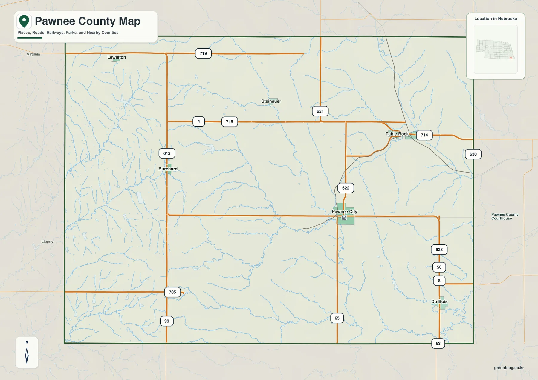
The stream network visible behind the roads also explains why the county is not simply a flat grid. Small blue tributaries cut across many of the road corridors, especially in the west, and longer valleys become more obvious near the middle and eastern side. A road may appear nearly straight on the map while still crossing a sequence of shallow valleys and higher ridges. That distinction matters when comparing map distance with the actual shape of the land.
Pawnee County’s official website lists Pawnee City, Burchard, Du Bois, Lewiston, Steinauer, and Table Rock as its cities and villages. That same set appears on the supplied maps, so the map package provides a consistent overview of the principal settlements without adding unverified place names. Precise municipal limits are a different matter: anyone who needs legal boundaries, parcel lines, or jurisdictional details should use official GIS or county records rather than treating the labels on this regional map as legal boundary definitions.
A six-community pattern stretching from Lewiston to Du Bois
The city-index map removes much of the road detail and highlights the six major communities. Pawnee City is ranked first in the supplied index, followed by Table Rock, Du Bois, Burchard, Steinauer, and Lewiston. The ranking is part of the map’s city-reference design and should not be treated as a substitute for a current population table. Its real value is visual: a reader can immediately see how far apart the communities are and which part of the county each one represents.
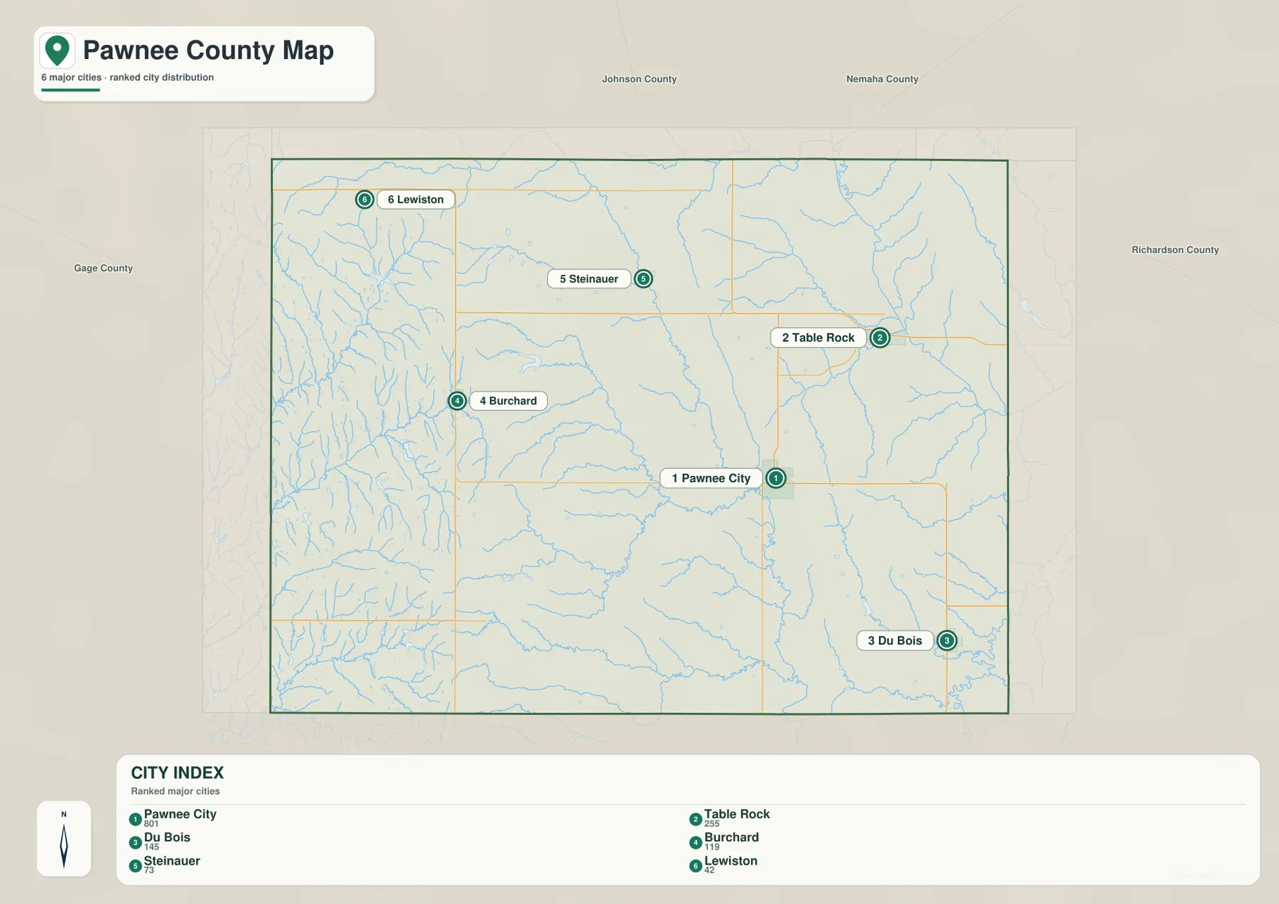
The pattern is notably dispersed. Pawnee City is the administrative center, but the county does not form a compact urban cluster around it. Table Rock is closer to the northeastern edge, Du Bois is near the southeastern side, and Lewiston sits close to the northwestern corner. Burchard occupies the western interior, while Steinauer provides a useful reference for the northern middle. This spread helps explain why county-scale road and terrain maps are more informative here than a simple list of towns.
Neighboring county labels add another layer of context. Johnson and Nemaha counties appear to the north, Richardson County lies to the east, and Gage County is to the west. The southern edge meets Kansas. These surrounding names help place Pawnee County within the broader southeast Nebraska region and make it easier to understand why roads near Lewiston, Table Rock, Du Bois, or the southern border may lead quickly into a neighboring jurisdiction.
The city map becomes more useful when paired with the elevation image. Burchard and Lewiston are positioned in the higher western terrain, while Table Rock and Du Bois sit closer to lower eastern drainage systems. Pawnee City occupies an intermediate setting near the Turkey Creek corridor. That comparison gives each town a clearer physical context instead of presenting the communities as points floating on an otherwise featureless background.
Turkey Creek through the center and the North Fork Big Nemaha River in the northeast
The terrain-and-water map reveals one of the county’s strongest geographic features: Turkey Creek curves through the central part of Pawnee County and receives several tributaries along the way. West Branch Turkey Creek approaches from the southwest, creating a branching valley system that helps organize the interior landscape. This drainage is especially useful when interpreting the terrain around Pawnee City because the town lies near the broader central lowland rather than on the highest western ground.
In the northeast, the North Fork Big Nemaha River forms another prominent blue corridor, with Clear Creek joining the drainage from the west. This system lies closer to Table Rock and the lower eastern side of the county. The western half contains many smaller named streams, including Wolf Creek and Plum Creek, while the southern area includes Johnson Creek, Mission Creek, and Wildcat Creek. Together they show how extensively the higher western country is dissected by short valleys.
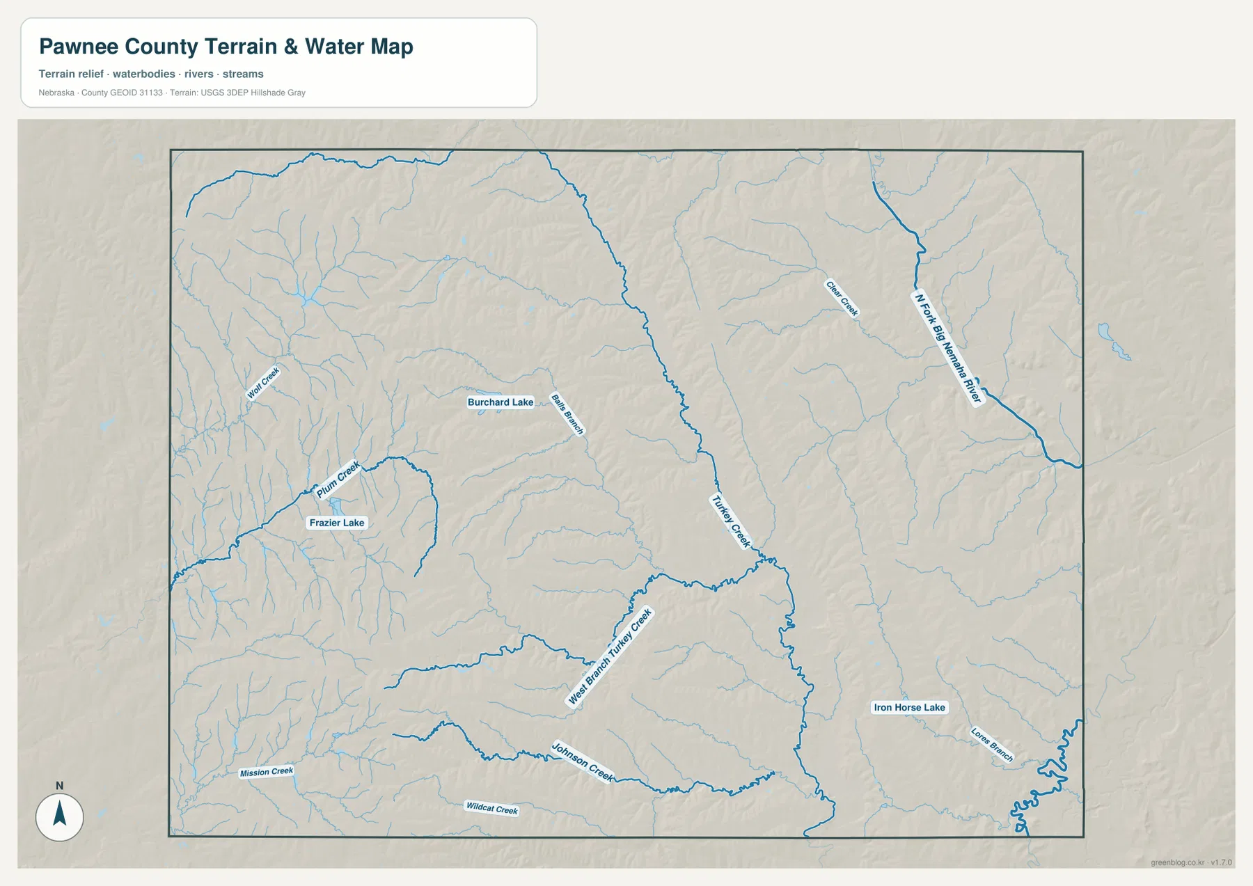
Several small lakes are also labeled. Burchard Lake appears in the western half, Frazier Lake lies farther southwest, and Iron Horse Lake is shown in the southeast. These water bodies are much smaller than the major river and creek corridors, but they are useful landmarks when comparing the water map with the road and city maps. Their presence also makes the county’s drainage pattern easier to understand because they sit within a landscape already divided by many small valleys.
This map is a regional hydrographic reference, not a flood-risk or water-depth product. Line thickness does not represent a guaranteed channel width, discharge, or navigability, and a lake symbol does not indicate current water level or public access. Floodplain decisions, fishing rules, water-quality questions, and site-specific drainage work require current information from the appropriate agencies. For ordinary geographic reading, the map is best used to locate named water features and understand how their valleys fit into the county terrain.
Higher western hills descending toward eastern and central valleys
The elevation map uses locally scaled colors to make the county’s west-to-east relief easy to see. The legend spans roughly 312 to 454 meters, while the map notes an actual surface range of about 292 to 469 meters and a mean near 390 meters. Brown and tan tones dominate much of the western half, indicating higher ground. Greens become more common toward the central valleys and the eastern side, where drainage associated with Turkey Creek and the North Fork Big Nemaha River reaches lower elevations.
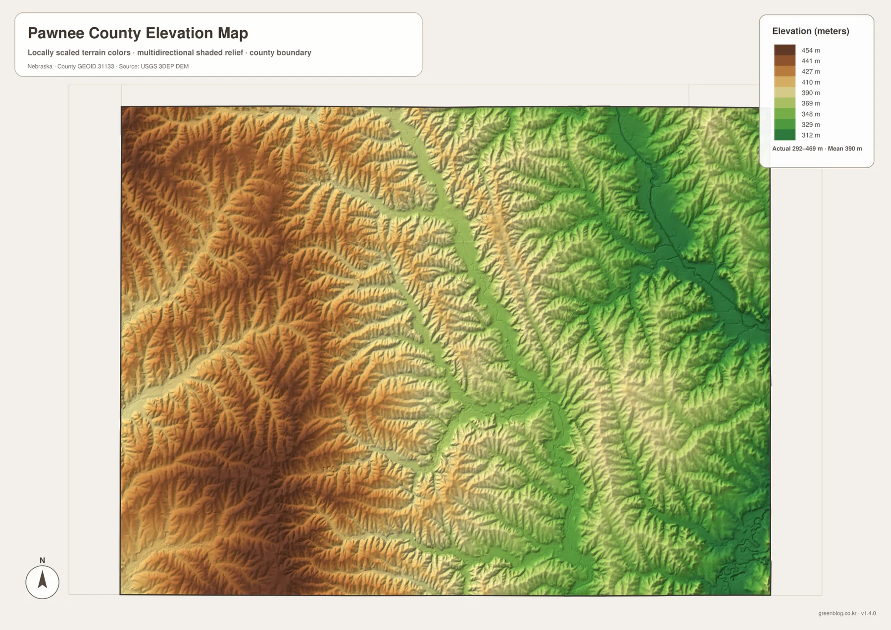
The western upland is not a smooth plateau. Narrow green and yellow branches cut repeatedly into the brown terrain, matching many of the small creeks visible on the water map. Around Burchard and Lewiston, this produces a strongly dissected surface of ridges and short valleys rather than a single flat high area. A reader comparing the two maps can see how Wolf Creek, Plum Creek, Mission Creek, and other tributaries occupy lower cuts within that higher western landscape.
The central county is organized around a lower north-south corridor associated with Turkey Creek. Smaller tributaries reach into that corridor from both sides, creating a broad branching pattern of low ground. Pawnee City is near this transition between the western hills and the lower eastern terrain. That setting helps explain why the town works well as a map reference: it sits close to a major drainage corridor while still connecting roads toward both the higher west and lower east.
Lower green terrain becomes more extensive toward Table Rock, Du Bois, and the northeastern river system. The North Fork Big Nemaha River corridor stands out as one of the deepest and most continuous low areas on the map. The southeast also contains lower stream valleys near Iron Horse Lake and the county boundary. As a result, a west-to-east trip across Pawnee County generally crosses a sequence of ridges and valleys before reaching the broader lower country, rather than following one uniform slope.
The elevation image is intended for regional interpretation. It should not be used to establish a parcel elevation, a building pad, an engineered road grade, or a legal drainage requirement. Those tasks require suitable USGS source data, professional surveying, or official engineering records. For classroom work, regional comparison, county orientation, and explaining why streams follow particular corridors, the map provides a clear and practical visual summary.
Local history fits the map at Table Rock, Burchard, and Pawnee City
Pawnee County’s official overview describes the county as one of Nebraska’s early counties, established in 1854, and identifies Pawnee City as the county seat. The same source notes that agriculture and ranching remain dominant land uses and that the county contains six incorporated communities. Those facts match the map’s rural settlement pattern: communities are separated by broad areas of roads, fields, creeks, and rolling terrain rather than forming a continuous urbanized corridor.
Table Rock adds a useful historical reference point in the northeast. Visit Nebraska describes the village as incorporated in 1860 and highlights its Public Square Historic District, with a long-established public square and historic buildings. On the maps, Table Rock lies near the North Fork Big Nemaha River drainage and clearly apart from Pawnee City. Seeing that location alongside the historic description gives the settlement a stronger geographic context.
Burchard provides a different county-specific example. Pawnee County’s official site identifies Burchard as the birthplace of silent-film actor and comedian Harold Lloyd. The city-index map places Burchard in the western part of the county, while the water map shows Burchard Lake and nearby tributaries within the higher western terrain. That combination of cultural history and physical setting makes Burchard easy to distinguish from Table Rock or Du Bois, which occupy lower eastern areas.
These maps are not historical reconstruction products. They do not show nineteenth-century town limits, former railroad alignments, land claims, or historic travel routes in detail. Their role is simpler: they provide a present-day geographic framework of communities, roads, water, and relief that can make local history easier to place. Readers interested in historic districts, museums, or early county development should pair the maps with dedicated county and state historical sources.
Selecting the best map for a Pawnee County question
Choose the general county map when the main task is comparing roads, community locations, county boundaries, and the broad stream network on one page. It is the easiest map for following Pawnee City toward Table Rock, Du Bois, Burchard, Steinauer, or Lewiston. Use the city-index map when road detail would be distracting and the question is simply where the six major communities sit relative to one another and to the neighboring counties.
The terrain-and-water map is the better choice for Turkey Creek, West Branch Turkey Creek, the North Fork Big Nemaha River, Johnson Creek, Burchard Lake, and Iron Horse Lake. The elevation map answers a different question: which parts of the county are higher or lower, and how do the major valleys cut through the surrounding hills? Using the two together is particularly effective because the named drainage corridors line up with the lower green bands on the relief map.
For a printed handout or classroom presentation, selecting the single map that matches the topic usually produces a clearer result than shrinking all four images onto one page. The downloadable JPG originals are substantially larger than the WebP previews and preserve labels better when enlarged or printed. Higher resolution does not make the maps parcel, survey, flood-control, or engineering products, so specialized decisions still require the appropriate official source.
Frequently Asked Questions
Which map best shows Turkey Creek near Pawnee City?
The terrain-and-water map is the best starting point because it labels Turkey Creek and West Branch Turkey Creek and shows the surrounding tributaries. Pair it with the elevation map to see how the creek occupies a lower corridor through the middle of the county. The general county map can then be used to compare that valley with Pawnee City and the road network.
What is the easiest way to compare Table Rock, Du Bois, and Burchard?
The city-index map provides the simplest comparison because Table Rock is clearly placed in the northeast, Du Bois in the southeast, and Burchard in the west, with Pawnee City serving as a central reference. If road connections matter, move next to the general county map. If terrain differences matter, the elevation map shows that Burchard is in higher western country while the eastern communities are closer to lower valleys.
Can the elevation map be used for surveying or construction design?
No. The elevation map is a county-scale visualization of relative relief. It does not provide survey-grade elevations, parcel boundaries, engineered slopes, or site-specific drainage measurements. Professional work should use appropriate USGS elevation data, official records, and field surveying rather than relying on the generalized colors in this map.
Map File Information
Download the four high-resolution JPG maps shown on this page for Pawnee County in one ZIP archive.
- Included Files: Use only the versions confirmed in the article and supplied images
- File Type: Use the confirmed download contents
- Intended Use: Printing, education, presentations, and map-based projects
Related Maps
Sources and references
County-specific settlement and history context comes from Pawnee County’s official website and Nebraska’s official tourism material for Table Rock. The federal data links below provide standard references for boundaries, hydrography, and elevation.
- Pawnee County – About Our County
- Pawnee County official website
- Visit Nebraska – Village of Table Rock
- U.S. Census Bureau – TIGER/Line Shapefiles
- USGS – National Hydrography
- USGS – 3D Elevation Program
Green Map creates custom-edited map images using open geographic data sources such as geoBoundaries, Natural Earth, OpenStreetMap, and government open data. These maps are edited visual materials, not raw data files, and are provided for education, documents, presentations, and graphic reference.