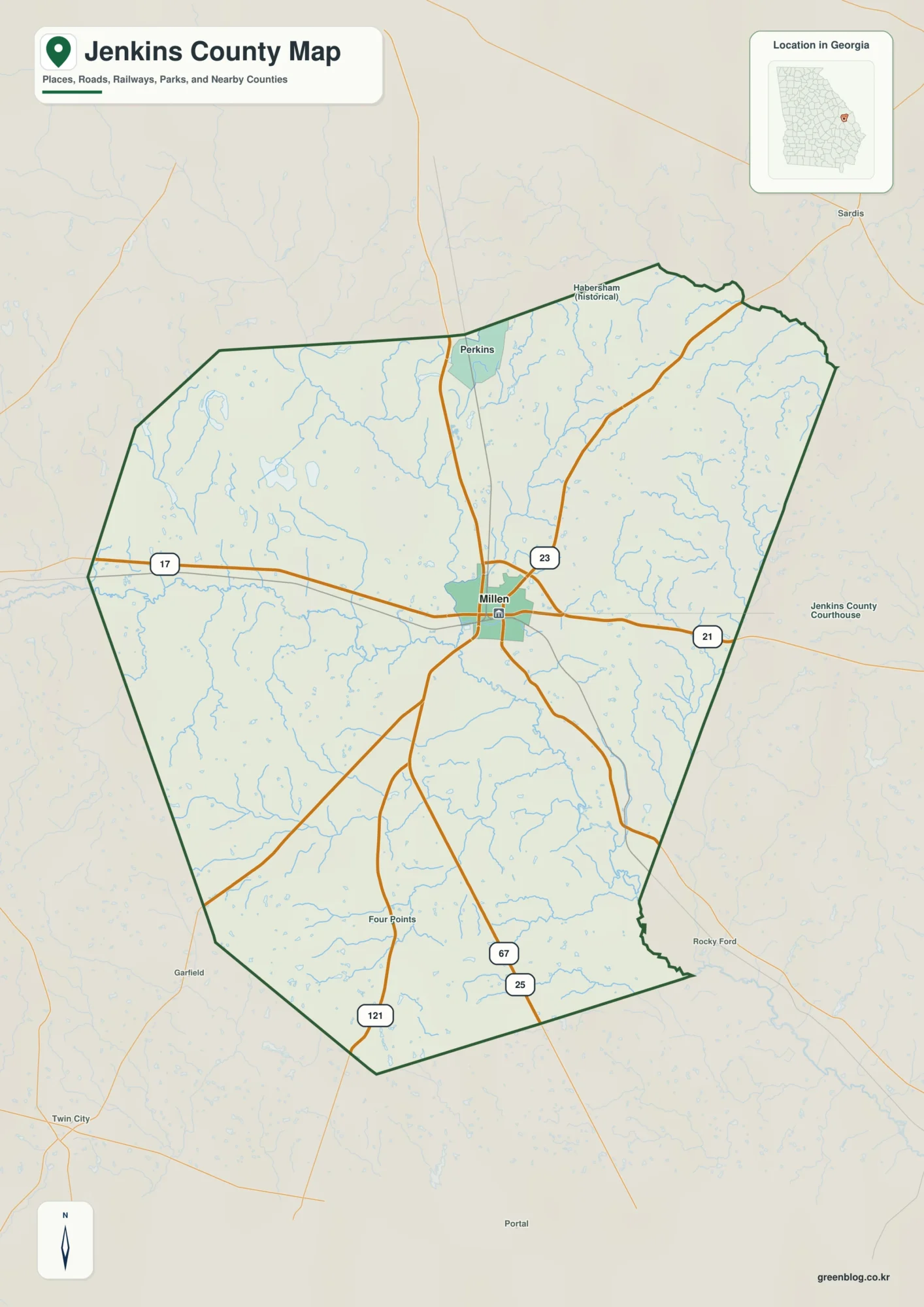
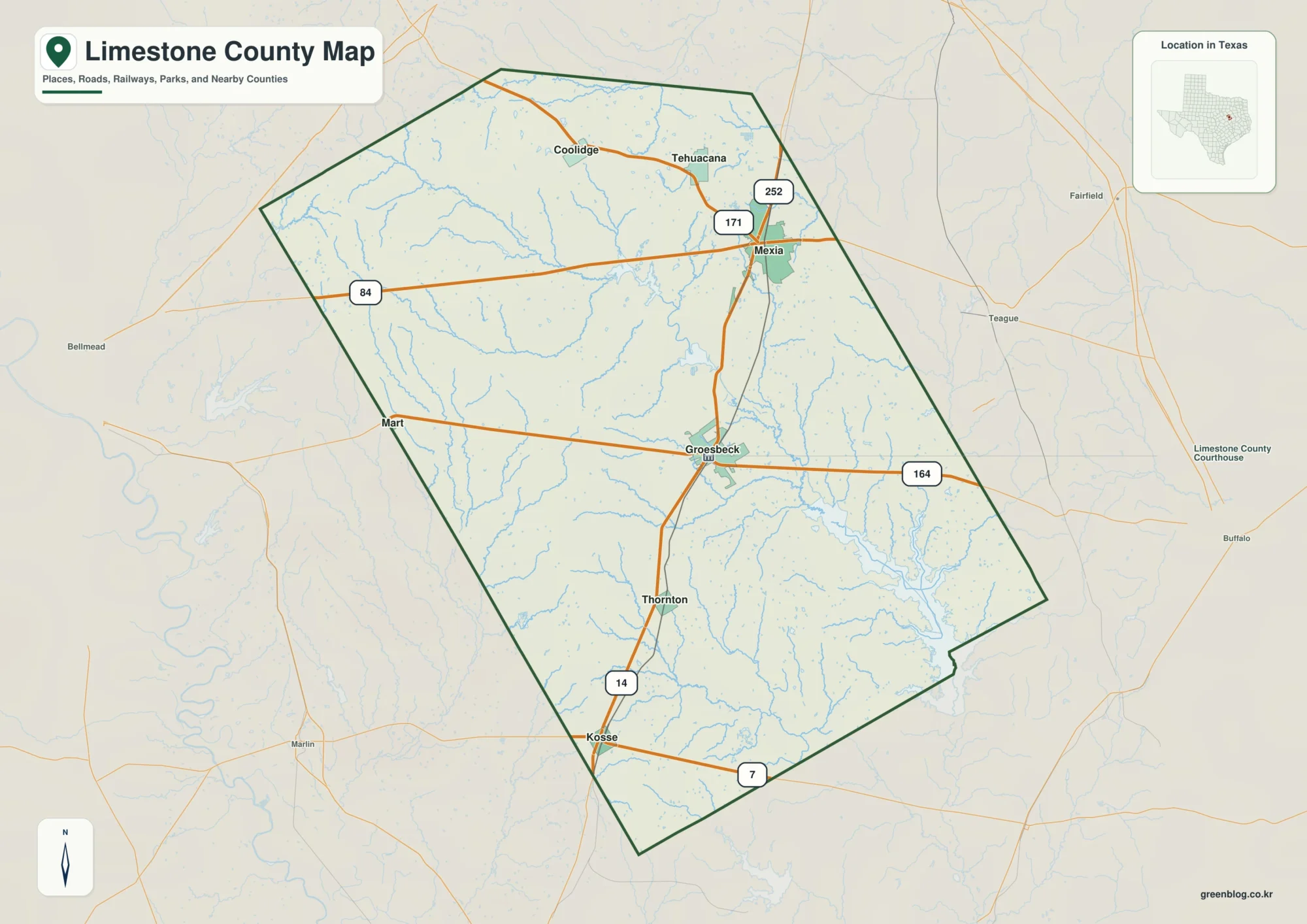
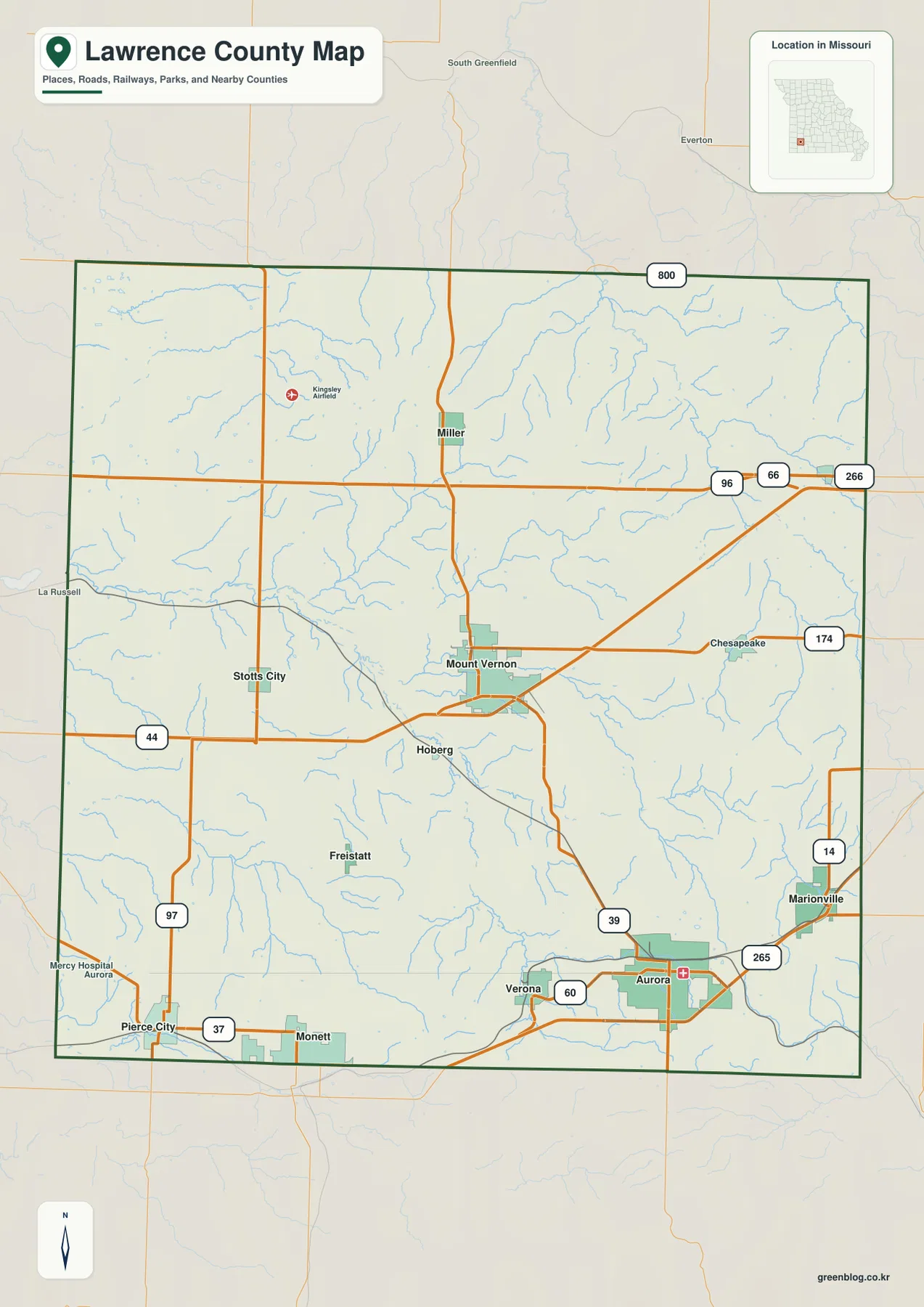
Lawrence County sits in southwest Missouri between Springfield and Joplin, with Mount Vernon near the center and Aurora occupying the largest urban area in the southeast. Marionville lies farther east, Miller is to the north, Pierce City reaches the southwest edge, and Verona sits between Mount Vernon and Aurora. Spring River cuts through the county’s middle, while Center Creek, Honey Creek, Turnback Creek, and smaller tributaries carve narrow valleys into the uplands. The mapped elevation ranges from about 289 to 461 meters. High-resolution JPG map files are available in the ZIP download below for printing and closer inspection.
The county makes more sense when Mount Vernon is used as the central reference and the Spring River valley is treated as the main terrain break. I-44 and Route 39 organize much of the road network, but the river and its tributaries explain why the surrounding countryside is far less uniform than the highway map first suggests. South and southeast of the river, broad high ground becomes more prominent, while several stream corridors cut sharply into those ridges.
Table of Contents
Mount Vernon ties the county road network to its government center
Mount Vernon sits close to the middle of Lawrence County. Route 39 approaches from Miller in the north and continues toward Aurora, while I-44 passes near the city and provides the strongest east-west road reference. Stotts City lies to the west, Verona is south, and Pierce City and Freistatt are farther southwest, so Mount Vernon works well as the point from which the rest of the county can be oriented.
The county’s administrative geography matches that central position. Lawrence County lists its Historic Courthouse at 1 Courthouse Square in Mount Vernon, with the County Clerk, Collector, Assessor, Commission, and other offices based there. The county history page explains that Mount Vernon was chosen as the county seat in 1845 because it was near the geographic center of the newly organized county.
Aurora and Marionville show how settlement shifts toward the southeast
Aurora is the largest mapped city in southeastern Lawrence County, close to Routes 39, 60, and 265. Mercy Hospital Aurora is also labeled on the base map, giving the city a second clear landmark. Marionville lies northeast of Aurora near Routes 14 and 265, where the developed area gives way quickly to rolling farmland and creek-cut hills.
Verona lies west of Aurora, while Pierce City and the edge of Monett appear near the southwestern boundary. These communities are separated by more than open farmland: the Spring River and Center Creek systems create pronounced low corridors, and the roads repeatedly cross or skirt those valleys. That terrain becomes much easier to see once the road map is compared with the water and elevation layers.
Aurora leads the ranked city layer, but location matters more than the index
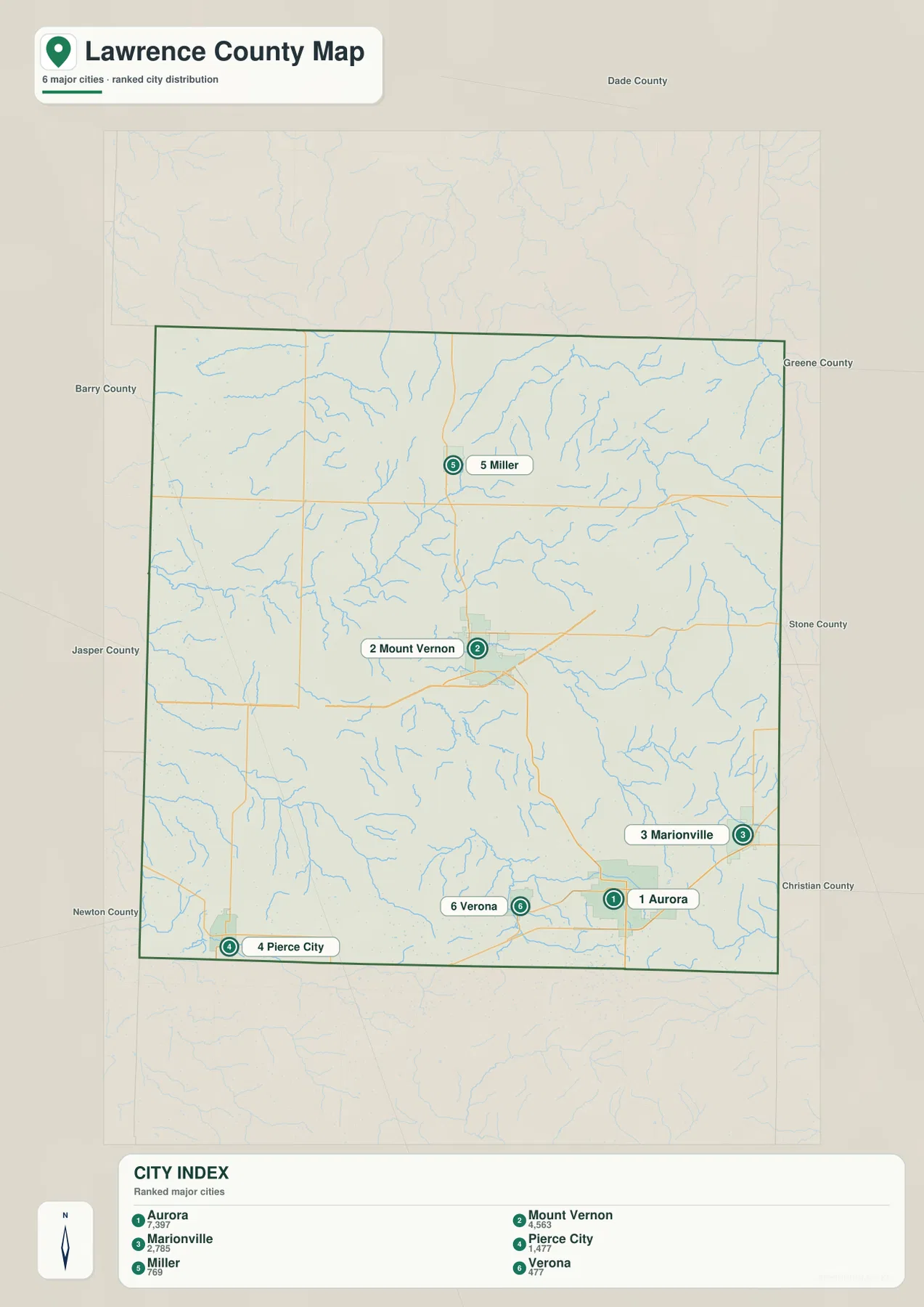
The city distribution map ranks Aurora first, Mount Vernon second, Marionville third, Pierce City fourth, Miller fifth, and Verona sixth. The accompanying CITY INDEX values are 7,397, 4,563, 2,785, 1,477, 769, and 477. Those values are part of the supplied mapping dataset and should not be presented as current official population estimates.
The map’s real value is the spread of the towns. Aurora and Verona occupy the south and southeast, Mount Vernon is central, Miller stands alone in the north, Marionville is east, and Pierce City reaches the southwest edge. The numbered markers show rank only; they do not represent road distance or travel time.
Spring River forms the county’s main low corridor
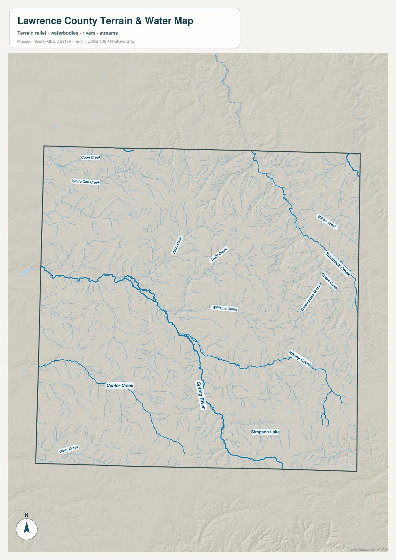
Spring River enters the county from the west, bends through the central interior, and then turns south. Its valley is broader than most of the surrounding tributary valleys and appears as a strong green corridor on the elevation map. Around the central county, this low route separates higher uplands to the north and south and gives the terrain a pronounced branching form.
Robert E. Talbot Conservation Area provides a useful local example of that river landscape. Missouri Department of Conservation places the area about 12 miles northwest of Mount Vernon in north-central Lawrence County and notes that an unchannelized section of Spring River runs through the southern part of the property. The site includes both rich bottomland soils and rocky uplands, closely matching the contrast visible on the county maps.
Center Creek cuts through the high country around Pierce City
Center Creek is the main named waterway in the southwest and runs through the country north and east of Pierce City. Clear Creek lies farther southwest, while Coon Creek and White Oak Creek add separate drainages in the northwest. None is as large as Spring River, but each creates a distinct valley through the rolling uplands.
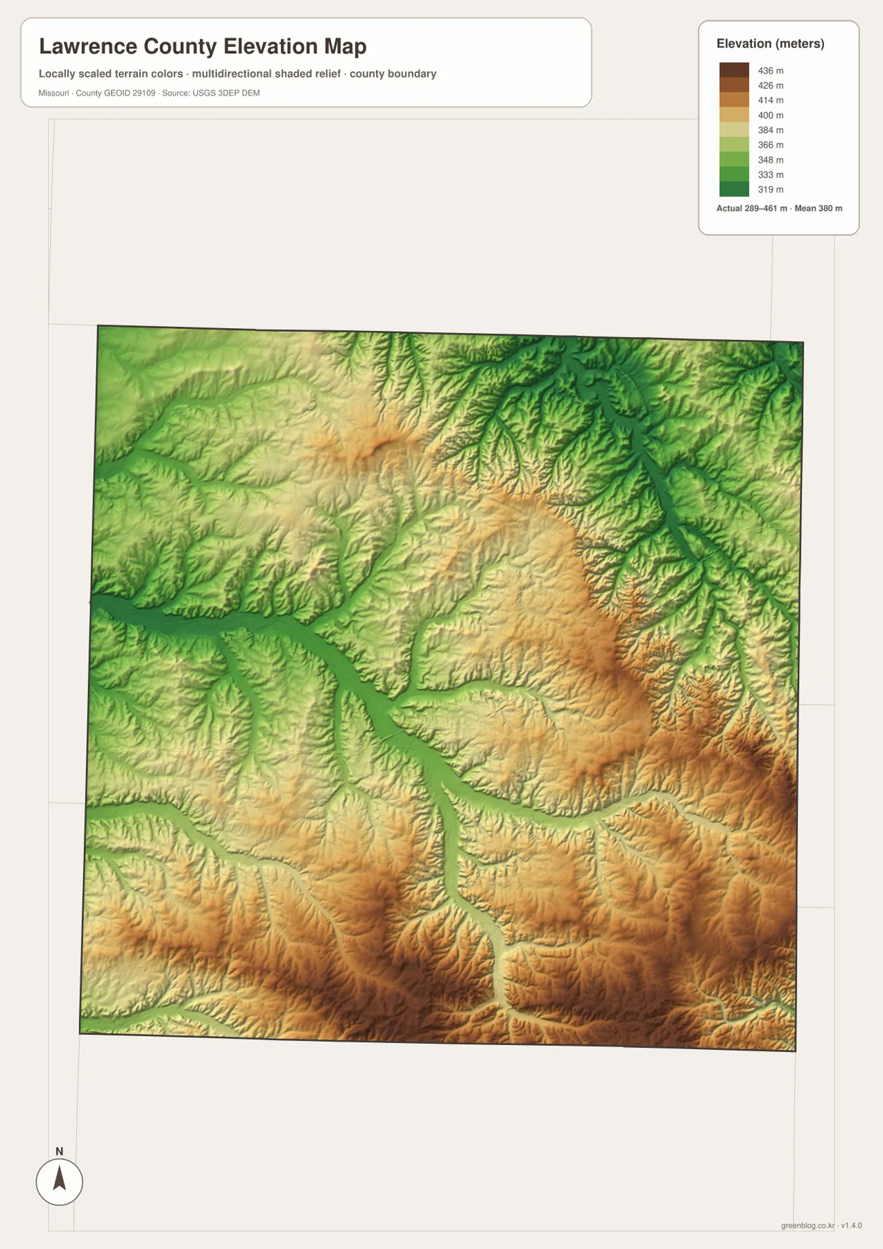
The elevation map shows why these waterways matter. Much of the southwest remains tan or brown, indicating higher ground, yet Center Creek cuts a long green channel through it. Ridges between the Spring River and Center Creek systems rise clearly above the valley floors, giving the Pierce City and Verona side a much more broken surface than a road-only map suggests.
Honey Creek and Turnback Creek carve the eastern hills
Honey Creek is one of the larger named drainages in the eastern half of the county. Turnback Creek and Goose Creek occupy the northeast, and Chesapeake Branch and Williams Creek provide additional references around the same set of hills. The area north and east of Aurora and Marionville is therefore divided by many short tributaries rather than one broad flat plain.
Turnback Creek creates one of the clearest low valleys on the elevation layer, dropping through high northeastern ground before reaching the broader drainage system. Honey Creek follows another deep corridor farther south. The contrast between narrow green valleys and surrounding tan ridges is among the most distinctive terrain patterns in eastern Lawrence County.
Simpson Lake helps anchor the rural country south of Aurora
Simpson Lake is labeled in the southeastern part of the terrain-and-water map. It is small compared with Spring River, but it provides a useful fixed point in the open country south and east of Aurora. Numerous unnamed ponds and short tributaries appear elsewhere, showing how thoroughly the rolling terrain is drained.
The water layer is designed for general geographic reference. It does not show current stream stages, flood warnings, legal water boundaries, or whether a particular pond or shoreline can be accessed by the public. Those questions require current information from the relevant agency or property owner.
The 289–461 meter range separates river bottoms from high Ozark ground
The elevation map reports an actual range of roughly 289 to 461 meters, with a mean near 380 meters. Spring River and the larger tributaries occupy the lowest green corridors, while the south, southeast, and parts of the interior rise into broad tan and brown uplands. More than 170 meters separate the lowest and highest mapped points.
The pattern is not one isolated mountain surrounded by flat land. Instead, rivers and creeks have cut a dense network of valleys into a generally high surface. Turnback Creek is deeply incised in the northeast, Spring River creates the central low route, and Center Creek and Honey Creek form additional cuts across the southern half. The layer is useful for county-scale terrain comparison, not survey-grade or engineering-grade measurement.
Route 66 and I-44 mark two generations of east-west travel
Lawrence County’s official history notes that Route 66 crossed the northern part of the county in the 1920s and that Interstate 44 arrived in the 1960s. Both reflect the long importance of east-west travel between Springfield and Joplin, with Mount Vernon occupying a strategic position along that corridor.
The supplied map is not a historic Route 66 itinerary, so it should not be used to identify every surviving segment of the old road. Its value here is broader: the modern I-44 corridor helps explain why Mount Vernon has remained a transportation reference even as the main highway changed over time.
Aurora and Stotts City also carry a mining-era history
The Lawrence County history page describes lead and zinc mining as an important part of local industrial development, especially around Aurora and Stotts City. Prospecting occurred more widely, but those communities became principal mining locations before the industry declined after World War I.
These maps do not locate mine shafts, waste piles, or hazardous sites, and they should not be used to infer that a particular property was mined. The mining history instead provides background for the growth of Aurora and Stotts City and for the transportation connections that served southwestern Lawrence County.
Choose the map by the question you are trying to answer
The general county map is the best starting point for Mount Vernon, Aurora, smaller towns, and the road network. The ranked city layer makes the distribution of the six leading communities easy to compare, while the terrain-and-water map is better for tracing Spring River, Center Creek, Honey Creek, and the eastern tributaries. The elevation layer is the clearest choice when the goal is to compare high southern ground with the lower river corridors.
The ZIP contains A3 high-resolution JPG files matching the map themes shown on the page. They are useful when labels need to be enlarged or a printed reference is more convenient. These files are not substitutes for live navigation, flood warnings, mine-hazard records, legal property boundaries, or professional elevation surveys.
Frequently Asked Questions
Should I use Mount Vernon or Aurora as my main reference point?
Mount Vernon is more useful for orienting the entire county because it sits near the center and county government is based there. Aurora is the better reference for the southeastern side and the Route 60 corridor. Using both together makes Miller, Marionville, Verona, and Pierce City easy to place.
Why is the Spring River corridor so low on the elevation map?
Spring River occupies a deeply cut valley through the central uplands. The elevation layer shows that valley in green, while higher ridges to the south and east appear in tan and brown, making the contrast especially easy to see.
Can the CITY INDEX values be used as current population figures?
No. The numbers shown for Aurora, Mount Vernon, Marionville, Pierce City, Miller, and Verona belong to the supplied map dataset. Current population estimates should be checked separately with an official source such as the U.S. Census Bureau.
Map File Information
Download the map files associated with this page for reference, printing, and compatible visual projects.
- Included Files: Use only the versions confirmed in the article and supplied images
- File Type: Use the confirmed download contents
- Intended Use: Printing, education, presentations, and map-based projects
Related Maps
Sources and references
- Lawrence County, Missouri – Official Website – county government and courthouse information in Mount Vernon
- Lawrence County Government – History – county organization, Mount Vernon, Route 66, and mining history
- Missouri Department of Conservation – Robert E. Talbot Conservation Area – Spring River and north-central county landscape
- U.S. Census Bureau TIGER/Line Shapefiles – county boundary and road data
- USGS National Hydrography – rivers, streams, and water features
- USGS 3D Elevation Program – elevation data
Green Map creates custom-edited map images using open geographic data sources such as geoBoundaries, Natural Earth, OpenStreetMap, and government open data. These maps are edited visual materials, not raw data files, and are provided for education, documents, presentations, and graphic reference.