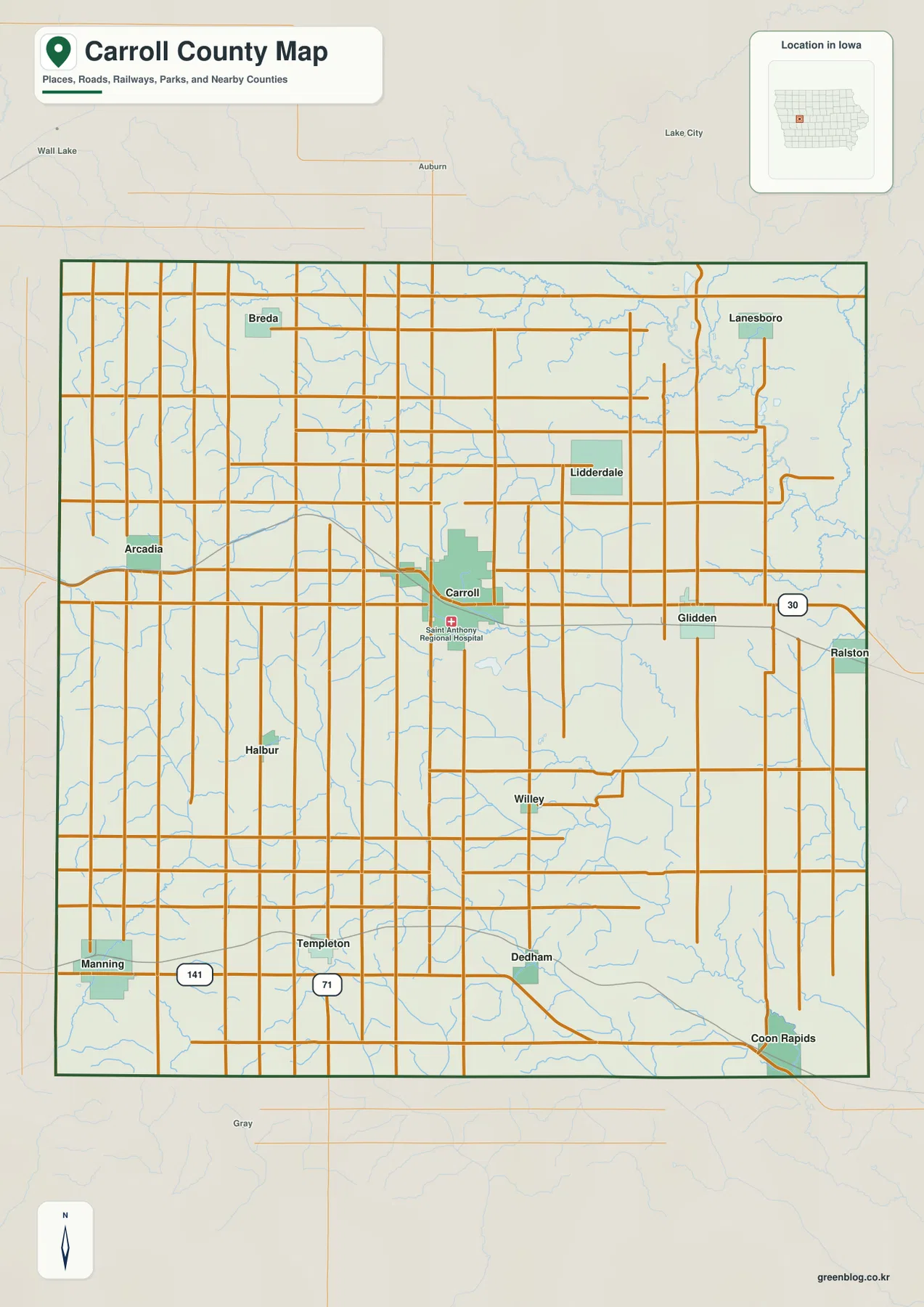
You can download the Carroll County maps on this page as a ZIP containing high-resolution A3 JPG files for printing, presentations, or closer viewing. The page also provides web versions of the county map, city distribution map, terrain-and-water map, and elevation map so you can compare roads, communities, rivers, and relief without switching to a separate data portal. Carroll is the best starting point: U.S. 30 gives an east-west reference through the middle of the county, while U.S. 71 provides a north-south line through the Carroll and Templeton area.
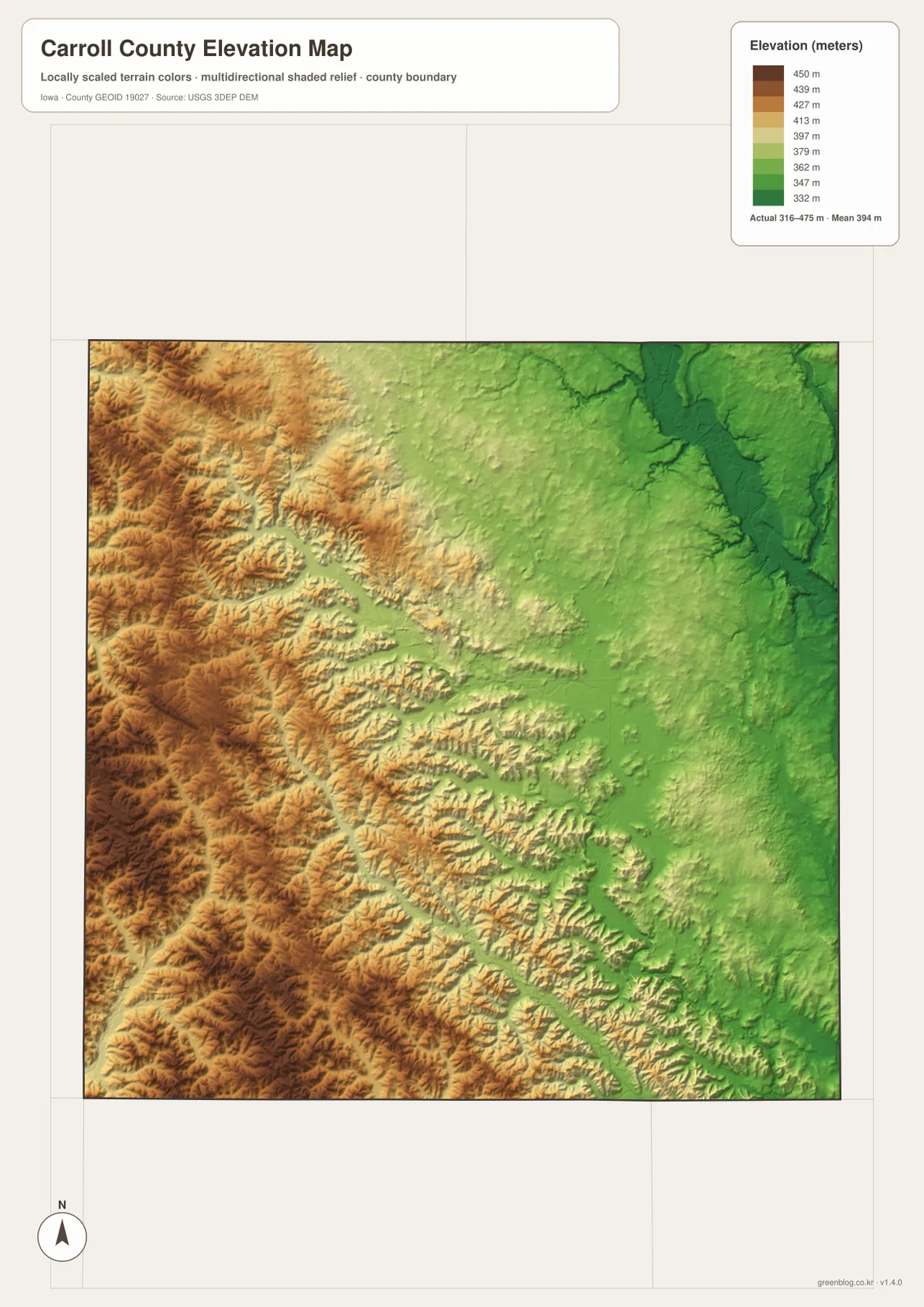
Carroll County has a stronger west-to-east physical contrast than its road grid first suggests. The supplied elevation map spans roughly 316 to 475 meters. Higher, more deeply cut ground occupies much of the west and southwest, while the eastern side drops toward lower Raccoon River valleys. Manning, Arcadia, and Breda help locate the western high ground; Glidden and Coon Rapids sit farther toward the lower eastern half. Waterways reinforce that difference because the Raccoon system drains central and eastern areas while Nishnabotna branches occupy the southwest.
Table of Contents
Use Carroll and the U.S. highways to build a quick mental map
Carroll sits slightly north of the county’s center and is the clearest reference point on the road map. U.S. 30 runs east-west through the central band, linking Carroll with Glidden and Ralston to the east and pointing toward Arcadia to the west. U.S. 71 turns the Carroll area into a north-south reference as it continues toward Templeton. Farther southwest, Iowa 141 passes near Manning. Once those routes are familiar, the smaller towns and local roads are much easier to place in relation to the county boundary.
The outer communities show how widely settlement is spread. Breda is northwest of Carroll, Lidderdale is to the north, and Lanesboro lies near the northeastern side. Halbur and Willey sit south of the central area, Dedham is farther south, and Coon Rapids is close to the southeastern corner. Manning occupies the southwest and is well separated from Coon Rapids. The county therefore works better as a set of regional reference points than as one continuous urban corridor centered on Carroll.
Manning and Coon Rapids anchor opposite sides of the southern county
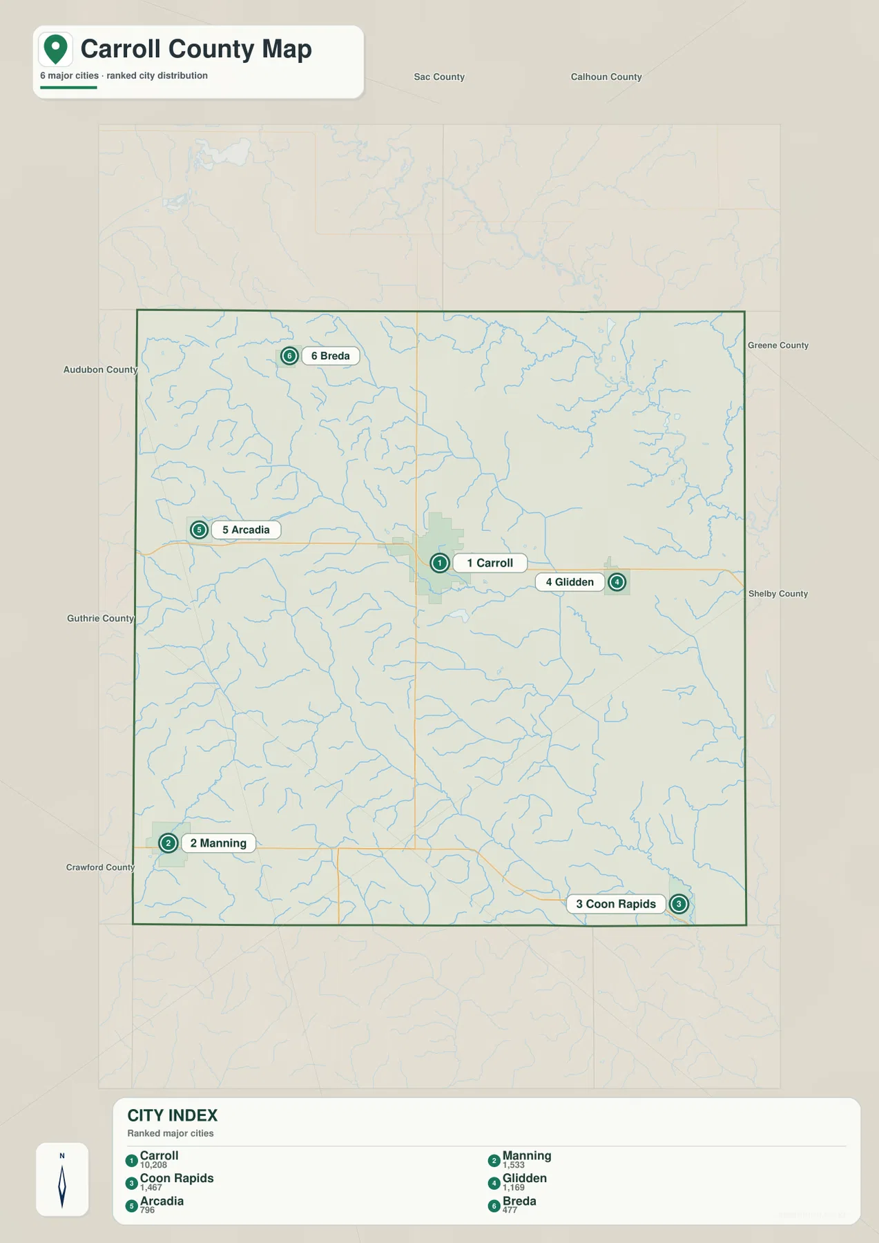
The city distribution map highlights Carroll, Manning, Coon Rapids, Glidden, Arcadia, and Breda. The comparison values printed on the supplied map are 10,208 for Carroll, 1,533 for Manning, 1,467 for Coon Rapids, 1,169 for Glidden, 796 for Arcadia, and 477 for Breda. These numbers are part of the provided map and are useful for comparing the mapped communities, but they should not be treated as a statement of the newest official population estimates. A current Census source is the better choice when a precise year-specific population is required.
Location matters more than ranking when you are trying to understand the county. Glidden sits only a short distance east of Carroll along the U.S. 30 corridor, while Arcadia is on the western side of the same central band. Breda stands apart in the northwest. The southern half is much wider: Manning is in the southwest and Coon Rapids is near the southeast corner, so the two communities are far from one another even though both are south of Carroll. This spread is one reason the city map is useful before moving to the more detailed road network.
Raccoon and Nishnabotna streams reveal two different drainage areas
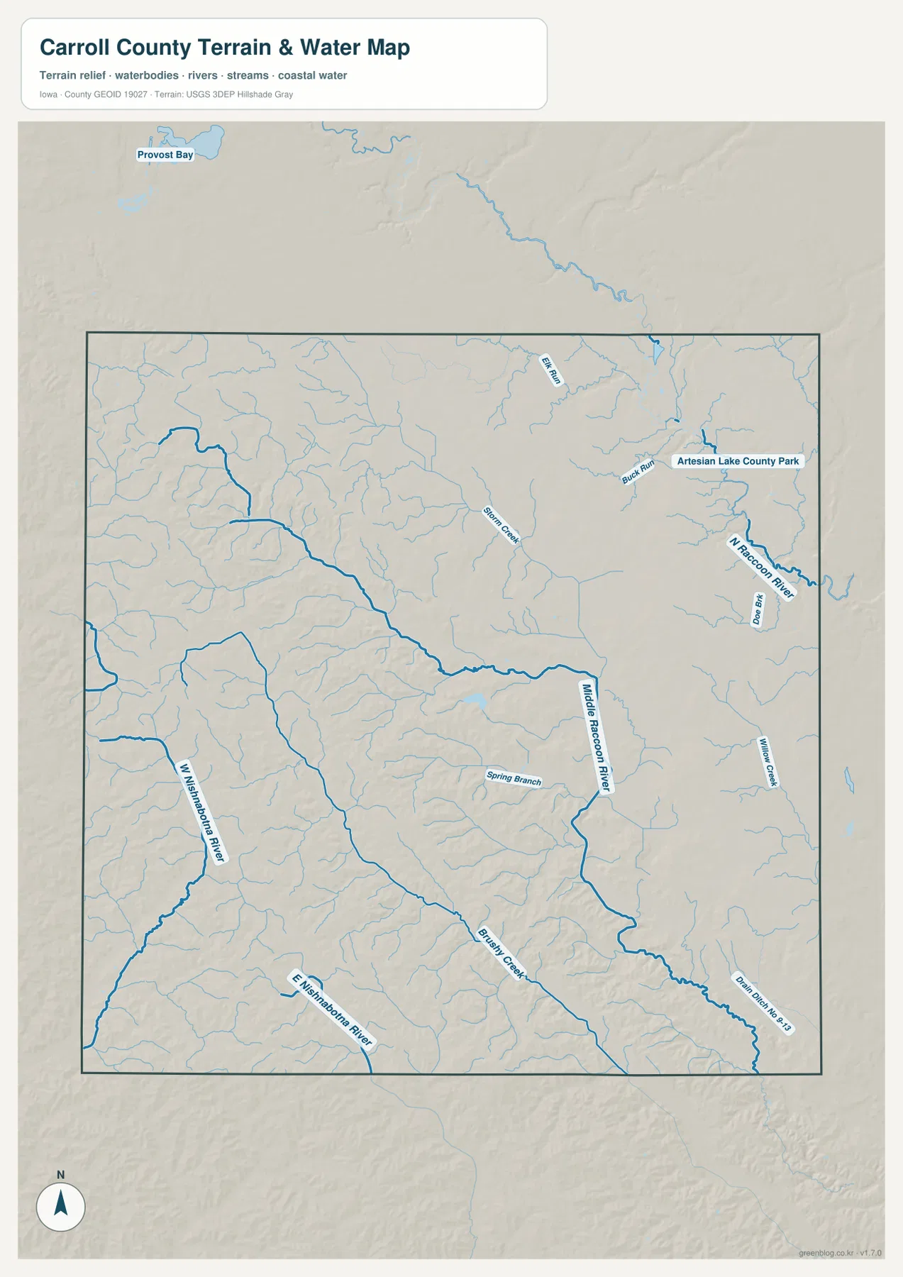
The terrain-and-water map makes the eastern half of the county look much less uniform than the road grid suggests. Middle Raccoon River is one of the dominant waterways through the central and eastern landscape, joined by smaller features such as Spring Branch, Brushy Creek, and Willow Creek. N Raccoon River, Bucks Run, and Elk Run appear farther north and northeast. These branching streams cut shallow valleys through the lower side of the county, creating a textured surface that is easy to miss on a road-only map.
The southwest belongs to a different system. West Nishnabotna River runs near the western and southwestern side, and the East Nishnabotna system is also shown farther south. Small tributaries descend from the higher western ground into those valleys instead of feeding the Raccoon system. Artesian Lake County Park appears in the northeastern area and gives another useful landmark when comparing the water map with the road map. The water layer is intended for geographic orientation; flood zones, legal water boundaries, and engineering decisions require current specialized sources.
The 316–475 m elevation range creates a clear high-west, low-east contrast
Brown and orange tones dominate much of the western boundary and southwest on the elevation map, marking the higher ground. The landscape around the Manning and Arcadia sides is not a single flat upland; short stream valleys repeatedly cut into it and create a more rolling surface. This higher terrain also explains why tributaries in the west tend to appear in narrow, branching valleys before they enter the larger Nishnabotna channels.
Green tones become more common toward the east, especially around the Raccoon drainage and the lower country leading toward Coon Rapids. Carroll and Glidden lie close to the broad transition between the high western landscape and the lower eastern valleys. Comparing the elevation map with the water map makes the change easier to understand: the low areas are not random patches of color but are closely associated with river and creek valleys. The overall range of roughly 316 to 475 meters is large enough to produce a noticeable countywide change even though there are no mountains here.
Choose the map by the question you are trying to answer
For basic orientation, begin with the county map and find Carroll, U.S. 30, and U.S. 71. If your main question is where Manning, Coon Rapids, Breda, or Glidden sits in relation to Carroll, the city distribution map removes much of the road detail and makes that spacing easier to compare. When the subject is a river, creek valley, or the difference between the high west and low east, switch to the terrain-and-water and elevation maps. The four views work best as companions because each removes some detail while emphasizing a different geographic relationship.
These are county-scale overview maps rather than live navigation, survey, parcel, or hazard products. Road closures, construction, property boundaries, flood risk, and precise engineering elevations can change or require a different level of accuracy. For those tasks, use current county, state, or federal sources. For classroom work, travel orientation, presentations, and general geographic reference, the simplified maps provide a much faster way to see where Carroll County’s communities, waterways, and relief fit together.
Frequently Asked Questions
What is the quickest way to find Manning and Coon Rapids from Carroll?
Use Carroll as the starting point and locate U.S. 30 and U.S. 71 first. Manning is southwest of Carroll near the Iowa 141 corridor, while Coon Rapids is close to the southeastern corner of the county. The city distribution map is particularly helpful because it shows how far apart those two southern communities are before you return to the road map for route detail.
Why does western Carroll County look so much higher on the elevation map?
The western and southwestern parts of the supplied map contain broad areas of higher ground, while the eastern side is lowered by the Raccoon River system and its tributary valleys. The map’s range of roughly 316 to 475 meters produces a strong color difference from west to east. The brown western tones therefore represent higher terrain, not a land-cover category.
Are larger Carroll County map files available for printing?
Yes. A ZIP download on this page contains high-resolution A3 JPG versions of the county, city, terrain-and-water, and elevation maps. They are intended for general reference and printing; legal boundaries, survey work, flood decisions, or current transportation conditions should still be checked against the latest authoritative data.
Map File Information
Download the high-resolution Carroll County map files used on this page for printing, presentations, classroom materials, or close inspection.
- Included Files: County map, city map, terrain-and-water map, and elevation map
- File Type: High-resolution A3 JPG files in one ZIP archive
- Intended Use: Printing, education, presentations, and geographic reference
Related Maps
Sources and References
- Carroll County, Iowa Official Website – county services and local information
- U.S. Census Bureau TIGER/Line Shapefiles – county boundaries and geographic reference data
- USGS National Hydrography – rivers, streams, and hydrographic reference data
- USGS 3D Elevation Program – elevation and terrain reference data
- Carroll Chamber of Commerce – Parks & Recreation – local parks, trails, and recreation information
Green Map creates custom-edited map images using open geographic data sources such as geoBoundaries, Natural Earth, OpenStreetMap, and government open data.
These maps are edited visual materials, not raw data files, and are provided for education, documents, presentations, and graphic reference.