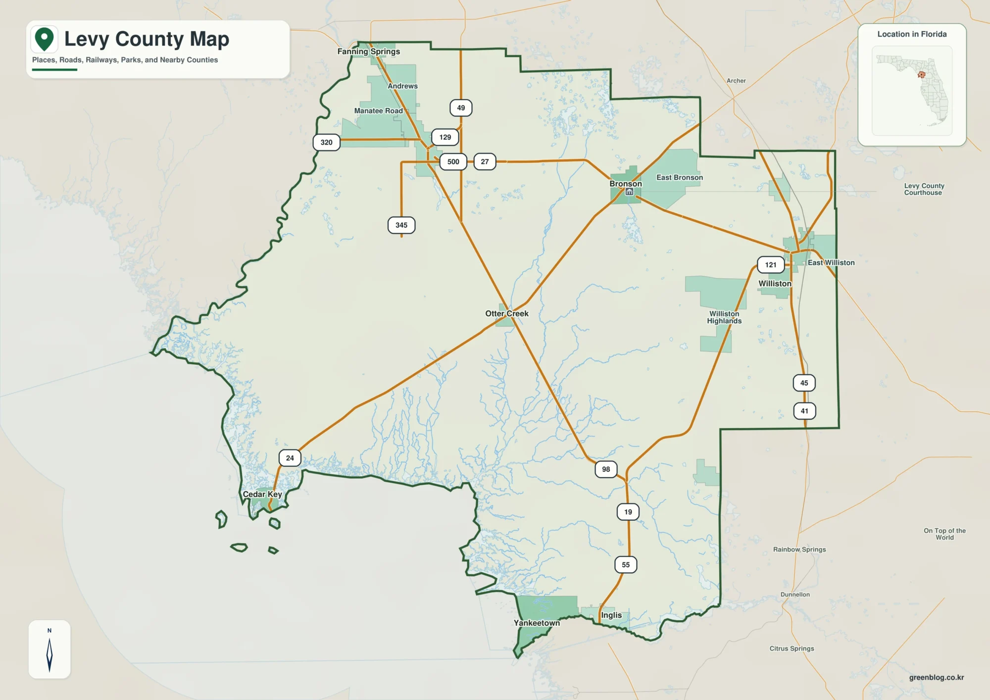
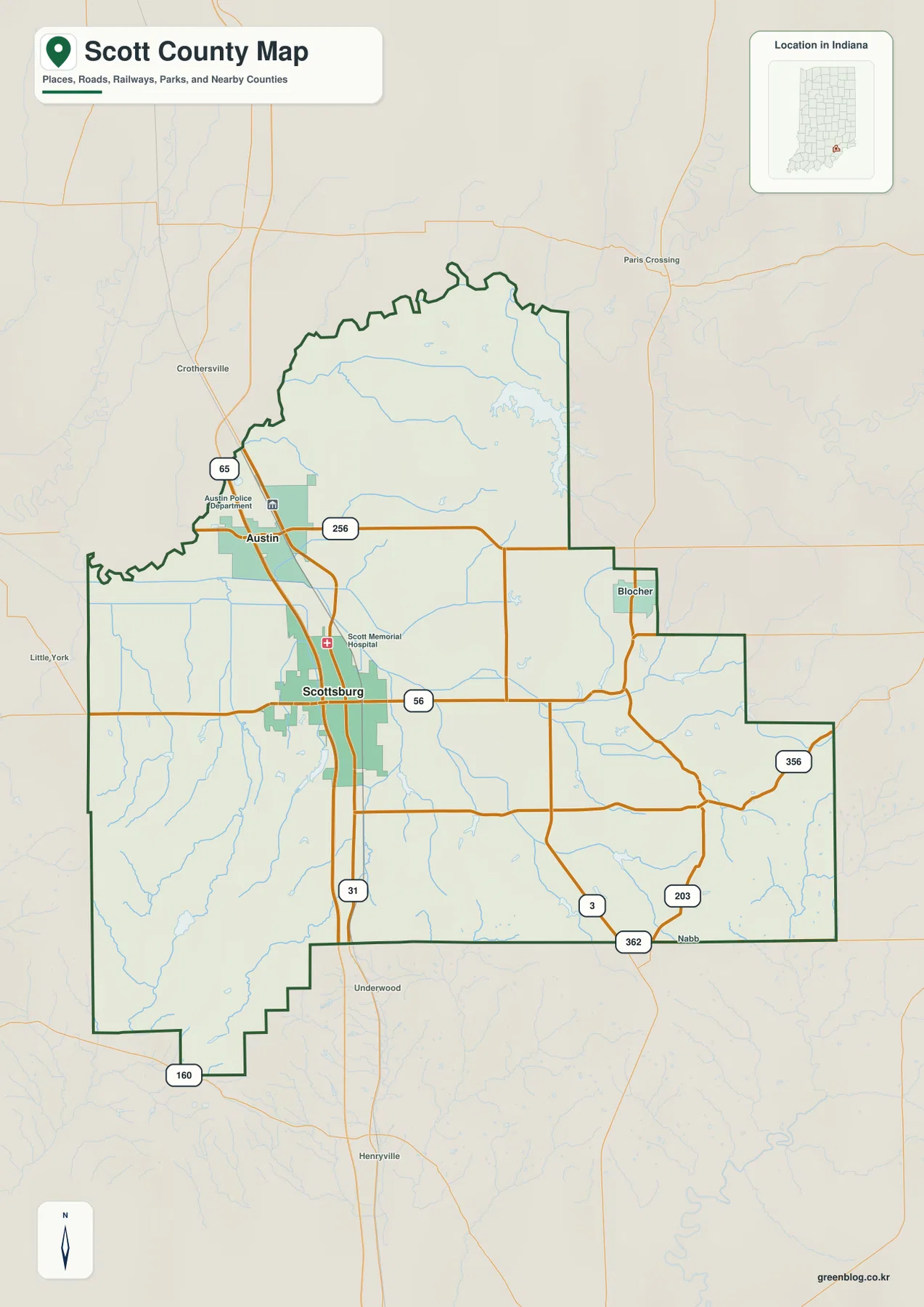
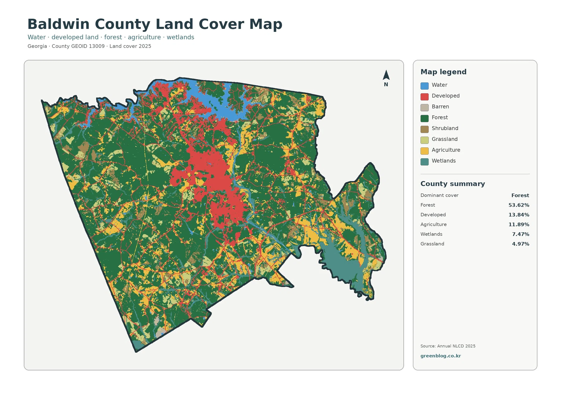
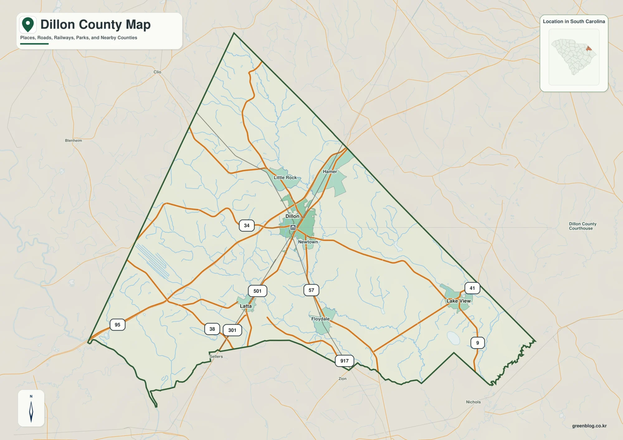
Waldo County stretches from the Belfast and Searsport shoreline into a much broader inland landscape around Unity, Swanville, and the county’s northern towns. The road map makes this contrast easy to see: settlement names and highways are more concentrated around the coast, while the interior opens into a network of smaller roads, streams, ponds, and wooded terrain. This page compares the county boundary and road map, the simplified city index, and the terrain-water map. The same map themes are also available as high-resolution JPG files in a downloadable ZIP archive.
The county government’s own overview states that Waldo County was incorporated in 1827 and contains 25 towns plus the City of Belfast, which serves as the county seat. That organization is reflected in the maps. Belfast is the strongest coastal reference point, Unity gives the northwestern interior a clear anchor, Winterport marks the northeastern side, and Searsport sits along the eastern shore. Islesboro appears separately offshore, reminding the reader that Waldo County includes both mainland communities and an island town in the coastal waters.
Table of Contents
Belfast anchors the coast without sitting at the center of the county
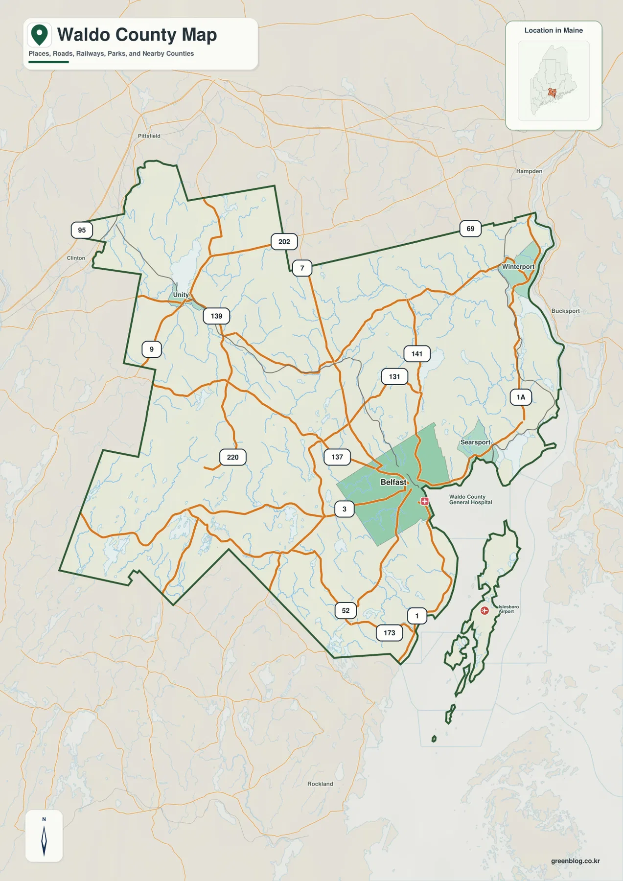
Belfast is the easiest place to start on the general county map because several roads meet there and the shoreline gives the city an unmistakable position. Route 3 approaches from the west, Route 7 runs northward, Route 137 reaches into the interior, and U.S. 1 follows the coastal side toward Searsport. South of the city, Routes 52 and 173 appear near the lower part of the county. This cluster makes Belfast useful as a reference point even though much of Waldo County extends well north and west of it.
Following the coast northeast from Belfast brings Searsport into view, while Winterport is farther north near the county’s northeastern edge. U.S. 1 and Route 1A help separate different coastal and inland approaches, and Route 69 appears near the Winterport side of the map. West of Belfast, the road pattern changes. Routes 137, 131, and 141 spread through a less concentrated interior where small waterways and town roads become more prominent than a single urban center.
Unity provides a second useful anchor on the opposite side of the county. U.S. 202, Route 9, and Route 139 are visible around this part of the map, while Route 220 runs through the western interior. Instead of one road radiating from Belfast to every town, the map shows several routes sharing the work of connecting inland communities. That distributed pattern is important when reading Waldo County: the county is not built around one dominant highway corridor, and different road numbers become useful depending on which side of the county a reader is examining.
The boundary itself also deserves attention. Inland sections include long straight stretches mixed with irregular corners, while the southeastern side becomes much more complex where rivers, coves, islands, and the coast meet. Islesboro is separated from the mainland and appears as a distinct island area. On a small printout, it is usually best to identify Belfast, Unity, Winterport, Searsport, and the county outline first, then zoom in or move to the full-size JPG when individual road numbers are needed.
U.S. 1 and U.S. 202 frame two very different parts of Waldo County
One practical way to organize the road network is to separate the coastal corridor from the inland routes. U.S. 1 is the clearest highway reference around Belfast and Searsport, where the shoreline bends and settlement names are closer together. Route 3 heads inland from Belfast, making it useful for understanding the county’s east-west relationship. These roads do not explain every local connection, but they establish a simple frame before the smaller numbered routes are added.
U.S. 202 is more useful in the northwestern and upper part of the county, especially around the Unity side of the map. Route 7 runs toward Belfast from the north, while Routes 137, 141, and 131 occupy the central and eastern interior. Route 220 is a strong western reference, and Routes 9 and 139 help identify the road pattern around Unity. The map therefore rewards a regional approach: rather than trying to memorize every number, choose the large road closest to the area of interest and then follow the smaller branches.
The Winterport side introduces another set of connections, including Route 69 and Route 1A. Farther south, Routes 52 and 173 appear closer to the lower boundary. Because the road network is spread across a broad rural county, the visual distance between routes can be much larger inland than around Belfast. This difference is useful in classroom or reference use because it shows why a coastal town map can feel busy while an inland section of the same county looks comparatively open.
This county map is not a live navigation product. Construction, closures, winter conditions, bridge restrictions, and route details can change, so actual travel should be checked with current MaineDOT information and a navigation service. The map works best for orientation: locating the main communities, seeing how roads cross the county, and understanding which routes lead toward the coast or deeper into the interior.
Why the City Index marks only Belfast
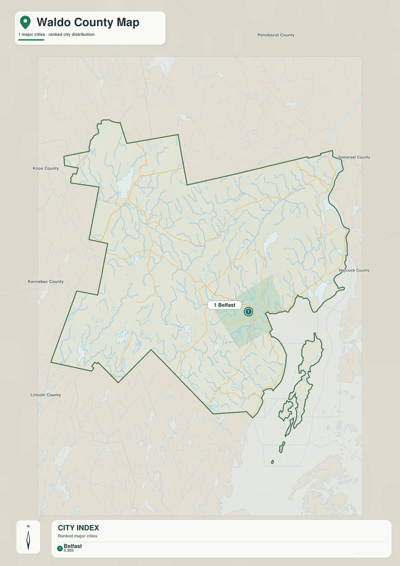
The City Index removes much of the road detail and places a single ranked marker on Belfast. The index at the bottom shows Belfast in the number-one position with the figure 6,986. The image does not state the year or statistical definition behind that figure, so it should not be treated as a current population estimate. Readers who need recent population data should use the latest U.S. Census Bureau figures rather than assuming the number on this graphic is current.
The point of this simplified view is location rather than statistics. Belfast appears near the southeastern coast, well away from the northwestern and western limits of the county. With small town labels removed, it becomes immediately clear that the county’s best-known city is not geographically centered. The outline also preserves the offshore island area, so the map still communicates that Waldo County extends beyond the mainland coast.
The official county website explains why the city index can look sparse: Waldo County contains 25 towns and the City of Belfast. A city-only ranking therefore omits places such as Unity, Searsport, and Winterport even though they are important geographic references on the full county map. The City Index should be read as a companion image, not as a complete settlement map. Use it when a presentation needs a clean city marker, then return to the general map for towns and road connections.
There are no connector lines or distance labels on this City Index. It does not provide straight-line mileage from Belfast to other communities, nor does it imply driving distance. If a trip or distance comparison is the goal, the general road map or a separate routing tool is more appropriate. Keeping that limitation clear prevents a simple city graphic from being used for a purpose it was not designed to serve.
Rivers and lakes connect the inland hills to the coast
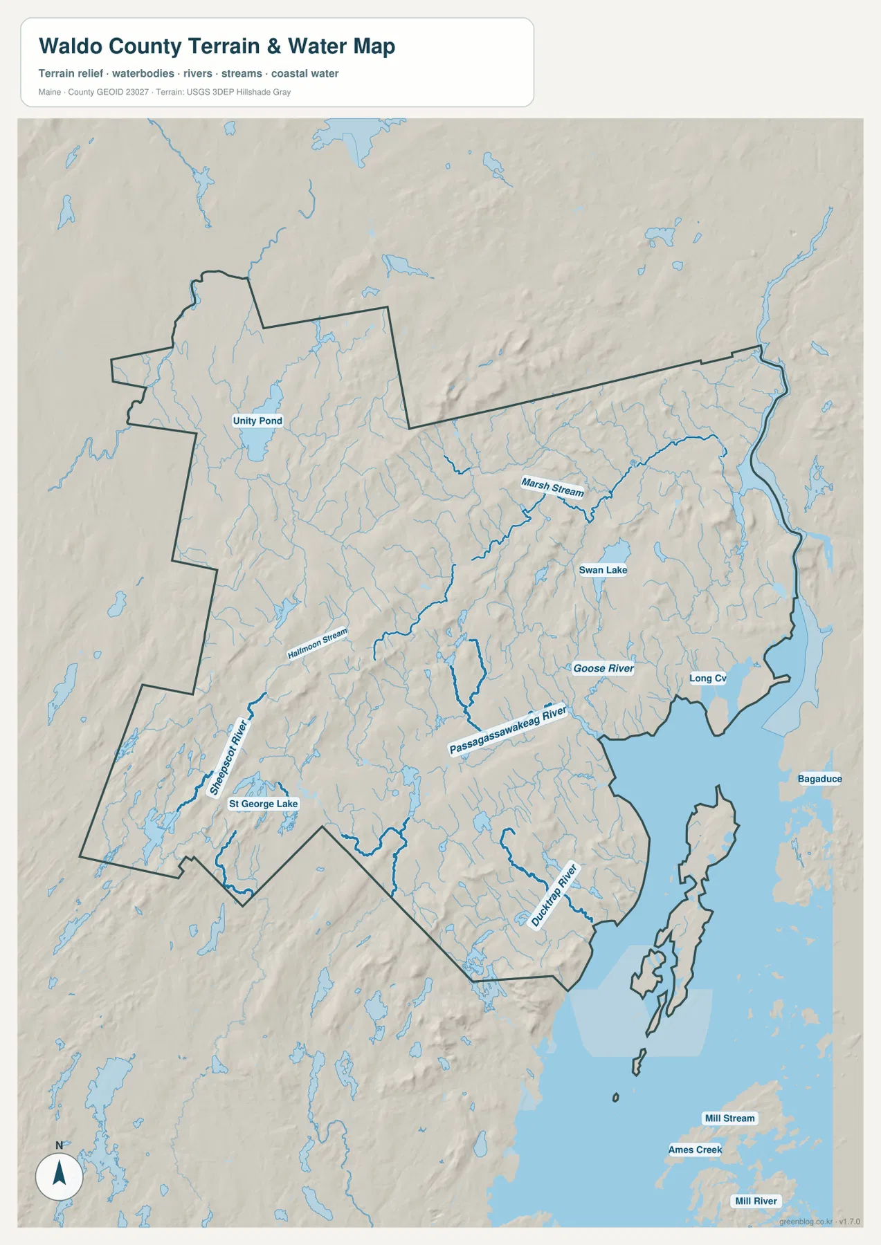
The terrain-water map changes the emphasis completely. Around Belfast, the Passagassawakeag River is one of the most prominent named waterways, while the Goose River appears farther east. Marsh Stream is labeled in the northeastern part of the county, and the Ducktrap River reaches the southern coast. Looking at these features after the road map helps explain why the coastal boundary is so irregular and why some roads bend around valleys and water rather than following a simple grid.
In the western and southwestern interior, the Sheepscot River is labeled as a long watercourse, with Halfmoon Stream and many smaller tributaries visible nearby. The map does not require the reader to identify every blue line. A better approach is to locate one large river or pond near the area of interest and then use the smaller streams to understand local drainage. Around Belfast, that starting point might be the Passagassawakeag River; around Unity, Unity Pond offers a much clearer landmark.
Several inland lakes stand out. Unity Pond sits near the northwestern community of Unity, Swan Lake lies farther east, and St George Lake appears toward the western side of the county. Together they show that Waldo County’s water geography is not confined to the coast. Ponds and streams are distributed well inland, so the county’s hydrology changes gradually from interior lakes and small rivers to tidal and coastal waters near Belfast, Searsport, and the islands.
The shaded relief in the background is useful for seeing ridges and valleys, but it is not a survey-grade elevation model. It can suggest where waterways follow lower ground and where the terrain becomes more rolling, yet it does not provide precise elevations or slope measurements. Engineering, construction, surveying, or detailed trail planning requires authoritative elevation data such as the USGS 3D Elevation Program rather than measurements inferred from this graphic.
From Unity Pond to Islesboro, water changes the shape of the map
The northwestern part of Waldo County is dominated by inland water references such as Unity Pond and numerous narrow streams. Moving toward the center introduces Swan Lake and additional river branches, while the Belfast side transitions into broader coastal water. This progression is not a straight geographic line, but it gives the terrain-water map a clear rhythm: ponds and narrow rivers inland, increasingly complex coves and shorelines closer to the sea.
Near Belfast, the Passagassawakeag River approaches the coast and Goose River appears on the eastern side. Long Cove is labeled near the shore, and the lower map shows the coastal water around Islesboro and smaller islands. The Ducktrap River reaches the coast farther south. These features make the southeastern edge of the county much more irregular than the inland boundary and help explain why a road-only map can understate how strongly water shapes the county’s geography.
The water map should not be used as a flood map, nautical chart, legal boundary survey, or source of water depth. It does not show tides, navigable channels, real-time river levels, flood probability, or parcel ownership. Boating, emergency planning, and regulatory questions require current information from agencies such as NOAA, FEMA, USGS, or the State of Maine. This map is best understood as a geographic reference for the relative locations of rivers, ponds, coastline, and terrain.
For readers working on the inland part of the county, the most efficient method is to begin with Unity Pond or St George Lake and then follow nearby streams. For coastal work, Belfast and the Passagassawakeag River provide a better starting point, with Goose River, Ducktrap River, coves, and the islands added afterward. Using a few strong landmarks is much easier than trying to absorb every water name at once.
Choosing the most useful Waldo County map
Use the general county map when the main question involves roads, town locations, county boundaries, or the relationship between Belfast and inland communities. It has the most complete transportation context of the three supplied images. U.S. 1, U.S. 202, Route 3, Route 7, and the smaller state routes make it possible to trace broad travel directions even without live traffic information.
Use the City Index when simplicity matters more than detail. A presentation focused on Belfast does not need every route number or stream name, and the single marker makes the city’s coastal position obvious. For rivers, ponds, shoreline form, and relative terrain, the terrain-water map is the better choice because it labels the Passagassawakeag River, Unity Pond, Swan Lake, St George Lake, and other water features directly.
All three downloadable originals are JPG files measuring 2572 × 3638 pixels. That size is useful for zooming into labels or placing a map on a full document page. A smaller handout may work better with a cropped area centered on the topic being discussed. Enlarging the file does not add live road conditions, parcel boundaries, survey measurements, flood risk, or navigation details, so specialized work should always be checked against the appropriate official source.
The ZIP archive contains the high-resolution versions of the same three map themes shown in the article: the county and road map, the City Index, and the terrain-water map. They work well for personal reference, classroom material, presentations, and general regional comparison. For legal, engineering, emergency, or navigation decisions, use the relevant current agency data instead of relying on these overview graphics.
Frequently Asked Questions
Why does the Waldo County City Index show only Belfast?
The supplied City Index ranks only major cities, and Belfast is the only location marked in that format. The county government’s overview explains that Waldo County is made up of 25 towns plus the City of Belfast, so places such as Unity, Searsport, and Winterport are not absent because they are unimportant. They appear on the general county map, which is the better source for town locations and roads.
Which roads are easiest to use as landmarks between Belfast and the interior?
Route 3, Route 7, and Route 137 are useful references around Belfast and the central county, while U.S. 202, Route 9, and Route 139 help orient the Unity side. U.S. 1 is the clearest coastal reference around Belfast and Searsport. These map relationships are useful for orientation, but actual driving routes, travel times, and current road conditions should be checked with a navigation service and MaineDOT information.
Can the terrain-water map be used for flood, boating, or precise elevation decisions?
No. The terrain-water map is a general reference showing rivers, ponds, coastal water, and shaded relief. It does not provide flood zones, water depth, tides, navigation channels, parcel boundaries, or survey-grade elevations. Use current data from FEMA, NOAA, USGS, or the State of Maine when those details affect safety, legal decisions, engineering, or navigation.
Map File Information
The ZIP archive contains three high-resolution JPG maps of Waldo County matching the map themes explained on this page.
- Included Files: county and major roads map, City Index map, terrain and water map
- Printable Size: 2572 × 3638 pixels each
- File Type: JPG
Related Maps
Sources and References
- Waldo County – About Waldo County
- U.S. Census Bureau – TIGER/Line Shapefiles
- USGS – National Hydrography
- USGS – 3D Elevation Program
Green Map creates custom-edited map images using open geographic data sources such as geoBoundaries, Natural Earth, OpenStreetMap, and government open data. These maps are edited visual materials, not raw data files, and are provided for education, documents, presentations, and graphic reference.