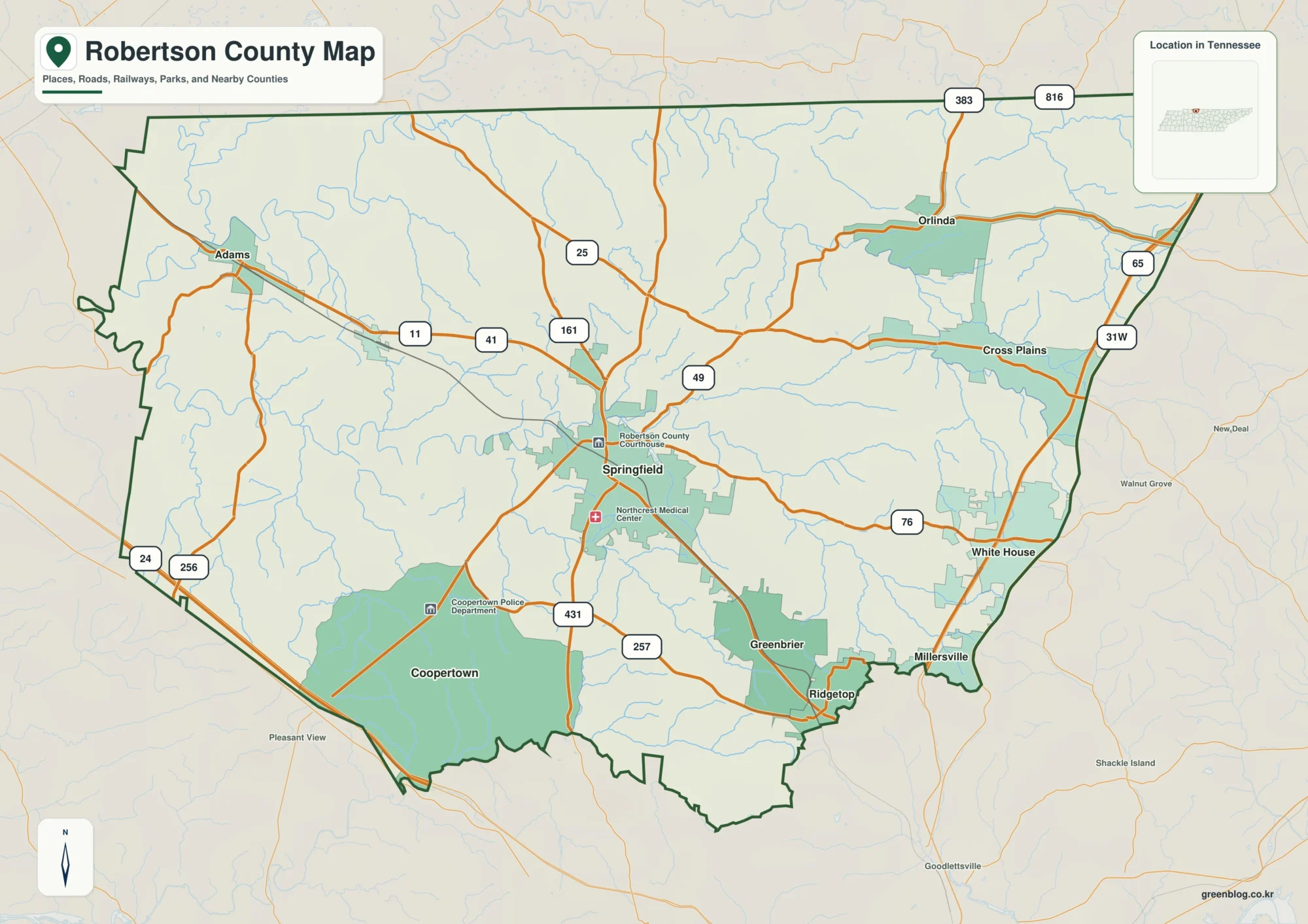
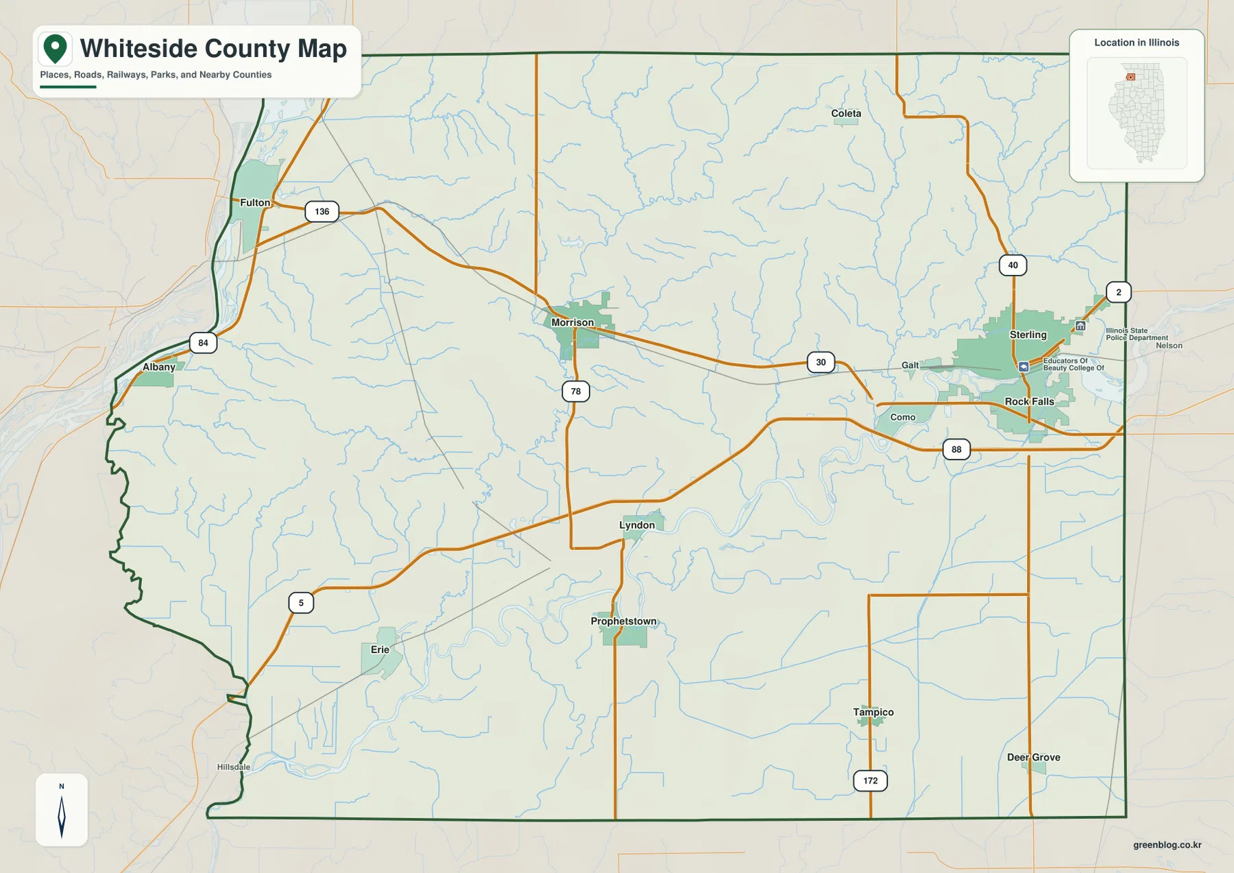
Allen County lies in south-central Kentucky, with Scottsville serving as the county seat and the clearest road reference in a landscape of rolling ridges, narrow stream valleys, and the southern reaches of Barren River Lake. US 231 and US 31E provide the major north–south framework, while KY 100, KY 101, KY 98, KY 234, KY 252, and KY 265 connect rural communities and the lake country. The terrain becomes lower around the Barren River system and more deeply cut across the central and southern interior. High-resolution map files are available for download in the section below.
This guide follows Scottsville, the main roads, Barren River Lake, Bays Fork, Trammel Fork, and terrain ranging from about 138 to 295 meters. WebP previews are available for quick viewing, and the matching high-resolution JPG files can be downloaded together in one ZIP for printing, classroom work, or offline reference.
Table of Contents
Scottsville anchors a road network built around US 231 and US 31E
Scottsville sits slightly north of the county center, with US 231 providing a major north–south route and US 31E linking the area toward Tennessee and Barren County. KY 100 heads east toward the Fountain Run side, while KY 101 and KY 234 organize much of the northern countryside. KY 585 and KY 265 serve the west, and KY 174, KY 482, and KY 99 provide references across the southern half.
The Kentucky Department for Local Government identifies Scottsville as the Allen County government center. A Kentucky Historical Society marker explains that Allen County was created in 1815 from parts of Warren and Barren counties and named for John Allen, a Kentucky legislator and officer killed at the Battle of River Raisin. The modern map still concentrates roads and public functions around Scottsville.
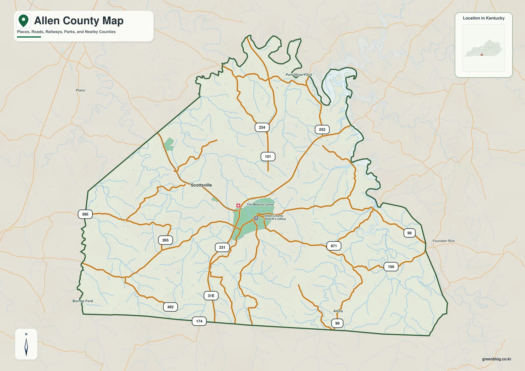
Port Oliver Ford appears near the Barren River Lake side of the northern county, while Fountain Run provides a nearby reference beyond the eastern boundary. The Tennessee state line lies just south of the map. Outside Scottsville, settlement is sparse enough that route numbers and creek valleys often provide better orientation than town markers.
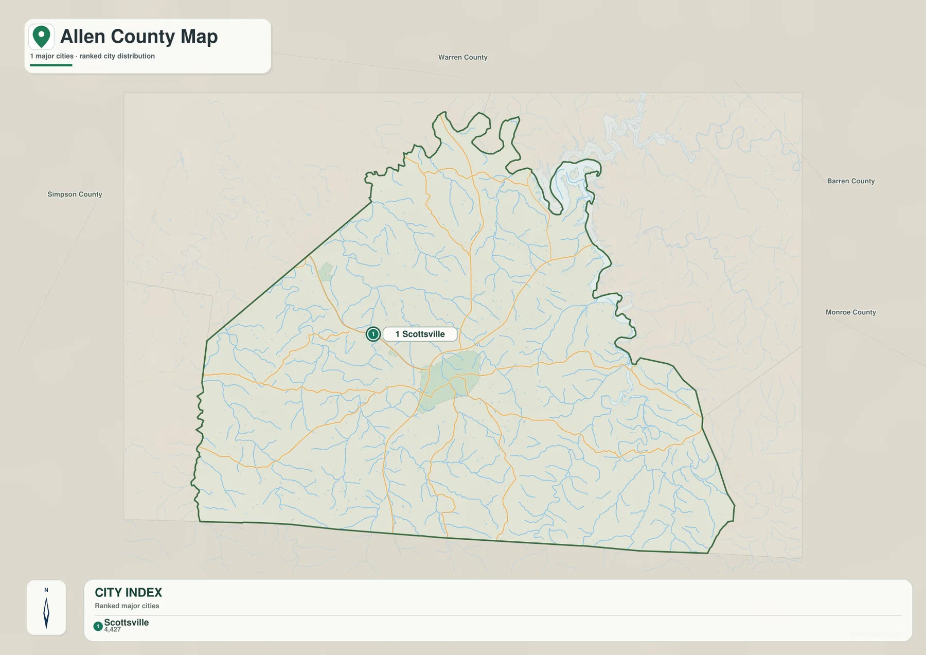
Scottsville is the only community ranked on the supplied city panel
The supplied city panel lists Scottsville at an index value of 4,427 and does not rank another Allen County city. This is a map index rather than a current official population estimate. The panel therefore works best as a statement of Scottsville’s central role rather than as a complete population table.
That single-center pattern fits the broader county map. Government offices, medical services, and the denser street network all cluster around Scottsville, while rural roads and streams become the dominant references farther from town. Other named places can appear on the general map without being part of the ranked-city dataset.
Kentucky Tourism presents Scottsville as the community center for Allen County and highlights its rural surroundings, outdoor recreation, and small-town setting. That local description reinforces what the map shows: one primary town serving a large countryside rather than several similarly sized urban centers.
Barren River Lake and the northern tributaries create the county’s largest water landscape
Barren River Lake is the strongest water feature in the northeast. The U.S. Army Corps of Engineers places the reservoir in the rolling hills of Allen, Barren, and Monroe counties and locates the dam about 12 miles east of Scottsville on KY 252. The county map’s Port Oliver and KY 252 references fit directly into this lake-and-dam setting.
Southwest of the reservoir, Difficult Creek and Walnut Creek cut through the northern interior. Bays Fork is a major drainage reference farther west, joined by short tributaries from both sides. Shallow Creek also divides the northwestern uplands and creates a long low corridor toward the broader drainage system.
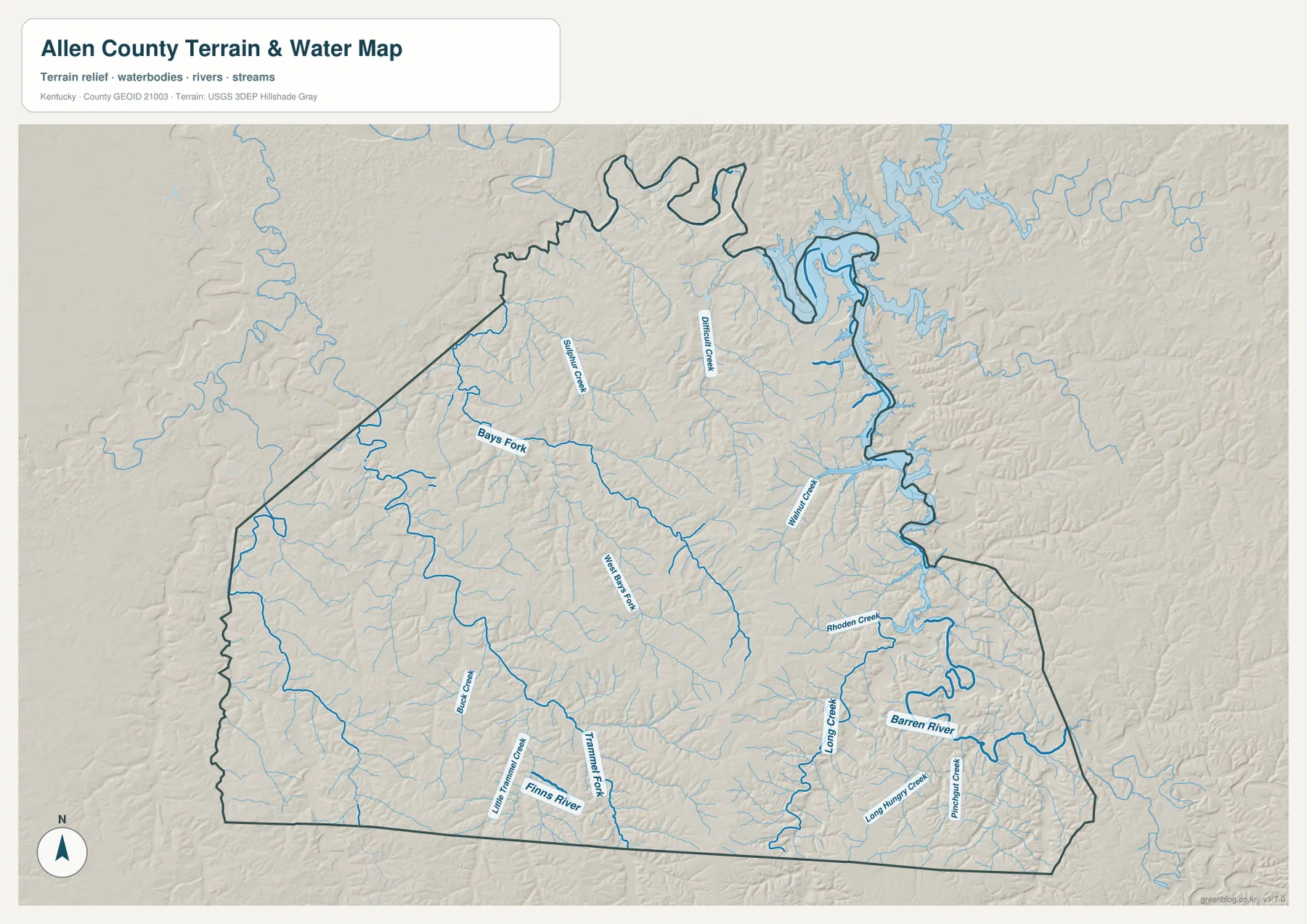
Across the southern half, Trammel Fork and Little Trammel Creek create long valleys through the hills, with Butts Creek and many shorter branches adding local relief. The Barren River forms a broad low corridor in the southeast, where Long Creek, Long Hungry Creek, and Pleasant Creek create additional deeply cut valleys.
Kentucky Department of Fish and Wildlife Resources listings identify Port Oliver and the Barren River Lake tailwater as access points in Allen County. The supplied image is still a geographic reference rather than a flood, navigation, water-quality, parcel, or access-status map, so current USACE and KDFWR information should be checked before boating or shoreline use.
Elevation from 138 to 295 meters reveals a county of ridges and narrow stream bottoms
The elevation surface ranges from about 138 to 295 meters, with a mean near 214 meters. The lowest green terrain follows the Barren River, the lake margins, and major creek valleys. Higher tan and brown ridges spread across much of the central and southeastern interior, creating more than 150 meters of county-wide relief.
The northern side contains many low corridors connected to Barren River Lake and its tributaries, but the terrain rises quickly inland. Around Scottsville, intermediate uplands are repeatedly cut by creek bottoms. South and southeast of town, higher ridges become more continuous even though Trammel Fork and numerous small branches carve long green channels between them.
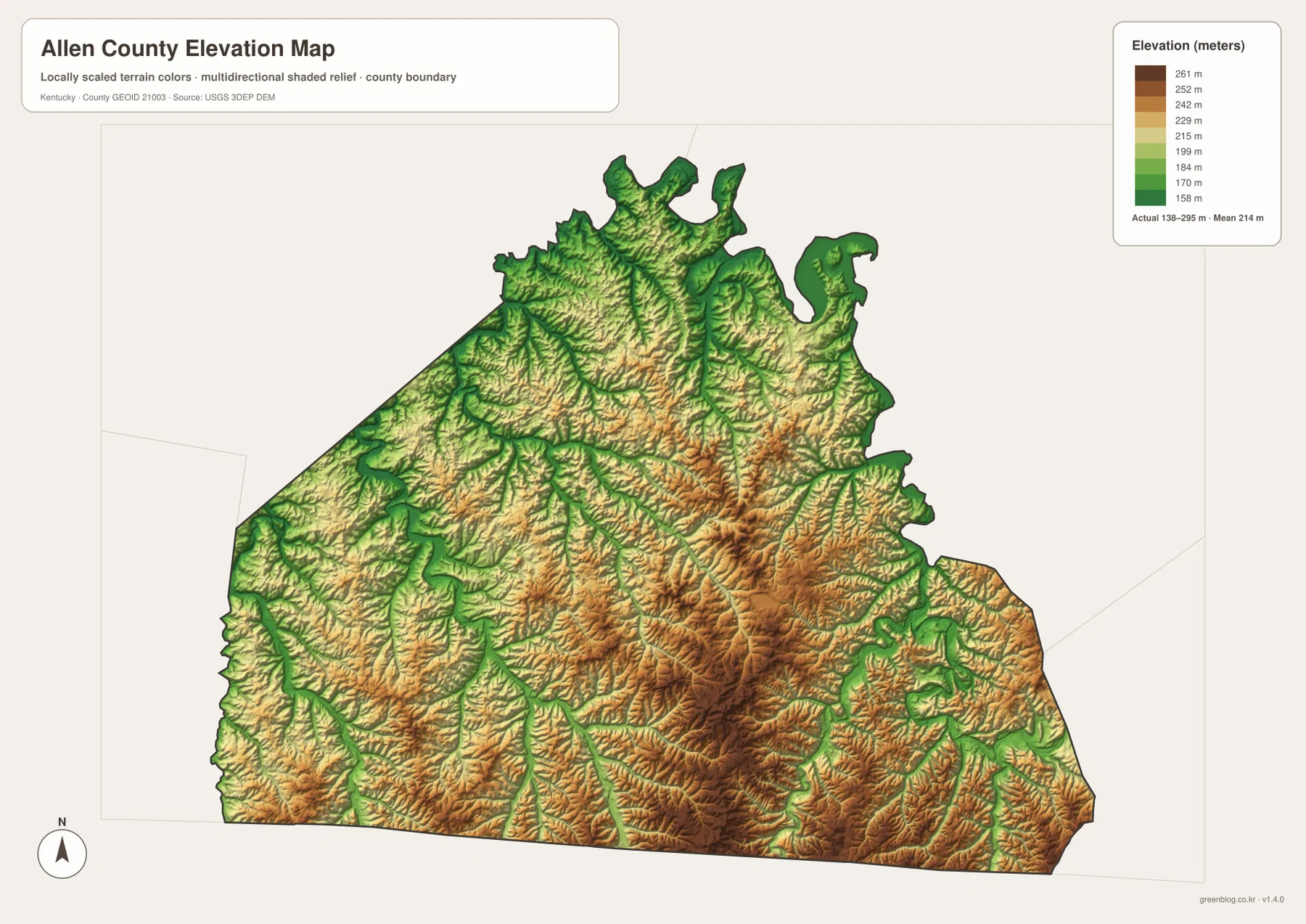
The southeast shows one of the strongest contrasts: the Barren River occupies low ground while higher terrain rises immediately to the west. Similar short-distance changes occur along Bays Fork and the Trammel system, explaining why many rural roads bend around ridges and follow lower stream corridors.
The elevation surface is generalized for county-scale comparison. It is not survey-grade or engineering-grade measurement and should not be used for parcel elevations, construction grades, drainage design, or legal boundary work.
Scottsville Public Spring explains why the county seat developed at this location
A Kentucky Historical Society marker records that Allen County was formed in 1815 and that the present Scottsville site was chosen as the county seat in 1816 because of the abundant water supply from the Public Spring. The county purchased 100 acres, laid out lots, and sold them to finance courthouse construction.
That history gives the modern road map an older geographic explanation. Scottsville is now the place where roads and public services concentrate, but its original advantage was dependable water. The spring story connects the settlement pattern directly to the water-rich landscape visible across the county maps.
Dumont Hill and Scottsville preserve a Civil War layer of local history
The Kentucky Heritage Council includes Dumont Hill in Scottsville on its list of Kentucky Civil War sites. A separate Kentucky Historical Society marker records a Confederate attack on Scottsville in December 1863, when a Union garrison was captured and military stores were seized.
Today Dumont Hill is part of Dugas Community Park, a 346-acre nonprofit park in Scottsville. The park combines woodland and open-space trails with local heritage, making it one of the easiest places to connect the rolling terrain shown on the elevation image with Allen County’s Civil War-era history.
The lake route and the southern forks reveal two different sides of Allen County
Traveling northeast from Scottsville on the KY 252 side leads into lower terrain around Barren River Lake and the dam. The USACE setting of a reservoir surrounded by rolling hills is clearly visible in the water and elevation images, and nearby Port Oliver provides a practical map reference for the lake side.
Heading south on US 231 or local roads toward the Tennessee line produces a different landscape. Trammel Fork, Little Trammel Creek, and numerous short tributaries cut through inland ridges. The KY 100 side moves closer to the Barren River and Long Creek system, while the western KY 585 and KY 265 side crosses the Bays Fork country.
For posters, classroom prints, or presentation slides, use the original JPG files in the download archive rather than enlarging the web previews. Small route labels, creek names, Scottsville text, and the elevation legend remain clearer at the higher resolution.
Frequently Asked Questions
Why does the city map show only Scottsville?
The supplied ranked-city dataset contains one Allen County entry: Scottsville at 4,427. Other place names can appear on the general county map, but they are not included in the city ranking panel, and 4,427 should not be treated as a current official population count.
Where is Barren River Lake in relation to Scottsville?
Barren River Lake occupies the northeastern side of Allen County, and the U.S. Army Corps of Engineers places the dam about 12 miles east of Scottsville on KY 252. Port Oliver is also an Allen County access reference near the lake.
Why was Scottsville chosen as the county seat?
According to the Kentucky Historical Society, the location was selected in 1816 because the Public Spring provided an abundant water supply. The spring therefore played a direct role in the early placement and growth of the county seat.
Map File Information
The archive contains the Allen County, Kentucky general county map, city map, terrain-and-water map, and elevation map as original high-resolution JPG files.
- Included Files: Use only the versions confirmed in the article and supplied images
- File Type: Use the confirmed download contents
- Intended Use: Printing, education, presentations, and map-based projects
Related Maps
Sources and references
- Kentucky Department for Local Government: Allen County — county government location and basic county information
- Kentucky Historical Society: County Named 1815 — Allen County formation and the origin of its name
- Kentucky Historical Society: Scottsville Public Spring — the 1816 county-seat decision and Public Spring history
- U.S. Army Corps of Engineers: Barren River Lake — reservoir setting and dam location in the Allen–Barren–Monroe county area
- Kentucky Heritage Council: Civil War Sites — Dumont Hill in Scottsville as a recognized Civil War site
- USGS 3D Elevation Program — elevation and terrain reference data
Green Map creates custom-edited map images using open geographic data sources such as geoBoundaries, Natural Earth, OpenStreetMap, and government open data. These maps are edited visual materials, not raw data files, and are provided for education, documents, presentations, and graphic reference.