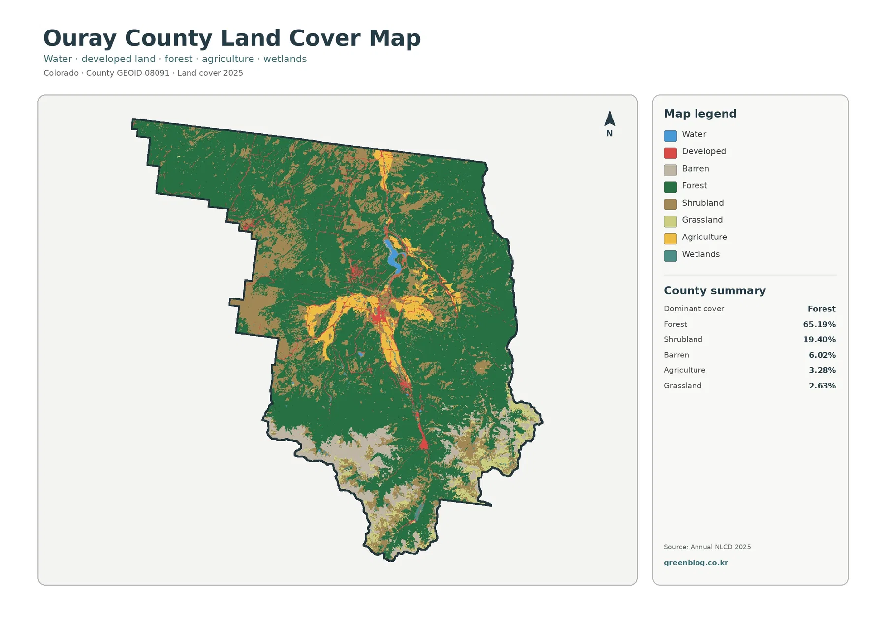
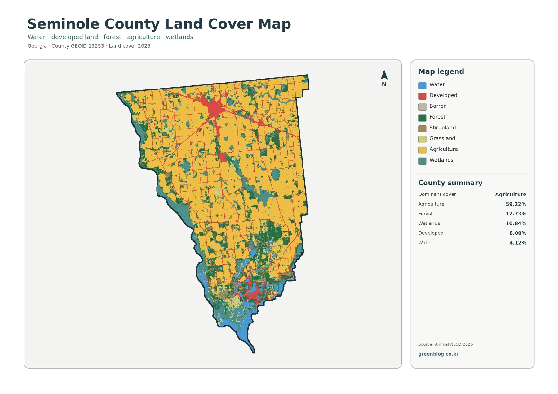
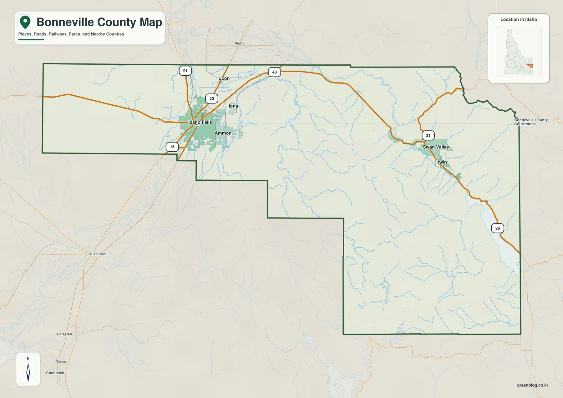
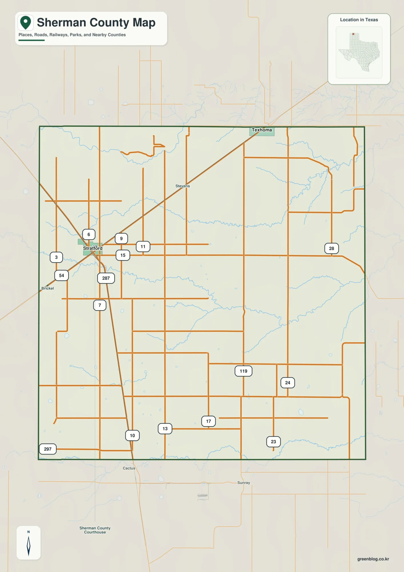
Miami County is organized around Peru and the Wabash River, with Denver and Macy in the north and Bunker Hill, Amboy, and Converse spread through the southern half. You can download the high-resolution JPG ZIP directly from this page when you need larger place names, road shields, river and creek labels, or elevation shading. This Miami County Indiana Map page combines the Peru road network with a six-place city index, the Wabash River and smaller tributaries, and a 152–274 meter elevation surface that contrasts the high northern county with the central river valley.
Peru is the strongest reference point because it sits near the middle of the county and directly on the Wabash River. Miami County’s official Peru page identifies the city as the county seat and notes its location on the river. On the map, U.S. 24 and State Road 19 meet the broad central road network around Peru, while Mexico, Denver, Chili, and Macy extend the settlement pattern northward. Grissom Air Reserve Base creates another unmistakable landmark southwest of Peru.
The relief map changes the county’s appearance dramatically. Its legend gives an actual elevation range of about 152 to 274 meters and a mean of 238 meters. Much of the north is brown and relatively high, while the Wabash River occupies a deep green lowland across the center. South of the river, the land rises again into gentler terrain, but Little Pipe Creek, Deer Creek, and other channels cut distinct lower valleys through it.
Table of Contents
Peru and the Wabash River make the central road network easy to orient
Peru has the largest developed footprint on the general map. U.S. 24 crosses the central county near the city, and State Road 19 approaches from the Chili side before continuing south. Route 124 provides another eastern and southeastern reference. Dukes Memorial Hospital is labeled on the western side of the urban area, which helps confirm the location of Peru when the surrounding road network becomes dense.
North of Peru, Mexico appears first, followed by Denver and Chili farther up the county. Denver sits near the road labeled 700, while Chili is close to State Road 19. Macy lies still farther north and west. Route 16 crosses the upper county from west to east, giving the northern settlements a simple road reference before the landscape reaches the Fulton County side.
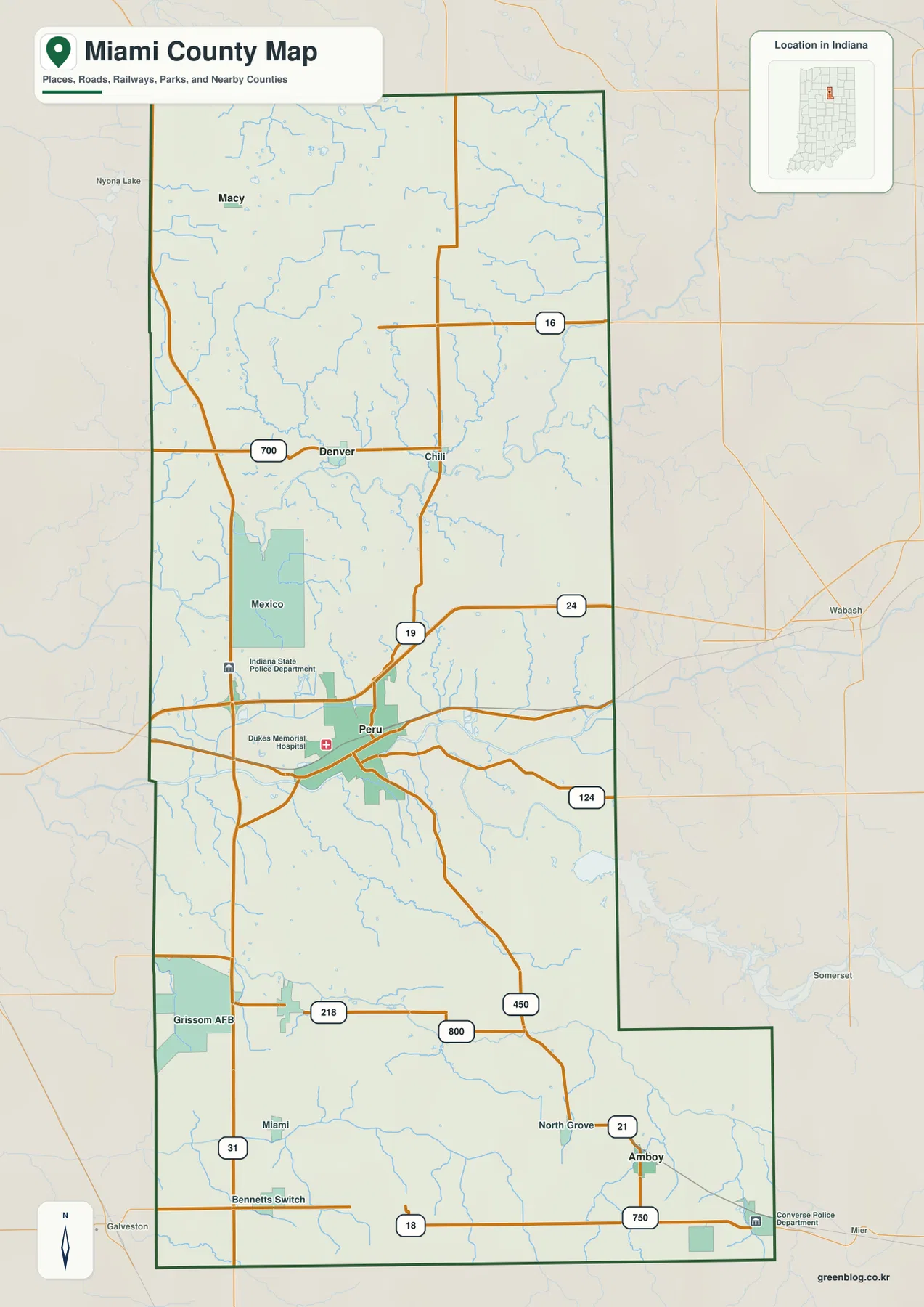
In the southern half, U.S. 31 runs down the western side and roads 218 and 800 help locate the Grissom Air Reserve Base area. Bunker Hill is the strongest settlement reference nearby, with Miami and Bennetts Switch appearing as smaller labels. Farther southeast, North Grove and Amboy align with Routes 21, 18, and 750 near the county’s lower extension.
Grissom Air Reserve Base is visually distinctive because its mapped facility area is much larger than the nearby small communities. The U.S. Air Force Reserve Command identifies Grissom as the home of the 434th Air Refueling Wing. On the county map, the installation also works as a practical southwestern landmark near U.S. 31 and Route 218.
The city index shows Peru far ahead of smaller settlements at both ends of the county
The supplied city index highlights Peru, Bunker Hill, Converse, Denver, Amboy, and Macy. Peru is printed at 10,901, followed by Bunker Hill at 940 and Converse at 813. Denver is shown at 553, Amboy at 338, and Macy at 199. These figures belong to the supplied map edition rather than a live population feed. Their clearest use here is to show how strongly Peru dominates the center while the other highlighted places are spread through the northern and southern ends.
| Rank | Place | Value printed on map | Position |
|---|---|---|---|
| 1 | Peru | 10,901 | Central |
| 2 | Bunker Hill | 940 | Southwest-central |
| 3 | Converse | 813 | Southeast boundary |
| 4 | Denver | 553 | North-central |
| 5 | Amboy | 338 | Southeast |
| 6 | Macy | 199 | Northwest |
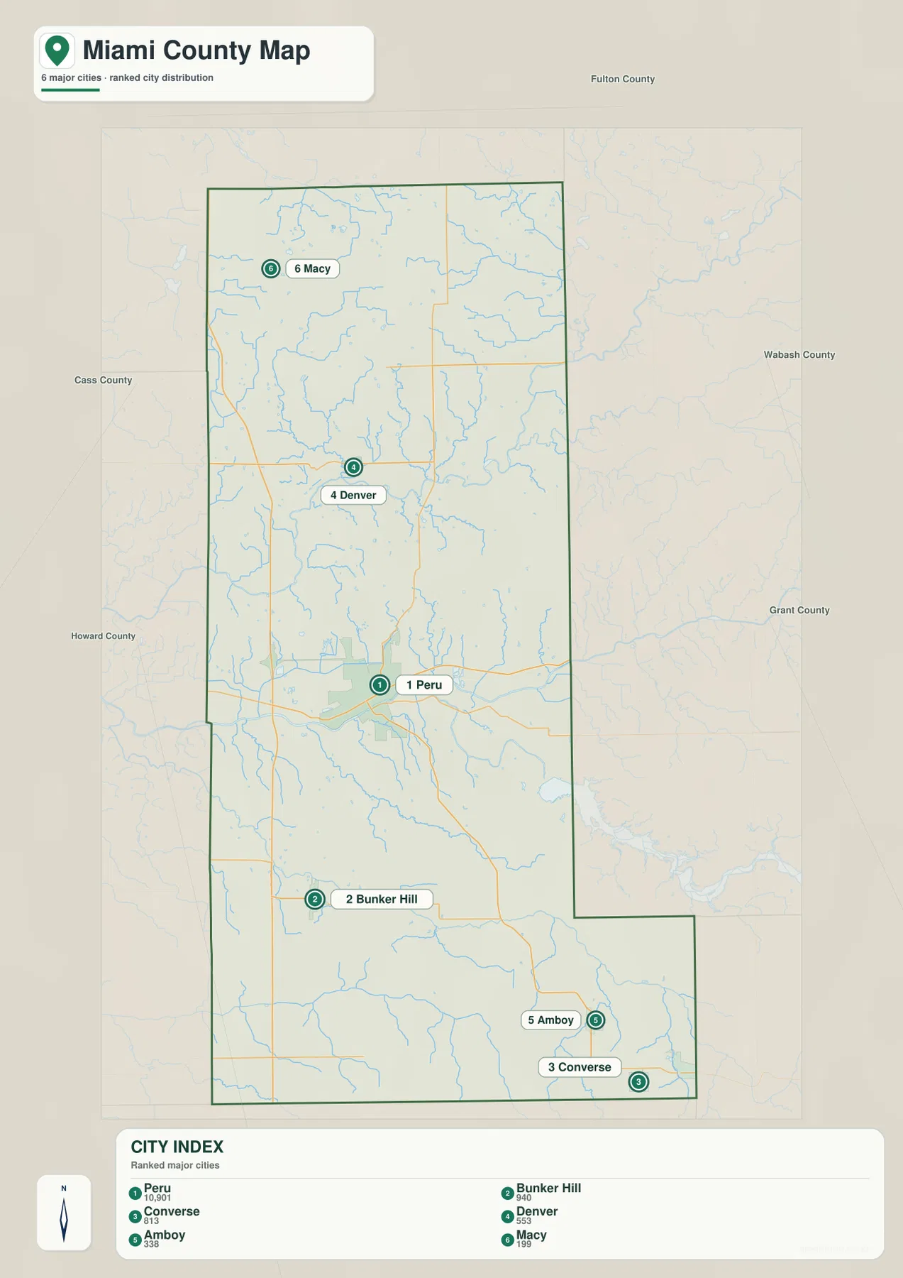
The gap between Peru and Bunker Hill is large enough that Miami County reads as one dominant urban center surrounded by small settlements rather than a chain of similarly sized towns. Denver and Macy are separated from Peru by a long northern rural section. Amboy and Converse occupy the elongated southeastern end, while Bunker Hill sits closer to the county’s southwestern middle.
The general map includes additional labels such as Mexico, Chili, North Grove, Miami, and Bennetts Switch that do not appear in the six-place index. Use the detailed map for those smaller places and actual road connections. Use the index when the goal is to compare the highlighted settlements without the visual competition of every road and water line. Current demographic work should use an up-to-date official source rather than the printed index values alone.
Wabash River forms the broad central lowland, with smaller creeks dividing the north and south
Wabash River is the strongest feature on the terrain-and-water map. It crosses the county from west to east in a broad series of bends and creates the low central corridor around Peru. Once Peru has been found on the road map, the river view immediately explains why the county’s middle section looks so different from the higher north.
The northern drainage is more intricate than one major river. Tenmile Creek and Little Weesau Creek lie on the western side, Washington Creek and Flowers Creek descend through the north-central area, and Squirrel Creek appears farther northeast. Simpson Rhoades Ditch adds another long artificial-looking drainage line on the eastern side of the upper county.
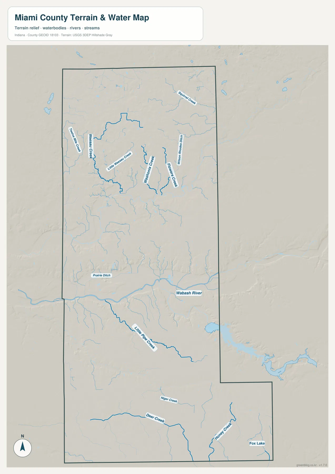
South of the Wabash, Little Pipe Creek creates a long southeastern corridor. Deer Creek crosses the lower western interior, and Honey Creek provides another low line farther southeast. Fox Lake is a small but useful landmark near the county’s lower-right corner. These features are especially helpful because the southern water map has few large city labels to guide orientation.
Miami County’s official Peru page reinforces the central geographic relationship by describing Peru as a city on the banks of the Wabash River. The supplied water image is still a reference map rather than a flood, navigation, legal-boundary, or current-water-condition product. Floodplain, property, or engineering decisions require the appropriate current USGS, FEMA, or local agency source.
The 152–274 m relief separates high northern ground from the deep Wabash River valley
The elevation legend gives an actual Miami County range of about 152 to 274 meters and a mean of 238 meters. Green identifies lower terrain, while yellow, tan, and brown mark progressively higher ground. The northern half is dominated by brown uplands, whereas the central Wabash corridor forms a wide dark-green lowland across the county.
The northwestern and north-central sections contain the strongest high terrain. Small creeks cut narrow lower lines into those uplands, but the overall surface remains well above the Wabash valley. The northeastern side becomes somewhat lighter in places, yet it still stands above the broad green river corridor.
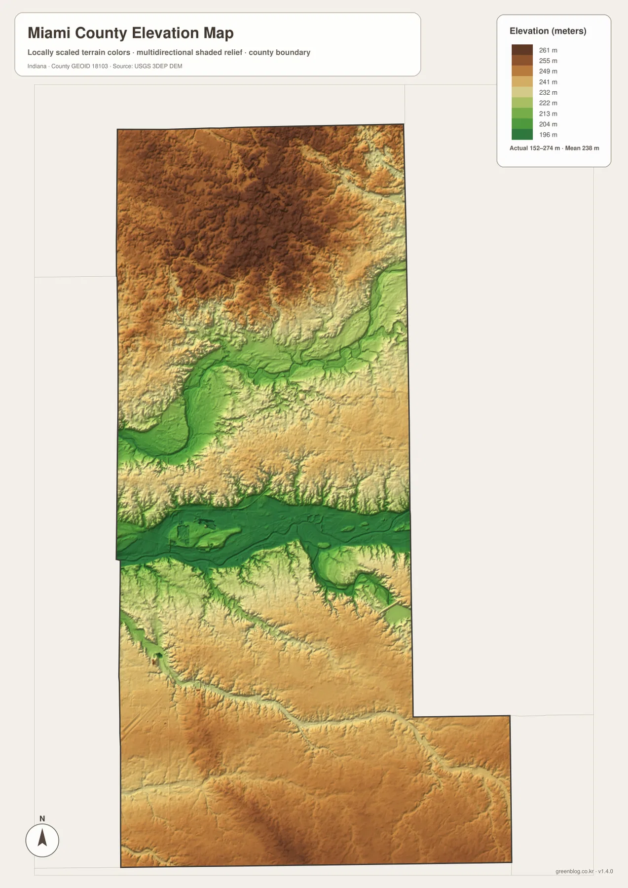
The Wabash River valley is the broadest low feature in the county. Its bends widen the green lowland around the Peru area, and the surface gradually rises into lighter greens and yellows away from the channel. The relationship between Peru and the river is therefore visible not only on the road and water maps but also on the relief surface.
South of the Wabash, the land rises again but does not become as uniformly high as the northern uplands. Little Pipe Creek and Deer Creek carve long green valleys through tan terrain, while Honey Creek provides another low route toward the southeastern boundary. A useful county-scale reading is high northern uplands, the deep Wabash lowland, and a gentler southern landscape dissected by creek valleys.
The 152–274 meter range is intended for broad terrain comparison, not survey-grade work. A parcel, foundation, road-grade, or drainage project should use original elevation data such as the USGS 3D Elevation Program or measurements from a qualified survey rather than this county-scale image.
Keep Peru fixed while comparing the Wabash valley, northern uplands, and southern creek corridors
For settlements and roads, start with Peru near U.S. 24 and State Road 19. Move north to Denver, Chili, and Macy, then south to Bunker Hill, Amboy, and Converse. Grissom Air Reserve Base and U.S. 31 make the southwestern part of the county easy to recognize even when smaller town names are difficult to read.
The city index works well when the goal is to compare the six highlighted places. Peru dominates the printed values, Denver and Macy mark the north, Bunker Hill and Amboy cover the southern interior, and Converse reaches the southeastern edge. Use a current official statistical source if current population totals are needed.
For physical geography, find Wabash River first, then add Washington and Flowers creeks in the north and Little Pipe, Deer, and Honey creeks in the south. Switch to the elevation image at those same locations and the pattern becomes clear: the Wabash occupies a deep central lowland, the north rises into broad uplands, and the southern creeks cut lower valleys through gentler terrain.
The WebP images on this page are reduced previews. The Miami County archive includes four 2572×3638-pixel JPG originals covering the general road map, city index, terrain-and-water view, and county elevation surface. The larger originals are better for printing or reading small road, river, creek, and place labels.
A practical comparison is to keep Peru fixed as the central reference. Find Denver and Bunker Hill on the general map, compare their scale on the city index, move to the water view to trace Wabash River and Little Pipe Creek, and finish on the elevation map by comparing the river lowland with the northern uplands. That sequence turns a long county with many small settlements into a much clearer geographic pattern.
Frequently Asked Questions
What is the county seat of Miami County?
Miami County’s official information identifies Peru as the county seat. On the supplied map, Peru lies near the middle of the county on the Wabash River and close to U.S. 24 and State Road 19.
Which waterways are easiest to recognize?
Wabash River is the strongest central reference. Little Pipe Creek, Deer Creek, and Honey Creek organize the southern half, while Washington Creek, Flowers Creek, Tenmile Creek, and several smaller channels divide the north. This Miami County water view is for locating rivers and creeks; flood status and legal water boundaries require the current agency source.
Can the 152–274 m elevation range be used for exact site measurements?
No. The elevation image gives a county-wide range with a mean of 238 meters and is intended for comparing the Wabash River lowland with the high northern terrain and southern creek valleys. Exact property or engineering work requires source elevation data or professional survey measurements.
Map File Information
The Miami County ZIP combines the general road-and-place map, six-place city index, terrain-and-water map, and elevation map as full-resolution JPG originals.
- File Type: ZIP containing four 2572×3638px JPG files
Related Maps
Sources and References
The article is based primarily on the supplied Miami County map set and asset manifest. The following official sources provide Peru, Grissom Air Reserve Base, boundary, hydrography, and elevation context.
- Miami County – Peru – official county information identifying Peru as the county seat and describing its Wabash River setting
- U.S. Air Force Reserve Command – Grissom ARB – official information on Grissom Air Reserve Base and the 434th Air Refueling Wing
- U.S. Census Bureau TIGER/Line Shapefiles – boundary and geographic reference data for the county framework
- USGS National Hydrography – reference data for Wabash River, creeks, and mapped water features
- USGS 3D Elevation Program – source terrain data for detailed elevation work
Green Map creates custom-edited map images using open geographic data sources such as geoBoundaries, Natural Earth, OpenStreetMap, and government open data.
These maps are edited visual materials, not raw data files, and are provided for education, documents, presentations, and graphic reference.