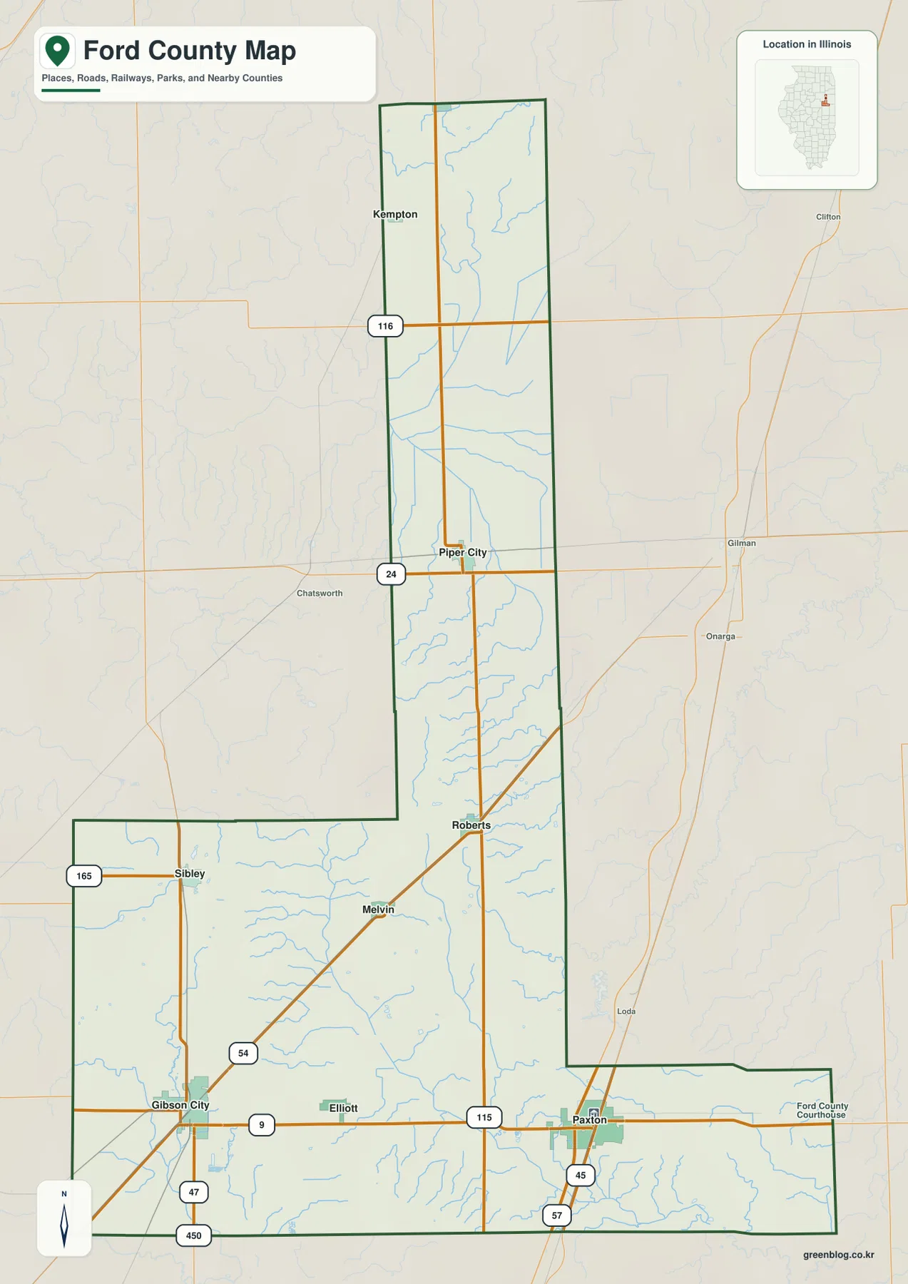
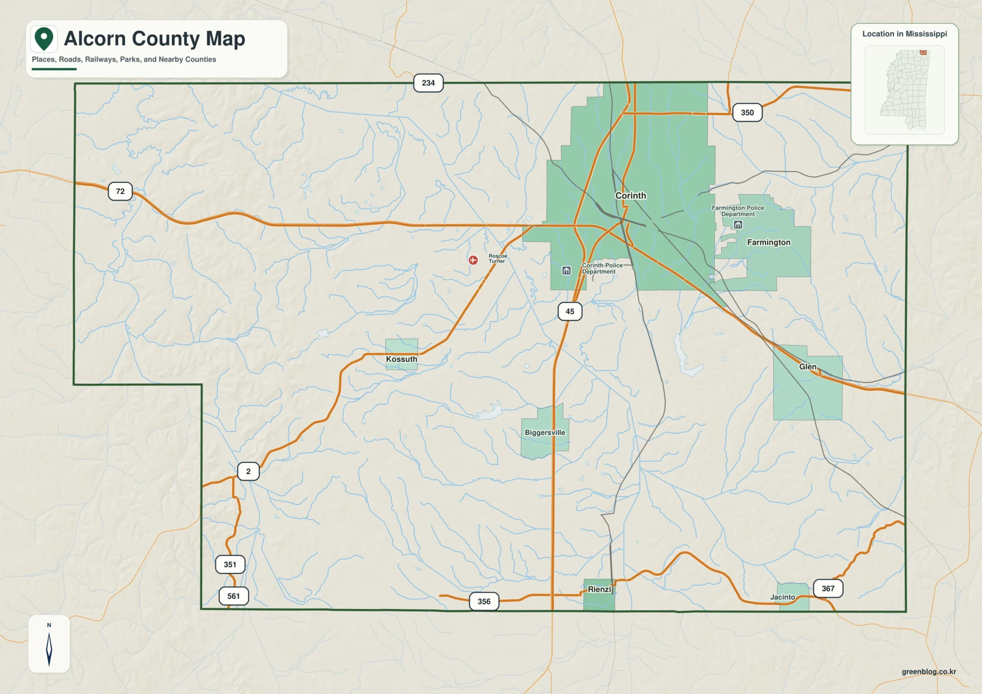
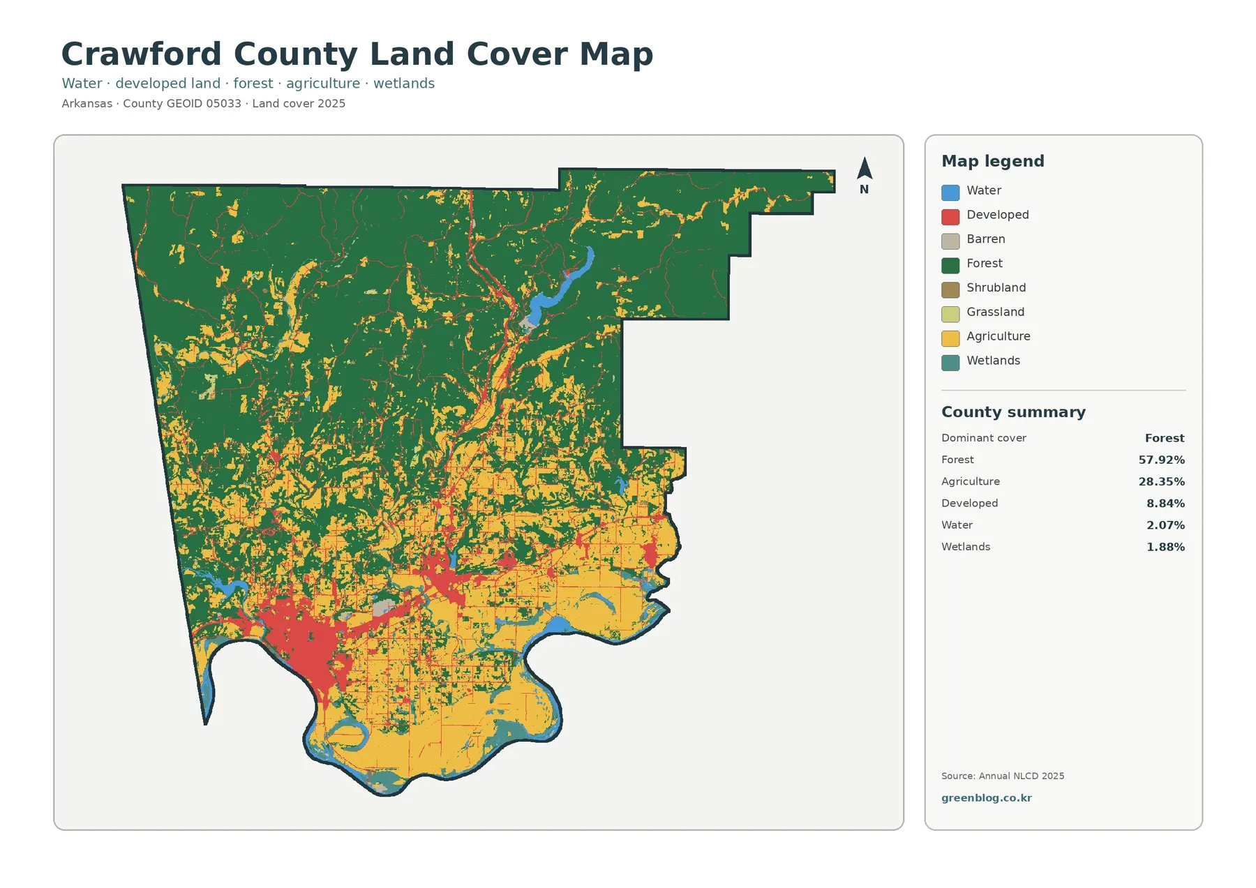
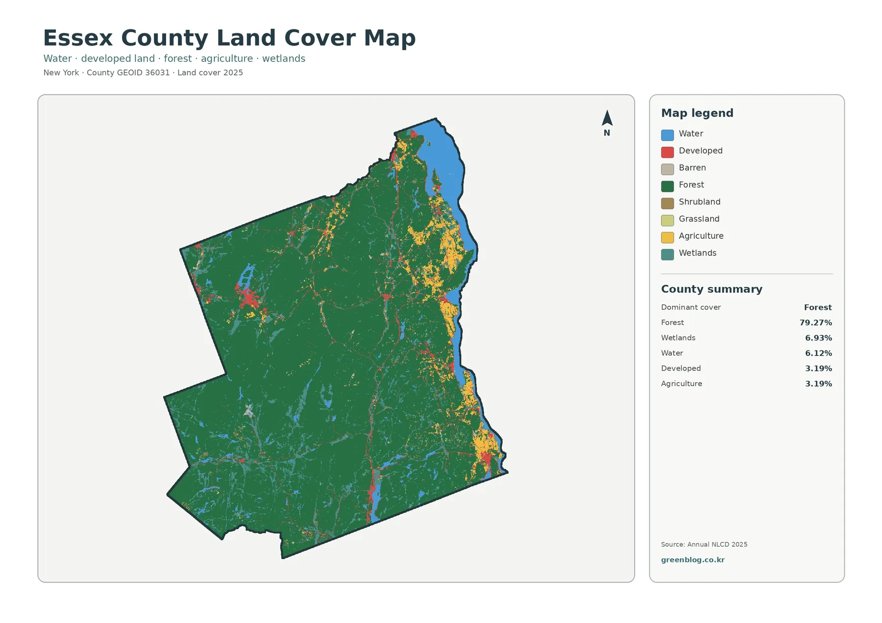
You can download the Henry County Illinois map files directly from this page. The article previews a general county map, a ranked-city map, a terrain-and-water map, and an elevation map, while the ZIP contains the original high-resolution JPG versions. The maps make it easy to compare Geneseo and Kewanee, I-80 and US 6, the Green and Edwards rivers, the Hennepin Canal, and the sharp change from lower northern ground to more rugged terrain across much of the south.
Henry County does not read as one uniform plain when the four views are placed side by side. The northern third around the Green River and the eastern I-80 corridor appears relatively low and open on the relief map, while the central and southern parts are cut by numerous creek valleys and higher ridges. Geneseo is a useful road reference in the north, Kewanee anchors the southeast, and Cambridge helps locate the county center. The discussion below stays with features visible in the supplied maps or supported by the linked official sources.
Table of Contents
Geneseo, I-80, and the east–west road pattern
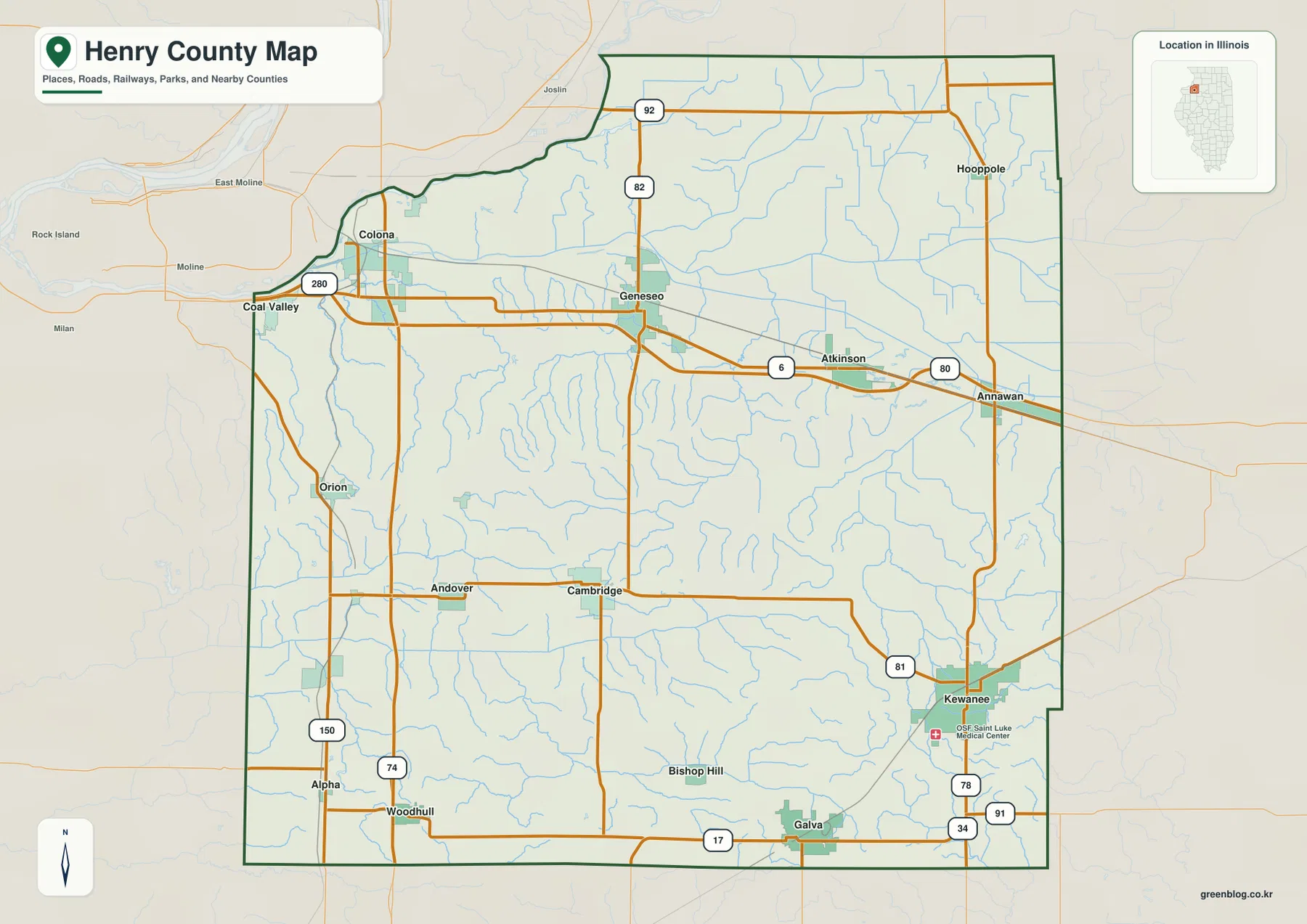
Geneseo is one of the easiest places to locate on the general county map. I-80 and US 6 pass through the northern part of Henry County, with Atkinson and Annawan continuing eastward and Colona appearing toward the northwest. Route 82 runs north from the Geneseo area, while Route 92 crosses the upper part of the county and Route 80 is labeled near Annawan. This network gives the northern third of the map a strong east–west orientation before the roads spread south toward Cambridge, Kewanee, and Galva.
The western side is organized differently. I-280 appears near Colona, Orion sits farther south, and Routes 150 and 74 are visible around Alpha and Woodhull near the southwestern edge. Cambridge and Andover occupy the central portion, while Kewanee in the southeast is surrounded by Routes 81, 78, 91, and 34. Galva lies along Route 17 near the southern boundary, and Bishop Hill appears between the Cambridge and Galva areas.
The county boundary also helps with orientation. The northwest corner bends around the Rock River side of the county, while the eastern edge is longer and more regular. Outside the boundary, labels for Rock Island, East Moline, and Moline provide regional context. A practical way to read the map is to follow the Geneseo–Atkinson–Annawan line first, then move south through Cambridge toward Kewanee and Galva.
Henry County’s official overview describes the county as part of northwestern Illinois and notes that it is served by Interstates 80 and 74. It also describes a mix of agriculture, manufacturing, business centers, wooded areas, rivers, lakes, and streams. Those broad characteristics fit the supplied map set: the road map emphasizes several dispersed towns, while the water and relief maps reveal the landscape between them rather than one dominant metropolitan center.
Kewanee and Geneseo lead the supplied city index
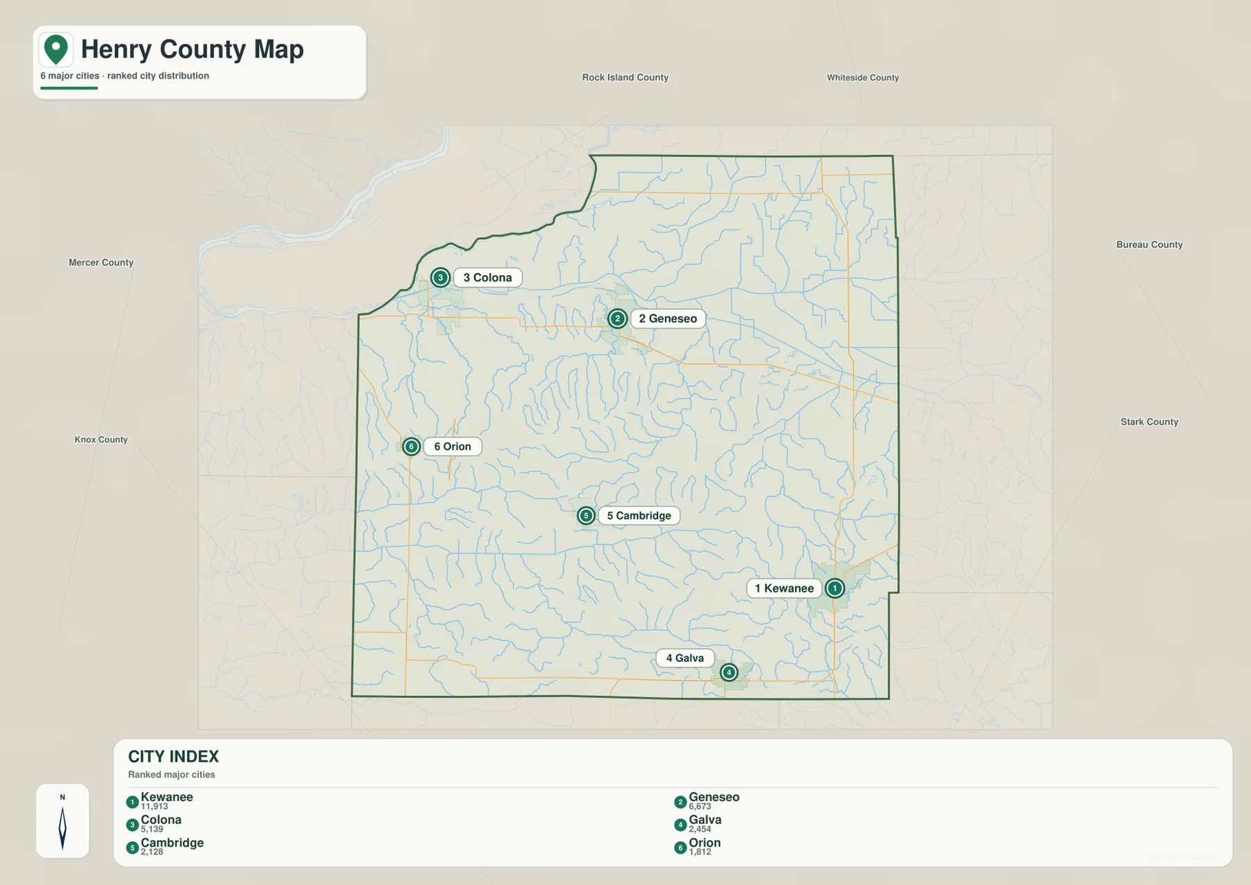
The ranked-city map selects six communities rather than trying to label every place in the county. Kewanee is ranked first with a map index value of 11,913, followed by Geneseo at 6,673 and Colona at 5,139. Galva is shown at 2,454, Cambridge at 2,128, and Orion at 1,812. These are the values printed on the supplied CITY INDEX and are used here only to explain the map’s ranking; they should not be treated as live Census population estimates.
Their positions are spread across the county. Kewanee sits close to the southeastern side, Geneseo is in the north-central corridor, and Colona is near the northwest corner. Galva anchors the south, Cambridge sits near the center, and Orion is west of the central group. Because the six points cover several parts of Henry County, the map is useful for seeing how the larger named communities are distributed rather than merely comparing their numeric ranks.
The surrounding labels place Henry County between Rock Island and Mercer counties to the west, Whiteside County to the north, Bureau County to the east, Stark County to the southeast, and Knox County to the southwest. For smaller places such as Hooppole, Atkinson, Annawan, Andover, Bishop Hill, Alpha, or Woodhull, the general county map is more informative. The ranked layer works best as a cleaner supplement when a presentation or handout needs only a small set of settlement anchors.
Cambridge deserves a separate note because the county’s official history identifies it as the county seat since 1843. That administrative role is different from the ranked-city values: Kewanee and Geneseo have larger numbers on the supplied index, while Cambridge functions as a central governmental reference point. Keeping those ideas separate prevents a city-ranking map from being mistaken for an administrative hierarchy.
Green River, Edwards River, and the Hennepin Canal
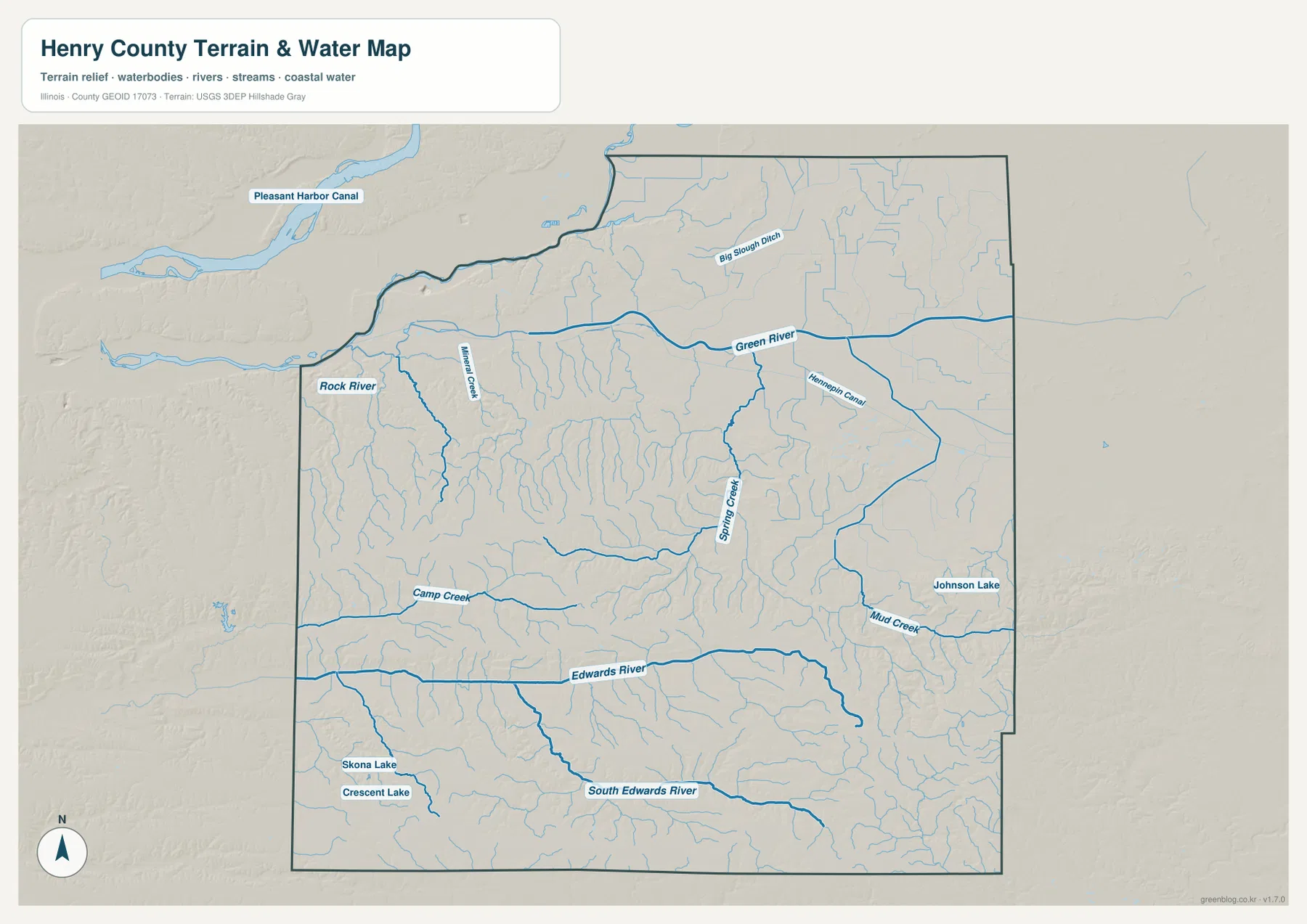
The terrain-and-water map divides the county into two especially clear drainage areas. In the north, the Rock River touches the northwest side while the Green River runs broadly from west to east across the upper part of the county. Big Slough No 1 Ditch appears north of the Green River, and numerous smaller tributaries enter the river from both sides. The wide spacing of the channels in the northeast contrasts with the denser, more deeply cut drainage farther south.
The Edwards River becomes the strongest southern reference. It crosses the county from west to east through the lower central section, while the South Edwards River runs across the southern part. Camp Creek is labeled in the west-central area, Spring Creek near the center, and Mud Creek near the east. Johnson Lake appears near the eastern side, and Skona Lake and Crescent Lake are labeled in the southwest.
The Hennepin Canal is also visible on the map, angling through the northeastern portion near the Green River system. The Illinois Department of Natural Resources describes the Hennepin Canal State Trail as a historic canal corridor spanning several Illinois counties, including Henry County. On this map it is useful as a named artificial waterway and orientation feature, but the map does not provide current lock operations, trail conditions, boating rules, or access details.
The water view should not be read as a flood map, parcel map, navigation chart, or water-quality product. It shows the relative position of rivers, creeks, lakes, and terrain at county scale. A thick line does not guarantee high water at a particular time, and a lake label does not indicate public access or ownership. Flood, safety, boating, and property questions require current agency information beyond the scope of these downloadable reference maps.
Lower northern ground and stronger relief across the south
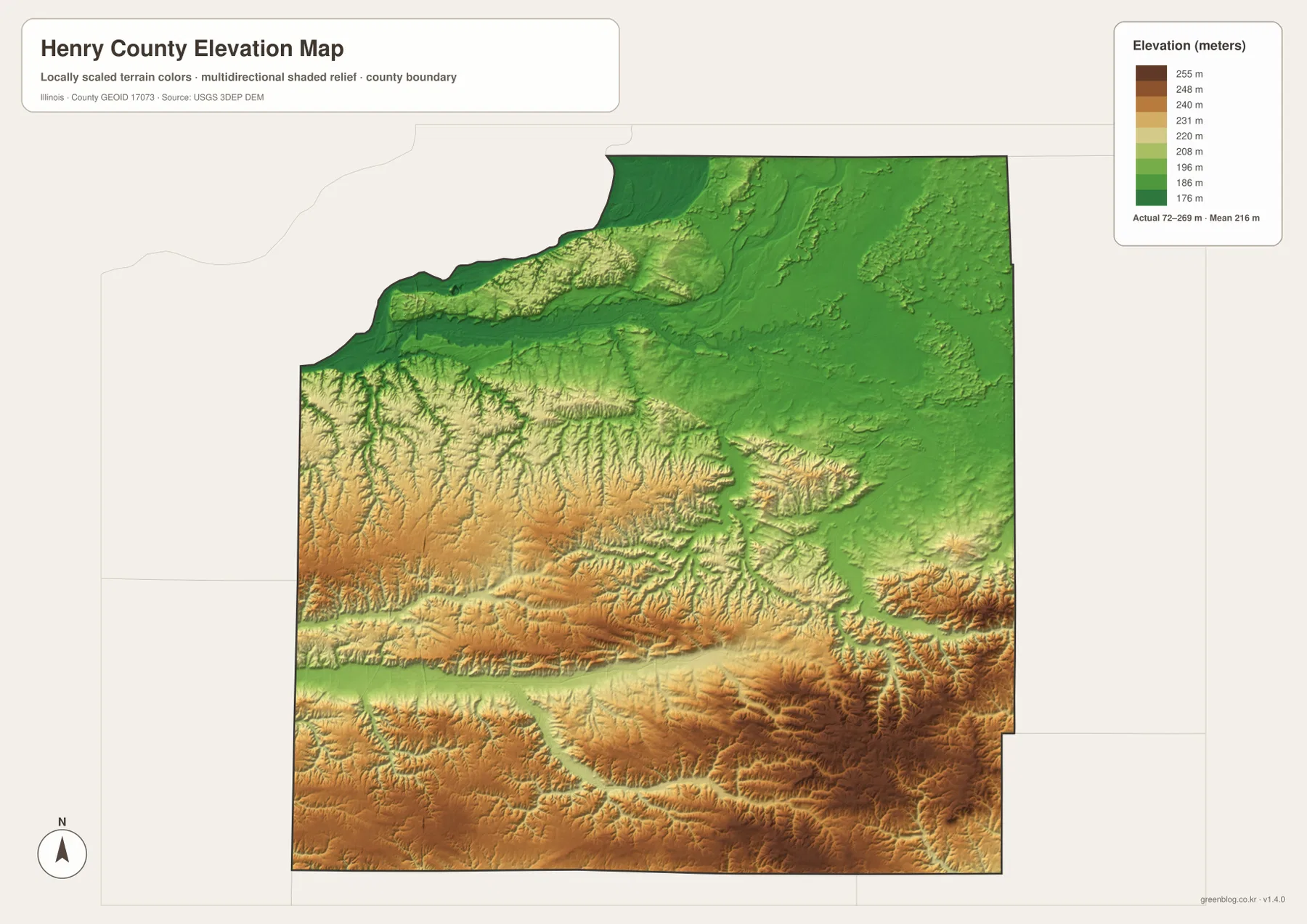
The elevation map uses a displayed color scale from roughly 176 to 255 meters. Its legend also prints “Actual 72–269 m · Mean 216 m.” Because those two ranges are not identical, the safest use of the map is comparative rather than survey-like: the broad green northern and northeastern areas are lower, while tan and brown terrain becomes much more common through the central and southern county.
The difference is particularly clear south of the Green River. Numerous narrow valleys cut into higher ground in the west-central and southern sections, and the Kewanee–Galva side contains extensive warmer colors. The Edwards River and South Edwards River occupy lower corridors that curve through those higher ridges. When the water and elevation maps are compared directly, many of the blue channels align with green or lighter bands in the relief surface.
The northwest near the Rock River and much of the northern I-80 corridor appear smoother and lower than the southern half. That does not mean every road or field in the north has the same elevation, but it provides a useful county-scale contrast. A road map alone can make Henry County look uniformly flat; the shaded relief reveals a much more varied pattern of ridges, creek valleys, and broad lower zones.
The elevation file is not suitable for construction staking, parcel elevation certification, drainage engineering, or legal surveying. Its colors are generalized for visual comparison, and the legend itself shows a difference between the displayed scale and the printed actual range. When precise heights are needed, original USGS 3DEP data and professional field measurements should be used instead of reading a value from the image.
Bishop Hill and the Hennepin Canal add local context
The general map labels Bishop Hill in the southern half of the county. Henry County’s official “About Us” page lists the Bishop Hill Colony and the Hennepin Canal among the county’s notable historic resources. The supplied map is not a tourism or historic-site plan, so it does not show individual buildings or visitor facilities, but it does place Bishop Hill in relation to Cambridge, Galva, and the surrounding roads.
The Hennepin Canal provides a different kind of landmark. IDNR describes the canal and its towpath as a long historic corridor crossing five Illinois counties, including Henry County. The water map shows only the segment that passes through the county, which can make it look like a short isolated feature unless it is viewed in that wider context. For route planning, closures, recreation, or facility information, the current IDNR page is more appropriate than the static county map.
These local references help connect the four map types without turning the article into a list of map versions. Geneseo and Kewanee provide settlement anchors, Bishop Hill adds a historic place, the Hennepin Canal adds a constructed water corridor, and the Green and Edwards rivers explain much of the visible drainage and relief. Each feature contributes a different piece of the county’s geography while remaining easy to verify on the supplied maps or official pages.
Choosing a map for roads, cities, water, or relief
Start with the general county map when the main question is where a town or road lies. Geneseo, Cambridge, Kewanee, Galva, and Colona provide convenient anchors, while I-80, US 6, Route 34, and Route 17 help establish direction. Use the ranked-city map when the goal is to compare the six selected communities with less visual clutter.
Choose the terrain-and-water map for the Rock River, Green River, Edwards River, South Edwards River, Hennepin Canal, and the named creeks and lakes. For a broad terrain comparison, the elevation map is clearer because the lower north and higher south can be recognized immediately by color. Moving between those views is more useful than expecting one map to carry every road, settlement, stream, and relief detail at the same time.
The WebP images in the article are sized for fast browser viewing. Small water labels and road numbers can be easier to read in the original JPG files, especially when the map is enlarged or printed. Each downloadable image measures 3638 × 2572 pixels, making the originals better suited to classroom handouts, presentation slides, county comparison sheets, or personal geographic reference.
These files are reference maps, not substitutes for authoritative parcel, flood, navigation, or engineering products. Use Census TIGER/Line data for boundary work, USGS National Hydrography for source water data, and USGS 3DEP when precise elevation information is required. The purpose of the set is to make Henry County’s cities, roads, rivers, canals, and broad terrain differences easy to understand and easy to download.
Download the original high-resolution JPG maps
The ZIP below contains the original JPG versions of the general county map, ranked-city map, terrain-and-water map, and elevation map. They preserve small labels better than the browser previews and can be enlarged or printed without relying on the lower-resolution WebP copies. Keep the original aspect ratio when resizing so the county outline and map symbols are not distorted.
Frequently Asked Questions
Are the CITY INDEX values current official population counts?
No. The numbers are the values printed on the supplied ranked-city map and are used here only to explain that layer. Kewanee is shown at 11,913, Geneseo at 6,673, and Colona at 5,139, followed by Galva, Cambridge, and Orion. Check current U.S. Census Bureau data when an up-to-date official population figure is required.
Does the Hennepin Canal really pass through Henry County?
Yes. The canal is labeled on the supplied terrain-and-water map, and the Illinois Department of Natural Resources identifies Henry County as one of the counties crossed by the Hennepin Canal State Trail. The county map is only a location reference, so current trail conditions, access points, and recreation rules should be checked with IDNR.
Can the printed 72–269 meter range be used for surveying?
No. The legend prints an actual range of 72–269 meters and a mean of 216 meters, while the displayed color scale runs from about 176 to 255 meters. That internal difference is another reason to treat the file as a county-scale visual comparison rather than a survey product. Use original USGS 3DEP data and professional surveying for precise site elevations.
Map File Information
The ZIP contains the Henry County general map, ranked city map, terrain-and-water map, and elevation map as high-resolution A3 JPG files.
- Included Files: 4 JPG maps
- Printable Size: 3638 × 2572 pixels each
- Intended Use: Printing, education, presentations, and geographic reference
Related Maps
Sources and references
- Henry County, Illinois – About Us: official county overview covering location, transportation, agriculture, business, history, and Cambridge as the county seat
- Illinois DNR – Hennepin Canal State Trail: official information about the historic canal corridor that crosses Henry County
- U.S. Census Bureau QuickFacts – Henry County, Illinois: current official county demographic and land-area statistics when data beyond the supplied CITY INDEX is needed
- U.S. Census Bureau TIGER/Line Shapefiles: authoritative geographic boundary and feature reference data
- USGS National Hydrography: source data and documentation for rivers, streams, canals, and other water features
- USGS 3D Elevation Program: source information for higher-precision elevation data
Green Map creates custom-edited map images using open geographic data sources such as geoBoundaries, Natural Earth, OpenStreetMap, and government open data.
These maps are edited visual materials, not raw data files, and are provided for education, documents, presentations, and graphic reference.