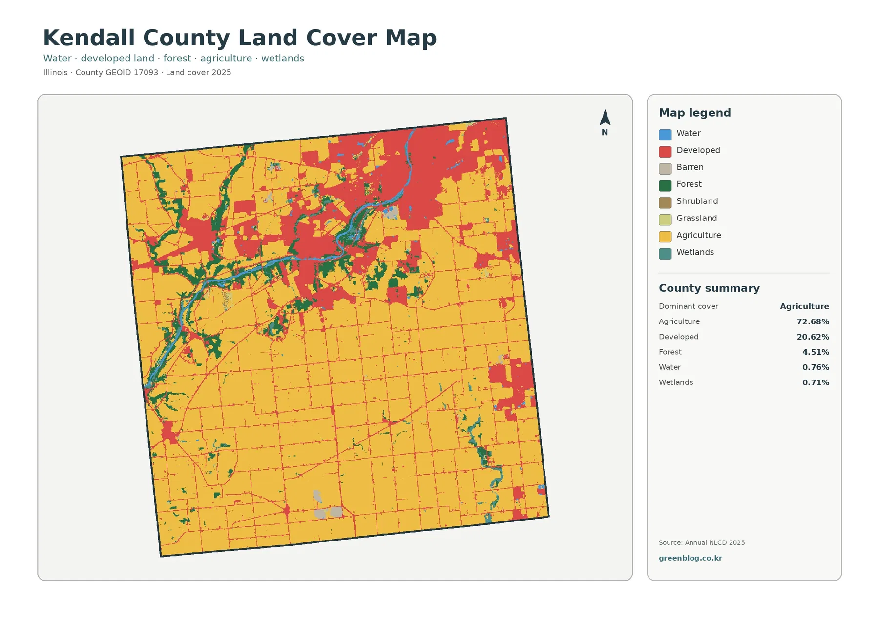
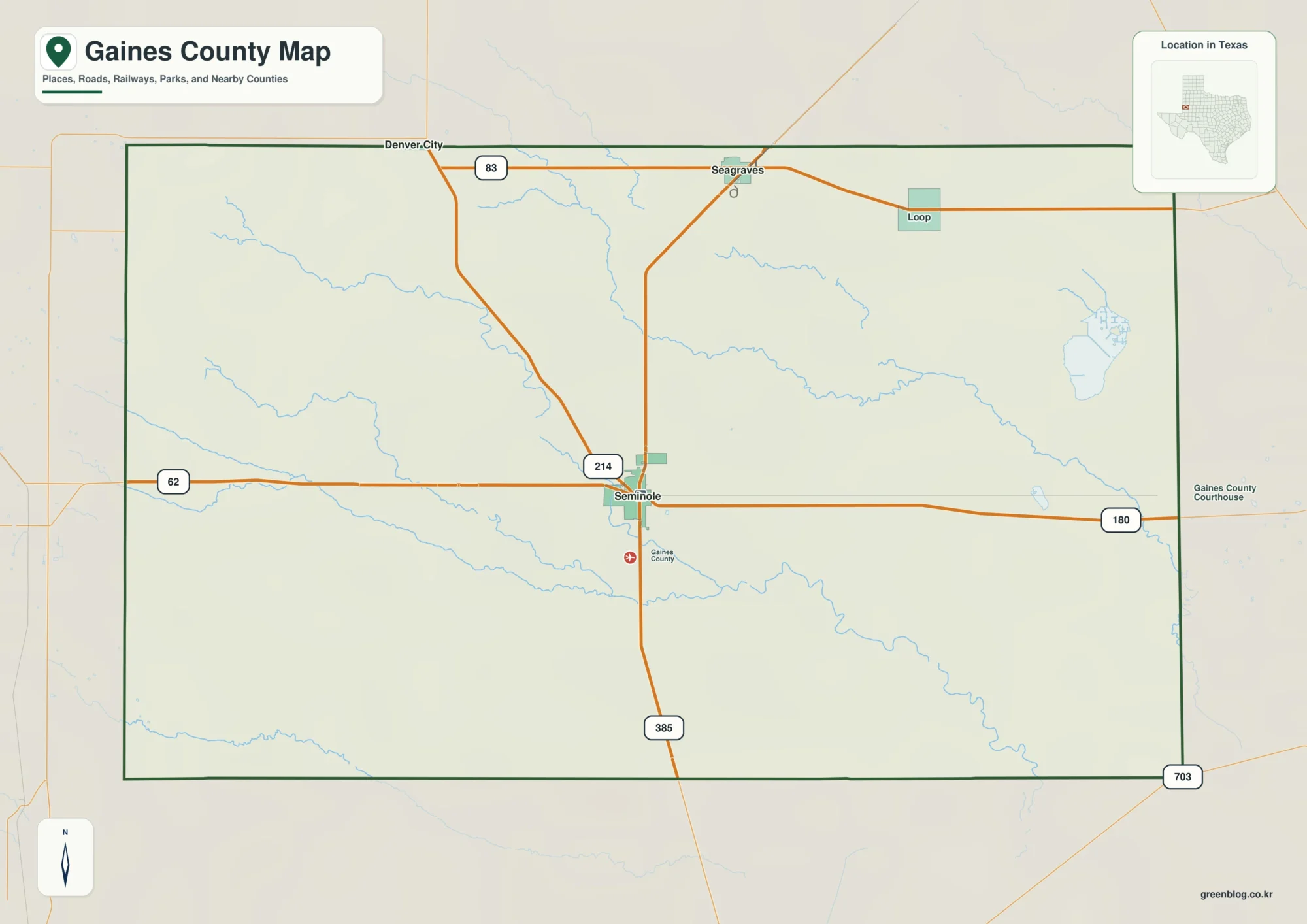
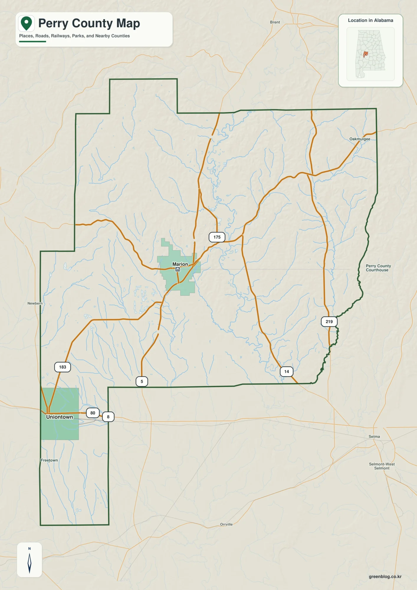
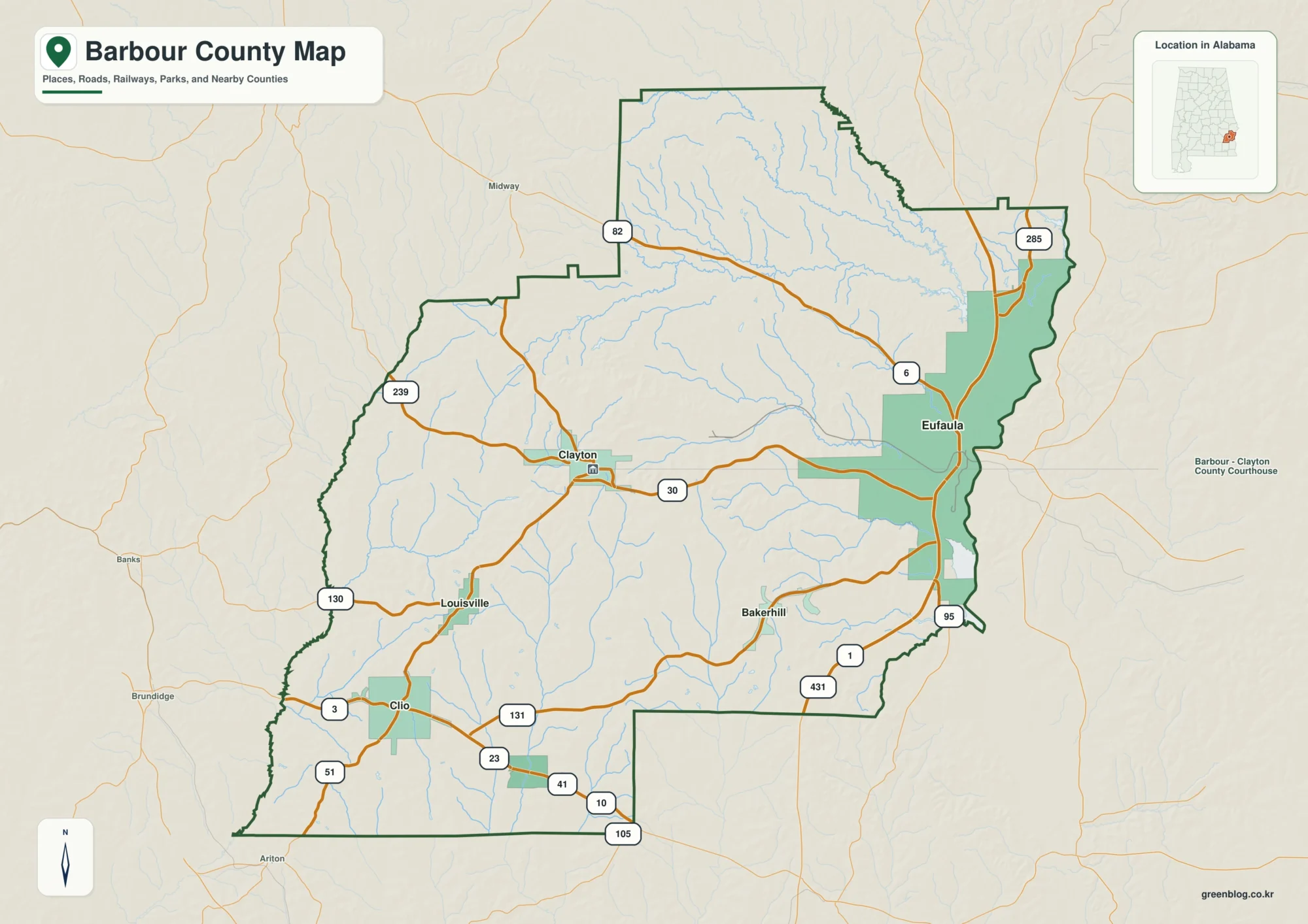
Douglas County sits in southern South Dakota, where small towns are separated by broad areas of rural roads, farm country, shallow creek valleys, and gently rolling ground. This page brings those features together without forcing them into one crowded image. The county map is best for boundaries, roads, and place names; the city-connections map makes the relative positions of Corsica, Armour, and Delmont easier to compare; the water map highlights named creeks and lakes; and the elevation map shows how the ground rises and falls across the county. High-resolution JPG versions of the same maps are available in the ZIP download farther down the page.
The outline of Douglas County is distinctive. Its northern and eastern sides are comparatively straight, while the southern boundary runs on a long diagonal from the west toward the southeast corner. Corsica lies in the north-central part of the county, Armour is farther south, and Delmont is toward the southeast. New Holland and Harrison appear in the western half, while Greenwood Colony is labeled near the southeastern tip. These place names provide useful anchors when the road grid begins to look repetitive.
Looking only at the roads can make the county seem almost flat, but the water and elevation maps add important detail. Choteau Creek is one of the prominent named waterways, and Corsica Lake, Simpson Lake, Lake Alcazar, New Holland Lake, and Joubert Lake appear among the smaller water features. The elevation surface also shows a clear contrast between higher ground along parts of the southwest and north and lower creek-cut areas through the middle and southeast. Comparing the maps at the same location is the easiest way to see how roads, settlements, water, and terrain fit together.
Table of Contents
County boundaries, farm roads, and the Corsica–Armour corridor
Douglas County borders Aurora County to the north, Davison County to the northeast, Hutchinson County to the east, and Charles Mix County to the southwest. Those four neighbors are also shown on the U.S. Census Bureau reference map for the county. Because the southern edge is diagonal rather than rectangular, the county becomes narrower toward the southeast. That shape is especially useful to remember when locating Armour, Delmont, or the small communities close to the southern boundary.
Armour is the county seat. The Douglas County government website lists the courthouse in Armour, and the City of Armour describes the community as lying along U.S. Highway 281 just south of South Dakota Highway 44. On the supplied county map, U.S. 281 gives the reader a strong north-south reference through the central part of the county. Corsica sits north of Armour, so this road and the two town labels make a practical starting point for anyone unfamiliar with the area.
The western half of the map is more sparsely labeled with towns, but New Holland and Harrison break up the broad road grid and help orient the viewer. Delmont is separated from Armour toward the southeast, while Greenwood Colony appears still farther down near the narrow end of the county. Those locations matter because the county is not organized around one dense urban center. Instead, small settlements are distributed across a rural landscape, and local roads spread outward in a regular grid between them.
The diagonal southern boundary is one of the easiest features to recognize after a quick glance. It cuts beneath the central and eastern road network and approaches the southeast corner below Delmont and Greenwood Colony. When comparing this county with neighboring Charles Mix or Hutchinson counties, that slanted edge is more useful than trying to memorize every road number. It also makes it easier to tell whether a place or road segment lies inside Douglas County when viewing a broader regional map.
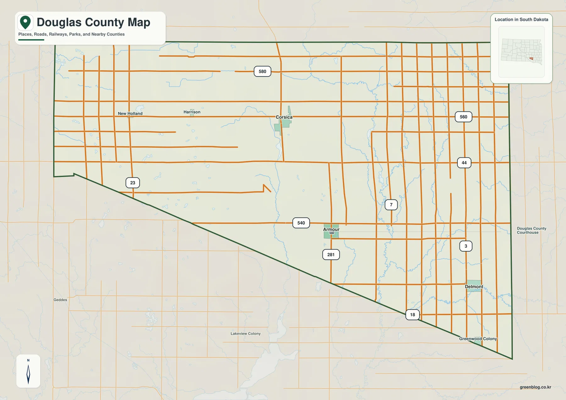
The dense network of local roads reflects the rural character of the county. Long east-west and north-south road segments form a grid across much of the map, while the main highways provide clearer connections between towns and adjoining counties. This map is therefore useful for geographic orientation, but it is not a live navigation product. It does not show current construction, temporary closures, road surface conditions, or turn-by-turn routing. For an actual drive, use the map to understand the county first and then check a current road service for the final route.
Corsica as a hub: where Armour and Delmont sit in relation to it
The city-connections map deliberately removes most of the local road detail and treats Corsica as the hub. Armour appears to the south, while Delmont is farther to the southeast. That simplified design is useful when the main question is not “Which road do I drive?” but “Where are these towns in relation to one another?” A visitor who has only seen the names in a list can quickly understand that Corsica occupies the northern part of this three-town pattern and Delmont is offset well to the east of Armour.
The connecting lines represent straight-line distance, not driving distance. They do not follow U.S. 281, state highways, county roads, or any other specific route. The map gives a direct-distance comparison from Corsica to Armour and Delmont, but an actual trip will follow the road network and can be longer. This distinction is important because a straight connector can cross fields, creeks, and places where no public road exists.
The relationship between Corsica and Armour becomes clearer when the city map is compared with the county map. The full map restores the road grid and shows U.S. 281 running through the central part of the county, while the connections view strips that detail away so the town positions stand out. Delmont, by contrast, sits near the southeastern side of the county and is closer to the eastern boundary with Hutchinson County. The two map styles answer different questions without duplicating the same information.
Corsica is the hub chosen for this graphic, but Armour remains the county seat. That is a useful distinction because a map can choose a visual reference point for practical reasons without changing the administrative role of a town. If the goal is to identify government services or the courthouse, Armour is the relevant place. If the goal is to compare the direction and separation of the three highlighted communities, the Corsica-centered connections map is the faster reference.
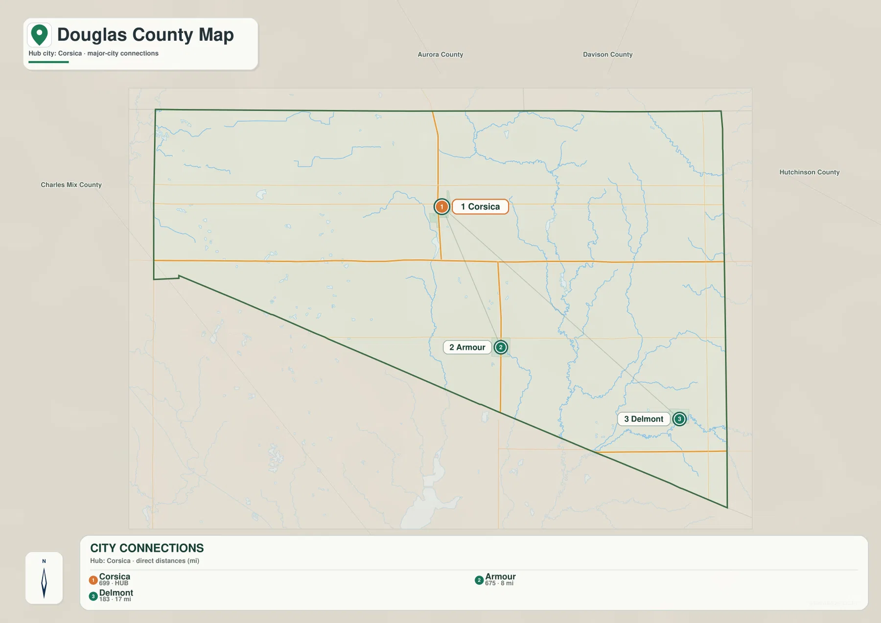
Neighboring counties are labeled around the outside of the city map as well. Aurora and Davison counties are above Douglas County, Hutchinson County is to the east, and Charles Mix County is to the west and southwest. Those labels give the town positions additional meaning: Corsica is relatively close to the northern side, Armour sits deeper inside the county, and Delmont occupies the narrower southeastern portion. This context is more memorable than distance numbers alone.
Choteau Creek, Corsica Lake, and the smaller water features
The terrain-and-water map shows that Douglas County is crossed by a collection of creeks, drainage channels, and small lakes rather than one dominant river. Choteau Creek is among the most prominent labels. South Dakota conservation material also identifies Choteau Creek as part of the county’s broader drainage toward the Missouri River system. On the map, the creek network helps explain why lower terrain appears as long, branching corridors instead of one broad flat basin.
Corsica Lake appears in the eastern half of the county, separate from the town of Corsica. A South Dakota watershed assessment describes Corsica Lake as a man-made impoundment in northern Douglas County and identifies Choteau Creek as its primary tributary. That official description makes an important map-reading point: the lake and the town share a name, but they are not in the same spot. The town lies farther west, while the lake is part of the water network to the east.
Several other named water features give the county map local detail. Joubert Lake and New Holland Lake are labeled in the west, Simpson Lake and Lake Alcazar appear closer to the center, and streams such as Andes Creek, South Fork Twelve Mile Creek, Point Creek, and North Branch Dry Creek are shown in other parts of the county. These labels are especially helpful in a rural area where road intersections can look similar from one section to the next.
This water map is a geographic reference, not a flood-risk map, parcel map, legal shoreline map, or navigation chart. A blue line tells you where a mapped stream or channel is located, but it does not tell you how often the channel carries water, whether nearby land floods, or where a regulated boundary lies. Anyone making a property, flood, boating, or engineering decision should use the appropriate official dataset for that purpose. Here, the goal is simply to understand where named water features sit within the county.
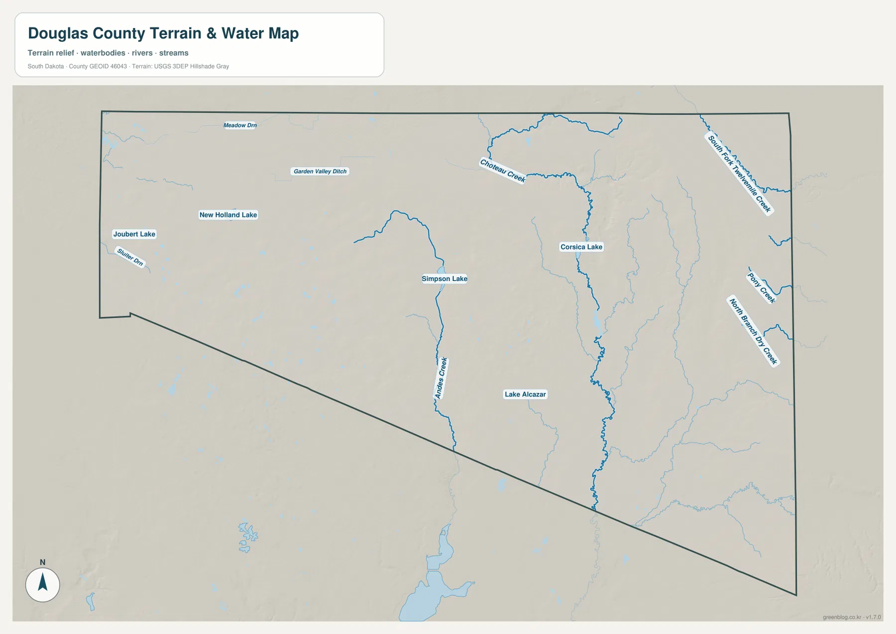
Comparing the water map with the road map reveals a useful contrast. Roads often follow the rectangular survey grid, while creeks bend through the landscape according to the terrain. The difference is especially visible in the central and eastern parts of the county, where branching drainage lines cut across otherwise regular road patterns. When those same areas are checked on the elevation map, many of the creek corridors align with lower green-shaded ground. That comparison provides a more complete picture than either map can give on its own.
Higher southwest ground and lower creek valleys toward the center and southeast
The elevation map makes the county’s rolling terrain much easier to see. The legend reports an actual elevation range of about 430 to 549 meters, with a mean near 475 meters. The color scale is locally adjusted to Douglas County, which means it is designed to emphasize differences within this county. It should not be treated as a universal color key for comparing elevations directly with a map from another state or county.
Higher colors are concentrated along parts of the southwest boundary and across some northern areas. The western half also contains numerous rounded rises that stand out from the surrounding surface. Lower green shades form broader corridors through the middle and continue toward the southeast. These are not dramatic mountain-and-canyon differences; they are the subtler changes of rolling prairie and shallow valleys, but the relief shading makes them visible at a glance.
The pattern agrees with the general description in South Dakota conservation records, which characterize Douglas County as mostly undulating to gently undulating terrain. The same records describe drainage through Choteau and Platte Creek systems and their tributaries. The supplied map does not need that text to show every creek, but the official description supports what the shaded surface suggests: water moves through low corridors between gently higher pieces of ground.
Corsica lies near the transition between higher northern ground and lower drainage corridors farther south and east. Armour is closer to the central-southern low areas, while Delmont sits near a mix of lower ground and gentle rises on the east side. These are visual relationships from the county-scale surface, not surveyed elevations for individual buildings. The map is useful for regional orientation, but it should never replace a benchmark, site survey, or engineering-grade elevation measurement.
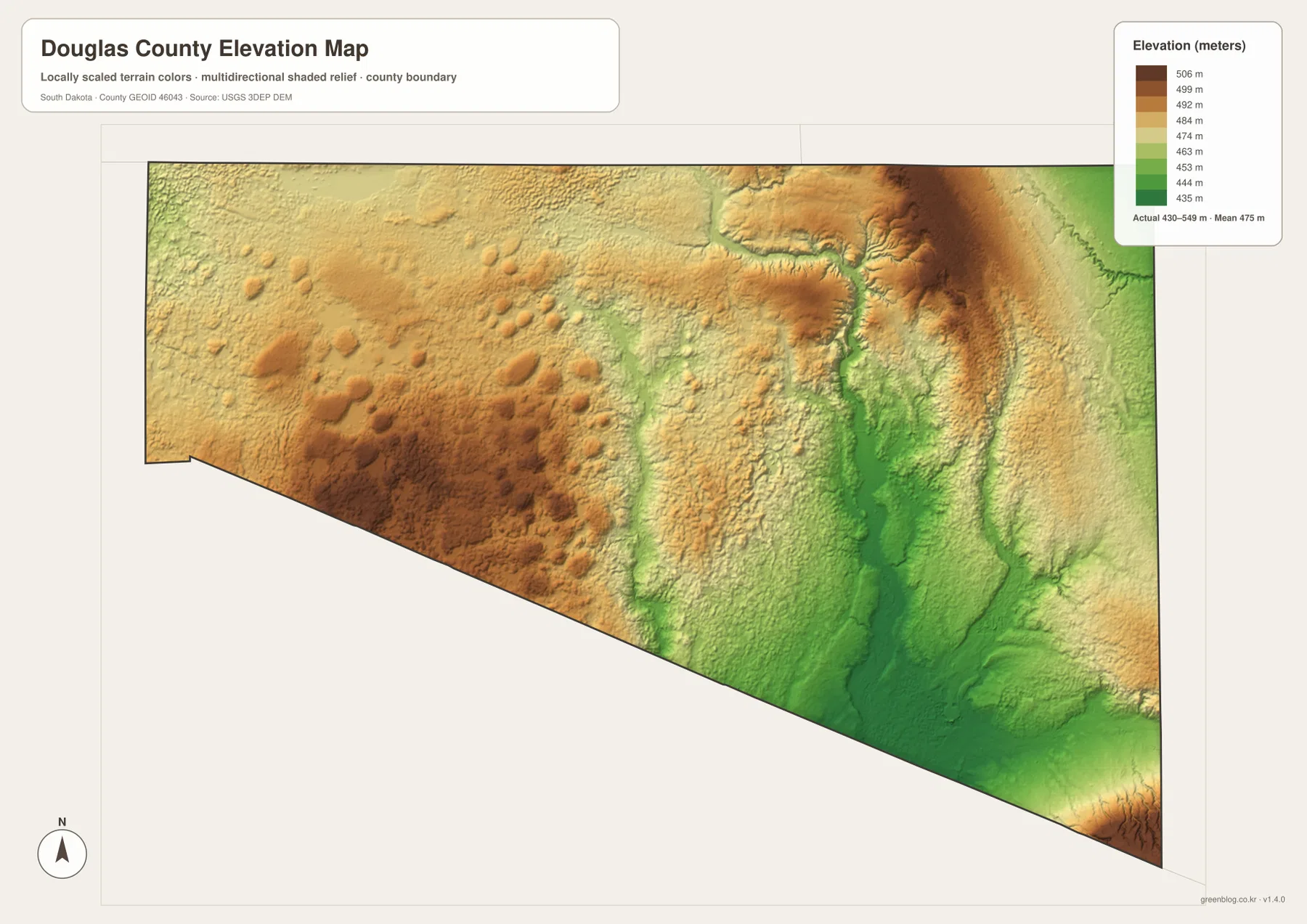
Relief shading can make small changes look more dramatic than they feel on the ground. The textured surface is intended to reveal ridges, shallow valleys, and rounded rises that would be hard to see on a plain road map. It does not mean that Douglas County contains steep mountain terrain. For precise elevation values, drainage design, construction, or surveying, consult U.S. Geological Survey elevation data and qualified local measurements rather than reading exact site heights from this rendered image.
Choosing the right map for a specific task
Start with the county map when you need the broadest orientation. It is the best place to find Corsica, Armour, Delmont, New Holland, Harrison, Greenwood Colony, the county boundary, and the major road pattern on one page. The slanted southern boundary is also clearest there. For classroom work, county comparisons, or a quick explanation of where a town lies inside Douglas County, this map provides the most complete single overview.
Use the city-connections map when the question is narrower. It reduces visual clutter and makes the relative positions of Corsica, Armour, and Delmont easy to compare. Because the connectors are straight-line distances, it works well for directional context but not for trip planning. Someone preparing to drive between the towns should switch back to the county road map and then confirm the route with current navigation information.
The terrain-and-water map is the better choice when a creek, lake, or drainage name is the subject. It is especially useful for locating Corsica Lake and Choteau Creek and for distinguishing the town of Corsica from the lake with the same name. The elevation map answers a different question by showing where the land is relatively high or low. Placing the water and elevation maps side by side makes the relationship between creek corridors and lower terrain much more obvious.
For printing, presentation slides, or a larger classroom handout, use the JPG files in the ZIP rather than saving the smaller images displayed in the article. The archive contains the original high-resolution versions corresponding to the county map, city-connections map, terrain-and-water map, and elevation map. Each file is 3638 by 2572 pixels, giving more room for road labels, town names, and fine terrain detail when the image is enlarged.
No single map needs to carry every type of information. Douglas County is a good example of why separating the views works: the road grid is easiest to read when the water and relief details are restrained, while creeks and subtle elevation changes become clearer when many road labels are removed. Switching between the four views at the same location is often faster than trying to interpret one overloaded map.
Frequently Asked Questions
Is Corsica or Armour the county seat of Douglas County?
Armour is the county seat. The Douglas County government website lists the county courthouse in Armour. Corsica is used as the hub on the city-connections map because that graphic is designed to compare town positions and direct distances; the choice of hub does not indicate the administrative center. For government services and the courthouse, Armour is the relevant community.
Do the lines from Corsica to Armour and Delmont show the roads to drive?
No. The city-connections graphic uses straight-line connectors between the town points. A real driving route follows public roads and can be longer than the direct distance shown on the map. Use the connections view for direction and relative separation, then check the county road map and a current navigation service before making a trip.
Can the water map be used to judge flood risk around Choteau Creek or Corsica Lake?
No. The water map identifies mapped creeks, lakes, and related terrain, but it is not a flood-hazard product. It does not show regulatory flood zones, parcel boundaries, legal shoreline limits, or guaranteed water conditions. For flood, property, or engineering decisions, use the appropriate FEMA, state, county, or survey data rather than relying on this reference image.
Map File Information
The ZIP contains high-resolution JPG originals for the Douglas County reference map, city-connections map, terrain-and-water map, and elevation map.
- Printable Size: 3638 × 2572 px each
Related Maps
Sources and references
The following official resources are useful for checking county administration, road mapping, water information, local terrain descriptions, and elevation data used to interpret the maps on this page.
- Douglas County, South Dakota official website – county government and courthouse information
- South Dakota Department of Transportation CADD Mapping – county and state road-map resources
- South Dakota DANR Douglas County Conservation District history – county terrain, drainage, and agricultural background
- South Dakota DANR Corsica Lake Assessment – Corsica Lake and Choteau Creek watershed information
- U.S. Geological Survey 3D Elevation Program – authoritative elevation-data reference
Green Map creates custom-edited map images using open geographic data sources such as geoBoundaries, Natural Earth, OpenStreetMap, and government open data.
These maps are edited visual materials, not raw data files, and are provided for education, documents, presentations, and graphic reference.