The Winston County Mississippi map centers on Louisville, with Noxapater in the south, Nanih Waiya in the southeast, and Highpoint in the northwest. Tombigbee National Forest, upper Pearl River hills, and the culturally significant Nanih Waiya landscape provide very different orientation references.
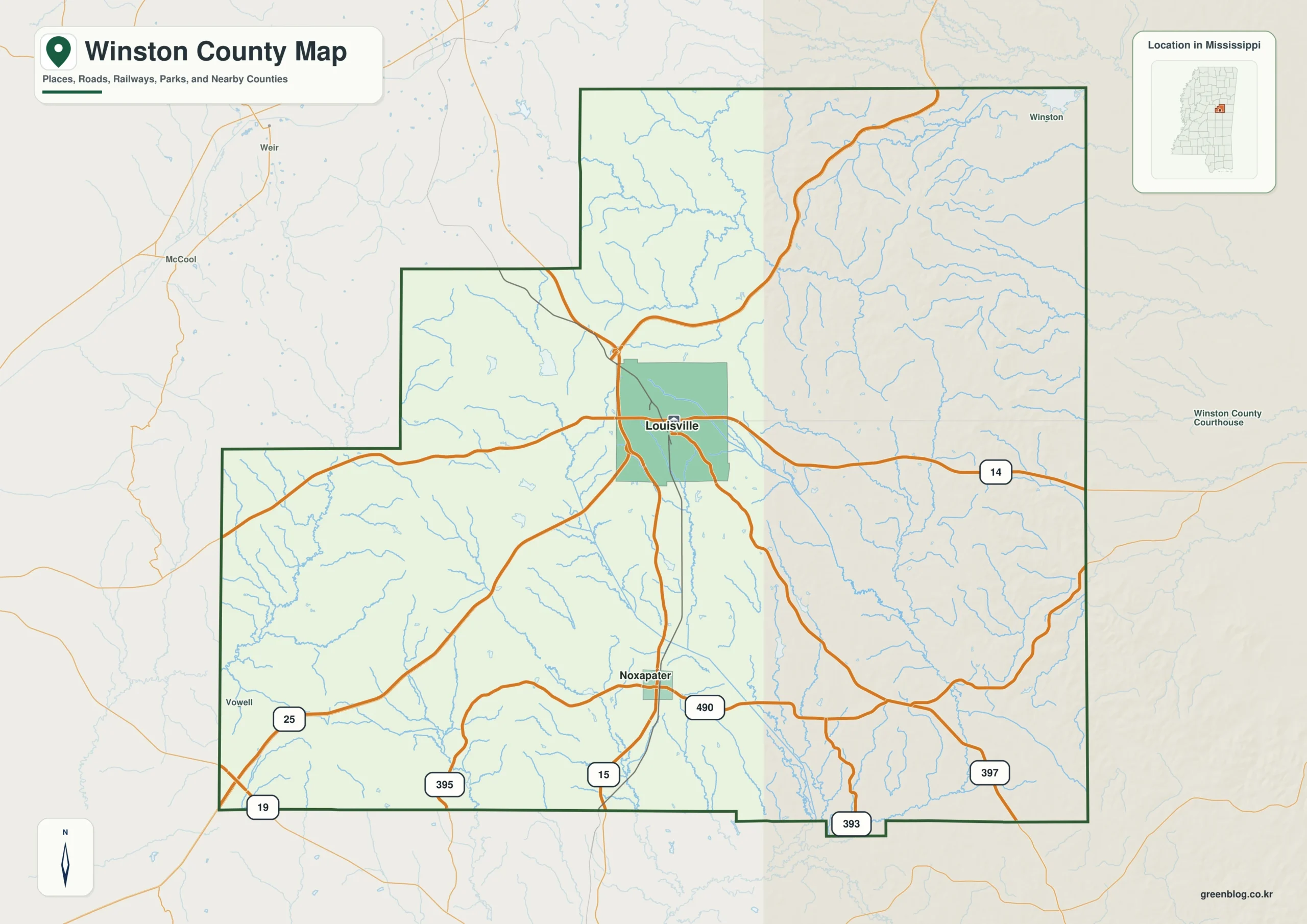
Winston County Mississippi map download
The WebP preview is optimized for the page, while the button preserves the original high-resolution JPG for printing and reuse.
- File: County reference map
- Format: JPG
- Print layout: A3
Quick Facts
- State and identifier: Mississippi, Winston County; FIPS 28159
- County seat: Louisville
- Selected map labels: Louisville, Noxapater, Nanih Waiya, Highpoint
- 2020 census population: 17,714
- July 2025 population estimate: 17,473
- 2025 Gazetteer area: 607.251 sq mi land and 2.835 sq mi water
- 2020 land-area density: 29.2 residents per sq mi
- Primary route references: MS 25, MS 14, MS 15, and MS 397
- Landscape references: Tombigbee National Forest, Nanih Waiya mound, Legion State Park, Pearl River headwaters, and wooded hills
The decennial count and July 2025 estimate use different reference dates. Land and water measurements come from the 2025 Gazetteer. The density of 29.2 residents per square mile divides the 2020 population by 2025 land area and does not imply an even distribution among cities, farms, forest, or wetland.
Reading the Winston County Mississippi map
MS 25 connects Louisville with Oktibbeha County to the north and Neshoba County to the south. MS 14 is the principal east-west route, while MS 15 serves Noxapater and southern approaches. Only major forest, park, and cultural-site access routes belong on a county-scale map.
Boundary, Water, and Terrain
Western and northern creeks feed upper Pearl River drainage, while eastern tributaries turn toward Noxubee and Tombigbee systems. Tombigbee National Forest and gentle wooded ridges occupy broad areas with little open water. The small lake at Legion State Park is a secondary reference north of Louisville.
Although Tombigbee National Forest and Nanih Waiya mound is geographically important, only about 0.5 percent of the county’s 610.086 square miles is recorded as water. Tombigbee National Forest and Nanih Waiya mound should be interpreted with roads and settlement labels rather than as a continuous water landscape. The spacing from Louisville to Noxapater, then toward Noxubee, gives the map a practical scale. The anchors at Louisville and Noxapater explain the county while smaller communities remain selectively labeled.
Settlement and Regional Context
Louisville concentrates courthouse, medical, manufacturing, and retail functions. Nanih Waiya Mound is a culturally important landscape for the Mississippi Band of Choctaw Indians and should not be treated as an ordinary roadside attraction. By July 2025, Winston County’s estimate stood approximately 1.4 percent under the 2020 count.
Practical Map Uses
- Orient MS 25 and MS 14 at Louisville
- Distinguish Noxapater from Nanih Waiya
- Compare national forest, state park, and headwaters
Frequently Asked Questions
Is Nanih Waiya only a town name?
It identifies a community and a mound and cultural landscape of deep importance in Choctaw tradition. A map should distinguish place name from heritage meaning.
Why compare Tombigbee National Forest with Louisville before reading the side toward Noxubee?
Louisville is a settlement anchor, while Tombigbee National Forest supplies a physical reference for separating the county interior from the approach to Noxubee.
Sources
- U.S. Census Bureau QuickFacts
- U.S. Census Bureau 2025 Gazetteer Files
- Mississippi Department of Transportation official highway map
- Regional landscape or institution reference
Related County Maps
Green Map creates custom-edited map images using open geographic data sources such as geoBoundaries, Natural Earth, OpenStreetMap, and government open data.
These maps are edited visual materials, not raw data files, and are provided for education, documents, presentations, and graphic reference.