A Belarus Map can be useful in many situations beyond simply locating the country in Eastern Europe. Teachers preparing geography lessons, students creating regional reports, bloggers writing about European countries, and designers developing educational graphics often need a map that is easy to read, print, and customize. A clear administrative map can help explain regional divisions, neighboring countries, and major cities without requiring additional reference materials.
Belarus is a landlocked country located in Eastern Europe, bordered by Russia, Ukraine, Poland, Lithuania, and Latvia. Because it sits between several important regional neighbors, Belarus frequently appears in educational materials, travel resources, and news-related content. Although many people recognize the country’s name, its exact location and border relationships are often less familiar. A well-organized Belarus Map helps make those geographic connections much easier to understand.
This printable Belarus Map collection includes three versions: a color administrative map, a black and white labeled map, and a blank outline map. The files were prepared in high resolution and arranged for A3 printing, making them suitable for classroom handouts, infographic projects, educational worksheets, travel presentations, and graphic editing work. Both digital viewing and printed use were considered during the design process.
While organizing this collection, special attention was given to regional boundaries, label readability, and overall visual simplicity. Administrative divisions were color-coded for quick reference, while neighboring countries were identified in a way that keeps the layout clean and easy to understand. Labels were also reviewed at larger print sizes to ensure that names remain readable when enlarged.
Table of Contents
Belarus Map Versions Included
Three different map styles are included in this collection, each designed for a specific purpose.
Administrative Color Map
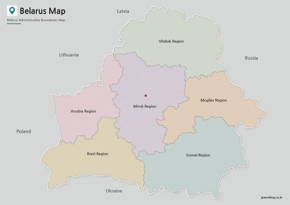
Designed for visual reference and regional comparison, the color Belarus Map uses separate colors to distinguish administrative regions while highlighting Minsk, the capital city. This makes it easier to identify regional boundaries and understand the country’s overall administrative structure.
To avoid unnecessary visual clutter, neighboring countries are labeled without adding excessive border detail. The result is a presentation-ready map that works well for educational content, regional studies, and travel-related materials.
Best for:
- Educational presentations
- Regional comparison projects
- Blog graphics
- Geography lessons
- Travel content
Black and White Printable Map
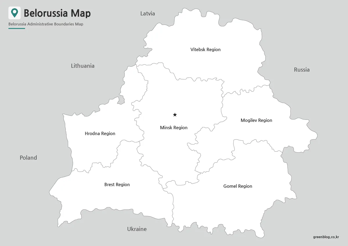
The black and white Belarus Map focuses on boundaries and labels without relying on color. This layout improves readability when printed and reduces ink usage, making it a practical option for worksheets, reports, and classroom activities.
The simplified appearance also makes it easier to add notes, highlight locations, or include supplemental information directly on the printed map.
Best for:
- Classroom handouts
- Educational worksheets
- Printed reports
- Study materials
- Reference documents
Blank Outline Map for Editing
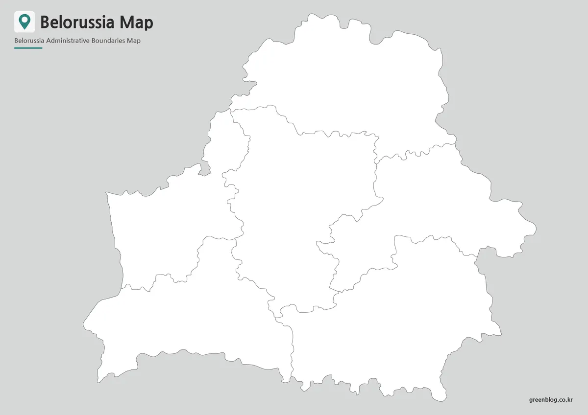
The outline Belarus Map removes color and labels, leaving only the administrative boundary structure. This format provides a flexible base for customization and graphic design work.
Whether adding demographic data, highlighting selected regions, creating infographics, or building educational activities, the clean layout allows users to start working immediately without removing existing elements.
Best for:
- Data visualization
- Graphic design
- Educational activities
- Infographic projects
- Custom regional maps
Belarus Map Regional Structure
Belarus covers approximately 207,600 square kilometers and is divided into several administrative regions centered around major cities such as Minsk, Brest, Gomel, Grodno, Mogilev, and Vitebsk. Unlike many coastal countries, Belarus has no shoreline, giving it a relatively compact and straightforward national outline.
One thing that became clear while preparing this Belarus Map collection was how important neighboring countries are when understanding the country’s geography. Because Belarus borders five different nations, regional context is often just as important as internal administrative divisions. Including nearby countries helps users understand Belarus’s position within Eastern Europe more easily.
The relatively simple national outline also makes the country well suited for educational exercises, regional comparisons, and customized map projects.
Designed for Printing and Educational Use
This Belarus Map collection was created with both digital and printed use in mind. Regional labels, boundaries, and spacing were adjusted to remain readable when enlarged or printed at A3 size.
Common uses include:
- Geography lessons
- Educational worksheets
- Regional comparison studies
- Travel presentations
- Blog illustrations
- News background graphics
- Infographic projects
- Graphic design work
Whether used in classrooms, presentations, websites, or reports, the collection provides multiple formats for different project requirements.
Frequently Asked Questions
Can I print the Belarus Map in A3 size?
Yes. The files were prepared in high resolution and are suitable for A3 printing.
Which Belarus Map version is best for presentations?
The color administrative version is generally the easiest to read on presentation slides.
Is the Belarus Map outline version editable?
Yes. The outline version was designed specifically for editing, annotation, and graphic design projects.
Can I modify the map in graphic editing software?
Yes. The files can be used in common graphic editing applications for adding colors, labels, or additional information.
Belarus Map Download
Choose the version that best matches your project. Color, black and white, and outline formats are included for printing and editing.
- File Format: JPG
- Image Size: A3 High Resolution
- Intended Use: Education, Printing, Presentations, Editing
Additional Resources
- National Cadastral Agency of Belarus – Official geographic and cadastral information source providing administrative and territorial reference data for Belarus.
Related Maps
- Britannica – Belarus Overview – A concise overview of Belarus covering its geography, history, major cities, and regional significance in Eastern Europe.