
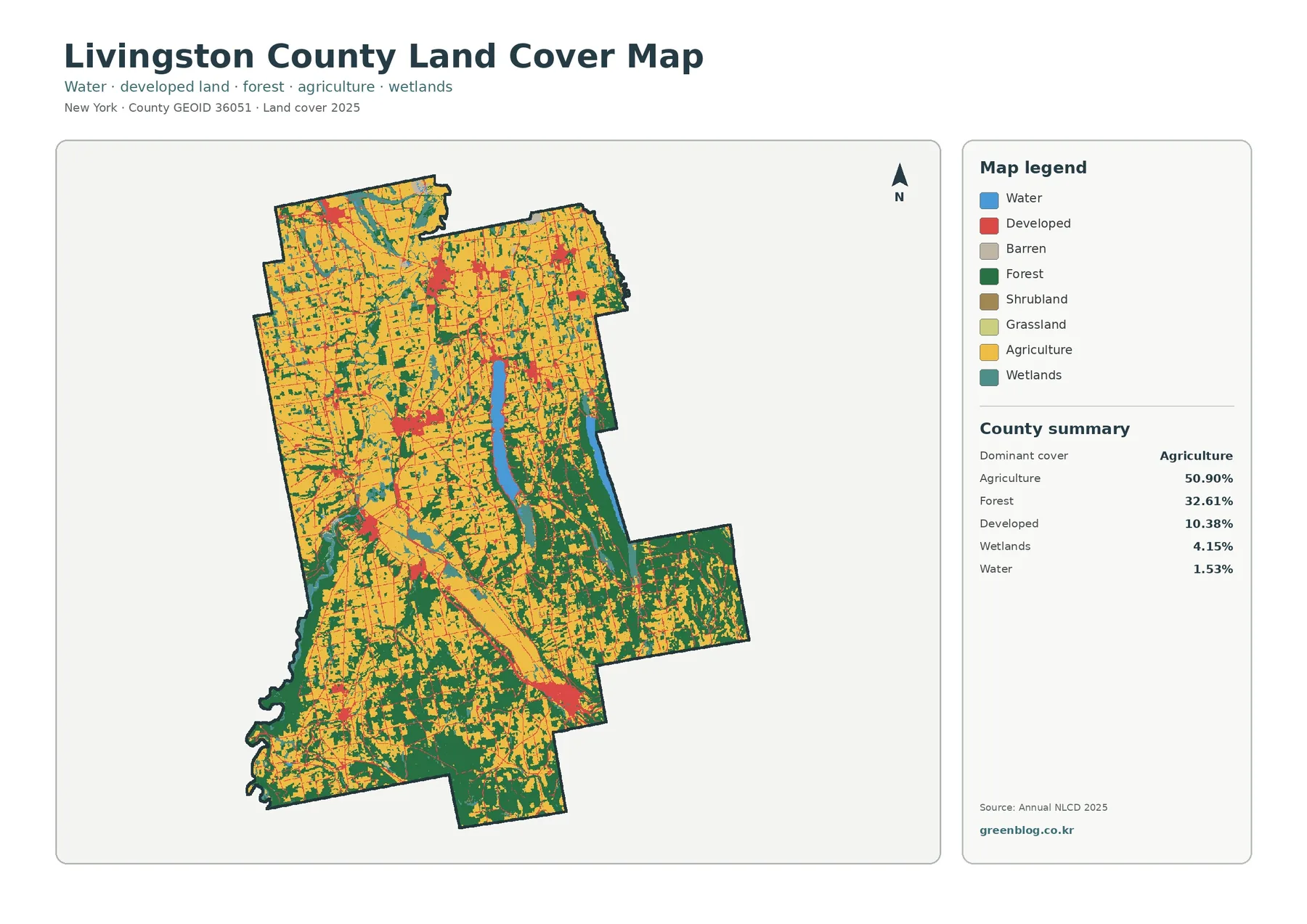
Livingston County New York Land Cover Map – Farming North, Wooded South, and Surface Change
Livingston County has an unusually clear internal contrast on the 2025 land-cover map. Broad agricultural ground dominates the northern and […]
Livingston County has an unusually clear internal contrast on the 2025 land-cover map. Broad agricultural ground dominates the northern and […]
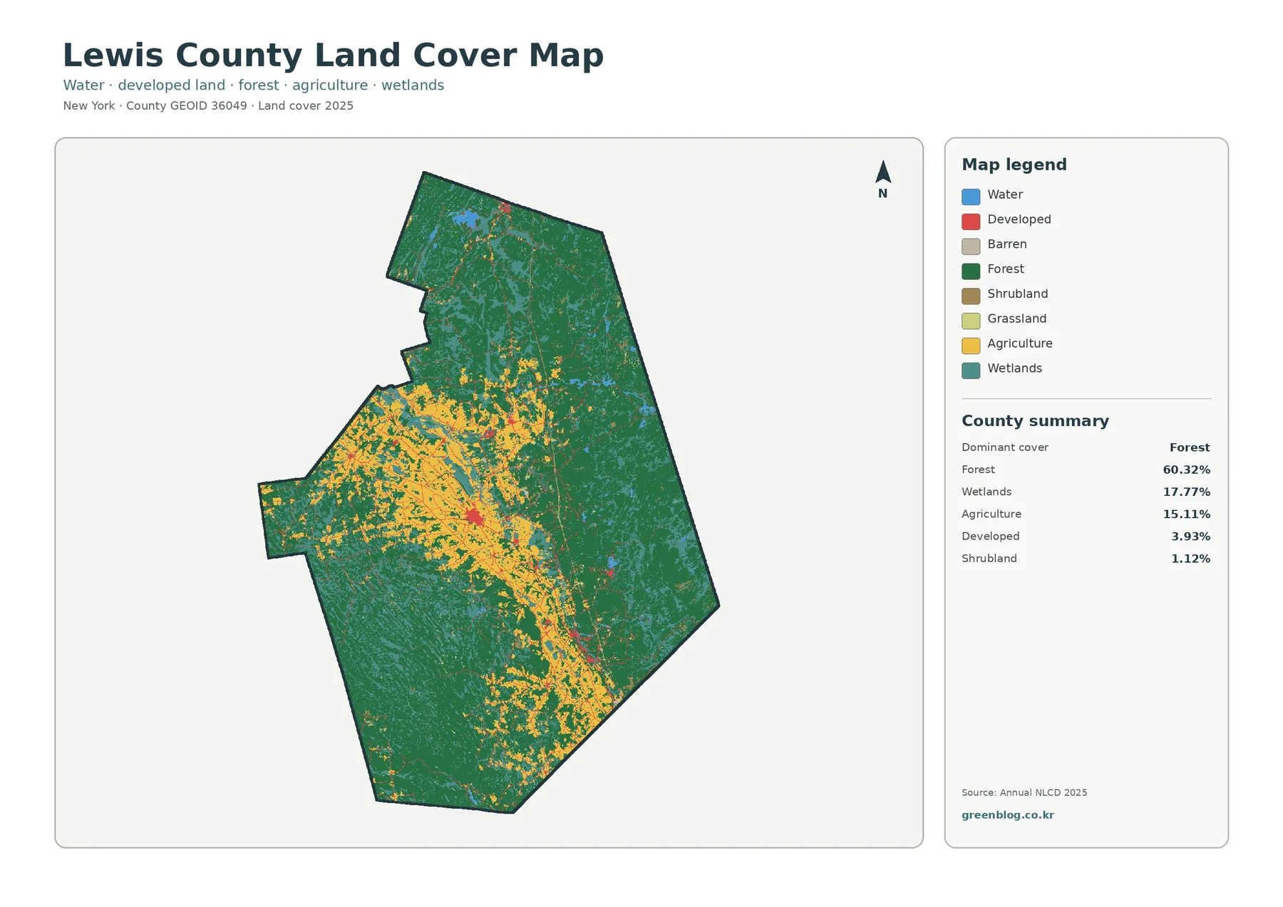
The Lewis County New York Land Cover Map is defined by broad forest cover, extensive wetlands, and a distinct band
Lewis County New York Land Cover Map: Forests, Wetlands, and a Central Farm Belt Read More »
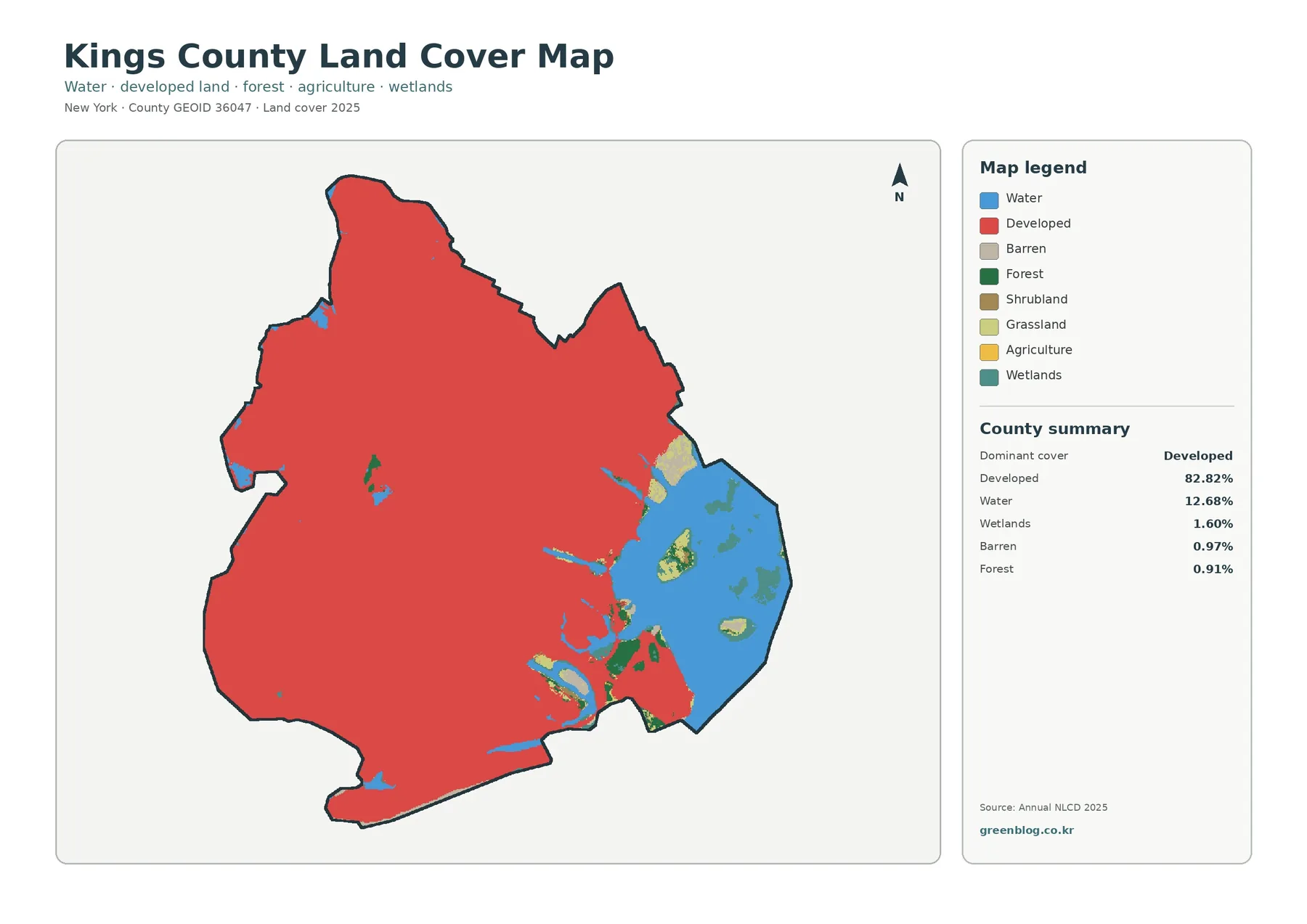
The Kings County New York Land Cover Map is dominated by developed land, with open water forming the largest contrasting
Kings County New York Land Cover Map: Dense Development, Waterfront, and 4 JPG Maps Read More »
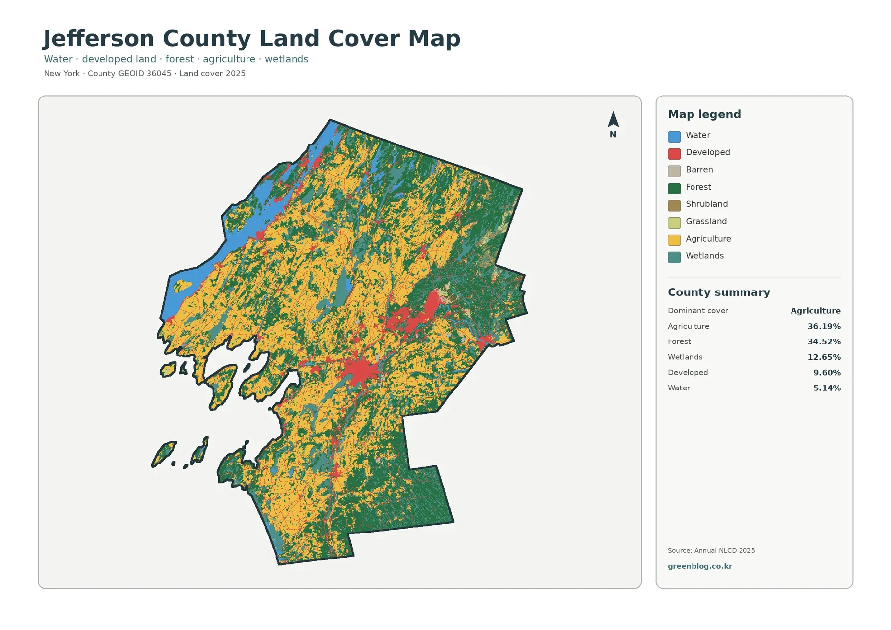
The Jefferson County New York Land Cover Map brings together a landscape where agriculture and forest occupy nearly equal shares,
Jefferson County New York Land Cover Map: Farm Country, Woodlands, Wetlands, and Lakes Read More »
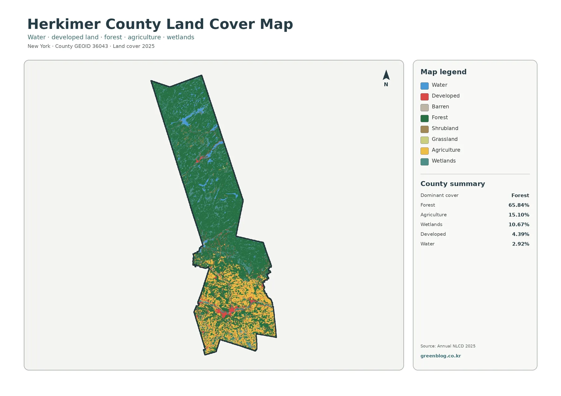
The Herkimer County New York Land Cover Map set makes the county’s north-to-south contrast easy to see. Forest covers 65.84%
Herkimer County New York Land Cover Map — 65.84% Forest Meets Southern Farmland Read More »
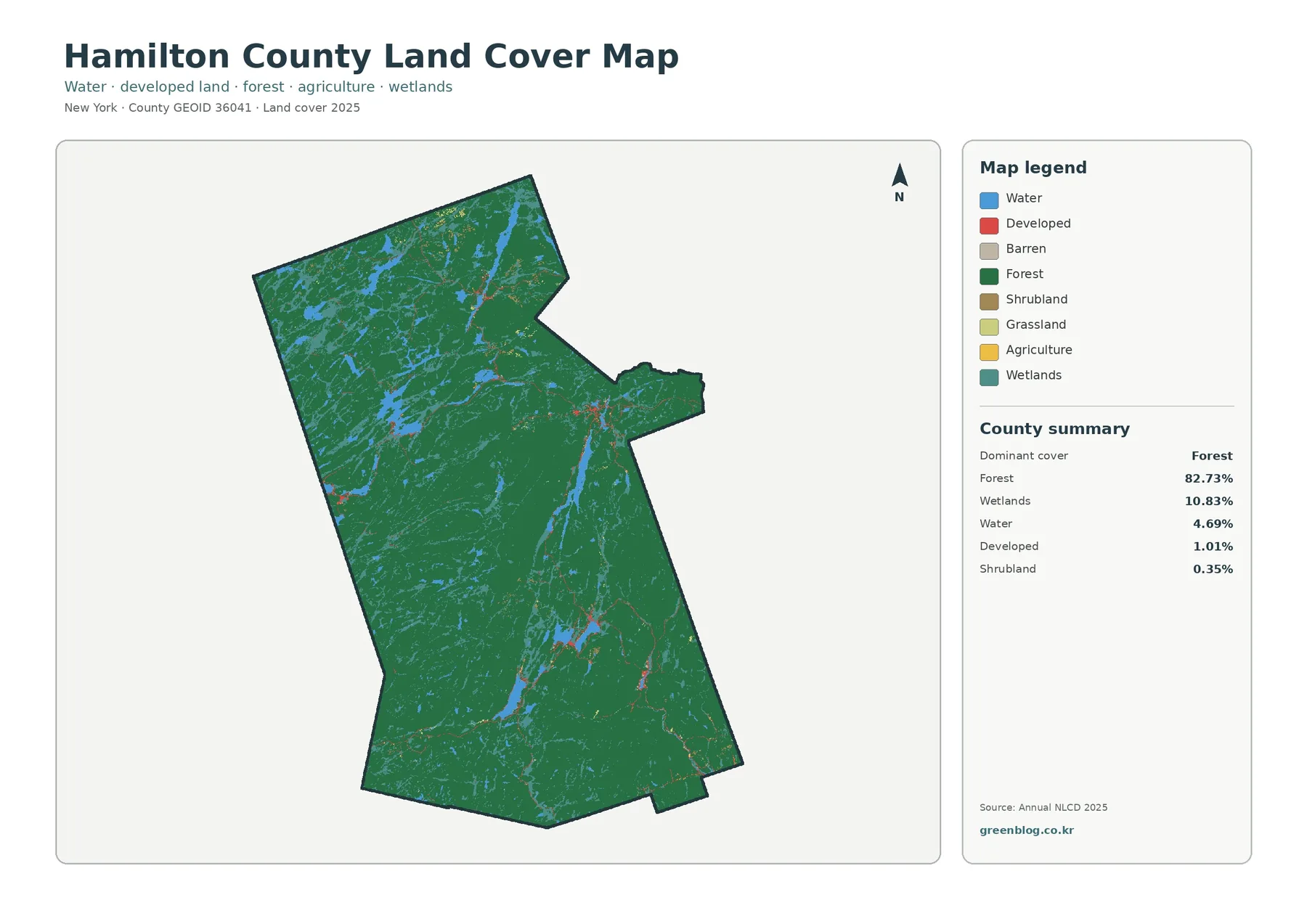
Hamilton County is dominated by natural cover rather than broad farm fields or large developed areas. The 2025 summary places
Hamilton County New York Land Cover Map: 82.73% Forest Broken by Lakes and Wetlands Read More »
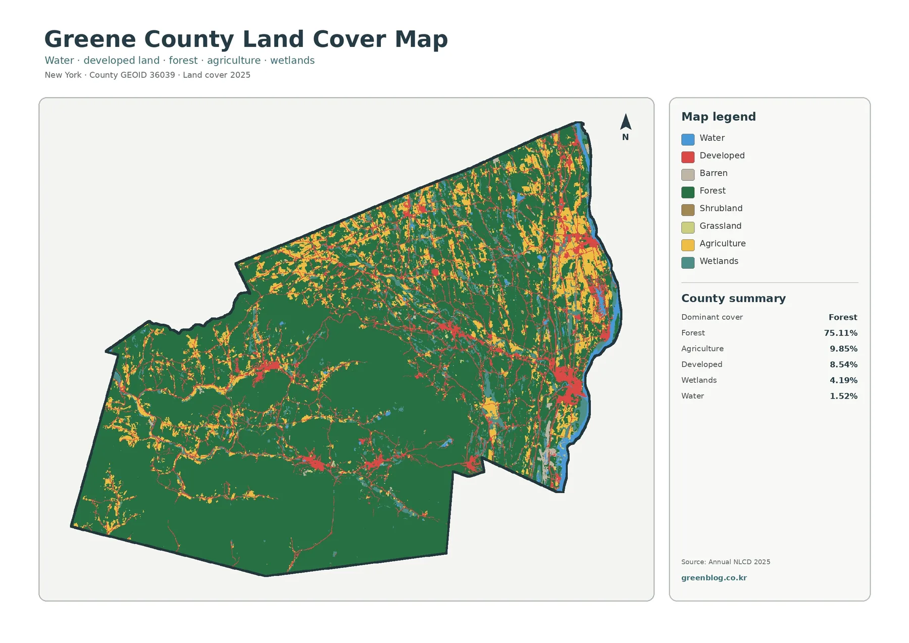
Greene County has one of the clearest land-cover contrasts in eastern New York. Broad forest dominates the Catskill portion of
Greene County New York Land Cover Map Shows 75.11% Forest and an Eastern Settlement Belt Read More »
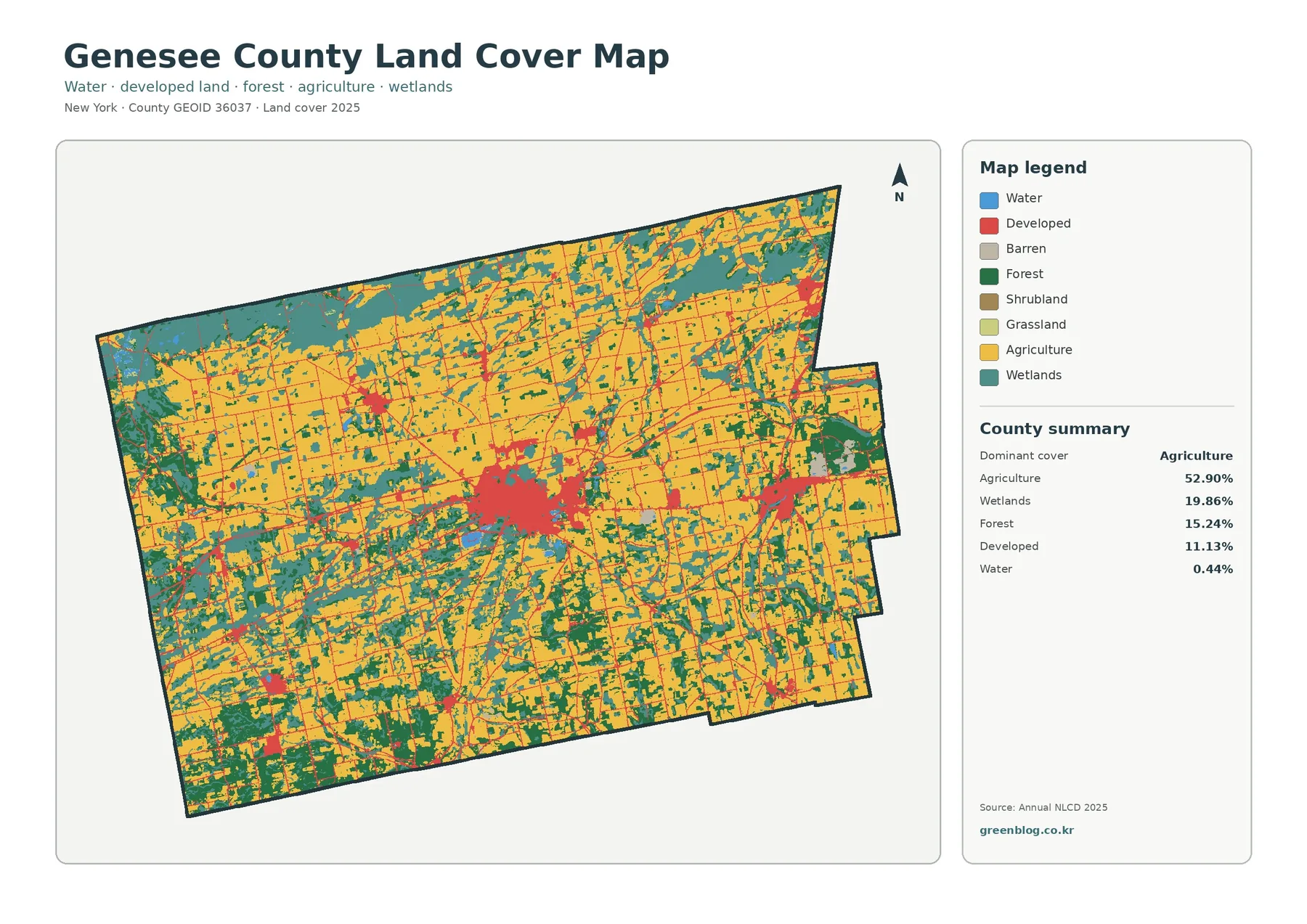
Genesee County in western New York is dominated by working farmland, but the land-cover maps also reveal broad wetlands, scattered
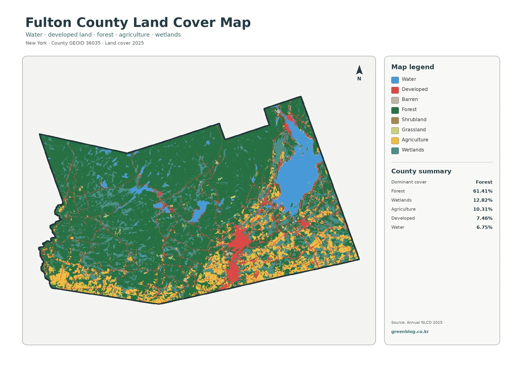
Fulton County, New York, shifts from a heavily wooded northern and western landscape to a more mixed southern area where