
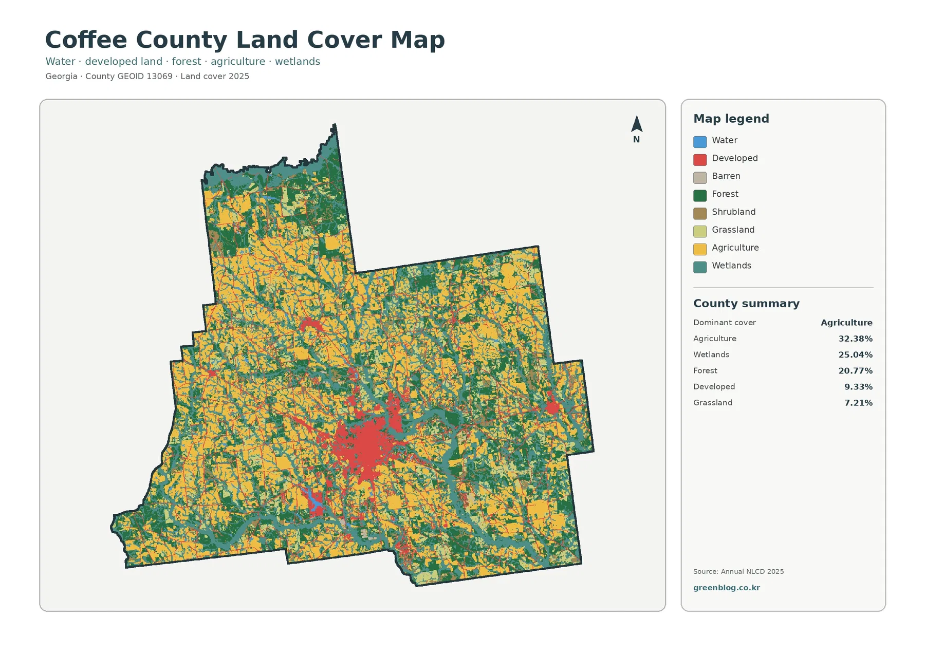
Coffee County Georgia Land Cover Map – Fields Lead Around a Compact Douglas Hard-Surface Core
Agriculture is the largest mapped cover in Coffee County, but the county does not read as one continuous block of […]
Agriculture is the largest mapped cover in Coffee County, but the county does not read as one continuous block of […]
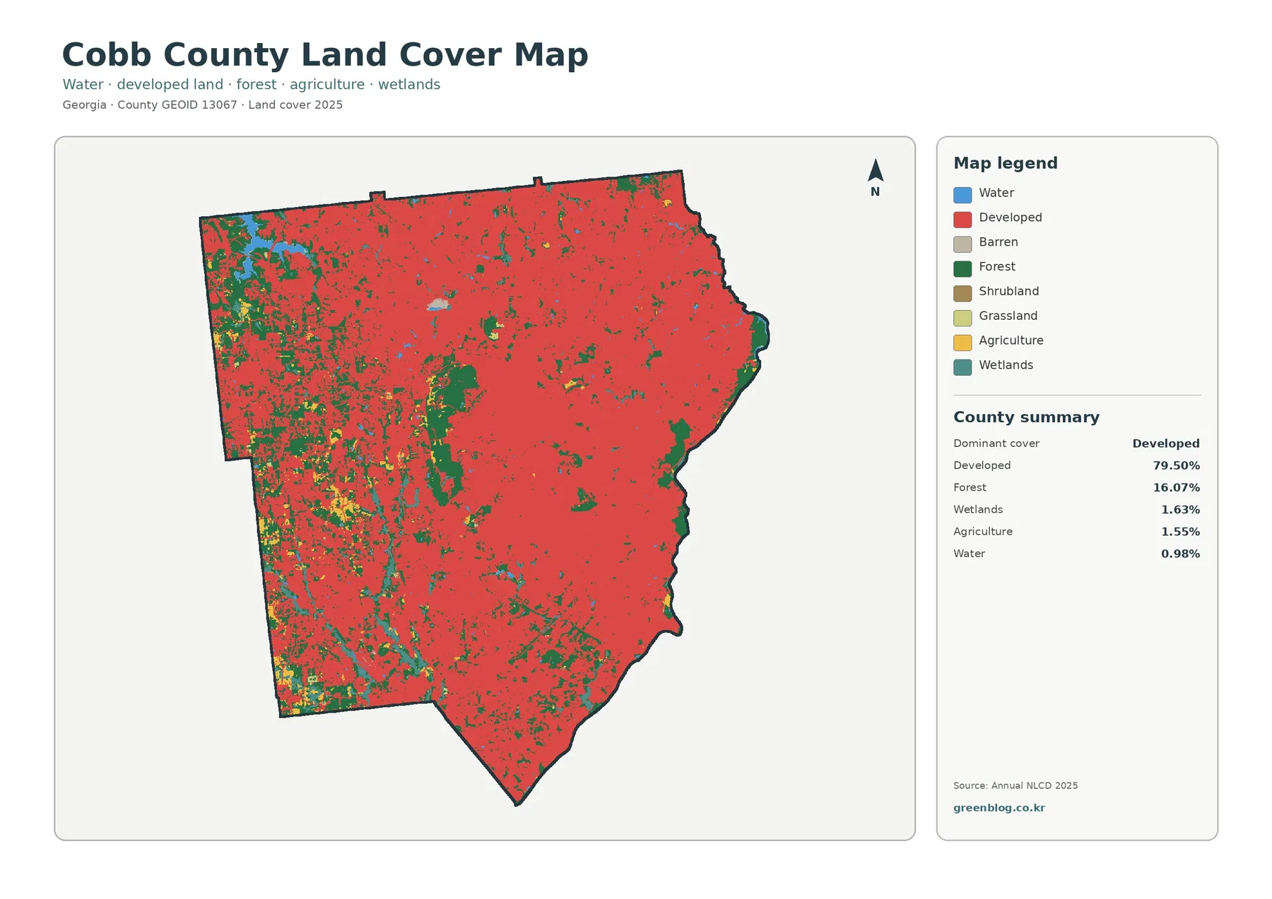
Cobb County is overwhelmingly developed in the supplied 2025 classification, but the county is not a single uninterrupted sheet of
Cobb County Georgia Land Cover Map – 79.50% Developed Cover with Forest and Water Edges Read More »
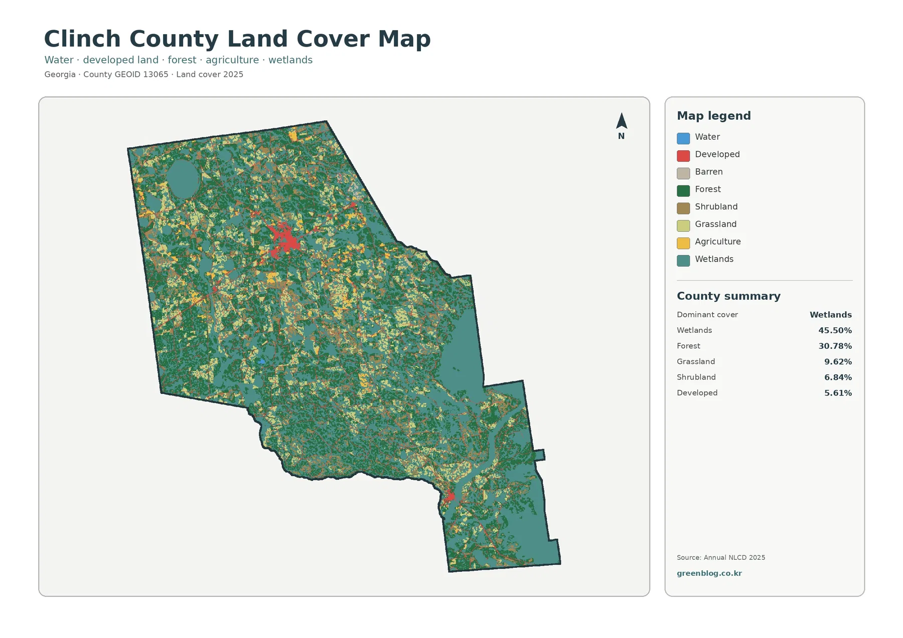
Wetlands are the defining feature of the supplied 2025 maps for Clinch County. They cover 45.50% of the county, while
Clinch County Georgia Land Cover Map – Where Wetlands Lead and Hard Surfaces Stay Sparse Read More »
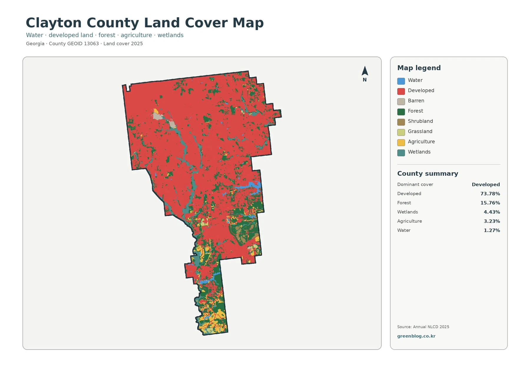
Developed land dominates Clayton County in the supplied 2025 classification. The Clayton County Georgia Land Cover Map reports 73.78% developed
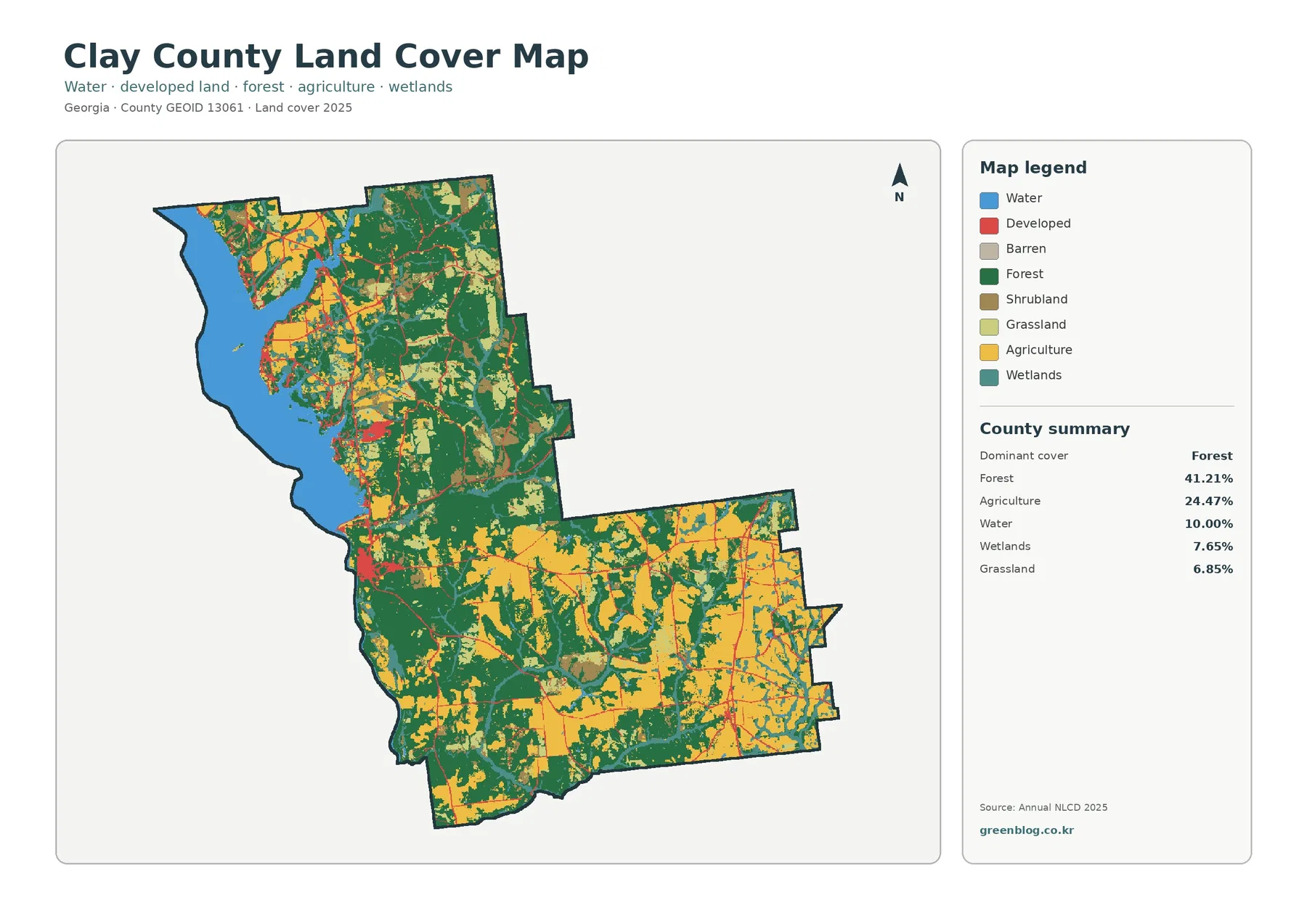
Clay County in southwest Georgia has a land-cover pattern that changes quickly from the broad water along its western side
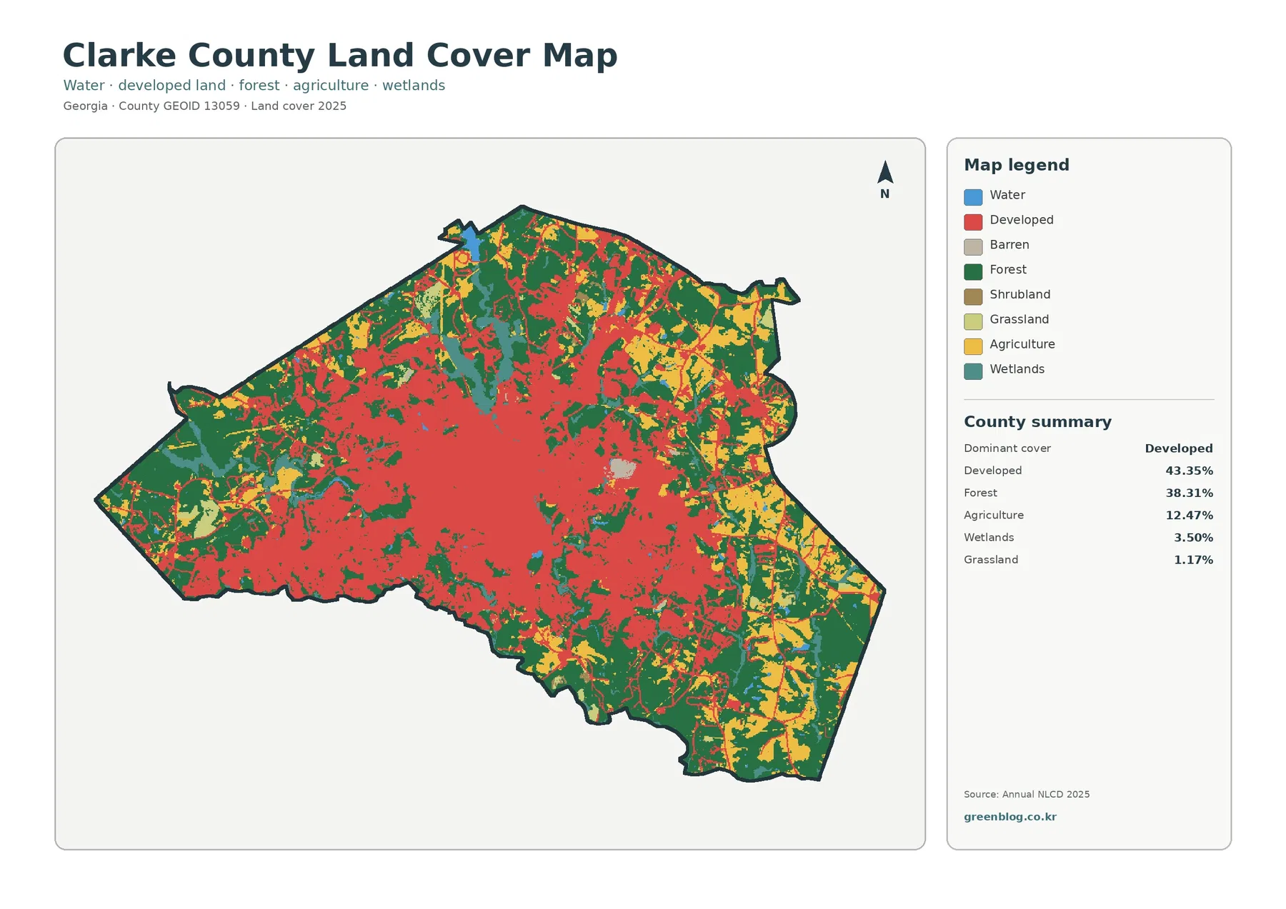
Clarke County is one of the more urban land-cover profiles in Georgia, but the supplied 2025 data does not show
Clarke County Georgia Land Cover Map – Athens Urban Core, Forest Edges, and Four JPGs Read More »
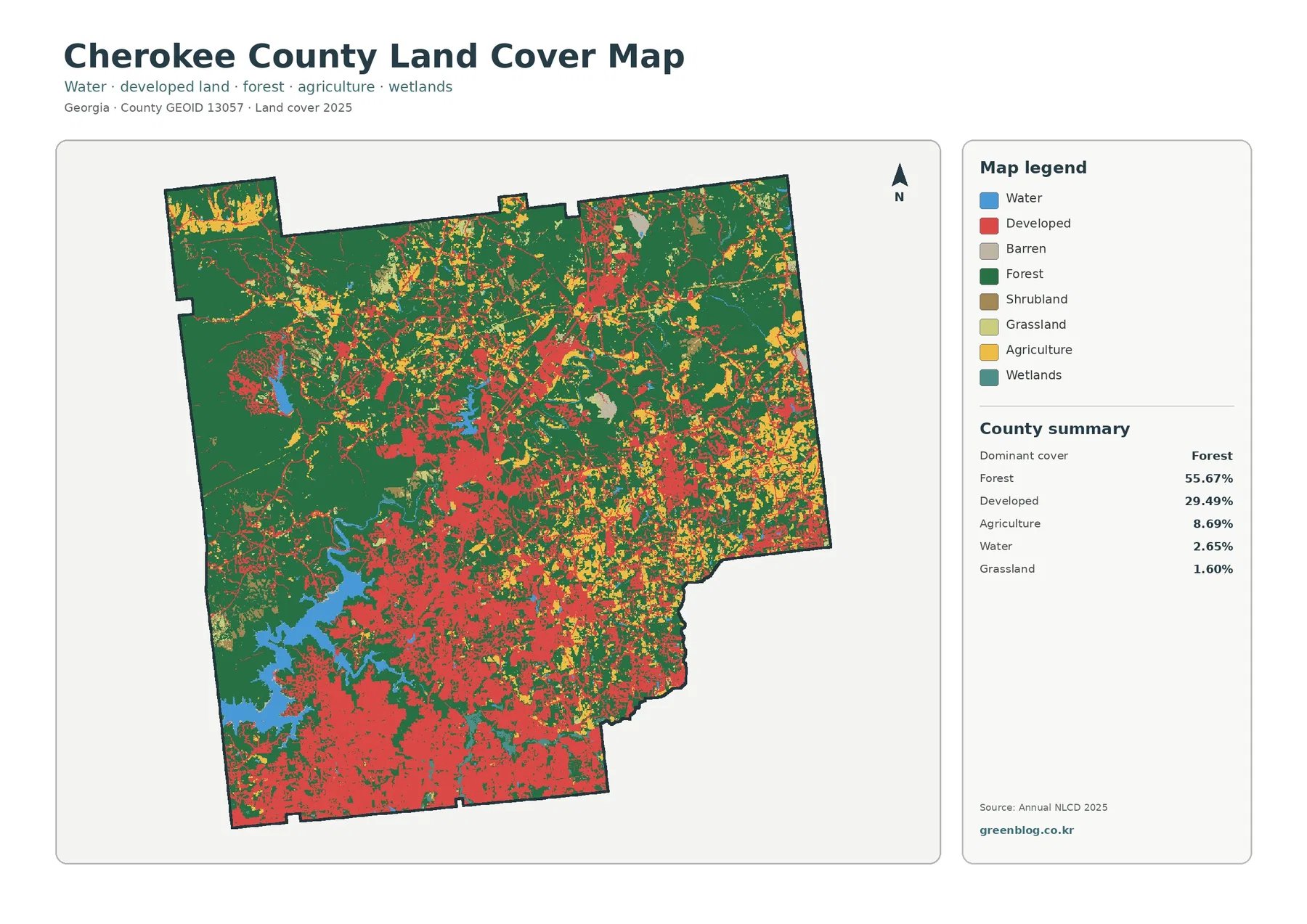
Forest still covers more than half of Cherokee County in the supplied 2025 data, but the county is far from
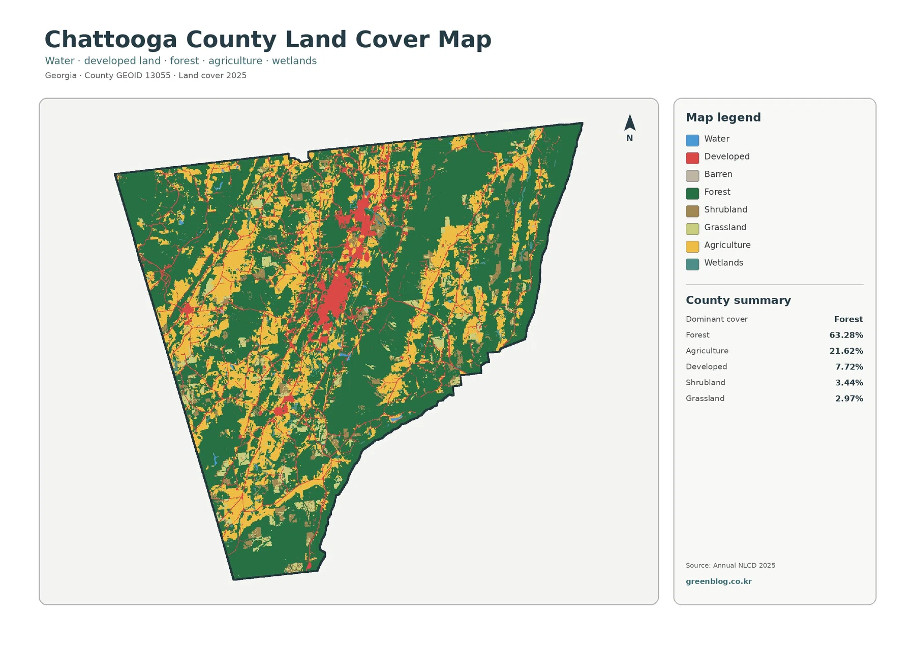
The Chattooga County Georgia Land Cover Map set captures a county where forest covers most of the landscape while farms
Chattooga County Georgia Land Cover Map – Forested Ridges and the U.S. 27 Built Corridor Read More »
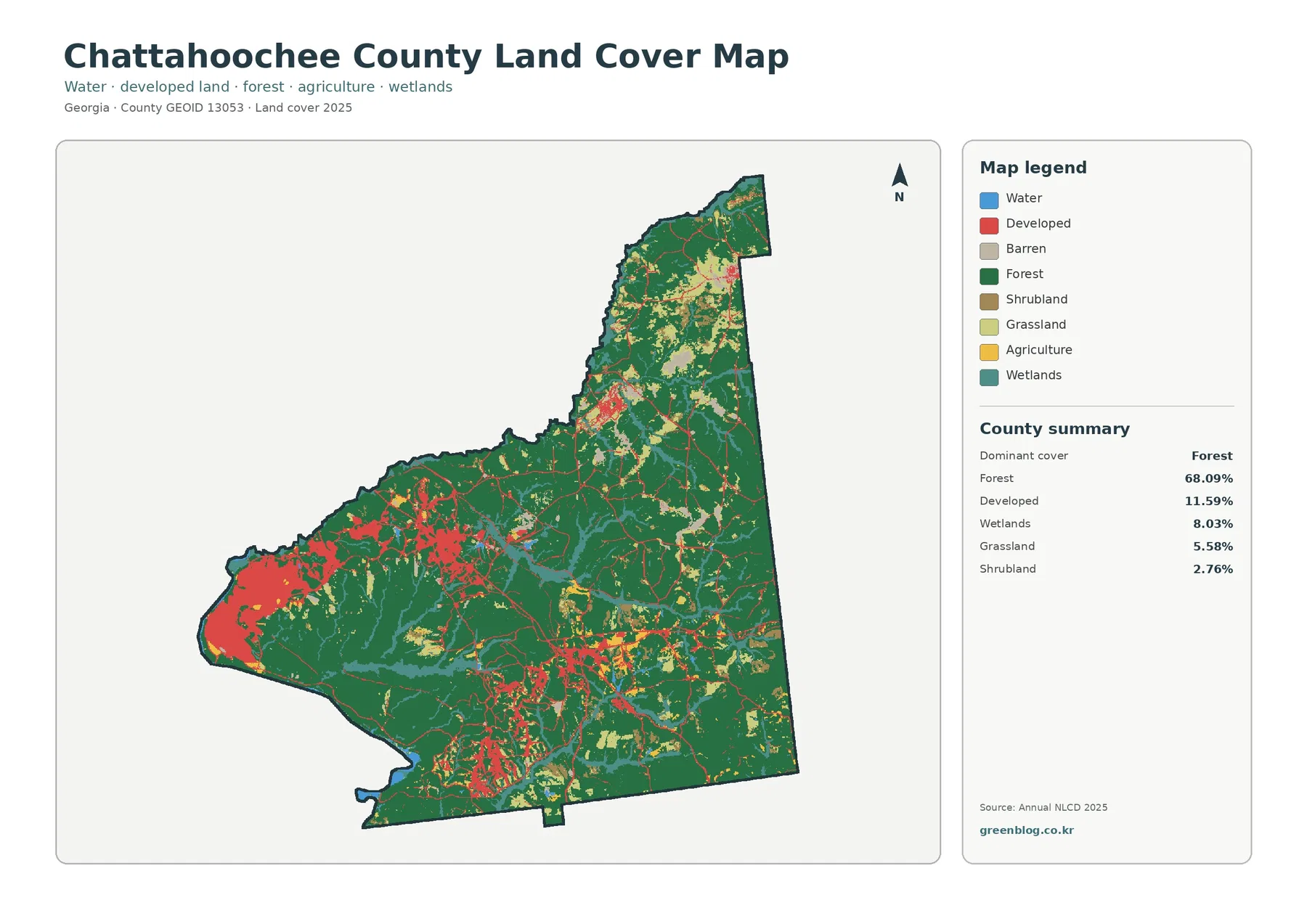
Forest is the defining surface across Chattahoochee County in the supplied 2025 data. It accounts for 68.09% of the county,