
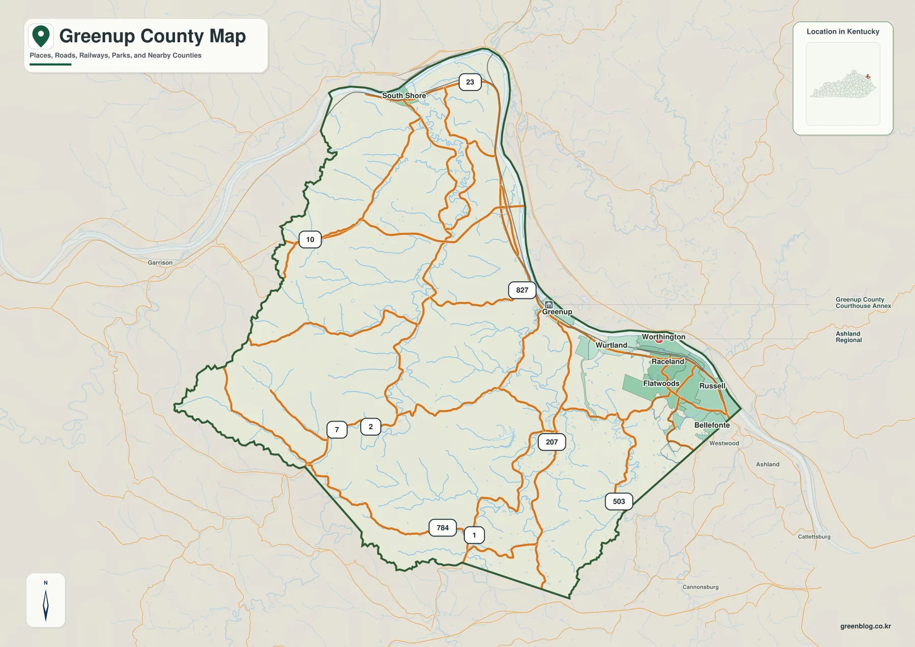
Greenup County Map — Flatwoods and Russell by the Ohio River, Greenbo Lake, and Western Ridges
Greenup County sits at Kentucky’s northeastern edge, where the Ohio River wraps around the county and a string of communities
Greenup County sits at Kentucky’s northeastern edge, where the Ohio River wraps around the county and a string of communities
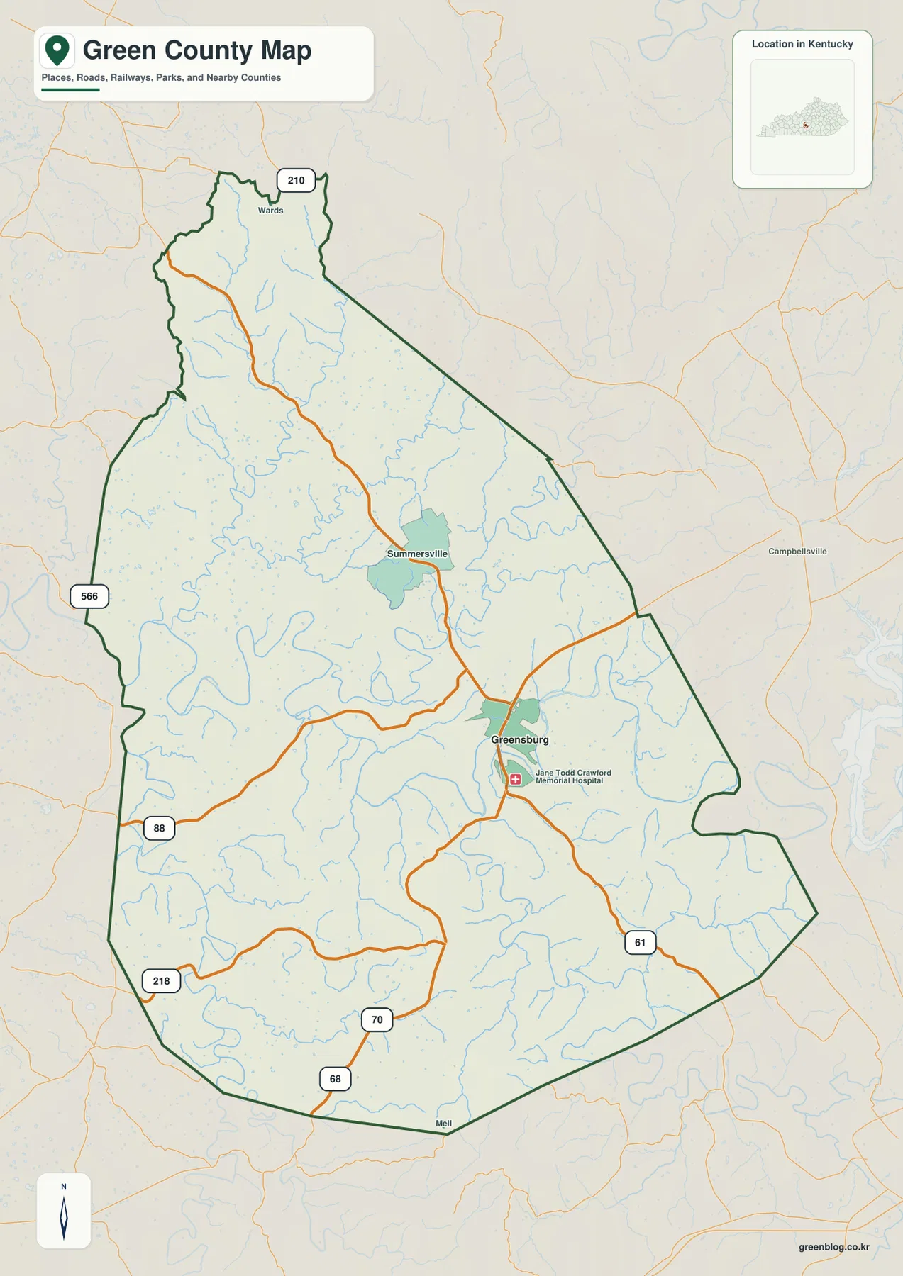
Green County lies in south-central Kentucky, where Greensburg provides the clearest town reference and the Green River loops through a
Green County Kentucky Map — Greensburg, Green River Bends, and Rolling Ridges Read More »
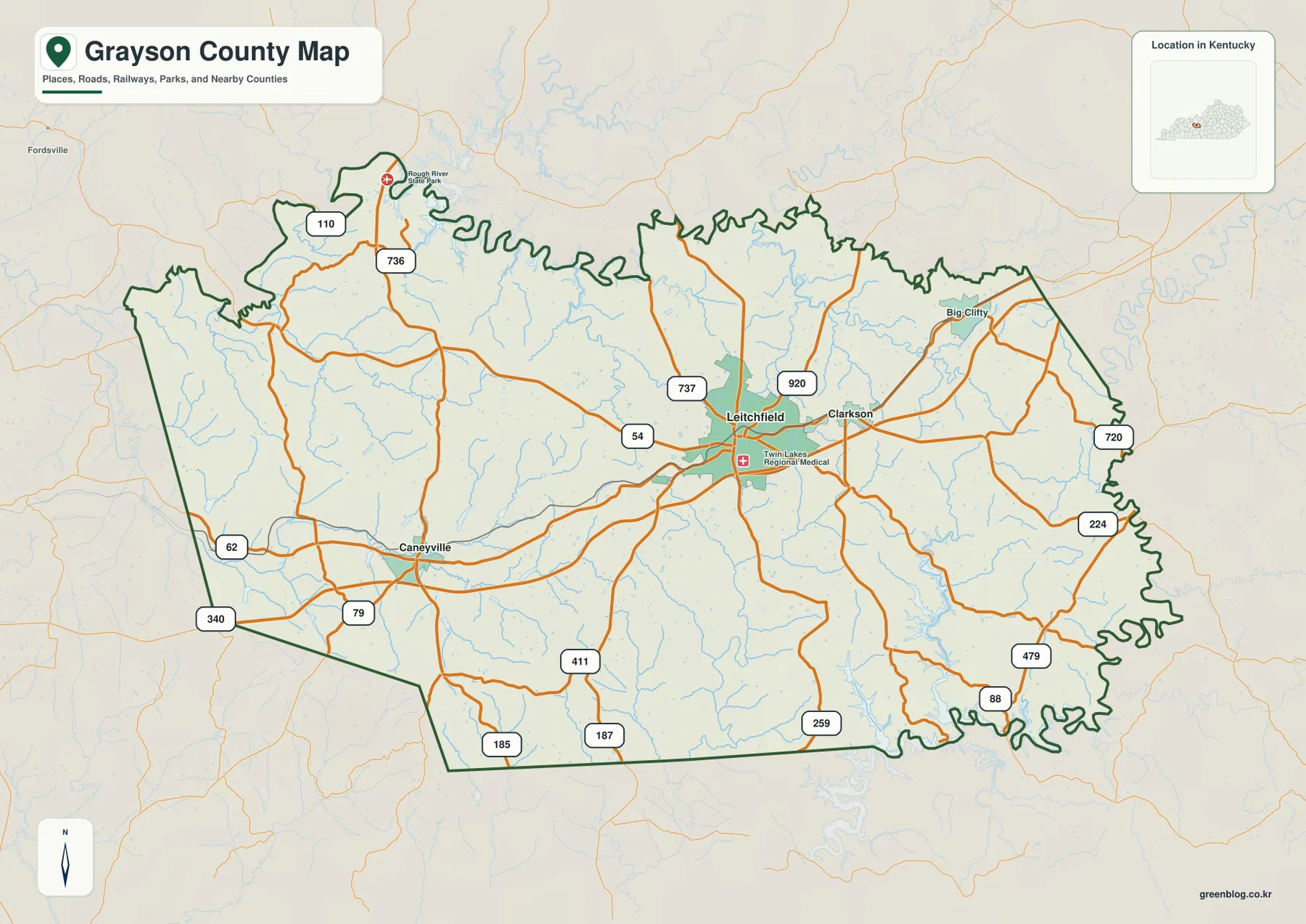
Grayson County sits in west-central Kentucky around Leitchfield, with Clarkson close to the east, Caneyville to the west, and smaller
Grayson County Kentucky Map — Leitchfield between Rough River and Nolin River Lake Read More »
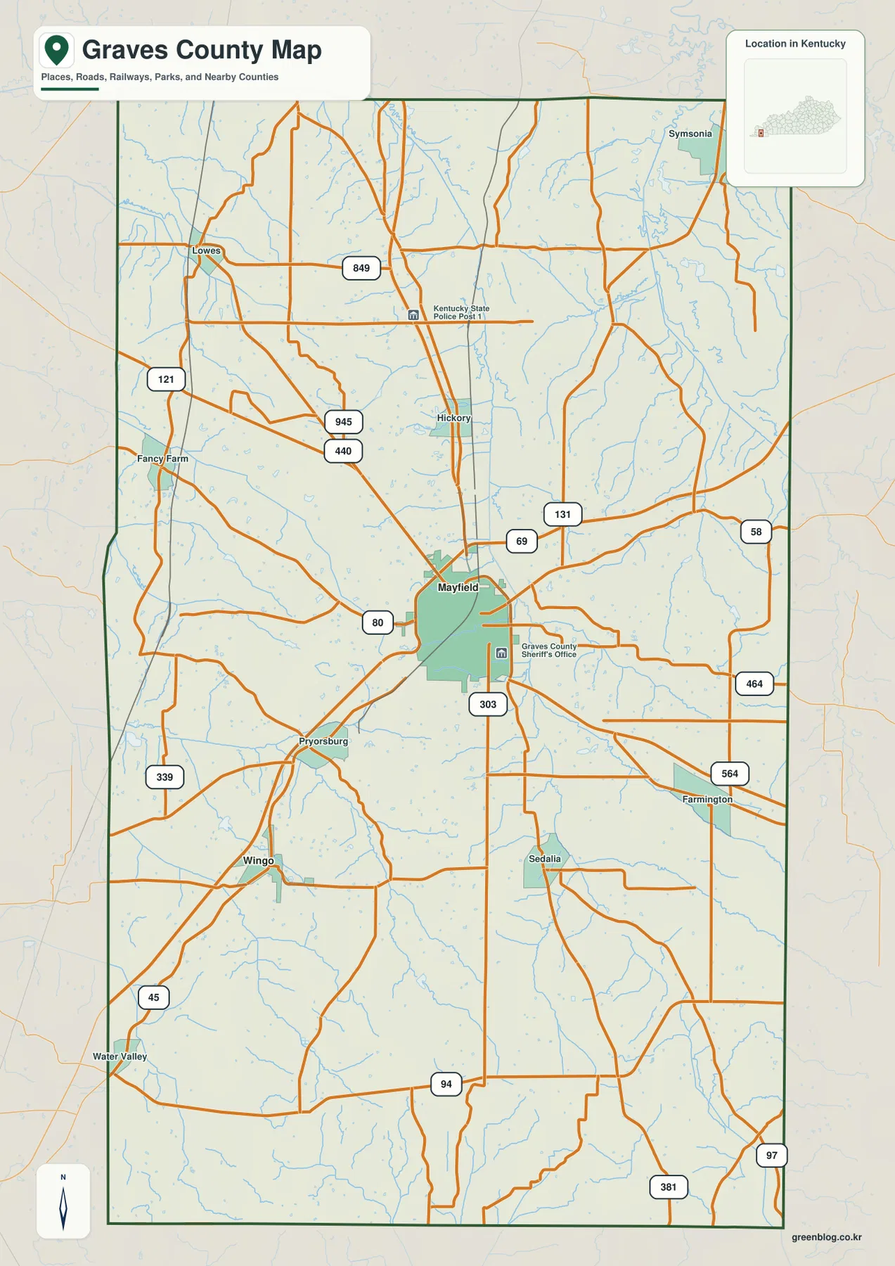
Graves County sits in western Kentucky with Mayfield as the clearest place to orient yourself. The maps on this page
Graves County Map — Mayfield, Wingo, and the Mayfield Creek Valleys Read More »
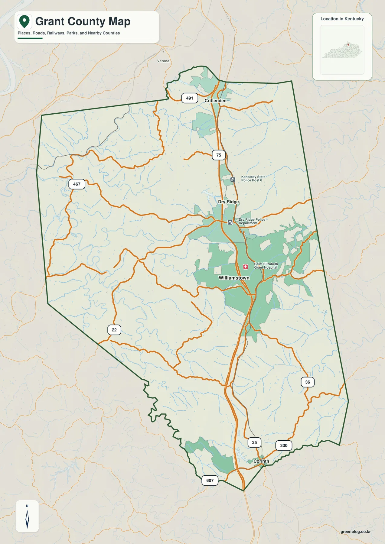
Grant County occupies a north-south corridor in northern Kentucky where Crittenden, Dry Ridge, Williamstown, and Corinth line up along or
Grant County Kentucky Map from Crittenden to Corinth — I-75, Lakes, and Rolling Ridges Read More »
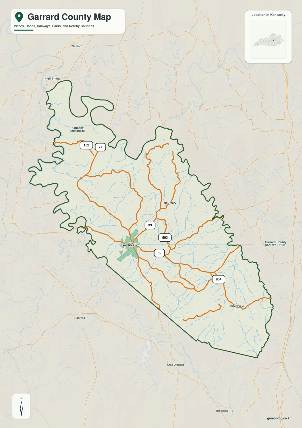
Garrard County sits in central Kentucky with Lancaster as its clearest road and settlement reference, while the landscape changes sharply
Garrard County Map — Lancaster, Kentucky River Lowlands, and Southeast Ridges Read More »
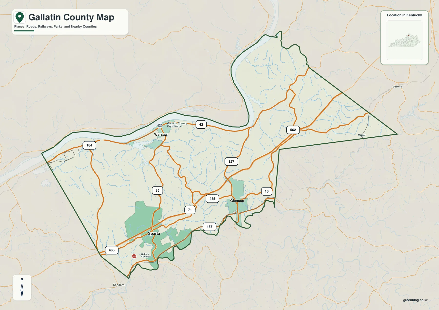
Gallatin County sits along a broad bend of the Ohio River in northern Kentucky, with Warsaw on the river and
Gallatin County Kentucky Map — Warsaw on the Ohio River and the I-71 Hills Read More »
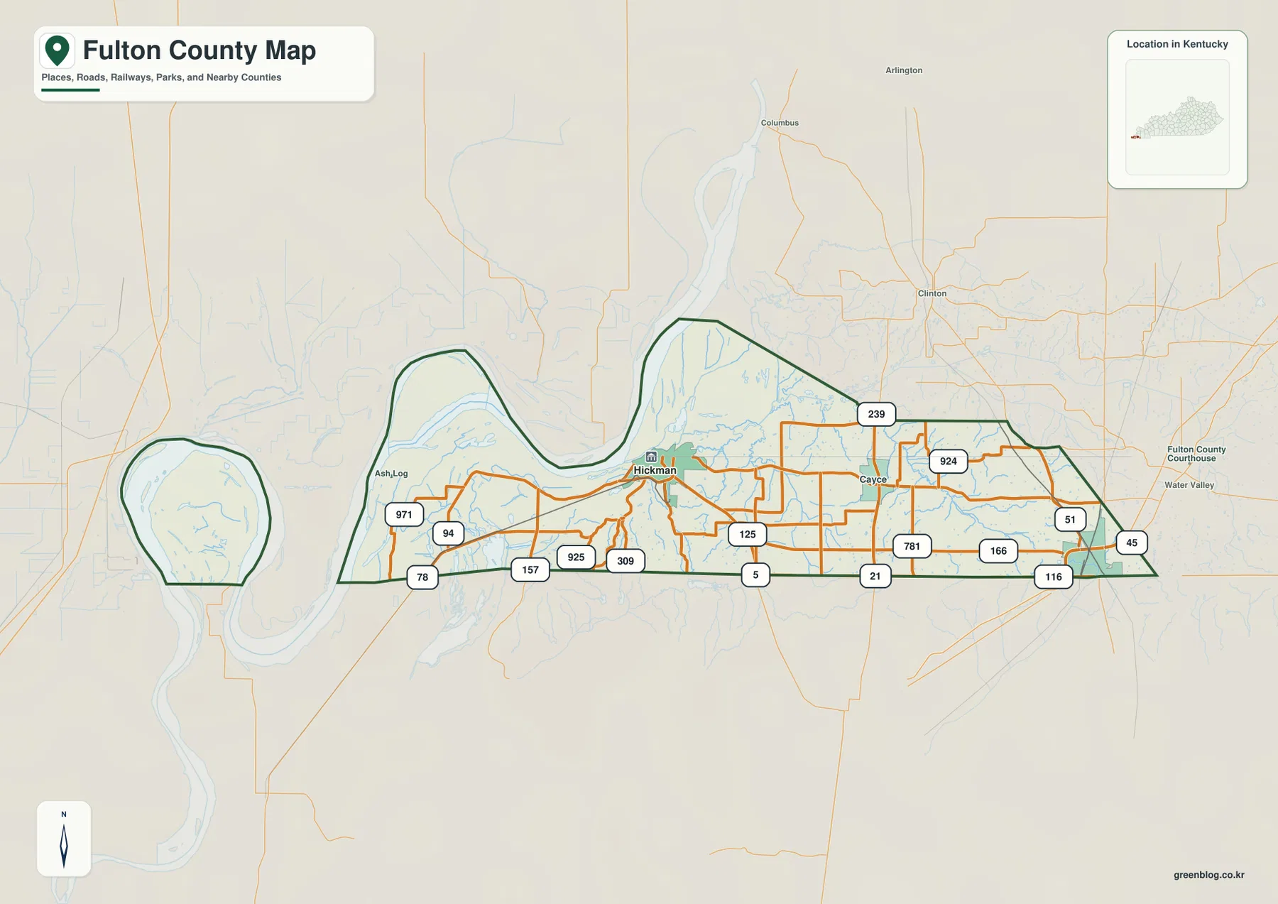
Fulton County sits at the far western edge of Kentucky, where the Mississippi River shapes one of the state’s most
Fulton County Kentucky Map — Hickman, Fulton, and the Mississippi River Bend Read More »
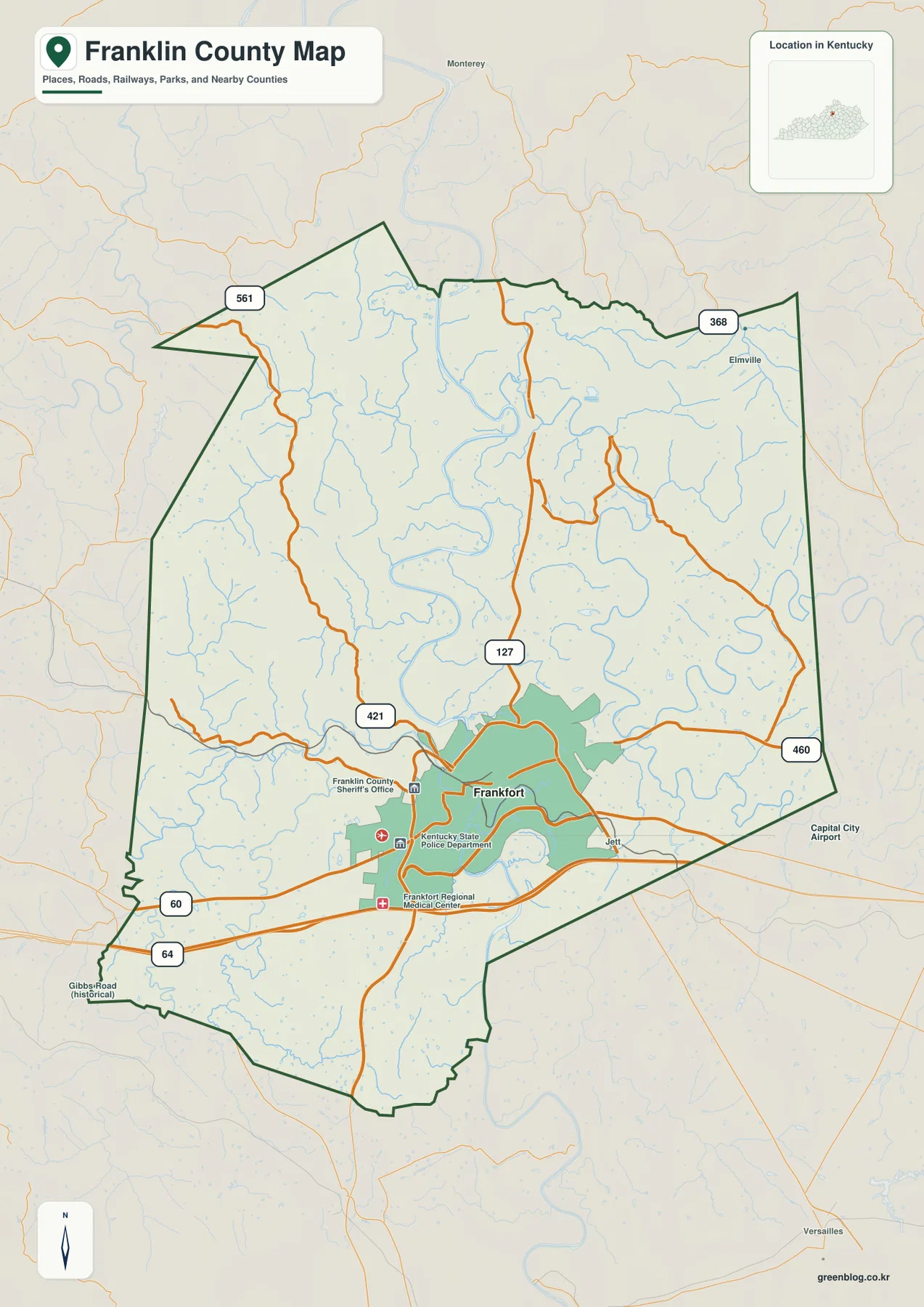
Franklin County, Kentucky is easiest to understand by starting with Frankfort and the broad bends of the Kentucky River. I-64
Franklin County Kentucky Map — Frankfort, Kentucky River Bends, and the I-64 Corridor Read More »