
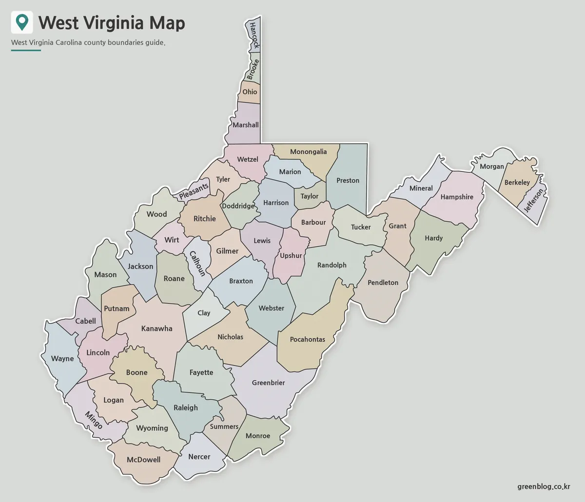
Why a West Virginia Map Needs Room for 55 County Labels
A West Virginia Map must accommodate one of the most irregular state silhouettes in the eastern United States. The Northern
Why a West Virginia Map Needs Room for 55 County Labels Read More »
A West Virginia Map must accommodate one of the most irregular state silhouettes in the eastern United States. The Northern
Why a West Virginia Map Needs Room for 55 County Labels Read More »
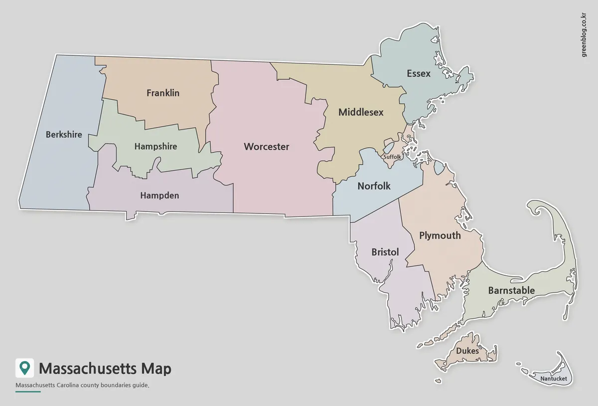
A Massachusetts Map is useful for much more than locating the state within the northeastern United States. Teachers often use
Massachusetts Map Collection | Printable County Maps in High Resolution Read More »
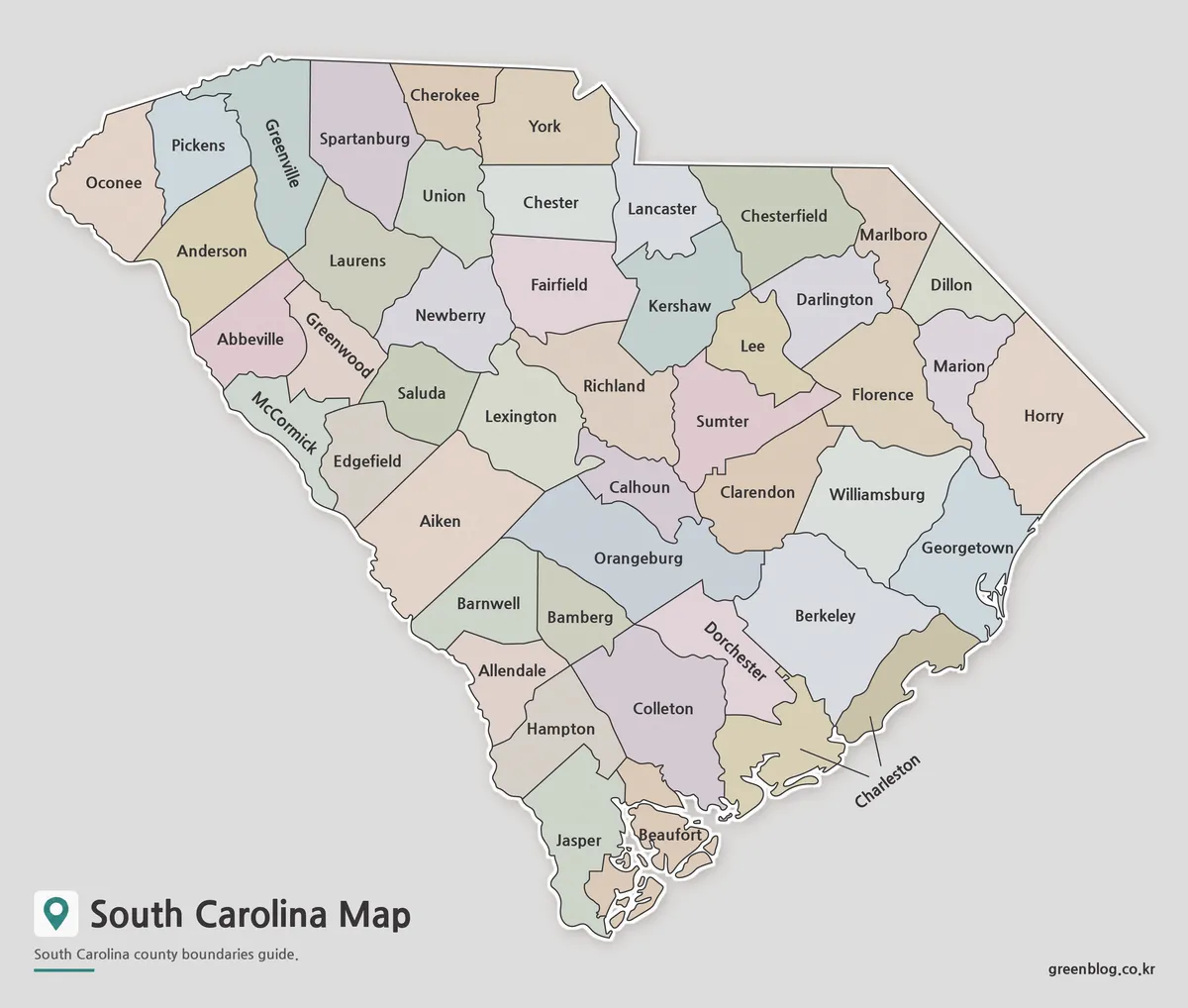
A South Carolina Map becomes most useful when it makes all 46 counties readable across a state that narrows toward
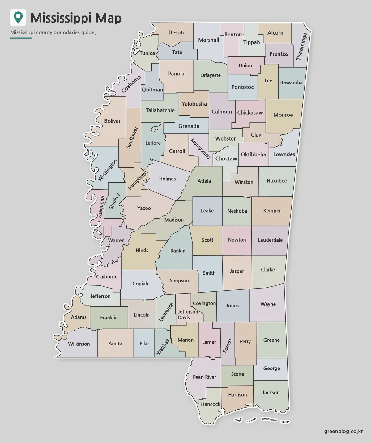
A Mississippi Map has two immediately recognizable edges: the winding western boundary associated with the Mississippi River and the short
Following 82 Counties Down a Mississippi Map to the Gulf Coast Read More »
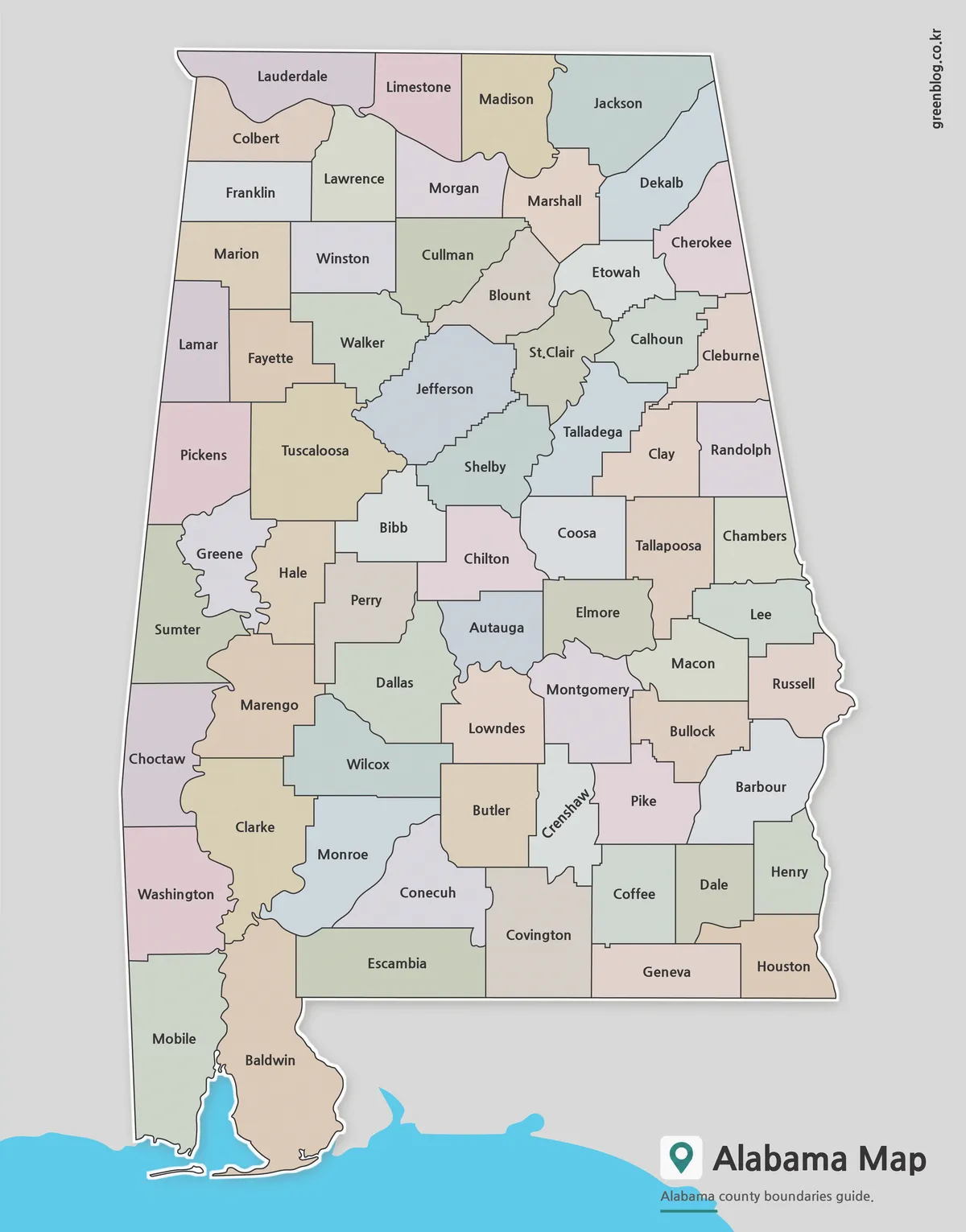
An Alabama map must keep 67 county shapes readable inside a state that is much taller than it is wide.
Why Mobile and Baldwin Shape the Bottom of an Alabama map Read More »
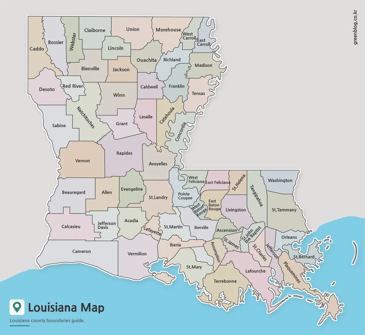
A Louisiana Parish Map has to fit 64 county-equivalent areas into a state outline that changes dramatically from the straight
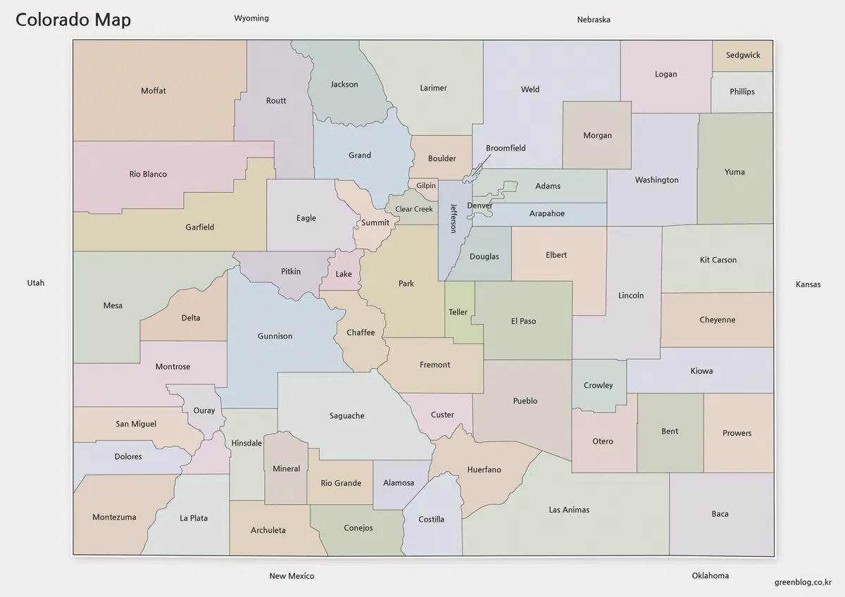
A Colorado Map becomes much more informative when it shows the state’s 64 counties rather than only its familiar rectangular
Colorado Map Guide to 64 Counties and the Denver-Area Cluster Read More »
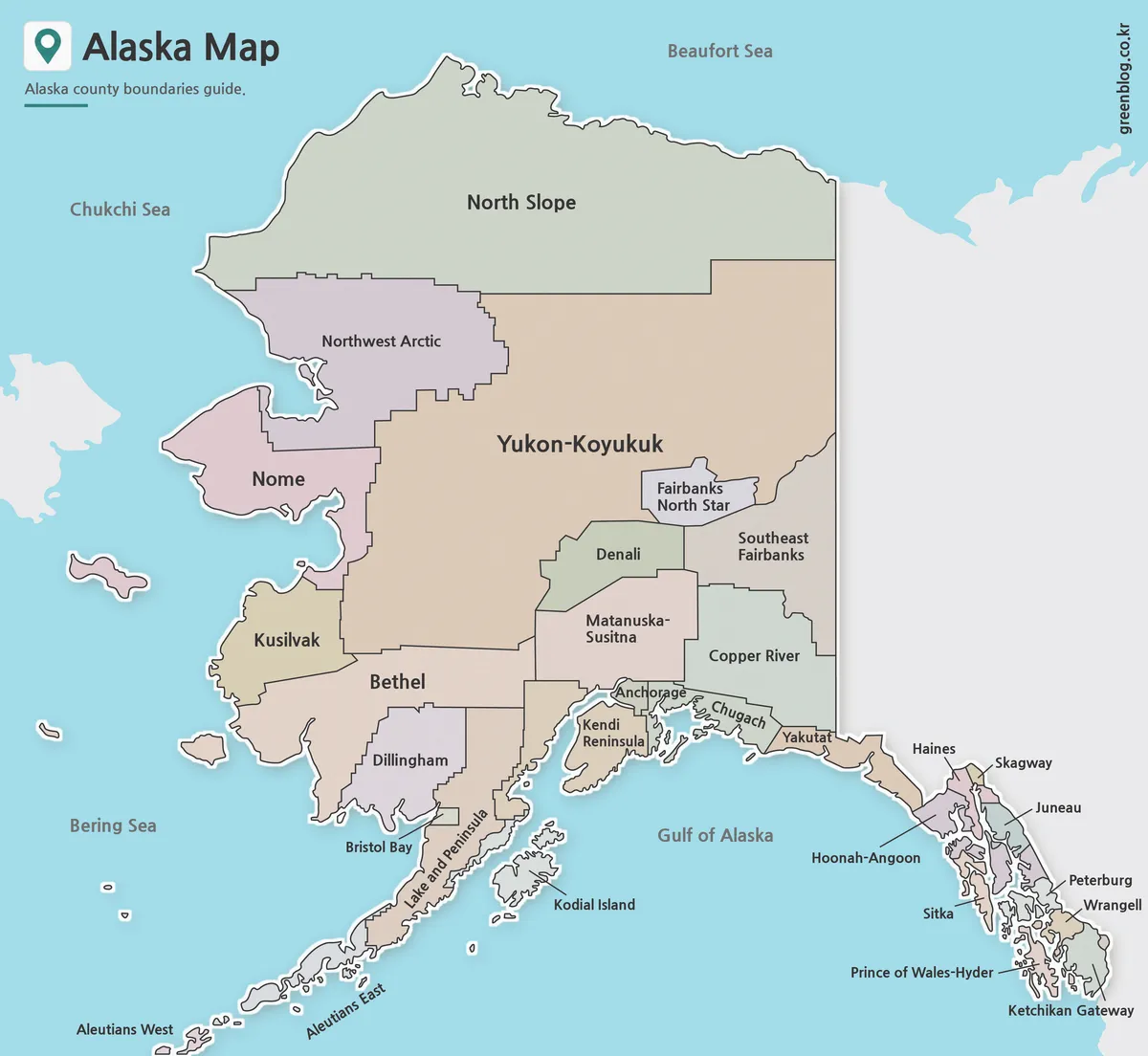
This Alaska Map has to fit three very different geographic forms into one frame: the enormous mainland, the Aleutian chain
Boroughs, Census Areas, and Islands on an Alaska Map Read More »
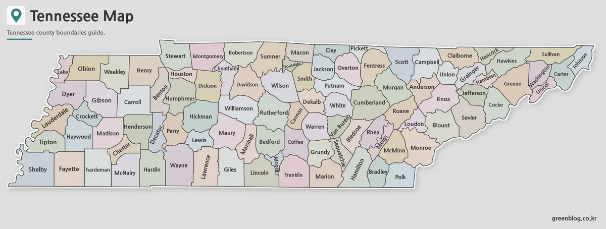
A Tennessee Map has to place 95 county shapes inside a state that is much wider than it is tall.
County Names Across a Ribbon-Shaped Tennessee Map Read More »