
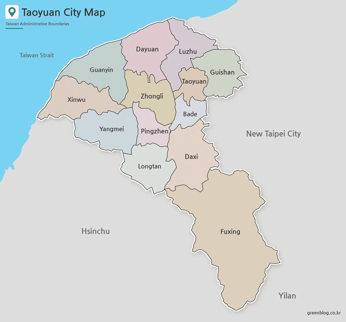
Coast to Fuxing: 13 Districts on a Taoyuan City Map
A Taoyuan City Map has to reconcile two very different spatial patterns: a tight group of northern and central districts
Coast to Fuxing: 13 Districts on a Taoyuan City Map Read More »
A Taoyuan City Map has to reconcile two very different spatial patterns: a tight group of northern and central districts
Coast to Fuxing: 13 Districts on a Taoyuan City Map Read More »
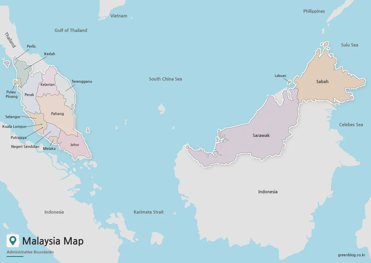
A Malaysia Map must connect two main land areas separated by the South China Sea. Peninsular Malaysia extends south from
Malaysia Map | 13 States, 3 Federal Territories, Peninsula & Borneo Read More »
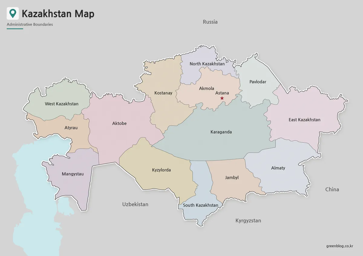
A Kazakhstan Map has to make an exceptionally wide country readable without shrinking its regional labels into the background. Kazakhstan
Reading a Kazakhstan Map: Regional Labels, Print, and Outline Use Read More »
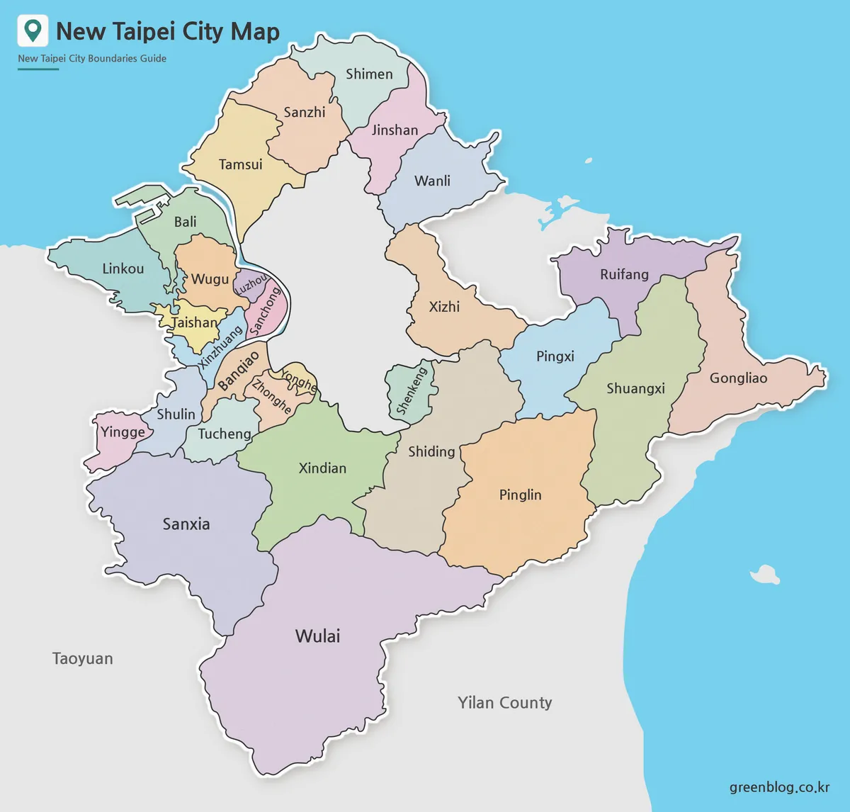
A Printable New Taipei City Map is useful when you need more than a simple location reference in northern Taiwan.
New Taipei City Map Download with District Boundaries Read More »
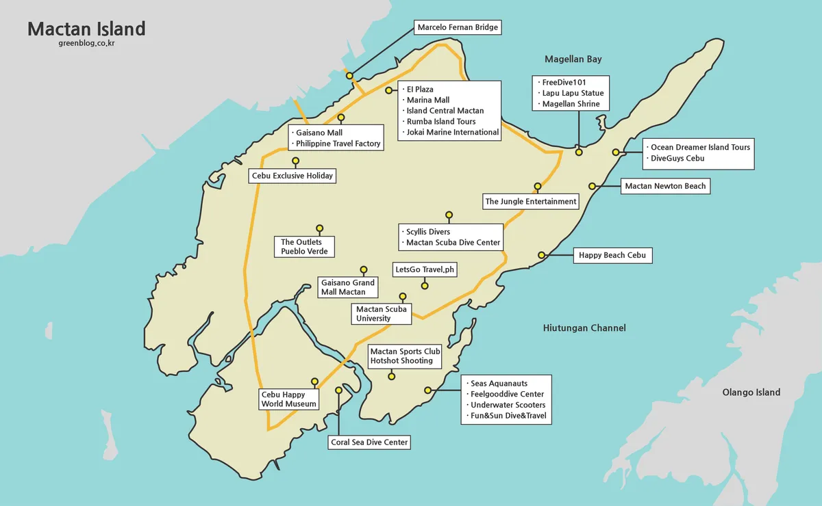
A Mactan Island Map is most useful when it separates three ideas that visitors often combine: the island itself, nearby
Across Bridges and Channels: Reading a Mactan Island Map Read More »
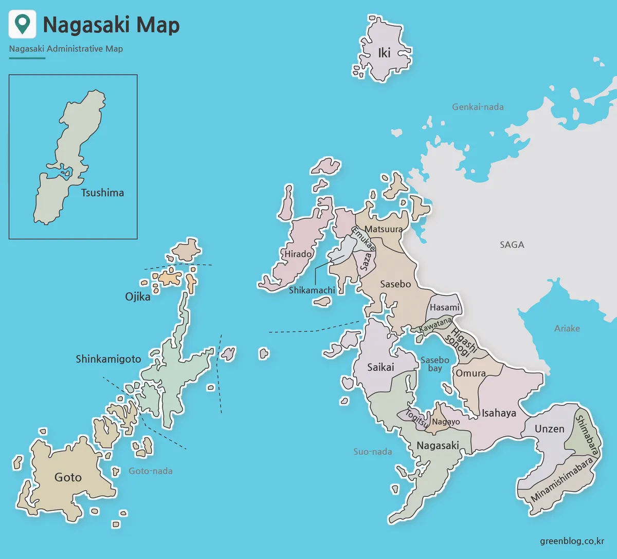
A Nagasaki Prefecture Map is useful when you need more than a simple outline of western Japan. Nagasaki is located
Printable Nagasaki Prefecture Map Collection for Education and Design Read More »
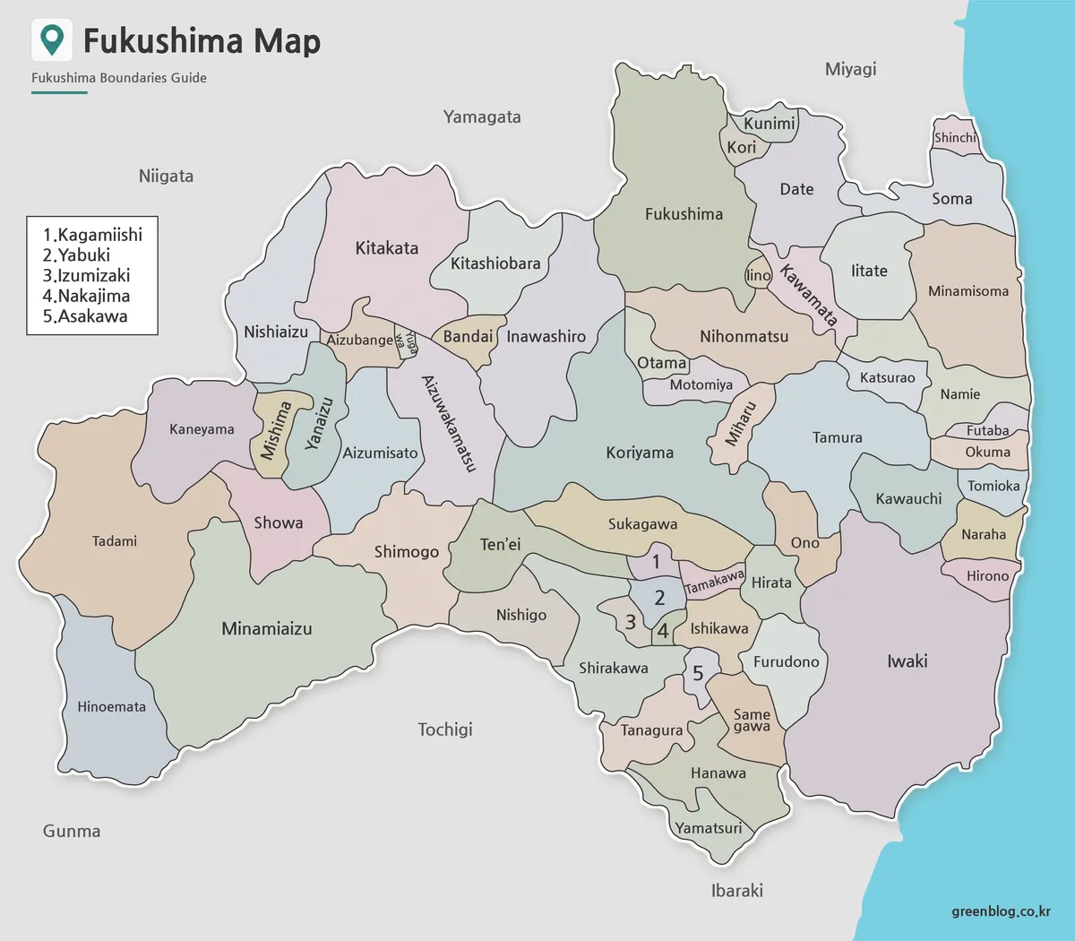
A Fukushima Prefecture Map has to make room for 59 municipalities across a prefecture that stretches from the Aizu interior
Five Numbered Labels on a Fukushima Prefecture Map Read More »
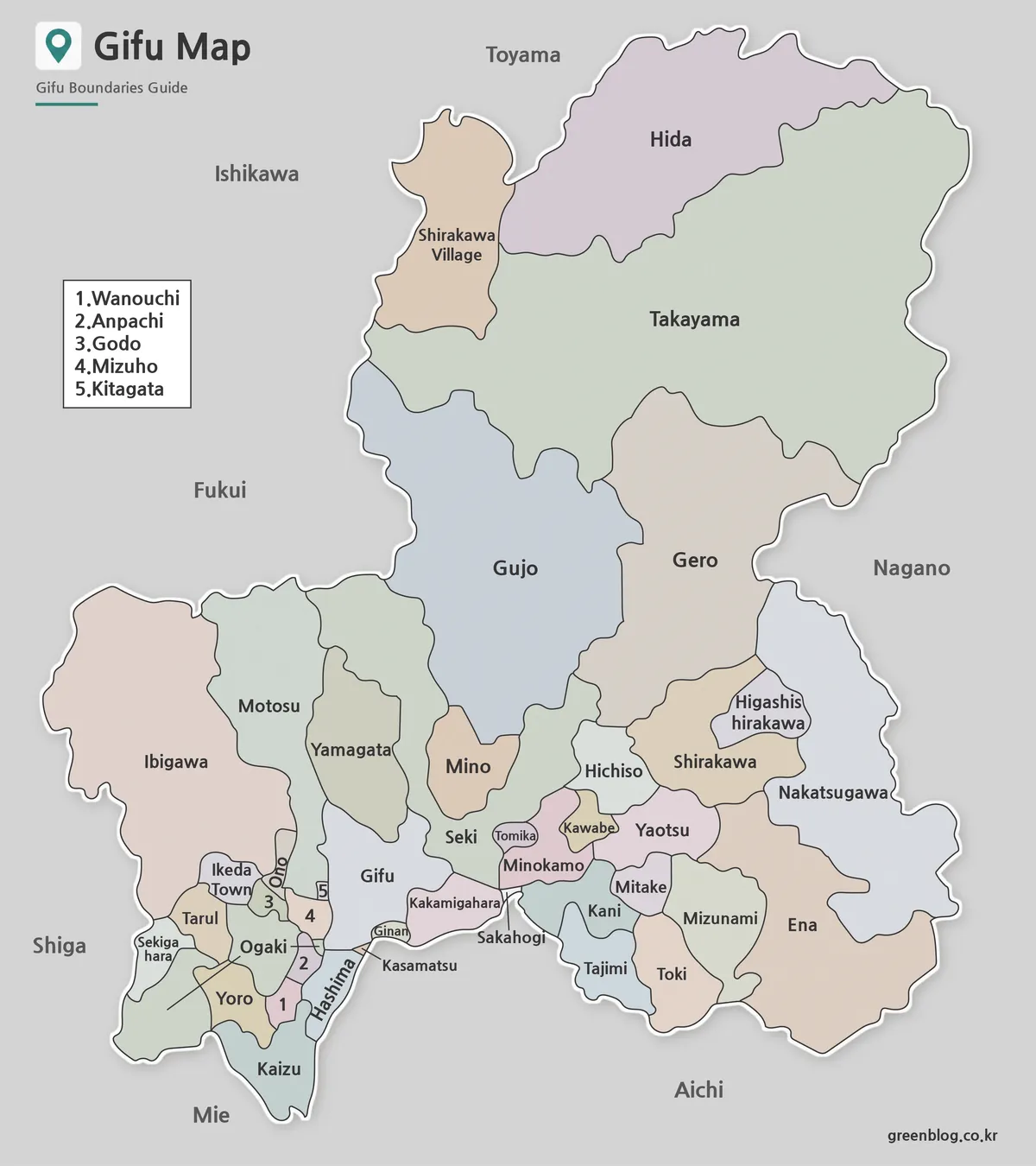
This Gifu Prefecture Map has to balance two very different administrative patterns on one portrait page. Takayama, Hida, Gujo, and
Reading 42 Municipalities on a Gifu Prefecture Map Read More »
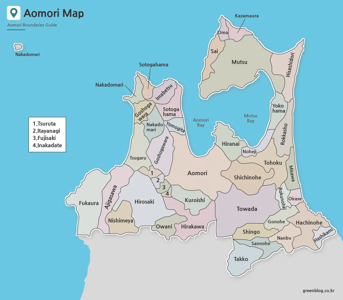
An Aomori Prefecture Map is unusually easy to recognize because two peninsulas reach north on opposite sides of Mutsu Bay.
Aomori Prefecture Map Guide to Mutsu Bay and Local Boundaries Read More »