
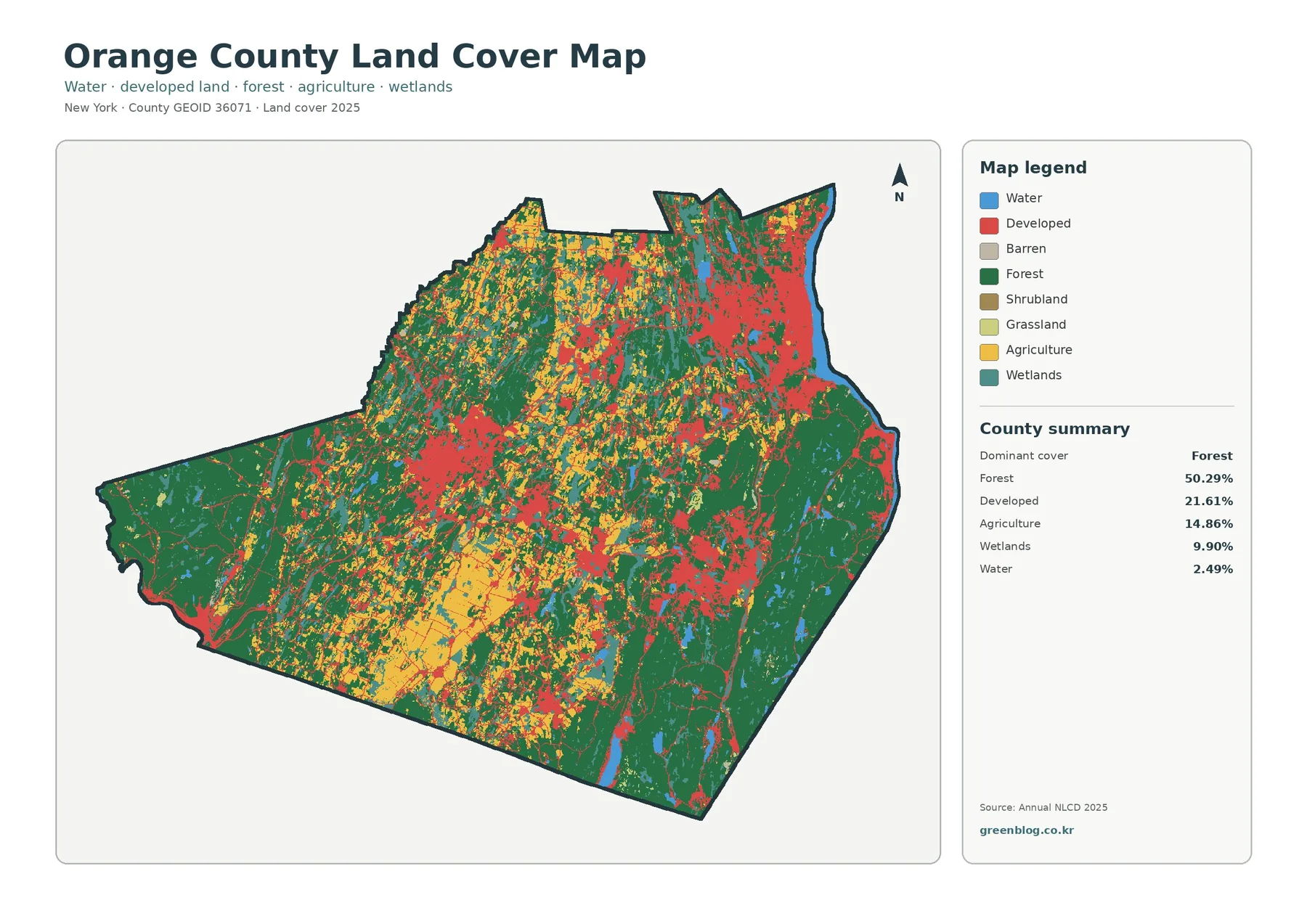
Orange County New York Land Cover Map – Forested Highlands, Black Dirt Farms, and JPG Download
Orange County, New York, is a place where broad forest cover, concentrated development, working farmland, wetlands, and water all remain […]
Orange County, New York, is a place where broad forest cover, concentrated development, working farmland, wetlands, and water all remain […]
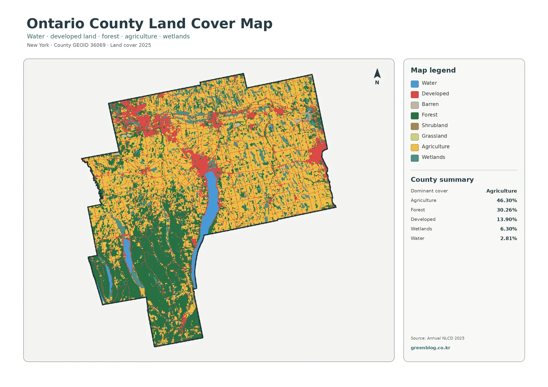
Broad farm country, wooded hills, long Finger Lakes, wetlands, and several compact developed centers all appear within Ontario County. The
Ontario County New York Land Cover Map around Canandaigua Lake and Farm Country Read More »
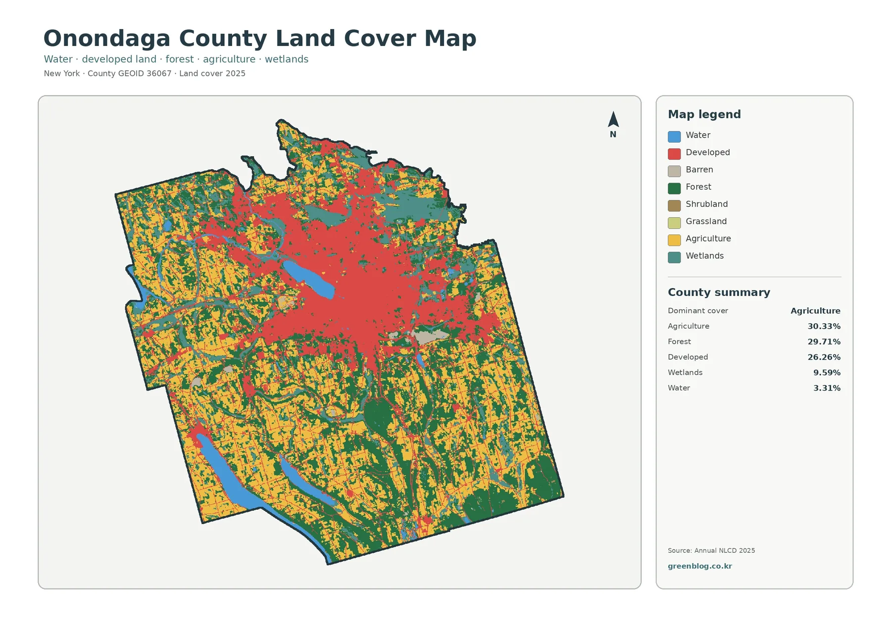
Onondaga County combines three land-cover patterns that are unusually close in scale. Agriculture accounts for 30.33% of the 2025 map,
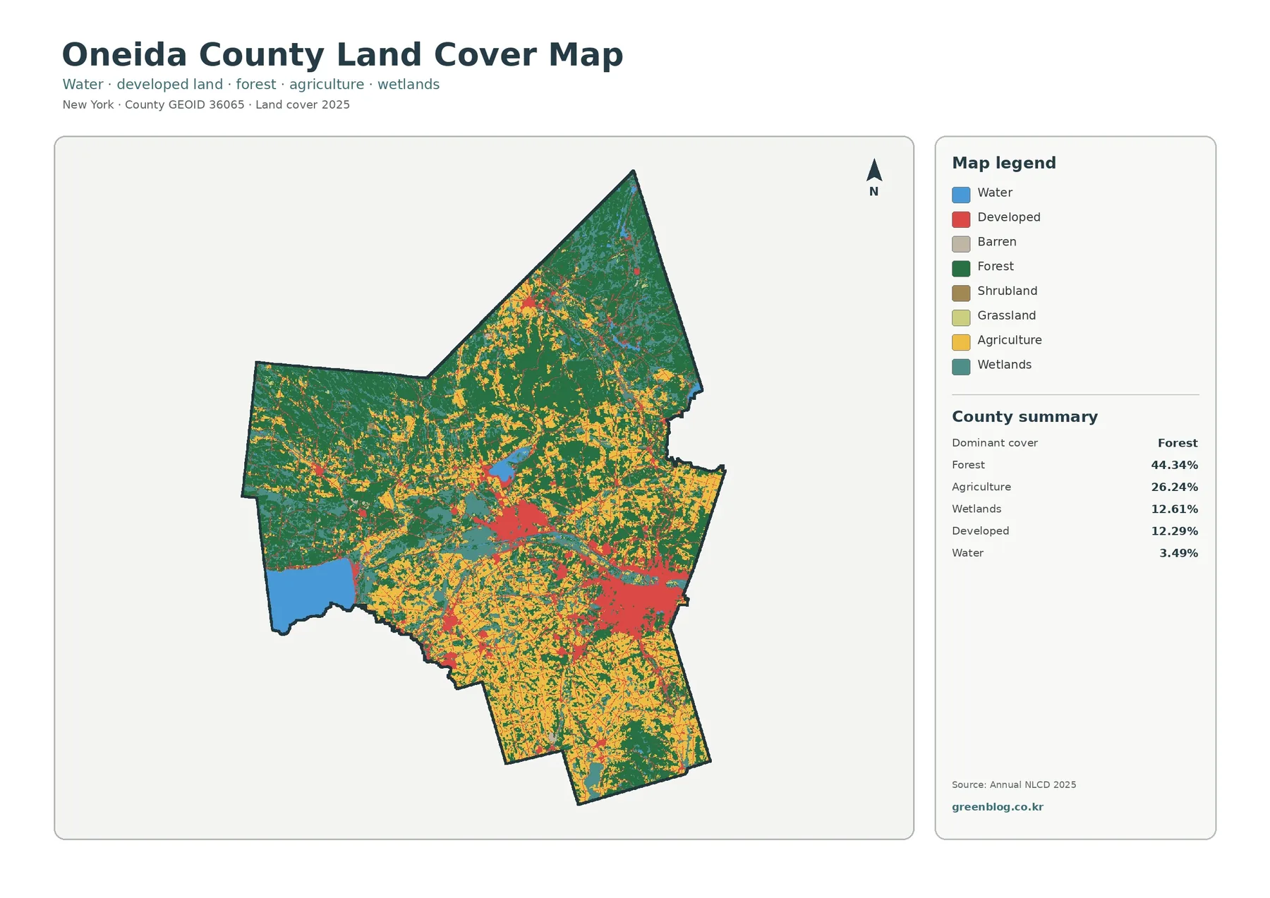
Oneida County in central New York has a land-cover pattern that changes noticeably from its wooded north to the more
Oneida County New York Land Cover Map – Forest, Farmland, Development, and Change Read More »
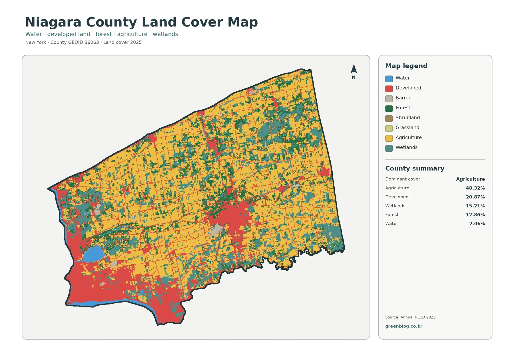
Niagara County has a land-cover pattern that is easy to recognize once the four maps are viewed together. Farmland covers
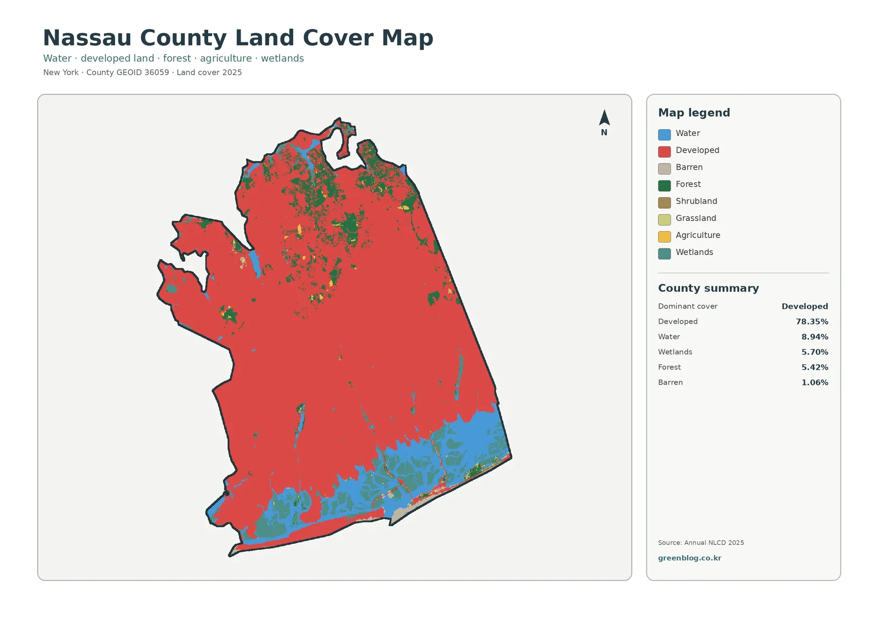
Nassau County is one of the most heavily developed parts of Long Island, yet its southern edge opens into bays,
Nassau County New York Land Cover Map Follows the Urban Grid to Tidal Marshes Read More »
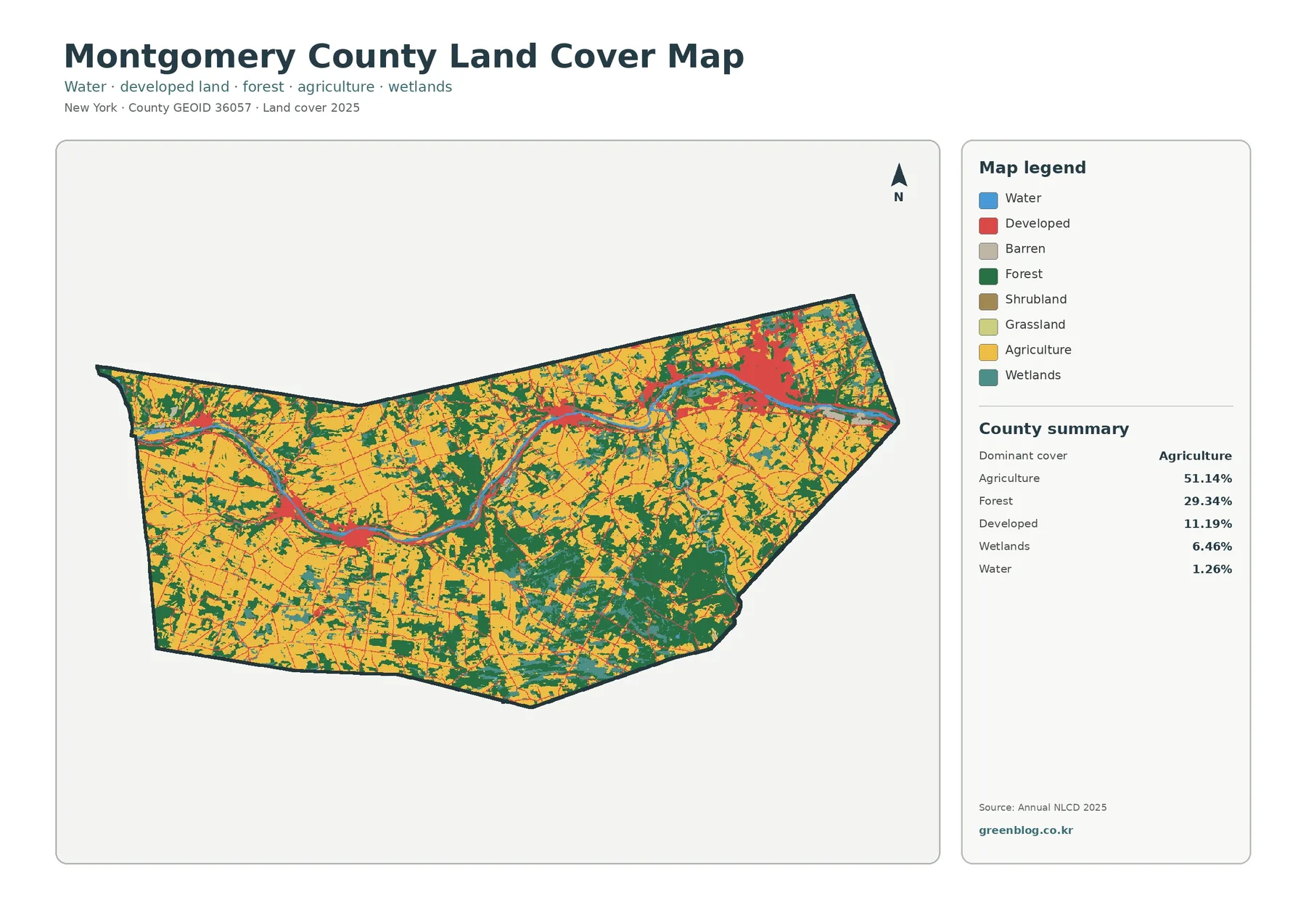
Montgomery County stretches along New York’s Mohawk River, where farmland fills much of the valley and developed areas cluster around
Montgomery County New York Land Cover Map Along the Mohawk River Read More »
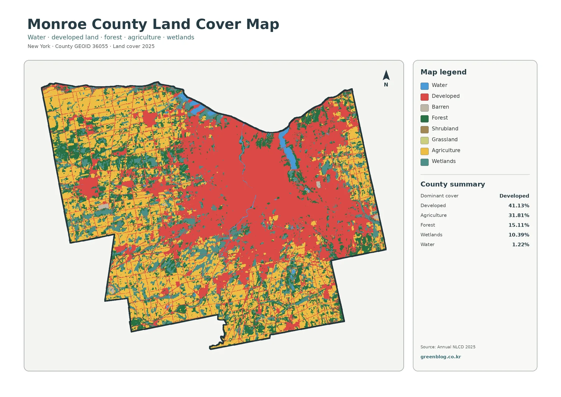
Monroe County sits on the south shore of Lake Ontario, with Rochester forming a broad developed center while farmland, forest,
Monroe County New York Land Cover Map: Rochester to Rural Farmland Read More »
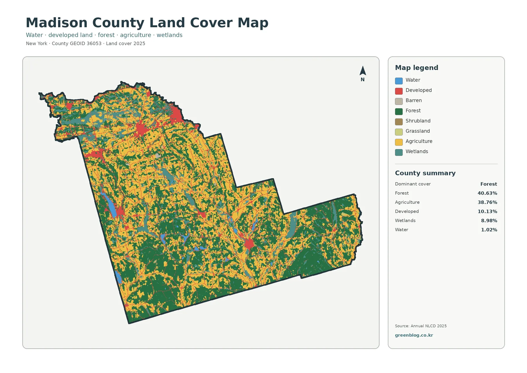
Madison County is unusual among the New York counties in this map series because its two largest land-cover groups are
Madison County New York Land Cover Map – Where Forest and Farmland Share the County Read More »