
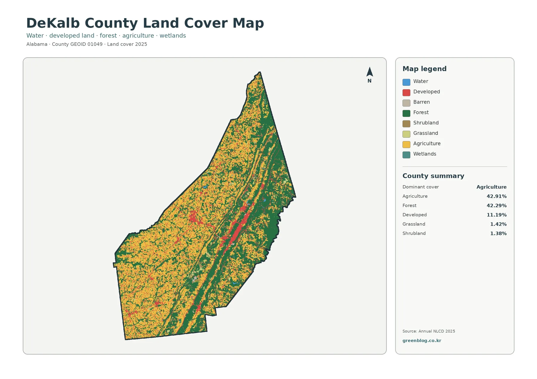
DeKalb County Alabama Land Cover Map | Farms, Forest Ridges and the Fort Payne Development Corridor
DeKalb County Alabama Land Cover Map presents four ways to examine the same northeastern Alabama county: 2025 land cover, forest […]
DeKalb County Alabama Land Cover Map presents four ways to examine the same northeastern Alabama county: 2025 land cover, forest […]
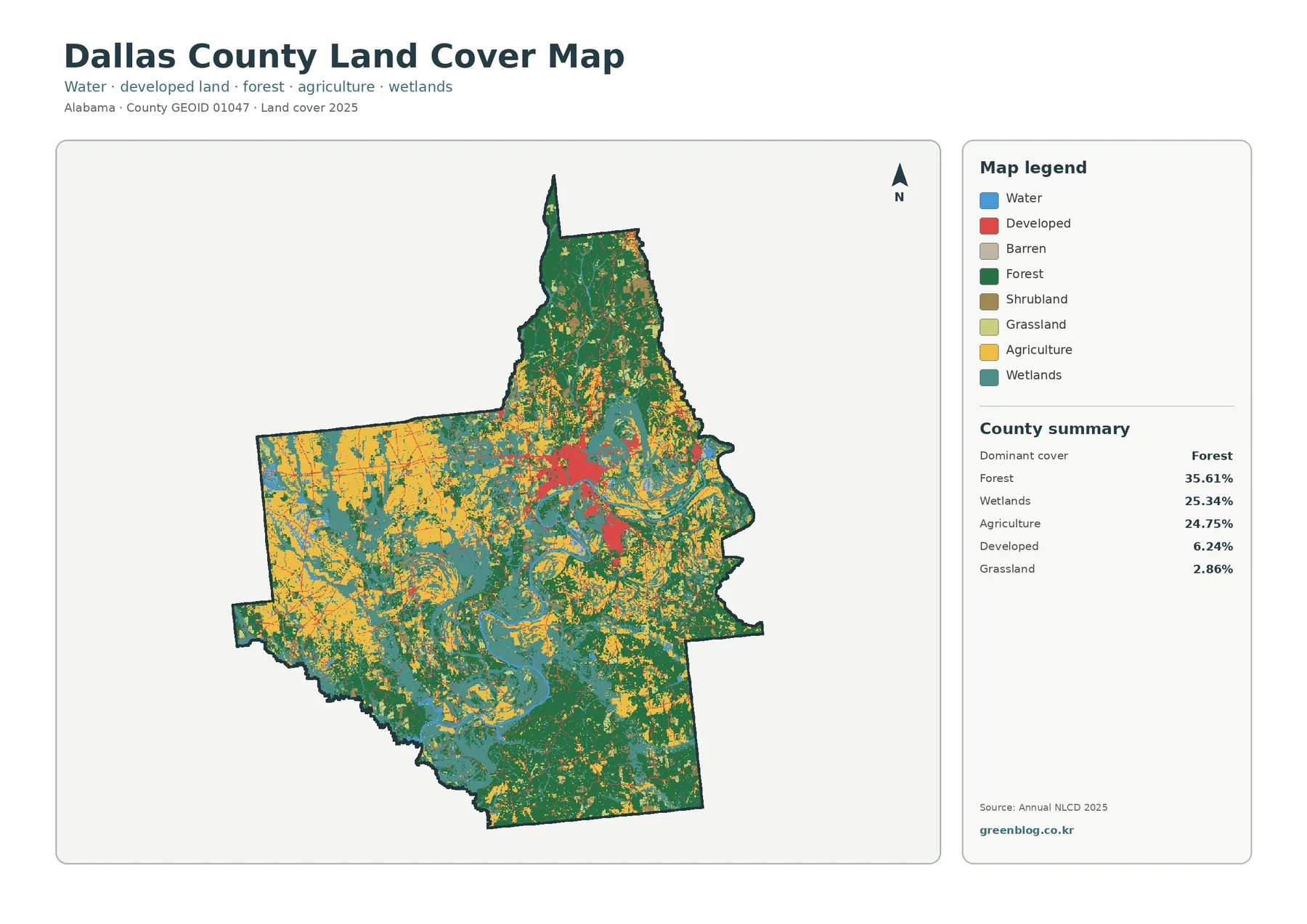
Dallas County Alabama Land Cover Map compares 2025 land cover, forest and farmland, fractional impervious surface, and mapped class differences
Dallas County Alabama Land Cover Map for Selma, River Wetlands and Western Farmland Read More »
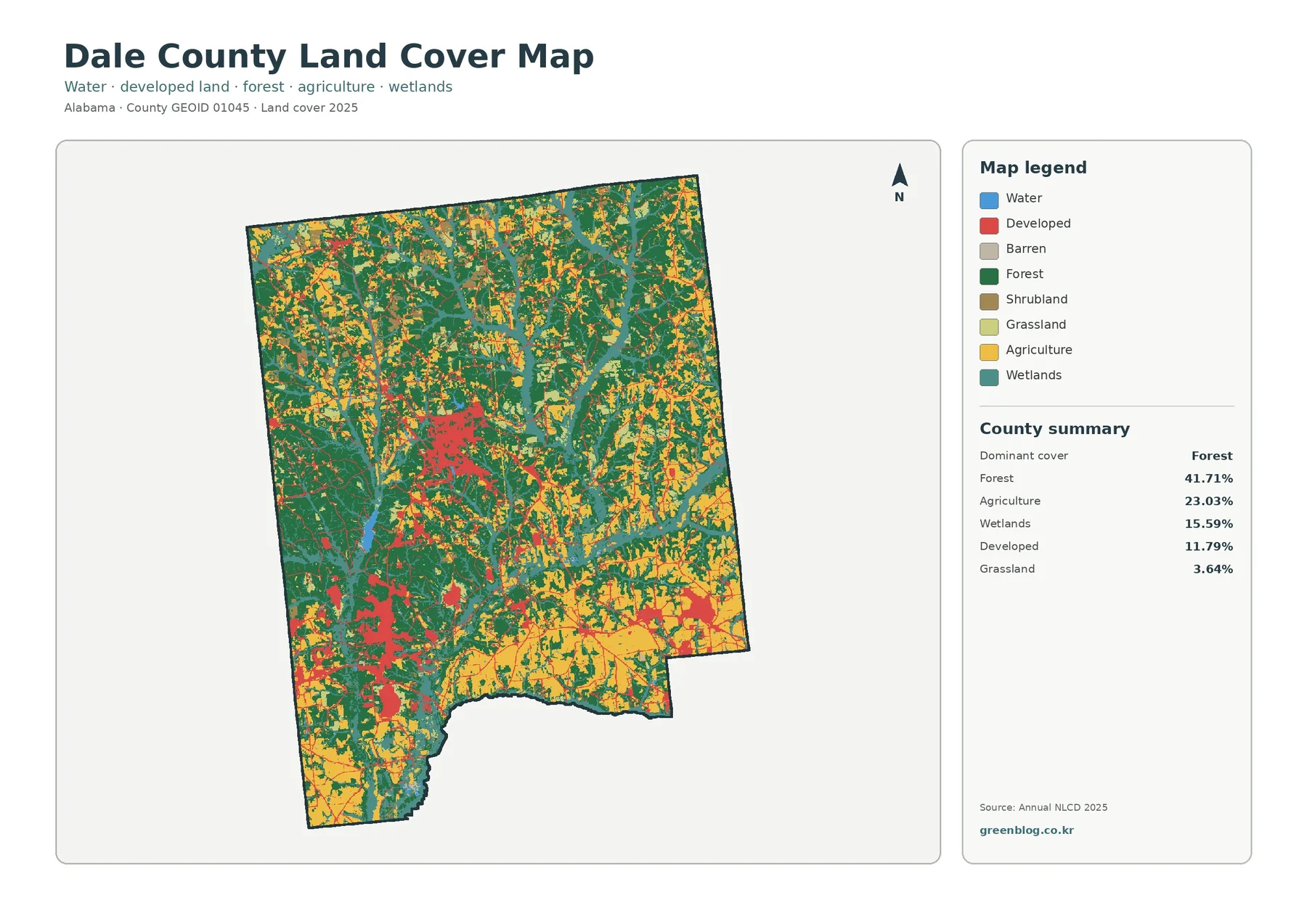
Dale County’s 2025 land-cover pattern is not dominated by a single surface type. Forest is the largest class at 41.71%,
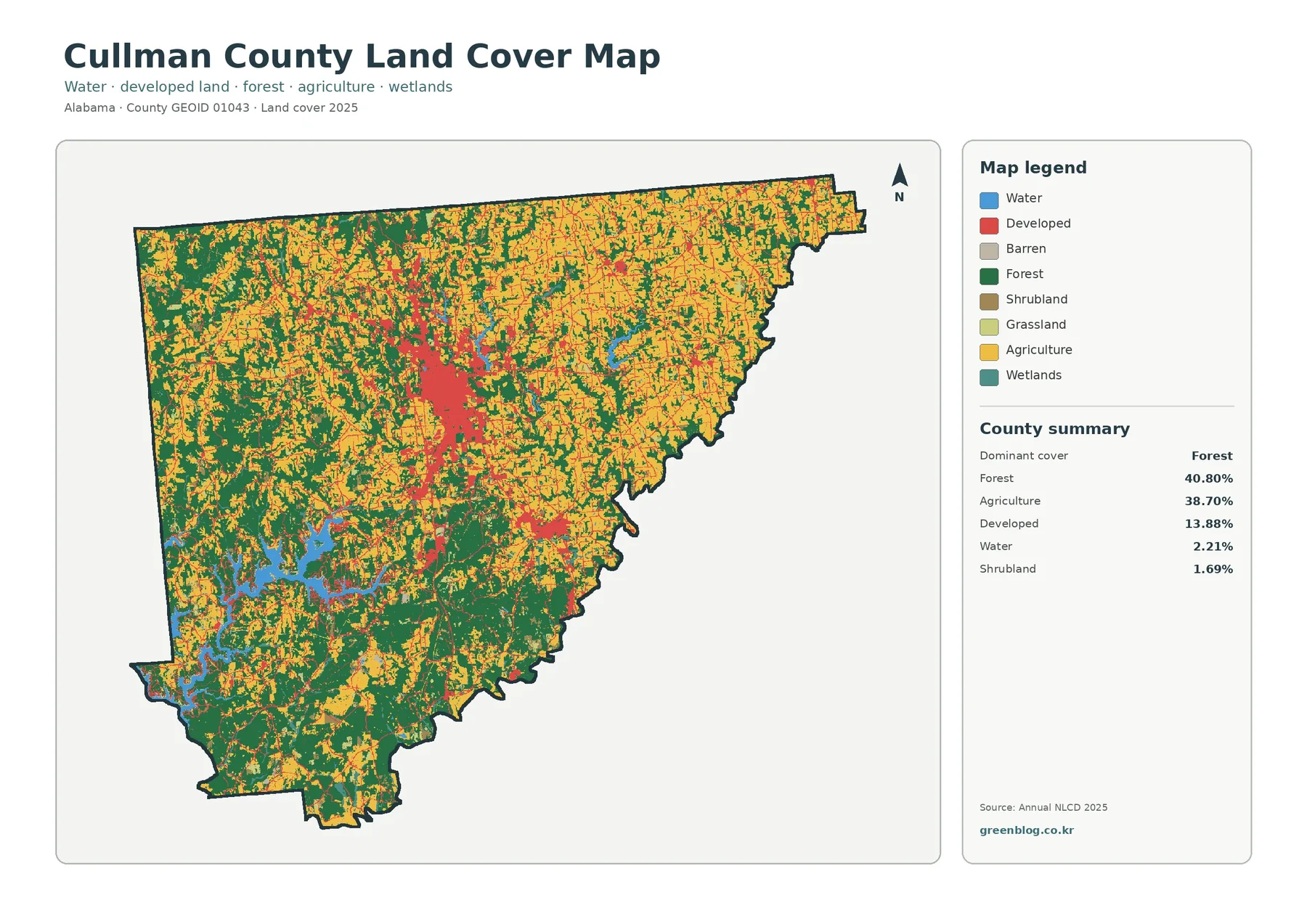
Cullman County’s 2025 land-cover pattern is unusual in one important way: forest and agriculture are almost evenly matched. Forest accounts
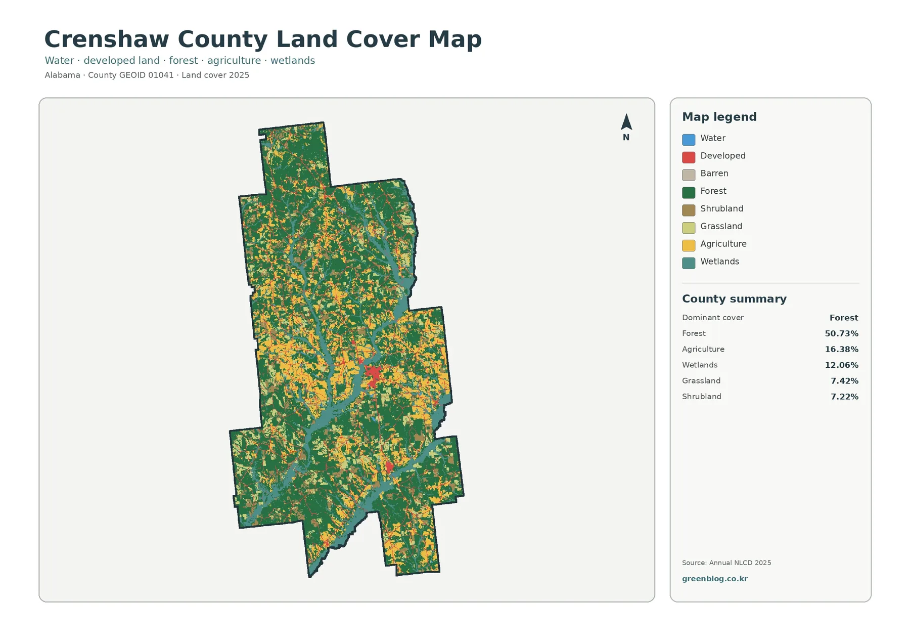
Crenshaw County is mostly wooded on the 2025 land-cover map, but the county is not a single block of forest.
Crenshaw County Alabama Land Cover Map: Forest Majority, Wetland Ribbons & 4 JPGs Read More »
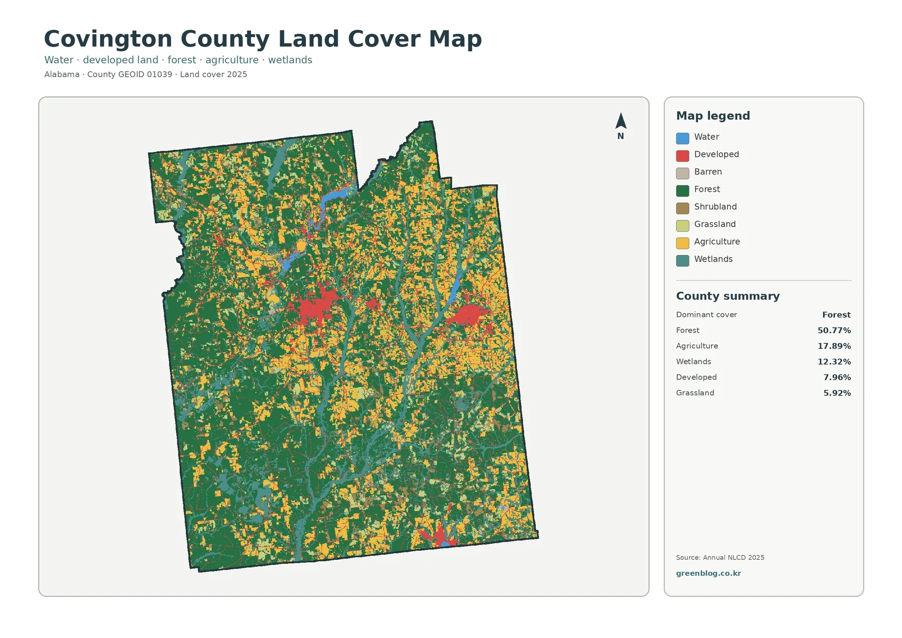
Covington County’s 2025 land-cover pattern is dominated by forest, which accounts for 50.77% of the mapped area. Agriculture makes up
Covington County Alabama Land Cover Map — Forest, Wetlands and Concentrated Development Read More »
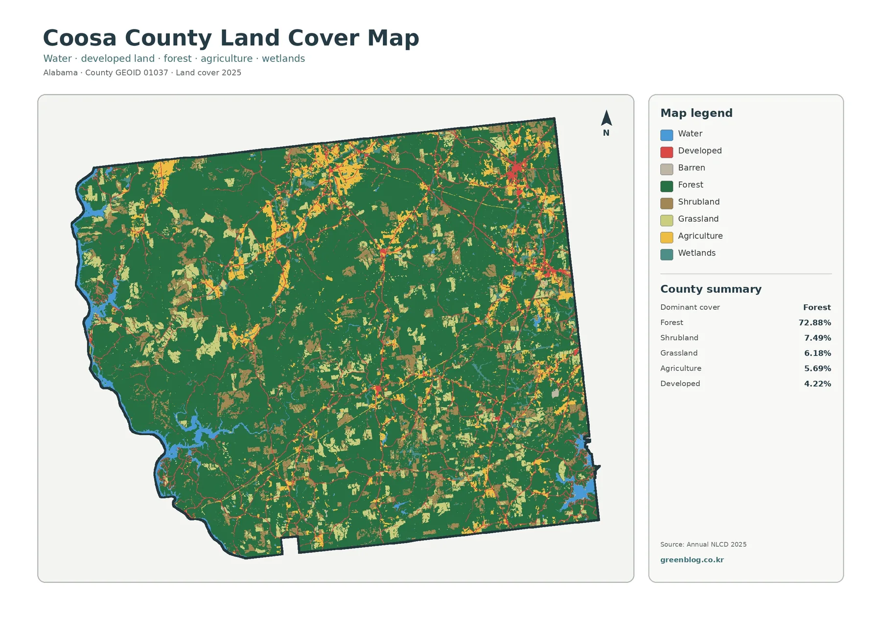
Coosa County’s 2025 land-cover summary is dominated by forest at 72.88%, a much larger share than any other mapped class.
Coosa County Alabama Land Cover Map Across a Wooded Interior and Reservoir Shores Read More »
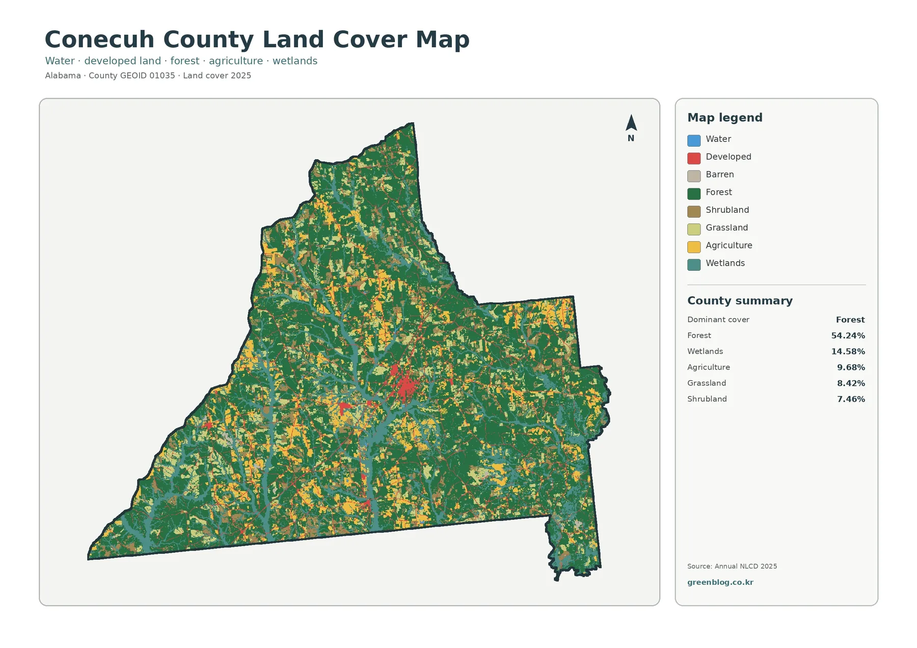
Conecuh County’s 2025 land-cover pattern is led by forest, but the map is far from a single-color landscape. Forest accounts
Conecuh County Alabama Land Cover Map: Forest-Dominant Cover and Branching Wetlands Read More »
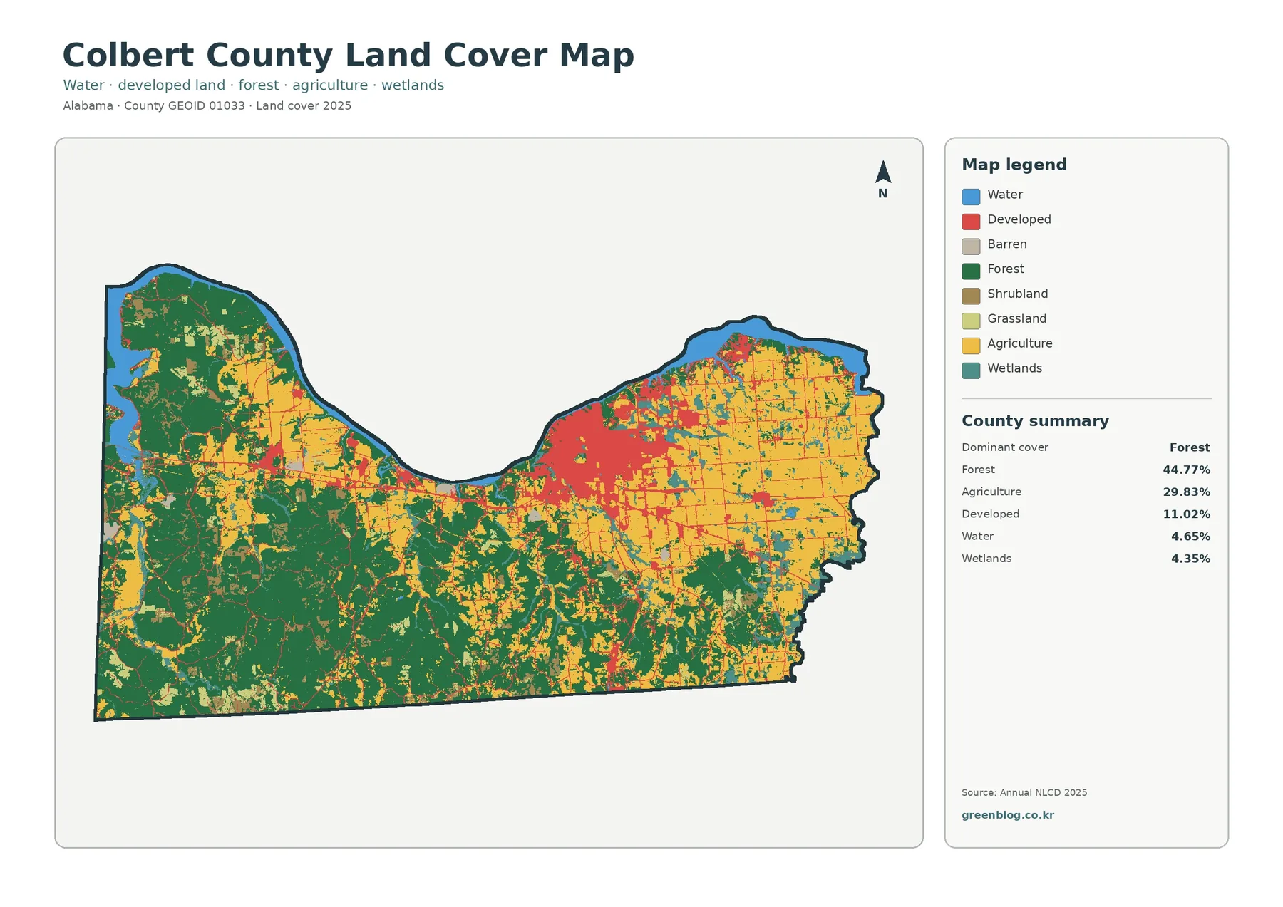
Colbert County sits in northwestern Alabama, and its 2025 land-cover pattern changes noticeably from one side of the county to
Colbert County Alabama Land Cover Map: Tennessee River Edge, Forest and Farmland Read More »