
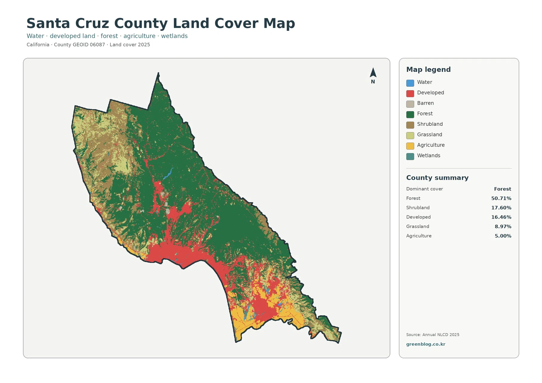
Santa Cruz County California Land Cover Map — Forested Mountains, Coastal Farms, and Compact Urban Areas
The Santa Cruz County California Land Cover Map is dominated by forest rather than urban cover. Forest accounts for 50.71% […]
The Santa Cruz County California Land Cover Map is dominated by forest rather than urban cover. Forest accounts for 50.71% […]
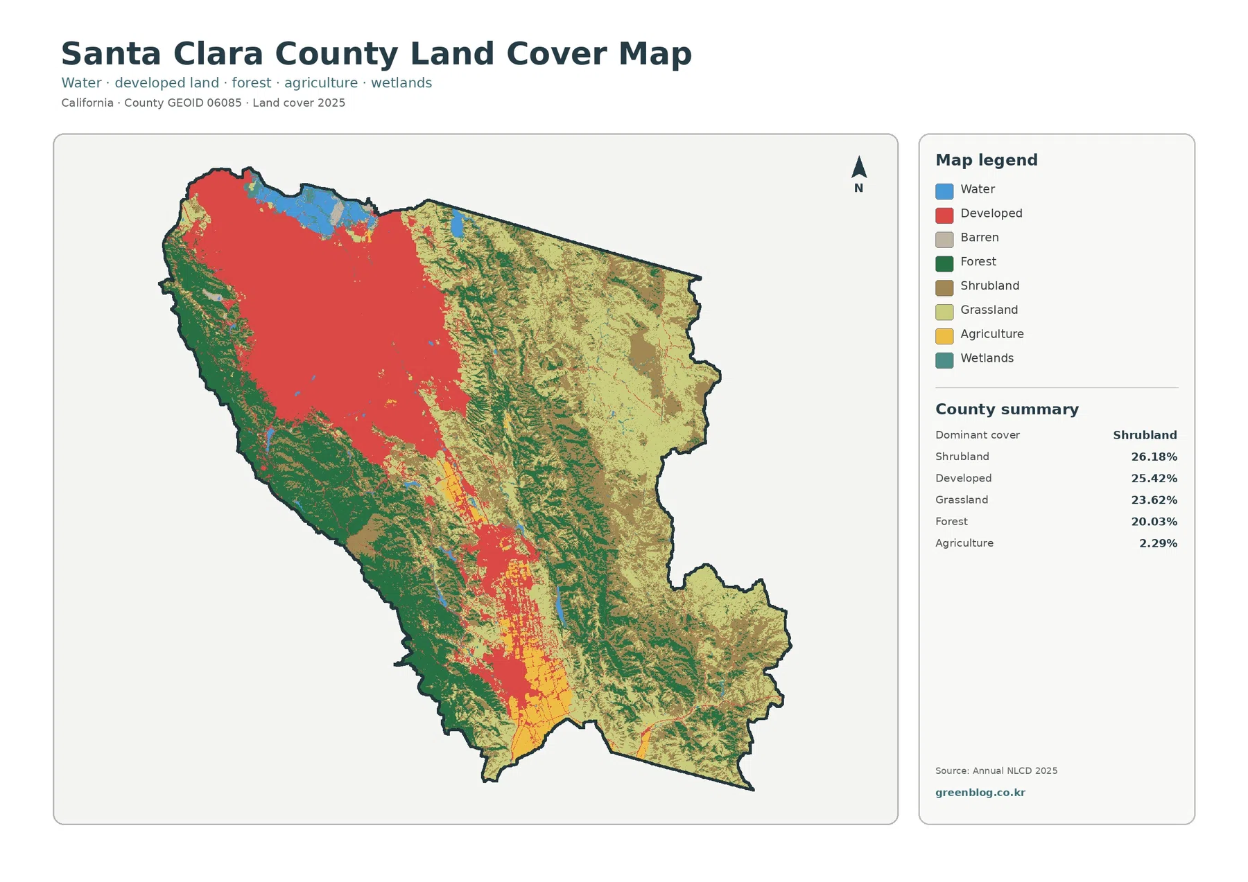
The Santa Clara County California Land Cover Map reveals a county that is far more varied than its Silicon Valley
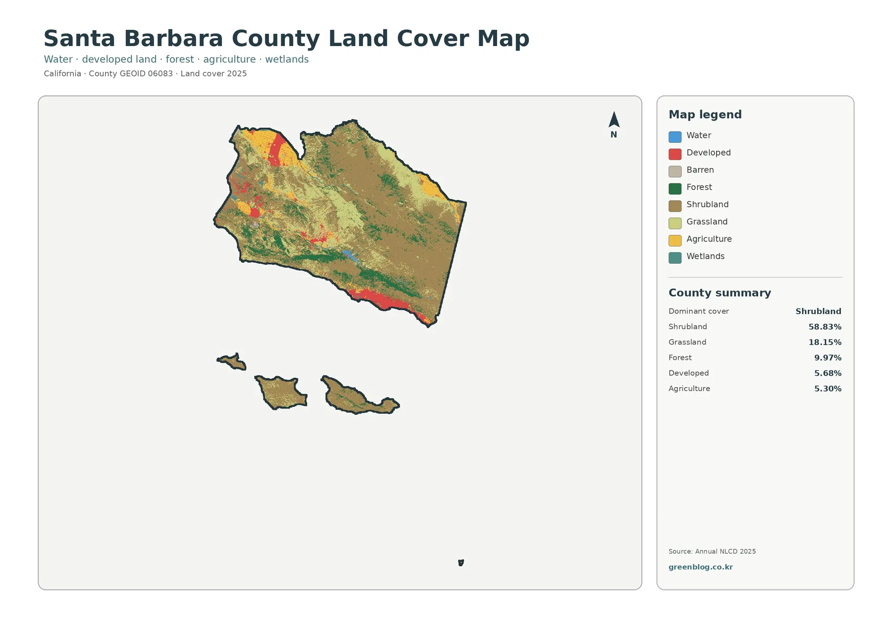
The Santa Barbara County California Land Cover Map is dominated by open natural cover rather than continuous urban land. Shrubland
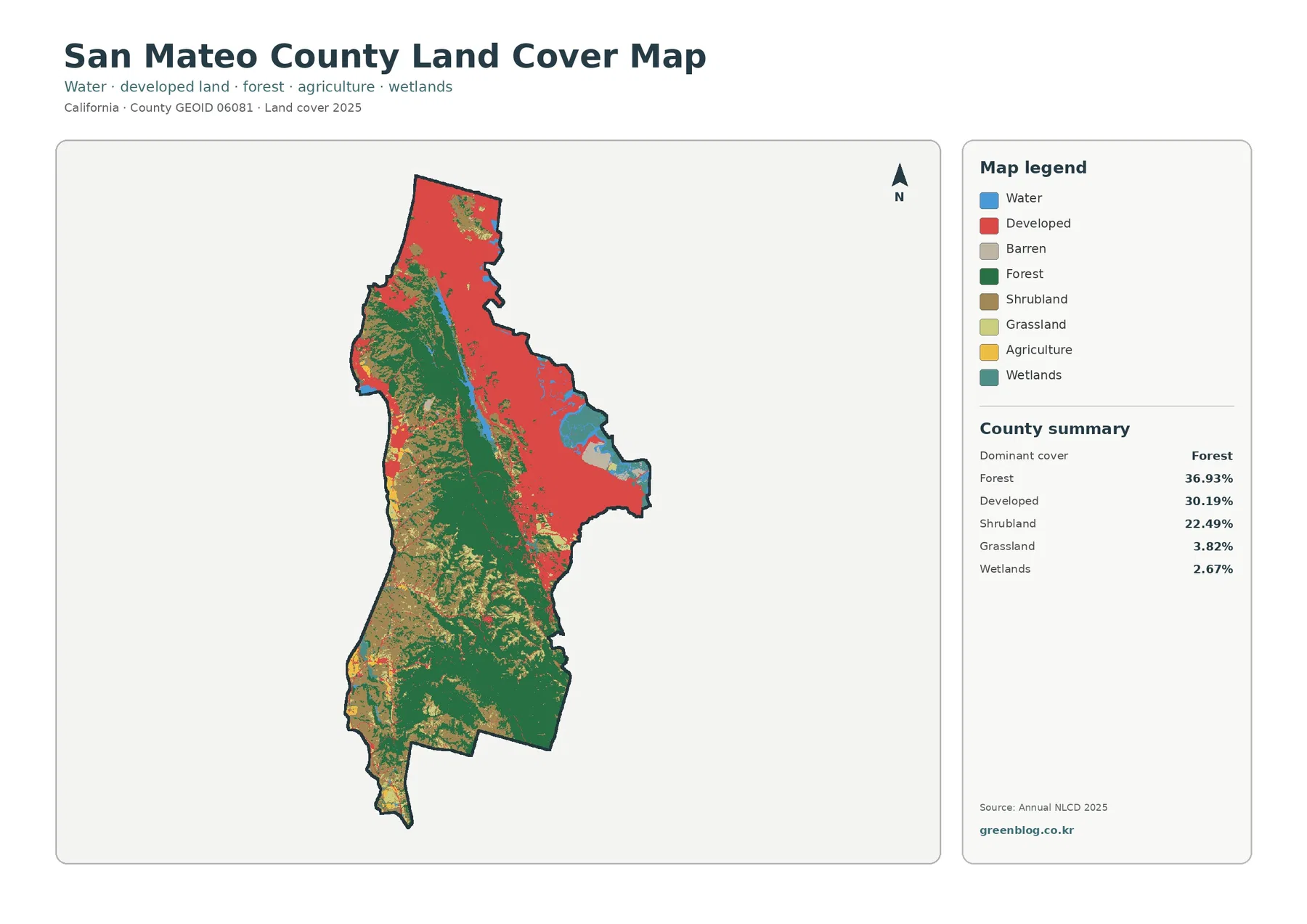
San Mateo County has one of the clearest land-cover contrasts on the California coast. Forest is the largest 2025 class
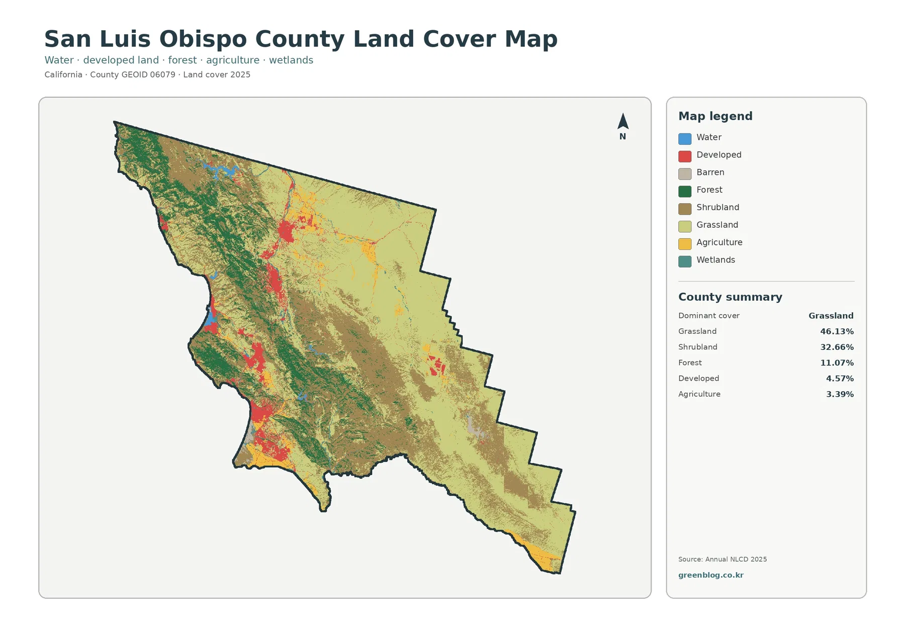
San Luis Obispo County is dominated by open vegetation in the 2025 land-cover classification rather than by one large urban
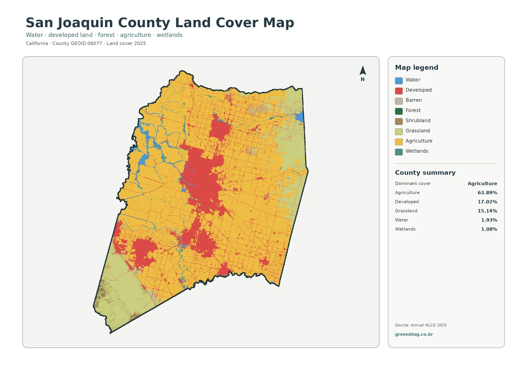
Farmland dominates San Joaquin County in the 2025 land-cover classification, but the county does not read as one uninterrupted agricultural
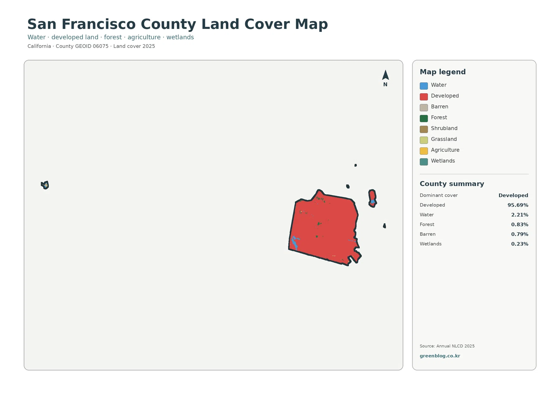
San Francisco County is an unusual land-cover case because nearly the entire county is urban. Developed cover accounts for 95.69%
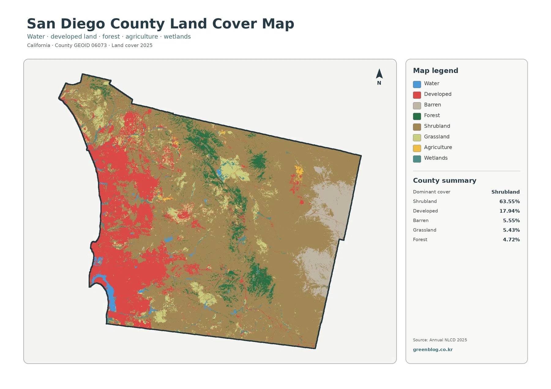
San Diego County has a sharp land-cover split between its heavily developed western side and a much larger shrub-dominated interior.
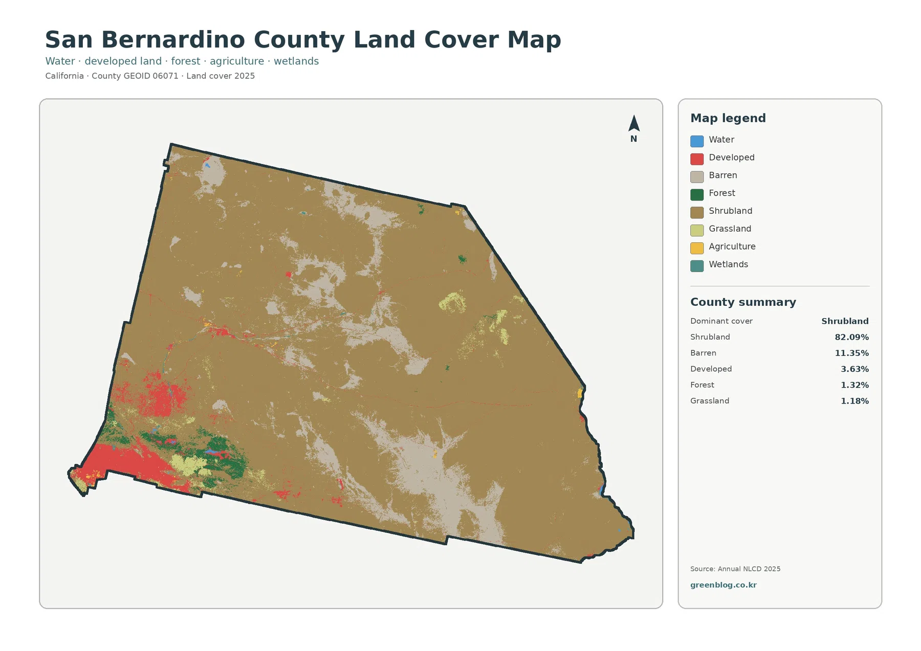
San Bernardino County looks urban at its southwest corner, but the 2025 land-cover map is overwhelmingly a desert map. Shrubland