
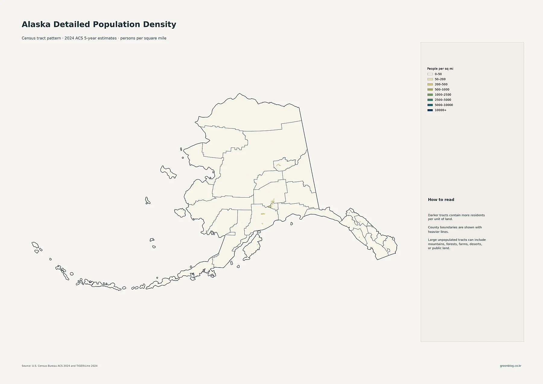
Where Alaska’s Population Clusters: Anchorage, the Sparse Interior, and a Decade of Change
Alaska’s enormous land area can make a statewide average feel almost meaningless unless it is paired with maps that show
Alaska’s enormous land area can make a statewide average feel almost meaningless unless it is paired with maps that show
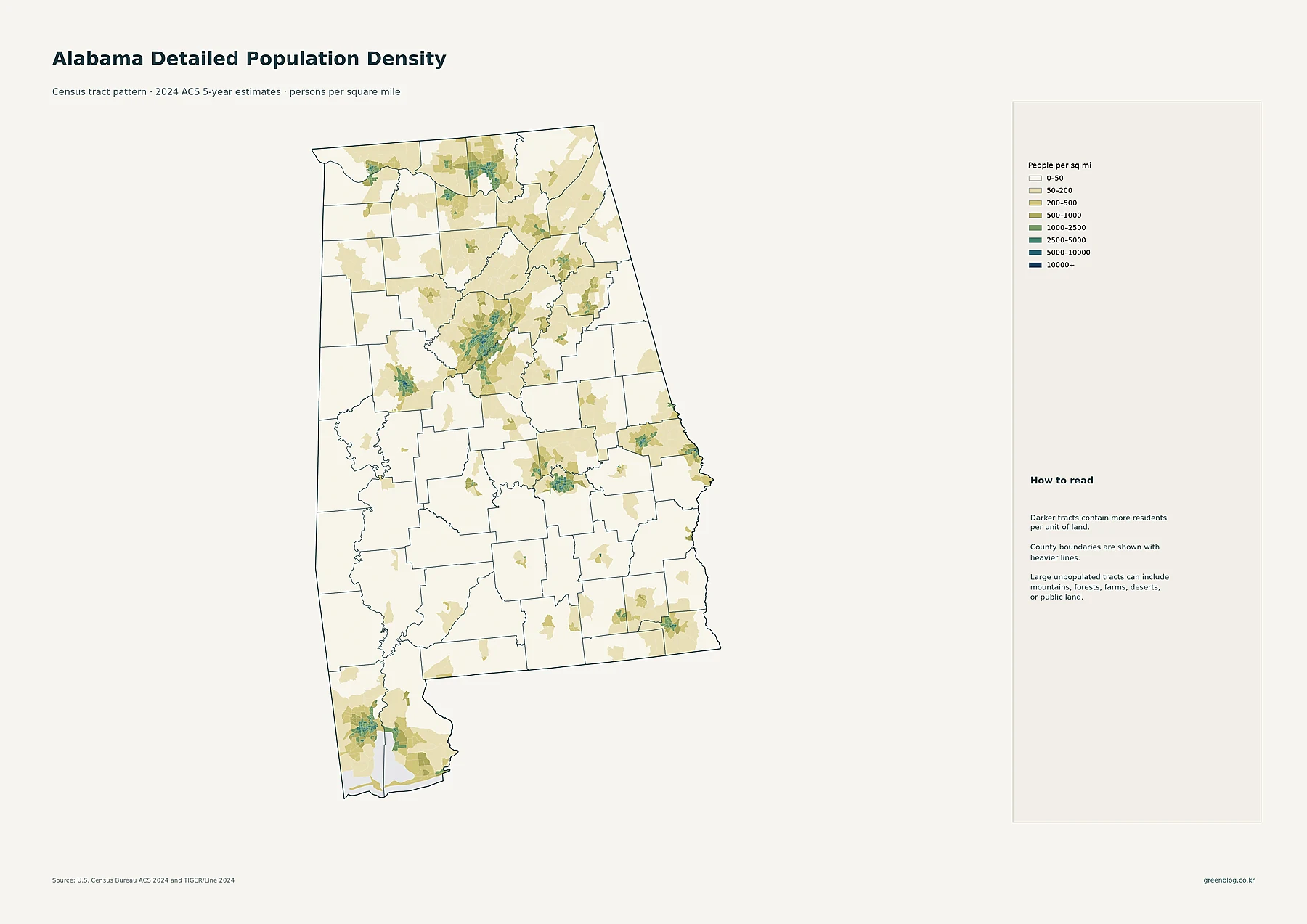
Population in Alabama is not distributed in one simple statewide pattern. A county can have a large number of residents
Alabama Population Density Map: Urban Clusters, County Totals and a Decade of Change Read More »
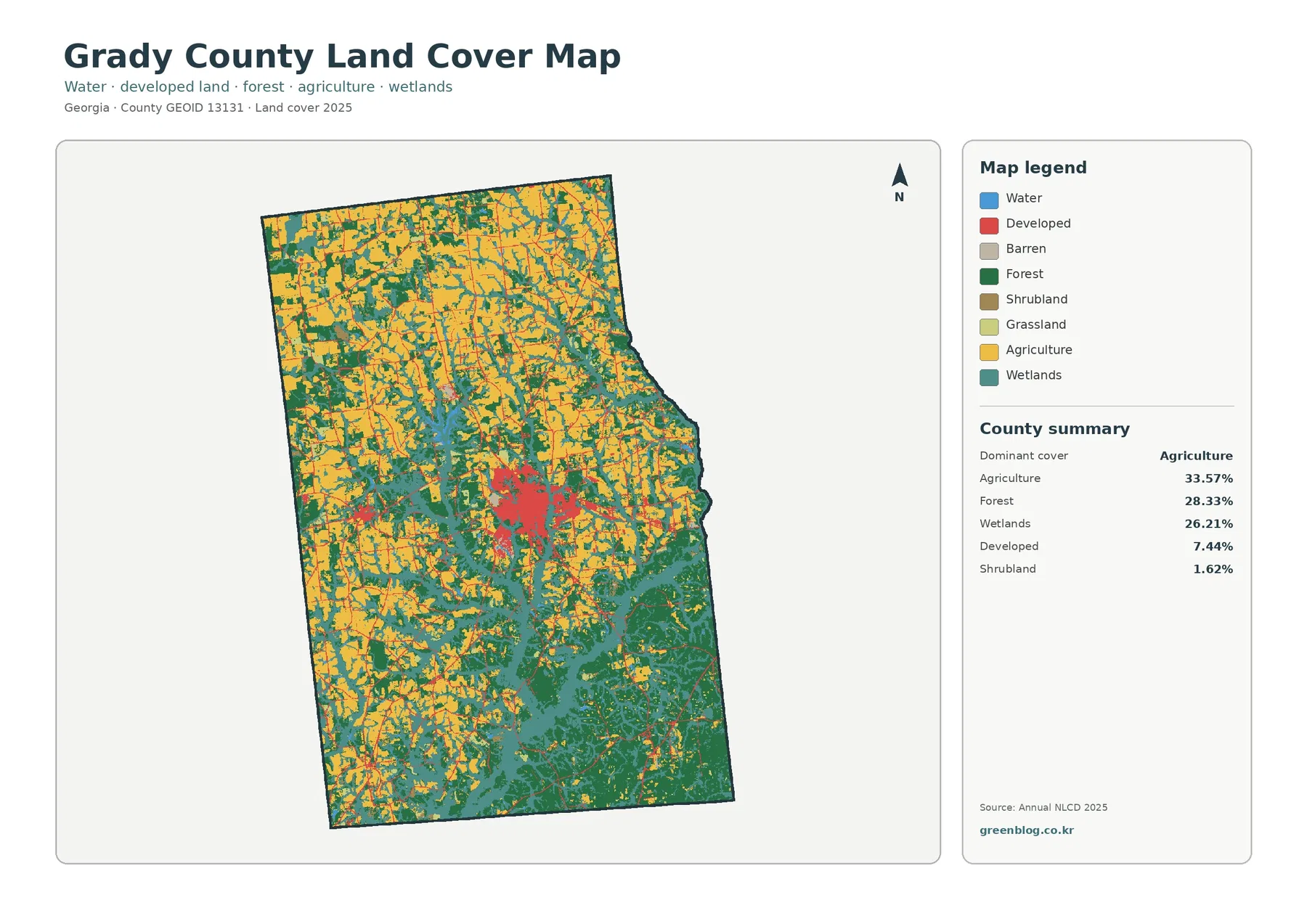
Agriculture is the largest class in Grady County’s supplied 2025 land-cover summary, but it does not dominate the county by
Grady County Georgia Land Cover Map — Farms, Wetlands & Cairo Read More »
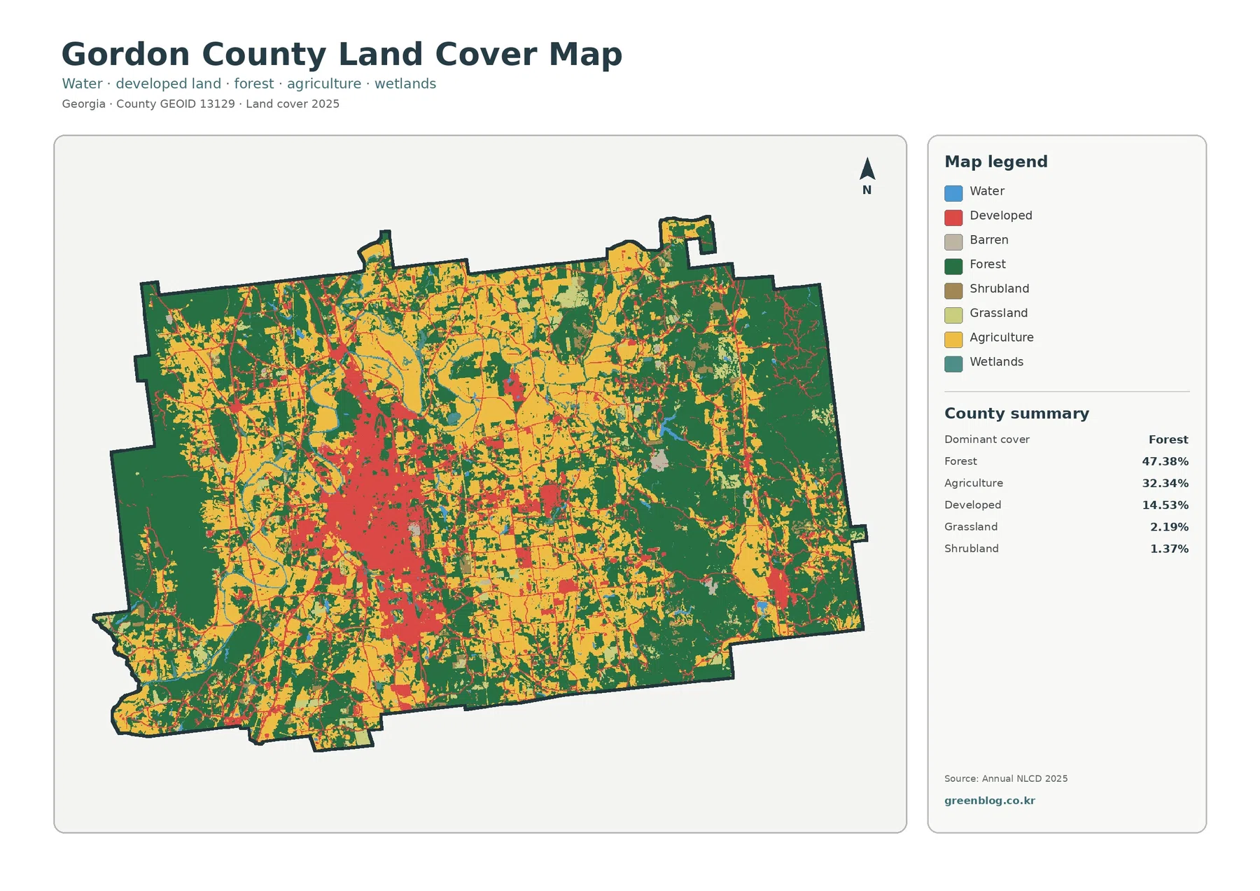
Forest covers 47.38% of Gordon County in the supplied 2025 summary, but the map is far from uniformly wooded. Agriculture
Gordon County Georgia Land Cover Map: How Forest and Farms Frame Calhoun’s Built Core Read More »
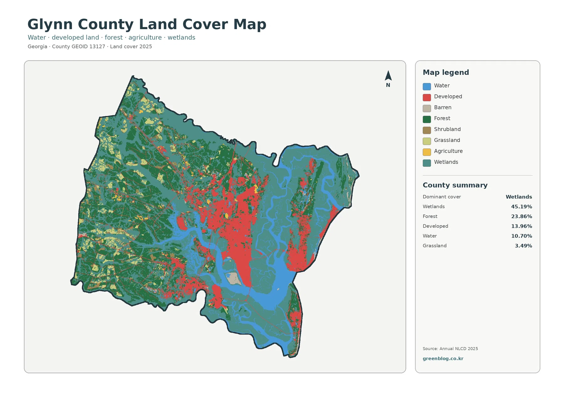
Wetlands dominate the supplied 2025 view of Glynn County, accounting for 45.19% of the mapped area. Forest follows at 23.86%,
Glynn County Georgia Land Cover Map – Wetlands, Brunswick and Islands Read More »
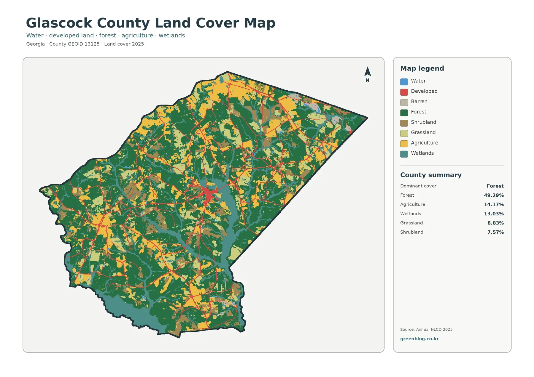
Glascock County has a distinctly mixed 2025 land-cover pattern. Forest is the largest class at 49.29%, yet farmland, wetlands, grassland,
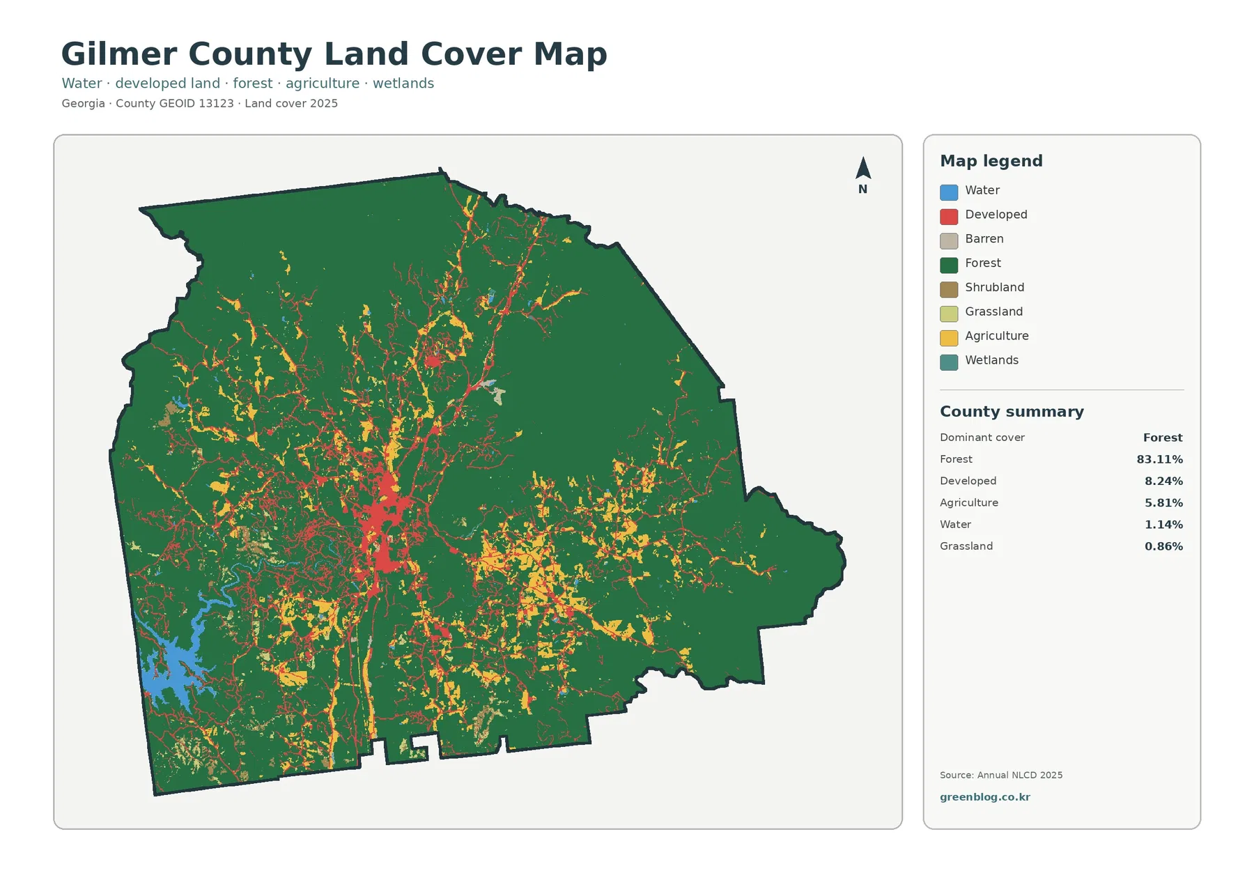
Forest is the defining land-cover pattern in Gilmer County, Georgia, but the county is not visually uniform. The 2025 summary
Gilmer County Georgia Land Cover Map – Forests and Ellijay Development Read More »
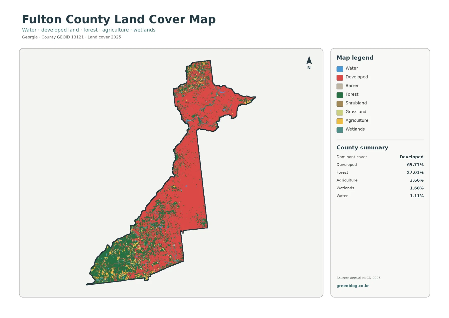
Fulton County is one of the clearest Georgia examples of why a countywide percentage needs a map beside it. Developed
Fulton County Georgia Land Cover Map | Atlanta-Area Development and a Forested Southwest Read More »
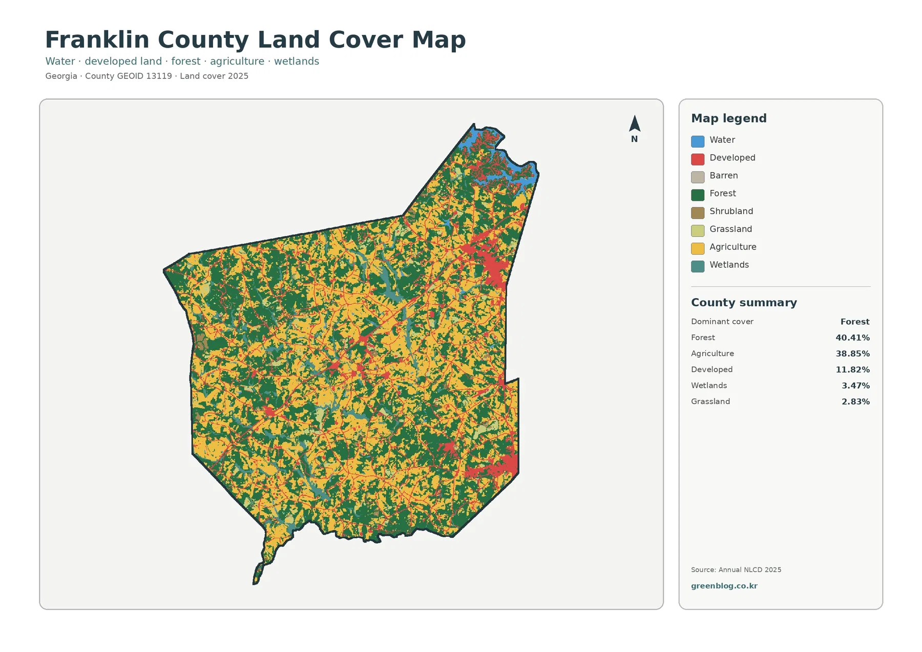
Franklin County in northeast Georgia has an unusually balanced countywide land-cover mix. The 2025 summary places forest at 40.41% and
Franklin County Georgia Land Cover Map | Forest, Farmland & Change Read More »